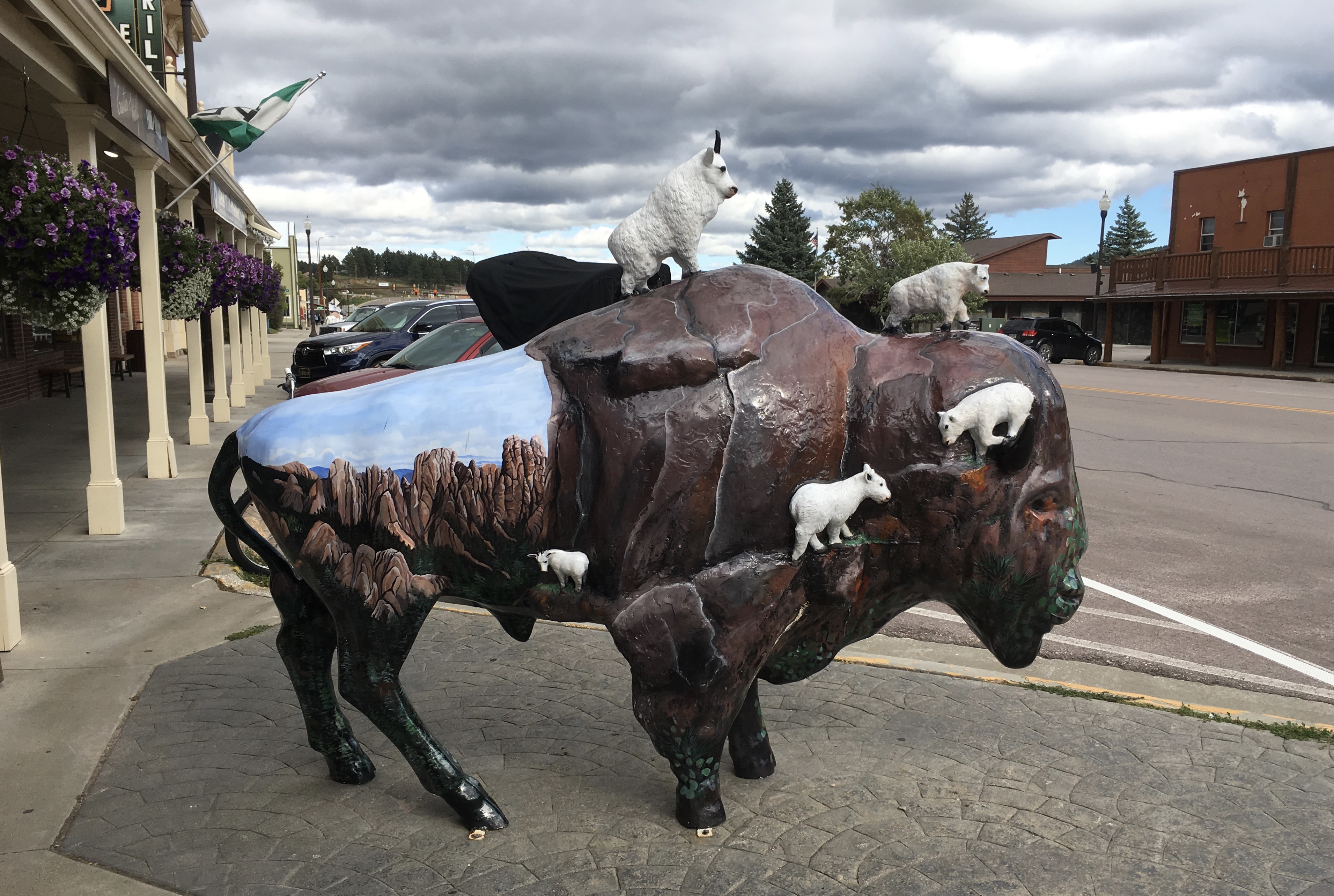
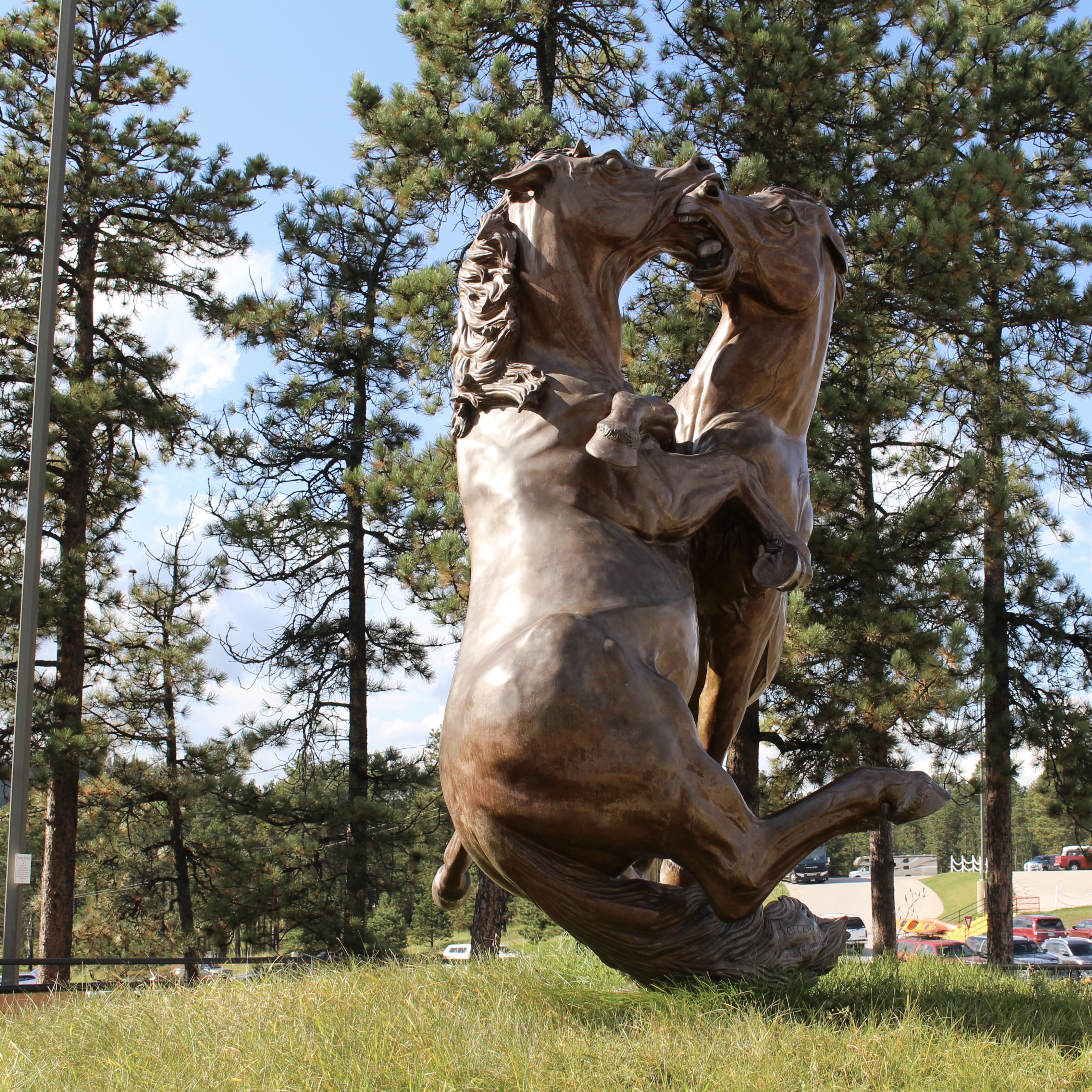
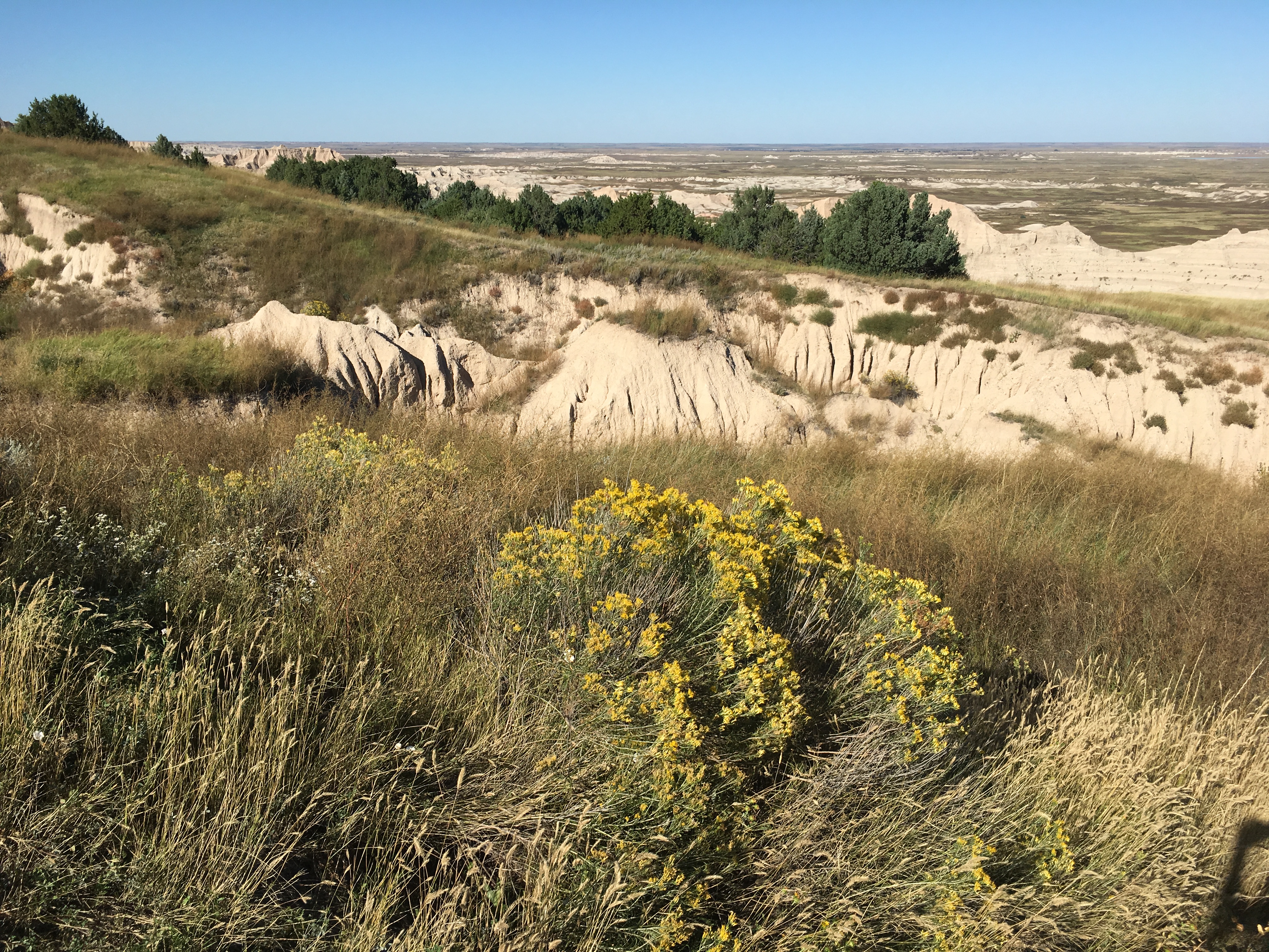
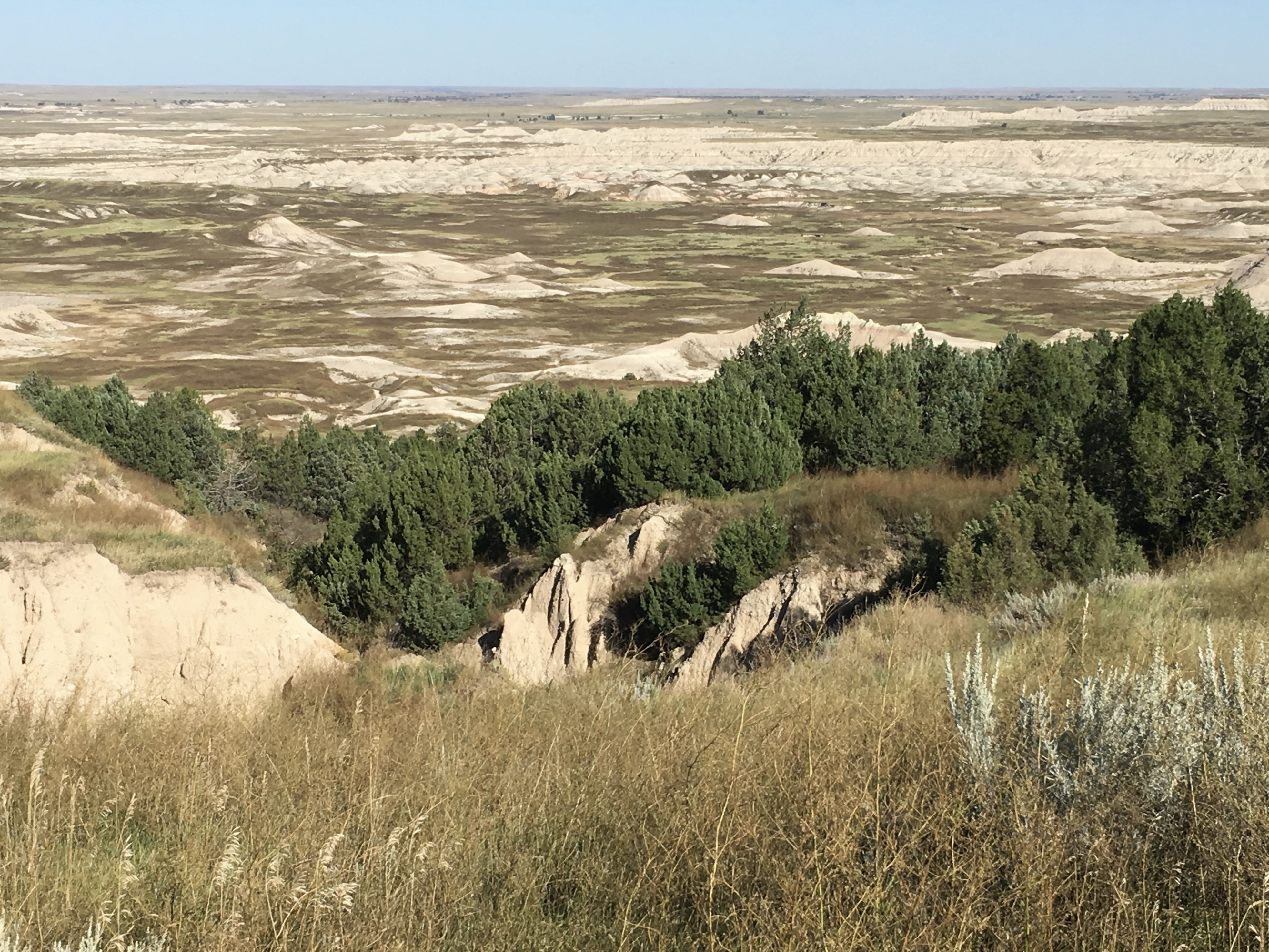
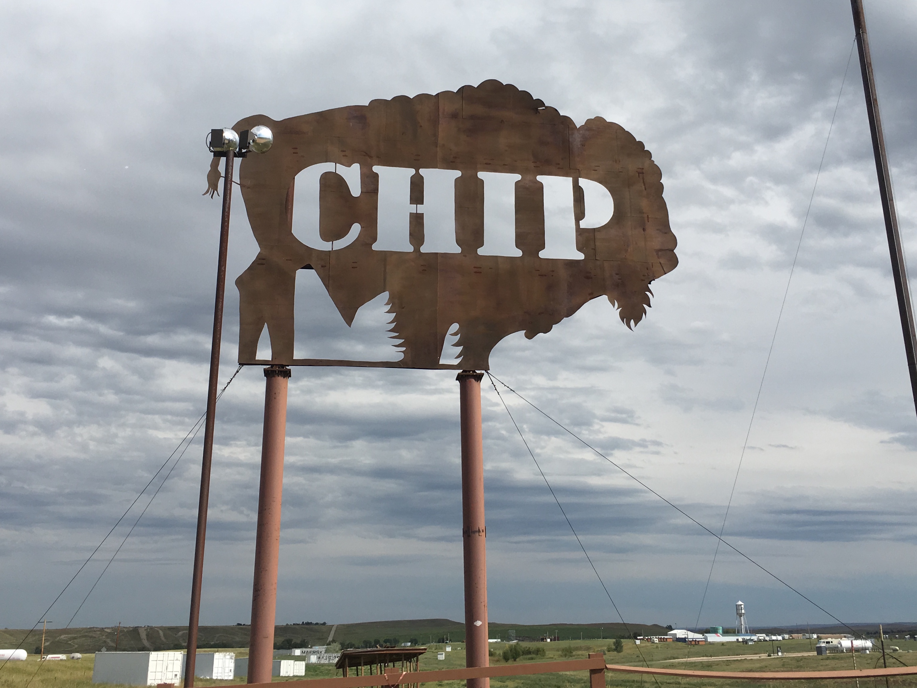
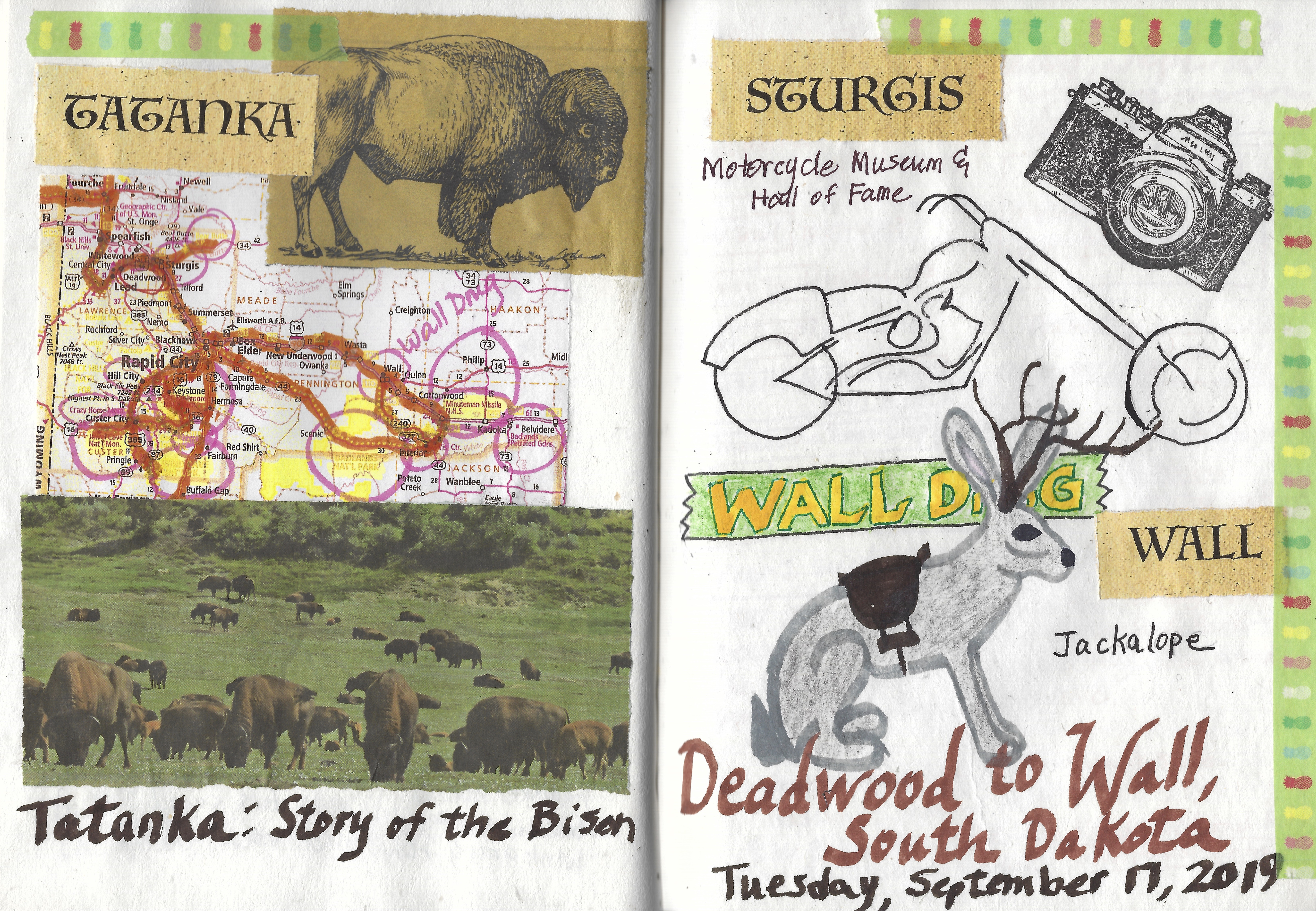
After a sausage, egg and canned mandarin orange breakfast, I ran back to Wall Drug to get the Montgomery Ward Catalog so I could used it for my art journals. By 9:07, I finally left Wall.

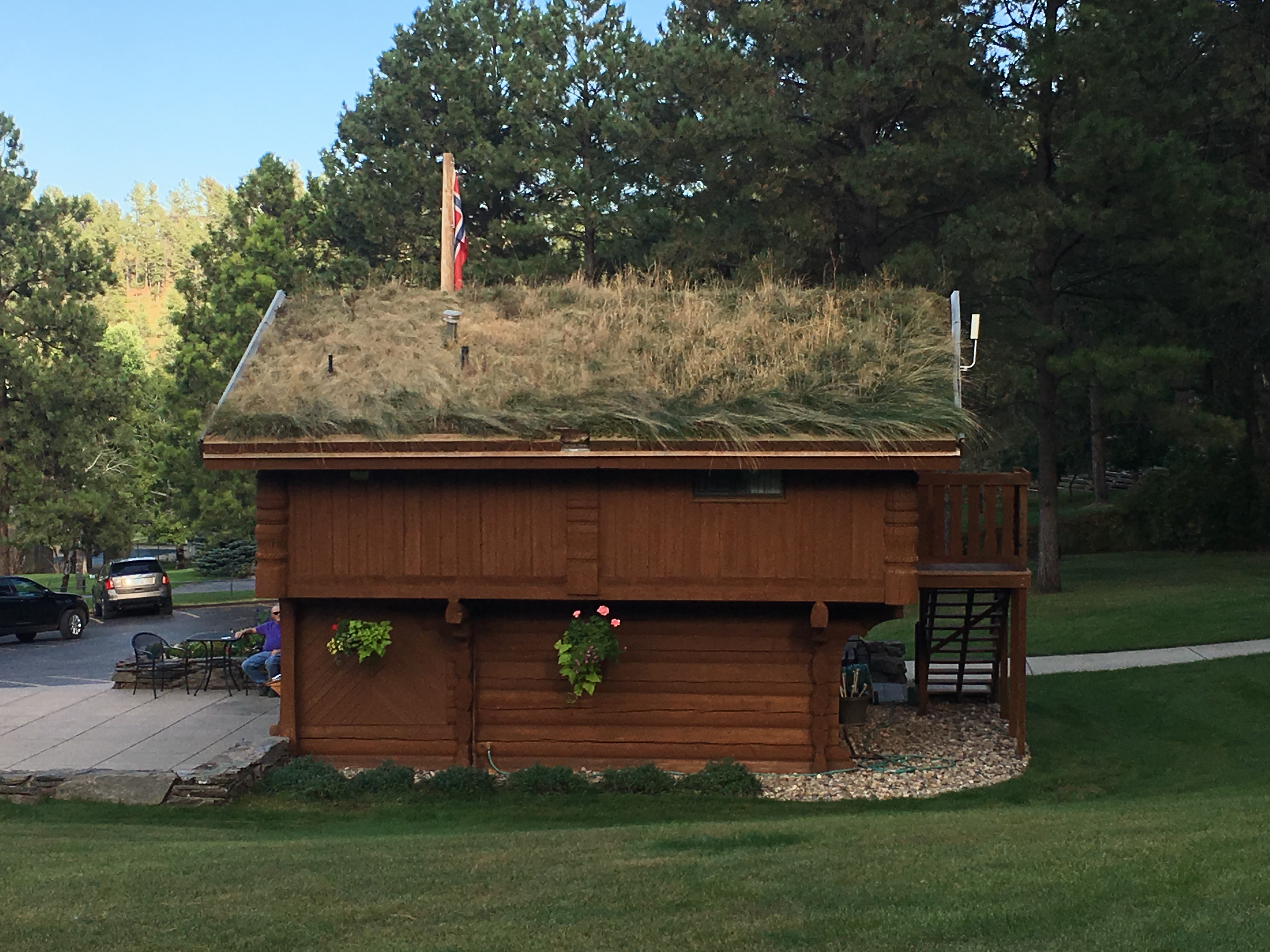
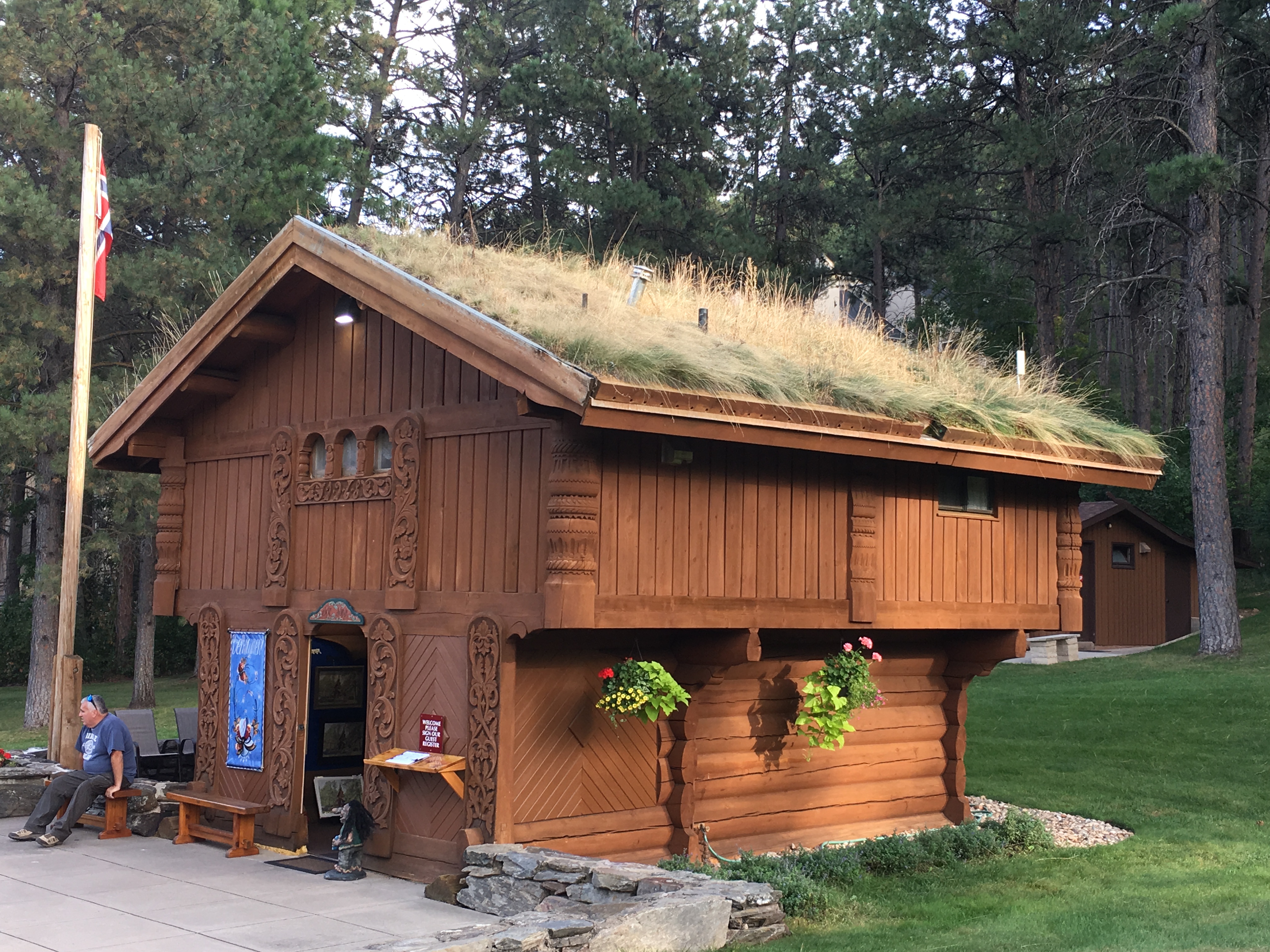
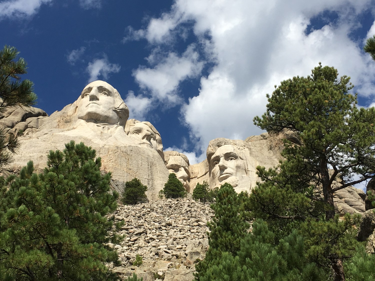
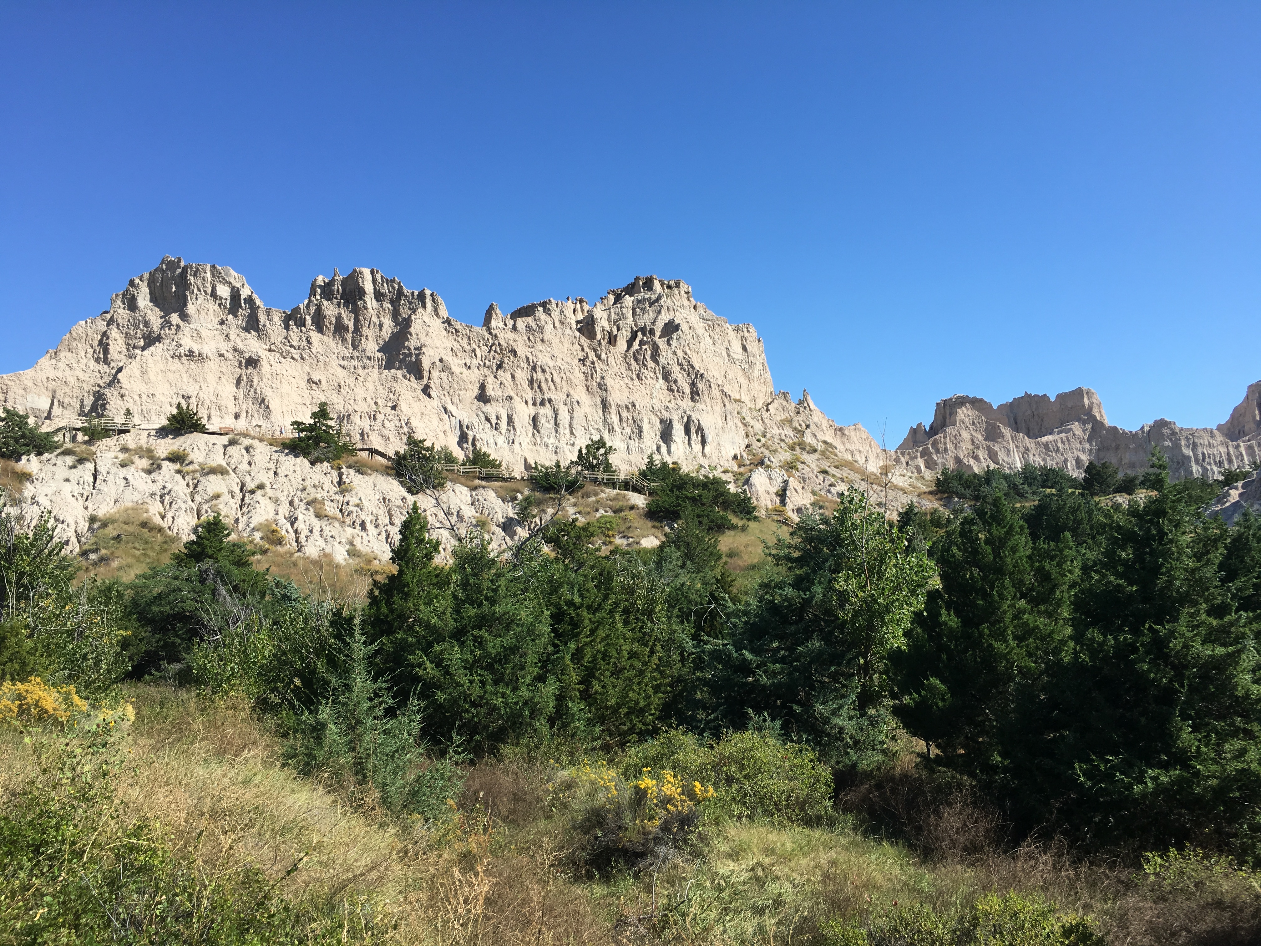
Wall Drug

Wall Drug
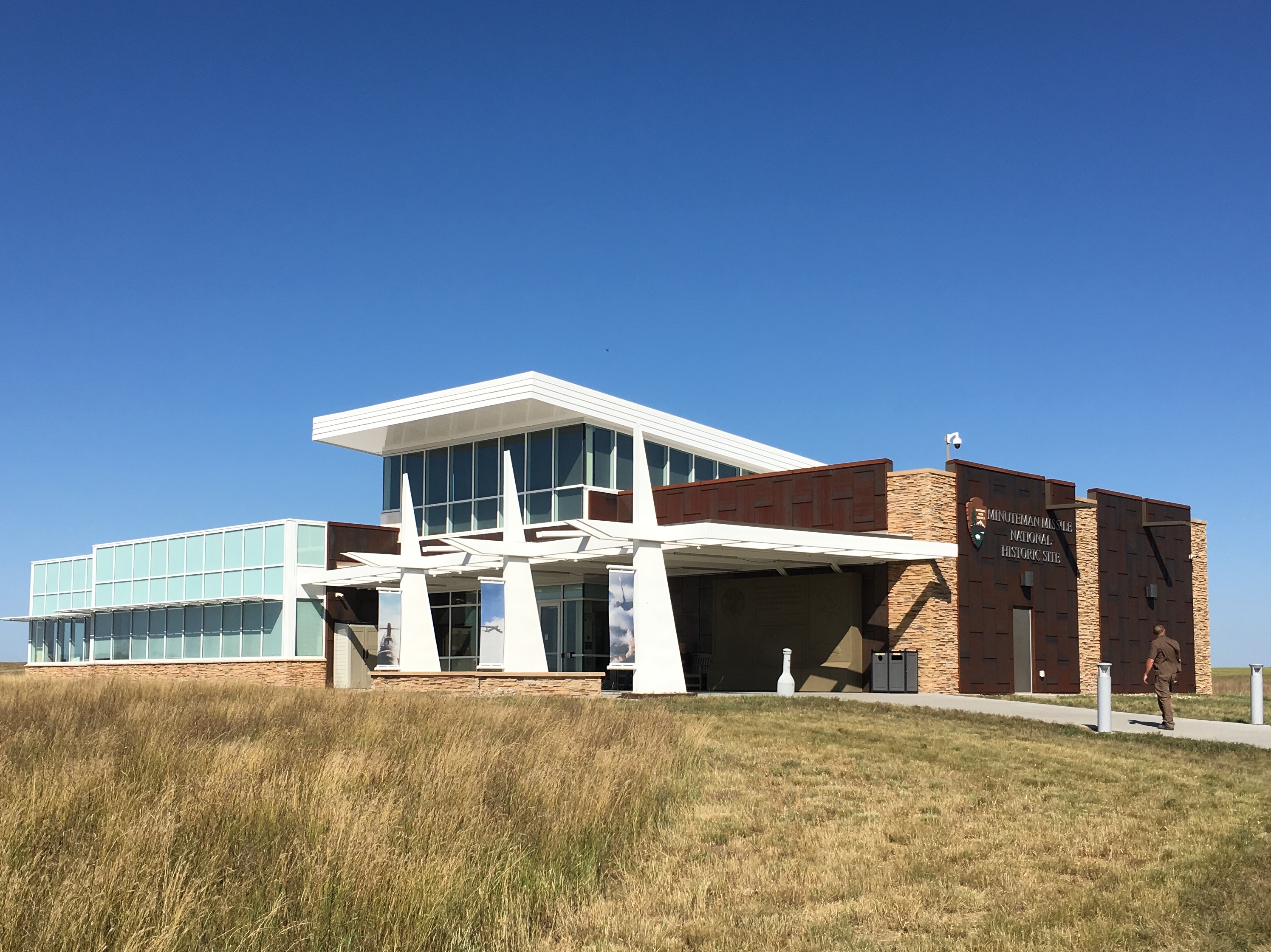
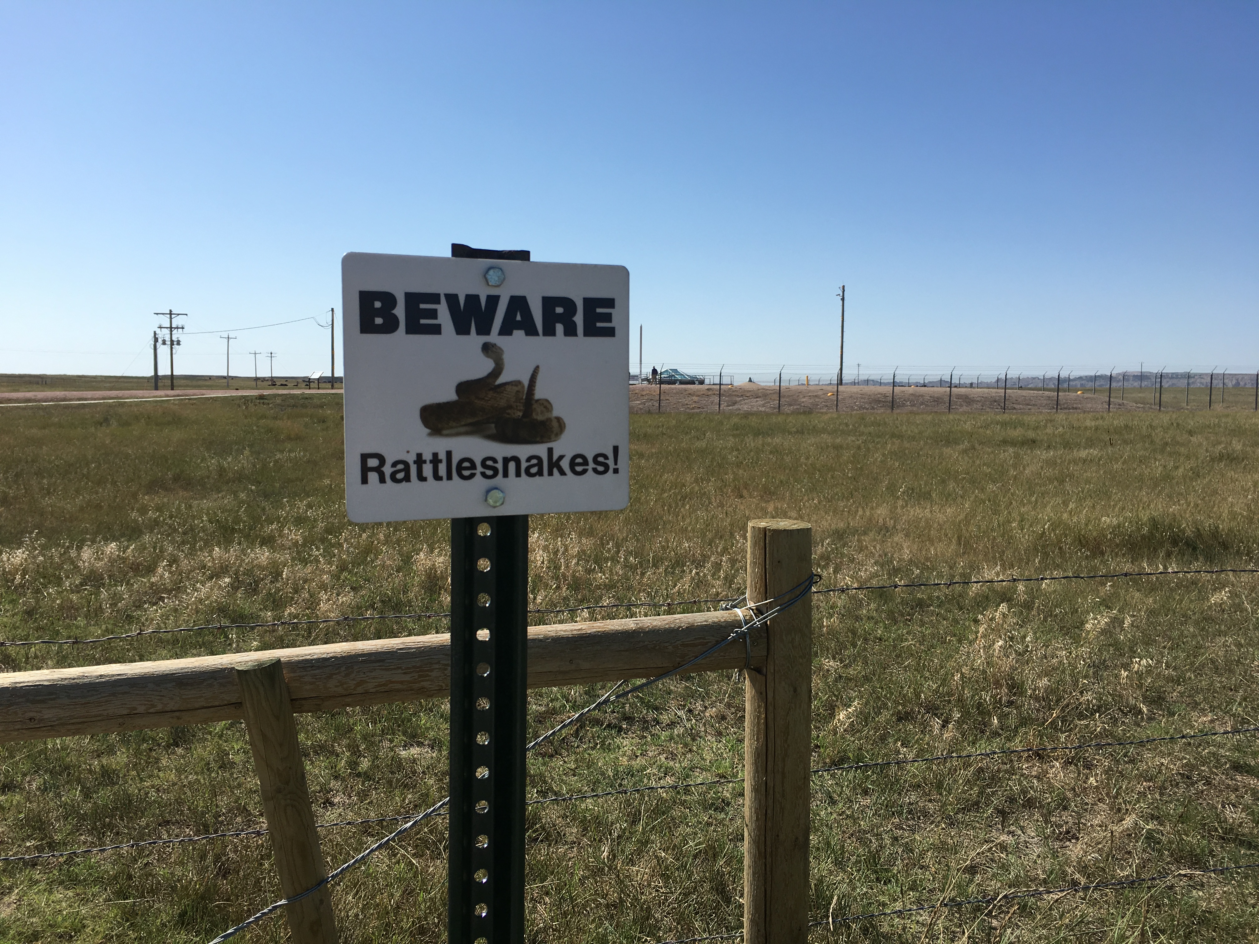
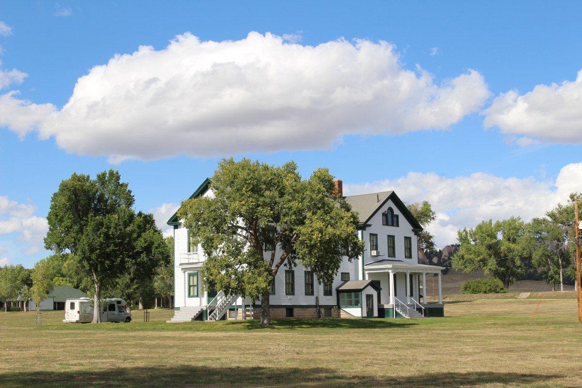
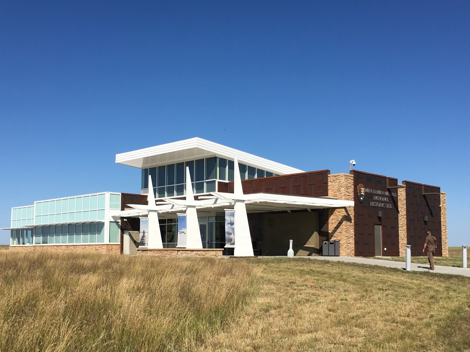
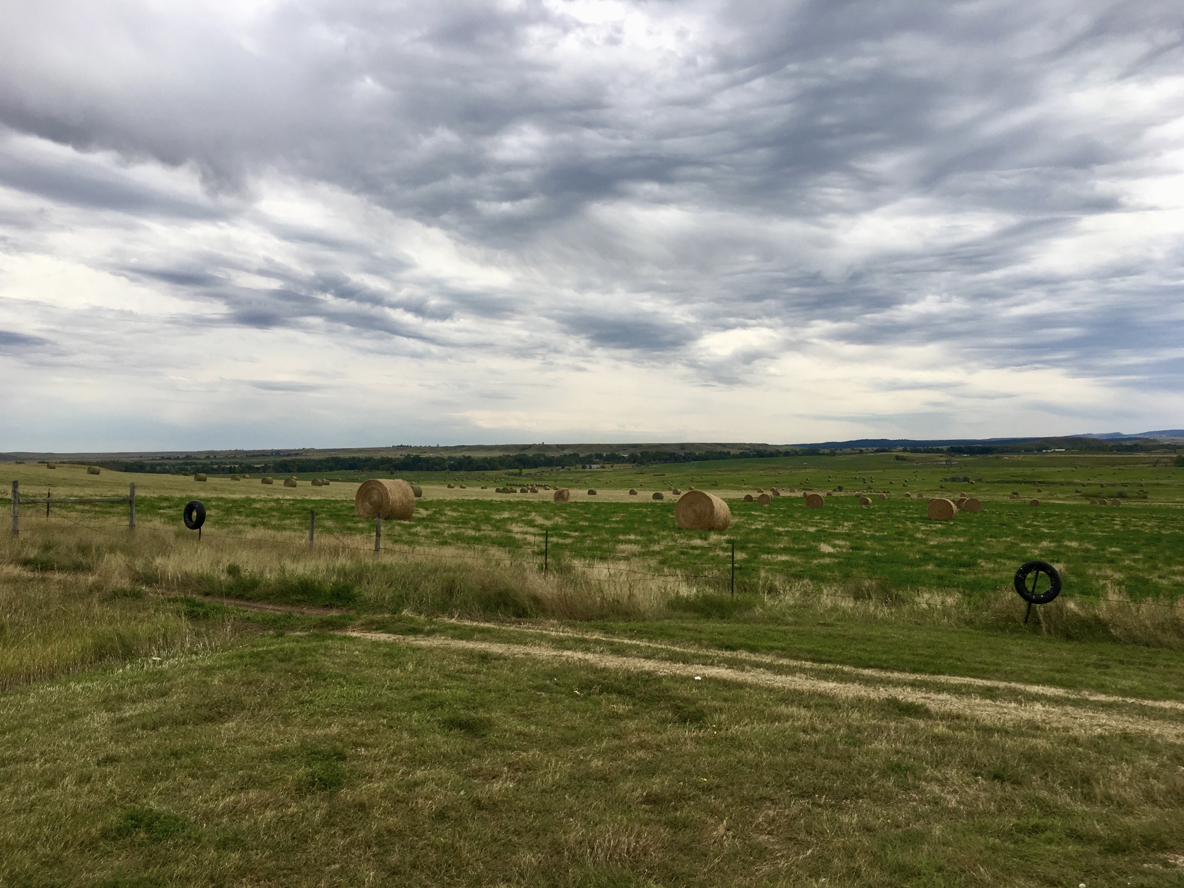
It was 66°F as I passed sprawling cattle spreads driving east on I-90. I arrived at the Minuteman Missile National Historic Site by 9:30. The site commemorates the perilous period of world history known as the Cold War and explores the choices a nation faces. During this period, hundreds of Minuteman Missiles were hidden beneath the sunflowers and wheat, the cows and corn of America’s Great Plains.
When the United States dropped two atomic bombs on the Japanese cities of Hiroshima and Nagasaki in August, 1945, we became a “different country,” in the words of nuclear physicist Robert Oppenheimer. These remain the only instances where nuclear weapons have been used in war. “Most of us felt like weeping,” a war correspondent wrote after he witnessed the aftermath of the nuclear attacks. “We were revolted by this new and terrible form of destruction.”
American political and military leaders weighed the decision to use the atomic bomb in the context of ending a costly war. A few months after President Harry S. Truman authorized the use of atomic bombs, he reflected: “It has fallen to my lot to assume the greatest burden any man ever had and I’m giving it all I have… You know that the most terrible decision a man ever had to make was made by me.”
For a few years after World War II, only the United States possessed nuclear weapons. But by 1949, the Soviet Union developed the atomic bomb, setting off an arms race that gripped the world for over 40 years.
While nuclear weapons remained an unused threat after World War II, all too real conventional wars erupted during the Cold War. Korea and Vietnam became familiar place names, as US forces fought the Cold War on distant soil. Angola and Afghanistan also became war zones as the US and USSR backed opposing forces within each country.
US and Soviet forces did not fight each other directly , but by ‘proxy’ — by supporting and supplying rival forces within other countries.
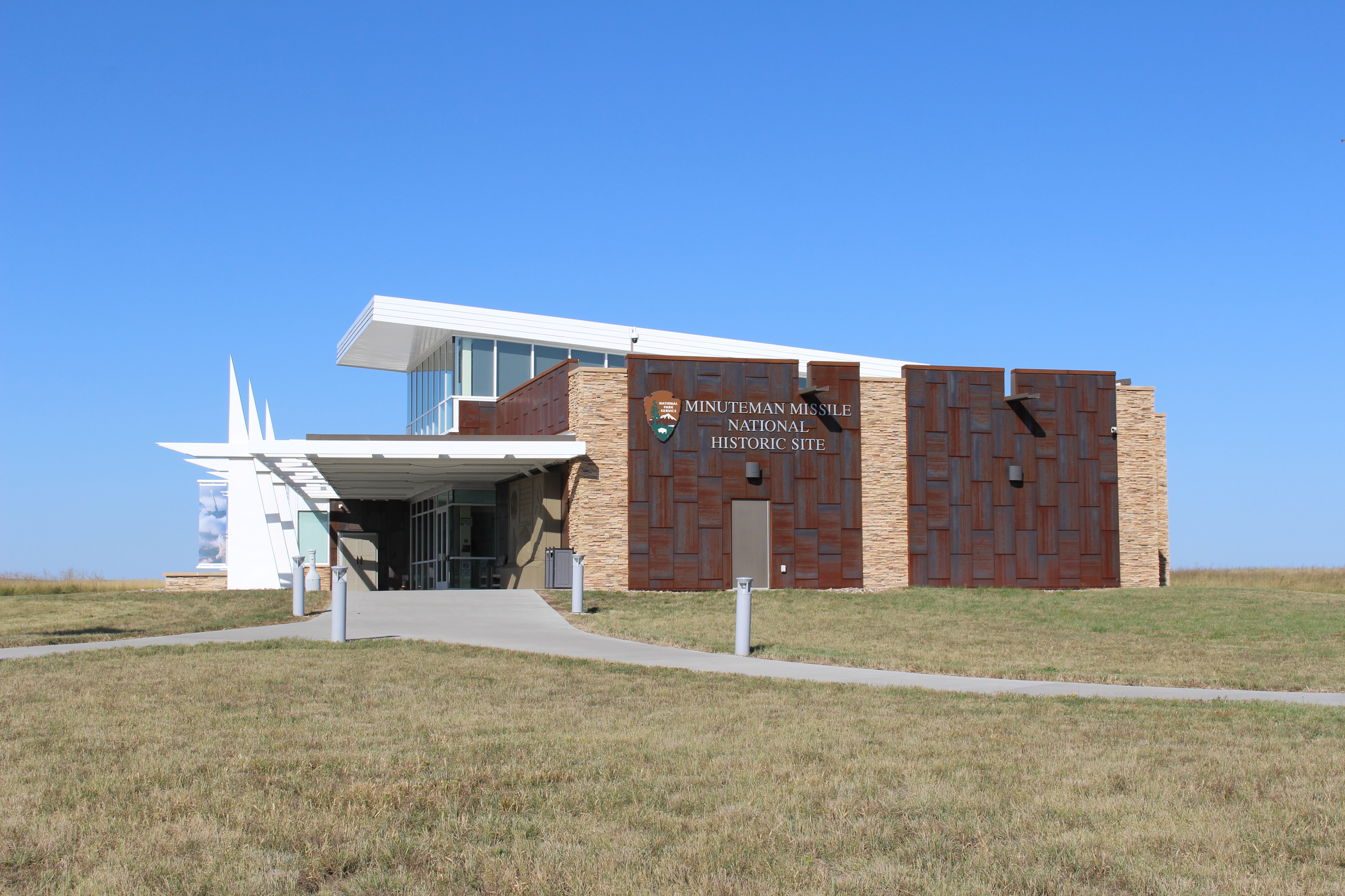
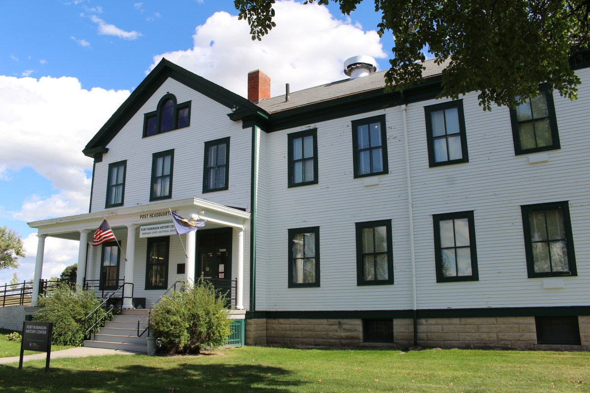
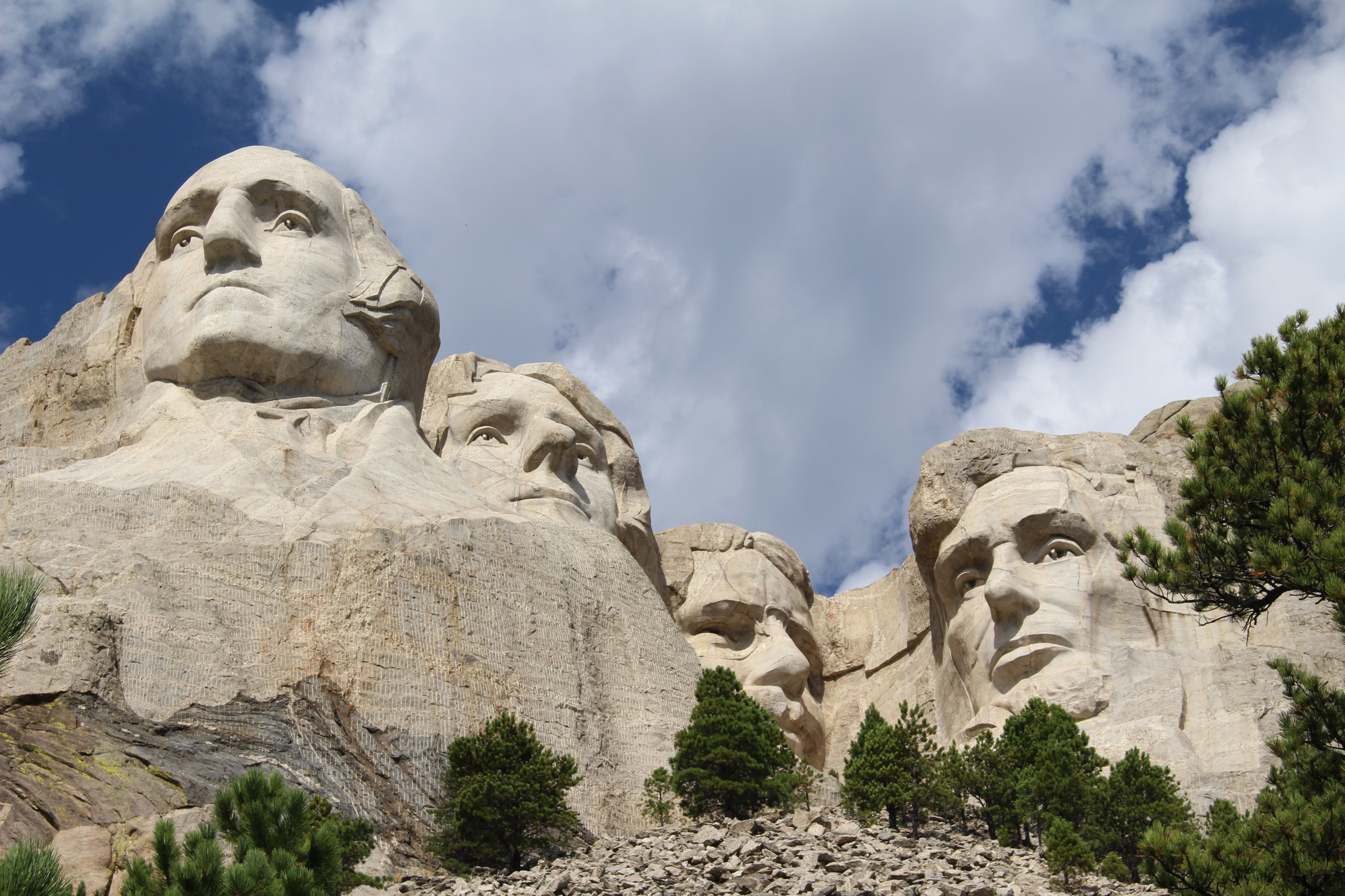
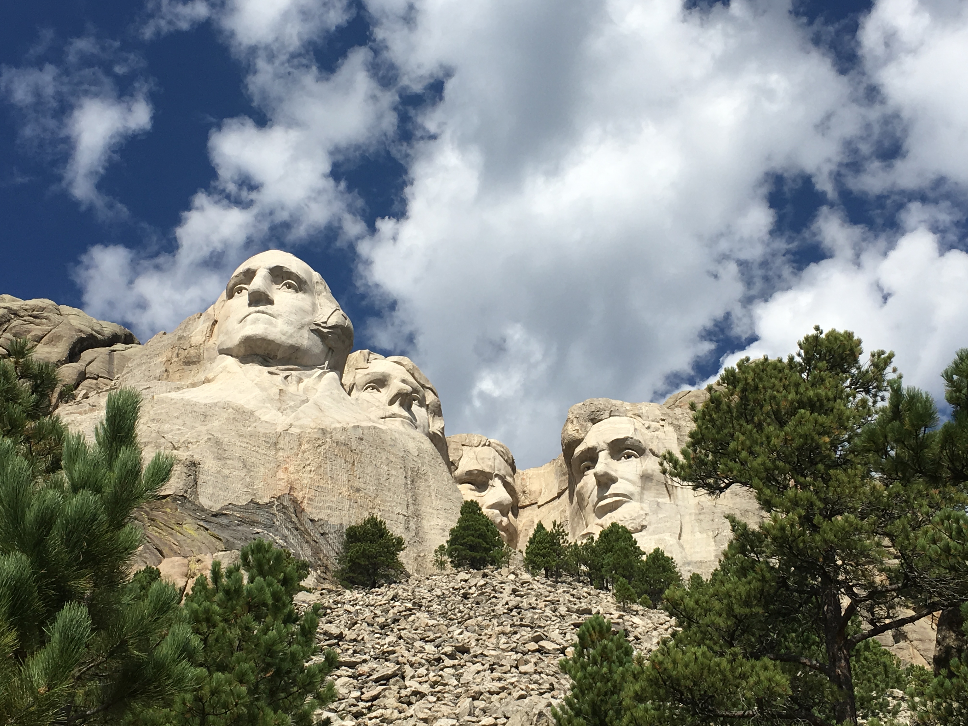
Minuteman Missile National Historic Site
From the 1960s to the 1990s, the United States and Soviet Union followed a strategy called MAD, or MUTUALLY ASSURED DESTRUCTION. Neither side would risk launching an attack because the other side would launch an equally destructive counterattack.
One “Little Boy” was dropped on Hiroshima during World War II. “Little Boy,” a World War II era atomic bomb, could have destroyed the center of Washington, D.C. One Minuteman Missile II (with 1.2 megatons of TNT) was equal to 80 Little Boys. One Minuteman Missile could have taken out most of the city plus adjacent cities and towns. If that happened today, at least one million people would die.
With 1,000 Minuteman missiles ready, the United States was ready to strike back if the Soviet Union struck first. But how many Americans would have already died? Each missile strike would create a crater 200 feet deep and 1,000 feet wide. One such strike could kill as many as two million people, including people in civil defense shelters. Imagine how many would die if 100 missiles struck at once along the U.S. East Coast.
I watched the half-hour film about the Cold War and the Cuban Missile Crisis, the arms race, and the near misses and mistakes made that might have been the end of the world.
One example of a near miss was on September 26, 1983. Soviet Lt. Col. Stanislav Petrov chose to ignore an alarm indicating a US nuclear attack was underway. He reasoned the US would never launch just five ICBMs; it must be a false alarm. He was right. Sunlight reflected from high altitude clouds had triggered a satellite detection system. The incident occurred during a period of extremely high tensions between the Soviet Union and the United States. If Petrov had reported the alarm, Soviet leaders may well have initiated a retaliatory nuclear strike. The incident was not reported in the West until after the Cold War had ended. Petrov was honored at a United Nations meeting in 2006. He has been called “the man who saved the world.” Petrov visited Minuteman Missile National Historic Site in spring 2007.
The museum included a timeline of nuclear weapon growth, and discussed tensions between the US and USSR, the Cold War, “Duck and Cover” drills, backyard bomb shelters, Sputnik, 1970s SALT (Strategic Arms Limitation Talks) that led to the Anti Ballistic Missile Treaty. Missiles in South Dakota were upgraded to Minuteman II.
The United States relied on a triad of weapons – launched from air, land and sea – to deter Soviet aggression. Nearby Ellsworth Air Force Base had two parts: strategic nuclear bombers and silos with long-range international ballistic missiles (ICBMs).
In the 1980s, a South Dakota rancher hosted a 10-day rally against nuclear weapons.
In the 2010s, fifty Minuteman Missiles were removed, leaving 400 beneath the Great Plains. None are now in South Dakota.
“Someday, an ultimate class of warriors will evolve, too strong to be contested. They will win battles without having to fight, so that at last, the day may be won without shedding a single drop of blood.” — adapted from Sun Tzu, The Art of War
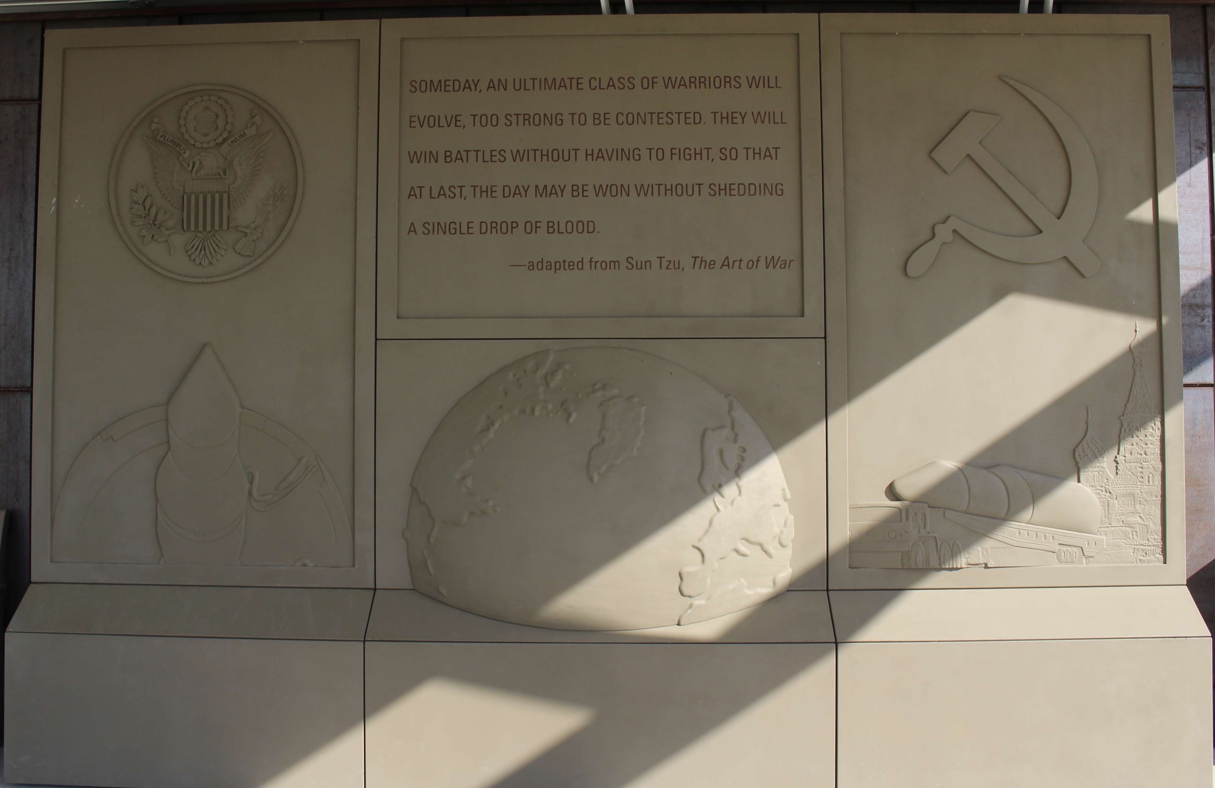
The Art of War
Throughout the Cold War, our nation’s home front became the front line of an unwinnable war.
From 1949 to 1991, the United States engaged in a nuclear-fueled standoff with the former Soviet Union. Nothing less than humanity’s survival hung in the balance. Despite this danger — or because of it — peace prevailed.
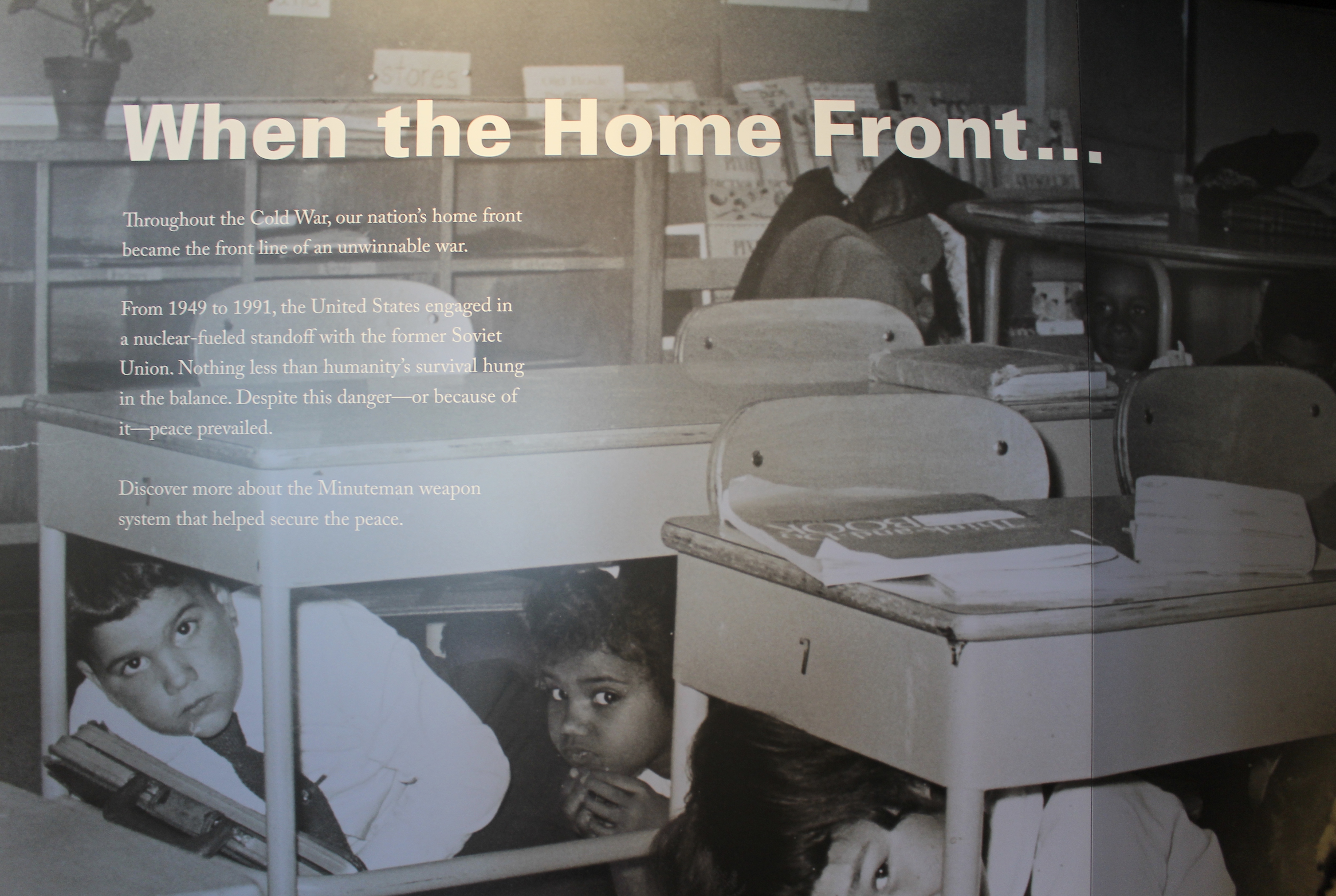
When the Home Front
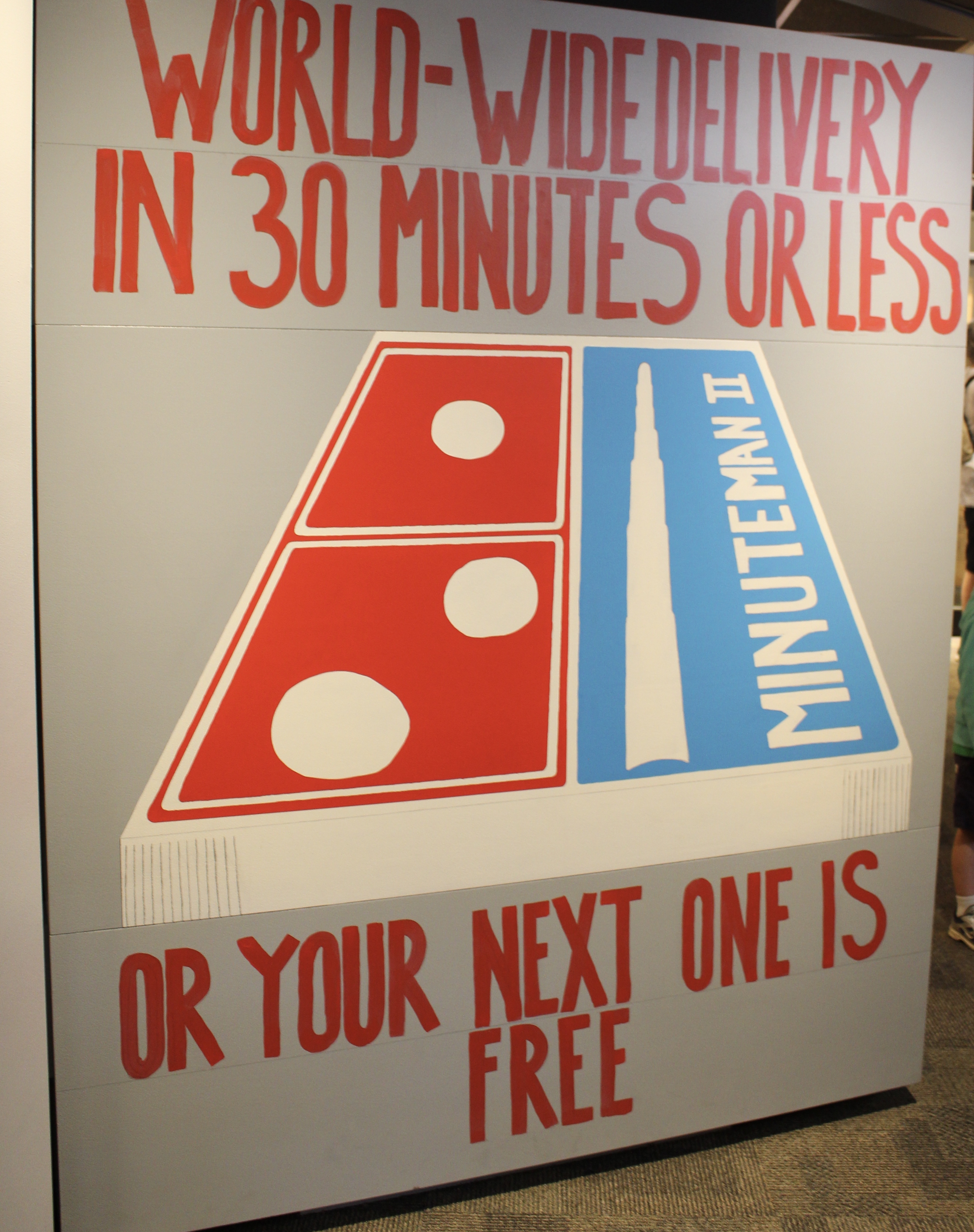
Minuteman II
When physicists first split the atom, they knew they unleashed unprecedented power. The terrific energy released could be used for war or peace, for destruction or creation.
Cold War movies, fiction, cartoons, and political discourse revealed our fascination with the promise of the atomic age paired with fear of its peril. Kids who practiced “duck and cover” drills at school could read comic books at home that either fueled or calmed their fears.
Duck and cover
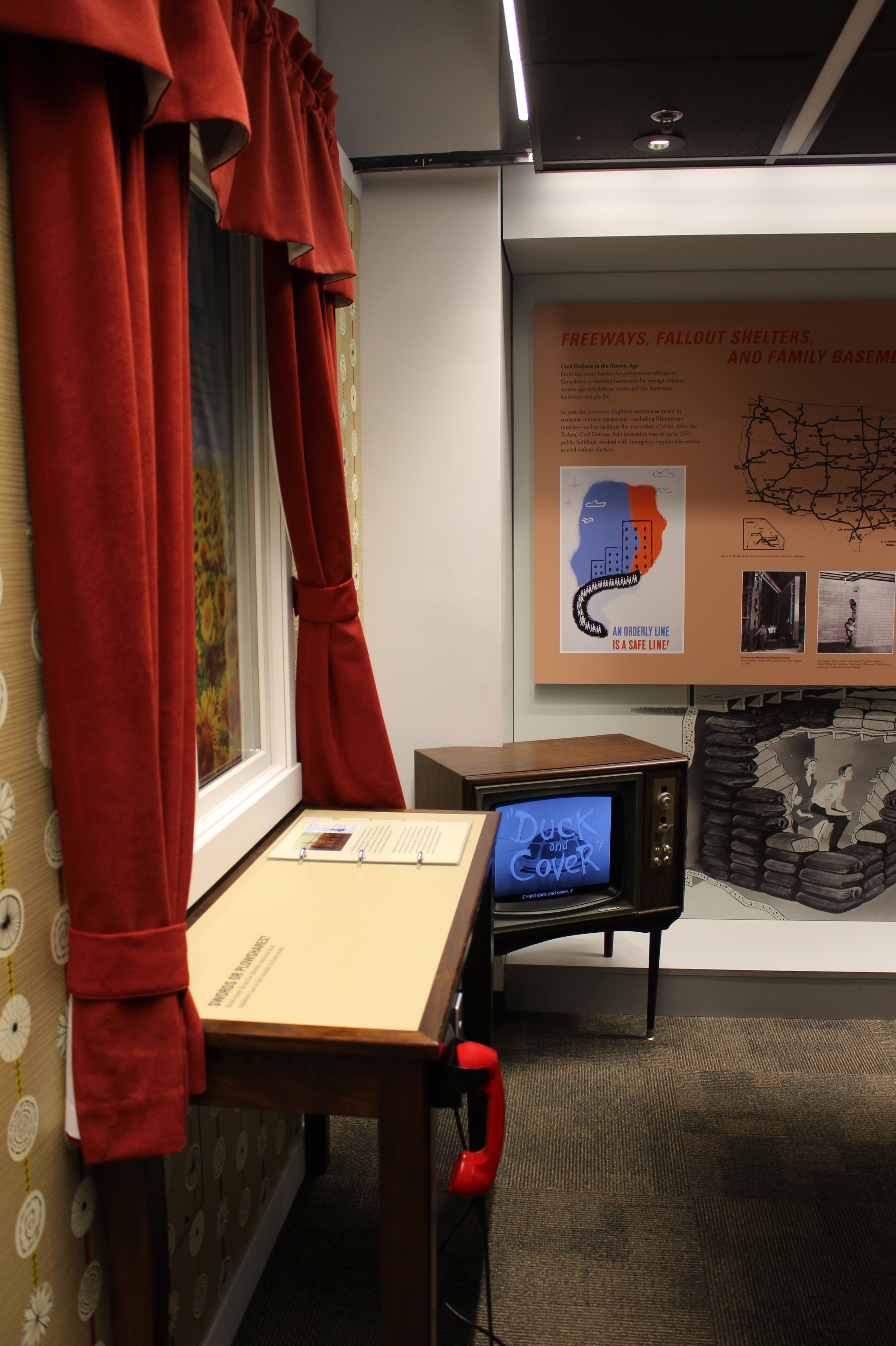
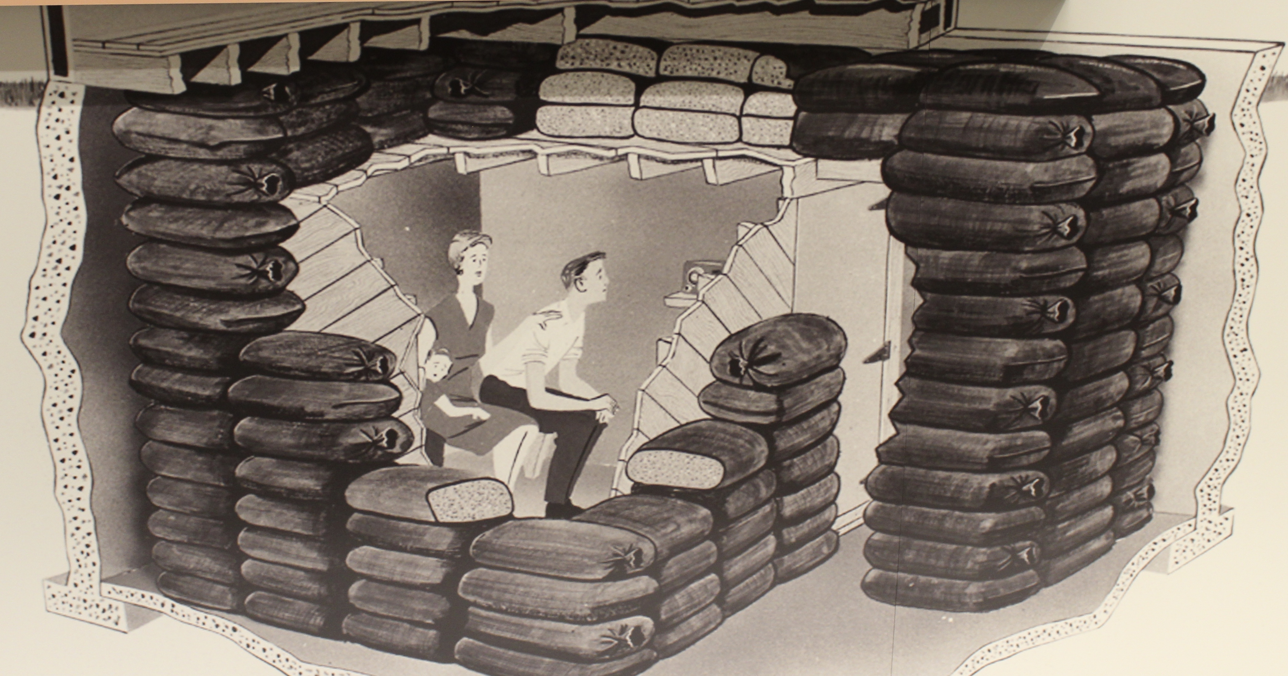
From the secret bunker for government officials at Greenbrier, to fortified basements for average citizens, atomic age civil defense imprinted the American landscape and psyche.
In part, the Interstate Highway system was meant to transport military equipment — including Minuteman missiles — and to facilitate the evacuation of cities. After the Federal Civil Defense Administration was set up in 1951, public buildings stocked with emergency supplies also served as civil defense shelters.
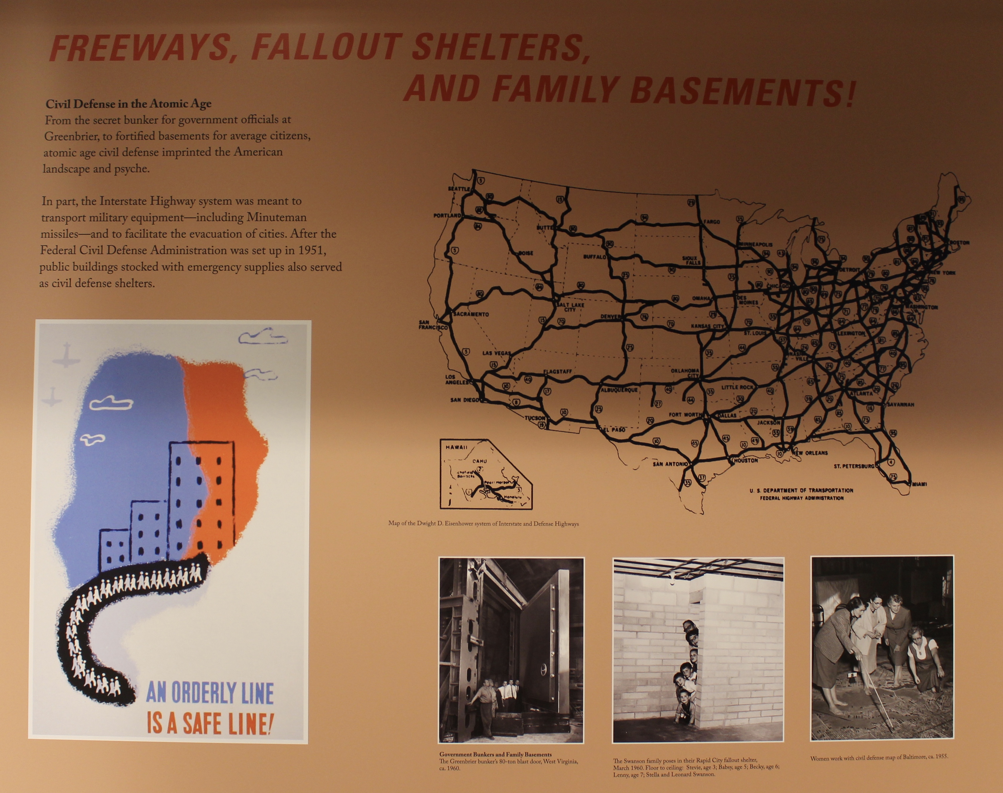
Freeways, Fallout Shelters and Family Basements
Fallout shelter

Air Raid Protection

Survival Supplies

LIFE Magazine – The Danger of War
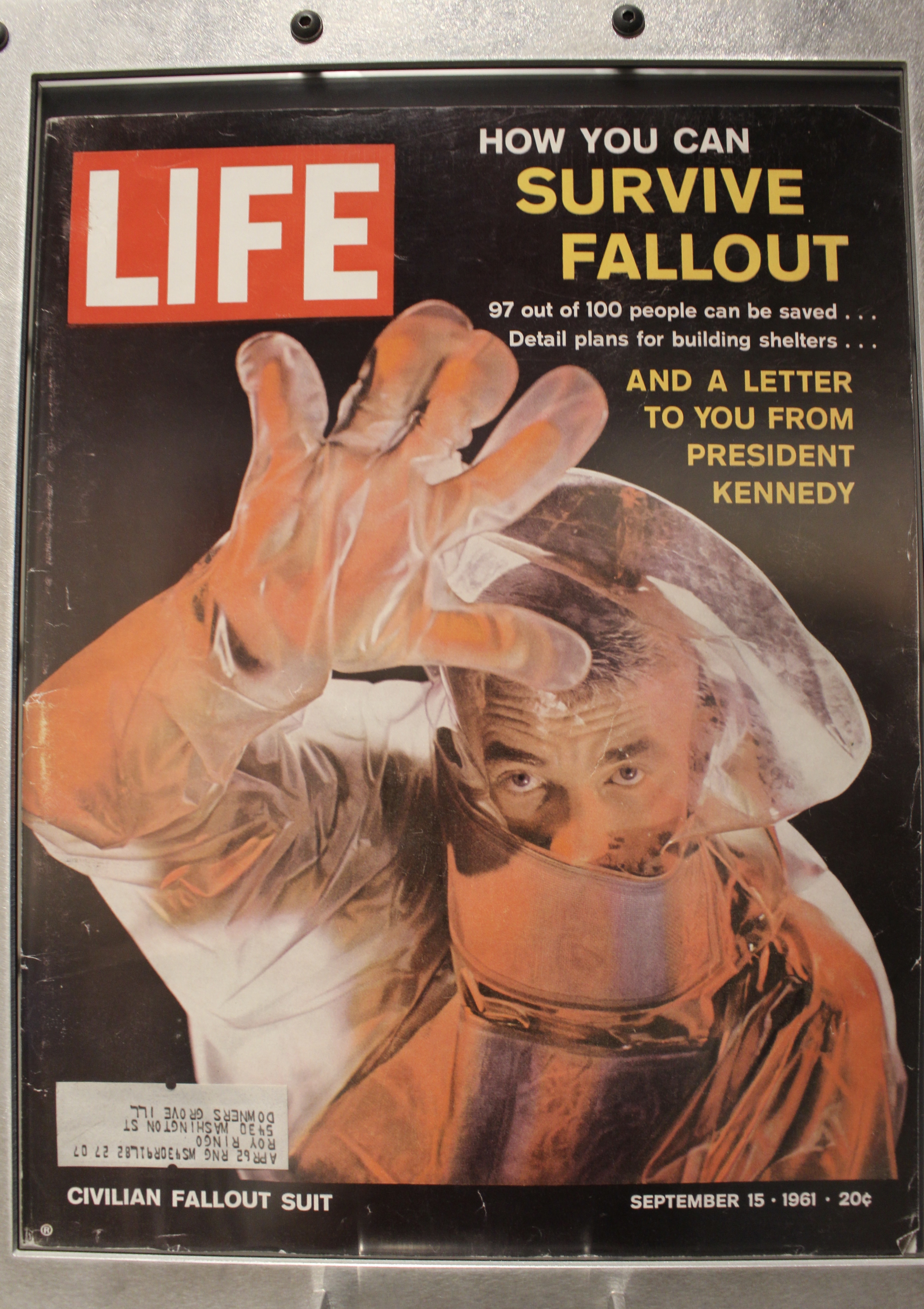
LIFE – How You Can Survive Fallout
Launch control center crews worked 24 hours a day to manage the weapons systems below ground. Topside personnel braved blizzards and heat waves alike to perform routine maintenance checks and make repairs. Missileers were two people who worked 24-hour shifts in a control center designed to protect them from a nuclear blast.
Not everyone could become a missileer. Candidates underwent psychological screening. Active duty missileers were monitored by a protocol called the Personnel Reliability Program (PRP). Besides strict personal accountability, this also included their financial responsibility, types of medication prescribed while under a doctor’s care, and the conduct of their personal lives.
No single person could arm, disarm, repair, or launch a nuclear weapon. Missile technicians working inside the silos observed a strict “no lone zone” policy. As for the capsule crew, two officers in one launch control center (LCC) needed to concur with two officers in another LCC in order to launch any missiles.
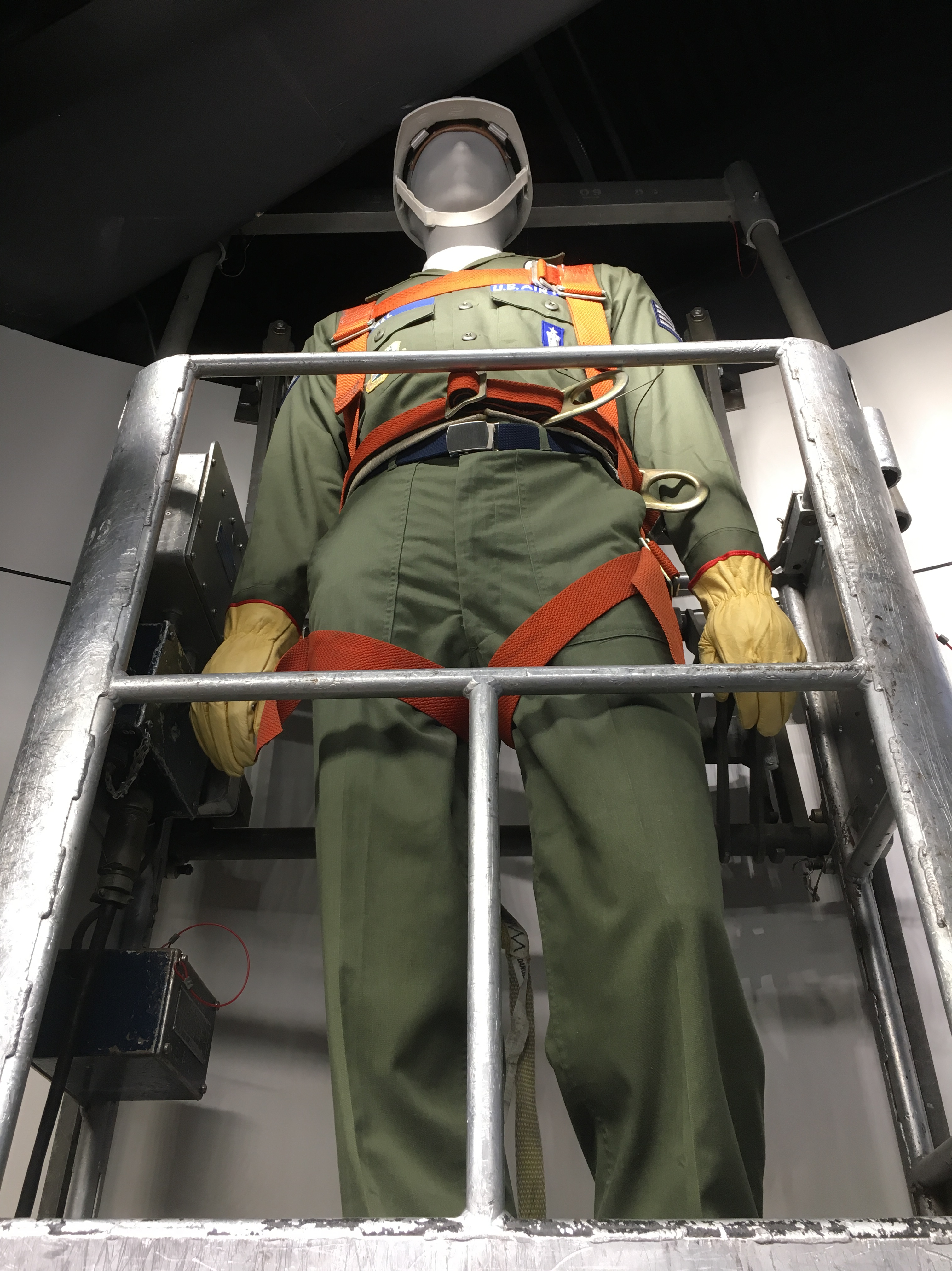
Missileers
The Berlin Wall appeared overnight in mid-August 1961. From East Germany’s perspective, too many skilled workers had already fled the country for the West. This hurt the Soviet Bloc country’s economy. Razor wire bundles became cinder block, and then 12-foot concrete walls, a stark symbol of the stand-off between capitalism and communism.
In 1989, the Berlin Wall came down. In the 1990s, START 1, the Strategic Arms Reduction Treaty was signed. The USSR dissolved and the Cold War ended.
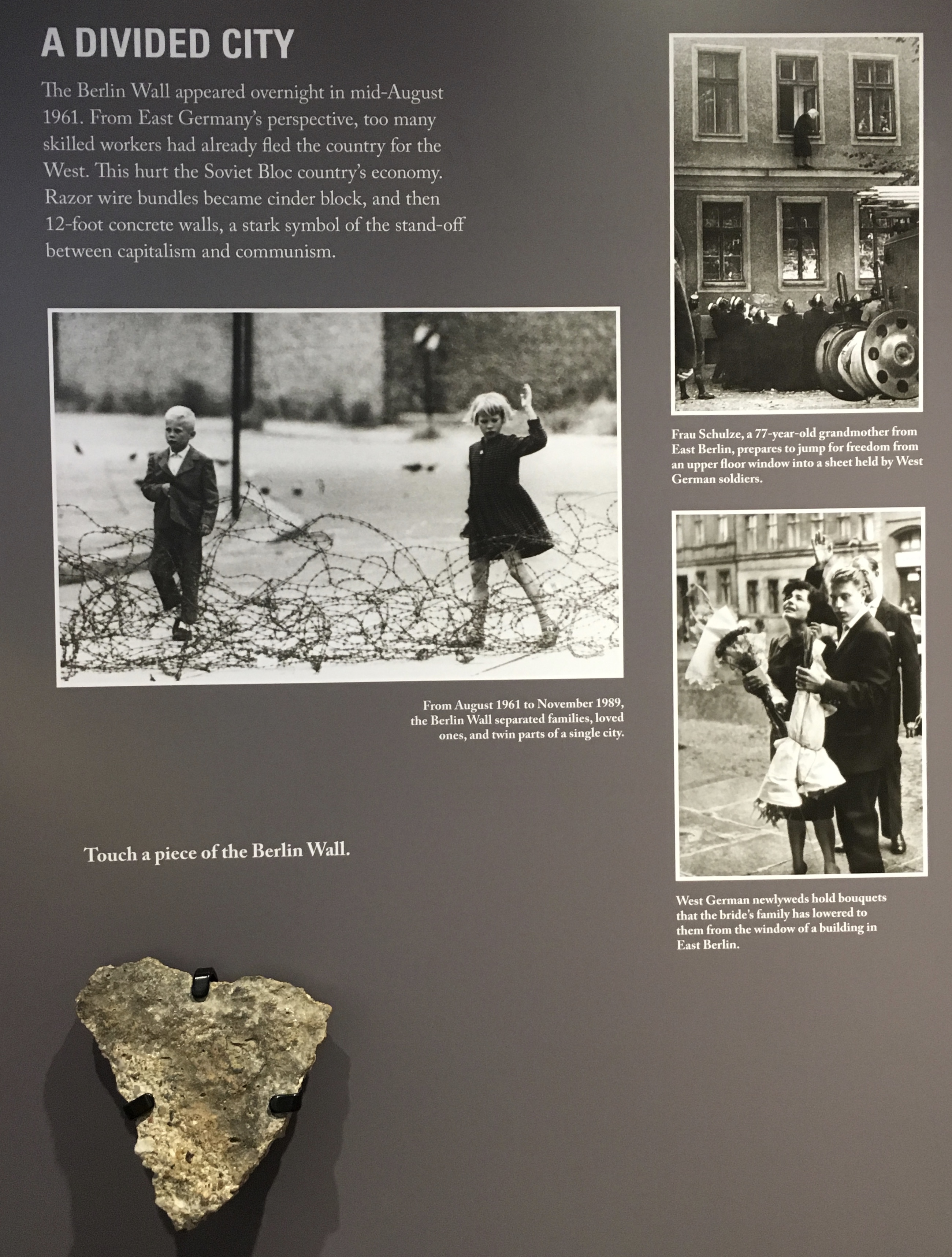
The Berlin Wall
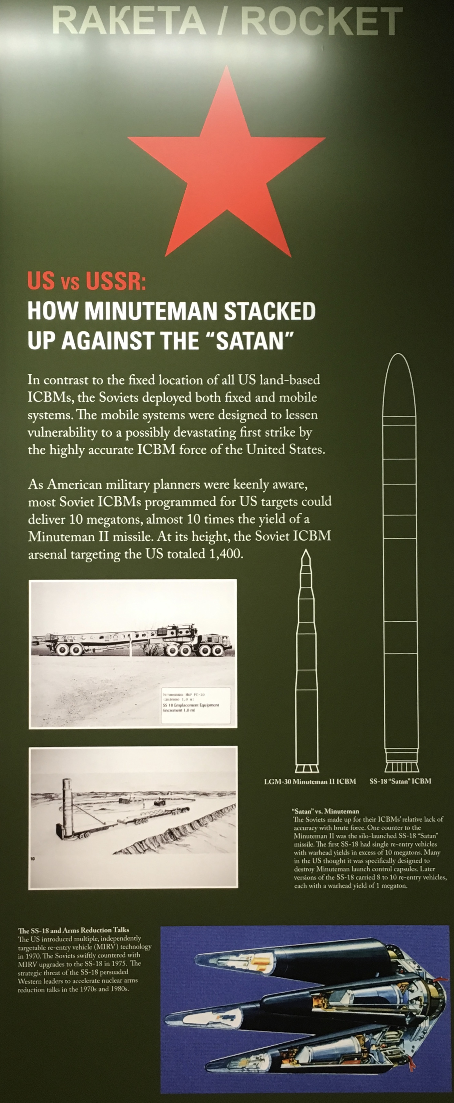
US vs. USSR
When Nikita Khruschchev told Western leaders, “we will bury you,” he meant that communism would inevitably prevail over capitalism. But many in the West thought he was talking about the arms race. Indeed by 1986, Russia had far more nuclear weapons than any other country.
The same fears that fueled the US military build-up drove the USSR to set up extensive civil defense facilities and amass a vast arsenal of nuclear weapons.

Soviet Civil Defense posters
In the event of a nuclear attack, every second counted. With a 30-minute flight path between the US and USSR, the decision whether to launch a retaliatory strike had to be made — and communicated securely — within minutes.
The grave nature of the decision required that no one ever act alone. From the White House to the missile fields, no one person could authorize, arm, or launch a nuclear weapons.

Split-Second Decisions
At the end of World War II — the first and only wartime use of atomic bombs — the United States possessed only six nuclear weapons. After the Soviet Union tested its first atomic bomb four years later, the arms race took off. Within four decades, the global arsenal had multiplied to a peak of around 65,000 weapons.
Charting the world’s nuclear stockpile illustrates how the United States, its allies, and its enemies went to the brink and back during the Cold War.
World War I was touted as the “war to end all wars.” So was World War II, which first introduced the weapons that could actually fulfill that vision. As world powers sought to redefine warfare in the nuclear age, the global arsenal reached epic proportions.
In an increasingly polarized world — hawks vs. doves, capitalists vs. communists — a series of treaties gradually put the brakes on the arms race. Leaders of both countries held fast to the conviction that only powerful deterrents, such as Minuteman missiles, could bring their opponents to the bargaining table.
Although the Cold War ended symbolically with the collapse of the Soviet Union and diplomatically with START II, the potential threat posed by nuclear weapons persists. Since the 1970s, Israel, India, Pakistan, and North Korea have become nuclear powers.
As of 2015, nine countries possessed about 15,700 nuclear weapons.

The Arms Race

Scale of Destruction

The Arms Race

the Arms Race
On September 27, 1991, the order came: “Minuteman II Launch facilities are to be rendered non-launch capable… with safety being paramount.” After 30 years of standing ready — often on high alert — hundreds of Minuteman II missiles and their missileers stood down.
Guided by the START agreement, the US Air Force deactivated 450 Minuteman II missile silos and launch control centers, while the Soviets undertook a parallel effort. Each inspected and verified the other’s progress via satellite as well as in-person visits. As of 2015, 450 Minuteman III weapon systems remain operational on the Great Plains.

Standing Down on the High Plains and Russian Steppes
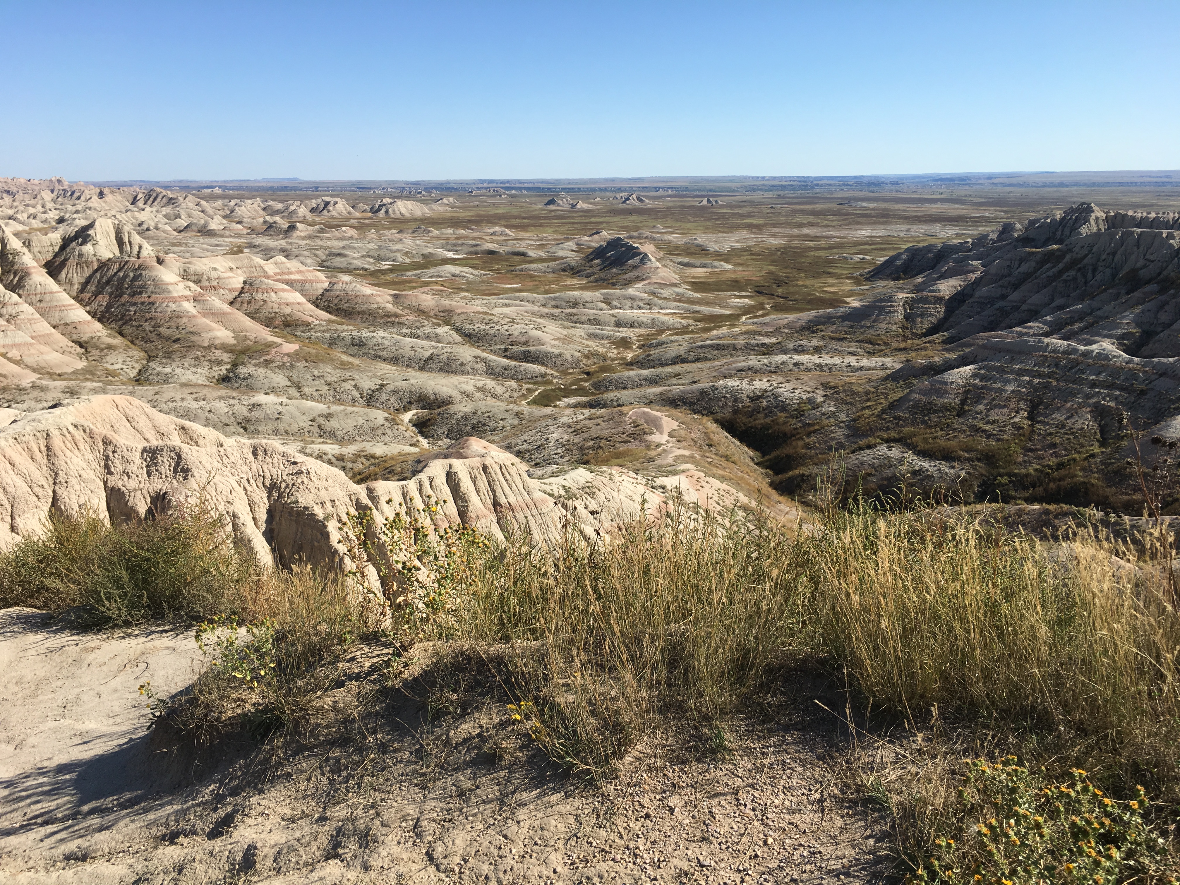
After visiting the museum, I drove back west again (toward Wall) to see Delta-09 Launch Facility .
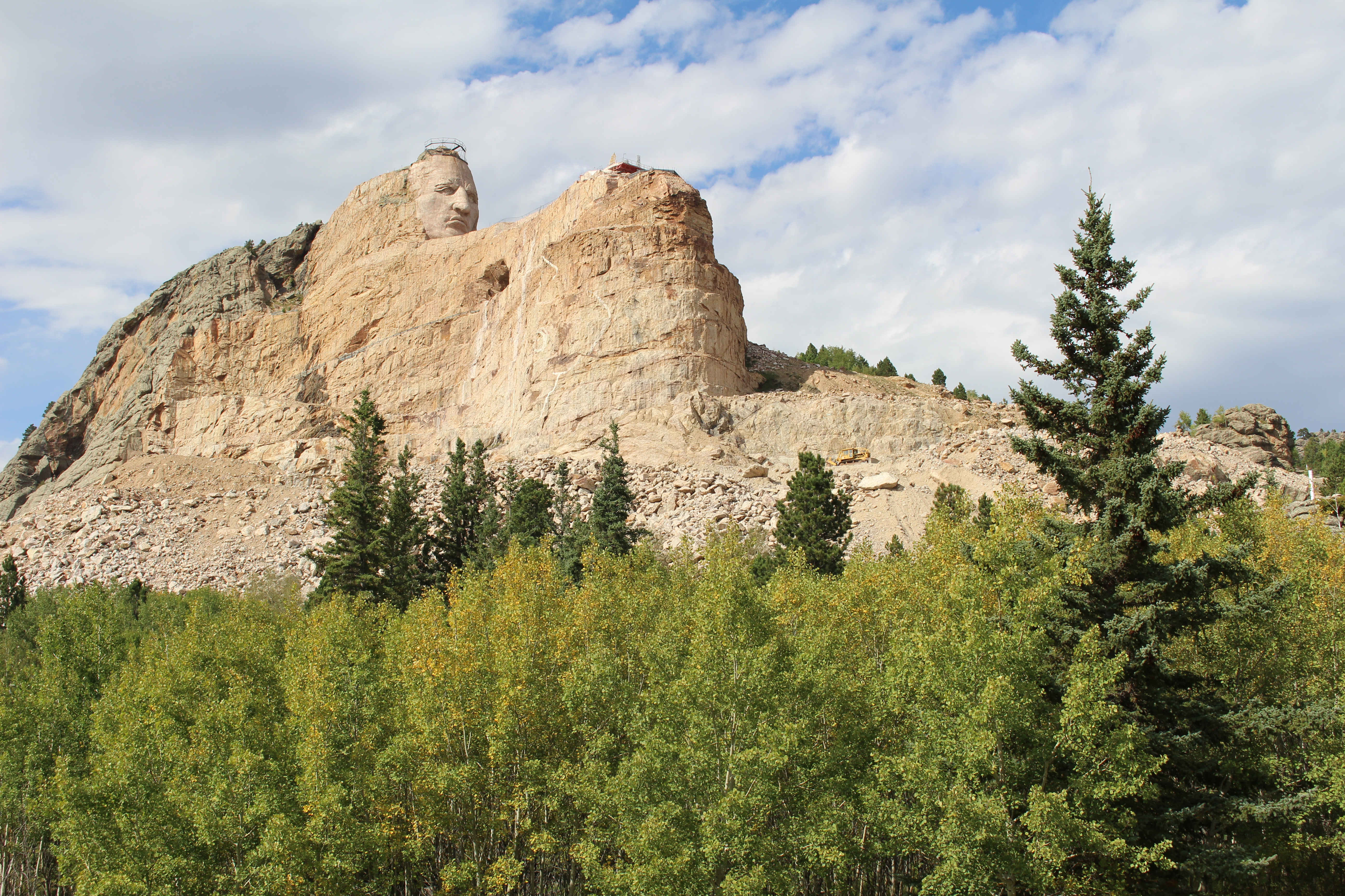
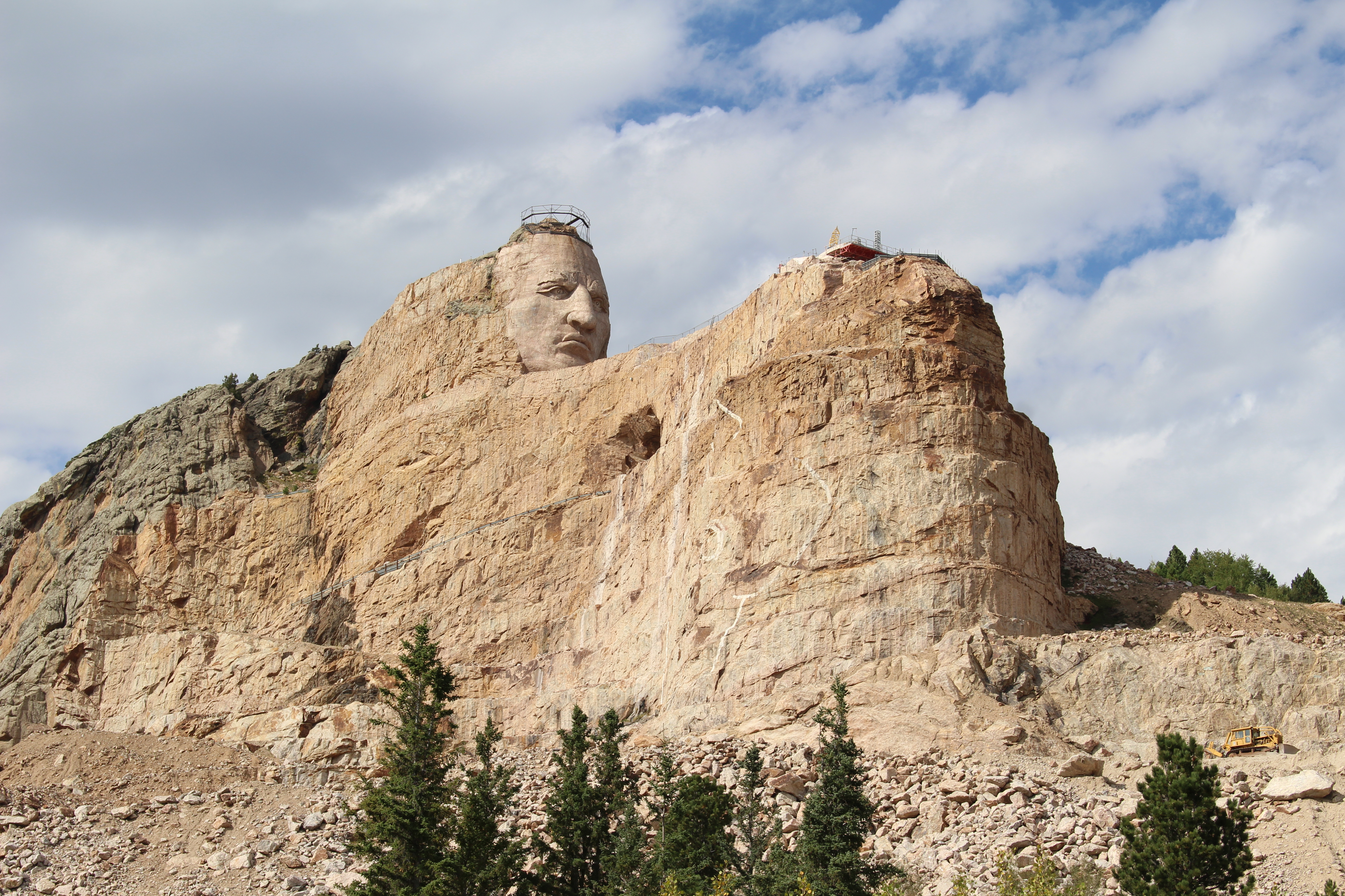
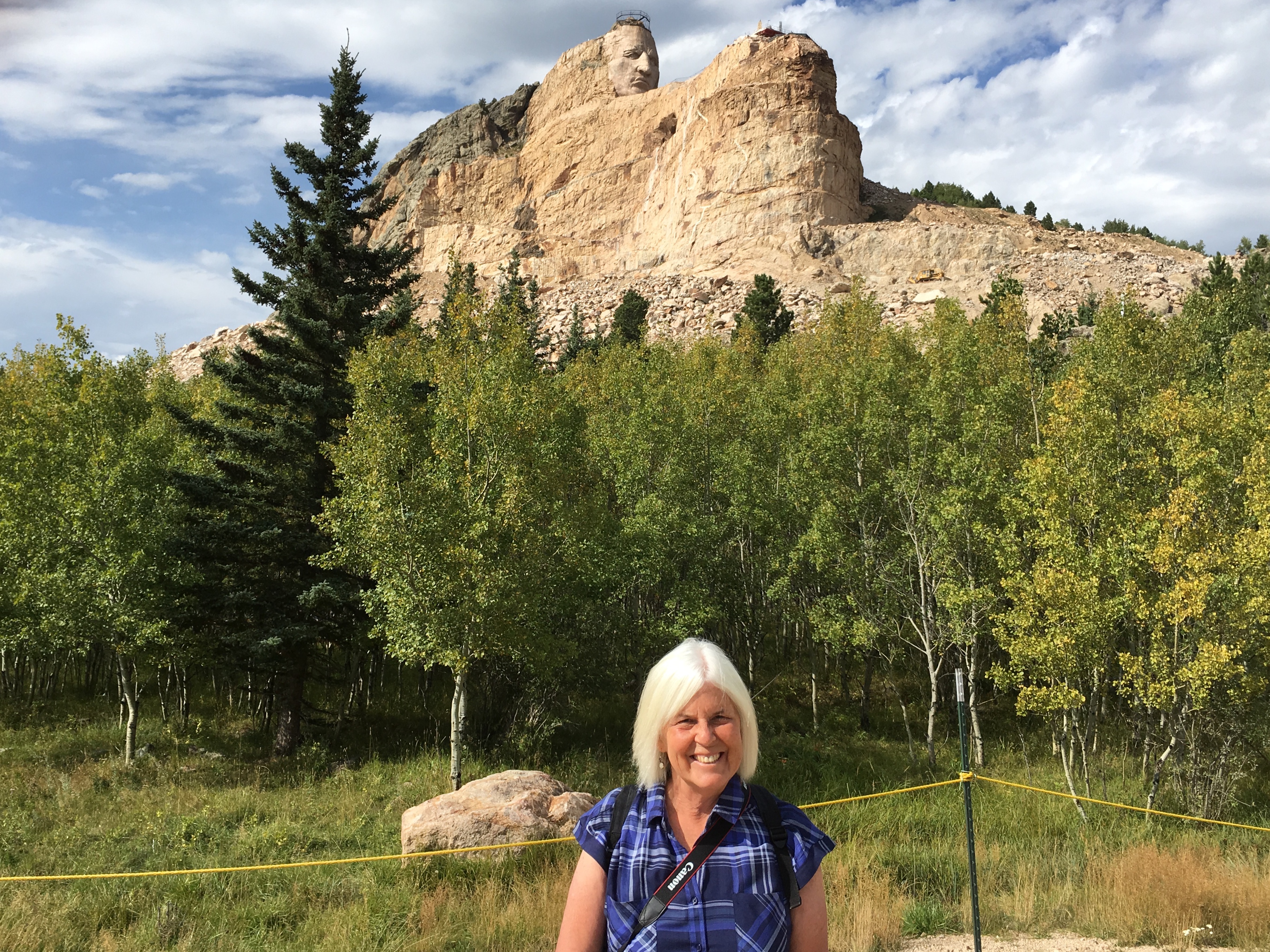
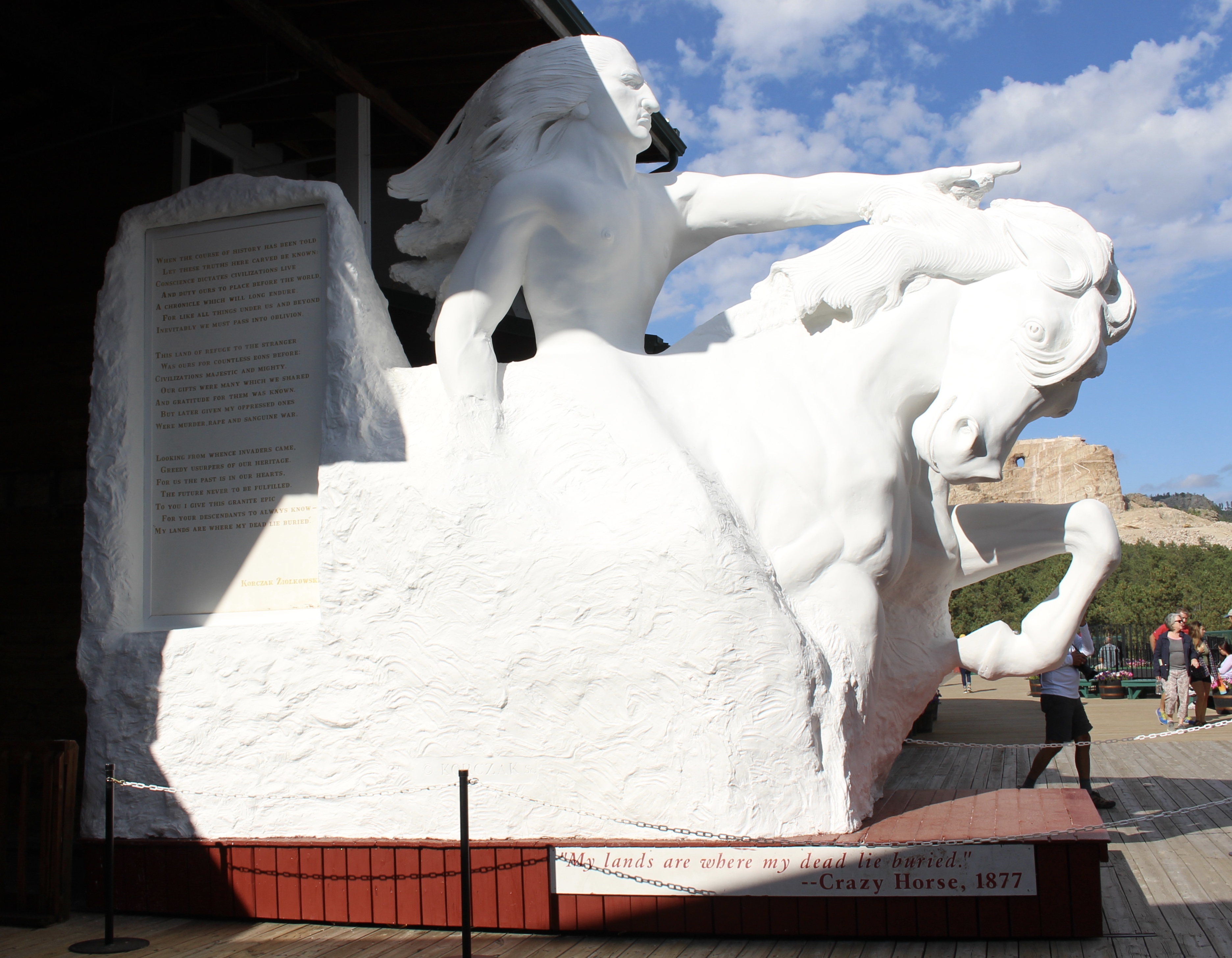
Minuteman Missile NHS
Brett Dennen sang that he didn’t know why he said the things he said, but he said them anyway.
Heading back towards Wall were the ubiquitous Wall Drug signs. TRADERS CHAPEL: WALL DRUG; WESTERN WEAR: WALL DRUG.
********
At exit 116, I got off to visit Delta-09 while Eileen Jewel sang about messing around.
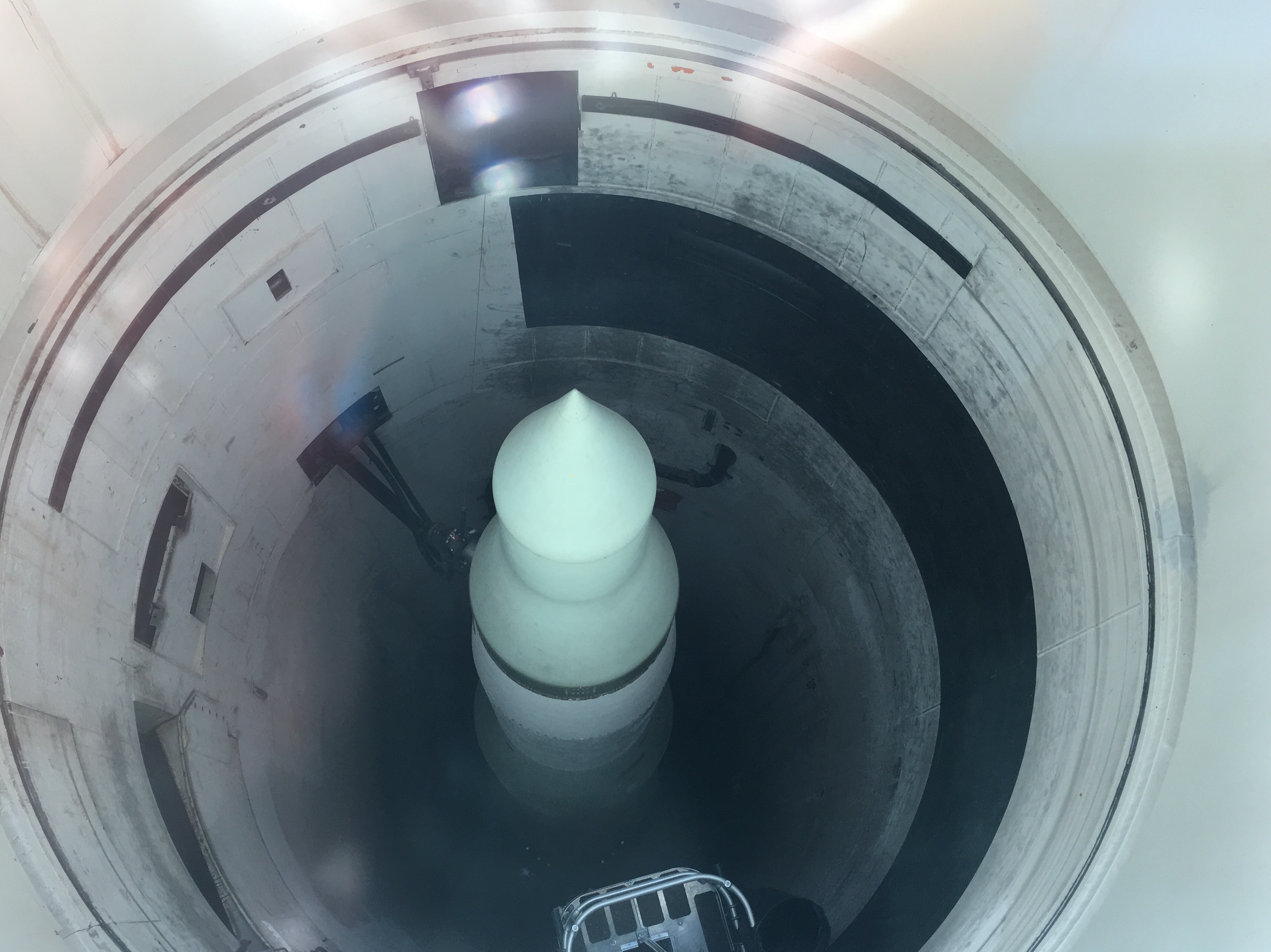
At Delta-09 Launch Facility, I saw a Minuteman II intercontinental ballistic missile in the silo. Its solid fuel was stable enough to last decades while still enabling the missile to launch in minutes. A tall motion sensor alerted Launch Control of intruders day and night. During the Cold War, anyone or anything that crossed the fence was in serious trouble. Standing orders meant the use of deadly force was authorized. The cone-shaped antenna communicated with airborne control centers.
A sign asked us to imagine one thousand ICBM silos like this, each roughly half the size of a football field, scattered widely across the American heartland. This was part of an enormous systems that kept the United States secure from a Soviet nuclear attack by threatening overwhelming destruction.
Launch Facility Delta-09

Launch Facility Delta-09

Launch Facility Delta-09
Launch Facility Delta-09
These missiles were located in the Great Plains because geographically this area was the closest to any point in the USSR. Missiles would have been launched over the North Pole.

Launch Facility Delta-09

Launch Facility Delta-09

Launch Facility Delta-09
Information about Minuteman Missile National Historic Site is from a pamphlet and plaques created by the National Park Service.
******
I drove back to exit 131 on I-90 and stopped at Prairie Homestead Historic Site. This was a far cry from what I’d seen at the Minuteman Missile National Historic Site, the highest tech to the lowest tech. This site has one of the only original farm sod buildings on public display in South Dakota. It is furnished in the style of the original homesteaders, Ed and Alice Brown. Letters and photos of the family and neighbors offer insights into hardships suffered.
I found Brown’s Original Grub Box, which kept all of the pioneer travelers’ kitchen supplies and equipment in it. A typical grub box would contain cooking utensils, spices, and anything needed to prepare meals. The Browns used this grub box on their journey west in 1909 from Pierce, Nebraska to their new homestead in the badlands of South Dakota. In later years, it was placed in the barn and was used by George Carr to store oats for his horses.

Brown’s Original Grub Box

Brown’s Original Grub Box
One of the homesteader’s problems was water. This well was dug 30 feet deep by hand. Many of the wells went dry. In later years, this one furnished only a few buckets of water a day.
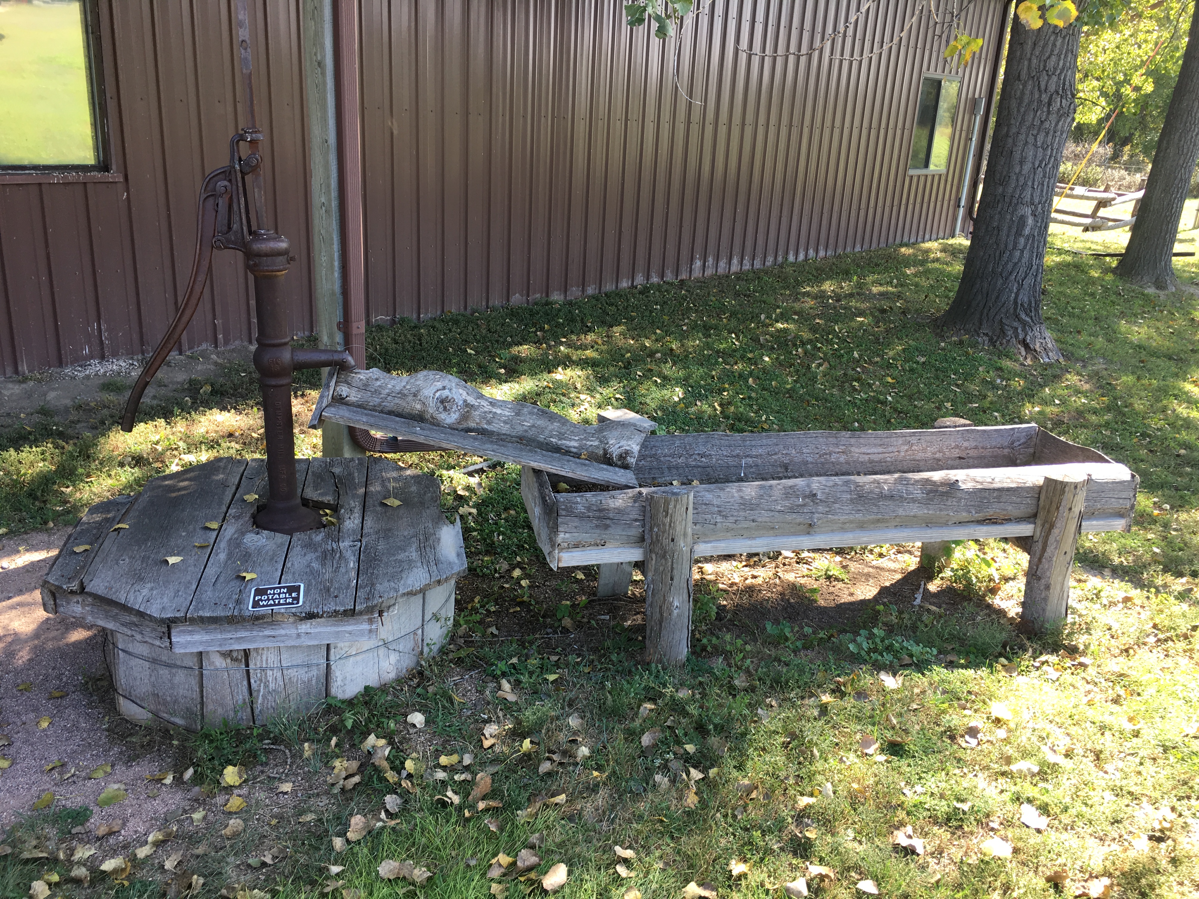
Well
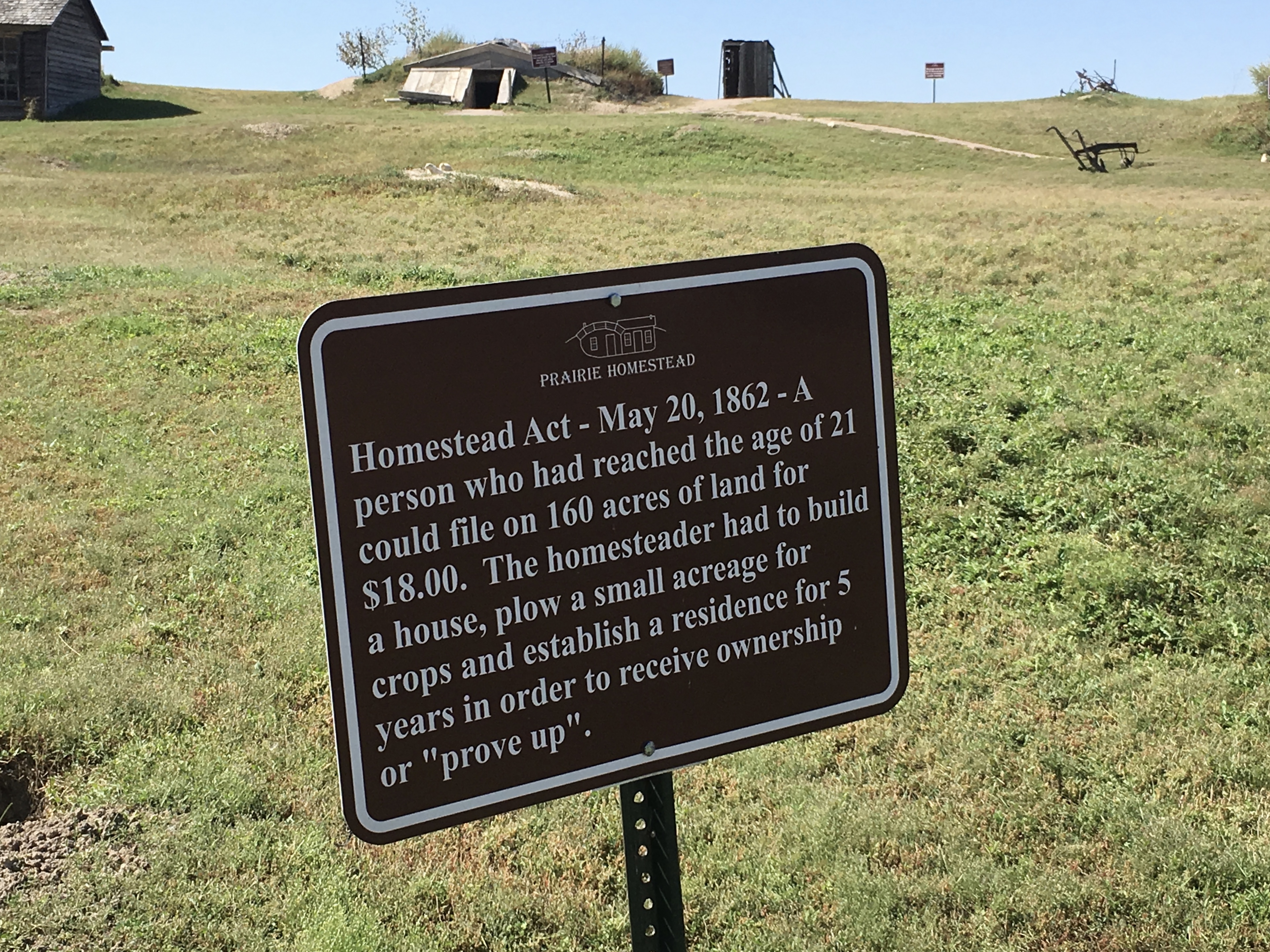
The Homestead Act of May 20, 1862, established that a person who had reached the age of 21 could file on 160 acres of land for $18.00. The homesteader had to build a house, plow a small acreage for crops and establish a residence for five years in order to receive ownership or “prove up.”
A common remark by homesteaders was that “the government bet you 160 acres of land against $18.00 that you will starve to death before you live on the land 5 years.”
Homestead Act
The pioneer home was built by Ed and Alice Brown in 1909 of dirt sod bricks and a dirt roof. They homesteaded these 160 acres in 1909. Mr. Brown used cottonwood logs (a native tree) for his homestead home. The log front is original. The cave and chicken house were dug into the bank, as was the house. The cave served as a refrigerator in summer and as a place where food and milk wouldn’t freeze in winter.
Ed and Alice Brown passed the homestead to their son, Charles Brown. He sold it to long time neighbors, Leslie and Jessie Crew. They sold the property to their son and daughter-in-law, Keith and Dorothy Crew.

Home of Mr. And Mrs. Ed Brown “1909”
There was an unending supply of building material for sod houses. The prairie buffalo grass sprouted from densely tangled roots, giving the top three inches of soil a tight consistency. The sodbuster shaved off a belt of roots and grass 12-18″ wide and 3″ deep. The ribbon of sod was cut into 18-inch strips. He started the building by laying each block, with the grass side down, staggering the layers like brickwork. Two rows were usually arranged parallel, making the finished walls about 24″ thick. Intersecting layers were lapped together at the corners with a pole used to hold the beams. As the sod house grew, spaces were left for windows.
A small portion of the furnishings are original; the rest typical of the sodbusters in this area.

car in the barn

Home of Mr. And Mrs. Ed Brown

Home of Mr. And Mrs. Ed Brown

Home of Mr. And Mrs. Ed Brown

Home of Mr. And Mrs. Ed Brown

Home of Mr. And Mrs. Ed Brown

Home of Mr. And Mrs. Ed Brown

Home of Mr. And Mrs. Ed Brown

Home of Mr. And Mrs. Ed Brown
Mr. Brown, or probably any homesteader, did not have all the machinery seen here. Usually the homesteader had a plow and maybe one or two other pieces of machinery. Whatever he was lacking, he had to borrow from a neighbor.
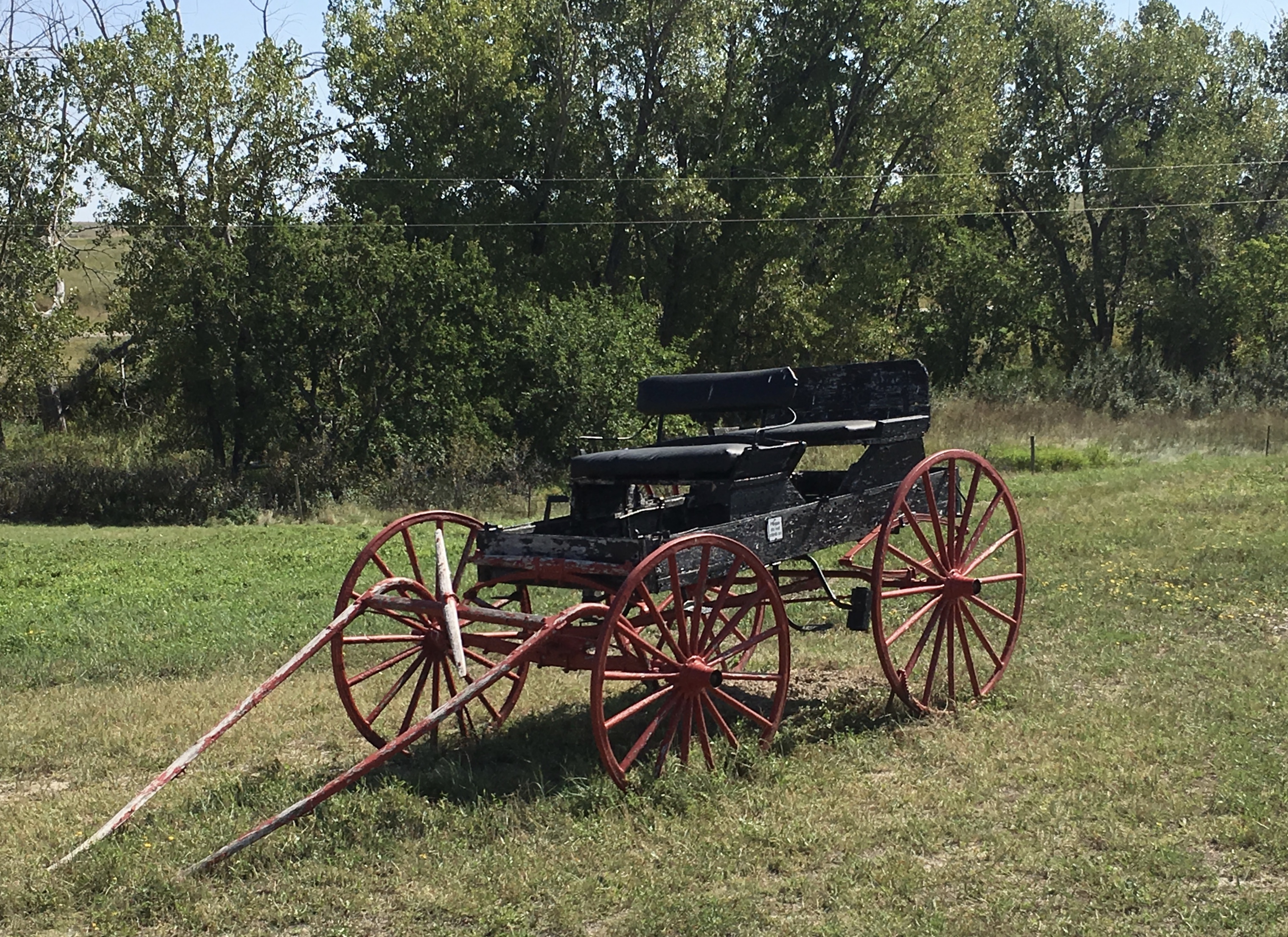
wagon
The cave, or “root cellar,” was used mainly for food storage and safety from the occasional severe storm.
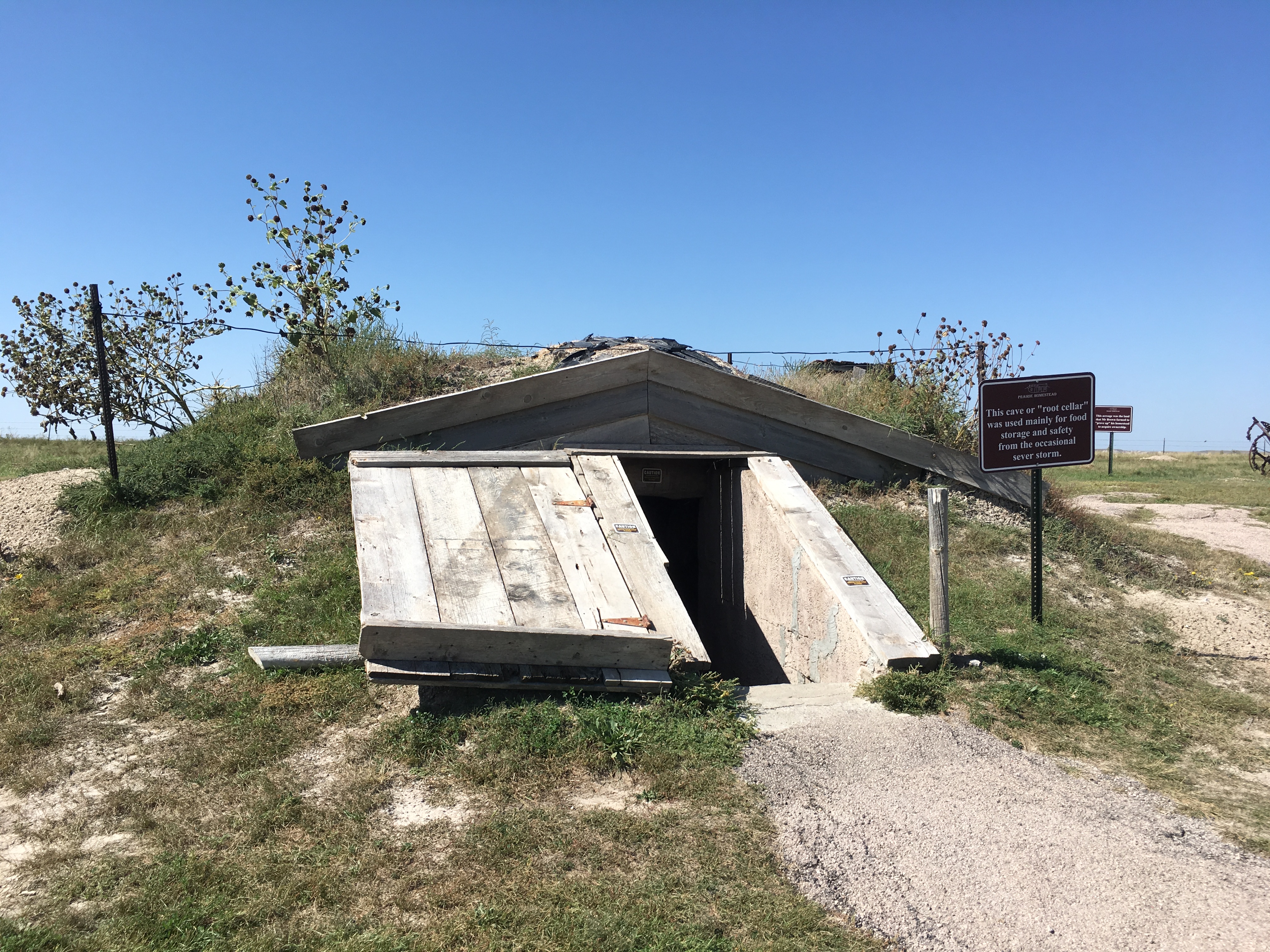
root cellar
Equipment in this “outhouse” consisted of a Sears & Roebuck Catalog, used for toilet paper.
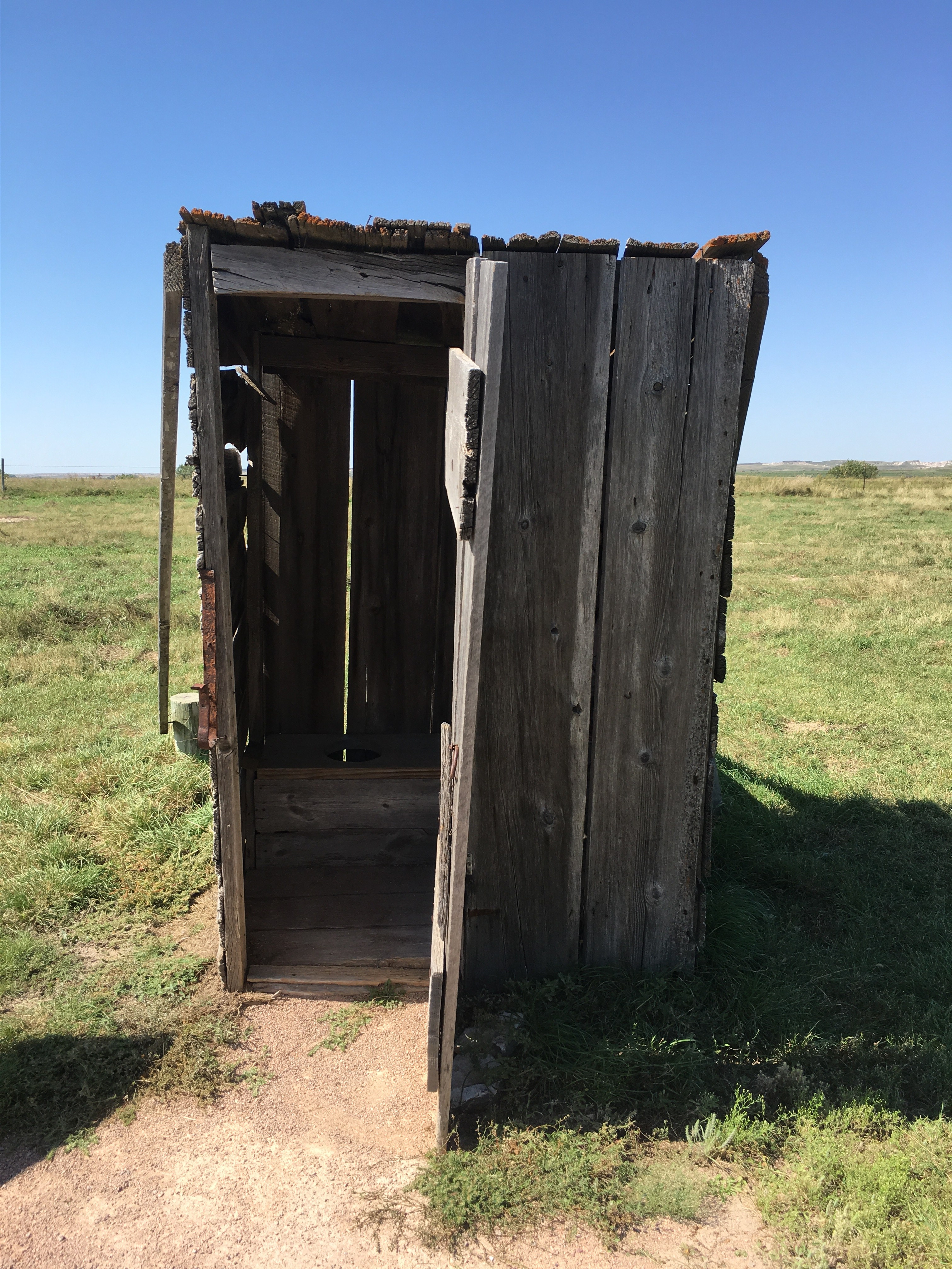
outhouse

farm equipment
The acreage here was the land that Mr. Brown farmed to “prove up” his homestead to acquire ownership.

the homestead
Edgar Irwin Brown was born of French, Scotch, and Dutch ancestry in Iowa on October 27, 1854 and died April 2, 1920 here at the Prairie Homestead. He married Alice Alberta Story, born April 9, 1858 of English ancestry in New York, and died December 21, 1943 in Long Beach, California. Two children, a boy and a girl, were born to Ed and Alice Brown while they lived in Iowa. In 1909, Mr. and Mrs. Brown and their son Charles moved to the Badlands of South Dakota and filed on a homestead. They came here as many homesteaders did, with a team and a wagon.
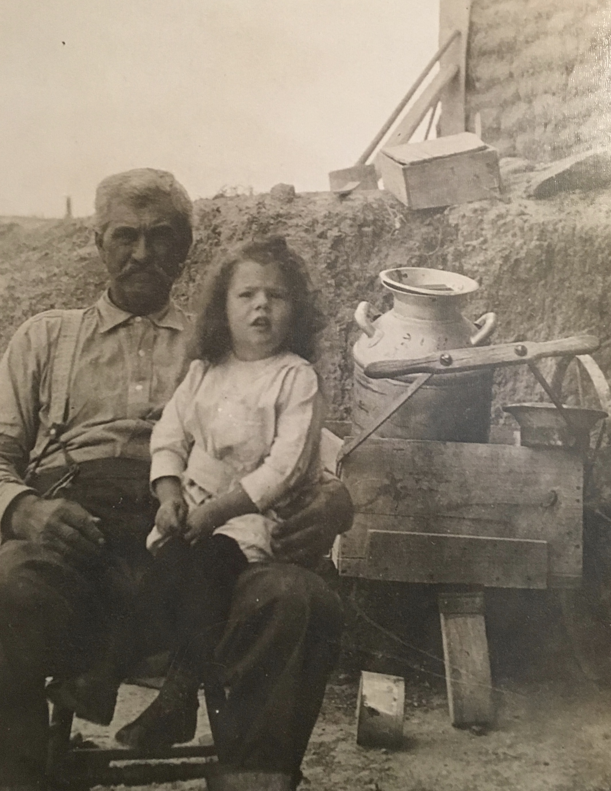
Ed Brown & daughter
Prairie dogs, rodents related to ground squirrels, were early inhabitants of this area. When the homesteaders came to this area, the prairie dog towns spread over thousands of acres.

prairie dog
The Prairie Homestead was placed on the National Register of Historic Places in 1974.

Prairie Homestead Historic Site

Prairie Homestead Historic Site

Prairie Homestead Historic Site

Prairie Homestead Historic Site

Prairie Homestead Historic Site
These pioneers played an important role in settling the Great Plains. This area of South Dakota was one of the last places to be homesteaded because western South Dakota was initially set aside as Indian reservation. An Indian treaty in 1890 was signed for the land between the White and Cheyenne Rivers to be homesteaded. This area was surveyed and settled by homesteaders between 1900 and 1913.
The sodbuster in this area had a difficult time surviving poverty – and many of them did not. It has now been determined that 160 acres in this area will produce grazing enough for only eight cows.
Information about Prairie Homestead Historic Site is from a pamphlet and signs on the property.
After visiting this site, I headed toward Rapid City.
*Thursday, September 19, 2019*


You must be logged in to post a comment.