Tuesday, October 4, 2022: We drove over the Confederation Bridge and headed to Summerside, Prince Edward Island. We had hoped to walk on a boardwalk there but we couldn’t find what was supposedly an appealing waterfront.
We looked for a restaurant and finally found G&T Book Cafe, a little Vietnamese restaurant/book store/gift shop. The proprietor was friendly and giggled a lot. I had a fried vermicelli with shrimp dish that was excellent. Mike had a big bowl of wonton soup. It took forever to get our meals. While we waited I enjoyed an orange juice with cinnamon and browsed the little shop. They said they made everything from scratch, using only fresh ingredients.
It was a nice little stop although I didn’t find Summerside to be that appealing.
Summerside is the second largest city in PEI and supposedly has an attractive waterfront with a beach and boardwalk in the west end. Sadly we must not have gone far enough west because we never found it. At the turn of the 20th century, Summerside was the headquarters of a virtual gold rush based on silver-fox ranching. At that time, fox fur was the height of fashion and fox “farming” was a thriving Summerside industry. Today fishing and potato processing are more profitable endeavors. Lobster is plentiful in early July during the 10-day Summerside Lobster Festival.
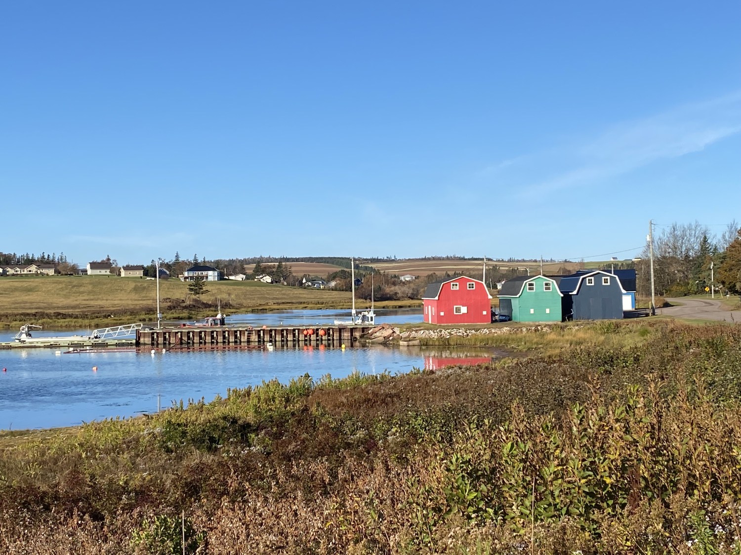
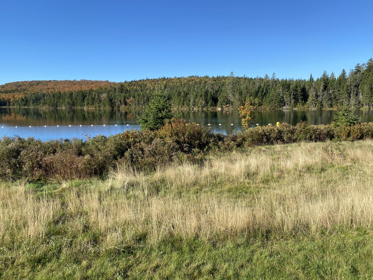
We passed Malpeque Bay as we continued on our way to Lisa’s house.
Malpeque Bay
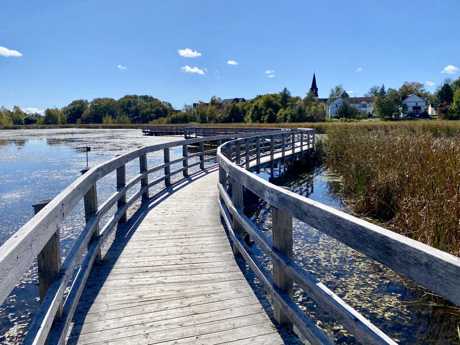
We were surprised to come across St. Mary’s Church, home to the Under the Spire Music Festival. Of course, we were too late in the season to hear any of the music from this festival.

St. Mary’s Church
Finally, after about 13 years, I was able to visit my friend Lisa, who studied Arabic in Egypt with me in July of 2007. I visited her in 2009 in Pennsylvania, but she now lives back-and-forth between PEI and Pennsylvania. The main reason I planned this trip to the Maritimes was to visit her.
When we arrived today, she took us in her big royal blue pickup truck to see some of her favorite people, Marjorie and Foulton. They used to be her neighbors when she rented a trailer next door to theirs. Foulton showed off his shed with two snow blowers and a riding lawn mower. Mike got a kick out of that because they only had a small rectangle of grass beside their trailer. Then Foulton took Mike into his tool shed where he regaled him with details about his huge collection of every tool known to man, all immaculate and well-organized. Marjorie wanted to know if we had kids or grandkids and how Lisa and I met, so we told her a bit about our time in Egypt.
After visiting her friends, Lisa took us to some of her favorite nearby places. One was Black Horse Corner. Lisa said the black horse is often dressed in clothes appropriate for the holidays or the seasons. Today the horse was naked! Lisa’s husband Mohammad apparently thinks it’s the most ridiculous thing ever, so Lisa insisted on taking selfies and sending them to him (he’s working as a traveling nurse in Pennsylvania and stays with Lisa’s 94-year-old mother). People often tell directions in PEI using this landmark: “Go left at Black Horse corner,” etc.


Lisa then took us to Park Corner Heritage Cemetery, a giant stone in a field “dedicated to the memory of the early settlers buried here from 1780 to 1865. May they rest in peace.” From that spot we had beautiful views of the surrounding cornfields and the Gulf of St. Lawrence. Houses perched prettily on the hillsides overlooking the sea.
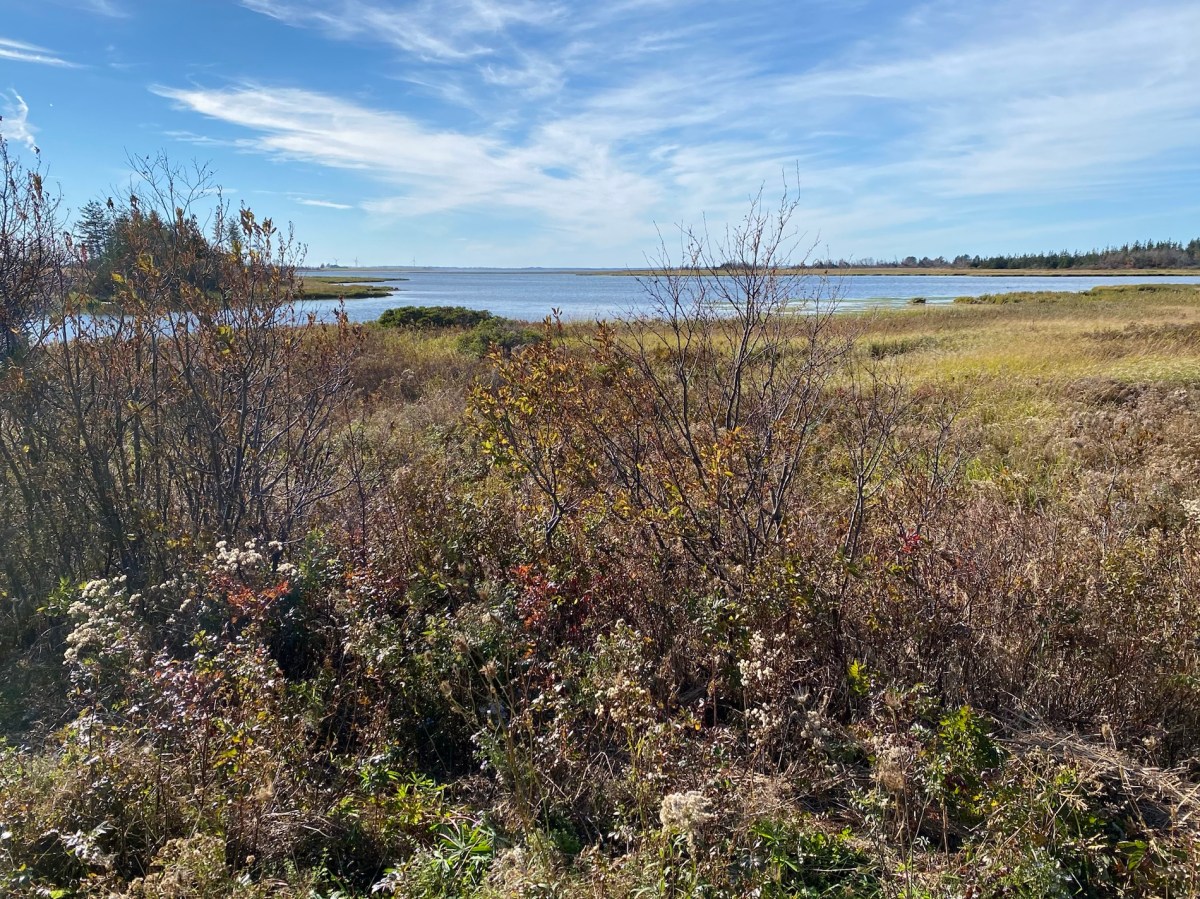
We also drove to a viewpoint of the picturesque fishing village of French River.


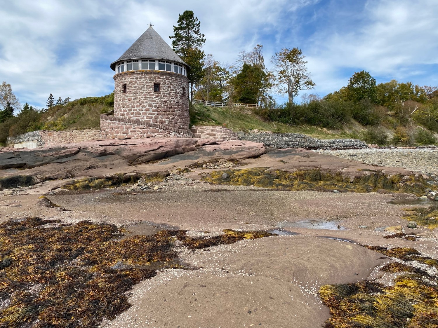
We went to the beach at Park Corner. We walked through a field to a lighthouse. I thought Lisa called it the Park Corner Lighthouse but I think it might be the New London Lighthouse, as it sits on New London Bay.


We took a short walk on the red sand beach then went on to the Cape Tryon Lighthouse and the red cliffs of Cape Tryon. The unassuming wooden lighthouse, which stands 33.4m tall is perched near the edge of a gorgeous sandstone cliff on Cousins Shore. The top of the lighthouse was lying on the ground and we couldn’t help but wonder if it was blown off by Hurricane Fiona.
The original lighthouse was put into operation in 1905, but decommissioned in 1969. The current lighthouse is still active to this day and is tucked away at the end of a narrow old farm road that rambles between two rolling hay fields.


Lisa insisted on chasing the beautiful sunset, looking for the perfect picture.


After our drive about, Lisa fixed us a fabulous dinner of salmon, stuffing, fresh tomatoes and peppers from her garden, and homemade sourdough bread. It was delicious! But she was very critical of it, saying she was disappointed in the salmon.
Lisa had spent the day gleaning tomatoes from the garden and then reducing them to sauce in order to freeze them, besides getting the house ready for us. All of that plus cooking dinner. I felt bad putting her out so much, although she seemed to revel in having us as guests. She had driven 15 hours straight from Pottsville, PA with only 4 stops for bathroom breaks! She had her truck loaded with stuff and didn’t want to leave it outside a motel room overnight in case someone stashed drugs in there which she might unknowingly carry across the border.
Lisa insisted that Mike and I each have our own bedroom. The other two bedrooms (she has 4) were all packed with clutter still waiting to be unpacked from the truckload of things she’d brought up from Pennsylvania. She insisted on sleeping on an air mattress on the floor in the midst of all the piles of stuff, cuddled up with her cat Josephine. I felt so bad and protested that Mike and I were perfectly fine in the same room, but she would have none of it. I learned long ago that there is no use arguing with Lisa; she will always win.
Lisa collects all kinds of things from her travels and from Ebay. She had ceramic heads and sad clown pictures all over her house. Her latest obsession is with Coca-Cola decor and various sets of dishes in different motifs. She served every meal (four in all – two breakfasts and two dinners) on a different set of dishes. She and Mohammad had sold their house in Pottsville, PA and Lisa, without telling Mohammad, bought the house in PEI. He was not happy with that decision as he feels PEI is too isolated for his work. She will stay in her PEI house until spring of 2023 and then go back to Pennsylvania, and will bring Mohammad up in summer. She is content and keeps very busy with various house projects; she’s quite handy and never sits still!


We sat up talking until midnight while Mike went to sleep earlier (in his own room!).
Steps: 10,905; Miles: 4.62. Drove 164 miles.
Wednesday, October 5: Lisa cooked us up a great breakfast of fried eggs and shredded potatoes, accompanied by her homemade sourdough bread. Yum! We had coffee and chatted and then we headed out for an early start to Charlottetown.
We made a stop at French Village to get some shots of the fishing village in the morning light.


In Charlottetown, we went straight to Rising Tide Electric Bicycles on Queen Street and rented two e-bikes. It was our first time riding e-bikes and it was quite a surprise to have the bike burst forth in spurts whenever we upped the power. We rode all along Victoria Park and saw the Brighton Beach Lighthouse and got reprimanded by a resident for riding a short distance on the boardwalk. We had mainly put the bikes up on the boardwalk to take pictures and then just rode them a half block. We’d been told by the Rising Tide guy we weren’t allowed to ride on the boardwalks, but it was only a short distance. Oh well.
I was worried about riding the bikes with the traffic and the downed trees in town because of the sudden bursts of speed on the e-bike. I was afraid the bike would get away from me and crash into someone or something.
We made our way to the Confederation Trail but we rode quite a way never to escape the ugly commercial or industrial areas. I didn’t care for it and said it wasn’t what I had in mind. We decided to cross the bridge over to Stratford, first passing the Charlottetown sign with a large homeless encampment behind it.


We zoomed over the bridge at what I thought was breakneck speed (4 out of 5), laughing at how silly it felt to be going so fast while hardly pedaling.
There wasn’t much to see on the other side of the bridge, and our time on the bikes (2 hours total) was winding down. We rode along the waterfront and saw the 2022 sign and another gate with stuffed lovers and lots of love locks.


We turned in our bikes and went to Water Prince Corner Shop for a lunch of steamed mussels, seafood chowder and some wonderful warm biscuits with butter. The whole time we chatted with another couple from Michigan who were sitting so close our elbows almost touched. They were on what seemed a whirlwind tour of the Maritimes. The man taught theology at a Catholic high school outside of Detroit and his wife was the vice principal. She was busy the whole time studying her phone and a map and trying to figure out their itinerary, so she wasn’t very talkative, but the man was. We weren’t that interested in continuing the conversation. First we’d thought, “Oh good, some liberal teachers to chat with,” but then we realized they were more likely conservatives and probably Trump supporters (and anti-abortion).


We wandered around the town and stopped into some shops and finally came across a bookstore, Bookmark, which was very cute and packed with all kinds of interesting things. I bought a bullet journal and another journal and two books by Canadian authors, one of whom, Olivia Robinson, worked in the bookstore and autographed her book, The Blue Moth Motel. The other was Speak, Silence by Toronto author Kim Echlin, who also wrote The Disappeared (which I loved).
There were Halloween characters like scarecrows all over town, a bit early for Halloween, along with lots of fallen trees from Fiona, one and a half weeks after the storm.
Designated as the Island capital in 1765, Charlottetown is both PEI’s oldest and largest urban center. The whole “metropolitan” area has a population of about 65,000, so a small-town atmosphere prevails. Gingerbread homes, converted warehouses, striking churches and monumental government buildings dot the town.
The city hosted the conference that led to the formation of Canada and is proud of its role as “The Birthplace of Confederation.”


Leaving Charlottetown, we drove the north part of the Central Coastal Drive. We left via the Kings Byway toward Dalvay-by-the-Sea, but it was closed due to downed trees. We then tried to drive through Prince Edward Island National Park, but it too was closed. We were led from one detour to another. Attempting to get to Brackley Beach, we were blocked again. We drove past Cavendish and Green Gables, which we would visit the next day. Roads were blocked in every direction as we made our roundabout way back to Lisa’s house.
The entire Central Coastal Drive is 253km (157mi), but we never made it to the southside along the Northumberland Strait.
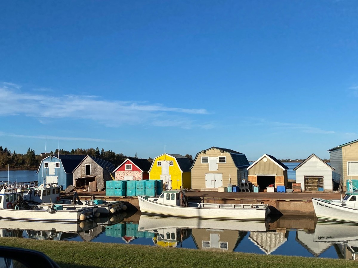
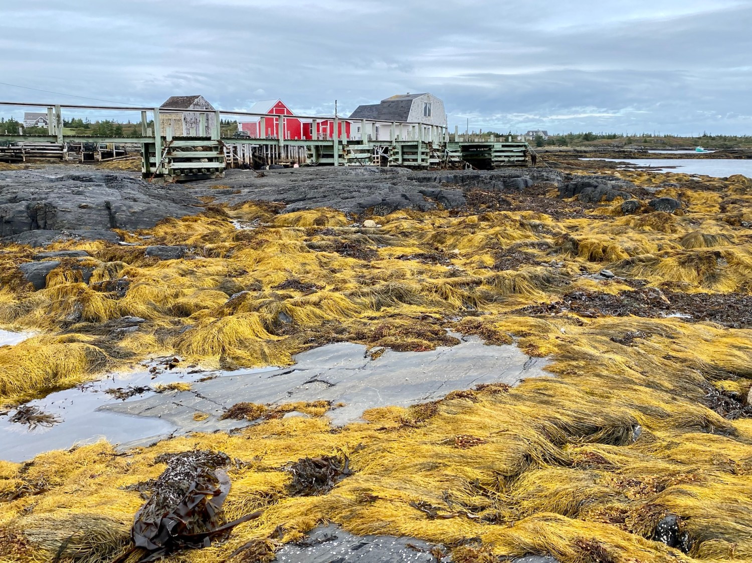
another fishing village we passed on our way to Lisa’s
When we arrived at Lisa’s house, her kitchen was in chaos as she was cooking a Thanksgiving feast. Canadian Thanksgiving is the second Monday in October, which would be October 10. She was steaming a turkey; she also made a homemade green bean casserole, mashed potatoes, cranberry sauce, Stove Top stuffing, gravy, and of course her sourdough bread.
She wouldn’t allow us to help and instead insisted that we relax and watch TV. Mike made us drinks and I sat posting things on Instagram while Mike did his Duolingo.
Dinner was served, again on a different set of china. It was all delicious. As it started to get dark, Lisa excused herself in the middle of dinner and said she needed to go out and put her riding lawnmower in the shed. As we sat there, abandoned and still eating, Mike looked out the window and said, “She’s mowing the lawn.” Sure enough, she was, and as it got darker, all we could see were the headlights buzzing around the yard. It was so hilarious and just like Lisa!


Lisa is a big collector of vintage and retro items, anything that strikes her fancy. At one point, she said she had to show me something I wouldn’t believe. In her living room, she has a kind of folding backless stool with a rough fabric stretched between the edges; the cat uses it to claw. A sort of cat hammock, I guess. Showing it to me, she asked if I recognized it. I didn’t have a clue what it was. She said the seat was made from a bath towel I bought for our Egypt apartment 15 years ago. It was all shredded and pilled from the cat clawing at it. She was proud of herself for making use of something I so easily left behind.
We told her in the evening that we would leave the next day, a day earlier than we intended. Many things we had wanted to see were closed, not only for the season but also because of Fiona. She said, “I never got to tell you all my secrets! And you never got to see my shed and my garage!”
We were all tired from our day so we went to bed early and prepared for a long drive back home after our planned visit to Green Gables.
Steps: 8,920; Miles 3.75. We drove 104 miles.
Thursday, October 6: Lisa made us another fabulous breakfast, a wonderful egg and cheese casserole with broccoli. It was delicious as usual, and she gets a AAA rating for the best host ever.
I think Lisa was sad to see us leave earlier than expected, but we were anxious to get home once we realized how little there was to do at this time of year in PEI. Lisa had warned me that everything would be closed in PEI by late September/early October but I figured the National Park and hiking trails would be open. But Hurricane Fiona made Lisa more right than she even meant to be.


The whole of PEI National Park and its hiking trails were closed due to huge numbers of fallen trees, so there went our planned day of hiking. Mike and I were both getting travel weary anyway because of having to rearrange our trip and encountering various closures, so we decided to leave PEI today.
We first made a quick stop at the L.M. Montgomery’s Birthplace, which was closed. The cottage-like white house with green trim overlooking New London Harbour is where the author was born in 1874. The interior has been furnished with antiques to conjure up that era.


Before leaving the island, we stopped at Green Gables, which luckily was open through the end of October.
Green Gables Heritage Place is a 19th century farm and literary landmark in Cavendish. Green Gables served as the setting for the Anne of Green Gables novels by Lucy Maud Montgomery. It is recognized as a Federal Historic Building by the Government of Canada and is situated on the L.M. Montgomery’s Cavendish National Historic Site of Canada. The National Historic Site has been part of Prince Edward Island National Park since 1937.
Green Gables is the green-and-white 19th century farmhouse that served as the inspiration for the Cuthbert place in Anne of Green Gables. The house, outbuildings and grounds, all of which belonged to the author’s grandfather’s cousins, brother and sister David and Margaret Macneill, recreate some of the settings found in the book. The same goes for the short walking trails dubbed the Haunted Wood and Lovers Lane/Balsam Hollow.
Lucy Maud Montgomery (1874-1942) was born in New London, Prince Edward Island. Her mother died in 1876 of tuberculosis. She lived with her maternal grandparents in Cavendish until 1911, when she married and moved to Ontario.
While living in Cavendish, she wrote her first novel, Anne of Green Gables (1908), which won international praise. Anne was one of the most lovable children in English fiction.
In her early years (1874-1892), her literary gifts emerged early. She read and reread every poem, magazine and book she could find. She covered every writing surface with stories and verse. She published her first poem and essays at 15 while spending a year with her father in Prince Albert, Saskatchewan. Homesick for PEI, she returned and continued her studies.
From 1893-1898, L.M. Montgomery finished a two-year teaching program in one year at Prince of Wales College in Charlottetown. She later studied literature and other courses at Dalhousie University in Halifax, Nova Scotia. Back in PEI, she juggled a demanding schedule as a teacher, maintained a busy social calendar and worked to improve as a writer. When her grandfather died, she returned to Cavendish to care for her grandmother.
From 1899-1910, she continued to develop her writing while helping her aging grandmother run the post office in the Macneill Kitchen. She discretely sent out submissions and hundreds of her short stories and poems were published in the U.S. and Canada. In 1908, after several rejections, Anne of Green Gables, her first novel, was published to wide acclaim and became an instant best seller.
From 1911-1925, Lucy Montgomery was faced with a number of life challenges. When her grandmother died, she married Reverend Ewan Macdonald, a Presbyterian minister to whom she’d been secretly engaged for five years. They moved to Ontario, north of Toronto; she mothered her two sons and continued to write.
Deeply affected by the first World War, Montgomery also suffered personal tragedies, including a stillborn child, the death of her best friend Frede, and her husband’s struggle with mental illness. While battling two court cases and fulfilling her roles as minister’s wife and mother, she continued to satisfy her publisher’s demands, writing novel after best-selling novel.
From 1926-1934, the author’s fame grew. She won a major copyright lawsuit and continued to write and publish. Her husband’s bouts of paralyzing “religious melancholia” strained her health. The pressure to keep his mental illness hidden added to worries about her children and finances. She returned to PEI for visits, which gave her solace.
From 1935-1942, Montgomery and her family moved to a new home in Toronto which she named “Journey’s End.” Despite deteriorating physical and mental healthy, horror at another world war, and grief over family matters, she continued to write until her untimely death, at home, at age 67. Her final manuscript, The Blythes Are Quoted, was delivered to her publisher on the day she died.
Montgomery’s body lies in state at Green Gables, in Cavendish Cemetery, surrounded by her favorite places.
I love learning about authors’ lives, and I was fascinated to discover that Montgomery documented her experiences in journals, scrapbooks and photographs. Fashion plates gave her perpetual joy; she whiled away the hours choosing frocks she would have if she could. I too love to create journals and take photos, and I also love clothes and textiles.


We walked through the Cavendish house and fictional Anne’s bedroom.


We took a walk on Lover’s Lane, aka Sentier Balsam Hollow Trail. L.M. Montgomery discovered the tree-arched lane when she was 12. It became a sanctuary for her. She took dozens of photos of it and paid tribute to it in her writing. Today, we found many trees downed from Hurricane Fiona. The Haunted Wood, another beloved path of the author’s, was closed due to downed trees.


After leaving Green Gables, we drove through part of Prince Edward Island National Park. The park encompasses 40km (25mi) of the north shore of the island. It’s a picturesque park defined by sea, sky and red sandstone cliffs. Marram grass is vital to the survival of the dunes. We stopped at Cavendish Beach, Gulf Shore Way West, MacNeill’s Brook Beach, Mackenzies Brook and Orby Head.


Finally, we stopped at The Village of North Rustico. A sign in town told us some facts:
- Mi’kma’ki Indian camps have been found around Rustico Bay dating back 6,000 years.
- Jacques Cartier sailed along this north shore in 1534.
- Rene Rassicot fished off Rustico in 1729 and gave the area its name.
- Acadians first settled North Rustico in 1790.
- Most present day residents are direct descendants of the original Acadian settlers.
We stopped to admire the fishing shacks and lobster pots here, then bought a few groceries at a small store and were on our way.


We drove back over the Confederation Bridge then through New Brunswick (again), crossed the Canadian border at St. Stephens with no problems (except a 15 minute backup), then drove through Maine and Bangor to the Traveler’s Inn in Brunswick, Maine, where we spent the night.
Steps: 7,450; Miles: 3.14. Drove 501 miles.
Friday, October 7, 2022: Today was a day of pure torture driving home from Bunswick, Maine, as it was the Friday before the Columbus Day three-day weekend. We would have been better off staying another night with Lisa and driving home on Saturday.
Everything was fine through the rest of Maine and New Hampshire and even around Boston. Of course it was once we hit Connecticut where the backups began. Every time we hit a backup, we took a detour, which probably ended up being longer than if we’d just waiting through the backup. Going through New York and New Jersey was a special kind of hell with backups and heavy traffic; it was slow miserable going.
There was another backup showing on the GPS at the Delaware Bridge and in Baltimore, so we decided to go down 301 on the Eastern Shore to the Chesapeake Bay Bridge. We got snarled up in some small town where there was no escape and were stuck there for a good 30 minutes. Then we drove down 301 for what seemed an eternity.
We stopped at Royal Farms to get gas and use the restroom. We had parked next to a huge concrete cylinder (most of the ones there had signs or flags) and when Mike pulled out and then forward to make a wide turn, we hit that block hard. It felt like whiplash! I thought he’d either hit someone backing up or they’d hit us from behind. It was a big jolt but when we got out to look, the fender only had scratches on it. I was surprised the airbag didn’t deploy!
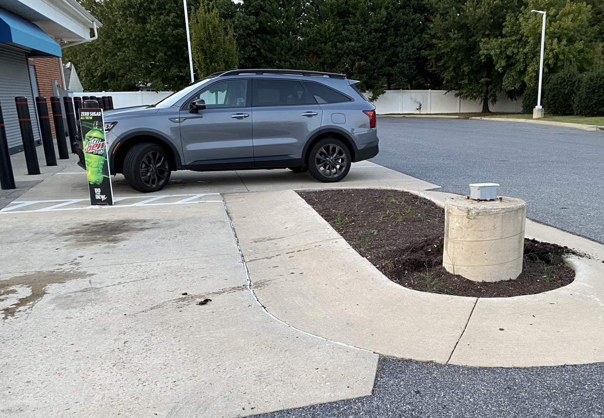
This was what we hit at Royal Farms
We ran into another huge backup to go over the Bay Bridge. By the time we finally got over the bridge, we were both in such bad spirits and Mike was so tense from driving all day that I insisted we stop in Annapolis at the Double T Diner for dinner. I told Mike he needed to calm down and that I’d drive home after dinner. After an Eggplant Parmesan and an omelet with spinach and cheese, we got back on the road, but Mike had calmed down and he insisted on driving the rest of the way home.

Double T Diner in Annapolis
We decided if we ever drive up north again, we must go through Scranton, PA and avoid New Jersey, New York and Connecticut at all costs.
The Capital Beltway was the last straw. Packed and fast-moving, I thought we would get killed for sure. I’m surprised that every day there isn’t some hundred car pileup on that roller coaster of a road.
We finally got home at 9:30 p.m (after nearly 14 hours of driving), and I was never so happy to get out of that damn car!
Steps: 3,122; Miles: 1.32. We drove 625 miles. 😦


You must be logged in to post a comment.