After driving from Telluride on the San Juan Skyway Scenic Byway, I arrived at the Mesa Verde National Park Visitor Center close to noon. The park was created in 1906 to preserve the archeological heritage of the Ancestral Pueblo people, who made their home here for over 700 years, from 550 to 1300, both atop the mesas and in the cliff dwellings below. The park includes over 4,500 archeological sites; only 600 are cliff dwellings, according to a brochure from the National Park Service.

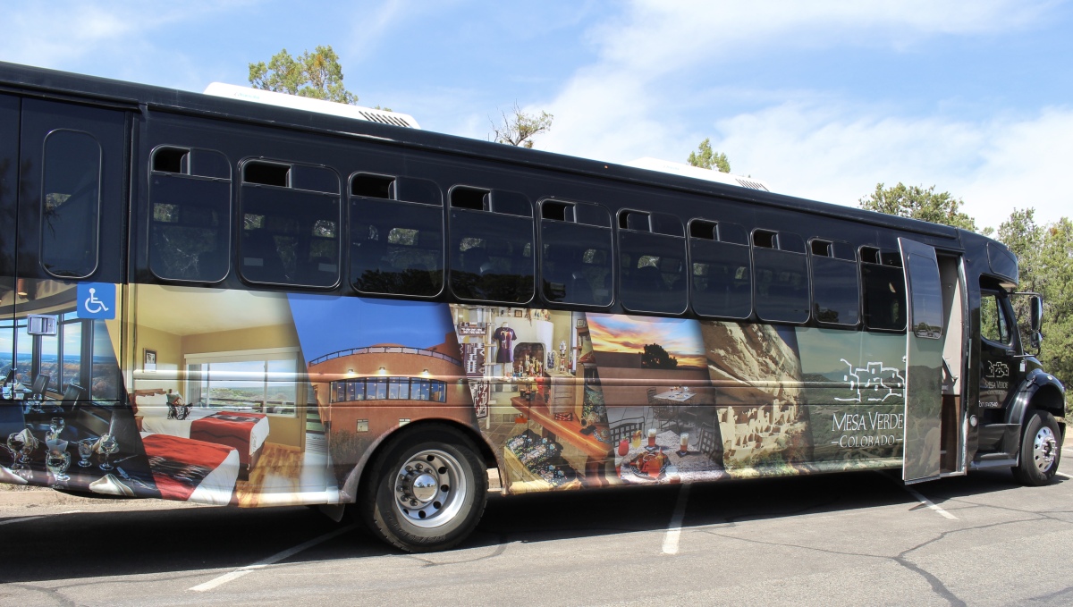
Mesa Verde Visitor Center

Mesa Verde Visitor Center

Mesa Verde Visitor Center

View of the road up to Mancos Overlook
The first Spanish explorers called this area Mesa Verde, or “green table,” for the lush mountain shrublands and pinyon-juniper forests. Geologically speaking, the area is not actually a mesa; it is a cuesta, which means it is tilted rather than flat. It dips toward the south at about a 7% grade. This slight tilt toward the sun created warmer conditions for growing corn and other crops. The growing season for the Ancestral Puebloans at Mesa Verde was up to 20 days longer than in the surrounding valleys.
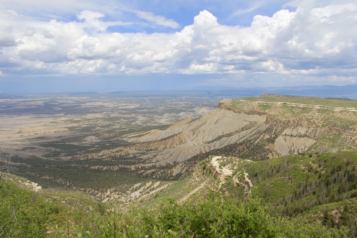
I drove up switchbacks to Mancos Overlook, where I had a great panoramic view of the Mancos Valley. The town of Mancos historically served as the “Gateway to Mesa Verde.”

Mancos Overlook

Mancos Overlook
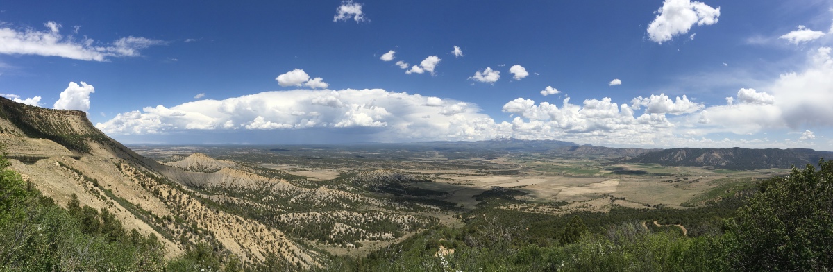
Mancos Overlook
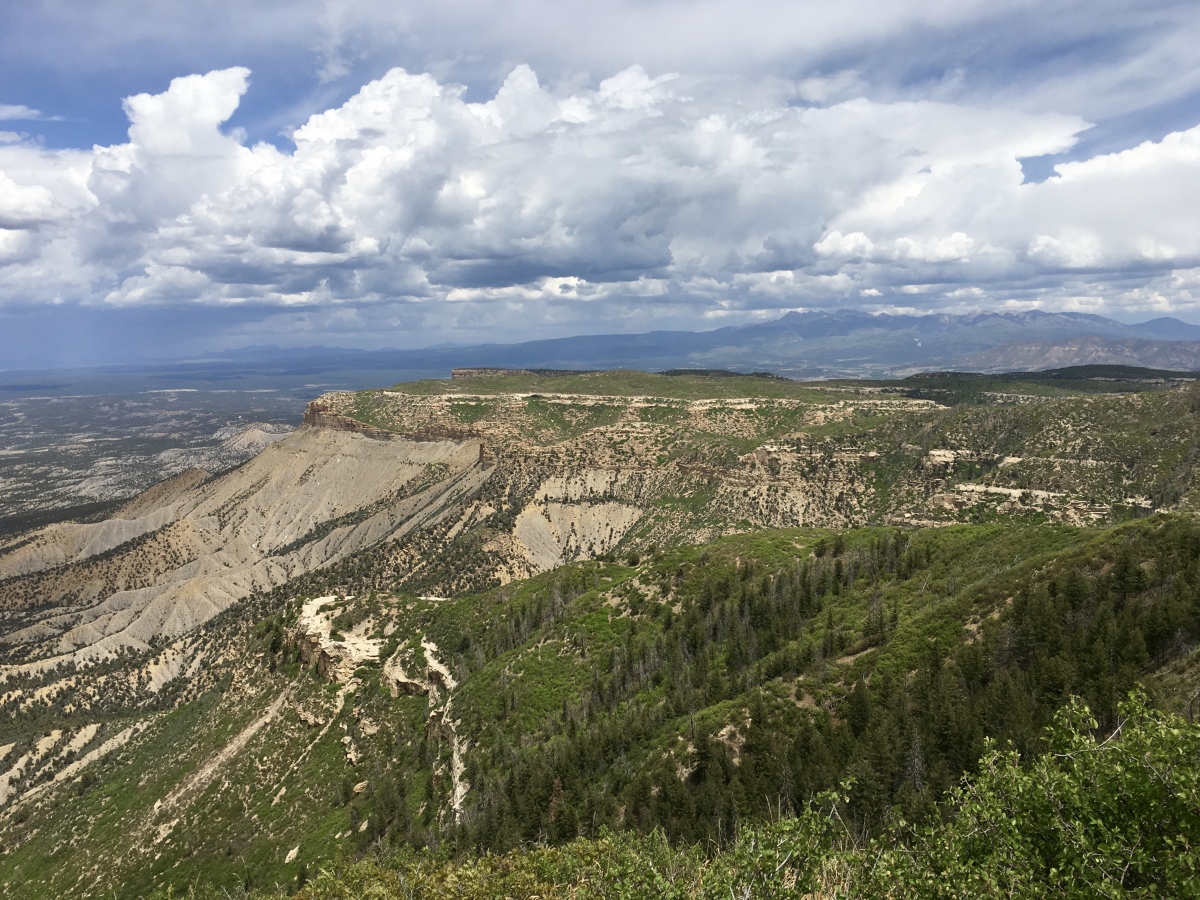
Further along, I arrived at the cold and blustery Montezuma Valley Overlook, where there is a short trail along The Knife Edge. The elevation is 8,290 feet (2,527 m).
Montezuma Valley, below the overlook, and Mesa Verde were once part of the Ancestral Puebloan homeland. Archeologists estimate that as many as 35,000 people lived in this region during the 1200s. At the start of the 21st century, Montezuma Valley had a population of only about 24,000 people.
In 1914, as tourists clamored to access Mesa Verde, a narrow dirt road was completed into the park. The few cars first entering the park, including Studebakers and Fords, made the journey to what is now the Park Headquarters in three hours. “Knife Edge” was an apt description for this precarious access into Mesa Verde.
Montezuma Valley Overlook
Montezuma Valley Overlook and The Knife Edge
Montezuma Valley Overlook and The Knife Edge
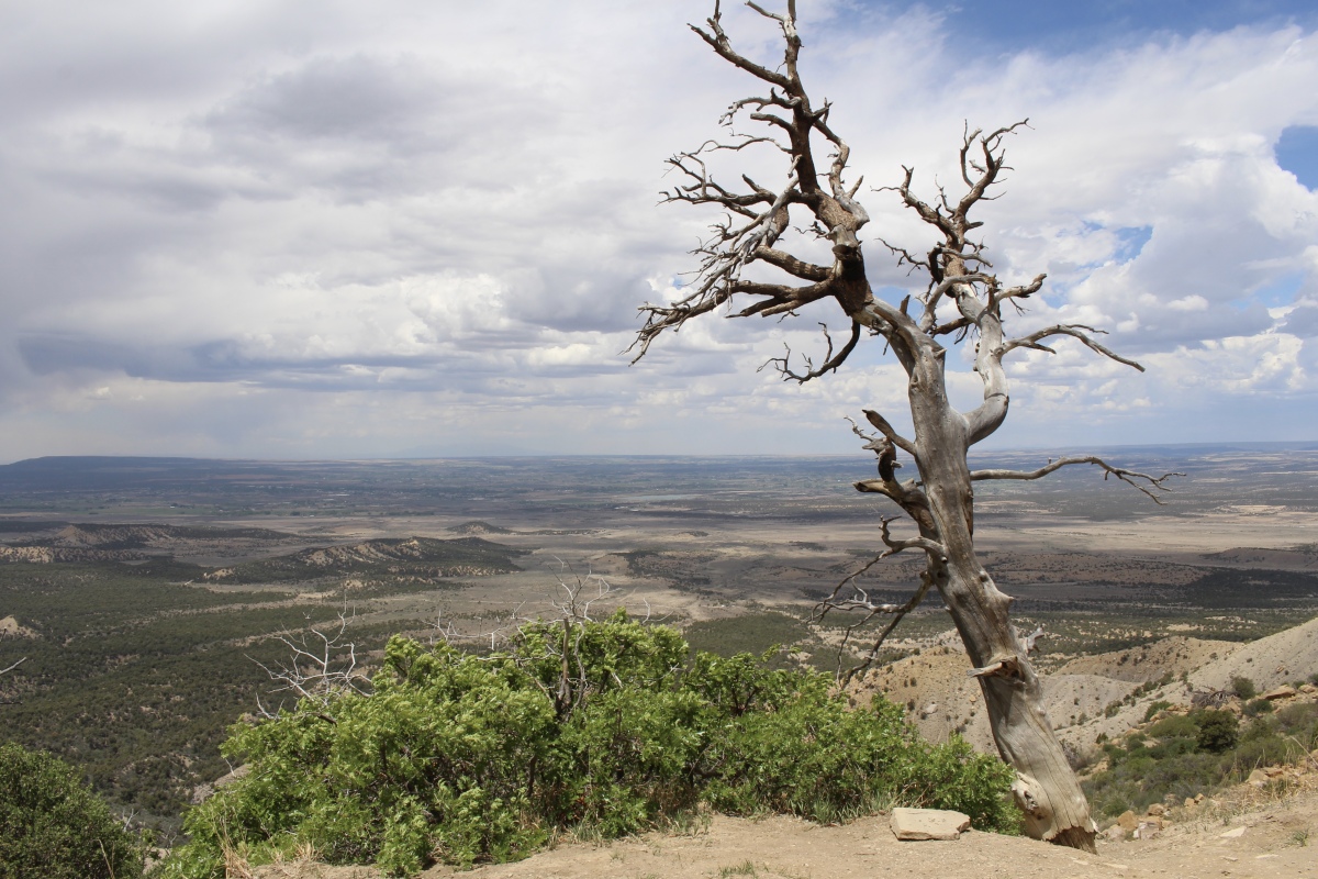
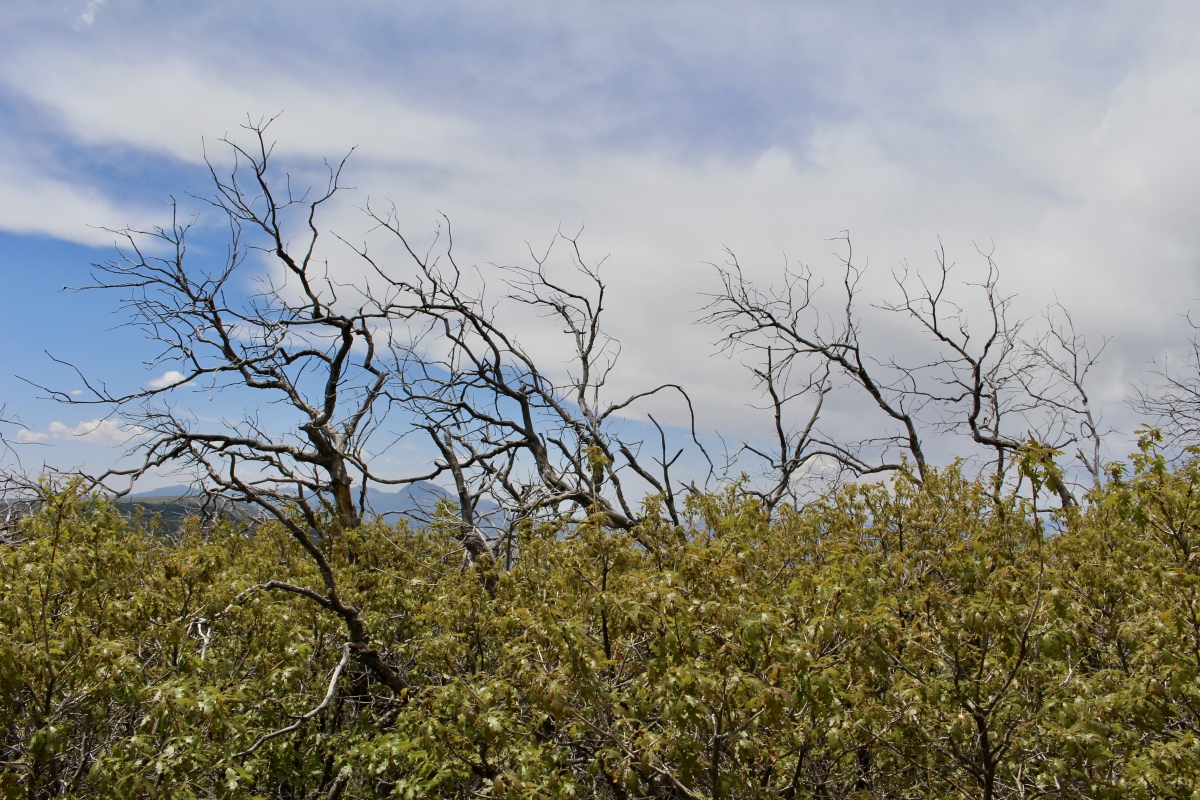
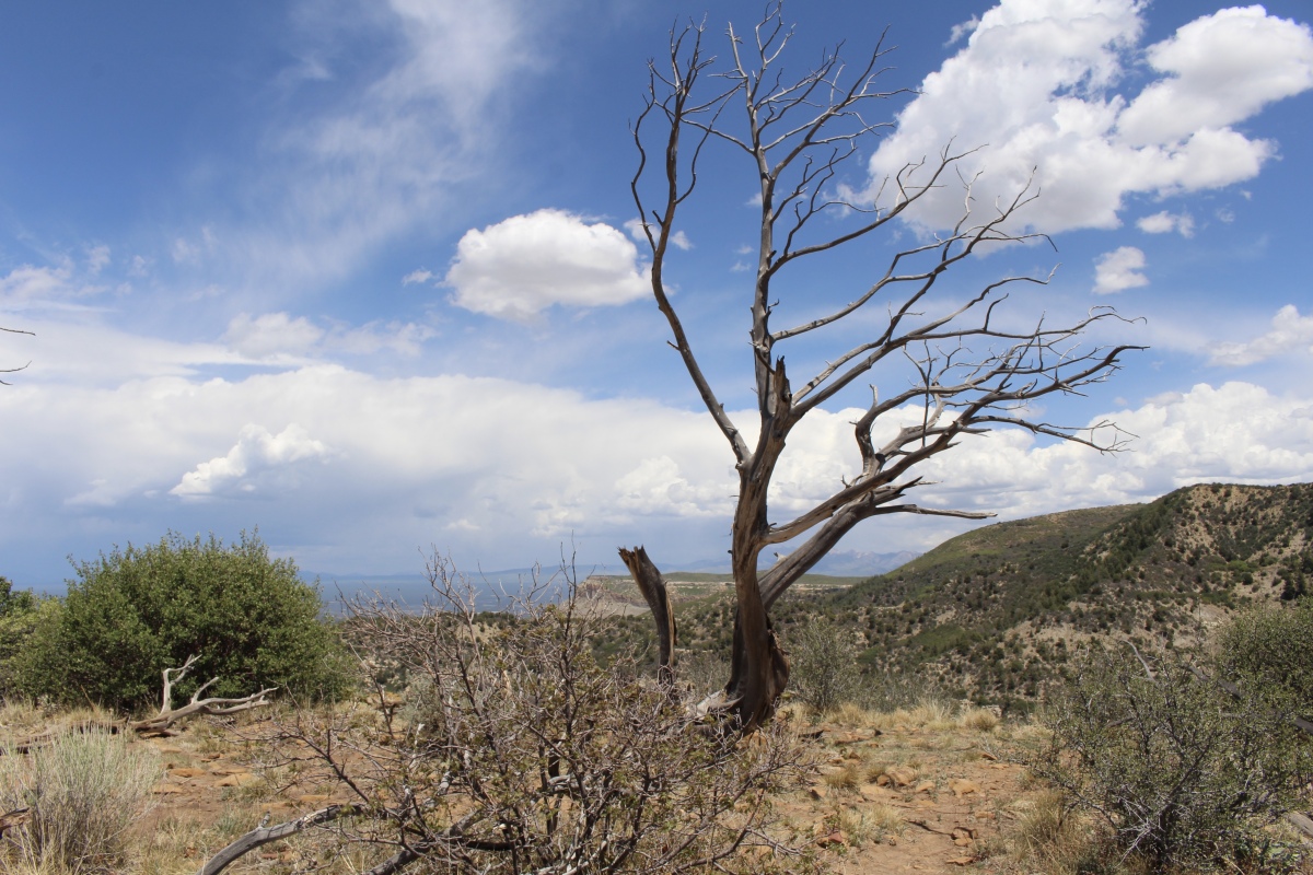
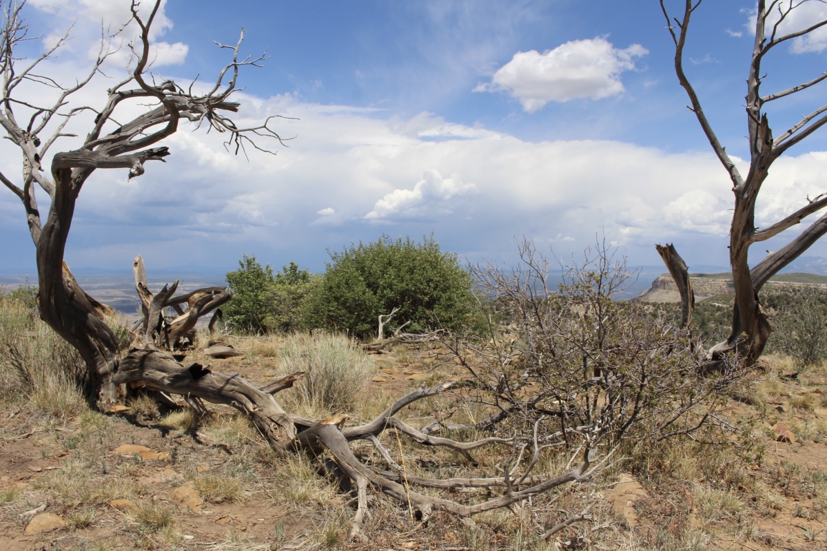
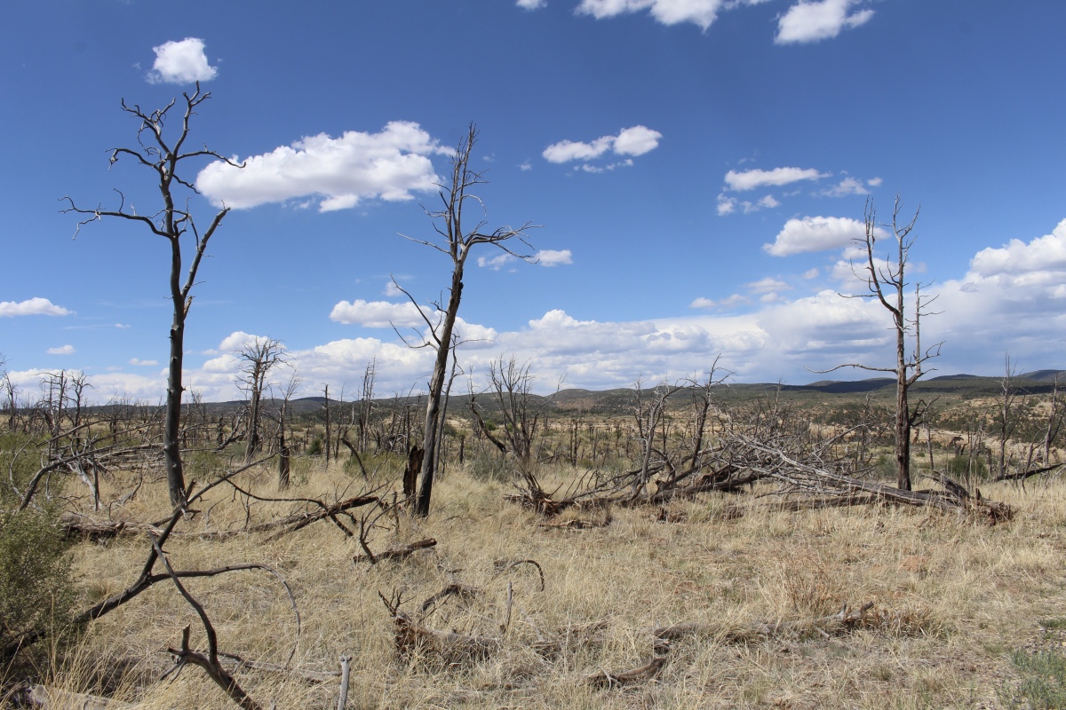
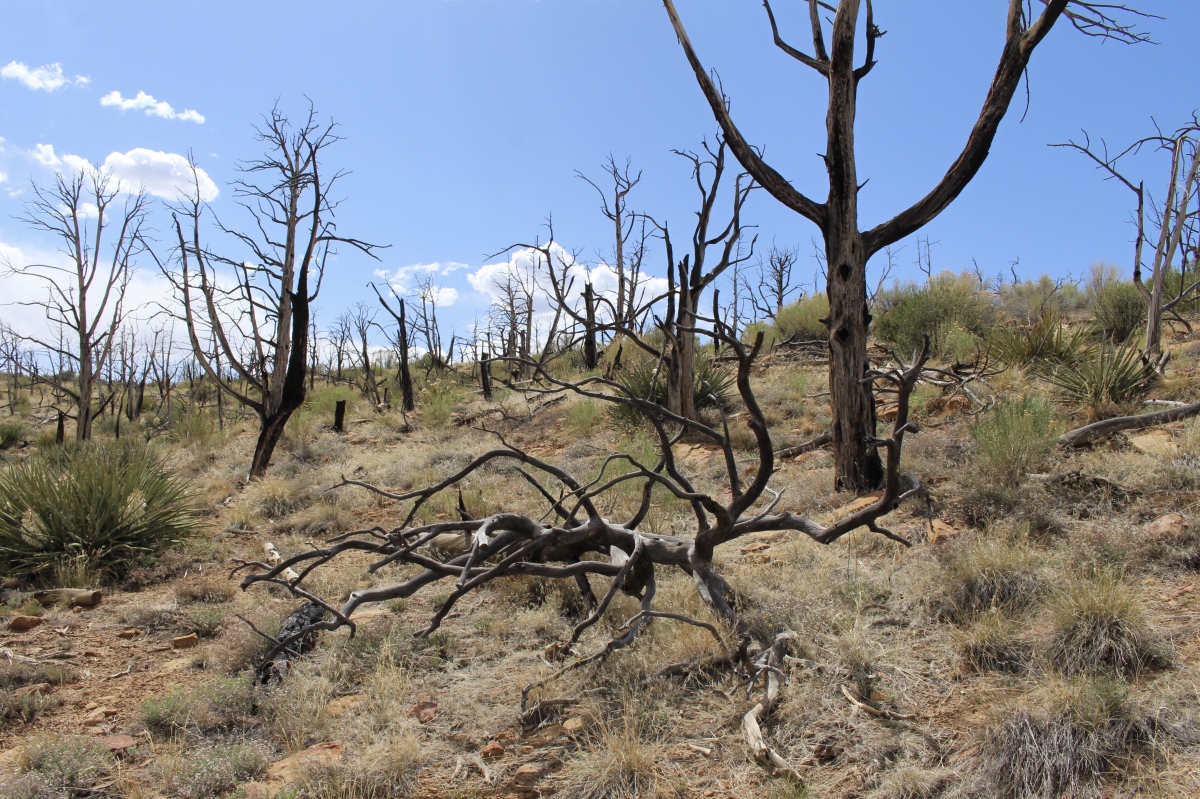
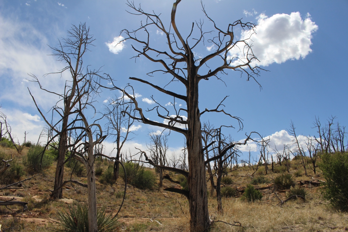
Further along, I got out of the car at Fire Lookout, where I walked through a scarred landscape that was slowly rejuvenating. Wildfire has an important ecological influence on Mesa Verde’s vegetation growth, change, and renewal. Historically, over 95% of all recorded wildfires within the park have been started by lightning, with only 5% caused by humans. Seventy percent of the park has been burned by wildfires since the park was established in 1906.
Each summer monsoon season often starts with “dry” lightning. Because the lower atmosphere and ground are so dry at the beginning of some monsoon seasons, little to no rain reaches the ground. However, lightning does. Dry lightning, combined with drought conditions has sparked all of the recent large wildfires throughout the park.
At Fire Lookout, there was an actual fire lookout manned by a ranger.

Fire Lookout
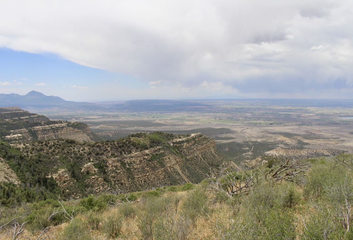
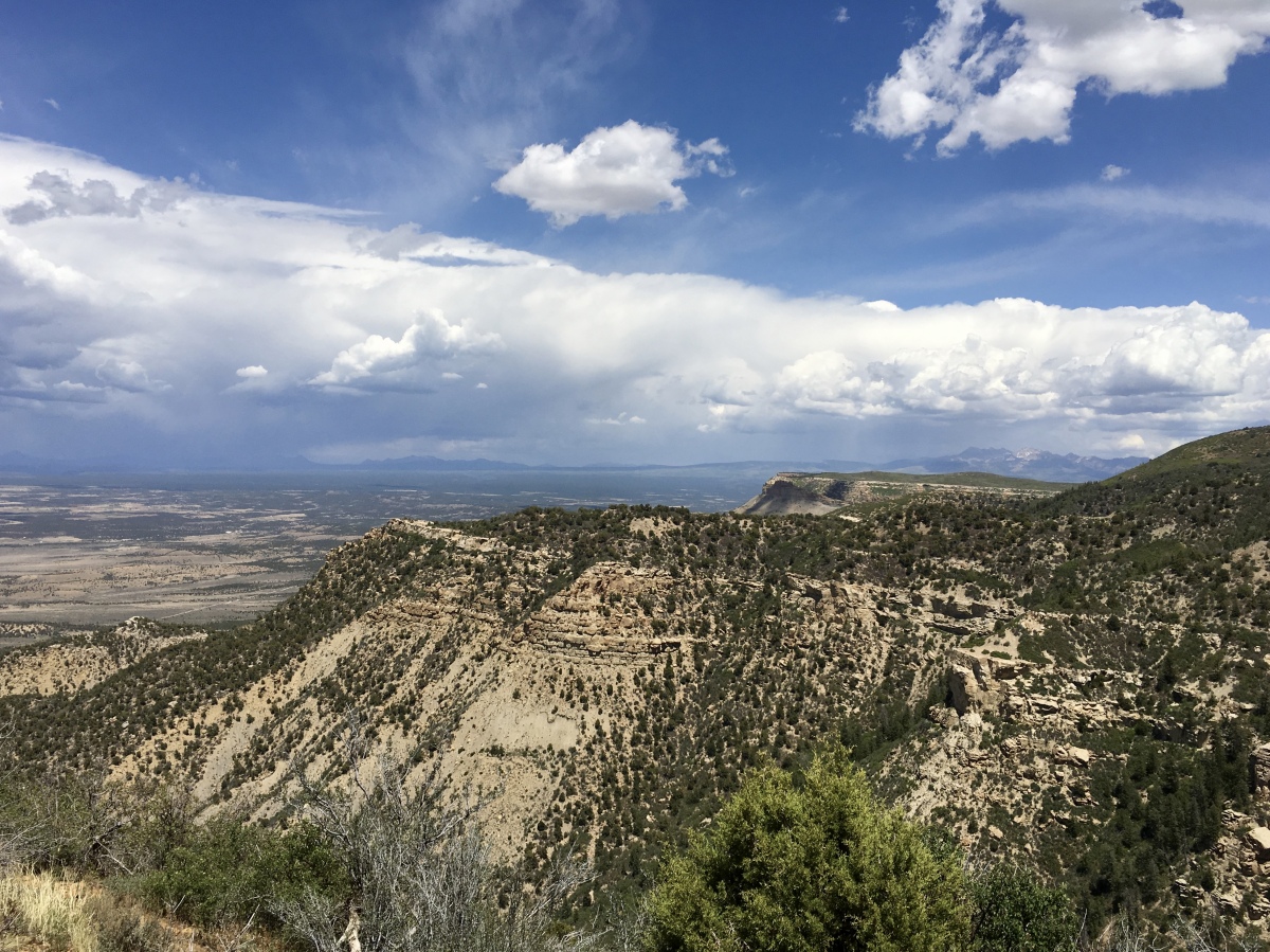
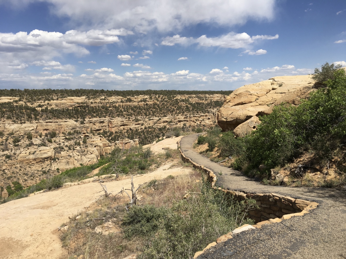
At Park Point Overlook, I took a short gentle trail to Park Point, the highest point in Mesa Verde National Park at 8,572 feet (2,613 meters) above sea level. I could see north to the valley below and to the Abajo Mountains and Manti-LaSal Mountains, as well as south to the ridges and canyons throughout Mesa Verde: Moccasin Canyon, School Section Canyon, Soda Canyon, and Prather Canyon. On a clear day, four states are visible, Arizona, Colorado, New Mexico, and Utah.
Park Point Overlook

Park Point Overlook
Park Point Overlook
Park Point Overlook
Park Point Overlook
Park Point Overlook
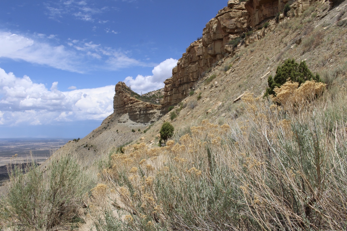
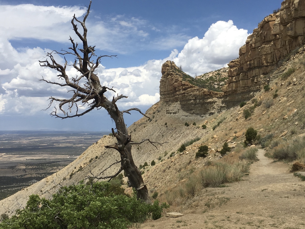
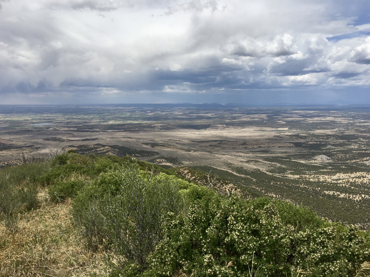
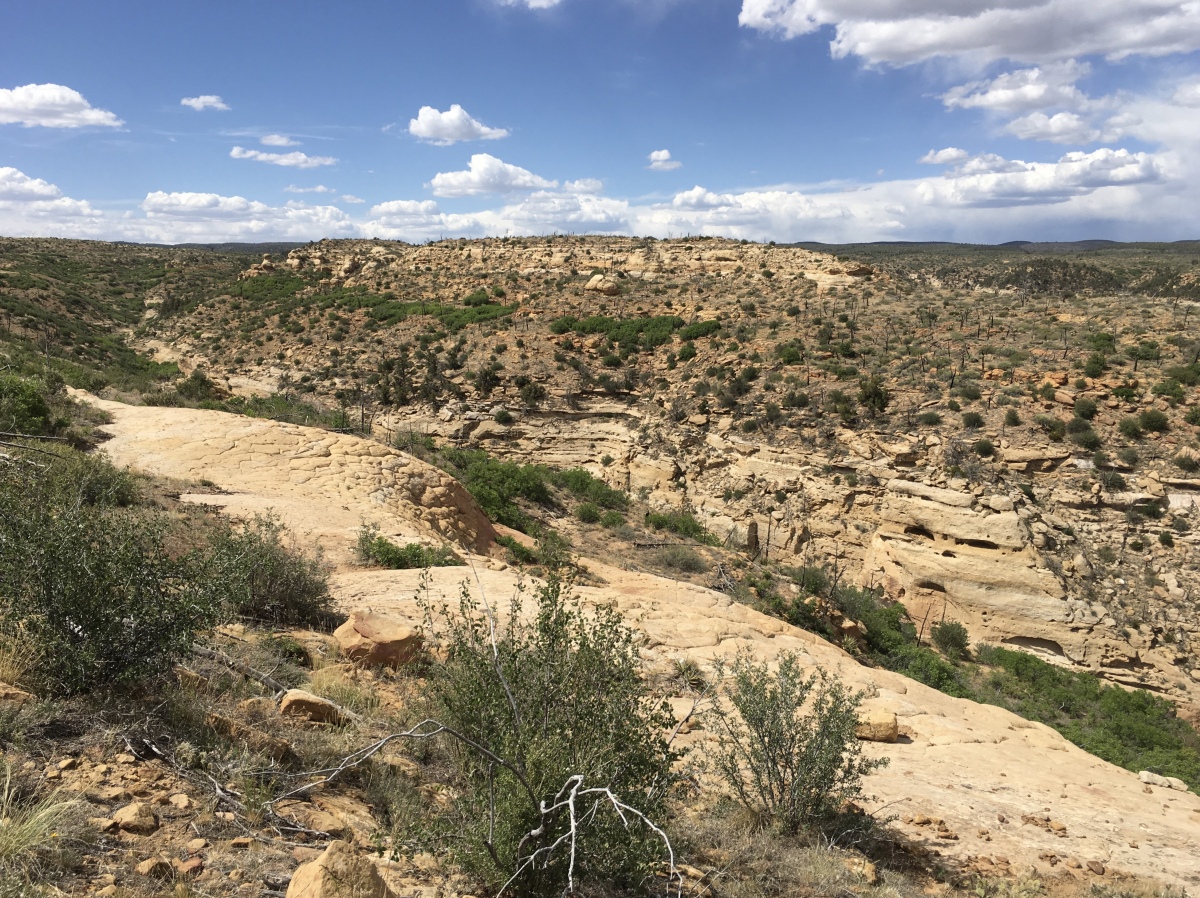
I made another stop at Geologic Overlook before proceeding to Wetherill Mesa. A sign at the overlook informs visitors about water on Mesa Verde. Moisture, in the form of rainfall or snowmelt, percolates through porous sandstone layers until it reaches a dense, impermeable layer of shale. Prevented from percolating farther downward, the water is forced to the rock surface resulting in a seep spring in the canyon walls. These springs provided a ready source of fresh water to inhabitants.
Geologic Overlook
Geologic Overlook
Geologic Overlook
The park road splits at the Far View Area, into fingerling roads to Chapin Mesa and Wetherill Mesa. I took the Wetherill Mesa road because the next morning I would go on a tour of Chapin Mesa.
The twelve-mile road on Wetherill Mesa is only open from May through September.
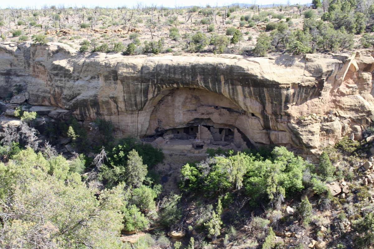
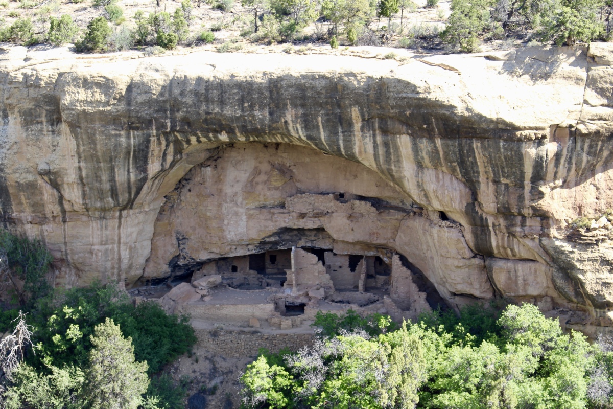
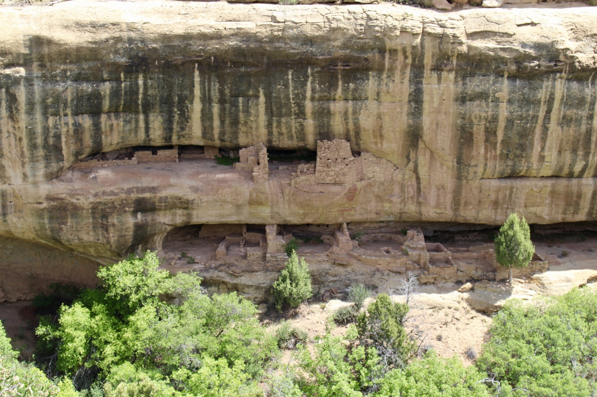
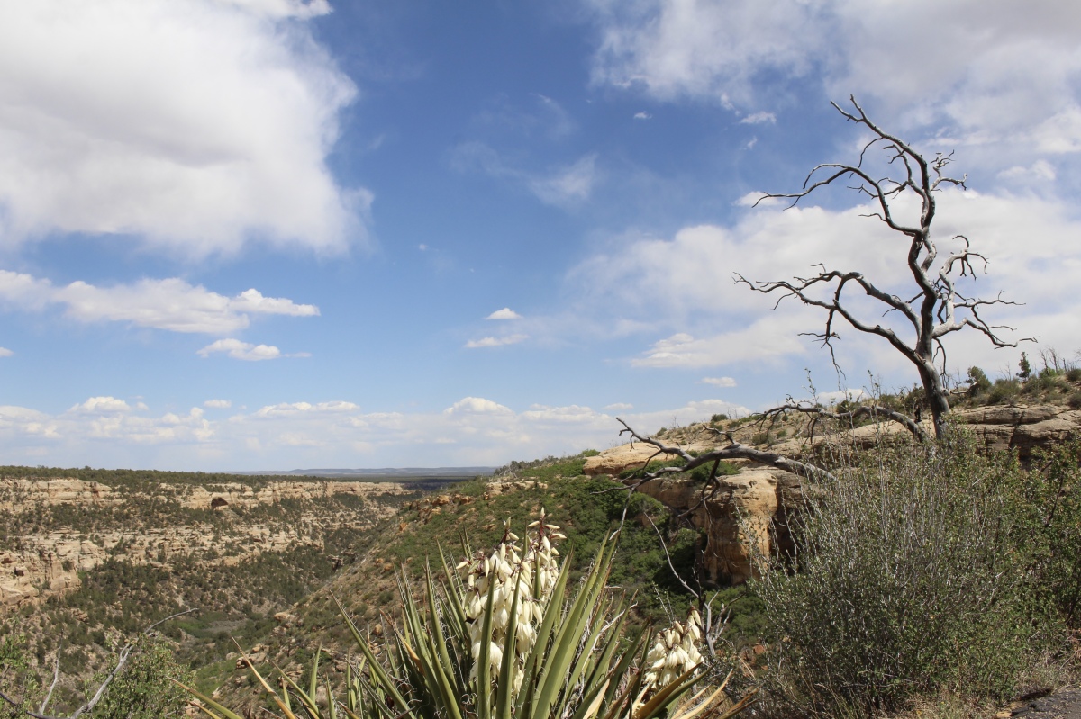
The first overlook on Wetherill Mesa is Windows to the Past. About nine hundred years ago, the Ancestral Puebloans lived in a cooperative society – trading, communicating, forming friendships, and nurturing their families. More people lived in this valley in the 12th century than live in the valley now.

Windows to the Past
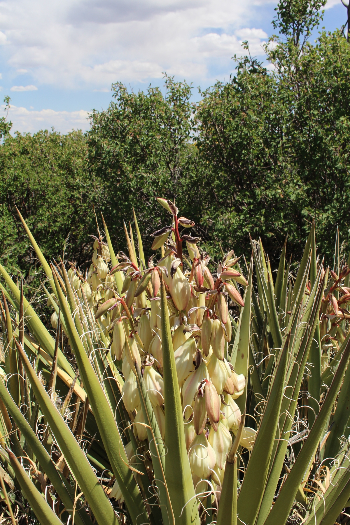
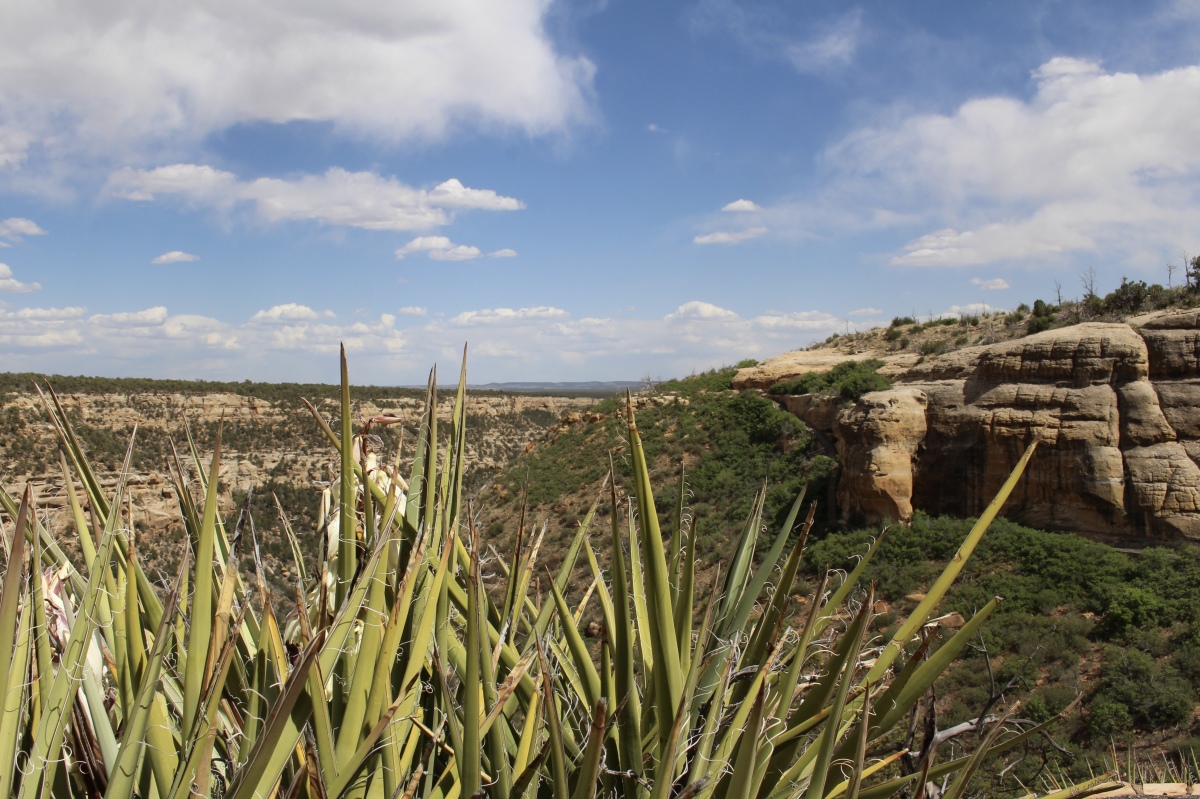
Yucca
From Shiprock View, it was supposedly possible to see Shiprock, located on the Navajo Reservation, but I didn’t see it on this day. Red Canyon Tower Overlook Tower showed a round tower across Rock Canyon which is on the Ute Mountain Ute Indian Reservation.
I walked the Step House Trail at the end of Wetherill Mesa, which I’ll write about in another post.
Far View Lodge is the incredibly nice lodge on the park property. This is where I stayed the night, checking into room 109 at around 4:30. I made a dinner reservation for 8:15 and then bought two Mesa Verde mugs and a pair of copper earrings at the Far View Terrace shop.

Far View Lodge

view from my room at Far View Lodge
Since I had plenty of time before dinner, I drove to the Chapin Mesa Archeological Museum, with its amazing dioramas.
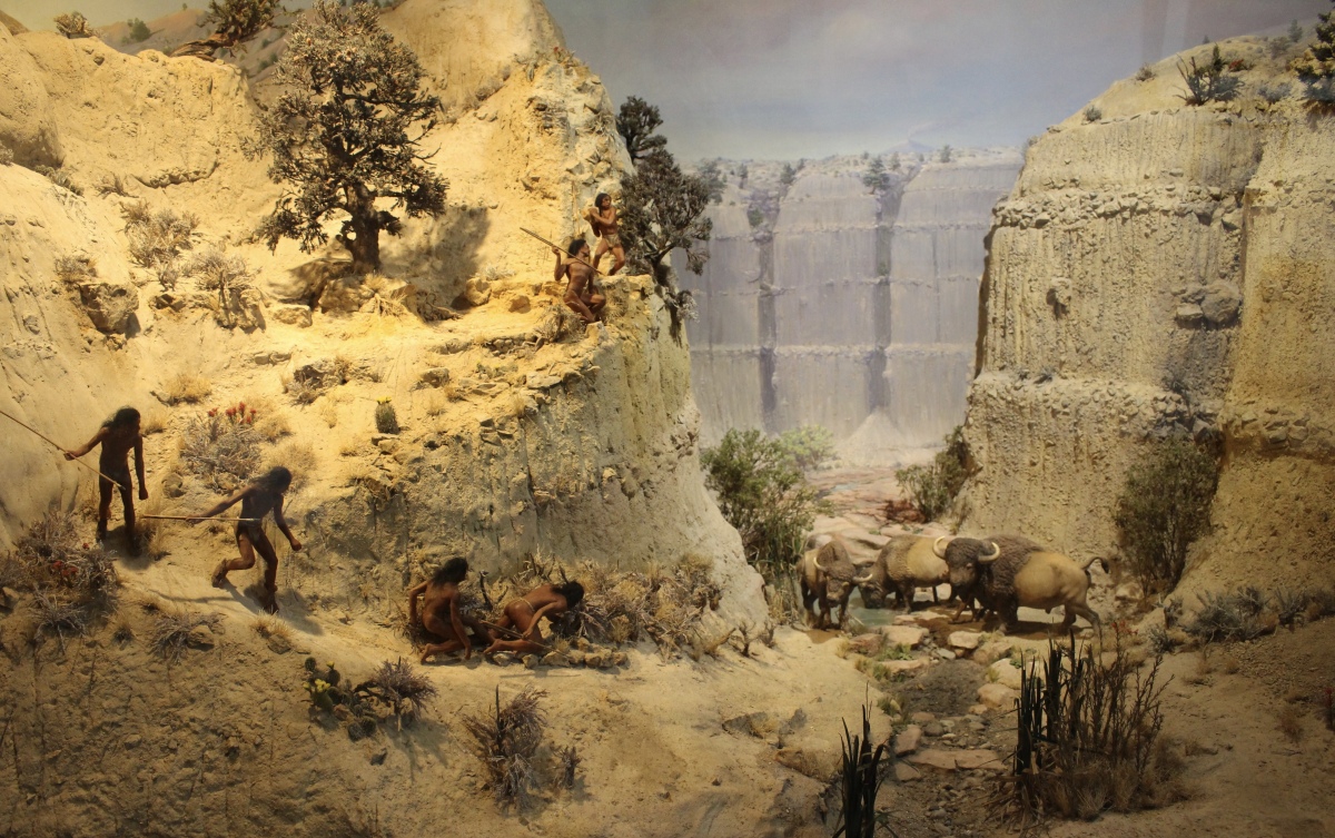
Early Habitation in North America (10,000-15,000 years ago)
America’s first inhabitants were hunters and gatherers. Archeologists found 19 fluted spear points among the bones of 30 bison at this site near Folsom, New Mexico. This big game hunt took place about 10,000 years ago.
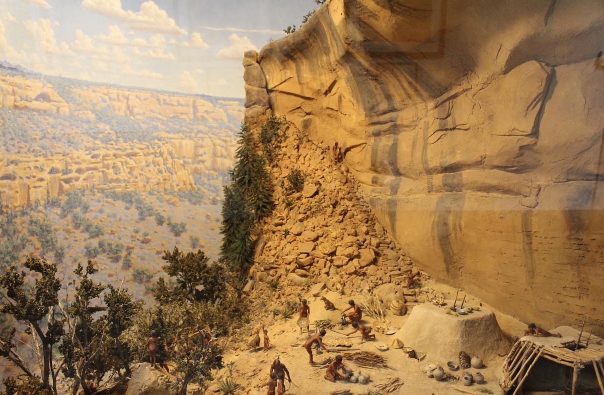
The Modified Basketmaker Period (1300 years ago)
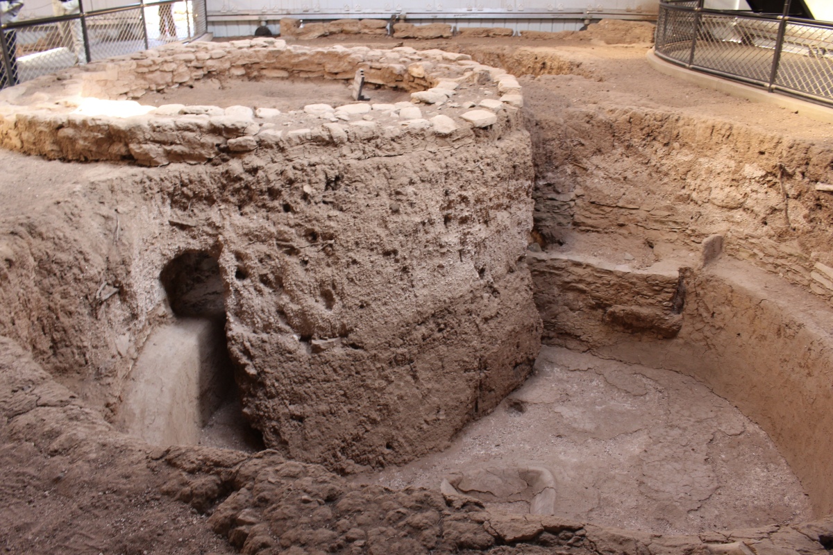
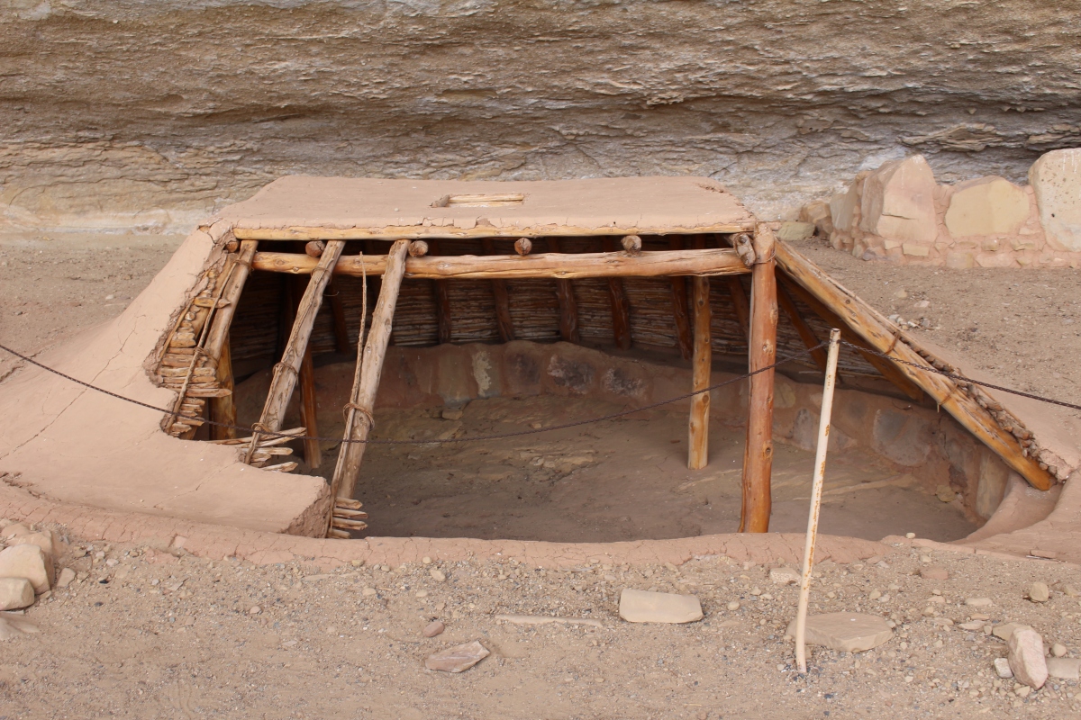
Between A.D. 550 and 750, the Pueblo people began living in the area now known as Mesa Verde National Park. Archeologists use the term “Modified Basketmaker,” to describe the culture of these people. These descendants of the earlier Basketmakers were more dependent on agriculture, abandoning their nomadic lifestyle.
The people began building permanent semi-subterranean houses, known as pithouses, in the alcoves as well as on the mesa top during this period.
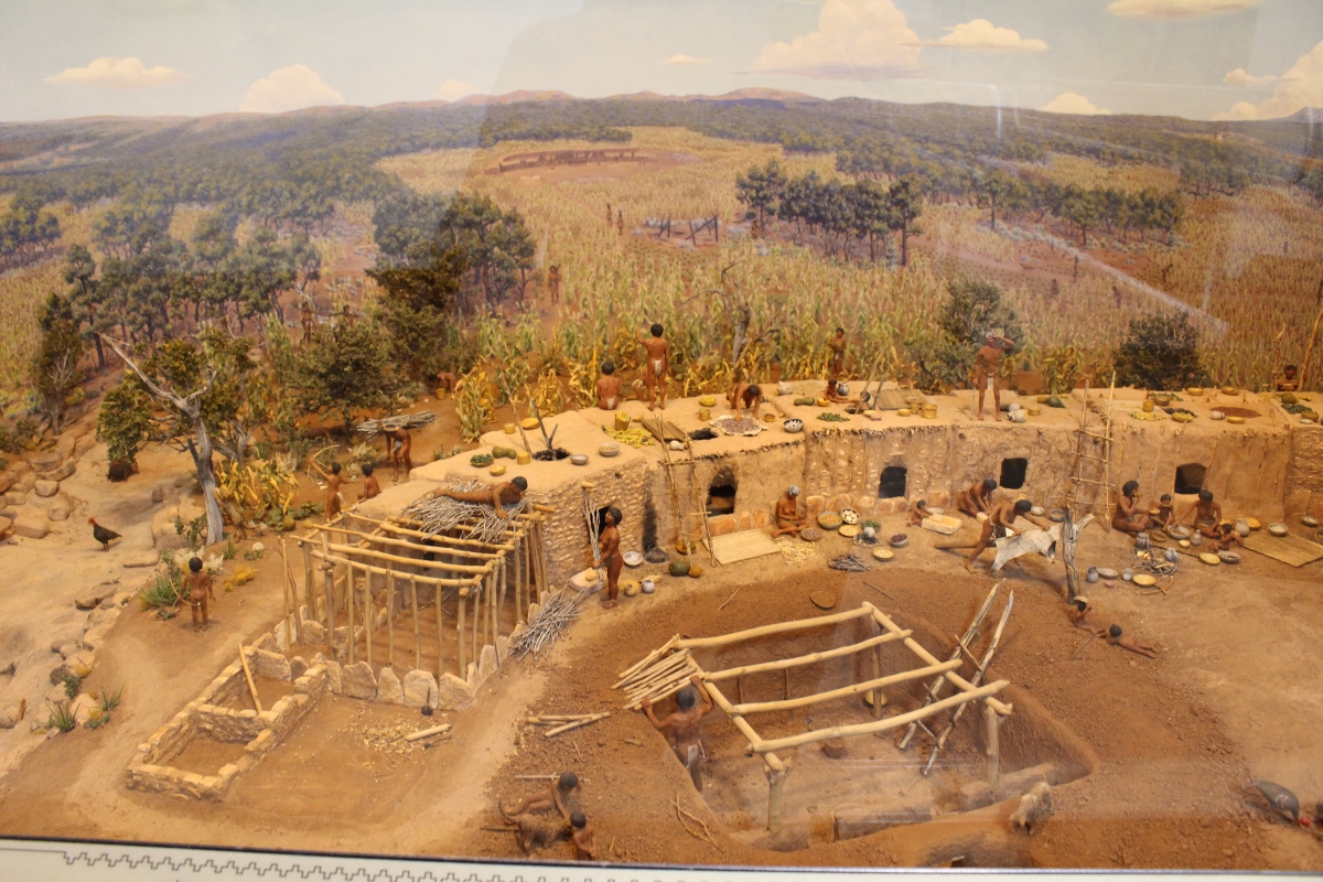
The Developmental Pueblo Period (1200 years ago)
The period from A.D. 750 to 1100 witnessed the development of the true pueblo, or village, architecture similar to styles existing in the Southwest today. During this “Developmental Pueblo Period” pottery-making flourished, new techniques of farming emerged, and trade became significant.
Pueblo people built this village about A.D. 850, when architecture was in an experimental stage. Water was obtained from springs and seeps at the heads of canyons and draws. Reservoirs were built to catch run-off from rain and snow. Fields of squash, beans and corn dotted the region. Although baskets remained common, pottery was the dominant craft.
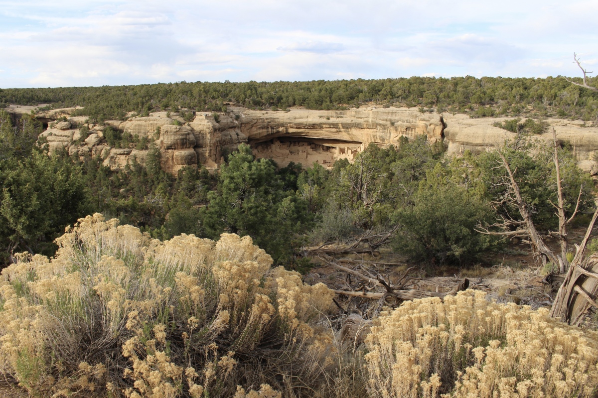
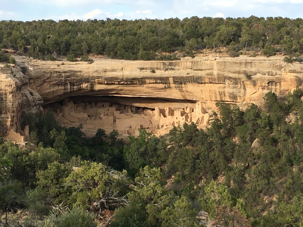
Leaving the museum, I walked down as far as I could to the Spruce Tree House overlook, which was sadly closed because of rock falls.

Spruce Tree House overlook
Spruce Tree House overlook
Spruce Tree House overlook
I drove the Mesa Top Loop on Chapin Mesa but I didn’t stop everywhere because I knew some stops would be on my Aramak tour the following morning. I also wanted to get back to my room so I could enjoy a beer on my balcony before dinner.
I stopped at the Navajo Canyon and Sun Point Views, as well as the Square Tower House, for glimpses into the canyons. As much as I peered out at the canyons, I could never find the actual Square Tower House.
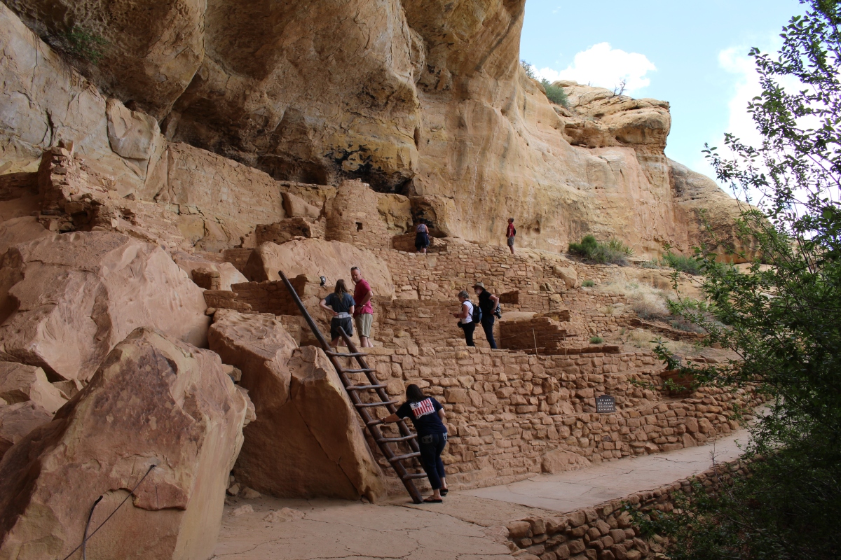
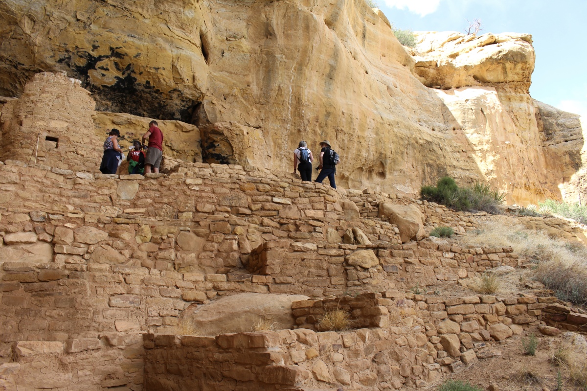
At Sun Point View, I could see both the mesa tops and the alcove dwellings. Although the Puebloans used the cliff alcoves throughout the entire time they lived in Mesa Verde, the cliff dwellings themselves were not built until the final 75-100 years of occupation. For over 600 years, these people lived primarily on the mesa tops.

Overlook

Overlook

Overlook

Overlook

Overlook
I stopped briefly at Fire Temple, New Fire House, and Sun Temple. Sun Temple has a D-shaped symmetry, with twin kivas, following a preconceived design that must have required a community-wide effort to build. The structure was never completed; there is no evidence of a roof or roof timbers. Apparently construction stopped when the Anasazi people began to leave the area. Though the structure appears ceremonial, its exact function remains a mystery.

Sun Temple
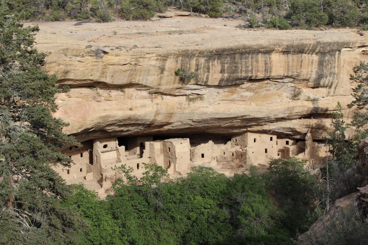
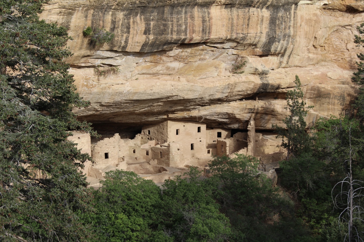
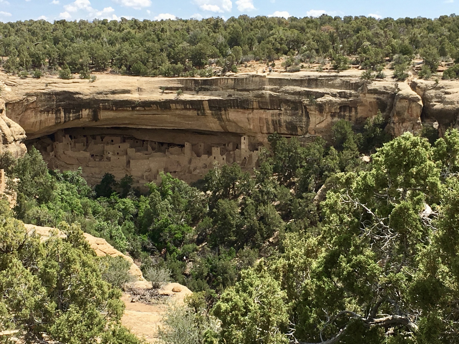
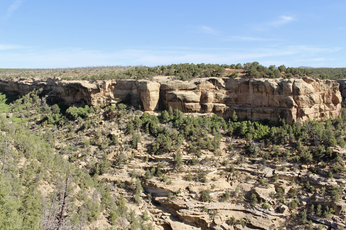
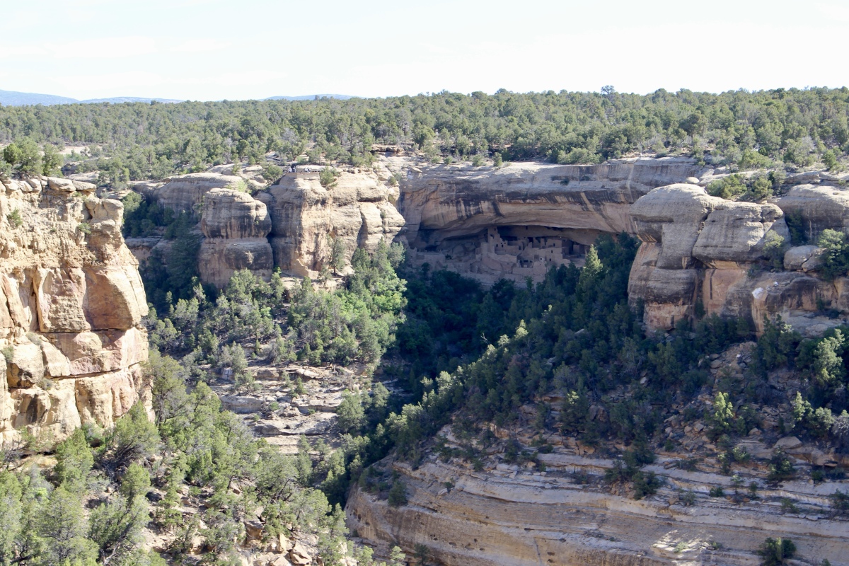
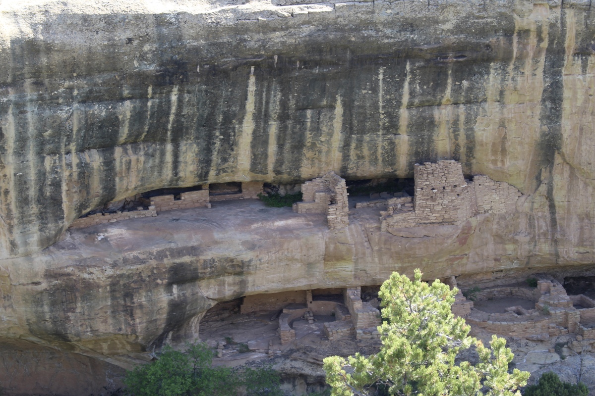
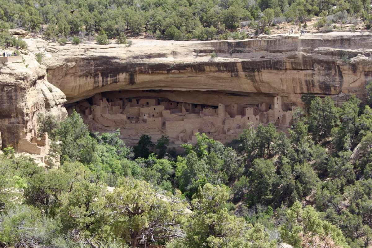
I was glad I stopped at the Cliff Palace View at nearly 7:00 p.m. as the light was perfect for photos. I wouldn’t find this to be the case when I took the tour the next morning. Cliff Palace is the largest cliff dwelling in North America. It is the crown jewel of Mesa Verde and an architectural masterpiece.
From the clifftop overlooks, the collection of rooms, plazas, and towers fits perfectly into the sweeping sandstone overhang that has largely protected it, abandoned and silent, since the 13th century. The construction of Cliff Palace was a major effort, taking place between 1190-1280. Its alcove is about 215 feet wide by 90 feet deep and 60 feet high. It includes about 150 rooms, 75 constructed open areas, 21 kivas and 2 “kiva-like” structures. It was inhabited by an estimated 100-120 people.
It was too early in the season to take the Cliff Palace tour. The tours would be offered the weekend after I left. I was able to take the Balcony House Tour, however, as I wrote about here.
Cliff Palace View

Cliff Palace View
Cliff Palace View
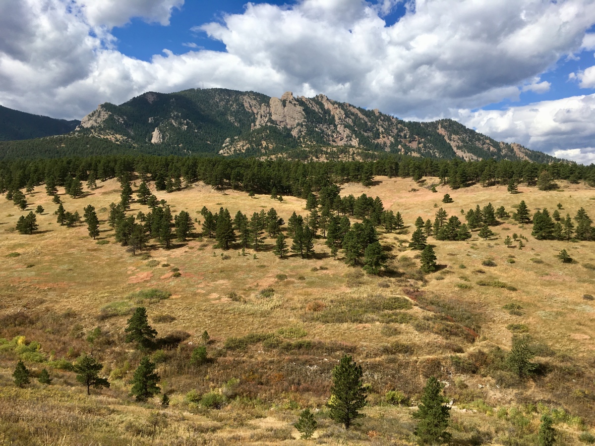
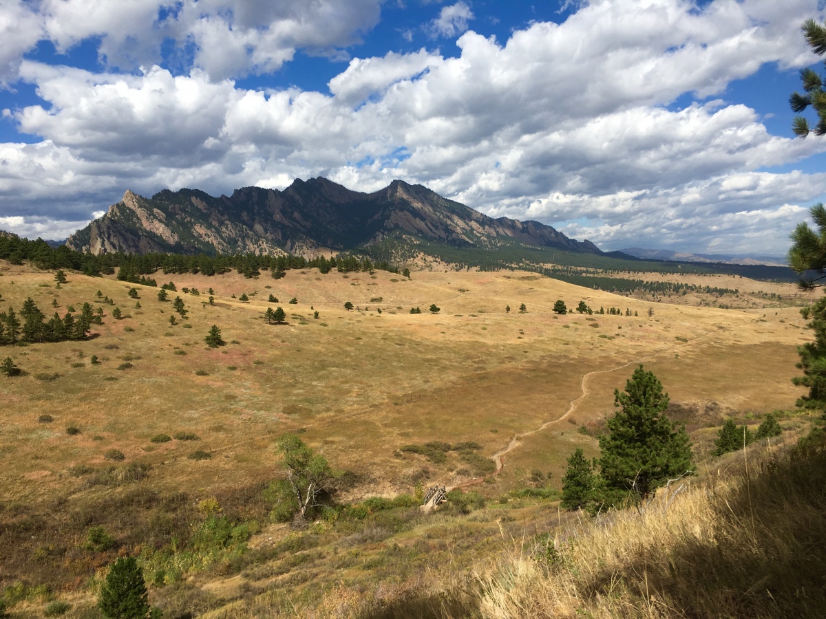
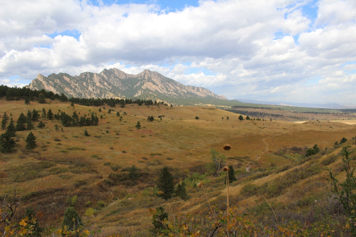
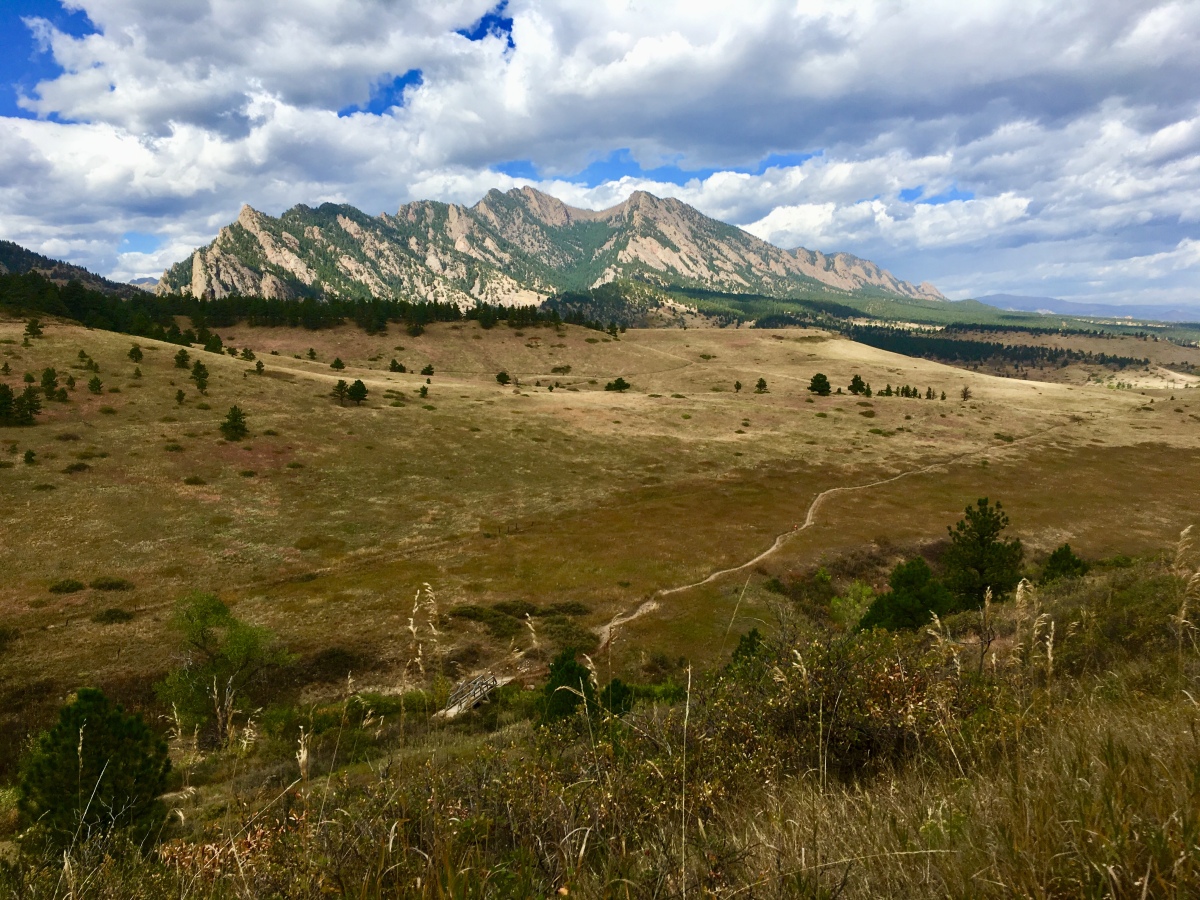
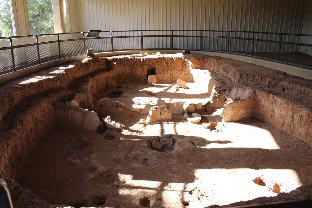
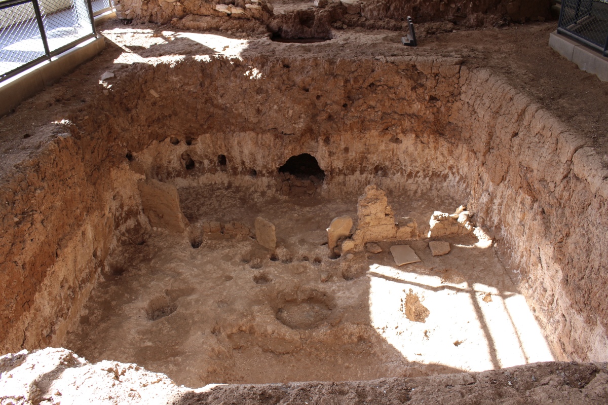
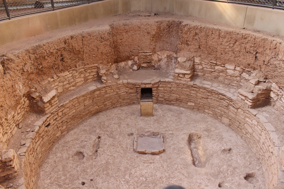
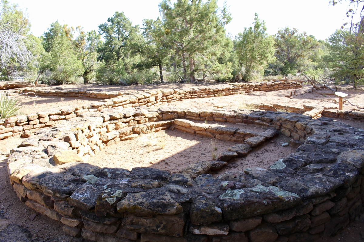
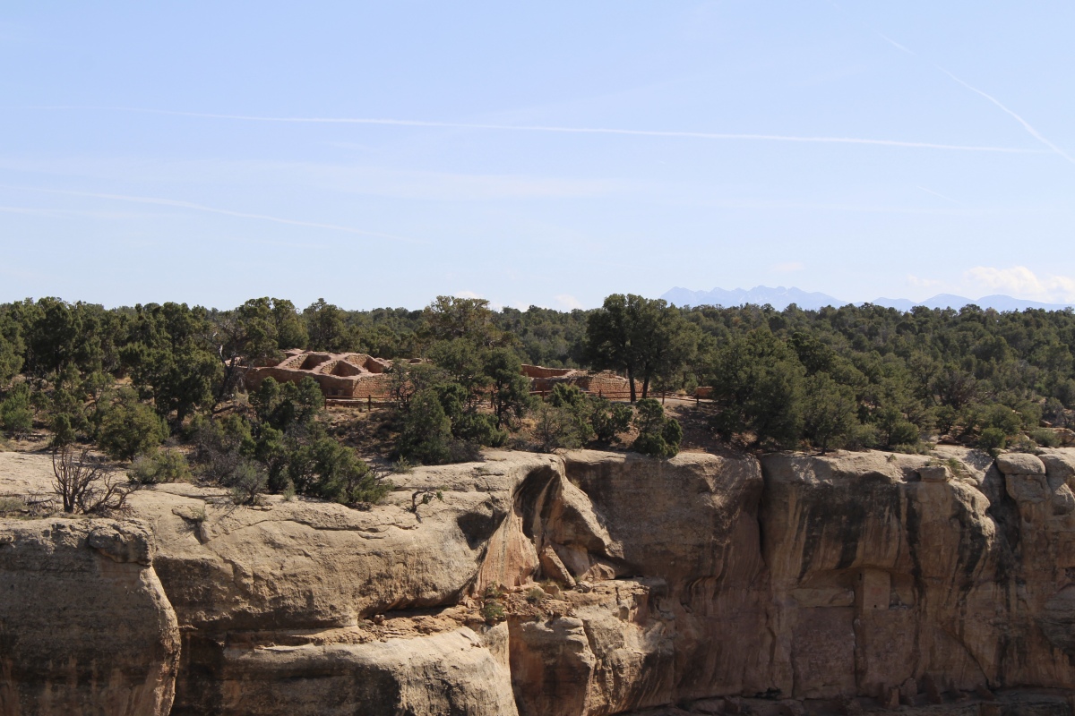
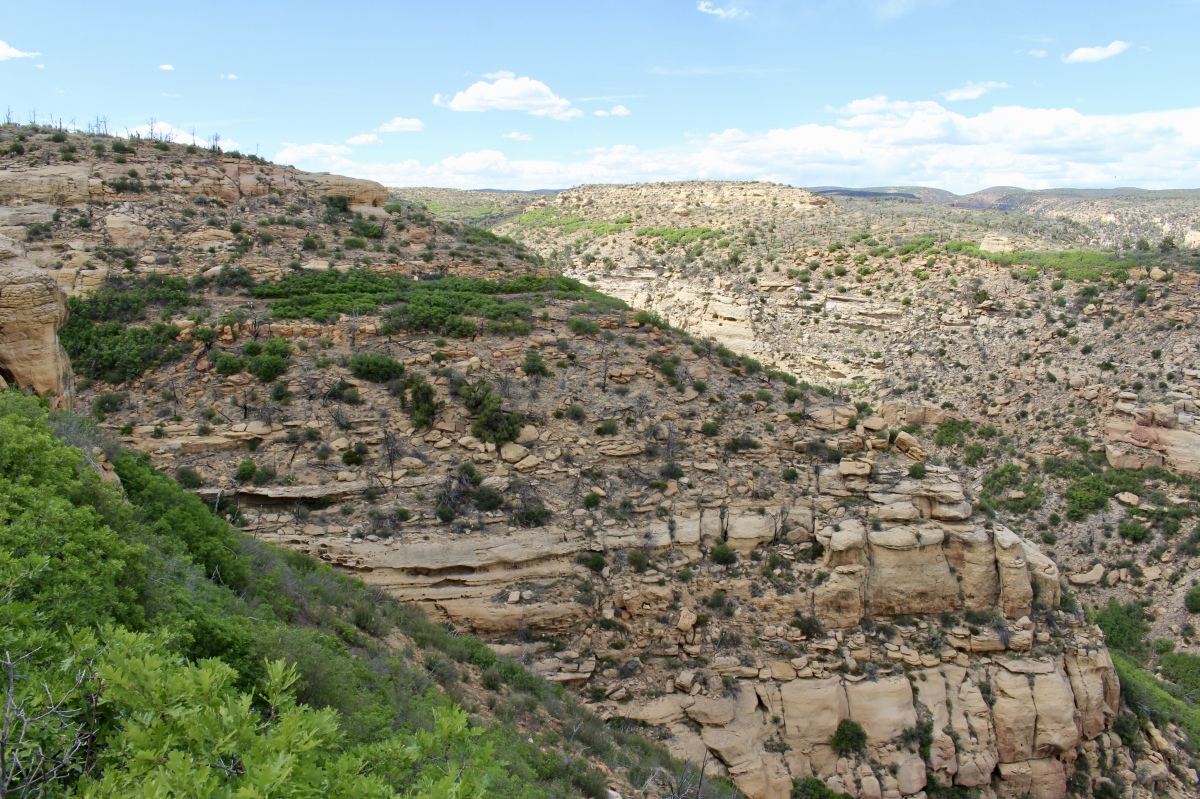
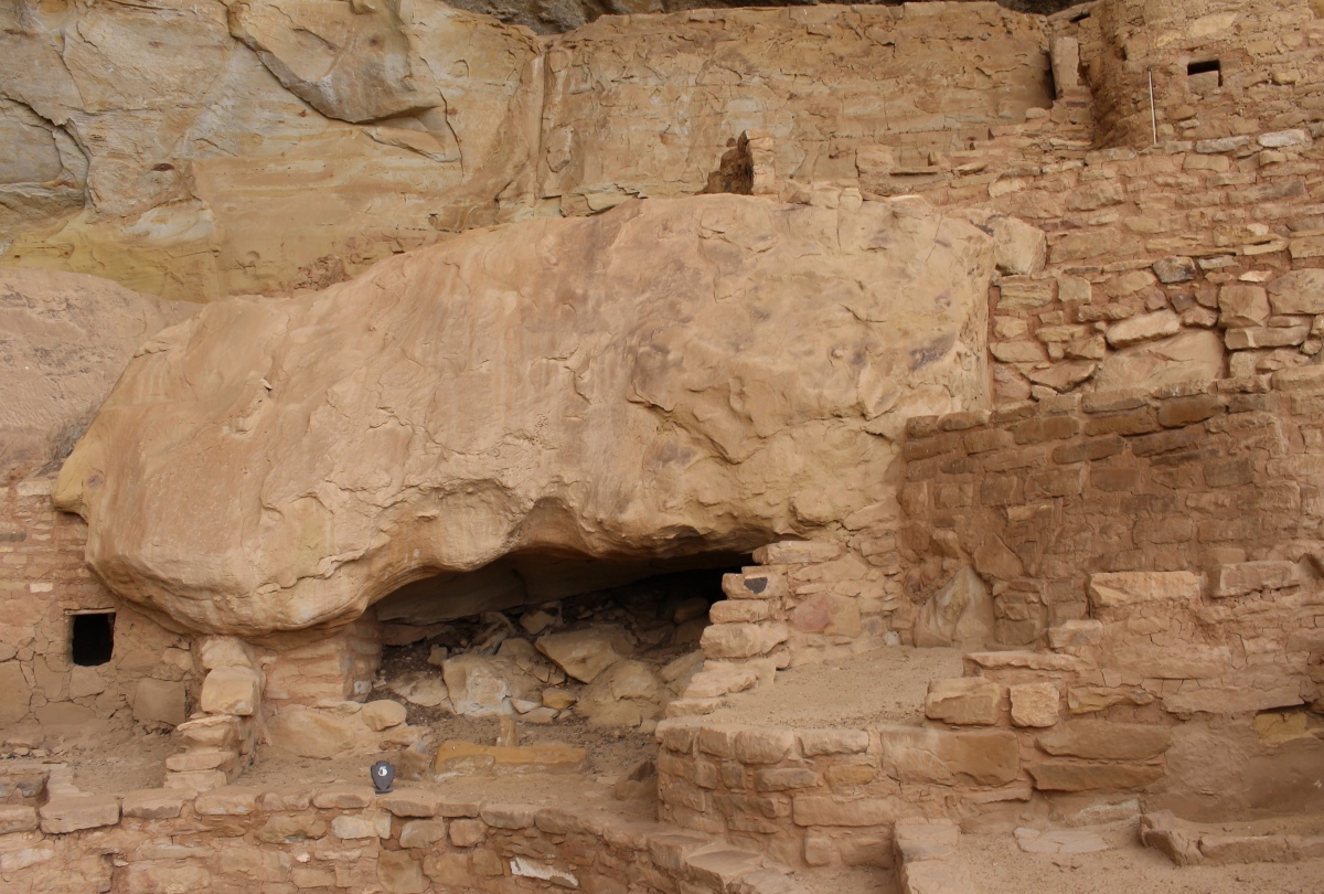
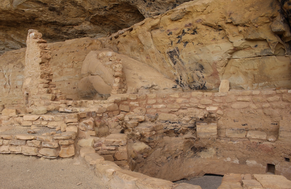
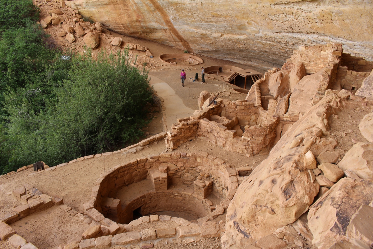
The Far View Sites came before the cliff dwellings, when Ancestral Puebloans farmed the area; the community supported dozens of families. Starting around 800 A.D., they lived here for several centuries, farming the deep mesa-top soils, building their homes, and raising their families. It was one of the most densely populated regions of Mesa Verde. In the mid-1100s, there may have been at least 35 occupied villages and surrounding farm and garden plots within a half-mile-square-area.

Far View Sites

Far View Sites

Far View Sites

Far View Sites
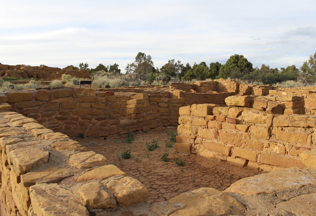
Far View Sites

Far View Sites
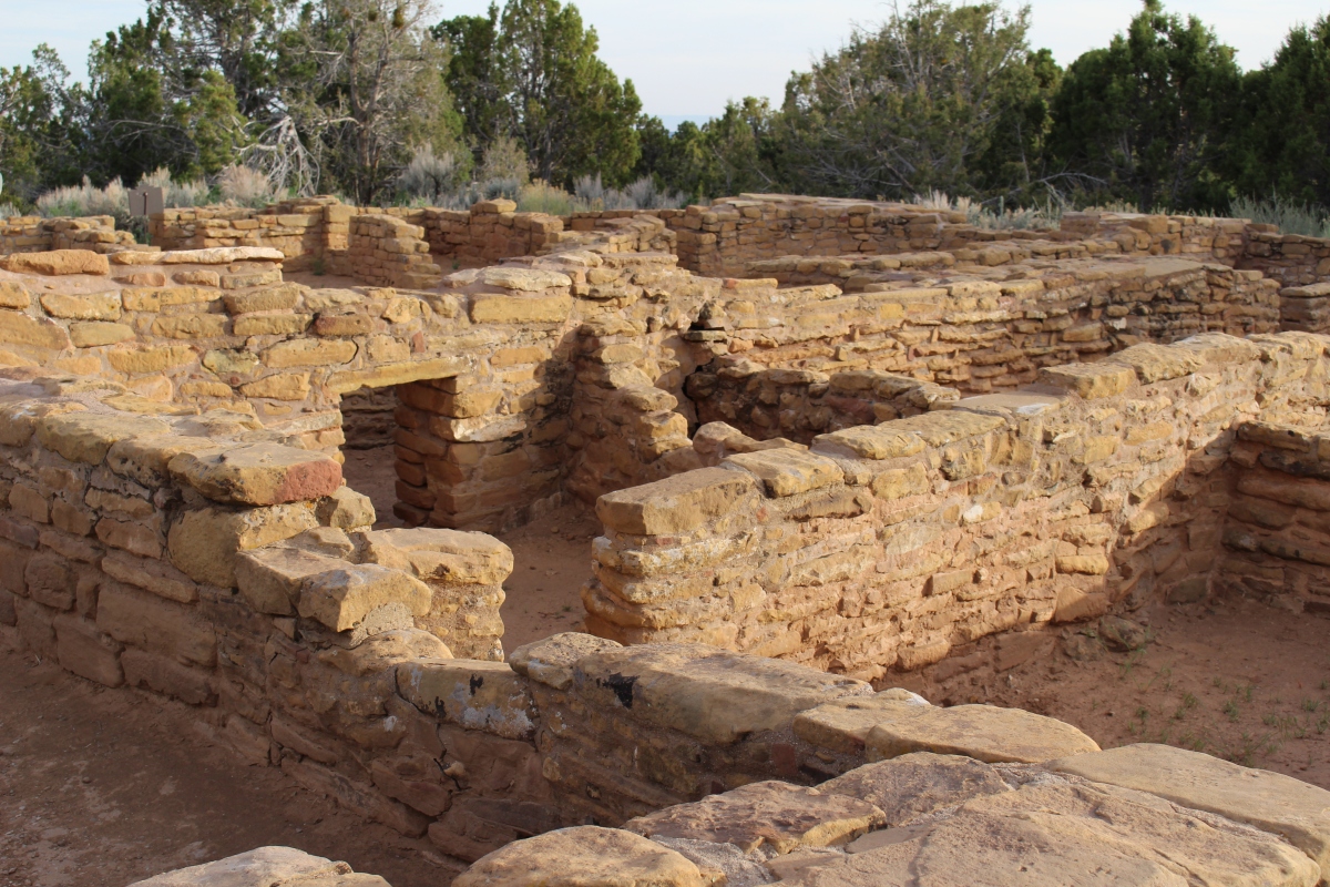
Far View Sites
I returned to the Far View Lodge and bought a Coors Light, took it to my room, and sipped it on the balcony while I scanned the day’s photos on my camera and watched the sinking sun.
At my 8:15 dinner reservation, I was seated at a window table in the Metate Rooom where I could enjoy the final dip of the sun below the horizon. My meal of Ancient Grain “Risotto” – asparagus, roasted mushrooms, wilted chard, oven dried tomatoes, and herb Parmesan breadcrumbs – was accompanied by fresh bread and tomato basil soup. All delicious!
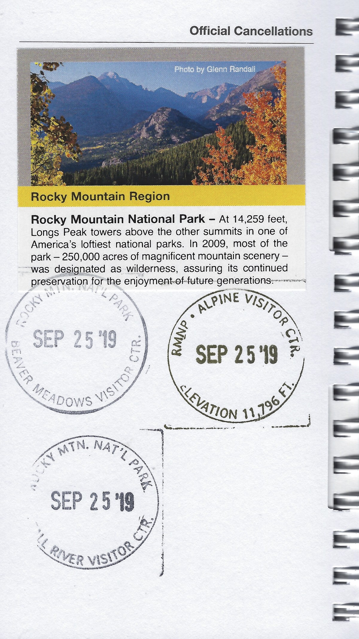
And I got my sticker and cancellation for my first day at Mesa Verde in my National Park Passport.
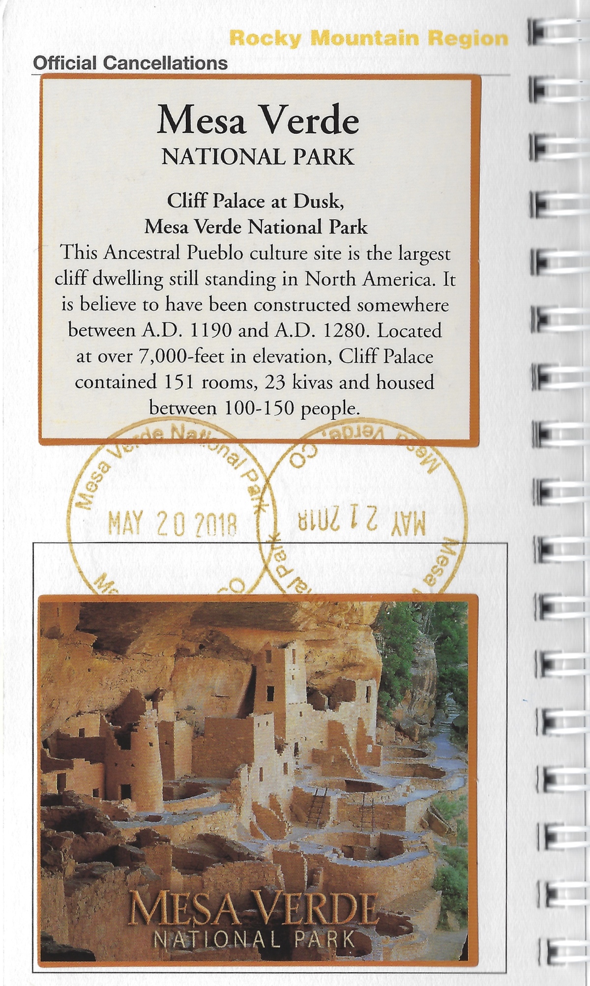
National Park Passport & cancellation stamp for 5/20/18
*Sunday, May 20, 2018*
*Steps: 14,873 (6.3 miles)
*********************
“PHOTOGRAPHY” INVITATION: I invite you to create a photography intention and then create a blog post for a place you have visited. Alternately, you can post a thematic post about a place, photos of whatever you discovered that set your heart afire. You can also do a thematic post of something you have found throughout all your travels: churches, doors, people reading, people hiking, mountains, patterns, all black & white, whatever!
You probably have your own ideas about this, but in case you’d like some ideas, you can visit my page: photography inspiration.
I challenge you to post no more than 20-25 photos and to write less than 1,500 words about any travel-related photography intention you set for yourself. Include the link in the comments below by Wednesday, May 15 at 1:00 p.m. EST. When I write my post in response to this challenge on Thursday, May 16, I’ll include your links in that post.
This will be an ongoing invitation, every first and third (& 5th, if there is one) Thursday of each month. Feel free to jump in at any time. 🙂
I hope you’ll join in our community. I look forward to reading your posts!
the ~ wander.essence ~ community
I invite you all to settle in and read a few posts from our wandering community. I promise, you’ll be inspired!
I am traveling from April 4 to May 10. If I cannot respond to or add your links due to wi-fi problems or time constraints, please feel free to add your links in both this post and my next scheduled post. If I can’t read them when you post them, I will get to them as soon as I can. Thanks for your understanding! 🙂
Thanks to all of you who shared posts on the “photography” invitation. 🙂


You must be logged in to post a comment.