
After leaving Fort Union Trading Post, I arrived at the North Unit of Theodore Roosevelt National Park at about 1:30 p.m. The park memorializes our 26th president and his conservation legacy.
Theodore Roosevelt first came to the Dakota Territory in 1883 to hunt bison and to invest in a local cattle operation known as the Maltese Cross Ranch, south of Medora. After both his mother and wife died on Valentine’s Day of the following year, he returned to immerse himself in the vast otherworldly landscape. He started a second ranch, the Elkhorn, and in this strange land, he found healing, solitude, adventure, and purpose. Though his ranch ultimately failed, his love for the rugged beauty of the land beckoned him to return time and again throughout his life.
Roosevelt credited his Dakota experience for his ground-breaking preservation efforts and the shaping of his own character. As president from 1901-09, he translated his love of nature into law. He established the U.S. Forest Service and signed the 1906 Antiquities Act, under which he proclaimed 18 national monuments. He worked with Congress to create five national parks, 150 national forests, and dozens of federal reserves – over 230 million acres of protected land.
Theodore Roosevelt National Park was established in 1947 as a national memorial park to honor President Roosevelt and to provide a place for visitors to experience his beloved Badlands.
The park is comprised of the North Unit, South Unit and the Elkhorn Ranch Site, site of Roosevelt’s home ranch. The 70,000 acre park offers colorful vistas and opportunities to view wildlife in the North Dakota badlands.
Theodore Roosevelt National Park
I drove the 14-mile scenic drive (28 miles round trip), stopping at all the overlooks. The drive goes through the badlands and meanders past River Bend Overlook.
Long ago, the Little Missouri River was flowing along a steep cliff face, on the left in the photos below. The moving water cut into the base of the cliff, leaving a large mass of rock unsupported. The unsupported rock mass gave way, sliding down intact and rotating as it came to rest in the river channel. As the river’s course shifted slowly across the valley, rain water eroded the cliff face which widened the gap between the cliff and the slump block, which is the hump to the right.


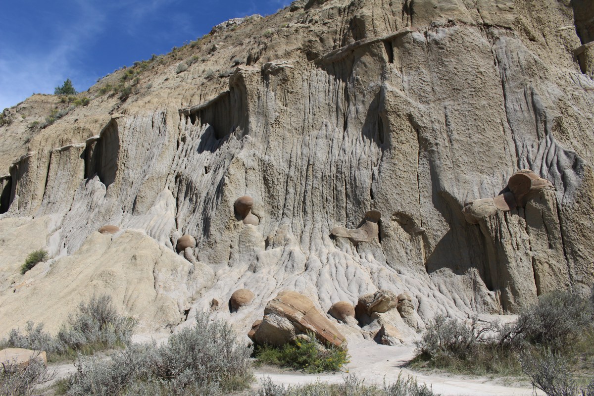
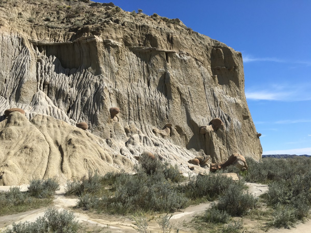
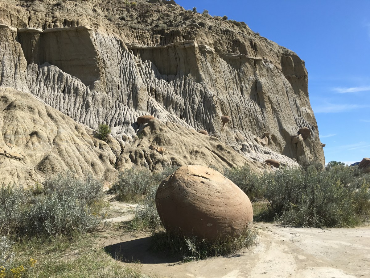
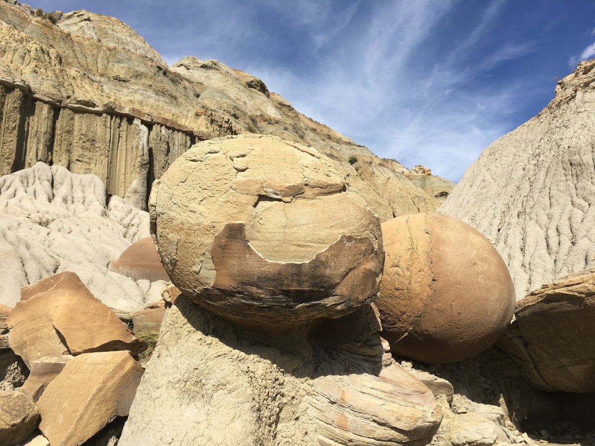
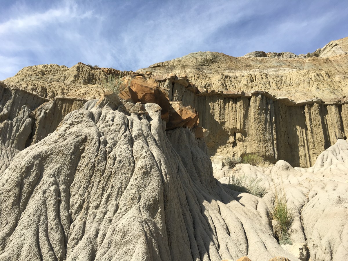
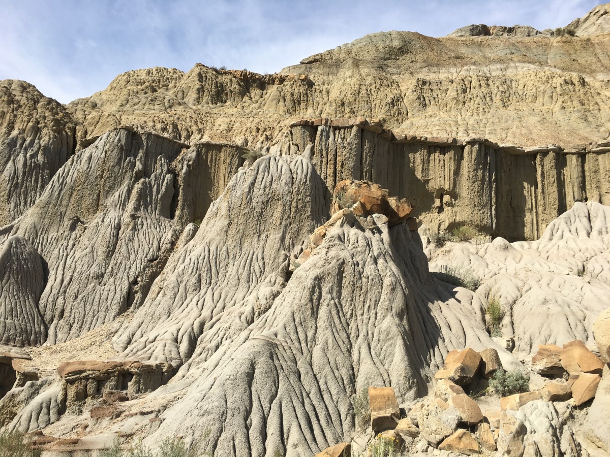
My first stop was the Cannonball Concretions Pullout. These “cannonballs” were formed when sand grains from an ancient river deposit were cemented together by minerals dissolved in groundwater.
Concretions form in many different shapes and sizes. Those that are spherical are called “cannonballs.” Formed within the sediment layers of the badlands, erosion is now exposing these buried treasures.
Cannonball Concretions Pullout
Cannonball Concretions Pullout
Cannonball Concretions Pullout

Cannonball Concretions Pullout
Cannonball Concretions Pullout

Cannonball Concretions Pullout
Cannonball Concretions Pullout
Cannonball Concretions Pullout
Cannonball Concretions Pullout
Cannonball Concretions Pullout
Cannonball Concretions Pullout
Cannonball Concretions Pullout
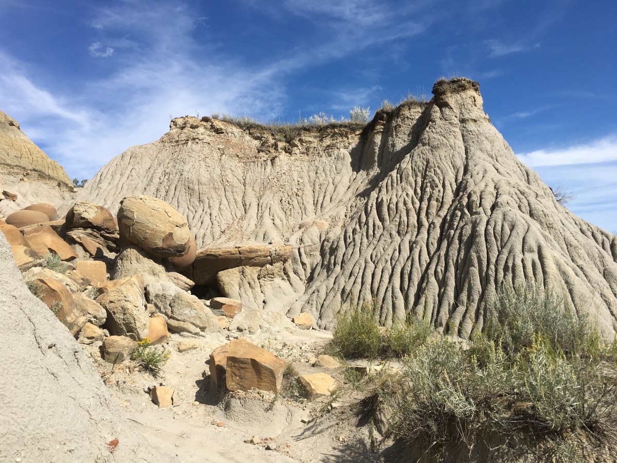
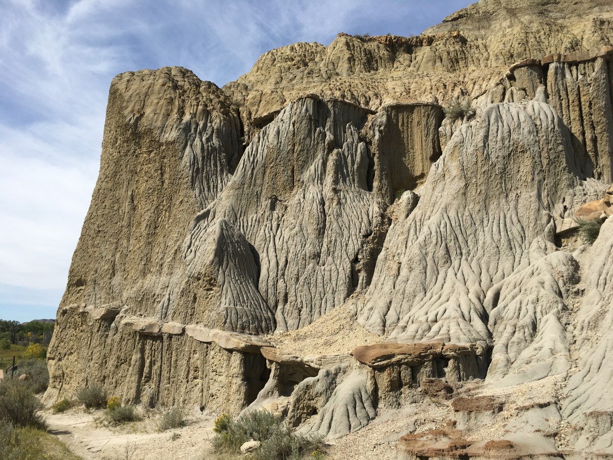
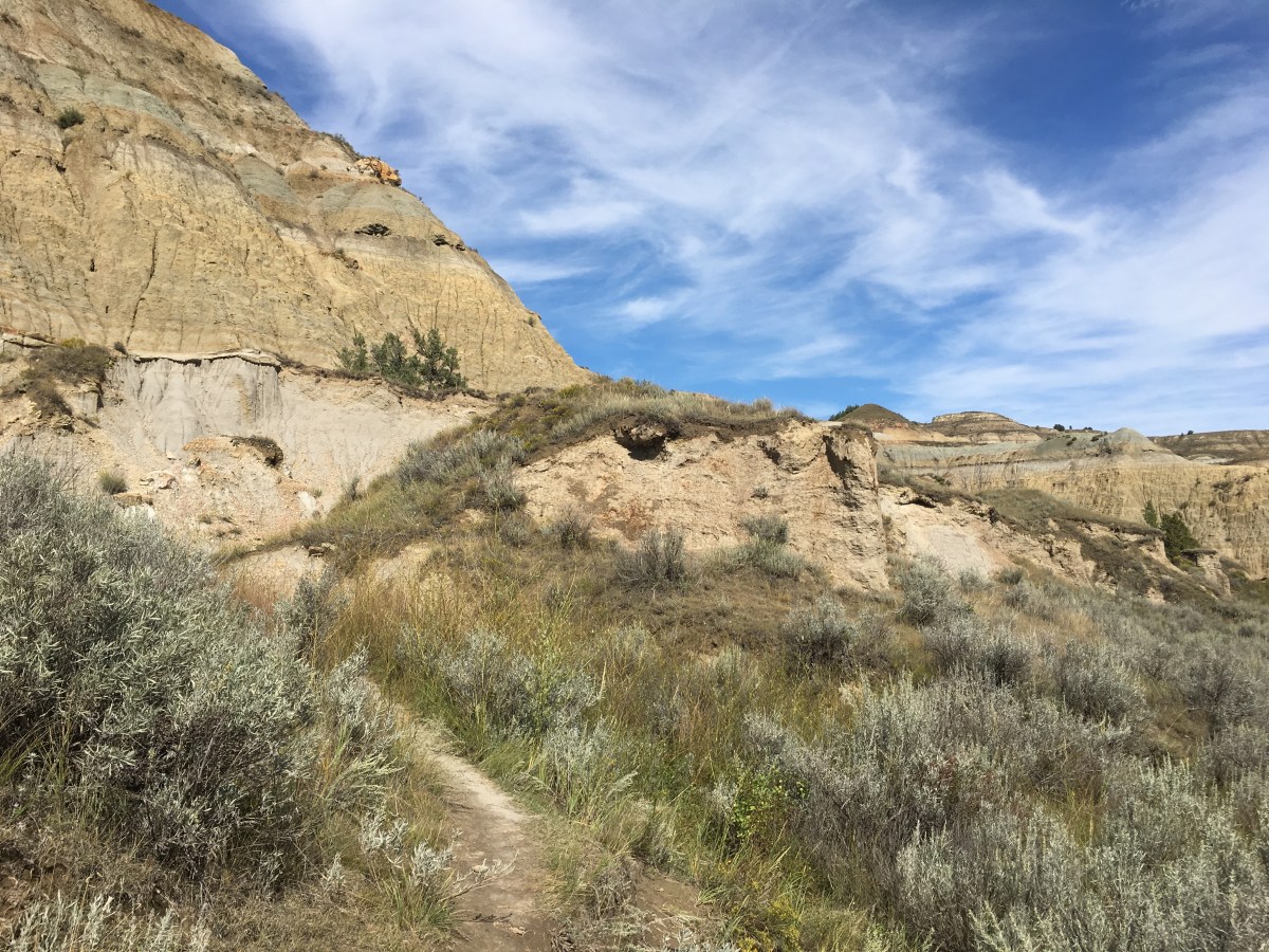
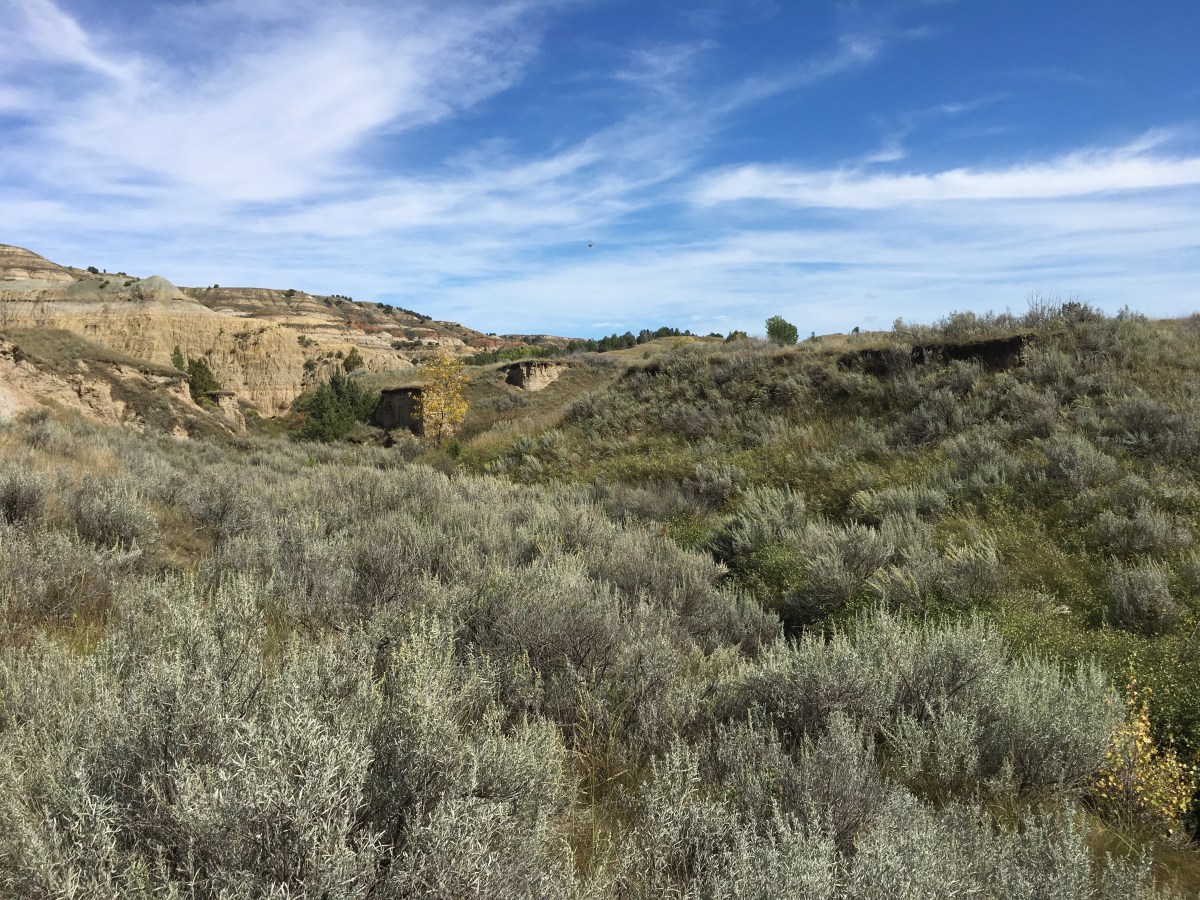
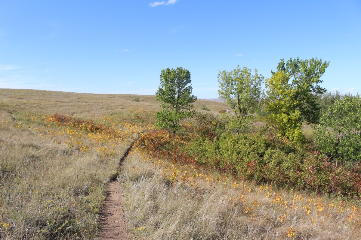
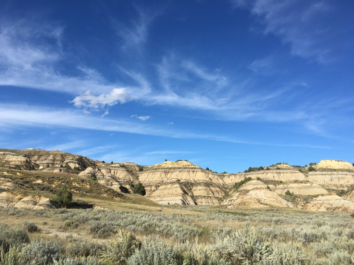
From the pullout, I also took a hike along the Caprock Coulee Trail, where I could see open prairie, sun-baked buttes, and juniper forests.


Caprock Coulee Trail

Caprock Coulee Trail

Caprock Coulee Trail

Caprock Coulee Trail
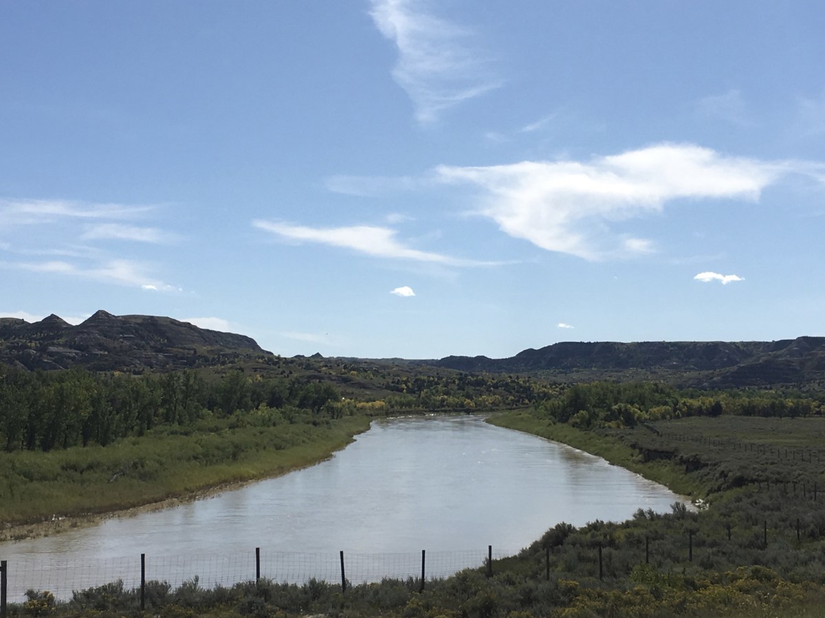
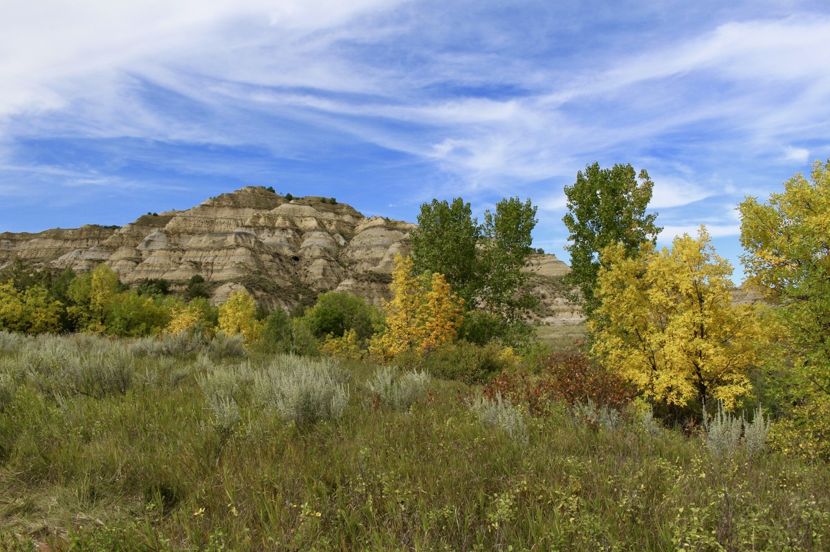
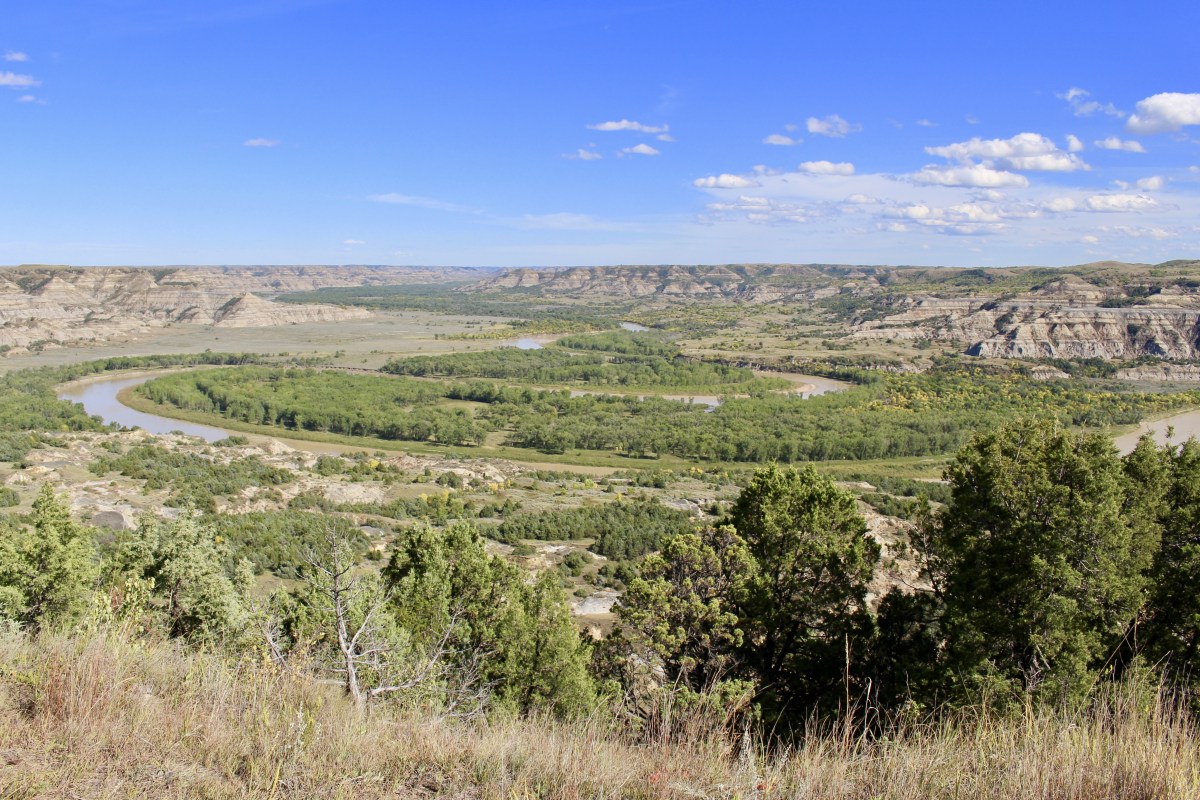
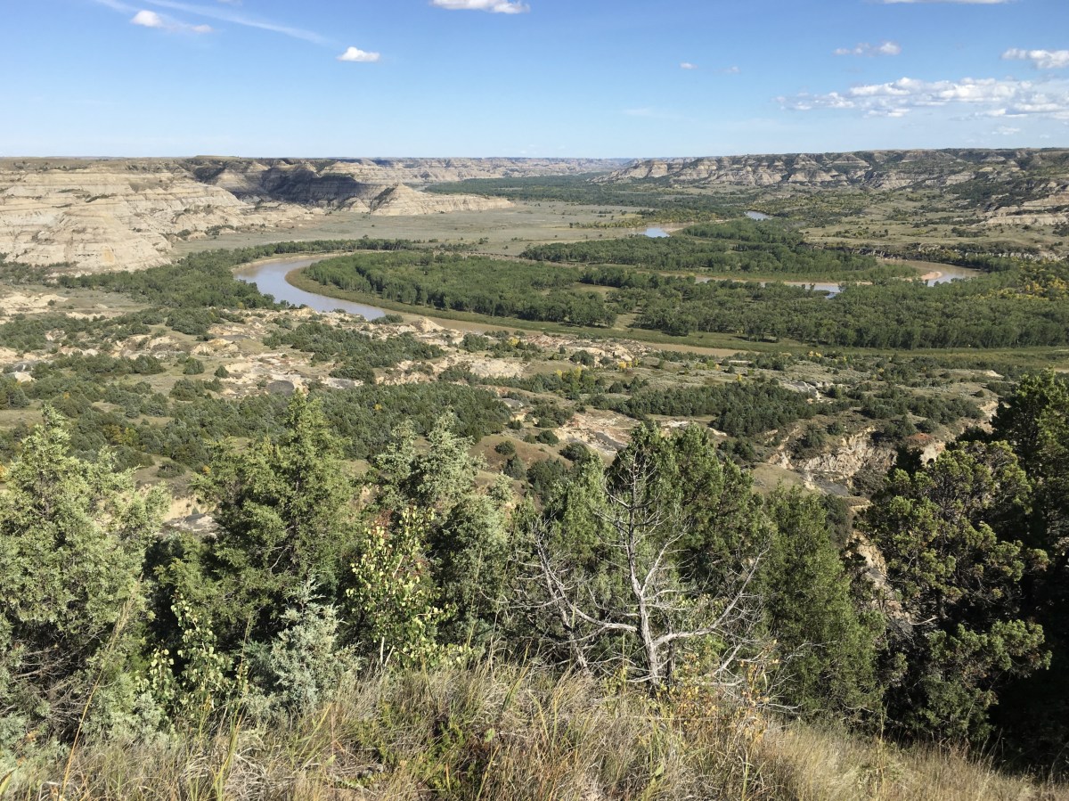
I stopped at the River Bend Overlook to a view of the Little Missouri floodplain. A small wedding was taking place at the stone shelter, built in the 1930s by the Civilian Conservation Corps.
Over thousands of years, the Little Missouri River and its tributaries have cut through the soft sedimentary layers of the northern Great Plains. Flowing water, along with wind, ice and plants, continue their erosive action. Each passing rain shower sculpts away the rolling plains, forming the rugged badlands.


By the 1880s, Roosevelt witnessed overhunting, overgrazing, and other threats to the natural world, so he became concerned about conservation. Through careful management, many animals that nearly became extinct are now living here again.
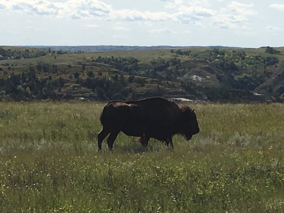
The bison is one success story. They once roamed the plains in the millions, until wholesale slaughter in the 1800s diminished their numbers to a few hundred. In 1956, a small herd was reintroduced here and has grown to the point where it has to be carefully managed. Elk, bighorn sheep, and pronghorn have also been reintroduced successfully.
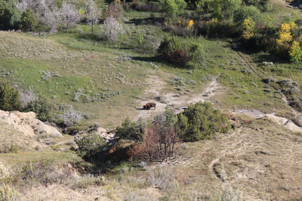
On my way to Oxbow Overlook, I pulled over to take a few pictures of a lone bison.
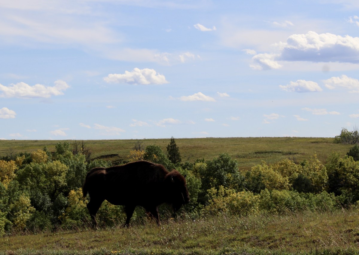
bison at Theodore Roosevelt National Park
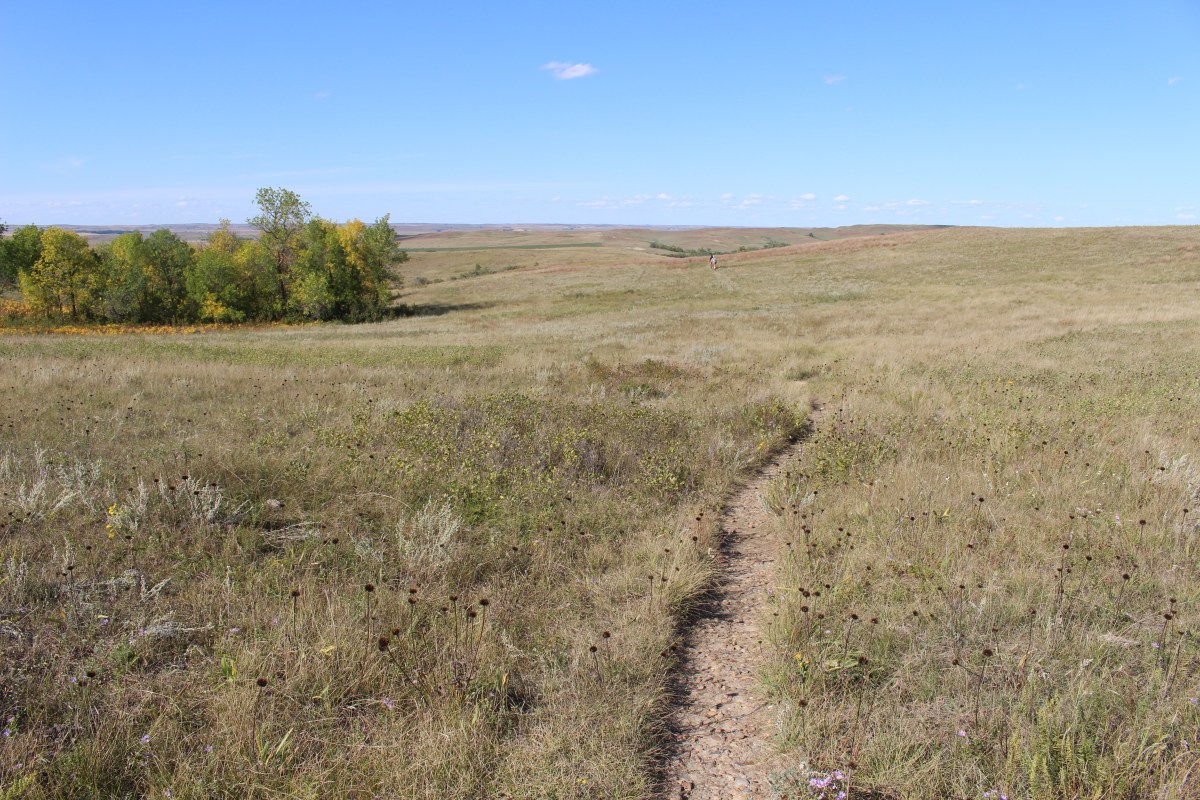
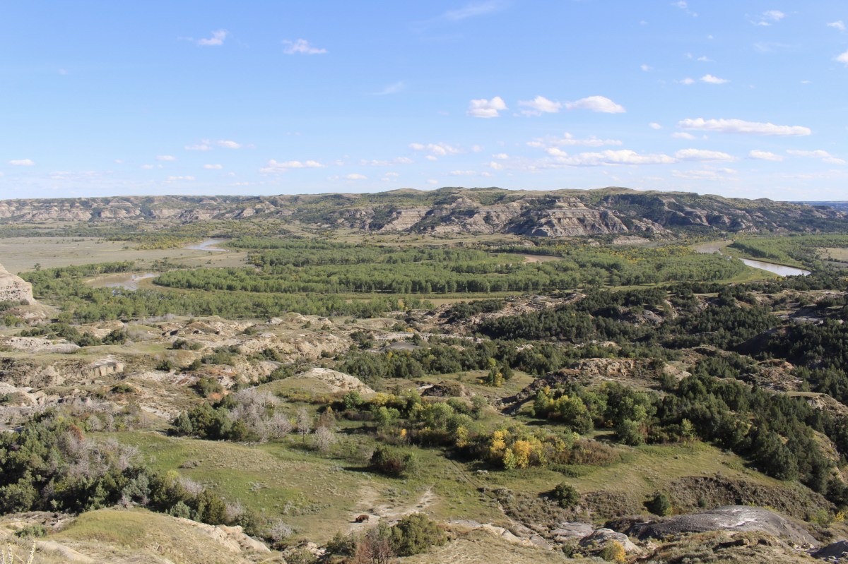
I took the hike to Sperati Point (1.2 miles each way); it was a breezy 75°F. Walking across grassland, I found fabulous views of the Little Missouri River with its twists and turns down in the valley. Cottonwood trees lined the riverbanks.
The mixed-grass prairie at Theodore Roosevelt National Park is a blend of shortgrass species like buffalograss and tallgrass species like big bluestem. Mixed-grass prairie survives on 15-24 inches of annual precipitation.


At Sperati Point, I met Mike and Deb from Dayton, Ohio. Mike said he worked as a chemist in petrochemicals. He told me I should check out an artist, Henry Farney, who often has paintings in the Cincinnati Art Museum. We talked about artist-explorer Karl Bodmer, China, travel and North and South Dakota. They told me I’d love Rapid City and Custer State Park.
The undammed Little Missouri River floods often, eroding areas of floodplain and depositing new land. This new land next to the river offers plenty of water and sunlight. It’s the only place cottonwood seedlings can survive. As the river changes slowly from year to year, new generations of cottonwood trees grow in its wake.
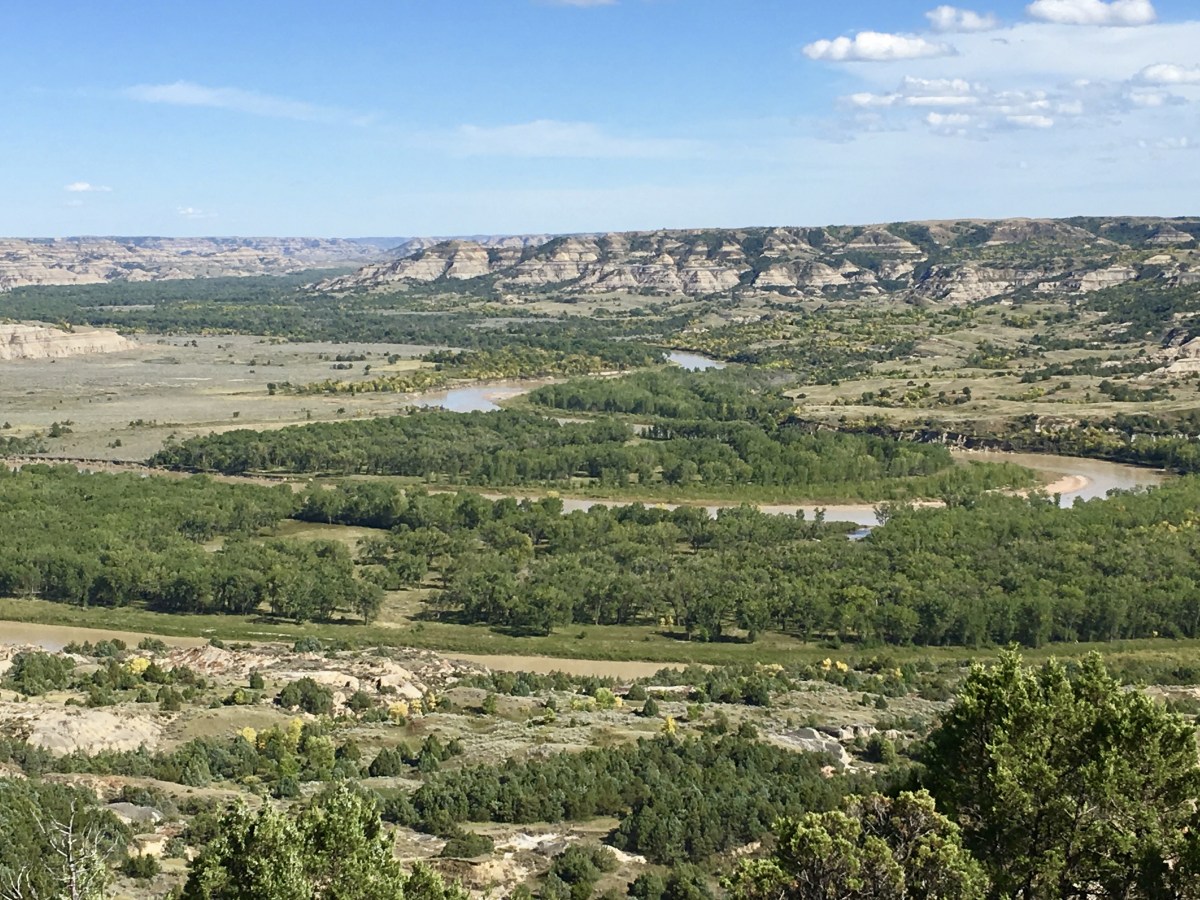
Sperati Point and the Little Missouri River
This natural cycle of flooding and tree growth is disappearing across the Great Plains where most rivers are tamed by dams and do not flood. Without natural flooding, new generations of cottonwoods fail to thrive. Other species, some of which are invasive, replace old generations of cottonwoods when they die.
Sperati Point and the Little Missouri River
Cottonwoods are water-loving trees with heart-shaped leaves. Their seeds are well adapted to the wet areas in which they grow. The fluffy, white “cotton” helps the seeds float on the surface of the water and cling to the soil where the water deposits them.

Sperati Point and the Little Missouri River

Sperati Point and the Little Missouri River
Sperati Point and the Little Missouri River
After reaching the point, I made the long walk back.
walk back from Sperati Point
walk back from Sperati Point
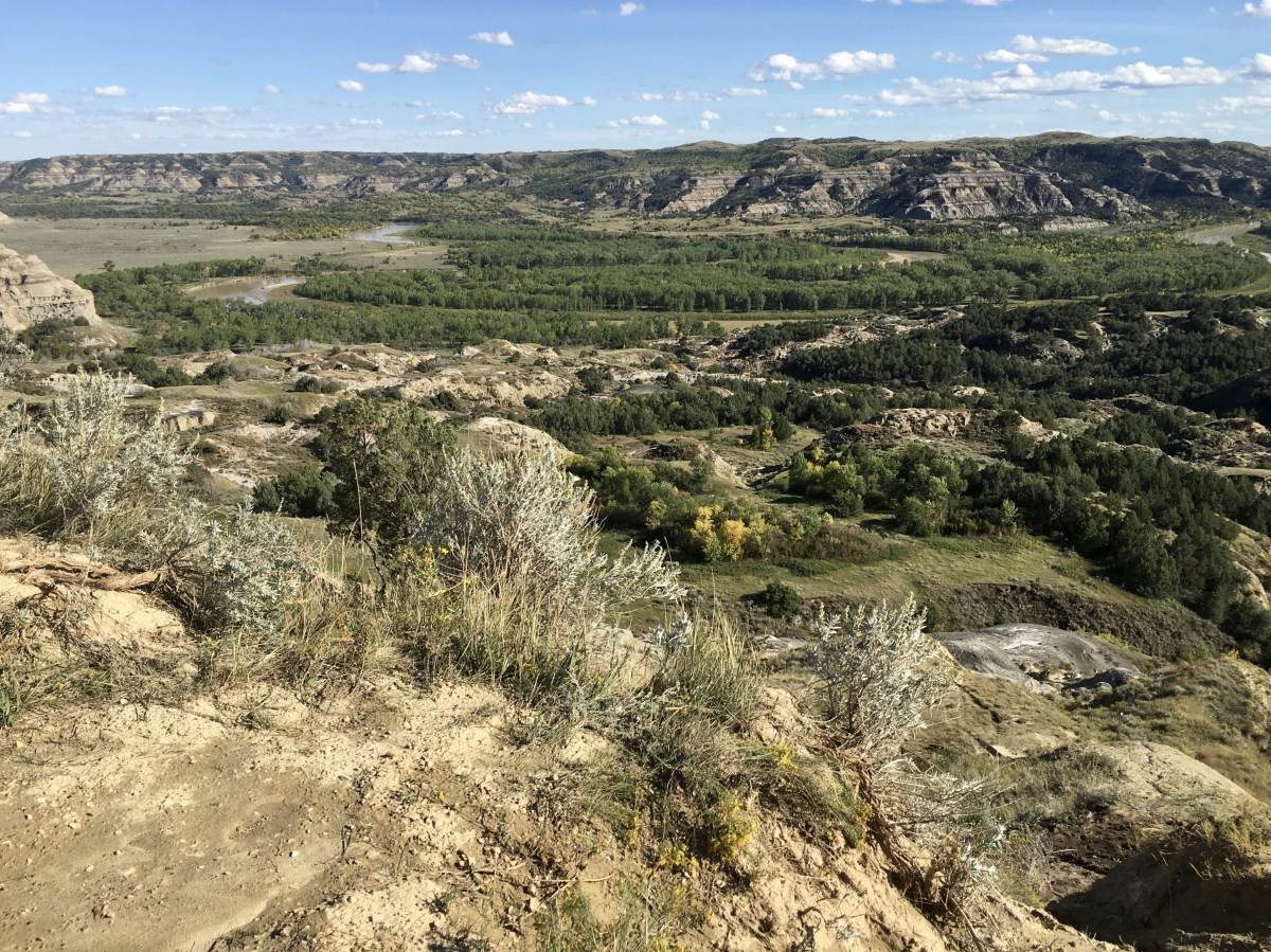
I walked to Oxbow Overlook, a fabulous view of where the Little Missouri takes a hard turn to the east. The river originally continued north to the Hudson Bay. During the most recent ice age, continental glaciers blocked its way, hence the turn.
Oxbow Overlook
Oxbow Overlook
Oxbow Overlook
I stopped at another overlook on my way out of the park.
Theodore Roosevelt National Park

I left the North Unit of the park at 5:40 Central Time. At 5:41, I entered Mountain Time Zone after crossing the Little Missouri. By Grassy Butte, I had gained an hour and drove 85S to 94W.
I talked to Mike while I was driving. He had taken his sister, Barbara, out for a drive, just to keep her from going crazy after her knee replacement. He was busy roasting okra and onion and garlic cloves to add to tofu. My youngest son had been going over to help Barbara every day before his Massage Therapy class.
I checked in to AmericInn by Wyndham Medora. There wasn’t much to the town of Medora; it was mostly an entrance to Theodore Roosevelt National Park South Unit, which I would explore the following day.
I ate dinner at the Little Missouri Saloon where the servers were all Polish girls. Service wasn’t great and neither was the menu. I ate out on the patio – Pinot Grigio and Taco Salad.
Here’s my journal spread for today.

Saturday, September 14, 2019
*Drove 231.2 miles; Steps: 19,890, or 8.43 miles*
*Saturday, September 14, 2019*
Discover more from ~ wander.essence ~
Subscribe to get the latest posts sent to your email.

Such a stark landscape: dramatic but overpowering. I don’t know how I’d feel in such wilderness.
LikeLike
It’s a very strange landscape, Mari. Wait till you see my post on the Badlands. Very stark, dry, and strange. 🙂
LikeLike
Fabulous rock formations, Cathy 🙂 🙂
LikeLike
I thought so, Jo. A very strange landscape. How are things there? I’m leaving today on my road trip! I’m so excited to have a change of scenery. 🙂
LikeLike
You never seem to have anything but a change of scenery, Cathy! 🤣🤣 The president has imposed tighter restrictions here because some of the hospitals in the north are at capacity and they don’t want it to spread. Groups down to 5 but we’ll cope. Hopefully it’s short term but we’ll see. Have a great trip! 🤗💕
LikeLike
Thanks Jo! Will this thing ever end?
LikeLiked by 1 person
As ypu know from my blog, Cathy, we only had a short stop at the scenic overlook on I-94. All the more I’m happy that I can now see your pictures of the park.
LikeLike
Ah, Pit, you would have gone by the South Unit of the park on I-94. I’ll be posting about that on Sunday. I’m glad you liked seeing the pictures of the North Unit. 🙂
LikeLike
I love this kind of landscape, such fascinating shapes and colours.
LikeLike
I loved it too, Anabel. It’s so different and otherworldly. The Badlands are even stranger, but that post will come later. These are badlands too, but at least they have a little greenery. 🙂
LikeLiked by 1 person
Wow – looks like an amazing place! Beautiful photos!
LikeLike
Thank you, M.B. It was a really unusual and otherworldly place. I enjoyed it. 🙂
LikeLiked by 1 person