When I left Springfield, Illinois, I drove on I-72 west under pale blue skies with wispy clouds. All around were tall cornstalks with shimmering tassels, and Lana del Ray sang “Get Free.” I was awed to think that all around me, farmers had been working this land to feed all of us. Acres and acres of corn were all around, as far as the horizon, punctuated by red barns and cows.
The corn and goldenrod glowed in the sunlight. A breeze was shimmying the cornstalks; it carried an earthy smell, of corn, soil, grains, pines, and soybeans. Illinois is famous for corn, soybeans and swine. Other crops include cattle, wheat, oats, sorghum, hay, sheep, poultry, fruits and vegetables. Specialty crops include buckwheat, horseradish, ostriches, fish and Christmas trees.
In Jacksonville, I passed huge silos, green houses, a freight train, Love’s Truck Stop and iHop.
The land got hillier with grazing pastures and more trees. Near Beardstown, I passed the Mark Twain Cave & Campground and a winery. Lana del Ray sang of hearing the birds on a summer breeze. Big rigs hunkered down on ramps. I crossed the Illinois River and passed the Jellystone Camp Resort and then raindrops started dotting the windshield. A Prairie Farms truck whizzed past with promises of ice cream. The corn here was a golden brown. I crossed the Mississippi River into Hannibal, home of the Mark Twain Boyhood Home. I was in Missouri.
I didn’t have time to see Mark Twain’s home, so I continued on 36W through Missouri. It would be 184 miles to get to St. Joseph on the western side of the state. I had to slow down as the Missouri speed limit was only 65mph, compared to the 70mph of Illinois. The Shins sang in “It’s Only Life” that it was natural for us all to go down a rabbit hole. It was 80°F by the time I drove past a collapsing barn, junky yard and a blue-roofed farmhouse in a wild copse of trees near Hunnewell, population 227.
John Prine sang a song about a caravan of fools while a green tractor plowed the fields. A farmhouse sat in a field of goldenrod. Then John Prine sang of the “Lonesome Friends of Science,” where he admitted he lived down deep inside his head and repeated “Uh-uh, Uh-huh.” I sang along, because the words were easy, soothing, and rhythmic, “uh-huh, uh-huh.”
When I rolled down the windows, the loamy earth smelled of a summer day. Crooked Creek was abundant with yellow wildflowers. Mr. Wrench’s Trading Post had pictures of farm equipment and wide silver silos. The landscape was a slow burn, mesmerizing. Kasey Musgraves sang in “Fine” how she picked those tomatoes they grew off the vine. The branches of a weeping willow dangled in the breeze, sweeping the grass, and the corn danced to the music wafting through the car.

silos near Crooked Creek, Missouri
I bypassed the Weathervane, an antique collectible mall, and stopped in Macon to use the restroom. A John Deere dealership squatted by the road with HUGE and gleaming green and gold farm equipment. Near the Chariton River were green rolling pastures dotted with hay bales. Jack Johnson sang of sleeping through the static. A red-roof barn’s worn wood was painted with an American flag.
near Chariton River, Missouri
I passed Turkey Creek, Muddy Creek and Locust Creek, and then the Swan Lake National Wildlife Refuge. Soon it was Medicine Creek and brown cornfields, before I stopped in Chillicothe, Missouri to grab lunch at a Subway. The line was long. Next door was a shop with a fetching display of plaid shirts, which reminded me of the Midwest and farmers. I had to go into the shop, maurice’s, (I’d never heard of this chain before) and I came away with two t-shirts.
Back on the road, John Prine serenaded me again with visions of swimming suits on the line just dryin’ in “Summer’s End.” I was welcomed to Hamilton, “Home to the J.C. Penney Museum,” which might have been a fun stop if I didn’t have so far to go.
Then all around me were wind turbines, swirling around in the cornfields, among silver silos and Red Angus bulls for sale.
I arrived in St. Joseph, Missouri at 2:05, and got on I-29N to Savannah. I passed the Loess Bluffs National Wildlife Refuge and Squaw Creek, and the Dusty Trail Cafe & Steakhouse. After Shelton Fireworks, The People of Iowa welcomed me, with “fields of opportunities.” Just a short while later I crossed the Missouri River and was in Nebraska: The Good Life. Home of Arbor Day.
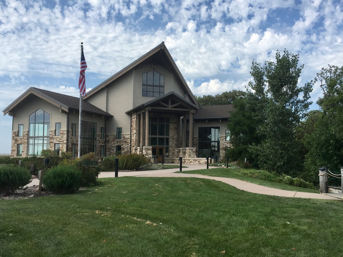
I stopped at the Missouri River Basin Lewis & Clark Center in Nebraska City. Here, I saw the first of many exhibits about the Lewis & Clark Corps of Discovery from 1804-1806. Much of my “Road Trip to Nowhere” would take place in the land of this historic expedition, and I would learn, and become fascinated, by all that I encountered. It is an amazing part of U.S. history.
In the early 19th-century, the United States was small and surrounded by foreign interests. For centuries, the entire continent had been home to hundreds of Indian tribes. President Thomas Jefferson was the young nation’s third president, and he signed the Louisiana Purchase Treaty on April 30, 1803, adding about 800,000 square miles to the U.S., doubling its size and greatly expanding its portion of North America.
Jefferson had a dream of finding a Northwest Passage – an all-water route across the continent. To lead the Corps of Discovery expedition, President Jefferson chose a man he knew well and admired, Meriwether Lewis. Lewis was a highly experienced army officer with strong leadership abilities. He became the expedition’s naturalist, putting his curiosity, keen observational skills and analytical mind to good use.
Lewis chose an old army comrade, William Clark, to share command. Besides helping lead the expedition, documenting plants and animals, and negotiating with Indians, Clark was the Corps’ principal cartographer. Clark’s maps resolved conclusively the issue of all all-water route to the Pacific.
Jefferson commanded the Corps of Discovery to draw maps, catalog plants and animals, and convince native peoples to accept him as their “Great Father.” He was a bookish visionary who insisted that Lewis and Clark keep detailed journals.
The Louisiana Purchase and the Lewis and Clark expedition that followed were considered to be the greatest accomplishments of Jefferson’s presidency.
Missouri River Basin Lewis & Clark Center in Nebraska City
The Corps of Discovery traveled on the water for 598 days of their 2 1/2 year journey. They used 25 different boats: one keelboat, two “pirogues,” sixteen dugout canoes, two Indian-made canoes, three bull boats, several temporary rafts, and one iron frame boat.
On the grounds of the center was a replica of the barge, or keelboat. It was 55 feet long and 8’4″ wide and carried an estimated 12-15 tons of supplies. It was used in the expedition until they reached the Mandan Villages in what is now North Dakota in November of 1804. After spending the winter of 1804-05 frozen in the ice of the Missouri River, it was loaded with scientific specimens and sent back down the river to St. Louis with a crew of twelve men. No one is sure what happened to the keelboat after its return to St. Louis.
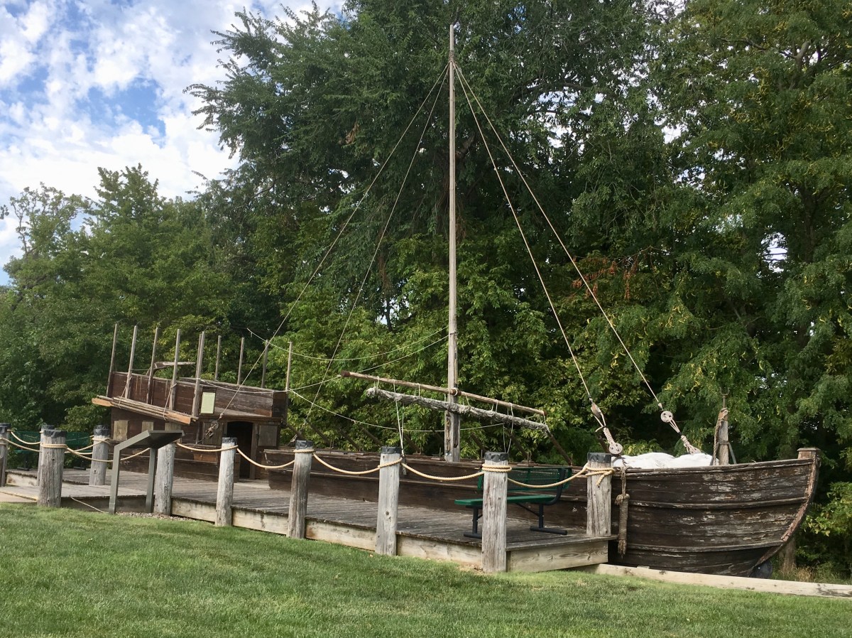
keelboat replica

keelboat replica
The task of mapping the expedition’s route across America fell to William Clark. He used his abilities as an experienced surveyor and skilled draftsman to create what has been called “one of the most influential [maps] ever drawn” of the United States. Clark’s final map, published in 1814, painted the first picture of a nation that could stretch all the way to the Pacific. This vision came to be known as Manifest Destiny.

The Lewis & Clark expedition from 1804-1806
The expedition set sail on May 14, 1804, in three boats: the keelboat and two pirogues. The smaller of these, the white pirogue, was slated to return the first summer with dispatches for President Jefferson. However, unfolding events changed the destiny of the white pirogue. It ended up traveling farther than the other boats, and returned as the command vessel.
A pirogue is a long, narrow riverboat. It often meant a dugout (a hollowed out log boat)), but also referred to boats of plank construction, like the pirogues of the Lewis and Clark expedition. This reproduction boat was built in 1999 for the IMAX movie “Lewis and Clark: Great Journey West.” It looks much like the original boat, which was built of poplar planks.
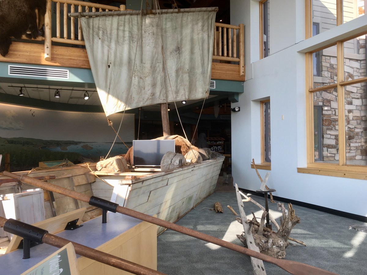
the white pirogue
Along the route, Lewis’s Newfoundland dog, Seaman, retrieved squirrels, geese, deer, antelope, and other animals brought down by the hunters. As a watchdog, he diverted a buffalo bull from camp and barked to warn grizzlies away. Seaman also suffered the difficulties of the trip along with his master – mosquitoes, prickly pear spines, heat, cold and hunger.

Seaman
In the Center, I met some of the animals and plants Lewis and Clark encountered in their westward explorations.
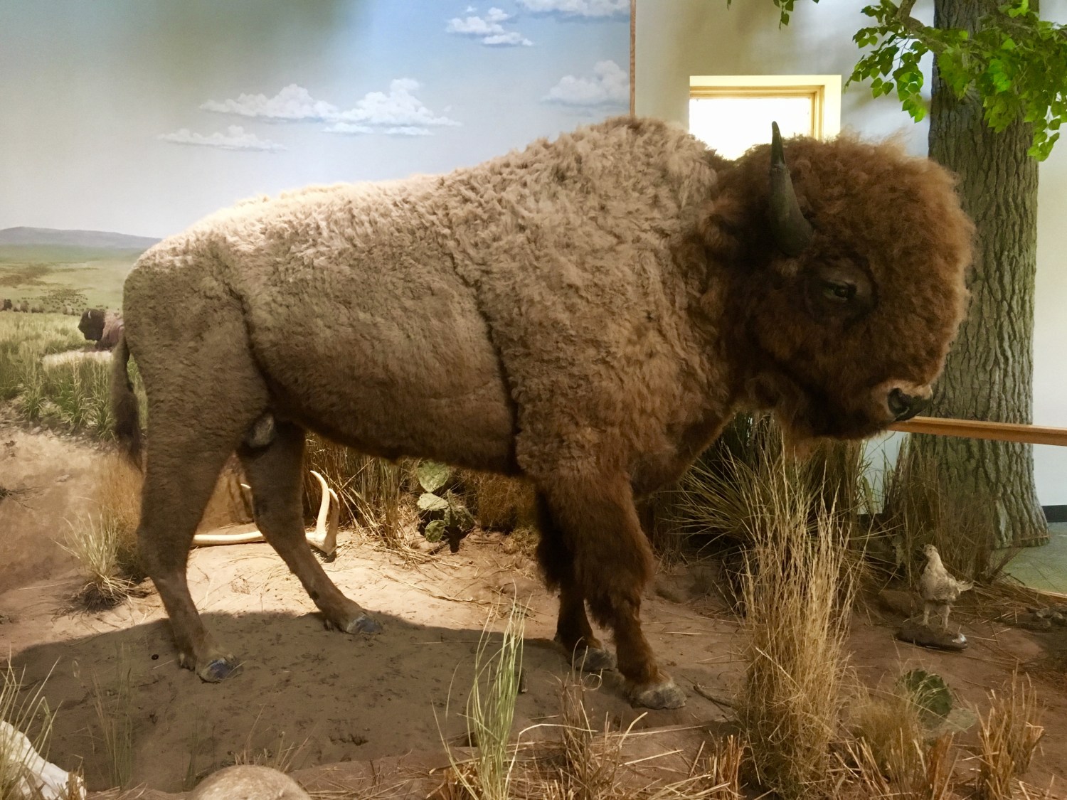
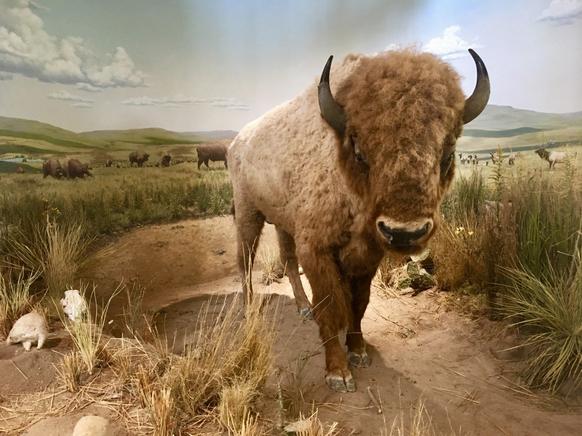
Plains Indians depended on the buffalo for food, clothing and shelter. They made tipis, robes, moccasins, saddle blankets, and many other things from buffalo hides. If they could not eat the buffalo meat immediately, they dried it for later use.

Missouri River Basin Lewis & Clark Center
Missouri River Basin Lewis & Clark Center
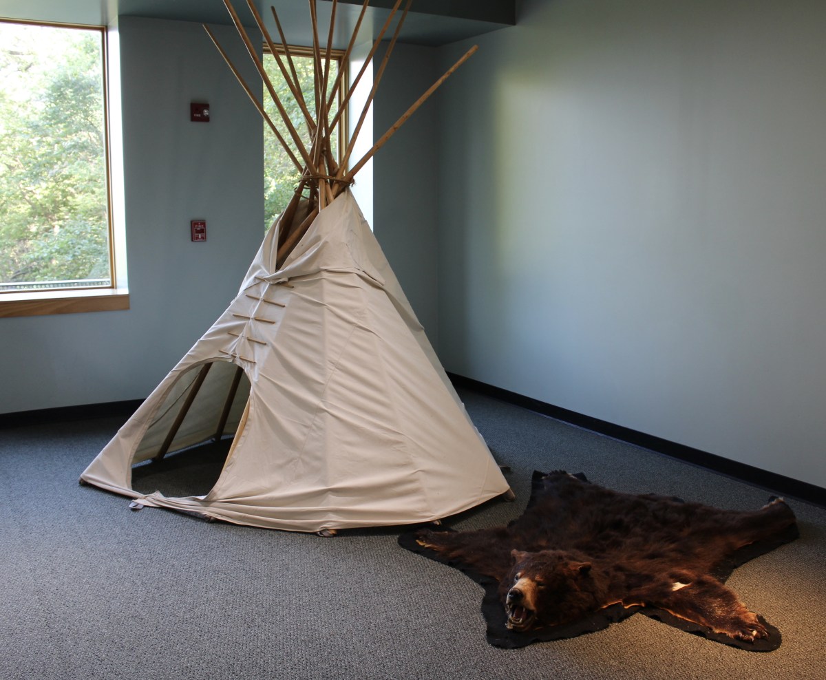
tipi and bear rug
Wolves followed the buffalo herds across the prairies, watching for old or weak animals. Sometimes they would attack a buffalo just to wound it, and then a few days later, attack again. In its weakened condition, the buffalo would be no match for the fangs of the wolves. However, healthy buffalo were dangerous. They could toss a wolf in the air with their sharp-pointed horns, and with a kick of the hind leg, they could kill or cripple.
The Grizzly Bear Claw Necklace shown below was believed to have been given to Lewis & Clark by an Indian chief. President Thomas Jefferson sent it to Philadelphia where it was displayed in America’s first museum until that museum closed in 1848.
Plains Indians believed that they received special powers from animals they dreamed about or saw in visions. The man whose “medicine,” or power, was derived from a grizzly could be fearless indeed. Those who killed grizzlies made the claws into a necklace to show their bravery.
The expedition relished bear meat because it was high in fat, and they needed lots of fat because they were expending so much energy. The cooks often “rendered” bear fat, or cooked it and stored it in kegs. From one bear, they made eight gallons of grease.


After making the rounds in the museum, I walked on a short grassland trail to see a reconstruction of Fort Mandan, which was the expedition’s winter quarters, from 1804-1805; it is located across from the Mandan Village in what is today North Dakota. I would visit the real site of Fort Mandan later in my trip. The fort was built in a triangular shape. This reconstruction, built by the Lewis and Clark Re-enactor Corps, is a reduced version of the original with only three rooms on each side.

lodge at the Missouri River Basin Lewis & Clark Center
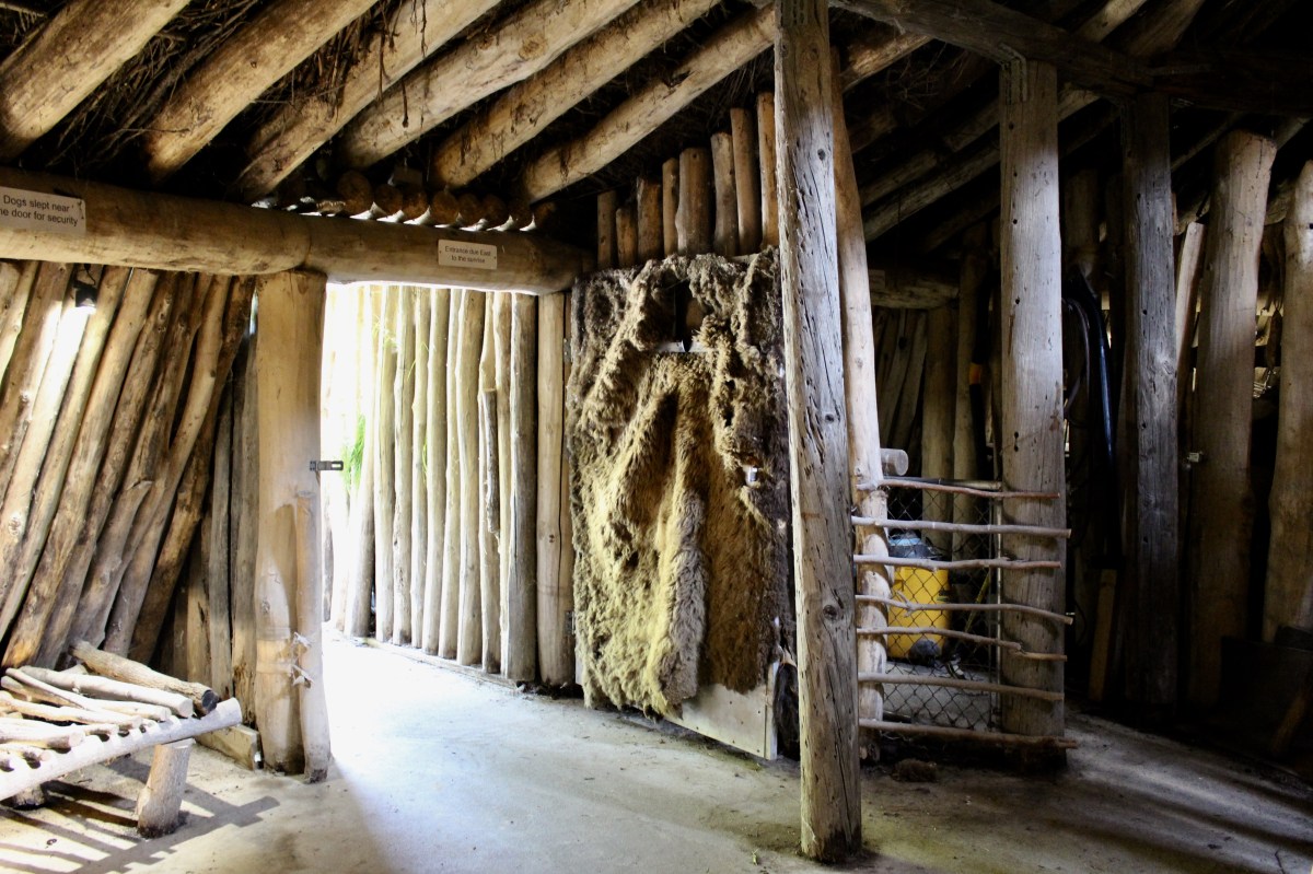
The grounds also had an earth lodge. The Otoe and Missouria people who lived in this area in the 1700s and 1800s built villages with small groupings of earth lodges. Like the Omahas, Poncas, and Pawnees who lived in Nebraska and Kansas, and Mandans, Arikawas and Hidashas in the Dakotas, their earth lodges were permanent structures.

earth lodge at the Missouri River Basin Lewis & Clark Center
A framework of heavy timber posts supported the circular, dome-shaped structure, with a covering of poles, prairie grass, and sod providing strength and insulation from heat and cold. In the summer, they built arbors to provide shade, and scaffolds to dry meat, vegetables and firewood.
Nearby were family garden plots, where women and children sowed and harvested corn, beans, watermelon, tobacco and pumpkins.
For brief trips in the spring and summer, and during buffalo hunts, they traveled with their “mobile homes” made of poles and animal skins, known as tipis.

earth lodge at the Missouri River Basin Lewis & Clark Center
earth lodge at the Missouri River Basin Lewis & Clark Center

earth lodge at the Missouri River Basin Lewis & Clark Center
I walked down to an overlook to catch a view of the Missouri River, which had recently flooded. Lewis and Clark were here in 1804 and 1806.
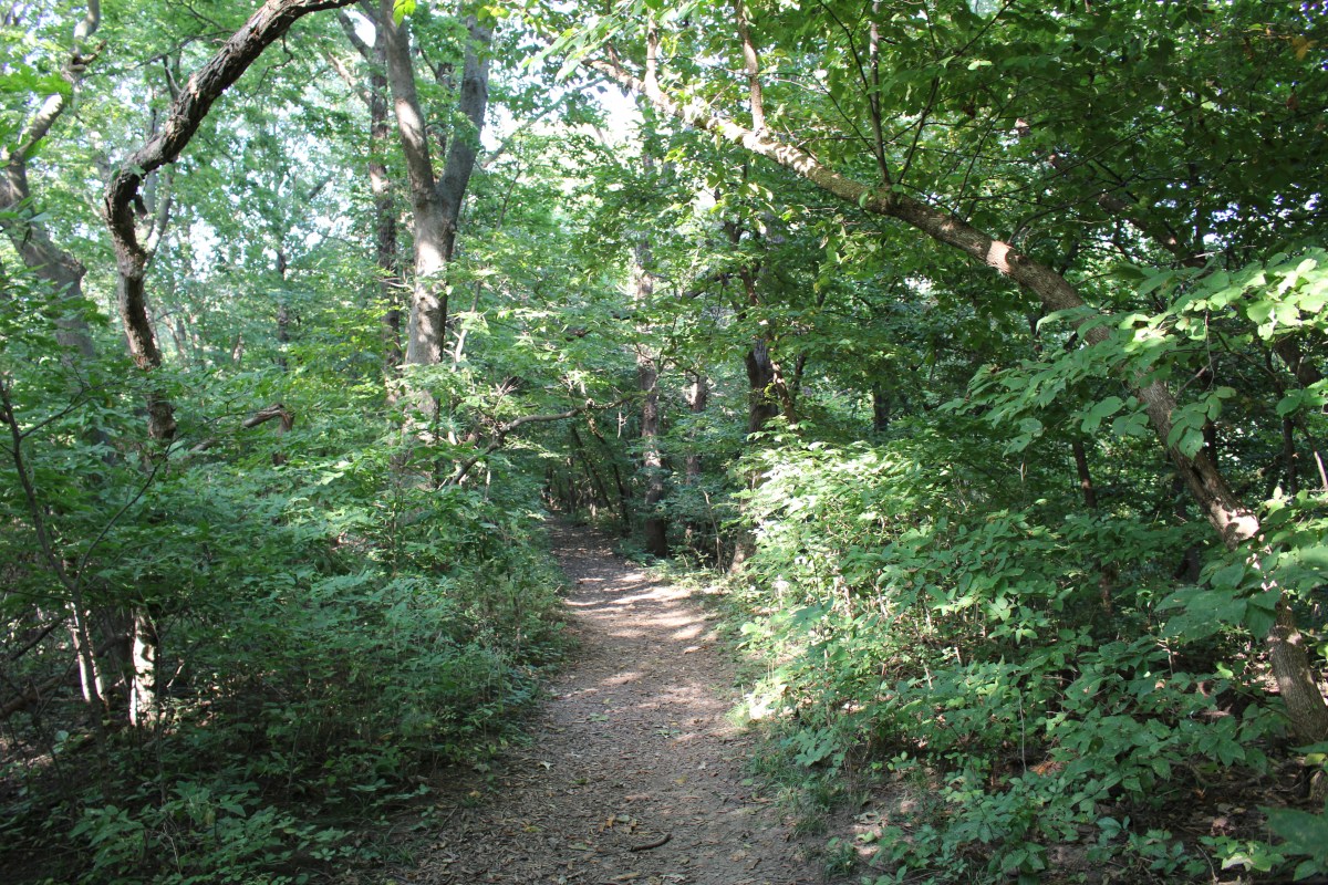
path to Missouri River overlook
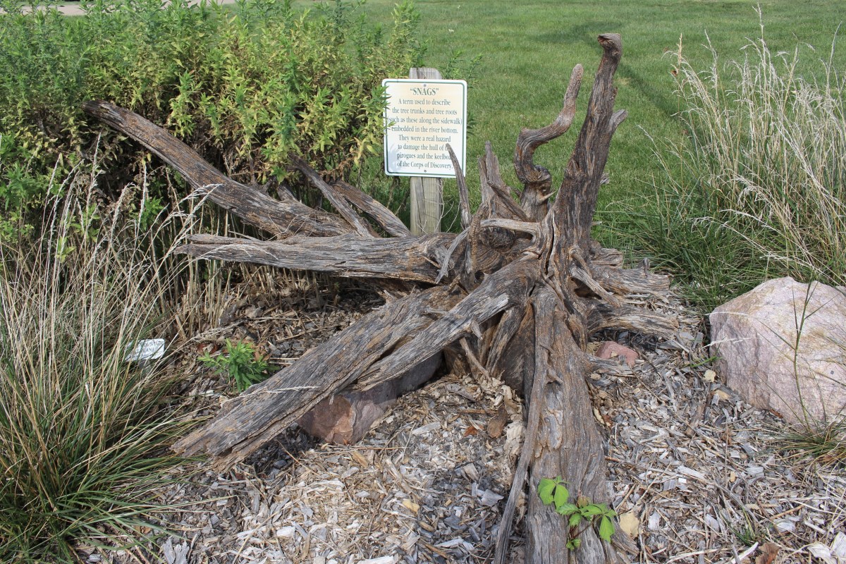
“Snags” is a term used to describe the tree trunks and tree roots embedded in the river bottom. They were a real hazard to the hulls of the pirogues and the keelboat of the Corps of Discovery.
snags
Today, the Missouri River is 2,315 miles long. At Nebraska City it is 1,755 miles from the headwaters in Montana, and 560 miles to its mouth near St. Louis, Missouri, where it empties into the Mississippi River. It is North America’s longest river but it no longer resembles the river Lewis and Clark explored in the early 1800s. In those days, floods were a regular occurrence in April and June of each year. The April floods were caused by ice and snow melt locally, while the June floods were a result of snow melt in the Rocky Mountains at the river’s source. These floods sent water into the low lying areas, cutting new channels and creating new islands and sandbars by depositing nutrient rich soil.
Beginning in 1927, the river was channeled by the U.S. Army Corps of Engineers from its confluence with the Mississippi to Sioux City, Iowa, to widen the channel for barge traffic. In 1944, the Pick-Sloan Plan called for a series of five dams on the Missouri. By the mid-1900s, major floods on the Missouri River were (mostly) a thing of the past. The communities along the lower Missouri River were grateful to be free of the annual floods. However, the controlled flow of the river reduced the amount of nutrient rich sediment that could be deposited on the low lying areas during traditional flood seasons.
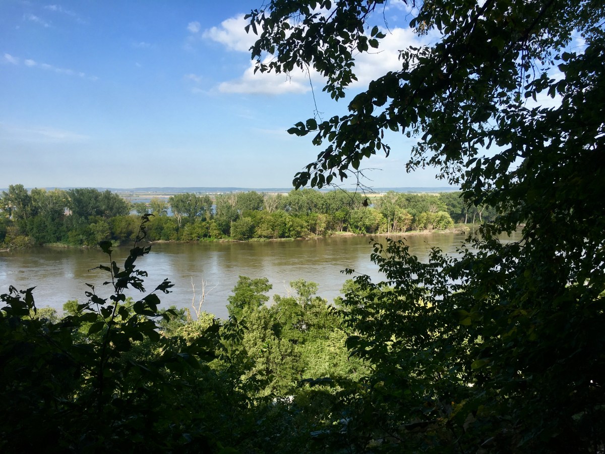
view of the Missouri River
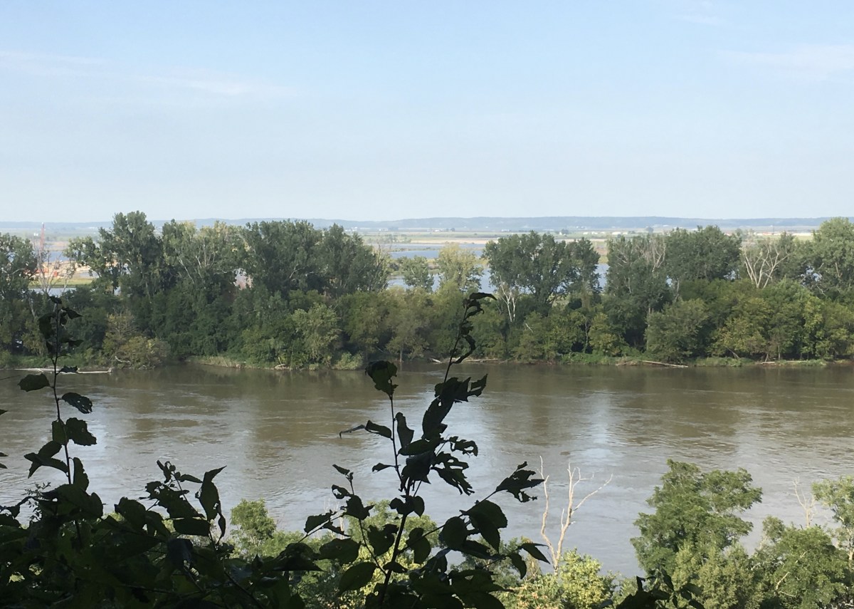
view of the Missouri River
A stamp collection in the Center showcased some of the firsts recorded by the Lewis & Clark expedition.


After leaving the center, I crossed back over the river to Iowa again. “America Needs Farmers,” said a big sign. By this time it was close to 6:00 and 86°F. Many fields had been flooded by the Missouri (so much for the idea that the floods were a thing of the past); one farm house was partially underwater. I would find out often on my “Road Trip to Nowhere” just how fickle and undependable the Missouri River can be. I passed Pony Creek and a sprawling smoke-belching industrial plant, bent on destroying the environment, and crossed the Missouri again, back into Omaha, Nebraska.
I checked into Sonesta E.S. Suites Omaha, and after settling briefly, I went out to Sakura Bana, where I enjoyed Godzilla Rolls (Shrimp tempura, eel, eel sauce, cucumber and avocado), Sapporo and warm sake, and spinach with sesame seeds.

Godzilla Roll, Sapporo and sake 🙂
The next day, I would explore Omaha, the largest city in the state of Nebraska.
Information about the Lewis and Clark Expedition came from plaques at the Missouri River Basin Lewis & Clark Center.


*Drove 438.7 miles, total “Road Trip to Nowhere: 1,314.50 miles*
*Steps: 4,985, or 2.11 miles*
*Tuesday, September 3, 2019*
**********************
“ON JOURNEY” INVITATION: I invite you to write a post on your own blog about the journey itself for a recently visited specific destination. You could write about the journey you hope to take in the year ahead. If you don’t have a blog, I invite you to write in the comments.
In this case, my intentions for my “Road Trip to Nowhere” was to pick a theme a day. My theme for today was Pioneering.
Include the link in the comments below by Tuesday, June 16 at 1:00 p.m. EST. When I write my post in response to this challenge on Wednesday, June 17, I’ll include your links in that post.
This will be an ongoing invitation, once on the third Wednesday of each month. Feel free to jump in at any time. 🙂
I hope you’ll join in our community. I look forward to reading your posts!


You must be logged in to post a comment.