Twenty twenty-five was: A year of venturing to Nicaragua in February to visit Adam and his family: María, Cristy, Andrea and Mía and finally meeting little Mikey (nearly 9 months old at that time). A year of exploring Mexico: Mexico City, Guanajuato, San Miguel de Allende and Querétaro. A year where the worst president on earth was sworn in and immediately began the destruction of our democracy and our standing in the world. A year in which Mike finally retired at the age of 71. A year of moving to Costa Rica for seven months, after doing numerous repairs on our Virginia home and doing a lot of decluttering, prompted by a desire to boycott the USA under Trump and a desire to visit the Nicaragua family more often. A year of visiting Adam and family in Nicaragua (again), this time from Costa Rica in July. A year of traveling to Panama, visiting Panama City and Bocas del Toro, as well as exploring places in Costa Rica such as Playa Hermosa, Tamarindo, the Nicoya Peninsula, La Fortuna, Parque Nacional Volcán Tenorio and the Central Highlands (including Zarcero, Sarchí, Grecia, Parque Nacional Volcán Poás, La Paz Waterfall Gardens, and the waterfalls around Bajos del Toro). A year during which Mike sliced his leg open while getting out of the pool and had carpal tunnel surgery on his right hand. A year of the continuing raging of war in Ukraine with our current president siding with Putin, the invader; a year where mass shootings (defined as shootings in which 4 or more people were killed) in the U.S. (485) outnumbered days in the year. A year in which the Merriam-Webster word of the year was “slop”: “digital content of low quality that is produced usually in quantity by means of artificial intelligence.” A year in which the Oxford word of the year was “rage bait”: “online content deliberately designed to elicit anger or outrage by being frustrating, provocative or offensive;” rage bait is “typically posted in order to increase traffic or engagement with a particular web page or social media account.” A year when the TIME Person of the Year was “the architects of AI:” “the most consequential tool in great-power competition since the advent of nuclear weapons. For delivering the age of thinking machines, for wowing and worrying humanity, for transforming the present and transcending the possible.” A year of favorite movies: A Complete Unknown, Emilia Pérez, Conclave, and The Wrong Track (På villspor). A year of reading 48/48 books for the year (My Year in Books 2025); these were my top ten books of 2025.
January was: A month where snow fell on the 5th and 6th of the month and didn’t melt until the last day because of constant sub-freezing temperatures. A month of wildfires in L.A. which began on January 7 and which destroyed communities and homes, forced the evacuation of over 200,000 people, and have killed 29 so far. A month of walks in the neighborhood, Pilates, gym workouts and my last rowing sessions. A month of the inauguration of our fascist president {along with his UNELECTED Nazi sidekick, Elonia Musk), and the prompt and methodical dismantling of our government and all progressive initiatives, setting us back decades and making us a laughingstock on the world stage (basically turning us into a hellhole). A month of hell freezing over. A month of steaming bowls of ramen with our friends Karen and Michael, Ethiopian food to celebrate Martin Luther King Day (FUCK YOU, Inauguration Day!), vegetarian Indian food at Woodlands and Lebanese food at SERAY, a new restaurant for us. A month of a haircut and hair straightening. A month of movies: A Complete Unknown, A Real Pain, Emilia Pérez and The Room Next Door. A month of the Wolf Moon, snowstorms and gloomy skies. A month of hiking boots, puffy jackets, warm woolly sweaters, and walks in the snowy woods. A month celebrating a belated Christmas with Mike’s sister Barbara over chicken tortilla soup & a game of Ticket to Ride. A month dreaming about meeting our grandson in Nicaragua & hanging out with the family, as well as exploring Mexico City and the Mexican Highlands. A month beginning to declutter our house as we seriously consider moving to Costa Rica for a year beginning in June. A month of reading 5 books toward my goal of 48 for the year, my favorites being American Dirt by Jeanine Cummins and Enter Ghost by Isabella Hammad. A month of finishing up various TV series: Better Things and La Palma, and continuing to watch Pachinko, Lincoln Lawyer, Maestro in Blue, Nobody Wants This, Unforgotten, Virgin River, The Diplomat, Bad Sisters, Shrinking, Another Self, Grantchester and Modern Family; a month of beginning Paradise. A month ending with a U.S. Army Black Hawk helicopter colliding in mid-air with an American Airlines flight from Wichita, Kansas as it approached the runway at Ronald Reagan Washington International Airport; both plunged into the frozen Potomac River near and killed all 67 people onboard both flights. A month where our new scumbag president tried to blame DEI for the crash with NO EVIDENCE. A month of lies upon lies upon lies. A month that ended with a long 1451 days left in the new administration. 😦


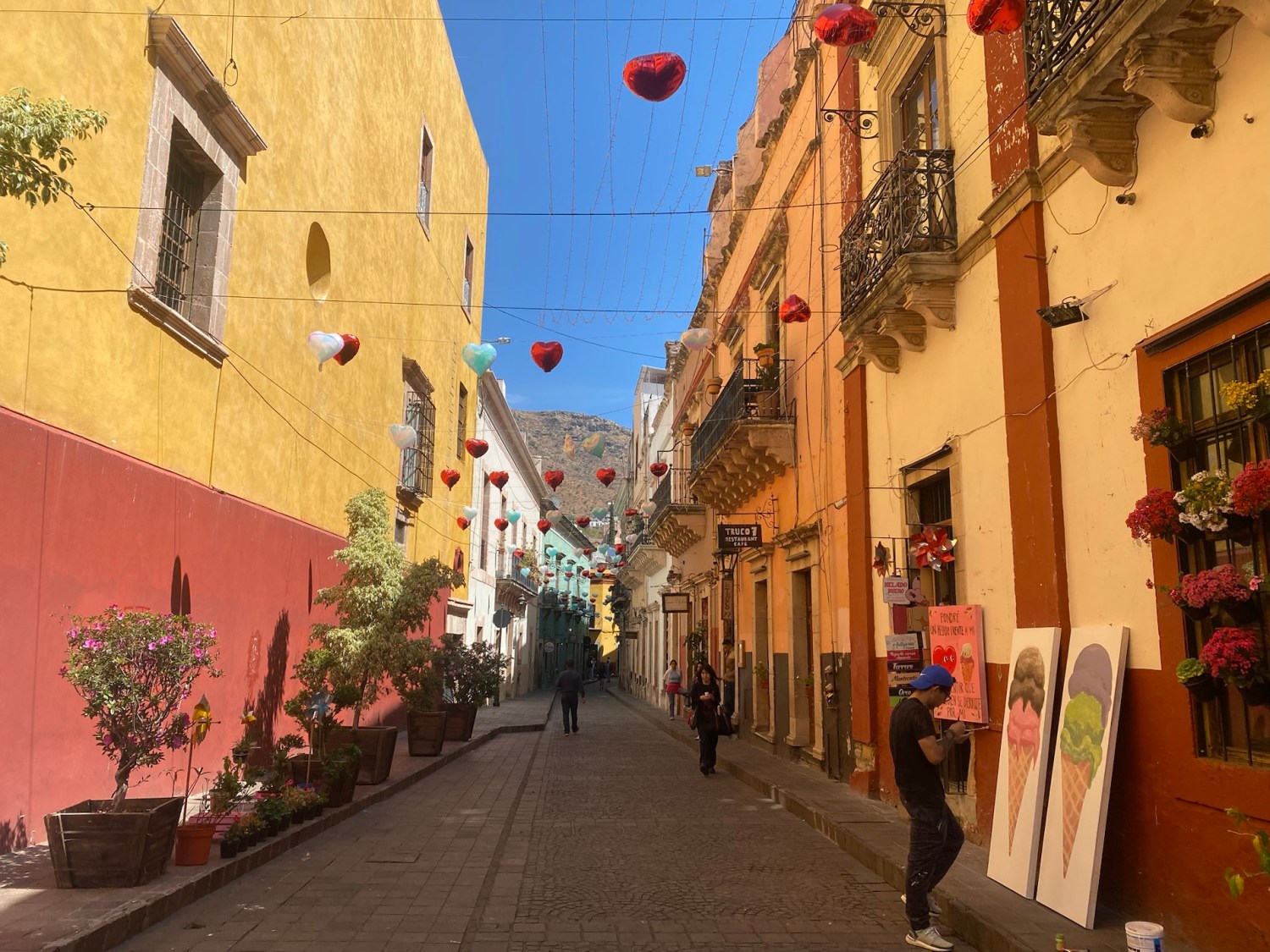
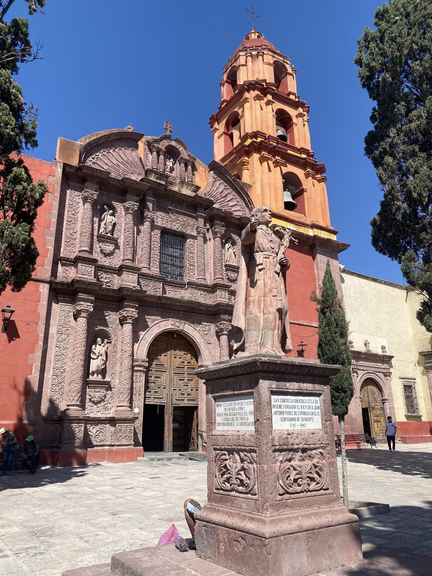
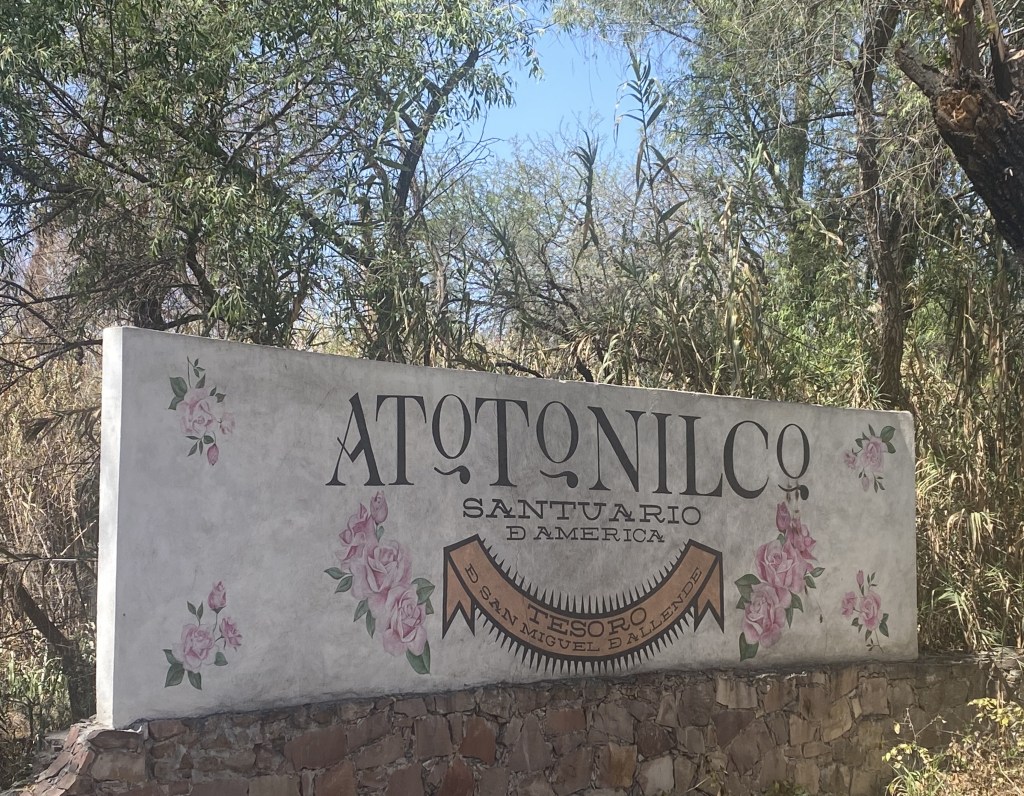
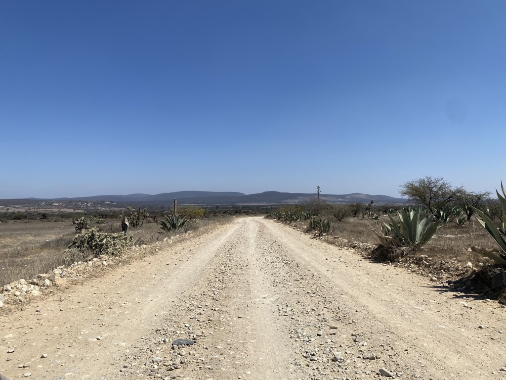
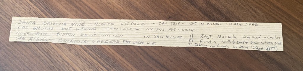
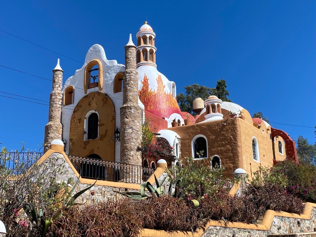
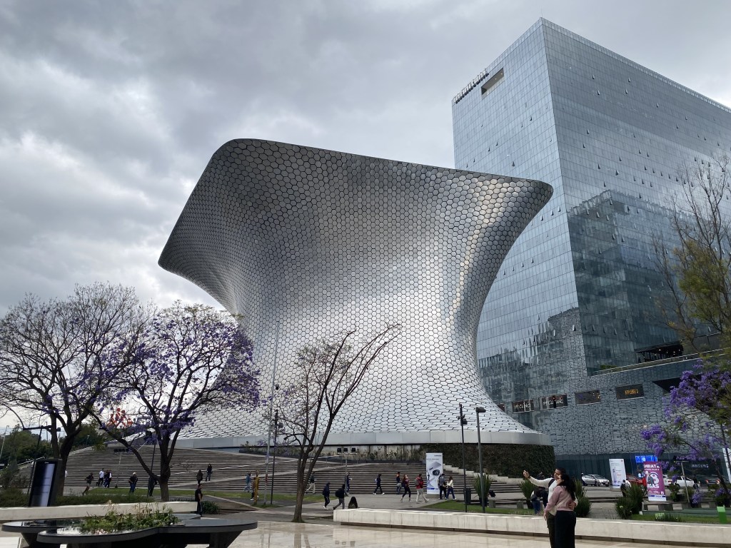
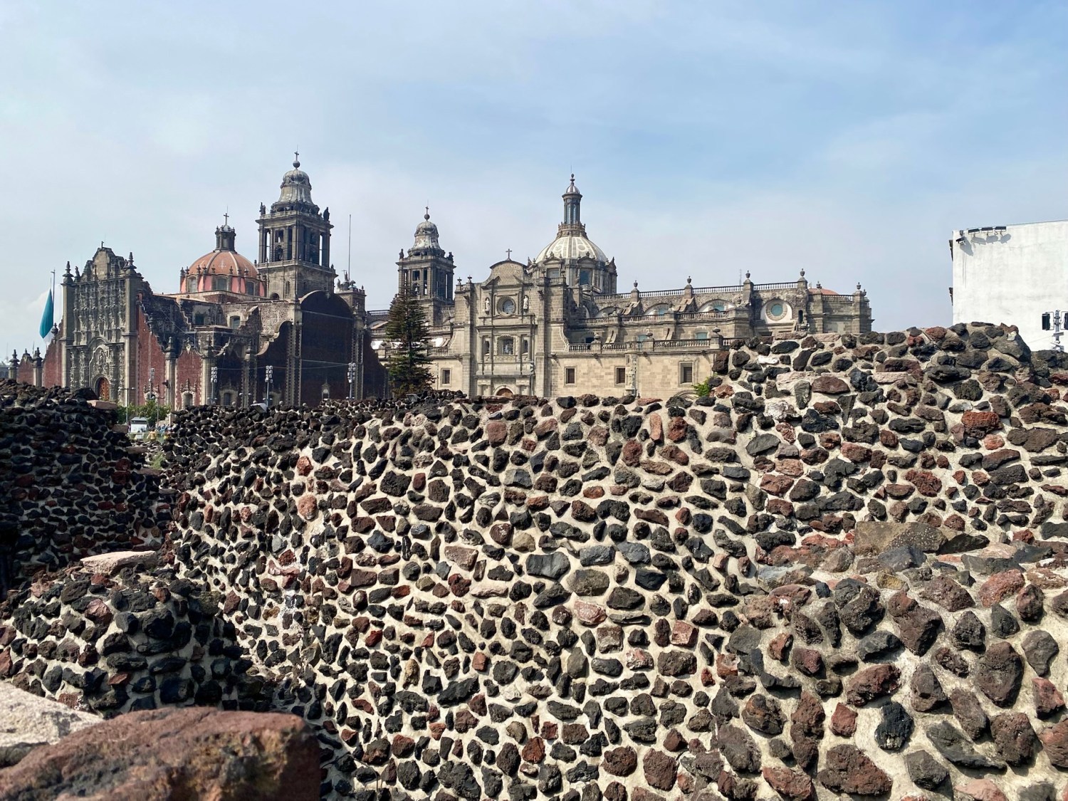
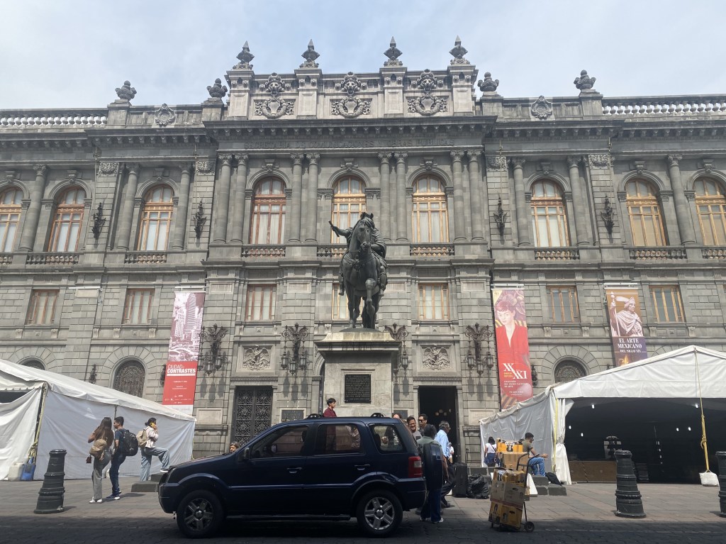
February was: A month of preparing to and going to Ometepe, Nicaragua to visit the family and to Mexico to explore possible places to move to put in motion our 75% boycott of the USA for the next four years. A month of Japanese sushi & ramen at Ariake, thanks to a Christmas gift certificate from our daughter Sarah, before taking off for Ometepe & Mexico. A month of meeting our new grandson, Michael Christopher Dutchak Hernandez, in Ometepe, Nicaragua, and swimming at Totoco’s pool & Ojo de Agua. A month of playing Kings-around-the-corner, having a sleepover and going to the Saturday market with our granddaughters. A month of Texas Hold’em with expats at Café Campestre, meeting Adam’s cows, assembling a playpen for Mikey, and doing yoga and healing with biofield tuning forks in Totoco’s new yoga pavilion. A month of a shopping trip to Moyogalpa, and eating out at Totoco, Pizzeria Mediterranea, Café Campestre, and Bustavo. A month flying to Mexico City and spending a day on a self-guided walking tour of our charming Roma Norte neighborhood. A month of exploring archeological ruins at Teotihuacán, capital of a pre-Hispanic empire, and Templo Mayor, the Aztec “center of the universe.” A month in Mexico City’s Centro Histórico visiting Catedral Metropolitana, Palacio de Correos de México, and the Museo Nacional de Arte. A month in Polanco and Condessa, perusing Museo Jumex and the Museo Nacional de Antropologia, and having beers along Avenida Amsterdam that encircles Parque México. A month of diving into Diego Rivera, Frida Kahlo and Leon Trotsky in San Ángel and Coyoacán. A month driving to Guanajuato and staying for 4 nights in a lovely Terra Vista apartment on a ridge above the colorful and charming town. A month of dropping into churches, the Museo Casa Diego Rivera, the Alhóndiga de Granaditas, & the Mercado Hidalgo. A month of driving to San Miguel de Allende, stopping into Santa Rosa de Lima where we picked up majolica plates at Mayólica Santa Rosa and mango jam at Conservas Santa Rosa, and then stopping in Dolores Hidalgo, where Mexican history was made. A month in which we celebrated Mike’s 71st birthday around San Miguel de Allende by spending a day soaking and drinking Micheladas in La Gruta hot springs, having lunch at Nirvana, visiting Santuario de Jesús Nazareno de Atotonilco to see its fantastic murals, and then tasting wine at Tres Raíces Winery. A month of exploring the many churches in San Miguel and doing some real shopping for the first time in our trip. 🙂 A month of walking through desert landscapes in San Miguel’s botanical garden, El Charco del Ingenio, and visiting the mining town of Mineral de Pozos and the ruins of Mine of Santa Brigida. A disastrous month of the FOTUS/Elon administration in the U.S.: dismantling government agencies, including USAID; threatening our allies with high tariffs or annexation (or war??); treating Ukraine’s President and war hero Zelensky with utter disdain and rudeness; handing the U.S. and its long-term interests over to Putin; and threatening all the alliances we have built up over decades. A month of feeling disgust over our country and its current direction. A month of reading 2 books toward my goal of 48 for the year, bringing my total to 7/48, my favorite being Berlin Poplars by Anne B. Ragde. A month of starting several TV series including The Åre Murders, Apple Cider Vinegar, and Thank You, Next. A month of finishing Maestro in Blue and sadly leaving the Greek characters behind on Paxos; a month of continuing Pachinko, Lincoln Lawyer, Nobody Wants This, Unforgotten, Virgin River, Paradise and Modern Family. A month that ended with a long 1,423 days left in our right-wing oligarchy. 


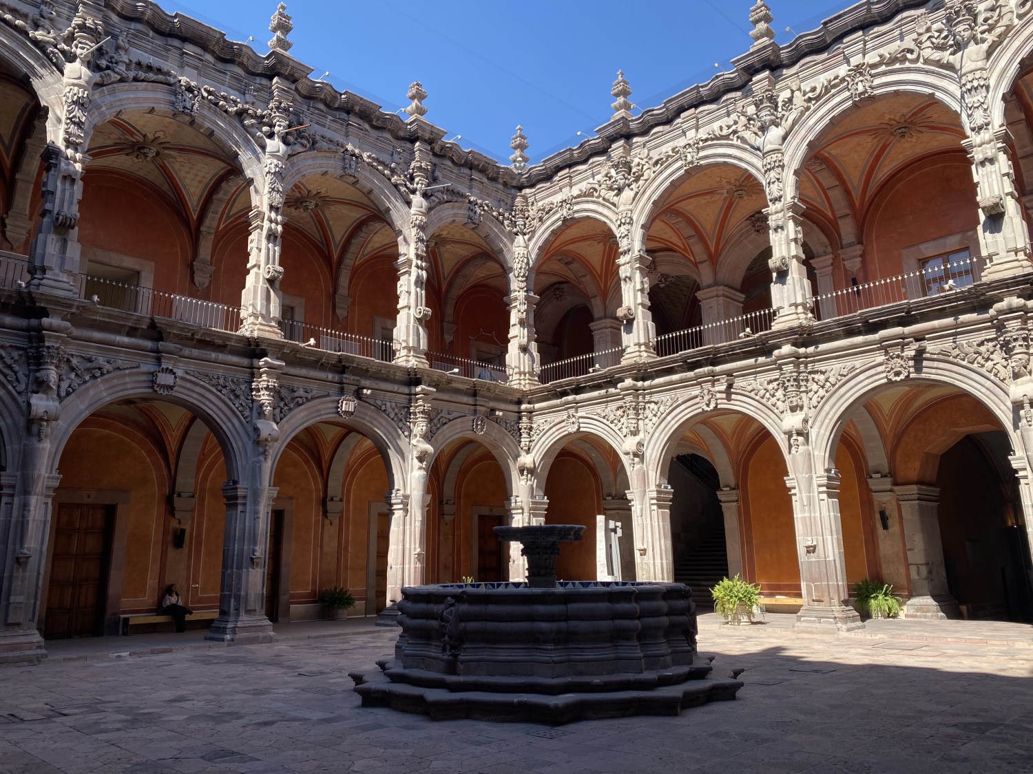
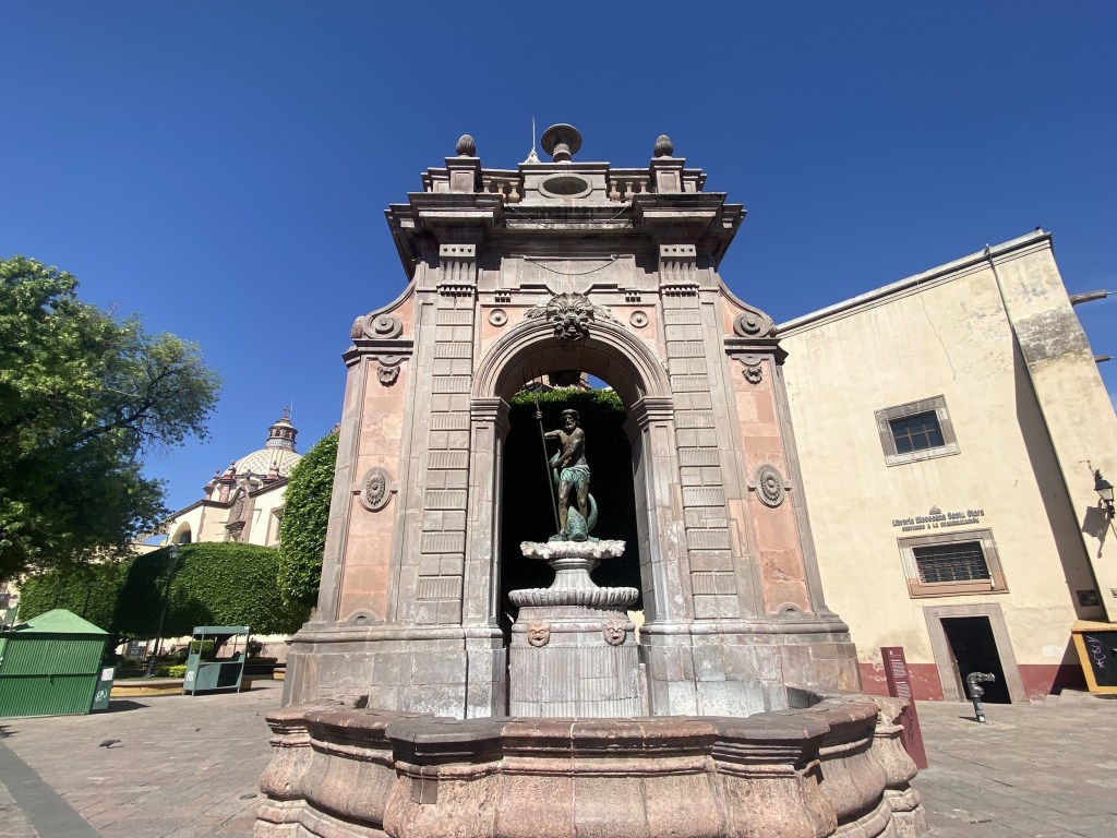
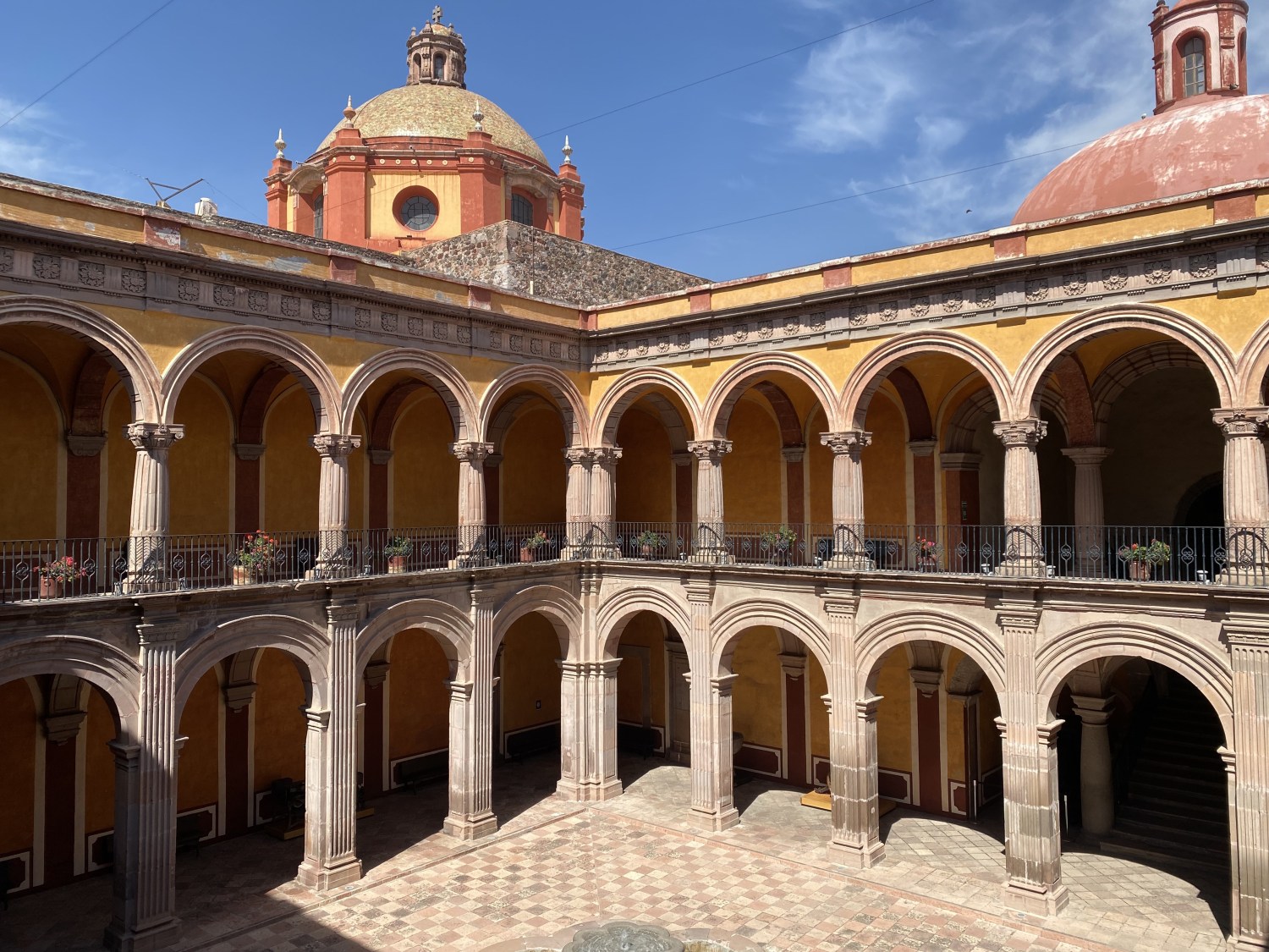
March was: A month of meeting fellow Instagrammers and bloggers, Ben and Peta of Empty Nesters on a Green Global Trek at the lively Mercado SANO, an organic market in San Miguel de Allende with great produce, excellent food, crafts and live music; we took a taxi together to the San Antonio neighborhood and saw the beautiful home that they recently renovated. A month of exploring Fábrica la Aurora, a large art gallery in barrio Aurora, then visiting the cute little Museo la Esquina del Juguete (Toy Corner Museum) not far from our apartment. A month of driving about 1 1/2 hours to Querétaro, checking into our hotel, and visiting the Templo y antiguo convento de San Antonio and walking through Plaza de la Corregidora and a street of shops selling Quinceañera and first communion dresses. A month of visiting the Museo de Arte de Querétaro, located in a beautiful baroque former convent. A month savoring a fondue dinner at Bistrot Chez Julien. A month of driving about an hour northeast of Querétaro to visit San Sebastián Bernal & its famous Peña de Bernal, a monolith which Mike partly climbed while I wandered around the charming town. A month of vegetarian pizza & 75-minute Swedish massages in our hotel, the first we had on this trip. A month of strolling around through the Centro Histórico de Querétaro, one highlight of which was MUCAL, the Museo del Calendario, housed in a gorgeous building with numerous flowering courtyards. A month in which we visited the Museo Regional de Querétaro, housed in another beautiful monastery. A month topped off by a visit to the Mercado de la Cruz, the city’s large covered market, and a lovely dinner and sunset on the terrace of our hotel, Casa Aspeytia. A month driving 3 1/2 hours back to Mexico City on Wednesday, the 5th, where we turned in the rental car and checked in at the airport for our 4:50 p.m. flight to San Salvador, which was delayed, and then on to Dulles, arriving home at 4 a.m. Thursday. A month of returning on March 6 to the U.S. hellscape we have to call home after we wrapped up our trip in Mexico. A month of being immediately barraged with continual Trump/Musk nonsense, cruelty and chaos, which will continue to wreak havoc on the next four years of our lives. A month in which our current regime: ruined what was a good economy under Biden; tanked the stock market; methodically dismantled the entire U.S. government, including the “soft power” agency of USAID that helped people all over the world; imposed outrageous tariffs on our allies; and belittled and threatened Canada, Greenland and Ukraine’s war hero and president Zelenskyy. A month of feeling vile hatred for these incompetent and destructive people with every ounce of my being; I will never forgive the people that chose this Nazi-loving administration over Kamala Harris and Tim Walz. A month of visiting the eye doctor and getting a new pair of glasses. A month of watching the Brazilian movie, I’m Still Here, at Angelika Theatre, which was incredibly disturbing; it showed what can happen in dictatorships when governments decide to make people “disappear.” A month of feeling powerless as our country descends into full-blown fascism. A month of watching the newest (3rd) season of White Lotus, in which obnoxious rich people treat other people like crap, apropos for Amerikkka. A month of crab cakes at Arties and Larb Gai at Vienna Thai and Bar. A month celebrating Alex’s 34th birthday on the 10th in Atlanta via WhatsApp; Jandira treated them both to couples massages and then a nice dinner out. A month in which we booked a house near Tilaran, on Lake Arenal, in Costa Rica beginning on June 1; we hope to frequently travel across the border into Nicaragua and visit the family in Ometepe. A month in which Alex and Jandira agreed to live in our house while we’re gone which helps them and us at the same time; other than a short visit in early October for Allie’s 2nd birthday, we hope not to return home until May 31, 2026, and then only briefly. A month of decluttering, designing a new closet, and buying a new laptop; our goal is to boycott as much as possible in the U.S. for at least 75% of the next four years. A month in which our daughter Sarah secured a new job as a paralegal in Richmond, VA, enabling her to move back to her favorite city from Virginia Beach. A month of going downtown to Politics & Prose in D.C. to listen to a book talk given by my ex-husband (& my daughter Sarah’s father), William Geroux, on his newest book: The Fifteen: Murder, Retribution & the Forgotten Story of Nazi POWS in America, followed by dinner at Comet Ping Pong; the place is an old D.C. standby but infuriatingly, since the rise of conspiracy theories and outright lies beginning with the FELON’s rise in 2016, the restaurant was the focus of the Pizzagate conspiracy theory, which has been discredited by a wide variety of organizations, including the Metropolitan Police Department of the District of Columbia. A month of finishing 4 books, bringing my total to 11/48 for the year, with my favorites being North of Dawn by Nuruddin Farah and A Harvest of Secrets by Roland Merullo. A month of watching several movies once we returned home, including I’m Still Here, which I mentioned above, but also the Academy Award-winning Anora and Il treno dei bambini (The Children’s Train). A month of starting several series including The Split and White Lotus; we finished watching Apple Cider Vinegar and we continued watching Younger, The Äre Murders, Pachinko, Virgin River, Paradise, Valeria, Black Doves, The Upshaws, and Modern Family. A month that ended with a long 1,392 days left in our right-wing oligarchy.


April was: A month of preparing our house for our son and his family to move in & house-sit when we move to Costa Rica for a year. A month of sorting through and tossing clothes, and then organizing the remainder in an Elfa closet we had installed in our smallest bedroom. A month of walking amongst springtime tulips and cherry blossoms and attending a couple of yoga sessions. A month of having my hearing tested; it’s getting worse but not to the point of needing hearing aids – yet. A month of sushi, pastichio, Indian food at Woodlands, and a Good Friday Italian lunch at Filomena Restaurante in Georgetown, surrounded by an extravaganza of Easter bunnies, cherry blossoms, and painted eggs. A month of walking by the Ukrainian Embassy in a show of solidarity for their endless fight against Russia, and feeling disgusted by our current administration and their gaslighting nonsense and outright lies about the war. A month when the world lost Pope Francis, a progressive pope who cared about the poor and the suffering, unlike the MAGA and so-called “Christian” Nationalists of the U.S. A month of thumbing our nose at fascists by drinking “Gulf of Mexico” and “Lady Justice” beers from the progressive Wisconsin brewery, Minocqua Brewing Company. A month of eating delectable meat mantu and lamb shanks at Mazadar. A month of upgrading my iPhone to an iPhone 16 Pro and all the hassle that the process entailed. A month of power washing and sealing our screened-in porch and replacing our roof. A month helping Sarah settle into her new apartment in Richmond and celebrating her 41st birthday with wine and dinner at Alewife. A month in which I was able to see a Frida Kahlo exhibit at the Virginia Museum of Fine Arts, since I missed seeing anything “Frida” in Mexico. A month of finishing 4 books, bringing my total to 15/48 for the year, with my favorites being Disappearing Earth by Julia Phillips and What You Are Looking For Is in the Library by Michiko Aoyama. A month of watching several movies: La Dulce Villa and Sult (A Copenhagen Love Story) on Netflix and The Ballad of Wallis Island at Cinema Arts Theatre. A month in which we finished the 3rd season of White Lotus, the 4th of The Upshaws, and the 6th of Virgin River, the 1st of The Äre Murders and Paradise, and the final seasons of Modern Family, Valeria, and the Turkish show Kimler Geldi Kimler Geçti (Thank You, Next). A month of starting several series: Dying for Sex, The West Wing, Long Bright River, Your Friends & Neighbors, & Severance, as well as continuing to watch The Split, Younger, & Unforgotten. A month that ended with a long 1,362 days left in our right-wing oligarchy.


May was: A month of continuing to declutter and prepare our house for our son and his family to move in & house-sit when we move to Costa Rica for a year. A month of Mike cutting back to an hourly schedule and switching our medical insurance to Medicare. A month of various medical appointments for Mike and me. A month of arranging to buy a used car in Costa Rica and putting down a deposit. A month of dirty martinis and lots of laughs at Se7en with our friends Karen & Michael. A month of Mike zipping his leg open on a lane hook at the pool, requiring 6 stitches inside and 26 stitches outside his right calf. A month getting recessed lights put in throughout our house and getting repairs done to our garage door. A month of getting our Real IDs. A month of eating delectable mezze at Lebanese Taverna with Mike’s sister Barbara to celebrate Mother’s Day. A month when Mike’s friend Mike from Ohio came for an overnight visit. A month of eating Chili Softshell Crab and braised beef Massaman at Tiki Thai. A month when Alex, Jandira and Allie came to visit to attend Louisa & Edwin’s wedding; we went to the rehearsal BBQ dinner but didn’t go to the wedding, opting instead to babysit Allie. A month in which we took off for Costa Rica on the 31st, spending the night in Cañas before checking into our Airbnb on Lake Arenal on June 1. A month of finishing 8 books, bringing my total to 23/48 for the year, with my favorites being Oh William! by Elizabeth Strout, Revolutionary Road by Richard Yates, The Summer House by Philip Teir, and Behold the Dreamers by Imbolo Mbue; I also read On Tyranny by Timothy Snyder, which basically outlines twenty lessons learned from 1930s Germany and Stalin’s Russia, and draws parallels with what is happening in the U.S. now. A month in which we eeked out time to watch two movies, Conclave, which was appropriate since Pope Francis died and the conclave picked a new pope during May, and Revolutionary Road, based on the book I read this month. A month of starting several series: The Four Seasons, Istanbul Encyclopedia, & W1A and continuing to watch The Split, Younger, Dying for Sex, The West Wing, Long Bright River, Your Friends & Neighbors, Severance & Unforgotten. A month that ended with a long 1,331 days left in our right-wing oligarchy.


June was: Our first month of moving to and living in Guanacaste, Costa Rica, near Tilaran on the shores of Lake Arenal. A month of stocking up on household items to make our home-away-from-home feel more like a real home. A month of Mike continuing to do some consulting for his company and me beginning a new blog: a pura vida year in costa rica. A month of buying a used 2014 Mistubishi ASX and relearning a stick shift. A month of taking hilly walks through stunning countryside, joining the Monster Gym in Tilaran, and taking up yoga at Living Forest Lodge & Retreat Center. A month of exploring the tidy town of Tronadora, including the beautiful Peninsula 1, until the road there nearly washed away and was in the midst of being repaired under threat of immenent collapse. A month of exploring local cuisine at Brisas del Lago, Mary’s Restaurante with our friend Bruce, Café & Macadamia, Beer Garden Tinajas, Chicharronera on Peninsula 1 in Tronadora, and Cevichera La Pasadita. A month of celebrating Father’s Day at Gingerbread in Nuevo Arenal, owned by an Israeli man who has lived in Costa Rica for 23 years. A month of making many soups using chorizo, ground beef & chicken; our favorite creation so far has been the chorizo, potato and green bean soup we made with the chorizo we got from Rigoberto in Tronadora. A month of driving the mountains around Lake Arenal, often on gravel or potholed roads, gasping at the gorgeous greenery and scenery, and trying to breathe when we got stuck behind trucks or buses belching black smoke. A month of a two-night escape from the rain to visit Playa Hermosa, where we enjoyed great food at Ginger, Café Corazon, and Hacienda Blu Beach Lounge & Grill; lounged on the beach; swam in the gentle Pacific; met interesting & lively fellow travelers, and read books: for me, Paul Theroux’s The Old Patagonian Express. A month in which we got the Permiso de Salida from the Registro de la Propiedad in order to take our car out of the country and into Nicaragua. A month in which Trump bombed nuclear sites in Iran after he had sparse attendance at his 79th birthday military parade while millions marched peacefully across the country on “No Kings Day” to protest his cruel White Supremacist fascist administration. A month in which I beat Mike at several games of online Scrabble. A month in which we deepened our connections to the community, took our first cash out of an ATM, found a barber for Mike, discovered La Casa del Plastica (a store that sells plastic goods), ate tacos and listened to Olsen del Torro sing at Lake Arenal Brewery’s Taco Tuesday, found a farm where yogurt is sold, enjoyed the pool, and went to Nuevo Arenal where we ate at the German Bakery and checked out a Farmacia Organica. A month in which I finished 2 books, bringing my total to 25/48; I enjoyed both: The Old Patagonian Express by Paul Theroux and The Confessions of Frances Godwin by Robert Hellenga. A month during which we watched two good movies: The Wrong Track (På Villspor) and the 2022 movie, What’s Love got to do with it? A month of beginning several series: Togetherness, Pernille (Pørni), The Secrets We Keep, and Sara: Woman in the Shadows, and finishing Four Seasons, Bad Sisters, and Your Friends & Neighbors. A month in which we continued watching Istanbul Encyclopedia, Younger, North of North, The Manny, and Severance. A month that ended with a long 1,301 days left in our right-wing fascist oligarchy.


July was: Our second month living in San Luis, Costa Rica, on the shore of Lake Arenal. A month of two pedicures, one called a “Ukrainian pedi.” A month of online Scrabble games where I was on a winning streak until Mike finally achieved his own victories. A month of birds serenading us around our house – Red-lored Amazon parrots, Crimson-fronted parakeets, and Tropical Kingbirds – as well as a hummingbird building a nest and laying eggs outside our kitchen window (sadly the hummingbird met an untimely end while we traveled). A month of a blessing of the boats on Lake Arenal and an open-water swim competition. A month of visiting Adam & family in Ometepe, Nicaragua for 6 nights, during which we watched Cristy march in a parade in Altagracia as Queen of her school and watched Andrea and Mia practice gymnastics in preparation for a competition in Managua (Andrea won gold in the floor exercises at the competition after we left). A month of beach days at Xalli, a day a Ojo de Agua, and dining out at Libélula Café, Xalli and take-out pizza from Pizzeria Mediterranea with the family. A month of bracelets and ice cream at the Saturday market with the girls. A month in which Mike and I went on a chocolate tour at El Pital Chocolate Paradise and drank ceremonial doses of cacao. A month of beach walks at Lake Nicaragua and at Tamarindo in Costa Rica, where we went for 2 nights. A month in which I got a shopping fix in the westernized beach town of Tamarindo and we ate Italian at Fish & Cheeses, a hamburger wrap at Cha Café, sushi at Kabuto Sushi, and tacos at Little Lucha. A month of taking an Estuary Boat Tour in Tamarindo where we saw mangroves, vultures, termite nests, green herons, black-bellied whistling ducks, a yellow-headed caracara, howler monkeys and scuttling red crabs, but no crocodiles or leatherback turtles. A month of dancing to Jimmy Loop at Lake Arenal Brewery and listening to “Smooth Jazz on the Lake” at La Tortuga. A month of dining out at Soda La Macha, Guadalupe, La Pradera, Paseo del Viento, Moya’s Place, Playa Tila, and La Pasadita. A month in which I finished 3 books, bringing my total to 28/48: I learned a lot about the Panama Canal in Cristina Henríquez’s The Great Divide and I truly enjoyed Speak, Silence by Kim Echlin. A month during which we watched one mediocre movie, Nonnas, and one enjoyable movie: The Life List. A month of beginning several series: Maid, The Survivors, and Letters from the Past; and finishing The Secrets We Keep, The Manny, Istanbul Encyclopedia, Thank You, Next, and Sara: Woman in the Shadows. A month in which we continued watching Togetherness, Pernille (Pørni), North of North, Seinfeld and Severance. A month that ended with a long 1,270 days left of the U.S. right-wing fascist oligarchy, which we are watching from afar with great disgust.


August was: Our third month living in San Luis, Costa Rica, on the shore of Lake Arenal. A month of one pedicure and a hair hydration, 3x/week workouts at Monster Gym and once a week yoga. A month of more online Scrabble games where Mike and I each claimed victories. A month of birds serenading us each morning: Keel-billed Toucans, Red-lored Parrots, Orange-chinned parakeets, and Great-tailed Grackles. A month which began with leaving Tamarindo in Costa Rica, where we had been for 2 nights. A month of a 2-hour stint witnessing our 80-year-old friends, Anne and Jack, sign their will and then being treated to lunch after at Restaurante Tinajas. A month of listening to tunes from Charly Lopez from Uruguay on Taco Tuesday and sampling Cuban food and music by Olsen del Toro on Día de las Madres at Lake Arenal Brewery (with Anne & Jack). A month of dining out at Gutierrez Family Pizzeria Express, Equus, Wabi Sabi Sushi, Hacienda La Pacifica Eco-Lodge, Plaza Paseo del Viento with our friend Carol, Restaurante Linda Vista with friends Darrell and Farida, Soda La Macha, and Vento Bistro. A month of attending a cool Desfile de Caballistas (Parade of Horsemen), as part of the Celebramos 102 Años de Cantonato del 21-31 Agosto 2025 (celebrating 102 years of Tilarán as a canton). A month of visiting La Fortuna, the area around Volcán Arenal at the east end of Lake Arenal, where we enjoyed upscale thermal springs from Volcán Arenal at Baldi Hot Springs; went whitewater rafting on the Class III-IV Río Sarapiqui; descended 517 steps to the Catarata Río Fortuna and swam in the surrounding pools; hiked a boring trail at Parque Nacional Volcán Arenal; enjoyed a mediocre massage at Spa Luz de Luna; and visited Mistico Arenal Hanging Bridges Park in the rainforest of La Fortuna. A month in which I checked off many experiences on my Summer Bingo Card, including: kayak, paddleboard and swim in the lake, beach time, make corn soup with shrimp, have a frozen drink on a rooftop, paddleboard and swim in the lake, and visit a puma sanctuary. A month in which I finished 3 books, bringing my total to 31/48: I especially enjoyed Out Stealing Horses by Per Petterson. A month during which we watched three movies, The Penguin Lessons (Argentina), My Oxford Year, and Fall for Me (Mallorca), all of which we enjoyed. A month of beginning several series: Territory, Asura no Gotoku, If Only (Si lo hubiera sabido), and Platonic and finishing North of North, Tuiskoms, Letters from the Past (Gelecege Mektuplar), and The Survivors (excellent!). A month in which we continued watching Togetherness, Pernille (Pørni), Maid, Younger, and Seinfeld. A month in which we made a decision to stop watching Severance: it’s just too bizarre and not our thing. A month that ended with a long 1,239 days left in the U.S. right-wing fascist oligarchy, which we were watching from afar with great angst and anger.


September was: Our fourth month living in San Luis, Costa Rica, on the shore of Lake Arenal. A month of one hair hydration, 3x/week workouts at Monster Gym and once a week yoga. A month of more online Scrabble games where Mike and I each claimed victories. A month of birds serenading us each morning – Montezuma Oropendolas, Crested Guans and Bare-throated Tiger-Herons. A month of dining out at new restaurants: Marisquería Lago Arenal, Chafi’s Restaurante, the Chinese Restaurante El Lago, Hotel La Rana de Arenal, and El Corral Restaurante, as well as old standbys such as Paseo del Viento, Chicharronera, Restaurante Brisas del Lago with our friend Carol and La Pasadita with Bruce. A month of visiting the “Blue Zone” Nicoya Peninsula – Sámara & Nosara – in search of longevity. A month taking a horseback ride to La Piedra del Indio Waterfalls, soaking in the pool at the bottom and riding up to ridges in the Tilarán mountains where we enjoyed strong breezes and stunning vistas. A month in which I checked off the last few experiences (except two) on my Summer Bingo Card, including creating a summer playlist. A month in which I created a Fall Bingo Card, which is full of all kinds of plans, including going home to Virginia for two weeks and seeing the family, celebrating my 70th birthday at Celeste Mountain Lodge, going to Panama (Panama City and Bocas del Toro) in November, attending a cattle auction, putting together at least 2 of the 4 puzzles we bought, moving into our new home at Lake Arenal Condos, making lots of bean soups and root vegetable recipes, wearing cowgirl or horse tee shirts, and exploring some towns in Costa Rica’s Central Valley as well as Poás Volcano and surrounding waterfalls. A month in which I finished 5 books, bringing my total to 36/48; I especially enjoyed What We Owe by Golnaz Hashemzadeh Bonde. A month of watching four movies: a Mexican family drama called Familia; The Unforgivable starring Sandra Bullock; a mediocre Turkish movie called Sen Büyümeye Bak (In Good Hands 2); and French Lover, starring Omar Sy, that we really enjoyed. A month of starting new TV series: Toxic Town and Diary of a Ditched Girl (Halva Malmö består av killar som dumpat mig). A month of continuing to watch Younger, Seinfeld, Togetherness, Platonic, Fisk, If Only, The Morning Show (S4), and Pernille. A month of finishing Maid (depressing yet fabulous!), Territory, and Hostage (also good!). A month that ended with a long 1,209 days left in our right-wing fascist oligarchy.


October was: A month in which we returned to the U.S. for two weeks to visit the family, celebrate Allie’s 2nd birthday, take care of doctor and dentist appointments, vote for Abigail Spanberger for governor of Virginia, and get our COVID vaccines and flu shots. A month in which we ate dinner out with the family at Bear Branch Tavern; went with the family, including Sarah, to the pumpkin patch at Temple Hill Farm and drank beers at Barnhouse Brewery; met our friends Karen and Michael at Lantern House Kitchen & Bar; watched Allie at her swim class; ate out on our own at Mazadar; strolled through Meadowlark Gardens with Allie and Alex; babysat Allie; and went to Old Farm Winery at Hartland. A month in which we returned to Costa Rica and enjoyed a cookout with Darrell and Farida at their home; went out to Soda El Nilo and Café & Macadamia; held signs and chanted “This is what democracy looks like!” at a NO KINGS protest with like-minded people in Nuevo Arenal; and ate lunch at Los Platillos Voladores (Flying Saucers) after the protest. A month in which I had my hair straightened and started a personal training regimen with Nela at Monster Gym. A month in which we celebrated my 70th birthday by: stopping at the Colibri Organic Chocolate Factory near Upala where we got a short tour by Giovanni and nibbled on PilHio chocolate bars; eating lunch at Bajo Mundo; enjoying a nice massage at Celeste Mountain Lodge where we stayed for the weekend; hiking in Parque Nacional Volcán Tenorio along the Río Celeste; eating another lunch at Yeye’s Restaurante where the staff sang “Happy Birthday” to me; and enjoying two wonderful meals by the French chef at Celeste Mountain Lodge. A month in which we went to the Subasta Ganadera (Livestock Auction) Tilarán and watched the fast-speaking auctioneer as the cattle were chuted in and out of the holding pen. A month during which I checked off more activies on my Fall Bingo Card including finishing our 1,000-piece “Hummingbirds” puzzle, doing an open-water swim in the lake, having a “spa day & massage (3x)”, making two bean soups, and going to the Friday cattle auction while wearing a cowboy t-shirt. A month in which I finished 2 books, especially enjoying At Home in Mitford by Jan Karon; this brought my total to 38/48, putting me behind in my goal. A month during which we watched one mediocre movie: Limpia (Swim to Me). A month of starting the mini-series Adolescence and finishing Toxic Town and Long Bright River, which we loved, as well as If Only, Togetherness, and Diary of a Ditched Girl. A month in which we continued watching Younger, Seinfeld, Platonic, The Morning Show (S4), Angela, Unforgotten, The Diplomat, and Pernille. A month that ended with a long 1,178 days left in our right-wing fascist oligarchy.


November was: A month during which Mike arranged a belated birthday/Halloween get-together at Paseo del Viento with friends. A month during which Democrats won seats in elections all across the U.S., especially in Virginia where we now have a Democratic governor, Abigail Spanberger, and a trifecta of Democrats in the state government. A month of a Ukranian pedicure in green just after the Beaver moon. A month of sunset-watching with Carol and then dinner after at Cielo’s Pizza, and another dinner with our long-lost friends Anne and Jack, who we hadn’t seen since August, at Chafi’s. A month during which we visited Panama City and Bocas del Toro on our first-ever trip to Panama (country #41 for me). A month of visiting Casco Viejo, staying in El Cangrejo, and learning about and seeing the Panama Canal in Panama City. A month of zipping around on an ebike to wade among starfish at Playa Estrella, taking water taxis to islands, and kayaking and snorkeling in Saigon Bay at Bocas del Toro. A month in which travel back to Costa Rica from Panama was rife with challenges and delays. A month of another dinner with Darrell and Farida at a new unnamed restaurant in Tronadora, during which they told us they were selling their home in Costa Rica and moving to Kenya, Farida’s home of origin. A month which marked the end of our first six months in Costa Rica, with 6 more months remaining. A month during which I checked off more activities on my Fall Bingo Card including visiting places in Panama, making a navy bean soup, visiting San Ramon and Atenas, celebrating Thanksgiving with friends, and moving into Lake Arenal Condos for our last six months in Costa Rica. A month in which I finished 6 books, especially enjoying The No. 1 Ladies’ Detective Agency by Alexander McCall Smith, Memento Park by Mark Sarvas, and 1968: The Year that Rocked the World by Mark Kurlansky, in which I found many similarities to the U.S. political environment right now; this brought my total to 44/48. A month during which we watched one movie: Mango, which took place in beautiful southern Spain. A month of starting The Beast in Me, The Asset, and A Man on the Inside, and finishing Adolescence, the 5th season of Pernille, and Angela. A month in which we continued watching Younger, Seinfeld, Platonic, The Morning Show (S4), Unforgotten, and The Diplomat. A month that ended with a long 1,148 days left in our right-wing fascist oligarchy.


December was: A month of carpal tunnel surgery on Mike’s right hand with Dr. Andrés Ugalde in Liberia; during his recovery time of 4-6 weeks, he had to refrain from using his right hand, so it fell to me to take over the driving, the cooking, the cleaning, and even tying his shoes. A month of beautiful views of the Cold Moon, Volcán Arenal, Lago Arenal, rainbows, and coral-hued cloud formations from the balcony of our new condo. A month of buying a fake Christmas tree to take to Ometepe in January. A month of a bronze-flecked pedicure and completion of our “Skull Whispers” puzzle. A month of eating at Eden’s new unnamed café in Tronadora for a “soft opening’ and then later for the grand opening as “Lava Lake Café.” A month of dinner and Christmas music by Andru & Anapau at Paseo del Viento with our friends Anne and Jack. A month of having lunch one day at Marisqueria Lago Arenal and meeting some adventurous tourists. A month welcoming our first guests: Anne and Jack for take-out pizza and Darrell & Farida for drinks and snacks before going up to Brisas de Tilawa. A month of a road trip to Costa Rica’s Central Highlands with a stop in La Fortuna, where we had massages, soaked in our room’s hot tub, ate Indian food at Sunny’s, shopped for Christmas gifts for each other, and fought an invasion of ants in our hotel, Yellow Tree Suites. A month of visiting three towns: 1) Zarcero with its whimsical topiary art and beautiful church, Iglesia de San Rafael; 2) Costa Rica’s artisan capital Sarchí which displays the world’s largest oxcart and is home to a cool oxcart factory, Taller Eloy Alfaro e Hijos; 3) Grecia, with its merlot-red church built entirely out of metal, Iglesia de Nuestra Señora de la Mercedes. A month of staying at La Terraza Guest House B&B, which sat on tropical grounds and had cottages in brightly colored murals. A month of visiting other places in the Central Highlands: Parque Nacional Volcán Poas with timed tickets to view the caldera (we didn’t see a thing because of steam and gas from the volcano); the animal sanctuary and waterfalls at La Paz Waterfall Gardens Nature Park where we saw toucans, peacocks, Scarlett Macaws, pink-footed ducks, parrots, butterflies, an ocelot, a mountain lion, a jaguar and a grey fox; waterfalls around Bajos del Toro, a tiny village in a cloud forest west of Volcán Poas, including Catarata del Toro and The Blue Falls. A month of working out at Monster Gym, walking around the town of Tilarán and on a ridge up near Tisú Farm where we were knocked off balance numerous times by blustery winds, and walking on the ridge above our condos around the small town of Parcelas. A month of a Christmas Eve dinner at Gingerbread, WhatsApp conversations with the family, and wine & cheese with Anne & Jack on Christmas day. A month of ceviche at Cevichera La Pasadita to see their Christmas decorations, having a home-cooked international meal with Anne & Jack at their home, and listening to Christmas music by Andru & Ana Paula at Moya’s Place. A month ending with a New Year’s Eve dinner at Chafi’s and falling asleep before midnight. A month of finishing 4 books in December, bringing my total to 48/48, especially enjoying Rules of the Wild: A Novel of Africa by Francesca Marciano. A month of being enlightened by books such as The Girl in Grey (by Annette Lyon) about the 1939 Winter War between Russia and Finland and Madness Visible: A Memoir of War (by Janine Di Giovanni) about the war in the Balkans which has got to be one of the most confusing and brutal wars in modern times. A month of watching four movies: Champagne Problems (France), A Merry Little EX-MAS — both of which were a bit hokey — as well as the 1945 Christmas in Connecticut and My Secret Santa. A month of starting a couple of new series: Home for Christmas (Hjem til jul) (S3), Grantchester (S3), and Untamed (Yosemite); finishing watching The Morning Show (S4), The Diplomat (S3), Nobody Wants This (S2), The Asset (Legenden) (S1), and Unforgotten (S6); and continuing to watch Younger, Seinfeld, Platonic, The Beast in Me, and A Man on the Inside. A month that ended with a long 1,117 days left in our right-wing fascist oligarchy.


Here are some of my previous years’ recap posts. I now wish I had one for every year of my life, as they serve as great reminders of my adventures, joys, challenges, and tribulations in years past!
- twenty twenty-four: family & friends in central america & colombia, a new grandson, return to japan (x3) & excursions to bali & atlanta
- twenty twenty-three: growing our family, travels from central america to italy, & a texas-new mexico road trip
- twenty twenty-two: a year of north-south travel, a tragic war in ukraine, & final passings
- twenty twenty-one: from insurrection to omicron, with a great lakes road trip and jaunt to croatia
- twenty-twenty: baltimore, the year of coronavirus, chicago, & a canyon & cactus road trip
- twenty-nineteen: morocco, central italy, a road trip to nowhere, & charleston
- twenty-eighteen: the four corners, niagara falls, & the camino de santiago
- twenty-seventeen: a semester teaching english in japan & trips to budapest, vienna, prague, český krumlov, and nashville
- twenty-sixteen: a wedding in oklahoma city, visit to dallas, a major home renovation, iceland’s ring road, west virginia & philadelphia
- twenty-fifteen: around & about china, myanmar, & california
- twenty-fourteen: california, losing shirley & bailey, puerto rico, & off to china
- twenty-thirteen: leaving oman, spain {barcelona, toledo, south of spain}, portugal {tavira, evora, lisbon} & a semester off
- weekly photo challenge: my 2012 in pictures {working in oman, home to virginia, a trip to greece {athens, meteora, crete & santorini} & ethiopia
Here’s wishing everyone a Happy New Year in 2026! 


You must be logged in to post a comment.