
After a breakfast of pancakes and eggs, I went to Theodore Roosevelt National Park – South Unit Visitor Center, where I got my passport cancellation stamp and watched the film about Theodore Roosevelt and his time in the Badlands. On the same day in the same house on February 14, 1884, he lost his wife Alice (22) in childbirth and his mother (50) to typhus. In his diary on that day he wrote one line:
“The light has gone out of my life.”
X
His first ranch was the Maltese Cross in 1883 and his second was The Elkhorn in 1884.
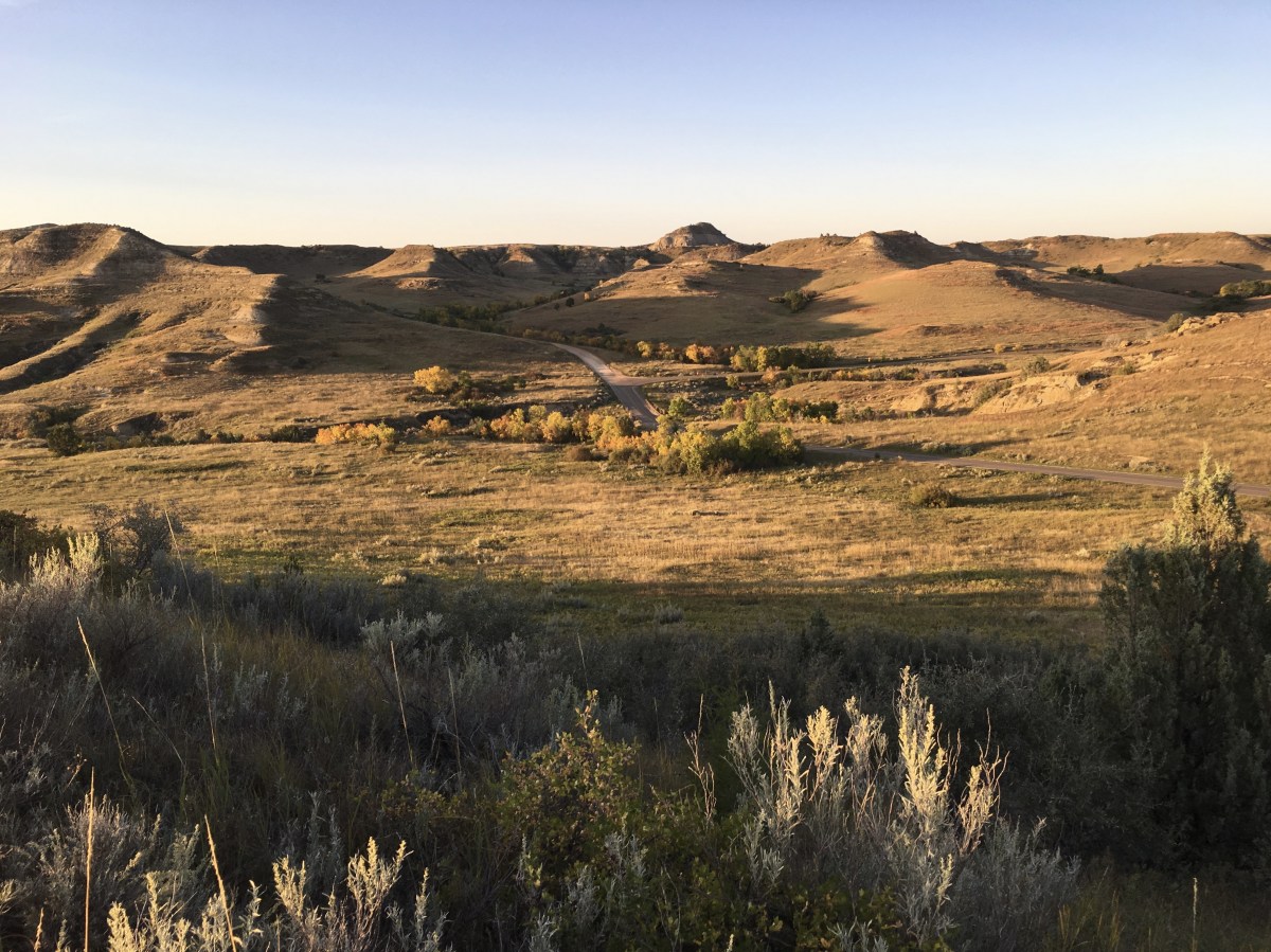
One stretch of road in the park was closed off, so it was a 24-mile out-and-back scenic drive. I was determined to drive to the end and work my way back.
I first stopped at Medora Overlook.
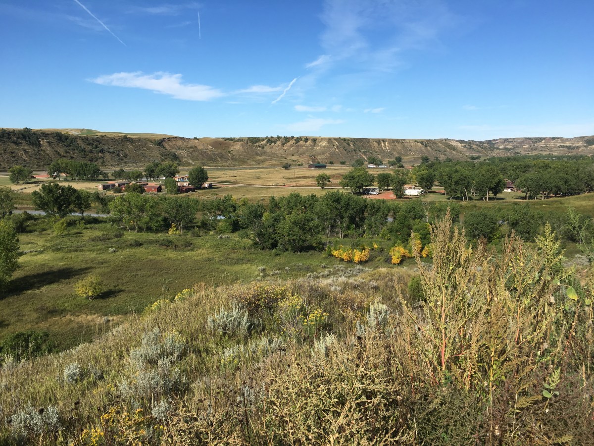
Medora Overlook

Medora Overlook
I had to keep pulling over to see the Prairie Dog Towns. I loved watching them scurrying about in the fields and popping in and out of their holes.


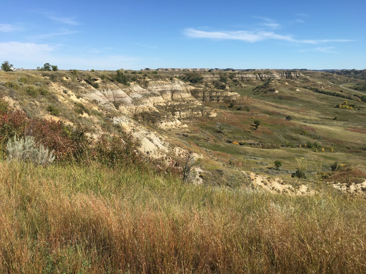
I drove most of the way, stopping briefly here and there to the Badlands Overlook, where I had to turn around.

Badlands Overlook

Badlands Overlook
I was lucky to see a couple of bison near the road.

bison at Theodore Roosevelt National Park


I finally changed the time on my camera from 12:30 to 11:30. It was so confusing going back and forth between Central and Mountain Time.
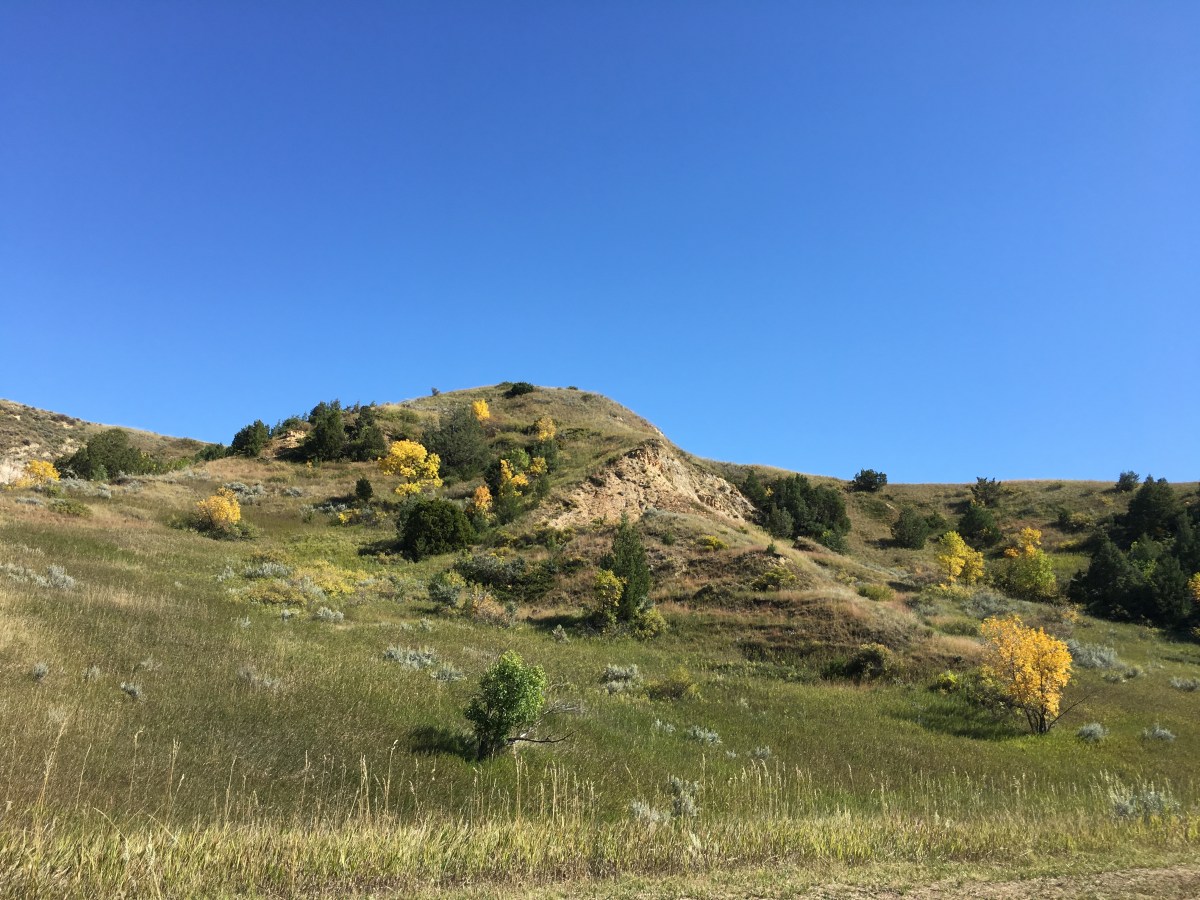
At Buck Hill, I ate a sandwich in the car and climbed up a short steep trail. A path went off to infinity, and I followed it as far as I felt like without having brought any water along. I also walked up a hill on the opposite side for views in another direction. Buck Hill was 0.2 miles round trip (my hike was longer). It was the highest accessible place in the park.


I saw some horses in a field alongside the road on the way to Boicourt Overlook.
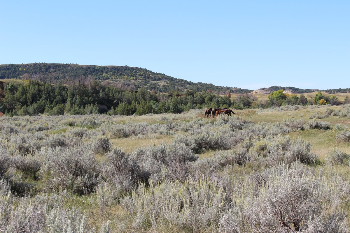
horses on the way to Boicourt Overlook

horses on the way to Boicourt Overlook

I then walked on the Boicourt Trail (0.3 miles round trip). A gentle gravel path led to a viewing area that looked across the park to the south. The park looked green and lively from this southern-facing vantage point. I stopped at Boicourt Overlook too.


I stopped at the Peaceful Valley Ranch and enjoyed views of the surrounding area. This complex spans the successive eras of the area’s recent history. It was a ranch in the late 1800s, dude ranch in the 1920s, headquarters of the CCC and WPA in the 1930s, park headquarters in the 1950s and 60s, and facility for guided horseback rides until 2014.

Peaceful Valley Ranch

Peaceful Valley Ranch

surrounds at Peaceful Valley Ranch

surrounds at Peaceful Valley Ranch

surrounds at Peaceful Valley Ranch
My next stop was Skyline Vista, a 0.2 mile round trip. A short paved path led to a viewing area overlooking the Little Missouri River.
Skyline Vista

Today, I met clacking flying bugs, bison and horses, along with numerous prairie dog towns and yellow cottonwoods.
I took a break to stop at the Visitor Center because I hadn’t yet looked at the museum. It was all about Teddy Roosevelt. Then I went into Medora to the North Dakota Cowboy Hall of Fame. Another post will follow with this visit.
I went to the Painted Canyon Visitor Center and The Painted Canyon Nature Trail. From here, I could explore the Badlands from top to bottom and back up again. It covered interesting geology and good views splashed with yellow cottonwoods.

Wildlife Petting Chart at the Painted Canyon Visitor Center


After eating dinner and exploring Medora, I went back into the park at 5:45 for 11 miles. A little deer with rounded ears bounded across the road. I walked up the Wind Canyon Trail (0.4 mile loop). The short trail followed a cliff edge overlooking the Little Missouri River. It is a favorite place for photographers at sunset. I had to leave before sunset because nature and a tree were calling my name.
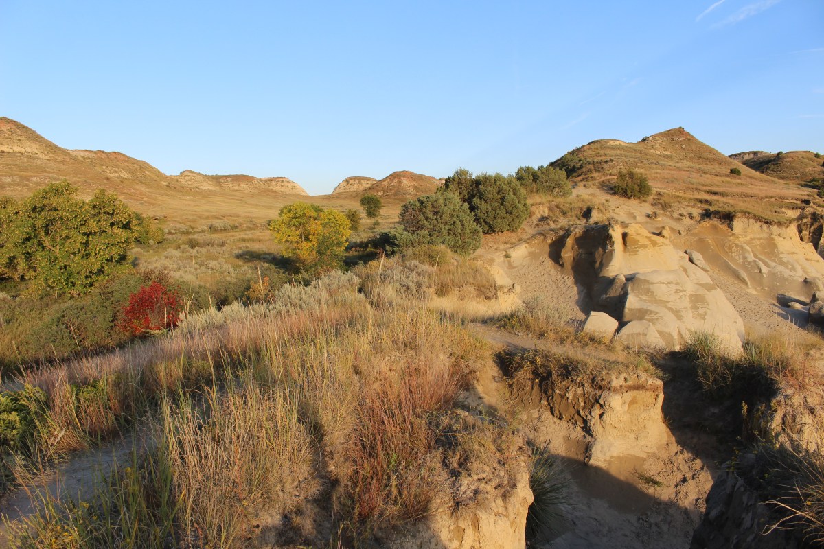
Wind Canyon Trail
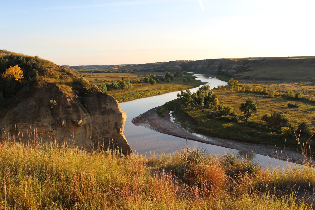
Wind Canyon Trail
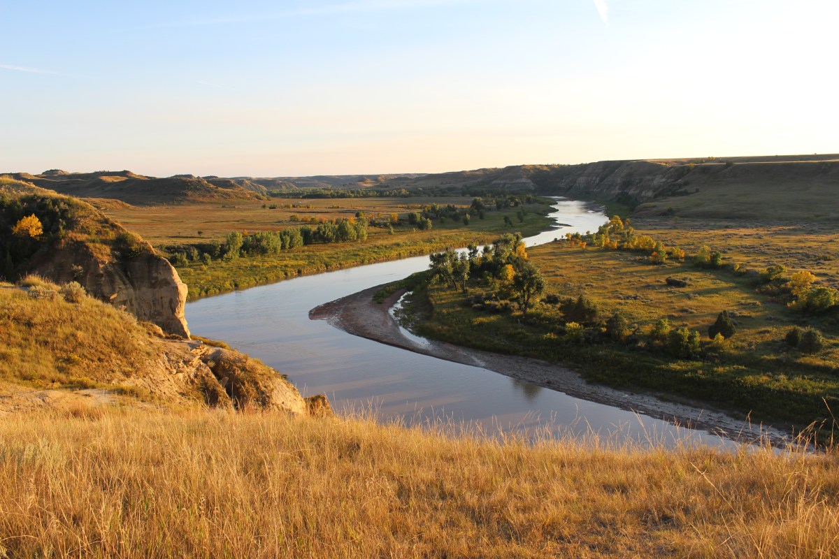
Wind Canyon Trail

Wind Canyon Trail
Wind Canyon Trail

Wind Canyon Trail


I was utterly exhausted today because I had woken up at 4:00 a.m. and never went back to sleep, although I had planned to sleep in. It was so nice to stay in one place for two nights, although I never hung around my room until 7:00 p.m.
Back at the homefront, Mike and our son went on a leisurely bike ride exploring roads from Penderbrook and around. Our son was agitated because he’d tried to get his friend M.J. to go to Riverbend Park to find pawpaws, but M.J. had never answered, and when he did call he said he’d been watching a soccer game with friends. He went with Mike to Barbara’s with take out.
Below is the journal spread from this day.
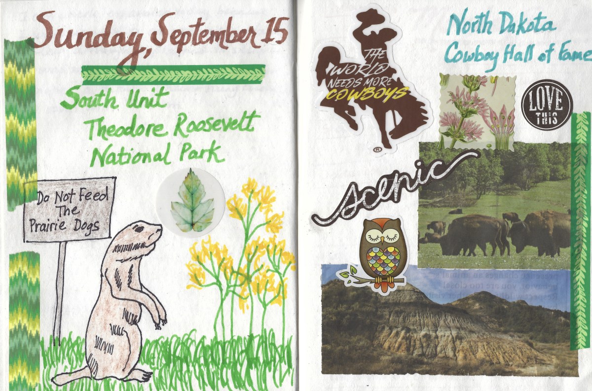
journal spread for September 15, 2019
*Drove: 89.9 miles; Steps: 14,931, or 6.33 miles*
*Sunday, September 15, 2019*
Discover more from ~ wander.essence ~
Subscribe to get the latest posts sent to your email.

Such a magnificent area: thanks for taking me there. 🙂
LikeLiked by 1 person
Thanks foe coming along, Pit. I enjoyed it all!
LikeLike
What a spectacular landscape, everything seems to be beautiful and uninhabited, just waiting for the visitor and his/her camera.
LikeLike
It is certainly a harsh landscape but also very pretty and a perfect place for photography!
LikeLiked by 1 person
Those bison are huge animals. The landscapes are amazing – great photos, Cathy.
LikeLike
Thanks Carol. I’m glad I at least got to see some bison up close!
LikeLiked by 1 person
Spectacular! I love the petting chart. It always amazed me how close some people were prepared to get to the wildlife.
LikeLiked by 1 person
I loved that petting chart too. I think many people are very foolish around wildlife!
LikeLiked by 2 people