I drove on a Wednesday morning to Canyon de Chelly National Monument from Gallup, NM. It turned out that Gallup was not the best place to stay to explore this park; it was too far away and over some bumpy Navajo Nation reservation roads. I didn’t plan this part of my trip well; the day before I’d visited Hubbell Trading Post and Window Rock, and I ended up backtracking past these places on my way to Canyon de Chelly.
Canyon de Chelly National Monument was established in 1931 to preserve nearly 5,000 years of human history. People have lived in this canyon, uninterrupted, longer than anyone has lived elsewhere on the Colorado Plateau. The monument is administered by the National Park Service but encompasses nearly 84,000 acres within the Navajo Reservation. These canyons today are home to the Diné, the Navajo people, with roughly 40 families residing within the park boundaries
It was a depressing drive through “The Rez,” a term Walt Longmire often used in the TV series Longmire, but his “Rez” was in Absaroka County, Wyoming. Ramshackle mobile homes and corrugated aluminum houses sat in desolate dirt yards along an endless stretch of road. Signs reminded drivers of Navajo poverty and unemployment: “Navajo families need jobs not talk! Vote jobs!” Periwinkle wildflowers fluttered along the roadside. Red buttes punctuated blue skies; a landscape of tan, beige and red sand and lavender-tipped grasses flew past my window.
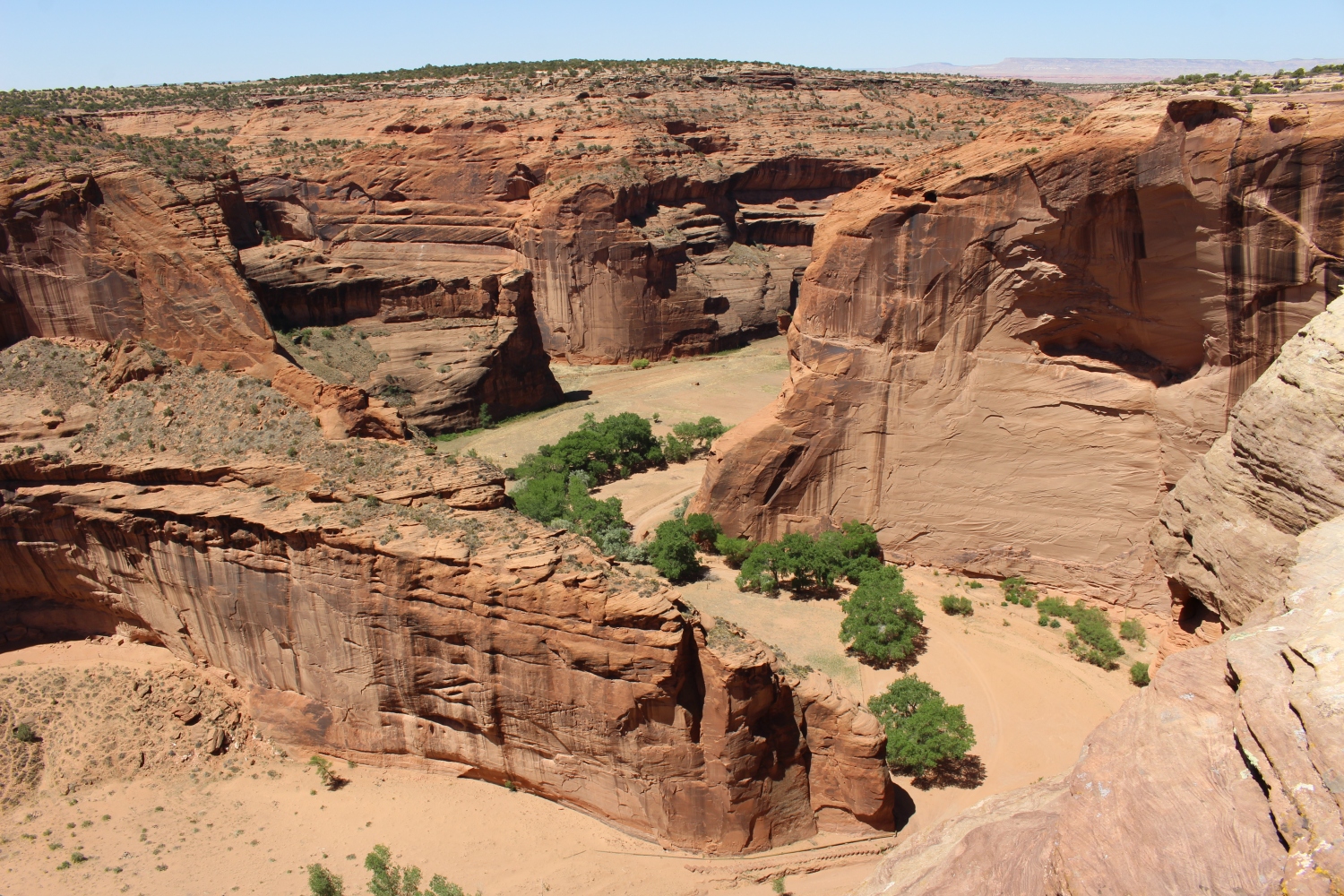
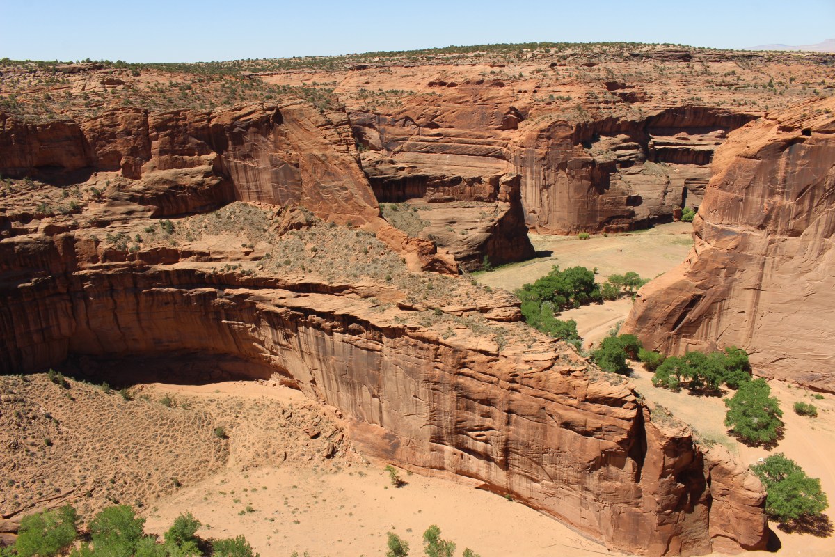
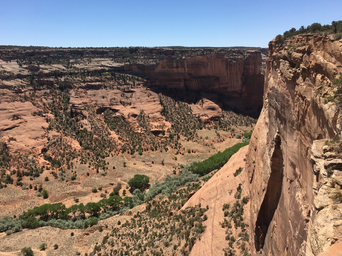
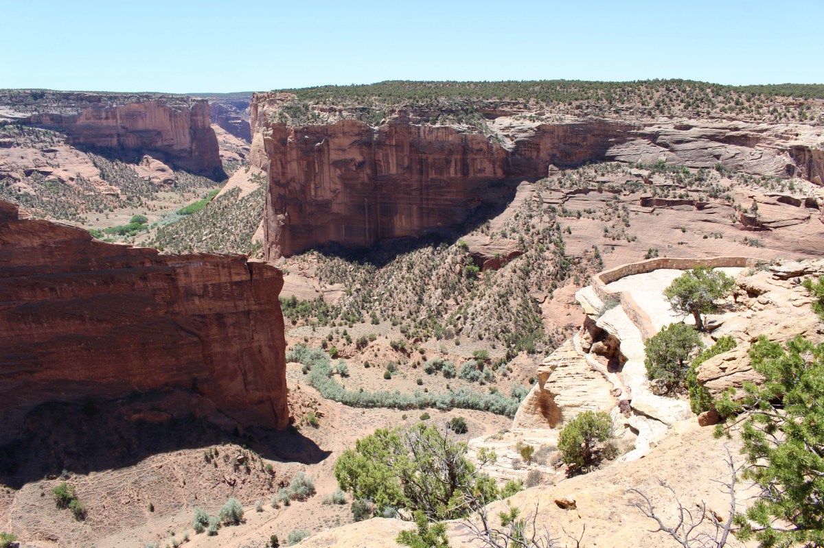
After stopping in the Visitor Center, I drove along the North Rim Road (34 miles round trip), stopping first at Antelope House Overlook. While walking around at the top of the canyon, two old Navajo guys told me they grew up down below. One of them said there used to be bushes growing out of the canyon walls. He said the National Park Service planted all the cottonwoods.
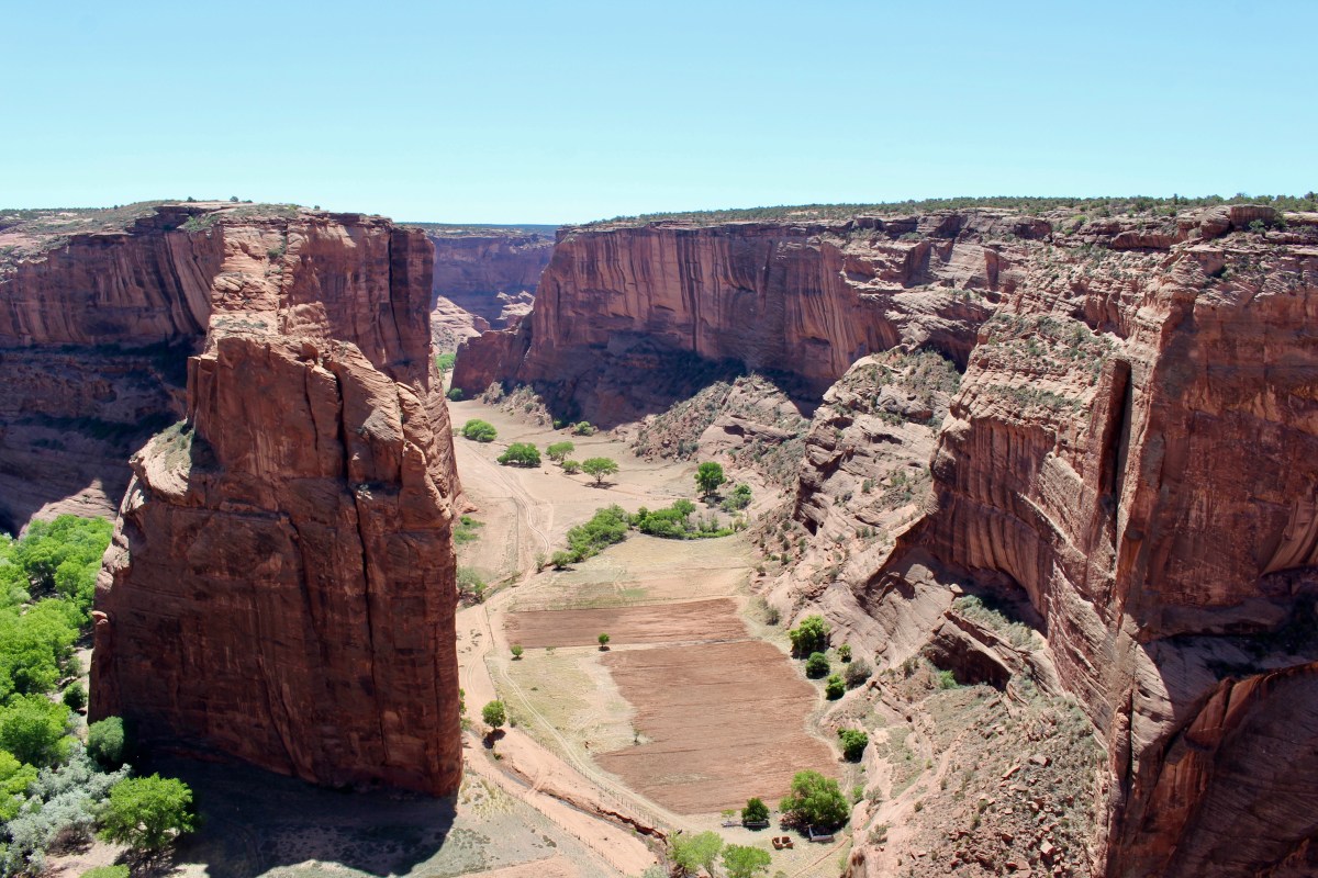
Antelope House Overlook
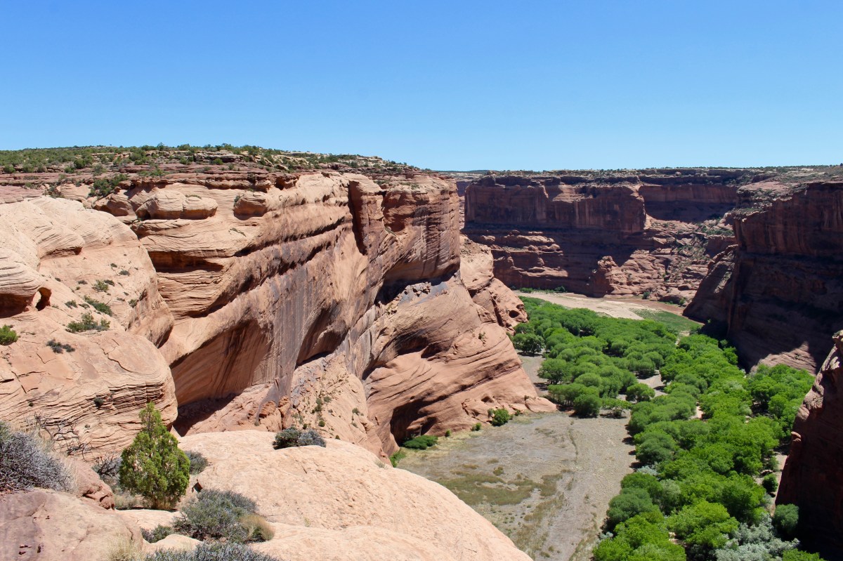
Antelope House Overlook

Antelope House Overlook
Antelope House Overlook

prickly plant at the canyon rim

hardy pine
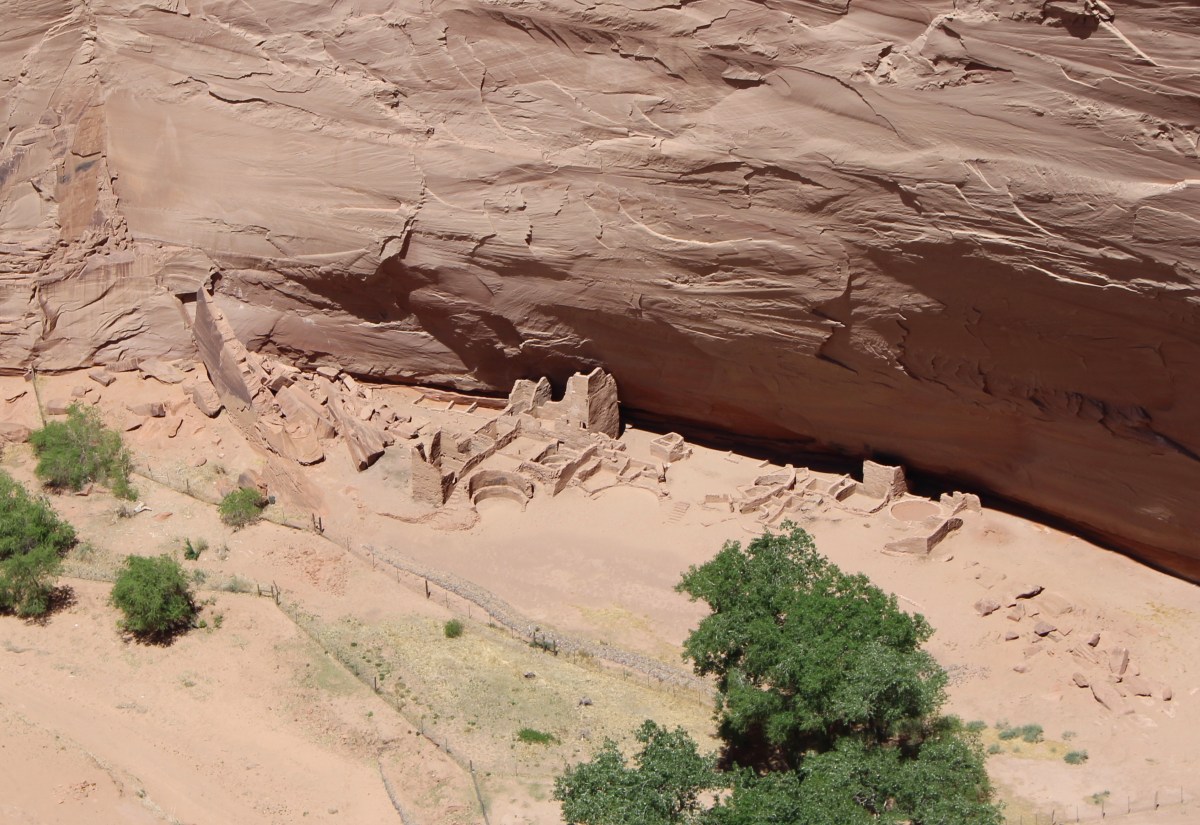
Antelope House Ruin is named for the illustrations of antelope attributed to Navajo Artist Dibe Yazhi (Little Sheep) who lived here in the early 1800s. Excavated in the 1970s, this site has an unusual circular plaza built in the 1300s.
Despite the two Navajo men’s attempts to point out the antelope illustrations, I could never spot them. I kept squinting and looking to no avail.

Antelope House Ruin
Antelope House Ruin
Antelope House Ruin

Antelope House Ruin
Antelope House Ruin
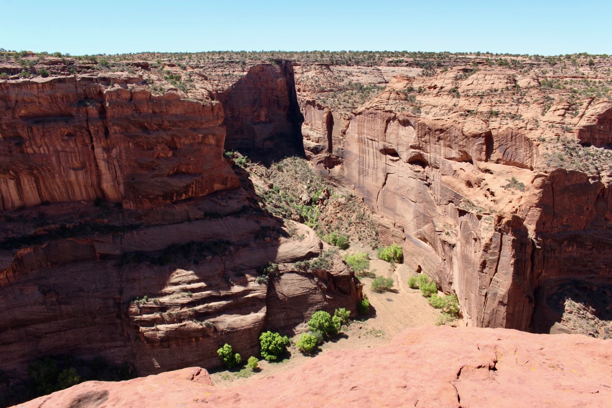
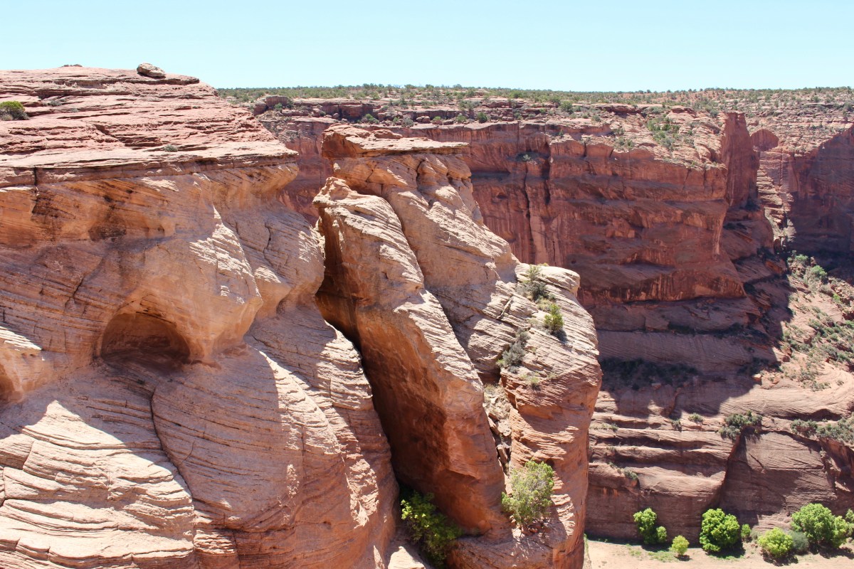
Navajo Fortress is a historic landmark used as a refuge by early Navajos.
Navajo Fortress at Antelope House Overlook
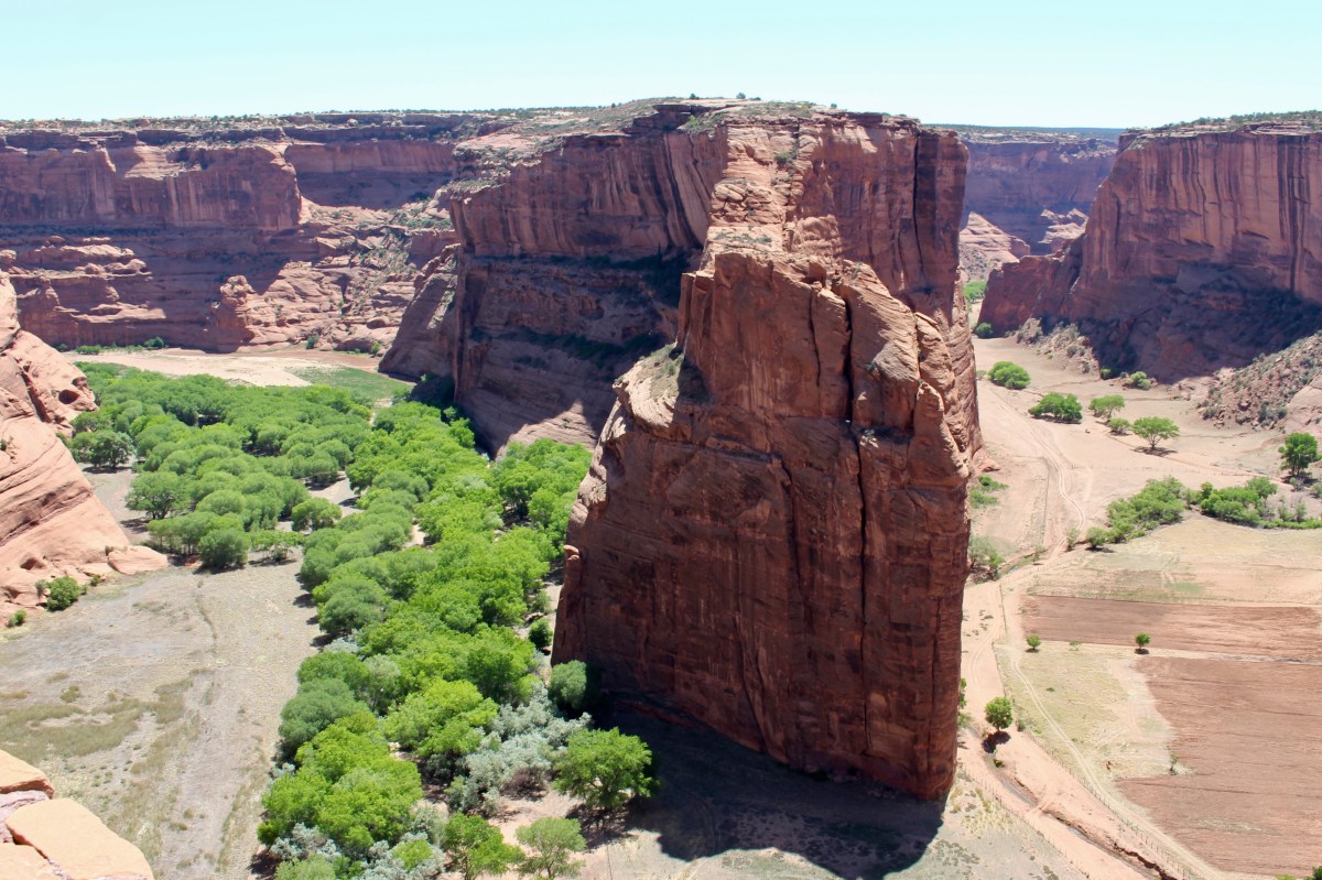
I drove to the Mummy Cave Overlook, from which I could see Canyon del Muerto and the Mummy Cave Ruin.
Canyon del Muerto

Canyon del Muerto
Mummy Cave Ruin is one of the largest ancestral Puebloan villages in the canyon. It was occupied until about 1300. The east and west alcoves comprise living and ceremonial rooms. In the 1280s, people who migrated from Mesa Verde built the tower complex that rests on the central ledge.

Mummy Cave Ruin
Close by, from the Massacre Cave Overlook, I could see Massacre Cave, as well as the Yucca Cave Ruin. Massacre Cave refers to the Navajo killed here in the winter of 1805 by a Spanish military expedition led by Antonio Narbona. About 115 Navajo took shelter on the ledge above the canyon floor. Narbona’s men discovered them, then fired from the rim, killing all the people on the ledge.

Massacre Cave Overlook
Massacre Cave Overlook

Massacre Cave Ruin & Yucca Cave Ruin

Massacre Cave Ruin


From Massacre Cave, I drove back to the Visitor Center and embarked on the South Rim Drive (37 miles roundtrip).
*Wednesday, May 16, 2018*
***********************
On Sundays, I post about hikes or walks that I have taken in my travels; I may also post on other unrelated subjects. I will use these posts to participate in Jo’s Monday Walks or any other challenges that catch my fancy.
This post is in response to Jo’s Monday Walk: Lagar da Mesquita.

You must be logged in to post a comment.