The southern route around Lake Ilopango
Monday, March 11, 2024: On Monday morning, Mario and I made a leisurely start and took the southern route around Lake Ilopango, heading for a rock formation called La Puerta del Diablo. We had views of Lake Ilopango and Volcán San Vicente along the way.


We stopped for lunch at Restaurante and Mirador Los Llanitos. Of course I forgot to take pictures of my delicious salmon with a caper salsa and French fries because we were too busy enjoying the views of Lake Ilopango and Volcán San Vicente. Also we were happily chatting and enjoying our Modelos.


La Puerta del Diablo & Panchimalco
After lunch, we drove 12 km to the south of San Salvador to La Puerta del Diablo, or the Devil’s Gate, located near Panchimalco.
The tourist attraction is renowned for the crack (I would call it a large gap) formed by two rocks on El Chulo Hill. The towering boulders are reputedly one single stone split in two. The summit offers a panorama encompassing the Salvadoran capital, the Pacific Ocean, Lake Ilopango, and the San Miguel Volcano.
During the civil war, this place was an execution point, the cliffs offering easy disposal of the bodies.
The park just completed a 5-year renovation, with numerous glass platform viewpoints and tourist concessions. We found great views of the town of Panchimalco in the backdrop between the two huge rocks.


We then drove to Panchimalco, a town set on the green slopes of Cerro Chulo. The town is known for its religious festivals, especially Palm Sunday, when residents march through the streets bearing decorated palm fronds. Early May’s Fería de Cultura de las Flores y las Palmas features palm artistry, folk dancing and fireworks.
Inhabited by descendents of the Pipils, Panchimalco has reinvented itself as an artists’ enclave. Sadly the main art galleries were closed when we strolled through the town.
We visited La Iglesia Santa Cruz de Roma, an old church with ancient statues and carved wooden ceilings, elaborately carved altarpieces, and niches.
The Santa Cruz Church was built beginning in 1543 by indigenous people; it was completed in 1730. Currently its classic Baroque-style façade survives. The interior hull is supported by 16 balsam wood columns on a stone base that separate the central nave from the lateral aisles.
There are nine altarpieces or altars that are in the Baroque style, both the largest one and those that are supported on the side walls of the church. To date, the main altar, in Baroque style, is the only one that preserves the primitive gilding.
We stopped for a coffee under a huge old tree after visiting the church.


We went for an early dinner and drinks at Los Boomwalos, a restaurant with sweeping views over San Salvador. Mario said they made the best pupusas around. I’d never had them before, and I agreed they were delicious. I had one with queso and aguacate 🥑 and half of another with very potent ajo (garlic). I enjoyed a limeade with a shot of vodka, while Mario had a Pilsener and pupusas with ajo and jalapeño. Most of all we enjoyed the music (including a modern version of “California Dreamin’”) and spectacular views over the sprawling capital city.
I checked in at Hotel Citlalli at around 7:00. Mario stayed nearby at his sister Sylvia’s house. I enjoyed a nice quiet evening but missed being at Mario’s house and talking until late.


Steps: 5,826; Miles 2.47. Weather Hi 96°, Lo 68°. Sunny.
Tuesday, March 12: On Tuesday morning, I had a nice breakfast at Hotel Citlalli to fortify myself for another day of exploring.


Cihuatán
Mario picked me up at the hotel and we drove north of San Salvador to Cihuatán, a major pre-Columbian archaeological site in central El Salvador. It was a very large city located in the extreme south of the Mesoamerican cultural area, and has been dated to the Early Post Classic period of Mesoamerican chronology (c. 950–1200 AD).
Between AD 800 and 900, the Maya world was shaken by profound changes which led to the abandonment of many communities. This phenomenon is known as the “Maya collapse.” It was in this panorama of abandonment that Cihuatán was founded as a new city. It was built upon a hill which strategically dominates the great valley of the Acelhuate and Lempa Rivers.
The modest ruins here were once an immense urban area alongside the Rio Guazapa, possibly the largest pre-Columbian city between Guatemala and Peru; its remains cover 290 hectares (716 acres). The builders leveled the entire hilltop for the center of their city. A vast residential zone surrounded the city center. There are surface indications of 5,000 homes. The average number of people per house is unknown, but if the commonly used number of five is applied, this would place Cihuatán’s population at around 25,000.
Cihuatán was the capital of a realm covering the western half of the territory of El Salvador. Although the ethnic identity of the site is unknown, the architectural style of the structures outside of the ceremonial core of the city is recognizably Maya.
Around AD 1200, about 100 to 150 years after it was founded, the city was destroyed by enemies who have yet to be identified. Houses, temples, and the palace were torched, and sacred ceramic sculptures were smashed. A massive fire spread rapidly throughout the city. Excavated evidence indicates that those inhabitants that did not die in the flames fled, abandoning their belongings. Spear points were frequent finds in the burnt layers and human remains were found trapped in drains in the acropolis that dated to the time of the city’s destruction.
Mario showed me the fruit of the morro trees on the site. The seeds are edible and high in protein with a sweet licorice taste. They’re used in Central America to make a kind of horchata. Mario told me the gourd-like fruits are often hollowed out, dried and used as containers for food or drink.


Archeological Structures here included:
- Circular temple (a possible wind temple)
- The Main Pyramid
- The Temple of the Idols and Temazcal (sauna)
- The Northern Ball Court
- Small temple
- The Western Ball Court
- Temple
We walked all around the Northern Ball Court, excavated by Antonio Sol in 1929. Mesoamerican ball courts were used for the oldest known team game, reaching back to 1400 BC, according to present evidence. While stone markers are famous in the ball courts of Mexico, none have been found in the approximately 25 ball courts in El Salvador.


We climbed the main, and largest, pyramid in Cihuatán, built with blocks of volcanic tuff (field stone, tuff, lava, pumice, and seashells). On its summit was the city’s preeminent temple.
One of the most notable architectural styles of that time is known as “talud-tablero” (slope cornice). In pyramids, the facing of each terrace had a slope (the “talud”), crowned by a cornice (“tablero”). This style originated about 2,000 years ago in the great city of Teotihuacan, Mexico and spread, in many variants, throughout Mesoamerica. In El Salvador, it appeared at around AD900 at Tazumal and here at Cihuatán; this is the southernmost known example of “talud-tablero.”
In all of Mesoamerica, Cihuatán would be the only known city whose main temple was dedicated to Xipe Tótec, “Our Lord the Flayed One.” He was important to warriors and war itself, and part of his celebration involved people wearing human skins taken from sacrificed prisoners of war. It wasn’t surprising he was worshiped considering the strong military emphasis found in this city.


The original name of the settlement is unknown as it was abandoned three centuries before the arrival of the Spaniards. During the 19th century, the word “Cihuatán” was applied to this sector of what was then a large hacienda called San Diego. It is a term from the Náhuat language and may be translated as “Place Next to the Woman.” This dovetails with modern oral tradition that the jagged peaks of nearby Guazapa Volcano resemble the silhouette of a reclining woman.
Throughout history, civilizations have originated in only 6 regions of the world. Mesoamerica is one of these “pristine civilizations.” The far-reaching territory of Mesoamerica extended from Mexico to Central America, and embraced many different cultural groups which spoke over 100 languages. Over several thousand years important civilizations evolved here, such as the Olmec, Maya, Aztec, Zapotec and many others.
Despite their differences, these groups shared many basic features which served to define Mesoamerica, including the ball game, use of cacao as money, and others. The fact that the inhabitants of Mesoamerica shared these features over such an extensive area was due to ancient common roots, intensive commerce, strategic marriages between kingdoms, warfare, the formation of kingdoms, migrations, and other factors.
Archaeological studies have shown that the origin of Mesoamerican civilizations was some 4,000 or 5,000 years ago. It was then that the people of this vast region changed their lifestyle from hunting and gathering to farming and cultivated corn and other domesticated plants. Village life began, with wattle and daub houses and pottery including cooking pots and serving dishes. These peasant villages constituted the foundation for the Mesoamerican civilizations which developed over the following millennia.
Aguilares
We had a fabulous lunch of typical El Salvadoran food at Restaurante Jardin del Sabor, not far from Cihuatán in Aguilares. I enjoyed Rellenos de güisquil, pipianes en crema salvadoreños, and arroz (rice) served with with a fresh melon drink. It may have been one of the most delicious meals I had in El Salvador, although all the food has been good.
In El Salvador “rellenos de papa or güisquil” is made with two thin slices of the vegetable (potato or chayote), stuffed with cheese, wrapped in egg batter, fried and then cooked in tomato sauce. Like a Mexican stuffed poblano pepper, these rellenos are made following the same process.
After leaving Aquilares, we got caught up in another traffic jam in El Paisnal. Mario joked, “People ruin everything!”


After lunch and making our way through El Paisnal, we headed to Joya de Cerén.
Joya de Cerén
Joya de Cerén (Jewel of Cerén in the Spanish language) is an archaeological site in La Libertad Department, El Salvador, featuring a pre-Columbian Maya farming village. It is often referred to as the “Pompeii of the Americas,” in comparison to the famed Ancient Roman ruins. It is a UNESCO World Heritage Site.


It was a small Maya settlement that was buried under volcanic ash when the Laguna Caldera Volcano erupted in AD 595. Residents fleeing the eruption left behind a wealth of everyday items that provide clues about ancient plumbing, home building, and food storage. Preserved structures include the village shaman’s house and the temazcal sweat lodge.
One of the main characteristics at Joya de Cerén is the earthen architecture. Building materials like limestone were not available near the Zapotitan Valley.
The shaman’s house and ceremonial center was a divination space where spindle whorls and grinding instruments were found; these objects were strictly for female use in Mesoamerica. Here, rituals related to the corn harvest and fertility were carried out.
A temazcal is a place for purification of body and spirit. It has a flagstone floor with a box of stones in the center; these were heated and a preparation of herbs was poured over the rocks to generate steam.
We found a sauna bath replica, which was “the bath for women after childbirth and other sick people to expel the cold they had in their body.”
Authorities resolved important conflicts and situations in an important community building at the site; this use was suggested by the existence of four niches and two large benches in the front room. In the Mayan culture, this was the distribution of seats for authority.
Strolling around the site, we found a storage area for a family of Mayan farmers. It was built of wattle and daub with a fence at the entrance. Originally, it was built for housing, but it was later modified to store food and everyday objects. The space was also used to process agave and obtain fiber, as a raw material in the production of cords and rope.
We also saw the sleeping and storage area of a family. Three vessels used by inhabitants to serve food were located; one of them still preserves the finger imprints from when family members took and ate the food with their fingers.
The settlement was rich in natural resources and shows an intensive agricultural tradition. There were once extensive areas of manioc, corn, and a great variety of food plants which are a sample of the Mayan diet, rich in vegetables.


After wandering around the grounds, we went into the museum to learn more about the archeological site. Throughout its history, the Zapotitán Valley has been affected by volcanic eruptions that have modified its geography and landscape, influencing its inhabitants directly and causing migrations and constant reoccupation of the territory.
The most relevant eruption was llopango Volcano in 535 AD, which affected most of what today is El Salvador. This eruption caused migrations of populations to the west and north of what is today El Salvador to other Maya areas in Guatemala and Honduras.
Joya de Cerén was established on top of the ash thrown by this eruption.
The village existed for about 150 years when it was covered by another eruption by Loma Caldera volcano approximately in 650 AD, The Late Classic Period. This eruption covered Joya de Cerén under 14 inches of ash.
Thanks to its excellent state of preservation, Joya de Cerén is the only archaeological site in Mesoamerica which shows evidence of the daily practices of peasant communities from pre-Hispanic times to date, through ceramics, architecture on land, the crops, and the knowledge and use of medicinal plants that tell-us about this continuous way of life.


San Salvador
After our visits to the two archeological sites, we went to Strikers Sports Bar in San Salvador for drinks to kill time before dinner. Neither of us likes sports but we couldn’t find other options. Even on the outdoor patio, huge screens were blasting away sports announcements. We still managed to enjoy margaritas even though we had to yell to talk.


When it finally was dinner time, we went to The Green House for dinner. We shared a bottle of red wine like in the good old days in Oman. The atmosphere in the restaurant was very pleasant with gardens and plants all around. We had a great time chatting and laughing.
I had the most delicious Avo Shrimp Cobb salad. Mario had a Churrasco Bowl with lettuce, steamed rice, roast beef tenderloin, roasted onions, roasted yellow corn, fresh grilled cheese, roasted cherry tomatoes, cucumber, avocado and house chimichurri.


It was a great last dinner to share. I would leave for Nicaragua early Thursday morning.
Steps: 7,195; Miles 3.05. Weather Hi 92°, Lo 67°. Sunny.
Playa Costa del Sol
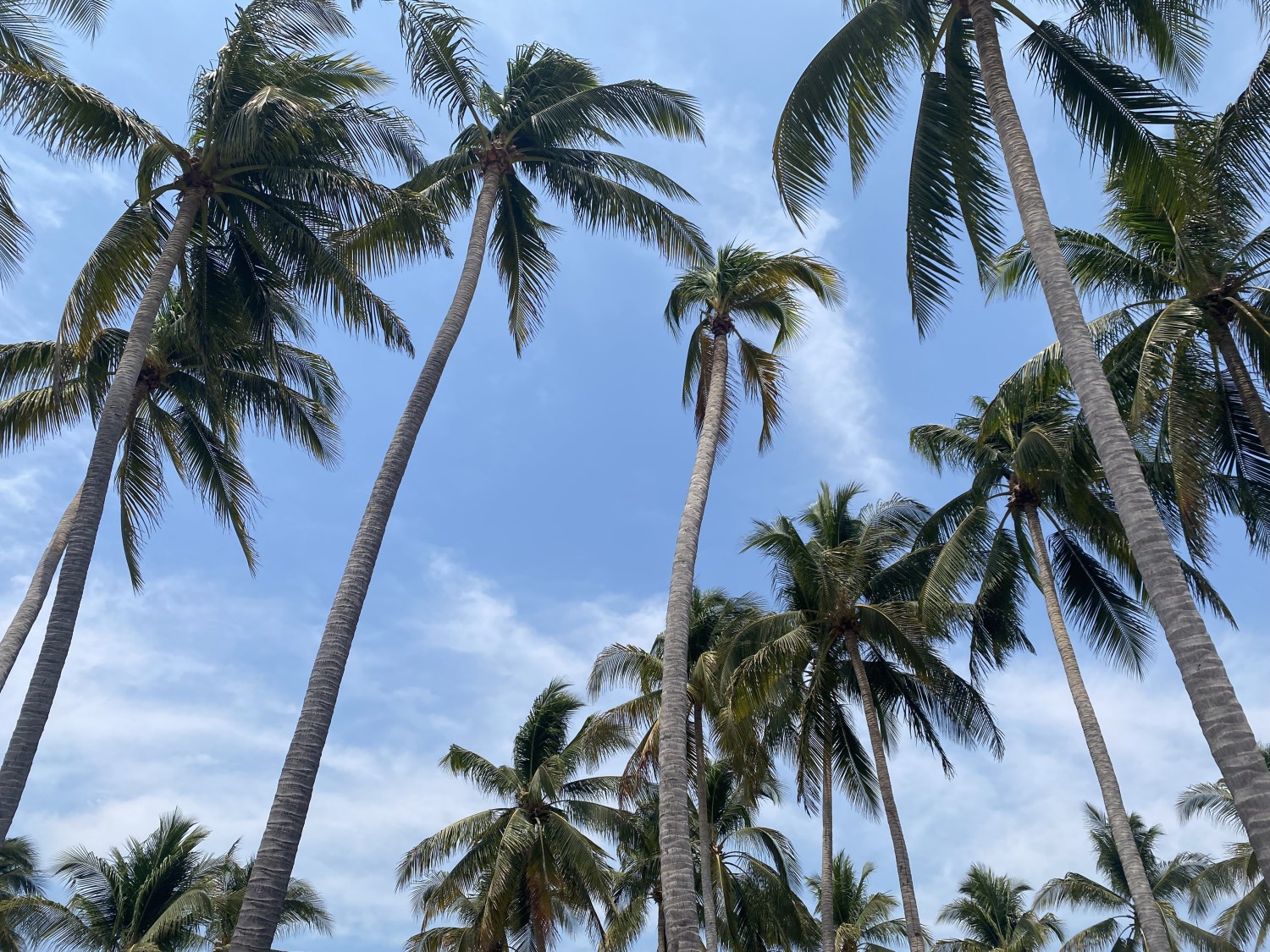
Wednesday, March 13: On my last day in El Salvador, Mario took me for 1 1/2 hours to his favorite beach at Playa Costa del Sol. We got a day pass at Hotel Tesero Beach, a lovely and sprawling hacienda-style hotel punctuated with palm trees. We had a few Modelos and I ate camarones al ajillo (shrimp with garlic) while Mario had calamari rice. The wind was blowing mightily and it was hard to keep our food from blowing away.
After lunch, we sat out by the pool with a swim-up bar and an ocean view. I sat in the shade and tried to read The Woman in the White Kimono, but I had trouble getting into it.
I had a pleasant conversation at the swim-up bar with a woman named Rosana from Jersey (she’s worked for USA Today for over 20 years). She was 55 and was with her El Salvadoran boyfriend. They both agreed Bukele has been great for the country. Rosana wants to retire and move to El Salvador as quickly as possible but she has to wait until she reaches retirement age.
Mario was very quiet; I guess after five days together we were talked out. He went for a walk on the beach and picked up a sand dollar and some kind of seed that looked like an eyeball.
I also chatted with a woman from Colombia and her husband from Costa Rica. Both now lived in New York; they came to El Salvador for vacation before it became too expensive. When I told her I was heading to Nicaragua and then Colombia, she said Bogotá is fabulous, so diverse and international, with many cuisines. She said Medellín was more “iffy.” She warned that we should only go out with a Spanish speaker who knows the neighborhoods, otherwise we could end up somewhere we wouldn’t want to be. Cartagena is fabulous, she said, very colorful.
A flock of pelicans flew low overhead, their shadows gliding over us.


It seemed an endless day as I am always bored at the beach. It holds little appeal for me anymore. However, in the heat of these Central American countries, it’s hard to get energized to do much more. I guess it makes it awkward if one person loves the beach and the other doesn’t. Most people do love it, and even I used to love it when I was younger. Then, I could easily tan. In my younger days, I loved to lather myself up with baby oil, bake all day, turning myself over back to front like a pig on a spit. As long as I was super tan by the end of the day, that was all that mattered. It was also fun to be with good friends, drinking beer and listening to music on a boom box. I have many fond memories of beach days in Virginia in my teenage years. Later, it got to be a chore, taking the kids and all their sand toys (shovels, dump trucks, pails, etc) to the beach and then reading a book all day while baking under an umbrella.
Now, I rarely tan, no matter what. I don’t have a desire to drink beers all day. I don’t like to swim in the ocean because of sea creatures. I also hate being covered in sand. Dipping into a pool is much more enjoyable, especially if the water is cool and there is a view. I do love a swim-up bar, but I simply don’t drink as much as I used to, nor do I want to.
I asked Mario what he and his ex-wife did when she came to visit and he said basically just go to restaurants to eat and go to the beach. She loves the beach, so they have that in common.
So the day was long and slow and I was happy when Mario said he was ready to leave before 4:00. I happily packed up and we left. It was only about a half-hour drive to my hotel near the airport. The place was rather a dive and not an alluring place to hang out.
Mario dropped me off at Hotel y Restaurante Maria Ofelia on our way back from the beach. After Mario dropped me, he had to continue another two hours to get home. I stayed about 7 minutes from the airport for my early flight Thursday morning to Managua, Nicaragua 🇳🇮.
It was wonderful to spend time with my old friend again after so many years. He was a fantastic host and spent much time entertaining me and driving me all over the country to introduce me to his culture. He told me I was welcome to come back anytime. It is very possible I might as it’s really not far from Nicaragua, which I’ll be visiting often to see the family.


At the hotel, I posted photos and did my Duolingo, and prepared my things for my early flight. In the hotel restaurant, I ate three pupusas and had a beer in the empty restaurant. I read The Woman in the White Kimono and went to sleep.
What a great introduction to the now safe and secure El Salvador where everyone feels like a huge burden of hopelessness has been lifted from their shoulders.
Steps: 5,250; Miles 2.23. Weather Hi 91°, Lo 67°. Sunny.
Leaving El Salvador for Nicaragua
Thursday, March 14: I woke up at 4:45 a.m., took a shower and just missed the 5:30 a.m. shuttle to the airport. I got the 6:00 shuttle, and checked in quickly at the airport. I found an art exhibit at the capital’s new airport, Aeropuerto Internacional Monseñor Romero. The art showed the beautiful landscapes and flowers of El Salvador.


Arrival in Managua, Nicaragua
I arrived at Augusto Cesar Sandino Internacional Aeropuerto at 9:10 a.m., having taken an 8:30 flight from El Salvador. Mike’s and my week-long adventure meeting Adam’s family in Nicaragua was beginning.
Discover more from ~ wander.essence ~
Subscribe to get the latest posts sent to your email.

We also visited Joya de Ceren and a different Maya pyramid. Such a fascinating history. I’m not sure if you meant Colombia on this trip, but it’s much safer than that person hinted to. Like any big city you don’t want to wander into the wrong neighbourhood, but Medellin is a great city, same as Bogata. Have fun, Maggie
LikeLike
Hi Maggie, I’d be curious to know the other Maya pyramid you visited in case I ever return to El Salvador, which I very well might. As our son lives in Nicaragua with his Nicaraguan family, it seems we will be going to that country a lot and it is easy enough to stop in El Salvador. Yes, Colombia followed Nicaragua on this trip and I’ll be writing about it after I write about our time in Nicaragua.
We ended up feeling very safe in Bogotá, Medellin, Guatapé and Cartagena; although we had received many warnings from the US State Department about kidnappings, armed robberies in restaurants that travelers frequent, and political violence. Also, while in Medellin, one of our drivers told us a very long and convoluted story about a young Canadian man who had been kidnapped and was being held for ransom; his mother ended up getting the driver to help rescue her son. I think the young man made the mistake of getting involved with drugs there and that was his downfall. I think any place can be safe or dangerous; even the U.S. is so. You just have to have common sense and be careful where you go.
Our biggest regret was that we heeded the warnings so much that we didn’t rent a car and drive more into the countryside, which we often do everywhere we go. There was much I would have liked to see outside of the cities. Maybe another time! Mike and I both felt after spending time in Colombia that we could have easily done that without any problems. 🙂
LikeLike
Governments seem to like to make us fearful of everywhere don’t they. I don’t go to bad neighbourhoods at home, so why would I do that when I travel!? Anyway, we visited El Tazumal ruins. They are between San Salvador and Santa Ana. We also hiked Santa Ana volcano which was fun. Here’s a link to our post. https://monkeystale.ca/2024/06/14/day-trips-from-santa-ana-el-salvador/
LikeLike
For sure, we all try to avoid bad neighborhoods in our home countries so of course we wouldn’t do it in a foreign country. Although the advantage is we generally know where the bad neighborhoods are at home where we may not know in another country.
I’ve heard of El Tazumal. Santa Ana Volcano must have been fun too. I’ll hop over to your link. Thanks for sharing. 🙂
LikeLiked by 1 person
By the way, Maggie, I did visit your link and learned a lot. I tried to make a comment twice and it seemed to disappear when my comment required me to sign in on WordPress again (twice). Finally gave up. But anyway, lots of ideas for more places to visit in El Salvador.
LikeLiked by 2 people
WordPress Games 😊 I’ve stopped comments for some posts because I was getting too much spam on them, but I don’t think I did to that one.
LikeLiked by 1 person
Mario certainly was a great host, you saw so many places with him. It does look amazing, but I would also want to skip the beach.
LikeLike
Mario was a great host, that’s for sure, and he extended an open invitation for me to return any time. That was nice. We had so many adventures in Oman during my two years there, and it seemed we were able to pick up where we left off despite 10+ years passing. As for the beach, no matter how much I try to like it, I just don’t. Mike and I often have this conflict while traveling, like for example in Cartagena. Now we’ll be spending 10 days in Bali in September and I told him I’d give one day at the beach; I’m much more interested in the culture and the rice terraces and temples. That one day will not be fun for me!
LikeLike
I think we’ve only ever had one ‘beach resort’ holiday, to Crete, and we spent very little time on the beach itself. I was the person with the most clothes on cowering under a sunshade trying to read my book!
LikeLiked by 1 person
How wonderful to be able to see all these amazing places with Mario as your guide. It really must have made the trip extra special.
LikeLike
It was definitely special to spend time with Mario in his home country, Carol. Also to see his love for El Salvador through his eyes and to learn about how much had changed. He at one time was on a hit list during the Civil War because he was a union organizer; he had told me in Oman about those days of the Civil War. So I was a little worried about going there, especially with the gang violence I’d always read about, but I’d also heard how safe it had become under Bukele. Mario’s enthusiasm was infectious.
LikeLiked by 1 person
An incredible adventure with some incredible views.
LikeLike
Thank you Mélodie. I’m glad you enjoyed coming along. Thanks for dropping by and for leaving a comment too. 🙂
LikeLike