
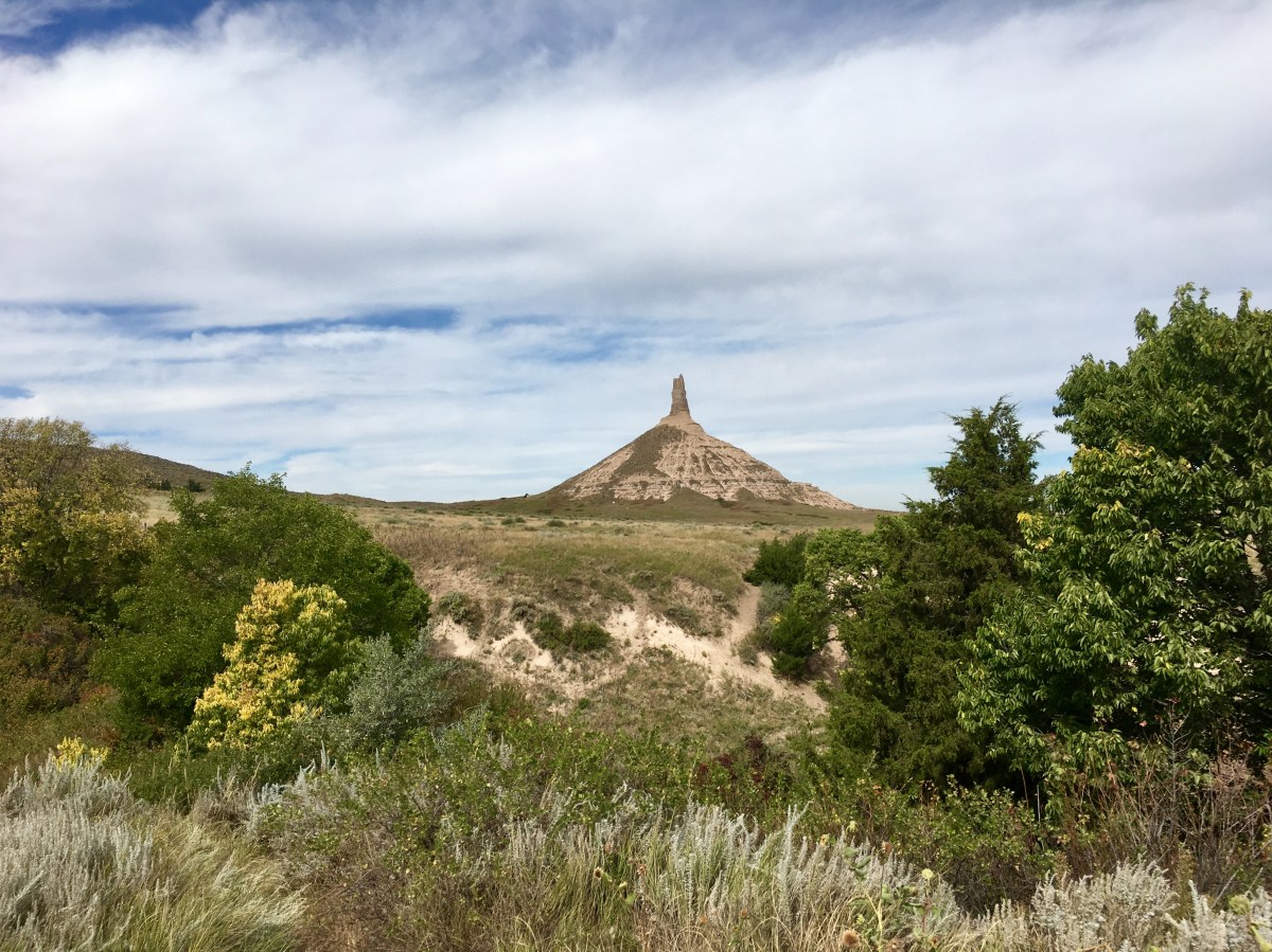
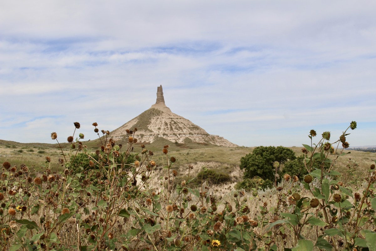
We visited Chimney Rock National Historic Site while in Scotts Bluff, Nebraska. In the 1800s, this pointy rock was the most noted landmark along the Oregon, California and Mormon Trails.
Names for the rock have ranged from inspiring to vulgar. Native Americans, according to early fur traders, named the rock after the penis of the adult male elk. However, prim and proper Anglo-Americans preferred the more delicate “chimney.” It has also gone by other names such as “Haystack with a pole stuck in the top,” “Nose Mountain” by Warren Ferris- American Fur Trading Company, “The Smokestack,” “The Teepee” and “Wigwam.”
Chimney Rock
The Oregon Trail began as an ancient network of Indian footpaths and animal trails that crisscrossed the West. In the early 1800s, British, French and American fur trappers followed these paths as they hunted for beaver. After a fur trader found a wide pass across the Continental Divide in 1812, South Pass in Wyoming made overland travel with ox-drawn wagons possible, and the trail became the gateway to the West. The “fur trace,” wheel tracks along the Platte River and through the Rockies, began the Oregon Trail. Christian missionaries, eager to convert Indians, joined the fur caravans for safe passage.
Desperate farmers and businessmen, hit hard by economic depressions in 1837 and 1841, traveled West in search of opportunities. The idea of “Manifest Destiny” – that God intended the United States to stretch from coast to coast – made citizens feel it was their patriotic duty to go West.
In early 1841, the first emigrant wagon train set out from Independence, Missouri. They followed the old fur trace past Chimney Rock and Scotts Bluff. Chimney Rock was by far the most mentioned landmark in journals of over 300 settlers who moved west along the Oregon Trail.


The risk of long-distance wagon travel was high, yet traffic on the trail kept growing. The highway was not straight, smooth or direct, and many discouraged travelers turned around.
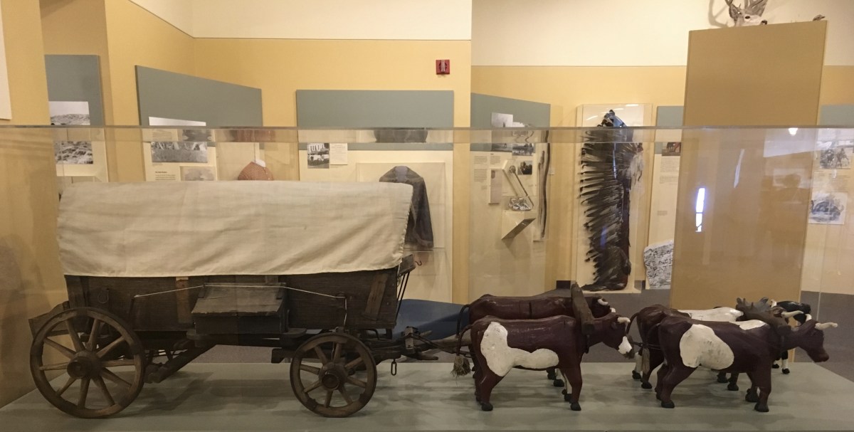
Wagon replica
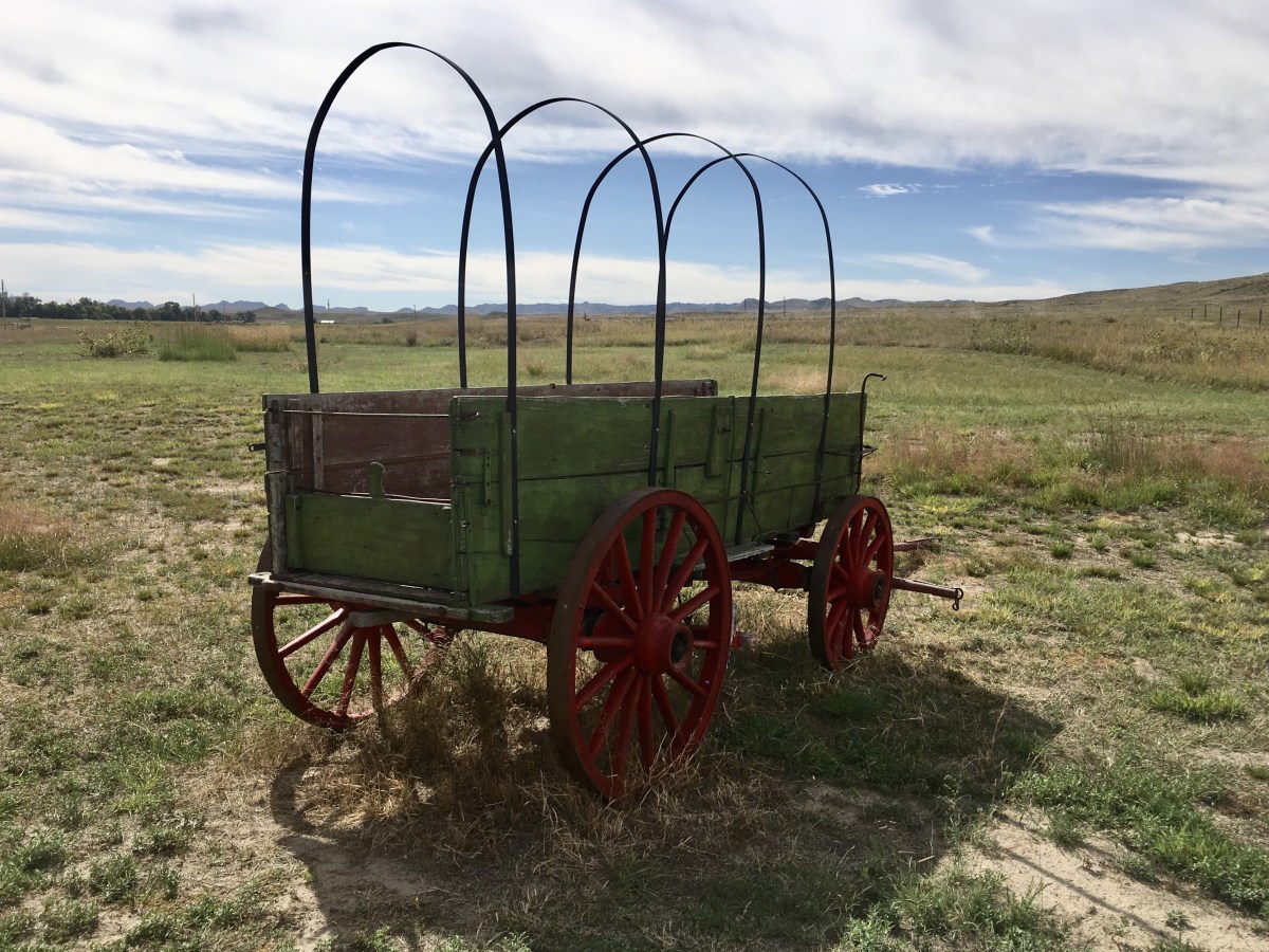
Wagon at Chimney Rock
At first relations between Native Americans and emigrants were cooperative, but when the stream increased in 1849 due to the California gold strikes, tensions grew. By the late 1850s, Indians killed travelers and travelers killed Indians. Indian resistance continued into the 1880s. By then the Indians had suffered military defeats, settlers had claimed their most productive lands, treaties were made and broken, and most tribes were forced onto reservations.
When the transcontinental railroad was completed in 1869, the Oregon trail fell into disuse except as local trips. In 1978 Congress designated the old wagon road as the Oregon National Historic Trail.

Historic Trails, Alternates and Cutoffs


The Lewis & Clark Trail is shown in cranberry on the map above. I have written about this extensively on my blog.
The California Trail, shown in orange in the map above, evolved as more than a quarter million people heeded the promises of California: Free land, gold, and adventure. By 1849, gold fever beckoned thousands of travelers, known as forty-niners, to California. They clogged the 2,000 mile California Trail, decimating grasslands, spreading cholera, and destroying plants and animals that Native Americans depended on for food; this led to increasing tensions with Native Americans. From Fort Kearny and South Pass in present-day Wyoming, the trail was a single cord, but it frayed after that, offering many paths to California.
By 1860, freight and mail companies, military expeditions, new settlements and trading stations, and thousands of travelers going in both directions transformed the California Trail into a road.
From 1846 and 1847, the start of war with Mexico, to 1869, over 70,000 Mormons traveled along the road west, what came to be known as the Mormon Pioneer Trail (shown in yellow on the above map). The trail started in Nauvoo, Illinois, went across Iowa, and ended near the Great Salt Lake in Utah. Generally following pre-existing routes, the trails took tens of thousands of Mormon emigrants to a new home and refuge in the Great Basin. From their labors arose the State of Deseret, later to become Utah Territory, and finally the state of Utah.
The Mormons had a different motivation than other emigrants. They wanted to maintain a religious and cultural identity in an isolated area where they could permanently settle and practice their religion in peace. Mormon leaders hoped to be insulated from harassment, antagonism, and persecution.
Congress established the Mormon Pioneer National Historic Trail, a designated corridor almost 1,300 miles long, as part of the National Trails System in 1978. This trail commemorates the 1846-47 journey of the Mormon people from Nauvoo, Illinois to the Valle of the Great Salt Lake.
Finally the Pony Express Trail, shown in purple on the map above, only lasted 19 months. After many less-than-ideal attempts to deliver mail across the continent, William H. Russell created the Pony Express. He and his two partners, who had great experience in hauling cargo and passengers, started a new firm, the Central Overland California & Pike’s Peak Express Company (COC & PP) – the official name of the Pony Express. It began mail service April 1860 between St. Joseph, Missouri and San Francisco, CA. Home stations were established every 75-100 miles (to house riders between runs) and smaller relay stations every 10-15 miles (to provide riders with fresh horses).
The company employed between 80 and 100 riders and several hundred station workers. Riders earned wages plus room and board. Hires ranged from teenagers to about age 40. Weight restrictions were strict. Riders had to weigh less than 120 pounds and carry 20 pounds of mail and 25 pounds of equipment.They also had to be “willing to risk death daily.”
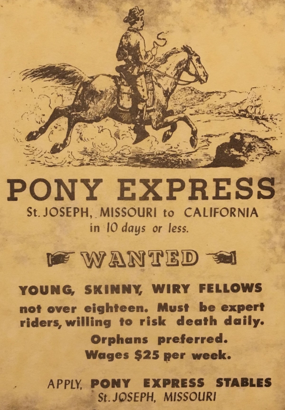
Pony Express Advertisement
Horses were selected for swiftness and endurance. The company bought 400-500 horses, many thoroughbreds for eastern runs and California mustangs for western stretches. Horses averaged 10 miles per hour, at times galloping up to 25 mph. During this route of 75-100 miles, a rider changed horses 8-10 times.
Transcontinental telegraph lines were completed in October of 1861 and the Pony delivered its last mail in November of 1861.
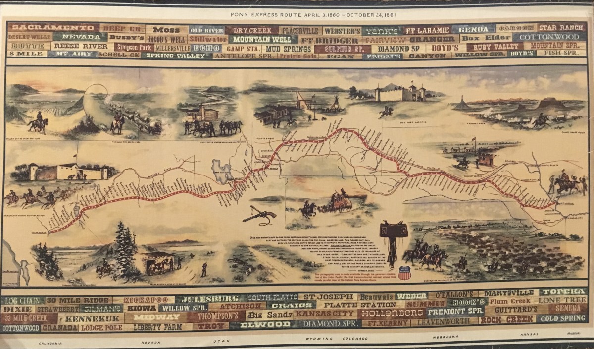
Pony Express Route
*********
According to the National Park Service, Chimney Rock consists of “Brule clay (not “rock”) interlayered with volcanic ash and Arikaree sandstone.” Because the soft Brule clay is susceptible to erosion, it undermines the hard Arikaree sandstone (which does not erode easily), resulting in episodic changes that are unpredictable, such as rock falls.
There were many dangers along the Oregon trail, including rattlesnakes. They are still a danger here today.

Rattlesnake warning
In 1895, the United States Geological Survey calculated the elevation of Chimney Rock as 4,225 feet above sea level. The spire has lost about 30 feet in the last 150 years. Today the summit rises 470 feet above the North Platte River and measures 325 feet tip to base, with the spire measuring 120 feet.
In 1906, Ezra Meeker, who went west in 1852, retraced the Oregon Trail from west to east, again in an ox-drawn wagon. His efforts led to the formation of the Oregon Trail Memorial Association.
The Chimney Rock Cemetery was a later addition to the Historic Site.


In 1941, the 80 acres containing the site were transferred to the Nebraska State Historical Society. In 1956, Chimney Rock was designated a National Historic Site by the federal government.

Chimney Rock
Chimney Rock
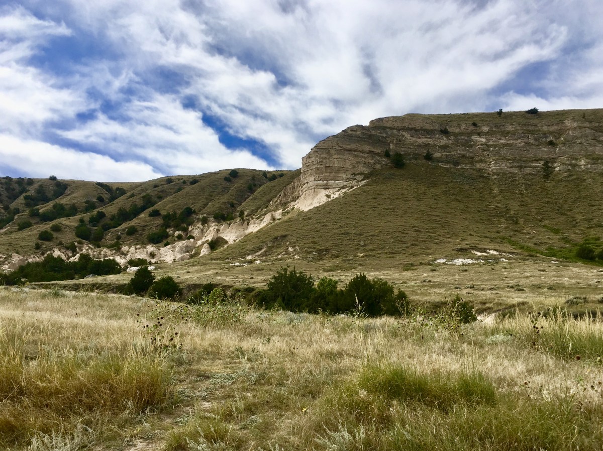
bluffs at Chimney Rock

bluffs at Chimney Rock
Below is my cancellation stamp in my National Parks Passport for Chimney Rock National Historic Site.

Cancellation stamps for Scotts Bluff National Monument and the Oregon National Historic Trail (NHT), California NHT, Mormon Pioneer NHT, and Pony Express NHT for 9/22 and 9/23, as well as Chimney Rock NHS.
All information comes from brochures and signs created by the National Park Service.
*Monday, September 23, 2019*

You must be logged in to post a comment.