After leaving Spoleto, we drove south and west through mountain passes, arriving in Orvieto, in Southern Umbria, around 3:15. We checked into the annex at the Hotel Duomo, handing over our car to valet parking. It was cold and rainy upon our arrival.
Our hotel was right next to the Duomo di Orvieto, so that’s where we started our walk. The Gothic cathedral, dating to 1290, boasts a black-and-white banded exterior fronted by a breathtaking facade with an exquisite display of rainbow frescoes, jewel-like mosaics, bas-reliefs, and delicate braids of flowers and vines. The bas-relief panels between doorways tell the story of the Creation and the Last Judgment.
The building took 30 years to plan and three centuries to complete. It was started by Fra Bevignate and later additions were made by Sienese master Lorenzo Maitani (c. 1275-1330), Andrea Pisano (of Florence Cathedral fame) and his son Nino Pisano, Andrea Oreagna and Michele Sanmicheli (Lonely Planet Italy).
Duomo di Orvieto
Duomo di Orvieto
Duomo di Orvieto
Duomo di Orvieto
bas-reliefs at Duomo di Orvieto
more bas-reliefs
interior of Duomo di Orvieto
Duomo di Orvieto
Duomo di Orvieto
Duomo di Orvieto
Duomo di Orvieto
Duomo di Orvieto
Duomo di Orvieto
Duomo di Orvieto
Duomo di Orvieto
Duomo di Orvieto
Duomo di Orvieto
Duomo di Orvieto
Duomo di Orvieto
Duomo di Orvieto
Duomo di Orvieto
shop in Orvieto
From the Piazza Duomo, we headed northwest along Via del Duomo to Corso Cavour and climbed up 250 steps in the 13th century Torre Del Morro, or Tower of the Moor, where we had sweeping views of the town.
At the end of the thirteenth century, the medieval Commune of Orvieto was at the height of its economic power and political stability. Public buildings became symbols of this authority: the original Town Hall was restored and the Palazzo del Popolo and the Cathedral were built. Extant buildings were restructured, forming a new urban layout with at its fulcrum the Palazzo dei Sette and the Tower known of as del Papa. From the top of the Tower, 47 meters high and almost perfectly oriented to the four cardinal points, the eye could sweep over the “contado” with its rural parishes, its hamlets, and its many castles and over the vast territory subject to the city of Orvieto. To the west, it stretched all the way to the sea.
In the 16th century, the name of the tower appeared as “del Moro,” probably after Raffaele di Sante known as il Moro. In 1865, the reservoir for distributing water from the new aqueduct was installed in the tower at a height of 18 meters. After restoration in 1866, the mechanical clock was set up and the two municipal bells were hoisted to the top.
views of Orvieto from Torre Del Morro
views of Orvieto from Torre Del Morro
views of Orvieto from Torre Del Morro
views of Orvieto from Torre Del Morro
views of Orvieto from Torre Del Morro
views of Orvieto from Torre Del Morro
We strolled through the town, admiring the ancient buildings and trying our best to keep warm.
Orvieto
Orvieto
butcher market in Orvieto
Orvieto
Orvieto
We stopped to visit Pozzo della Cava, or Well of the Quarry, the short version of the “Città sotterranea,” or the Orvieto Underground, a labyrinth of caves and tunnels hidden in the dark cliff.
The Etruscans were the first to settle here, digging a honeycombed network of wells and storage caves out of the soft volcanic stone known as tufa. The Romans attacked and destroyed the city in 283 B.C.; since then it has transformed into a charming maze of alleys and squares, all built from the tufa that was removed and used as building blocks, or ground into pozzolana, which was made into mortar.
Over the past 3,000 years, those who lived on top of this high plateau dug a huge number of cavities into the soft volcanic rock on which Orvieto stood. The series of 440 caves, cisterns, secret passageways, storage areas, and cavities (out of 1200 in the system) that overlap and intersect beneath the streets and buildings of the modern town have been unearthed. This reservoir of historical and archaeological information found in these underground structures showed that locals used the the caves over millennia for various purposes, including WWII bomb shelters, refrigerators, wine storage, wells, and as dovecotes to trap pigeons for dinner. Some caves were used to ferment the Trebbiano grapes used in making the region’s popular white wine, Orvieto Classico.
At times the subterranean path runs parallel to the cliff wall, and panoramic openings let in the light, revealing an endless succession of tunnels, stairs, unexpected passageways, and superimposed rooms with innumerable small square niches.
Orvieto Underground
Orvieto Underground
Orvieto Underground
Orvieto Underground
Orvieto Underground
Orvieto Underground
Orvieto Underground
Orvieto Underground
out back at the Orvieto Underground
out back at the Orvieto Underground
We then walked ever upward to the highest point in the town for views off the cliff into the valley below.
Orvieto
view of Orvieto
church in Orvieto
view from the cliff in Orvieto
view from the cliff in Orvieto
view from the cliff in Orvieto
view from the cliff in Orvieto
view from the cliff in Orvieto
view from the cliff in Orvieto
view from the cliff in Orvieto
view from the cliff in Orvieto
We walked back down through the town.
pretty window box
note in the bathroom
Off a little alley, we found some interesting wood carvings.
wood carvings
wood carvings
wood carving shop
wood carvings
wood carvings
Shivering, we stopped into the enoteca Bottega Vera, a wine bar where I had Fabbrica Birra Perugia Golden Ale and Mike had a red wine and we shared warm bruschetta with cheese and truffles. We had such a pleasant time.
me at Bottega Vera
me and Mike at Bottega Vera
bruschetta with cheese and truffles
It was so cold outside, that we went back to our room to warm up a bit before dinner.
bicycle in Orvieto
Duomo di Orvieto
Orvieto
Later, at Il Cocco, Mike had a beer and I had a glass of red wine, and I enjoyed tortellini with cherry tomatoes, ricotta cheese and walnuts. Mike had lasagna with Bolognese sauce. As usual, our food was delicious.
pasta with walnuts
Fiat parked after dark
The next morning, we would head to Rome to spend the night, stopping on our way in Civita di Bagnoregio.
                    Eight Ways of Looking at Italy

I
We dwelt momentarily in many countries: Italy of antiquity,
Italy of vineyards and wines,
of stone monasteries set in silvery olive groves,
Italy of wisteria skies,
of elegant umbrella pines silhouetted against blue skies,
Italy of poppy and rapeseed fields,
of rugged coastlines and half-moons of beach chairs on glittery sand.

II
Amidst cities clad in stone
the only movement was implied --
Oceanus commanding the waters, boats sinking and spouting,
gods taming rivers, hot oil poured from medieval skyscrapers,
gladiators fighting to death,
thirteen obelisks converging on Rome.

III
On ancient maps, Italia was a wobbly sketch of boot,
a pink country jutting into the blue
Tyrrhenian and Mediterranean Seas,
a fashionable high-heeled boot,
flirting with, beckoning,
all the edges of Europe, Asia and Africa.

IV
The Holy Trinity – the Father, Son and Holy Spirit –
the Virgin Mary, the saints, and all the heavenly hosts,
breathed in paintings, sculptures and churches.
In marble, David, slayer of Goliath, was enlivened,
and in small smooth statues of the Virgin
hand-held in supplication.

V
Cypress trees danced frantically in gusts,
innuendos of restlessness.
Cobblestones soaked up rain,
turned slick and mirrored the moon,
which floated behind heavy clouds.
Roads curled though mountains and hills
transporting  travelers to medieval times.

VI
Tempting were the country’s displays of cellophane-wrapped pasta,
its jars of olives, its cloves of garlic hung on string,
its ravioli with fresh truffle,
its pansotti with walnut sauce,
its tortellini in meat broth, its gnocchi, its pasta with chicory,
its zuppa toscana,
its Picio Cacio e pepe,
its imbrecciata,
its rainbow displays of gelato.

VII
Flights to the heights were hard-fought,
climbs ever-upward in hilltop towns
within labyrinths of tightly clustered lanes,
climbs for tower views over terracotta rooftops
and inundating green hills,
climbs to fortress ruins,
to catch horizon glimpses on the wings of sparrows.

VIII
We had a surprise encounter with the Fiat 500 Club Italia.
The little cars zipped through Asciano,
cutting a wake through our path,
singing musical ditties,
like children in colorful raincoats.
In the midst of heavy history,
moments of joviality.
Trevi Fountain, Rome
David at Accademia
Florence
wisteria in Panzano
San Gimignano
road to Volterra
Siena
Fiats in Asciano
Sant’Antimo
on a road in Tuscany
Assisi
“POETRY” Invitation: I invite you to write a poem of any poetic form on your own blog about a particular travel destination. Or you can write about travel in general. Concentrate on any intention you set for your poetry.
One of my intentions for my trip to Italy was to write a “thirteen ways of looking” poem, where I focus on a single subject and reexamine it in a series of imaginative leaps (Poetry Everywhere, p. 173). I narrowed it to eight ways of looking.
I waited way too long to write this poem. Italy as a subject was much too broad. I should have focused on one aspect. I’ll have to work on another poem of this type with a much narrower focus.
You can either set your own poetic intentions, or use one of the prompts I’ve listed on this page: writing prompts: poetry. (This page is a work in process). You can also include photos, of course.
Include the link in the comments below by Thursday, August 6 at 1:00 p.m. EST. When I write my post in response to this challenge on Friday, August 7, I’ll include your links in that post.
This will be an ongoing invitation, on the first Friday of each month. Feel free to jump in at any time.
I hope you’ll join in our community. I look forward to reading your posts!
After our visit to Assisi, we drove a short distance to Spello, a hilltop town at the edge of Monte Subasio. The buildings of the town glowed with the warm rosy-beige tones of the local pietra rossa stone.
“The return of Francis” – bronze statue in Spello
church in Spello
We walked all around the town in a big circle because we were only able to park for one hour. Some obnoxious Americans, two couples, were being very loud, tossing their Southern twangs in a free-for-all around us. We stepped up our pace to keep our distance from them.
Spello
Spello
Spello
Spello
At the edge of town, we enjoyed a view over the Umbrian plain.
view from Spello
Spello
Spello
Spello
painting on arch in Spello
view from Spello
Spello
painting on a niche in Spello
We stopped for a gelato after our walk. I had Amarena (black cherry) and Mike had Fichi e Noci (figs and walnuts).
gelato 🙂
Spello
We returned to our Airbnb in Perugia and had wine on the patio. I took a long hot bath. Francesco came to replace some light bulbs that were out. We had snacks of cheese, prosciutto, and jarred Asparagi verdi (green asparagus).
Perugia Airbnb kitchen
Perugia Airbnb patio
Perugia Airbnb covered patio
Mike whipped up a dinner of tortellini with salsa fave e pecorino (sauce of fava beans and pecorino) and leftover sausage from lunch.
The following morning, we would leave Perugia and head to Orvieto by way to Spoleto.
We had breakfast in our apartment: yogurt, strawberries, granola, orange juice and coffee, although it took Mike a while to figure out the espresso machine. As I am so bad with mechanical things, I always count on him to figure them out. 🙂
We meant to get an early start but didn’t leave until 9:00. We arrived in Assisi at 9:45 and parked on a mountain road on the far side of town.
Assisi is one of the Christian world’s most important pilgrimage sites and home of the Basilica di San Francesco, built in honor of St. Francis (1182-1226).
view of Rocca Maggiore from our parking spot
We walked downhill forever until we were in sight of the Basilica di San Francesco. On the way, we passed the Temple of Minerva, which dates from the first century B.C.
walk downhill through Assisi
Bar de Piazzanova
all about lavender
shop on the way downhill in Assisi
alley in Assisi
Temple of Minerva
mural of the Virgin
Cacio pepe e…
For a restroom break, we stopped at a cafe for a chocolate muffin and Mike had coffee and a pistachio and jam cookie.
a chocolate muffin at a cafe near the Basilica
Basilica di San Francesco
We went in to the Gothic Upper Church, known as the Basilica Superiore (built from 1230-1239), which sits atop the lower one. It has soaring arches and tall stained glass windows (the first in Italy). It is covered floor to ceiling with some of Europe’s finest frescoes. Sadly, no photography was allowed. 😦
The St. Francis fresco cycle is the highlight of the Upper Church. Twenty-eight frescoes depict the life of St. Francis, born in Assisi in 1181, the son of a French noblewoman and a wealthy cloth merchant. He had a troubled youth carousing; he was fascinated with troubadours. After a military expedition to Perugia in 1202, he spent a year in prison. He had planned a military career, but during a long illness in 1206, he heard the voice of God, renounced his father’s wealth, and began a life of austerity in imitation of Christ, preaching and helping the poor.
He traveled around Italy and beyond, performing miracles such as curing the sick, communicating with animals, and spending months praying in a cave like a hermit. He embraced poverty, asceticism, and the beauty of man and nature. He quickly attracted a vast number of followers. He was the first saint to receive the stigmata (wounds in his hand, feet and side corresponding to those of Christ on the cross). He died on October 4, 1226 at the age of 45 in the Porziuncola, a secluded chapel in the woods where he’d first preached the virtue of poverty to his disciples. He was declared patron saint of Italy in 1939 and today the Franciscans make up the largest of the Catholic orders.
Peace was for Francis the greatest ideal, the highest aspiration at the center of his life. The Franciscan Rule asks the friars to do what the Gospel says: “In whatever house they enter, before entering, they should say: Peace to this house!”
It is largely believed Giotto was behind the creation of the frescos, but assistants helped with the execution. Some say he wasn’t involved at all.
The 16th century choir is made of delicate inlaid wood. We went to the saint’s tomb over the small altar in the Crypt Church and the reliquary room as well.
We then went to the Romanesque Lower Church, known as the Basilica Inferiore. Construction began in 1228, just two years after St. Francis’ death, and was completed in a few years. It has low ceilings and a candlelit interior. It embodies the introspective spirit of Franciscan life.
In the first chapel to the left, a fresco cycle by Simone Martini depicts scenes from the life of St. Martin. The main altar has “Three Virtues of St. Francis” (poverty, chastity, and obedience), and “St. Francis’s Triumph.” The main body of the church is decorated by Florentine masters Cimabue, Lorenzetti and Martini.
The entire Basilica was truly magnificent.
Outside, the Courtyard overlooks the 15th-century cloister, the heart of the monastic complex. The courtyard also functioned as a cistern to collect rainwater for 200 monks (which have now dwindled down to about 40).
cloister at Basilica di San Francesco
exiting the Basilica di San Francesco
Basilica di San Francesco
Basilica di San Francesco
view over the Umbrian plains from the Basilica di San Francesco
me at the Basilica di San Francesco
Basilica di San Francesco
St. Francis
an ornate church
inside a church
inside a church
We passed a busy square, the Piazza del Comune, with an elaborate fountain.
fountain in Assisi
On the way to the castle, we stopped in a little church with an exhibition of Virgin Mary images which were meant to be held in hands during prayer. They were beautiful, serene and smooth.
a smooth Virgin Mary to hold in prayer
We stopped into various shops along the way. In one shop, I bought a silk scarf, then I stopped in another shop of the same name and bought two more. The woman there gave us a card for a 10% discount at her family’s Trattoria: Trattoria Spadini.
We then walked up to the castle on the hill, the 14th-century Rocca Maggiore. We had great views of Perugia to the north, the surrounding valleys, and the Basilica from on high.
Rocca Maggiore
Rocca Maggiore
Rocca Maggiore
view of Basilica di Santa Chiara from Rocca Maggiore
View of Basilica di San Francisco from Rocca Maggiore
Rocca Maggiore
Rocca Maggiore
view of Basilica di San Francesco from Rocca Maggiore
view from Rocca Maggiore
view from Rocca Maggiore
Rocca Maggiore
Back down in the town, we visited Trattoria Spadini, where I ordered Zuppa dell a casa: imbrecciata (a soup of mixed vegetables: gluten, barley, spelt, soy, & lupini beans). Mike got “Salsicce Umbre alla griglia, con spicchi di torta al testo a verdura cotta,” or Grilled Umbrian Sausages with wedges of flat bread and cooked spinach.
Trattoria Spadini
me at Trattoria Spadini
Zuppa dell a casa: imbrecciata
Grilled Umbrian sausages with wedges of flat bread and spinach
We then walked around the 13th-century Romanesque Basilica di Santa Chiara with its pink and white striped facade, which frames the piazza’s panoramic view over the Umbrian plains. It is dedicated to St. Clare (1194-1253), one of the earliest and most fervent of St. Francis’s followers and the founder of the Sorelle Povere di Santa Chiara, Order of the Poor Ladies, or Poor Clares, based on the Franciscan monastic order. She is buried in the church’s crypt. It was closed so we didn’t go in.
Basilica di Santa Chiara
view from Basilica di Santa Chiara
Basilica di Santa Chiara
Then we walked back out of the town the same way we came in.
Assisi
Assisi
We stopped into the 13th-century Romanesque Cattedrale di San Rufino, remodeled by Galeazzo Alessi in the 16th century. St. Francis and St. Clare were among those baptized in Assisi’s Cattedrale, which was the main church in town until the 12th-century. St. Rufino was martyred on August 11, 238.
Cattedrale di San Rufino
Cattedrale di San Rufino
inside Cattedrale di San Rufino
inside Cattedrale di San Rufino
inside Cattedrale di San Rufino
inside Cattedrale di San Rufino
inside Cattedrale di San Rufino
inside Cattedrale di San Rufino
Adoro questo posto! (I love this place!)
door decor in Assisi
walking out of Assisi
We retrieved our car and were on our way to Spello.
We drove up into Perugia and walked ever upward. Perugia, population 170,000, is the capital of Umbria. It is a majestic, handsome and wealthy city with trendy boutiques, upscale cafes, and grandiose architecture. A university city, it has a 30,000+ student population.
gate into Perugia
It was a cold 54°F and it started raining so we dropped into a pizzeria called ristorante ferrari where we shared umbricelli pasta with bacon and fava beans with pecorino cheese, accompanied by two glasses of red wine. I picked all the bacon out of my pasta and gave it to Mike. It was a nice cozy place to get out of the cold and rain for a while, with its brick barrel-vaulted room, like an old wine cellar. Bottles of wine for offer were everywhere in the regions of Umbria and Tuscany.
ristorante ferrari
umbricelli pasta with bacon and fava beans with pecorino cheese
We went into the Duomo, Cattedrale di San Lorenzo, which overlooks Piazza IV Novembre. The version seen today was begun in 1345 and building continued until 1587, although the main facade was never completed.
The Cathedral apparently has the Virgin Mary’s wedding ring, which was stolen by the Perugians in 1488 from the nearby town of Chiusi, according to Essential Italy: Fodor’s Travel. The Virgin’s ring is kept high up — under 15 locks — in a red-curtained vault to the left of the entrance. It is shown to the public on July 30 (the day it was brought to Perugia) and the second-to-last Sunday in January (Mary’s wedding day), according to Fodor’s.
Cathedral of San Lorenzo
In the chapel, reserved for prayer, I snapped some photos as no one was using it. I got reprimanded by a man who motioned for me to delete the photos. I deleted one but not all.
inside Cathedral of San Lorenzo
inside Cathedral of San Lorenzo
inside Cathedral of San Lorenzo
inside Cathedral of San Lorenzo
inside Cathedral of San Lorenzo
inside Cathedral of San Lorenzo
inside Cathedral of San Lorenzo
inside Cathedral of San Lorenzo
inside Cathedral of San Lorenzo
inside Cathedral of San Lorenzo
Outside the Duomo is the elaborate pink-and-white marble Fontana Maggiore, the centerpiece of Piazza IV Novembre, which dates from 1278. It is adorned with scenes from the Old Testament, zodiac figures, a griffin, a lion, and symbols of the seven “liberal arts.”
Fontana Maggiore
The Palazzo dei Priori is a historic Gothic palace, constructed between the 13th and 14th centuries, that was the seat of the priori (“first citizens”). This magistrature was established in Perugia in 1303. It is striking with its tripartite windows, ornamental portal and crenellations. Now it houses the city’s main art gallery, the Galleria Nazionale dell’Umbria, the Nobile Collegio del Cambio, the Nobile Collegio della Mercanzia, and the Sala dei Notari.
Palazzo dei Priori
We stopped for a little chocolate treat so I could use the bathroom after drinking all that wine and sparkling water. 🙂
Teatro Pavoni
Perugia
We dipped into DeSigual for what turned out to be a shopping spree. I got two cute shirts, one funky jean jacket with a patchwork of various fabrics, and a scarf. The saleswoman was very creative and had great suggestions, so I ended up buying more than I would have on my own. Mike was encouraging the whole thing, and sat watching on a stool as I tried things on.
my purchases from DeSigual
We walked around the edge of the wall for views into the valley.
views from Perugia’s walls
views from Perugia’s walls
views from Perugia’s walls
views from Perugia’s walls
views from Perugia’s walls
We returned to our apartment for wine then we decided to go to the PAM Superstore and get breakfast groceries: yogurt, bananas, strawberries, crackers, prosciutto, orange juice, and more.
the area around our Airbnb
After asking, “Dov’è il ristorante più vicino?” (where is the nearest restaurant?), we went out to dinner at Al Battibecco ristorante / pizzeria. It was a family place with a vast interior, a grass playground outside, and tables covered in checkered tablecloths.
Al Battibecco ristorante / pizzeria
tables at Al Battibecco ristorante / pizzeria
Whole families were eating huge plates of breaded fish. We wondered if it was a regional specialty, but no one spoke English enough to tell us.
They brought us two glasses of prosecco, and we also had two glasses of wine. Mike ordered a kind of caci e pepe and I had imbrecciata, an Umbrian soup of beans and grains, delicately flavored with local herbs.
caci e pepe
imbrecciata, an Umbrian soup of beans and grains
We also had a dessert of vanilla pudding with cherries served in a jar. Our waitress was a goofy face-making waitress who spoke no English, but she was very friendly.
We only stayed one night in Montepulciano, so after Roberto’s breakfast of a small ham, salami and cheese plate, croissants, peach cake, vanilla yogurt, and Cafe Americano, we walked up into the Piazza Grande to see the town bathed in sunlight.
On the square sits the 14th century Gothic-style Palazzo Comunale, which functions as Montepulciano’s town hall. It was remodeled in the 15th century by Michelozzo.
Palazzo Comunale
From this large square at the heights of the old town, we had sweeping views over the Val di Chiana and Val d’Orcia.
views from Piazza Grande
views from Piazza Grande
views from Piazza Grande
In the bottom left, we got a glimpse of San Biagio, a church built below the town between 1518 and 1540; it’s an example of Renaissance Greek cross central plan.
views from Piazza Grande
The elegance of the Piazza Grande is contrasted with the rough brick facade of the Duomo. Started in 1570, it wasn’t finished until 1680, and even then the facade that had been designed for the building was never completed. The unadorned brick gives the church an ancient look.
Duomo of Montepulciano
Inside we found an airy church with a baptismal font to the left, backed by a beautiful, vivid painted terra cotta sculpture by Della Robbia. The stunning triptych is another highlight, by Taddeo di Bartolo.
interior of the Duomo of Montepulciano
interior of the Duomo of Montepulciano
interior of the Duomo of Montepulciano
We walked a bit more through the town, packed up our car, and left through the town gate, Porta al Prato.
Montepulciano
Montepulciano
our hotel, La Terrazza Di Montepulciano
we squeeze through Porta al Prato
We bid the pretty town farewell.
Montepulciano
After leaving Montepulciano, we backtracked over our previous day’s route, admiring the Tuscan countryside.
drive from Montepulciano to Bagno Vignoni
drive from Montepulciano to Bagno Vignoni
drive from Montepulciano to Bagno Vignoni
drive from Montepulciano to Bagno Vignoni
drive from Montepulciano to Bagno Vignoni
drive from Montepulciano to Bagno Vignoni
drive from Montepulciano to Bagno Vignoni
We took a side trip to Bagno Vignoni, based on a recommendation by Sue, of WordsVisual; she called it a “mesmerizing tiny hamlet.” From the edge of the town, we saw Castiglione d’Orcia, a castle on a hilltop across a valley. Thermal baths and ruins were on the outskirts; we didn’t take the time to walk up into the town.
Apparently Bagno Vignoni has thermal waters of 49°C, classified as bicarbonate-sulphate-alkaline-earthy and hyper-thermal. These thermal waters are used to prevent and cure a great number of diseases of the muscle-skeletal system thanks to baths and mud therapies, and the respiratory system due to inhalation treatments.
Bagno Vignoni
ancient thermal baths of Bagno Vignoni
ancient thermal baths of Bagno Vignoni
view from thermal baths
Castiglione d’Orcia
view from hilltop town of Bagno Vignoni
view from hilltop town of Bagno Vignoni
Castiglione d’Orcia
It was a sunny day after a series of gloomy ones, so we determined to go back to San Quirico d’Orcia to look for that famous photographed spot. We parked at a spot along a bridge where bunch of people had pulled off to take pictures. We walked on a dirt track that cut through a field and took pictures of cypress tree stands and fields of rapeseed, but we never found that elusive spot seen in so many photos. 😦
on the way to San Quirico d’Orcia
on the way to San Quirico d’Orcia
countryside near San Quirico d’Orcia
countryside near San Quirico d’Orcia
countryside near San Quirico d’Orcia
countryside near San Quirico d’Orcia
countryside near San Quirico d’Orcia
countryside near San Quirico d’Orcia
countryside near San Quirico d’Orcia
countryside near San Quirico d’Orcia
countryside near San Quirico d’Orcia
countryside near San Quirico d’Orcia
countryside near San Quirico d’Orcia
countryside near San Quirico d’Orcia
countryside near San Quirico d’Orcia
countryside near San Quirico d’Orcia
countryside near San Quirico d’Orcia
countryside near San Quirico d’Orcia
countryside near San Quirico d’Orcia
By 11:00, we’d left the spot to begin our drive to Umbria. Our destination was Perugia. We passed stunning vistas, olive groves, rapeseed undulating on rolling hills, vineyards, and stone Tuscan houses. We listened to Italian radio in our little Mercedes, and even heard The Police singing “Roxanne.”
countryside heading to Perugia
By 11:40, we approached Montepulciano again and saw the pretty domed church, San Biagio, which we’d seen earlier from the lofty heights of the town’s Piazza Grande.
We passed into Umbria by 12:15, and then passed a big lake, Lago Di Trasimeno. As we drove, we ate our cold leftover pizza from the night before.
We tried to go to Gubbio. We drove through a number of long tunnels, each time emerging into increasingly gloomy skies and finally rain, so we turned around. We stopped at a fancy Esso station with a waitress, a bakery and very nice restrooms.
Directed by our finicky GPS, we drove around in circles, finding ourselves on a dirt road in the middle of nowhere that eventually dead-ended. We knew we were hopelessly lost, so we backtracked. Finally, we found our Airbnb, where Francesco, father of Ale and Sarah, let us in, but he didn’t speak any English.
Our Airbnb was a “villa with a swimming pool in Perugia,” but it was too cold to use the swimming pool and besides, the pool was shared with the owners.
After settling in, we drove up into the town of Perugia.
After leaving Montalcino, we drove 15 minutes to Abbazia di Sant’Antimo, which sits in a valley under the hill town of Castelnuevo dell’Abate among vineyards and olive groves. It glows with pale stone in the midst of a silvery olive grove.
approaching Sant’Antimo
Tradition has it that the imperial abbey of Sant’Antimo, first founded in 813, can be attributed to Charles the Great, also known as Charlemagne (748– 814). During the 9th century, thanks to imperial donations and the purchase of the relics of Saint Anthony, the abbey consolidated its prestige and in the 11th century, due to its close vicinity to the Via Francigena, it found itself in the midst of the the great European pilgrimage itineraries. The activity of offering refuge and assistance to pilgrims helped multiply donations to the abbey, which became one of the most powerful monastic foundations in all of Tuscany, with its properties extending into the counties of Siena and the Maremma.
Thanks to the donations to the abbey by Count Bernardo degli Ardengheschi, during the years immediately following 1117, the new Romanesque abbey church was erected to replace the old one, the so-called Carolingia Chapel, which is still visible today. A combination of French, Lombard and Spanish influences can be seen throughout the abbey.
Sant’Antimo
Sant’Antimo
Sant’Antimo
A matroneum (women’s gallery) runs above the nave of the church; this is an unusual feature once used to separate the congregation.
inside Sant’Antimo
We found a pretty garden in back, along with a gift shop. There Mike put some snail slime lotion on his face from a free sample. It said it treated six or seven things, one of them being old age. It is touted as the “Anti-aging holy grail.” I noticed that he immediately looked 20 years younger!
Sant’Antimo
Sant’Antimo
There were ancient gnarled olive trees on the grounds.
Sant’Antimo
Sant’Antimo
Castelnuevo dell’Abata on the hillside
valley under the hill town of Castelnuevo dell’Abata
valley under the hill town of Castelnuevo dell’Abata
olive trees at Sant’Antimo
Sant’Antimo
Sant’Antimo
leaving Sant’Antimo
We backtracked to Montalcino and then onward to San Quirico d’Orcia. There are supposed to be two of the most photographed places along this route. Through there were lots of cypress trees, I couldn’t find any of the iconic scenes; besides, it was gloomy and raining. After a bridge, we found several people parked and climbing a ridge with cameras but we couldn’t quite see what they were photographing; it must have been something on the other side of the hill. We drove to San Quirico then backtracked along a windy parallel route and then circled back, but we never could find the iconic spot. Even if we’d found it, it was too rainy and dark to get a decent photo.
This was the best we could find
Disappointed, we went on our way to Montepulciano, bypassing Pienza altogether. The town is a pyramid of red-brick buildings set on a narrow ridge of volcanic rock within a circle of cypress trees. From the town are spectacular views over the Val di Chiana and Val d’Orcia. The town is famous for its Vino Nobile.
We got stressed out driving up into the medieval hilltop town, where we found ourselves driving down prohibited zoned streets. The GPS was leading us all around in circles, so I turned on my travel pass and tried to get directions on my phone, but I couldn’t access any signal. We were snipping at each other because we couldn’t spot our hotel or street names or anything.
Finally, we found a sign pointing us up a hill, then down another one, and we finally found La Terrazza Di Montepulciano, quite by accident. Roberto ushered us in with flair and humor. We had to go downstairs two long flights of stairs as the hotel was built on a steep hillside and our room was on the bottom level, though we’d entered at the top. I dreaded carrying our suitcases back up those stairs again!
After settling in, we went for a stroll around the cold and damp town, looking for a dinner restaurant.
Montepulciano
Montepulciano
Montepulciano
Montepulciano
shoe planters in Montepulciano
shoe planters in Montepulciano
shoe planters in Montepulciano
Close by our hotel, we found the cozy Trattoria di Cagnano, where we ordered too much food once again. We started with a bottle of red Vino Nobile di Montepulciano 2015. I had asparagus souffle with “Parmesan cream;” Zuppa toscana, or “legume soup;” Pizza Mediterranea, or “Mozzarella, cherry tomatoes, smoked cheese, and rocket salad.”
asparagus souffle with “Parmesan cream”
Zuppa Toscana
Pizza Mediterranea
It was all delicious, although we brought back half a bottle of wine and half our pizza to the room.
Here is the map of our travels on this day, from Castello di Fulignano near San Gimignano, to Asciano to Montalcino to Sant’Antimo to San Quirico d’Orcia to Montepulciano.
Castello di Fulignano near San Gimignano, to Asciano to Montalcino to Sant’Antimo to San Quirico d’Orcia to Montepulciano.
After leaving Abbazia di Monte Oliveto Maggiore, we continued driving along a ridge where we could see the valley far below on both sides. Even though it was gloomy, the scenery was beautiful with lush green rolling hills, yellow rapeseed, cypress trees lining serpentine driveways, ridges, poppies and scattered umbrella pines. White and pink flowering trees bloomed all around us, possibly Hawthornes. It was stunning and I kept asking Mike to pull over so I could take pictures.
Tuscany between Abbazia di Monte Oliveto Maggiore & Buonconvento
lines of cypress trees
Tuscan countryside
tree lined driveway
tree-lined driveway
Tuscany
Tuscany
Next, we drove down S451 to Buonconvento and then on a smaller rural road among picturesque vineyards to Montalcino. It was gloomy, sprinkling, and getting colder. The town seemed deserted, although there were cars in the parking lot and cars parked on the streets.
The tiny town claims an Etruscan past and was fairly well traveled as it was directly on the route from Siena to Rome. It was briefly autonomous during the Middle Ages until 1201, when it fell under the orbit of Siena. Today, Montalcino’s claim to fame is that it produces Brunello di Montalcino, one of Italy’s most well-regarded red wines (Fodor’s Travel: Essential Italy 2019).
In the town, we climbed ever upward and hardly saw a soul in sight. We passed the 14th century Duomo di Montalcino without knowing what it was. It was elevated to the status of cathedral in 1462 by Pope Pius II. It was demolished and rebuilt between 1818 and 1832 in the Neo-Classical style. It has a porch with six Ionic columns and entablature. The bell tower dates from the eighteenth century.
Duomo di Montalcino
We stopped in one small cafe but it was booked. It seemed everyone was huddling inside to get out of the rain. Then we moseyed down the street to the next available cafe, Caffé la Fortezza, where I ordered ravioli with spinach and ricotta cheese and Mike ordered tagliatelle with wild boar sauce. I sampled a Brunello wine – Camigliano 2013 and Mike sampled one too.
ravioli with spinach and ricotta cheese
Brunello di Montalcino is among Italy’s finest and most expensive wines, made from 100% Sangiovese Grosso (aka Brunello) grapes. It’s smooth, dry and aged for a minimum of two years in wood casks, plus an additional four months in the bottle, according to Rick Steves Best of Italy.
Wine Bar
Wine route
Enoteca
After lunch, we walked around the town to the 14th-century La Fortezza, which provided refuge to what remained of the Sienese army during the Florentine conquest of 1555. It was expanded under the Medici dukes and now dominates Montalcino’s skyline.
La Fortezza
Montalcino
Montalcino
Montalcino
Montalcino
As we walked back through the town to the lower parking lot, we ended up having to climb back uphill again. This time, we passed the backside of the Duomo di Montalcino.
Thursday, January 17: Oman Air flight 331 flew in over the green Churia Hills of Nepal as the sun went down. Below were soft peaks with winding dirt paths etched into their surfaces. As we landed, the sun went down in a spectacular array of corals and lavender. We were on the ground in Kathmandu.
Kathmandu Guest House offered a free airport pick up. I spotted the sign, greeting the Nepali man with “Namaste,” head bowed and hands in a prayer pose. In Sanskrit the word is namah + te = namaste which means “I bow to you” – my greetings, salutations or prostration to you. The greeting helps one see the true divine spirit in everyone and meet them at the soul level. I loved this greeting and gesture of honoring another person and found myself wishing we all would great each other in this way.
I hopped into a dilapidated van, and we drove through the city to the tourist neighborhood of Thamel, where KGH, and practically every other guesthouse in Kathmandu, was located. We bounced along over potholes in the dirt roads. On the way through the smog and haze of the city, we heard a cacophony of honking horns. Colorful figures wrapped in yak’s wool blankets moved through the darkening sky under neon lights; some sat tending ramshackle shops or hunched over baskets of cabbages and tomatoes. Cars, brightly painted trucks and hordes of motorbikes clogged the roads. The city reminded me of many poor cities, but especially Delhi, Hanoi and Addis Ababa.
I headed directly to the garden restaurant for a glass of wine and some dinner. It was chilly, but I sat strategically under a heat lamp to keep somewhat warm. I ordered fish tikka and some garlic naan, all delicious.
After dinner, I wandered out into the streets of Thamel, where there were lots of Chinese and Korean tourists mingling with the Nepalis. And there were the expected Western tourists wearing their colorful woolen hats with ear flaps & tassels. Sometimes their hair was dyed platinum or hot pink or matted in dreadlocks. Sometimes their hair was just clipped up to their heads in a razzmatazz way. Either way, I didn’t think I had to worry about what my hair looked like here, as everyone looked a mess!
I wandered past shops selling singing bowls, thangka paintings, brass Buddhas and Hindu deities, pashminas, jewelry, Nepali crafts, embroidered handbags, books, maps, guidebooks, meditation and chanting CDs, carpets, scarves, and knock-off trekking gear. I heard the Tibetan Incantations that my friend Mona Lisa sent me before I came; she had told me I’d hear it everywhere on the streets of Kathmandu. I bought the CD from a shopkeeper for 250 rupees ($2.91). Other shops offered every kind of thing a tourist could ever want: money exchange, internet, SIM cards, photo printing, trekking, bicycling or rafting trips. This was the place of dreams; whatever dream you had, these vendors could supply. I wondered: could they give me the answers to my problems, the dilemmas of my life?
Flying into Kathmandu
Flying into Kathmandu
fish tikka and naan
me at the restaurant
Thamel
Thamel
Thamel
Thamel
Kathmandu Guest House
a carriage
Kathmandu Guest House
Kathmandu: Swayambhunath
Friday, January 18: After eating a great buffet breakfast in the chilly courtyard dining area of Kathmandu Guest House, I sat down over coffee with Uttam Phuyal and Lamichhane Dipak so they could help me plan my stay in Nepal. As I didn’t have any time to plan or even read anything about Nepal before I came, I relied on their advice as native Nepalis. They came up with a great plan, which included a city tour of Kathmandu today (Friday), a flight Saturday to Pokhara with a two night stay there, a return to Kathmandu on Monday, a drive to Nagarkot via Bhaktapur on Tuesday, a long walk from Nagarkot to Changu Narayan on Wednesday with a return to Kathmandu that night, and finally another day in Kathmandu. All this for the cost of $600, not including entrance fees to attractions, lunch, dinner or my stays at Kathmandu Guest House.
Our first day in Kathmandu, we started with Swayambhu (or Swayambhunath), a 5th century Buddhist stupa that is the source of Kathmandu Valley’s creation myth. Tantric Buddhists believe that an act of worship on this conical hill carries 13 billion times more merit here than anywhere else, according to the Rough Guide to Nepal. Though many tourists call it the “Monkey Temple,” the name minimizes its importance to Buddhism.
On the hilltop to the west of Swayambhu, at Manjushri Shrine, we encountered a wishing pool with a brass bowl in front of a Buddha image. If you tossed a coin and it went into the bowl, your wish was sure to be granted. I only had one coin in my possession. I made a wish, tossed the coin, and watched as it danced to the bottom of the pond.
At Swayambhu, we found artfully arranged slivers of coconut; Buddha’s three all-seeing eyes, two of which stand for world peace and one for meditation; and a completely solid white-washed dome, which symbolizes the womb. Monkeys flitted about on walls and the walkway and gathered for a small community meeting on the walkway. Pilgrims walked around the stupa in a clockwise direction, turning the prayer wheels around the perimeter. According to Rough Guide to Nepal, there are six thousand small prayer wheels around the perimeter of the hill.
My guide Buddhi told me that the colors of the prayer flags represented the five elements: earth, water, air, fire and sky. He told me Nepal’s people are about 75% Hindu, 15% Buddhist, and 5% Christians.
We came upon the gilt-roofed Harati Mandir, built to appease Harati (also known as Ajima), historically the goddess of smallpox, but now known as the goddess of all childhood diseases. Harati/Ajima is both feared, as the bearer of disease, and revered, as the protectress from disease (if appropriately appeased).
Around the edges of the complex were the ubiquitous tourist attractions: a cafe in Nirvana and healing bowls offered as solutions to the soul’s distress. A courtyard full of monuments held the gravestones of monks who have lived and died here. At the northeast corner was the Shree Karma Raj Mahavihar, an active Buddhist monastery with its big Buddha and numerous butter candles, which Tibetan Buddhists light much as Catholics do.
As nice as my guide Buddhi was, I found myself wishing I didn’t have a guide so I could spend time in a clockwise walking meditation around the stupa, turning the prayer wheels slowly. I had enjoyed these kinds of walking meditations before, especially using labyrinths in the Episcopal Church. I liked moving slowly on predetermined paths while trying to still the incessant chatter in my mind.
Courtyard of Kathmandu Guest House
flowers at Kathmandu Guest House
Kathmandu Guest House
a wishing pool near Swayambhu
Swayambhu
Swayambhu
coconut for sale
monkeys at “The Monkey Temple”
Buddha’s eyes on the stupa stand for world peace. The third eye is for meditation
the Swayambhu stupa
monkeys at “The Monkey Temple”
monkeys at “The Monkey Temple”
the Swayambhu stupa
cemetery of monks
Swayambhu
Buddha heads at Swayambhu
Shree Karma Raj Mahavihar
Shree Karma Raj Mahavihar
a monk splashes arcs of saffron paint over the stupa in a lotus-flower pattern
the steps to Swayambhu
an oversized vajra, a tantric symbol of power and indestructibility
the bullet shaped shikra of Anantapur
pilgrims and tourists rove around the stupa
colorful prayer flags representing the 5 elements of earth, water, air, fire & sky
pilgrims at Swayambhu
reclining Buddha
Kathmandu: Durbar Square
One of the eight Cultural World Heritage sites by UNESCO, Kathmandu Durbar Square is a cluster of ancient temples, palaces, courtyards and streets that date back from the 12th to the 18th centuries. The square is known to be the social, religious and urban focal point of Kathmandu.
We found Kasthamandap, an ancient open pagoda-roofed pavilion said to be Kathmandu’s oldest building and one of the oldest wooden buildings in the world. The name of Kathmandu probably came from this building. Buddhi told me it was built in the 12th century from the wood of a single tree. We passed the 17th century Trailokya Mohan, a three-roofed pagoda dedicated to Narayan, the Nepali name for Vishnu, and the 17th-century Maju Dewal atop a pyramid of 9 stepped levels.
At Kumari Chowk, we hoped to get a glimpse of Kathmandu’s Raj Kumari, the most important of a dozen or so “living goddesses” in Kathmandu Valley.
The Kumari is a prepubescent girl who is worshiped as the living incarnation of the goddess Taleju. Apparently the last Malla King of Kathmandu, the weak Jaya Prakash, lusted after Taleju. Offended, she told the king that he should select a virgin girl in whom the goddess could dwell. The Kumari is considered a Hindu goddess, but she is chosen from the Buddhist Shakya clan of goldsmiths. Elders interview Shakya girls between the ages of 3 and 5 and base their decision on whether she has 32 auspicious signs: a neck like a conch shell, a body like a Banyan Tree, etc. (Rough Guide to Nepal).
The young goddess lives a cloistered life inside the Kumari Chowk and is only carried outside on her throne during certain festivals. Her feet are never allowed to touch the ground. The goddess’s spirit is said to flow out of her with her first menstruation, at which time she is retired with a modest pension. Apparently, it’s hard for the Kumari to find a husband since legend has it that the Kumari’s husband will die young.
The Kumari courtyard was decorated with intricately carved windows and doorways. We were told upon our arrival into the courtyard that she was having something to eat, but we waited for a bit and she finally showed her face at the window, dressed in an auspicious red-colored coat, her eyes heavily made up. This Kumari had been in place since 2008, since she was 3 years old, meaning she was at that time about 8 years old. Sadly, it was strictly forbidden to photograph the Kumari.
Walking along, we came to another area chock full of temples — and pigeons. We saw a column topped with a gilded statue of King Pratap Malla. East of this column was the 16th century pagoda-style Jagannath Mandir. The struts supporting the lower roof of the temple contained numerous erotic carvings, quite common in Nepali temples. Other smaller temples surrounded the Jagannath Mandir. Cows lounged in the square among the pigeons, and a solitary monk stood silently, not moving, accepting donations in a bowl. Buddhi told me that monks don’t ever ask people for money, but just stand silently in the belief that people will give them alms.
At Taleju Mandir, which sits atop a 12-tiered plinth, we saw Kathmandu’s largest temple, erected in the mid-16th century by King Mahendra Malla, who made a law that no building could exceed it in height. This law was in force through the mid-20th century.
Finally, we went to the Old Royal Palace, usually called Hanuman Dhoka. A statue of the monkey-god Hanuman stood outside, installed by the 17th century king, Pratap Malla, to ward off evil spirits. The Hanuman idol was veiled to render his stare safe from mortals and he’d been anointed with mustard oil and vermilion paste (abhir) through the centuries.
We entered the courtyard through the brightly decorated Hanuman Dhoka (Hanuman Gate). The large central courtyard inside, called the Nassal Chowk, was the setting for King Birendra’s coronation in 1975. The brick wings of the southern and eastern walls date from the 16th century.
These sites at Durbar Square received significant damage due to the devastating earthquake of 2015 but most structures still remain.
It started to sprinkle and we heard claps of thunder. We headed back immediately to the car, where we hopped in just in time. As soon as we were in the car, driving toward the great stupa of Boudha, it began to pour.
on the way to Durbar Square
Trailokya Mohan Narayan Temple
Kumari Chowk
me under the window where the Kumari appears
Kumari Chowk: the top center window is where the Kumari finally appears for a showing
Kumari Chowk
Column of King Pratap Malla and the Jagannath Mandir
near Jagannath Mandir
cows and pigeons in the square
a monk stands silently seeking alms in front of Jagannath Mandir
one of the many temples in this complex
Chasin Dega
Kala Bhairab
Lion’s Gate to Taleju Mandir
Panch Mukhi Hanuman Mandir
Nassal Chowk, the interior courtyard of the Old Royal Palace (Hanuman Dhoka)
Chasin Dega
Kathmandu Valley: The Boudha Stupa
The great stupa at Boudha (also known as Boudhanath), guessed to have been built in the 5th century, was the biggest, most auspicious landmark along the ancient Kathmandu-Tibet trade route. One of the world’s largest stupas, Boudha is also the most important Tibetan Buddhist monument outside of Tibet.
The Boudha stupa commands veneration because it’s believed that it contains holy relics, perhaps part of the Buddha’s body (bones, hair and teeth) and possibly objects owned or touched by him, including ritual objects and sacred texts. Because the stupa has been sealed for centuries, no one knows for certain what is inside, but faith continues to draw pilgrims to this day.
Pilgrims come from all over the Himalayan region because of the Boudha’s powers to fulfill wishes and bestow blessings. People are allowed to climb up on to the stupa’s base. The stupa is elevated on three 20-cornered plinths of decreasing size; this establishes the idea of the stupa as a mandala, or meditation tool. The Buddha’s blue eyes are painted on four sides of the central spire, topped by the 13 steps to nirvana.
Buddhi and I walked clockwise around the huge stupa. We stopped into a studio where thangkas were painted. A good thangka takes hundreds — even thousands — of painstaking hours to do. I watched as an apprentice worked on one with fierce concentration.
There are four main types of thangkas: Wheel of Life, Buddha’s Life Story, tantric deities, and finally mandala drawings used in meditation. I was interested in these, so I did buy two of them, but not the outrageously expensive ones: a mandala and a wheel of life.
On one side of the stupa, we stopped into a room with a giant prayer wheel, where I was able to turn the wheel while saying a prayer for the thing I wanted most in this world. Then we climbed up into the Tamang gompa, where we had a good vantage point of the stupa.
From the balcony, we could see people climbing and walking atop the stupa, but Buddhi said that today was not an auspicious day to climb up on the stupa. Apparently the monks determine which days are auspicious and announce those days to the public; today wasn’t one of them, but that didn’t stop people from climbing up.
I commented on the pigeons that were like drab confetti sprinkled all over Kathmandu. Buddhi told me that while Europeans routinely poison pigeons because they’re nuisances, Buddhists believe all life is sacred. They value the lives of pigeons, as they do every life (I didn’t know if what he said about Europeans was true!).
We continued to make the circle around the Boudha, enjoying the colorful shops, the devout pilgrims turning prayer wheels and walking meditatively, the different perspectives of the Boudha, and warm wool gloves for sale along the way.
After wandering around the stupa, we ate lunch at Boudha Kitchen, where I had a delicious Momo and vegetable noodle soup and an order of Momos on top of that. It was too much food! It was delicious, although I took most of the momo order back to the hotel for a snack later.
After our lunch and long stop at the Boudha, we headed next to the cremation grounds of Pashupatinath.
The Boudha Stupa
pilgrims & tourists walk clockwise around the Boudha stupa
the Boudha with prayer flags
pilgrims & tourists walk clockwise around the Boudha stupa
the painted doors and walls inside Tamang gompa
The Boudha Stupa
back on the ground again: pigeons up close and personal
wollen gloves
a mandala thangka
Boudha Kitchen
Momo and vegetable noodle soup at Boudha Kitchen
Kathmandu Valley: the Cremation Grounds of Pashupatinath
Pashupatinath, a complex of temples, statues, and pilgrims, is Nepal’s holiest Hindu pilgrimage site. Buddhi took me directly to the public cremation grounds along the Bagmati River, which he told me was a tributary of the sacred Ganges in India. He also told me it was okay to take pictures, which I did because I found it fascinating. In Varanasi, India, it was strictly forbidden to take photos, so I saw this as an opportunity. If you think it might offend your sensibilities, then I might suggest you don’t read further (or look at my pictures)!
We found a spot along the east bank of the river across from Arya Ghat, the cremation area reserved for the higher castes: for prominent politicians, minor royals, and these days, anyone else who can afford it. We stood on a stone terrace studded with 15 great shivalaya (boxy linga shelters), erected to honor women who committed sati on the pyres opposite. Sati was the now-banned practice where a widowed woman threw herself on her husband’s funeral pyre. Other onlookers were positioned on a bridge over the river.
There were two cremations in progress. Buddhi told me that when a Hindu dies, the body must be burned on that same day. It takes about 3 hours for a body to burn, during which time the family stands and watches respectfully. After the body burns, the ashes are thrown into the Bagmati River. Sadly, the river itself was clogged with rubbish: plastic bags and containers and every other sort of debris you can imagine. I couldn’t understand why there wasn’t some effort by the Hindu community or by the government to keep such a holy place clean.
Both corpses were wrapped in orange-colored cloths, which Buddhi said was a spiritual color. The first body was taken down to the river by family members and the feet were washed. I couldn’t tell if the corpse was a man or a woman. Buddhi told me that the feet of the corpse were washed in order to purify the body, to wash away its sins. After the feet of the first were washed, the family of the second body carried it down to the river and performed the same ritual.
After the washing rituals, the two families carried both bodies under the bridge to the cremation pyres upriver, to the Ram Ghat, which was used for cremations by all castes. These two cremations were obviously of the lower castes since the bodies were burned here.
The bodies were put on two pyres. The families used yak tails to brush away the evil spirits and then placed marigold necklaces around the deceased’s necks. Then the families placed brush on top of the bodies and the eldest sons walked around the bodies seven times. Buddhi didn’t think these two bodies were related people, as there seemed to be two separate families gathered around each body and they didn’t seem to mingle. We watched in silence as they started to burn the bodies, but it was obvious it would be a slow process.
Before I came here, my friend Mona Lisa told me that when she spent five months living in Kathmandu, she used to come here to watch the cremations. It gave her a sense of calm to watch the way Nepalis accept and understand the cycle of life. As Westerners, we tend to treat death as something to be feared, whereas Eastern cultures see it as a part of the natural cycle. I didn’t feel upset watching these cremations as, over the years, I have become more accepting, and less afraid, of death. I found other cultures’ treatment of death as interesting, something I could learn from.
Buddhi pointed out the tall whitewashed buildings overlooking the river as dharmsala (pilgrims’ rest houses), for Hindus who were approaching death. He likened them to what we westerners know as Hospice.
After Pashupatinath, we headed back to Kathmandu Guest House, where I checked my emails, rested a bit, ate my leftover Momos from lunch, and then headed to the outdoor dining area for an Everest beer. I relaxed and read the book I brought along, What I Loved by Siri Hustvedt. So far, this book had been about the friendship between two men, art critic Leo and Bill, a famous artist. It also involved their wives, Lucille (Bill’s first wife), Violet (his second) and Erica (Leo’s wife) and the families’ sons: Matthew and Mark. This was the first night I’d picked up the book in Nepal, though I had been reading it for some time in Oman before I came here. I was shocked to come upon the death of Leo and Erica’s son Matthew in a freak accident at camp. It was funny how reading a book could color your experience of a place, and I was upset reading this turn of events in the book. Little did I know how disturbing it would become in the coming days.
fruits and vegetables for sale
the family washes the deceased feet in the Bagmati River
watching burials
one of many sacred cows along the riverbank
one of many sacred cows along the riverbank
Kathmandu Guest House courtyard
Arrival in Pokhara: The Pokhara Bazaar & Bindyabasini Mandir
Saturday, January 19: Saturday morning I got up early at Kathmandu Guest House for an 8 a.m. Yeti Airlines flight to Pokhara, the closest thing to a resort town in Nepal. Here the contrast between the high, sheer icy peaks of the Himalayas and the subtropical lush valley and lake shore of Pokhara was the most noticeable in Nepal. From Pokhara there was a clear view of the 8,000+ meter Annapurna and Manaslu ranges, just 25 km to the north. In addition, one peak of the 6,997 meter twin-peaked summit of Machhapuchhre (“Fish-Tailed”) dominated the skyline.
I arrived in Pokhara and was driven directly to the Pokhara View Garden Hotel, a sister hotel of Kathmandu Guest House (Pokhara View Garden Hotel). There was no view of Phewa Tal (Phewa Lake) from my hotel, but as I walked to my balcony I caught a glimpse of the garden below, the town of Pokhara, and the cloud-topped Himalayas. This was my first view of the Himalayas in Nepal.
I didn’t want to hang out in the hotel, so I headed immediately out to do a city tour of Pokhara. The first place we went was to the Pokhara Bazaar, a small old Newari market town along a former trade route from Butwal to Mustang. My driver dropped me at one end of what he called the Old Market, and I just walked along taking pictures. I found the old painted buildings and the businesses to be quite photogenic.
I came across two children concentrating seriously on their schoolwork. I asked if I could take their picture, and the little girl jumped up to pose. She looked so earnest, I couldn’t help thinking she was like I was when I was a kid. I used to be so studious, and took great pleasure in doing my homework to perfection.
After my walk down the market street, we climbed up a hill to Bindyabasini Mandir, a Hindu temple complex sitting atop a hill with sweeping views of Pokhara and the Himalayas. Bindyabasini is an incarnation of the Hindu goddess Kali in her bloodthirsty aspect. Apparently animal sacrifices are common here. Luckily I didn’t see any such thing going on while I was up there, but I did see a long line of people waiting with gifts for the deity.
flying into Pokhara
my room at the Pokhara View Garden Hotel
the view of the mountains from my balcony at Pokhara View Garden Hotel
Pokhara Bazaar
Pokhara Bazaar
an enticing little cart
this little boy and girl are working diligently in their schoolbooks
movie posters
two HIndu ladies walking down from the temple wearing auspicious red
a view of farms and haystacks as we walk up to the temple
a rather unique looking Hindu worshipper
view from Bindyabasini Mandir
lines of pilgrims waiting to present offerings to the goddess
Bindyabasini Mandir
making offerings
offerings for sale outside of the temple
pokhara: mahendra cave, seti gorge, a buddhist monastery & the regional museum
After leaving the Hindu temple, we continued on our “City Tour” of Pokhara, which, other than the Buddhist monastery, turned out to be one disappointment after another. The things the Nepalis called tourist attractions in Pokhara were a far cry from what the rest of the world called tourist attractions. I wished I hadn’t wasted my time and money seeing them on a “guided” tour. I only had a driver who barely spoke English, so there was no “guiding” being done.
First we went to Mahendra Cave. According to Mahendra Cave‘s website, this cave’s main attraction was that it was completely different from other gufa ( gufa being “cave” in Nepali). The other draw was that 95% of tourists visited it!! What a circular argument. It was popular because so many people visited it, and people visited it because it was popular. No reason was given for its popularity, nor did I find any reason for its popularity once I went there. We climbed down into it and it was barely lit. It had no walkways, so I found myself stumbling down a long twisted passage, tripping and stubbing my toes. And all this for what? There was absolutely NOTHING to see, mainly because there were no lights!!
The next stop was even better. The Seti River gorge was quite a sight to behold. Rough Guide to Nepal called it “dramatic,” but I didn’t see much dramatic about it. Hmmm. It would have been better to spend my time strolling aimlessly around the town of Pokhara and around the lake. Those activities were much more pleasant than visiting these “tourist sites.”
The best thing on this second half of the city tour was the Karma Dubgyud Chhoekhorling Manag Monastery. It was a Buddhist Monastery with both Nepali and Tibetan monks. What made it lovely was its colorful temple and the views of Pokhara from atop its hilltop location.
The Pokhara Regional Museum was okay; it was a small museum with displays on Nepali ethnic groups. The woman who took my money at the door acted like she was doing me a big favor allowing me on the premises.
After our tour, I asked my driver to drop me at a restaurant near lakeside so I could eat some lunch and enjoy the views of the lake.
the not-so-fabulous Mahendra Cave
the bridge over the Seti River Gorge
the steps that leave me breathless walking up to the monastery
Karma Dubgyud Chhoekhorling Manag Monastery
the view of Pokhara from the monastery
Karma Dubgyud Chhoekhorling Manag Monastery
Karma Dubgyud Chhoekhorling Manag Monastery
Buddha & friends
Buddha in the garden
display in The Pokhara Regional Museum
pokhara: lunch at the black & white cafe and a lakeside view
After the tour was over, I asked the driver to drop me at the Black & White Cafe near the lakeside so I could eat some lunch. I ordered the famous Nepali dish I’d heard all about: daal bhaat. Many Nepalis ate this as their only meal twice a day, every day of their lives. It consisted of rice, lentils, vegetable curry, some pickled relish.
After lunch, I walked along Phewa Lake toward my hotel, so I could relax a bit before my planned afternoon walk along the lake shore.
At a little lakeside shrine, I was intercepted by a Tibetan lady who appealed to me to buy some of her jewelry. She told me she was a woman without a country, without citizenship. I felt bad for her struggles. I looked at her jewelry, and if I had liked any of it, I would have bought something. But I didn’t particularly care for anything she had to sell. With all the people in Nepal who were asking for help, just as in India, I could not help everyone. I did try to buy things from locals, but my general rule was to only buy if I really liked something. Otherwise I’d have been handing out money every half hour or so, and accumulating things I didn’t need or want. I was not wealthy and I had to scrimp and save for every vacation. In so many parts of the world, everyone thought Westerners had money to throw away.
I returned to my hotel where I went out on my balcony to search for a view of the Annapurna Range. This afternoon, the mountains were shrouded in clouds. I did enjoy a view of the gardens and the town, and read a bit of my book, What I Loved, before I went out for a lovely walk around the lake.
the outside of the Black & White Cafe
a little shrine or temple on the lake
Phewa Lake
pretty boats all ajumble in the lake
pokhaha: a stroll around phewa tal & seeking shelter (& warmth) at moondance
In the afternoon, I met a young guide named Krishna who took me on a stroll through part of the town and along the shore of Phewa Tal (Phewa Lake).
Krishna was an amiable & easy-going young man who told me he was neither Buddhist nor Hindu, but Christian, a minority in Nepal. He pointed out birds along the way, and when we got to the lake, we walked silently, watching the paragliders ride the wind down to the lakeshore from Sarangkot. We saw ox and water buffalo and white egrets among the waterlogged water hyacinths.
Because the watershed was steep and fast changing, large amounts of sediment were carried down into the lake, which settled out, forming a delta that covered the western third of the lake. Water hyacinths started appearing along the lake edge a decade ago and continued spreading. Locals organized clean-up sessions in order to keep the water hyacinths from taking over.
We came across a Nepali movie being filmed. It was called Kale and was scheduled to be released in January 2014. A skimpily-clad man sat in a canoe on the lake being filmed. He reminded me of Daniel Day-Lewis in Braveheart, from what I could see from a small cliff above the shore.
We met a famous Nepali actor hanging out on his motorcycle at the top of a small cliff; with a large grin he asked jokingly if I thought he was handsome. I was taken aback and smiled. “Oh yes! Of course!” I said, though he was certainly NOT handsome. He was actually a little scary-looking. He said he played a fighter in the movie. His name was Sagar Ansari and he had been in other movies, including Kalapani, which he said I could buy in a DVD shop. Then he agreed to pose with me in front of the movie poster glued to the hood of their filming truck.
After that bit of excitement, we leisurely strolled back toward town as the sky grew increasingly ominous. As we approached town, we heard thunder and raindrops started dropping around us like prickly needles. I told Krishna I would see him the next day for another walk, and I dashed into Moondance for a drink and a light dinner. It was Happy Hour, so I got a free slice of pizza with a reduced-price Everest Beer. Santana’s 1970 rendition of “Oye Como Va” played on the sound system, while outdoors, cows mooed at full decibel as they leisurely sauntered by. A motorcycle pulled another motorcycle by rope past the restaurant as torrents of rain poured from a sky smudged with charcoal.
I sat next to a fireplace where the staff was trying to get a fire going, but it wasn’t really taking and wasn’t putting out much heat. I decided to linger longer, in hopes of getting warmer, and ordered some delicious bruschetta with feta on top.
I sat in the restaurant until the storm passed, and then I walked back to the hotel, where I tried to get comfortable in my room, which had no heat. Luckily there were extra blankets in the cupboard, which I piled on top of myself. I felt like I was sleeping under a heavy coat of armor. I didn’t even want to get out of bed to use the bathroom or brush my teeth, it was so cold.
I poked my head out from under the covers just enough to read my book, What I Loved, on my Kindle. The story was becoming increasingly disturbing as Bill & Violet’s son, Mark, compulsively lied about everything in his life; he was so charming, everyone believed everything he said. Mark, who was the friend of Leo & Erica’s son Matthew before he died, not only lied, but got involved with an artist named Teddy Grimes, who created horribly violent art filled with maiming and mayhem, as a statement about pop culture’s fascination with horror films. What was doubly disturbing was this artist’s creation of a myth about himself as a violent murderer in order to get publicity for himself and his art. Reality and myth and art were getting all tangled up in this book, which I found unsettling.
When I couldn’t take more of this story, I turned on the TV and watched episode after episode of the American TV series I’d heard a lot about: Homeland. I got caught up in several episodes and in the midst of the second one, at about 1 a.m., the electricity went out and I had to face a long night ahead trying to sleep in the ice-cold room.
colorful lodging along the way
a balcony covered in Flame Vine, or orange trumpet vine
another colorful restaurant
bicycles in Pokhara
Phewa Tal
lakeshore wetlands
The movie poster for Kale
me at Phewa Tal
me with Sagar Ansari
lakeshore wetlands
Krishna, my guide for today
lakeshore wetlands
a restaurant along the lake
boats on Phewa Tal
another bicycle
Moondance ~ where I come in out of the rain
flowers in a bowl outside of Moondance
bruschetta with feta and Everest Beer
boats on Phewa Tal
pokhara: the electricity dilemma, a stroll around town, & a little shopping spree
Sunday, January 20: Sunday morning I woke up to a room that felt like a walk-in refrigerator. On top of that, there was no electricity in the Pokhara View Garden Hotel. I walked out on the balcony, where the sun was shining and it was warmer than in my room. There, in front of me, were the gorgeous Himalayas: the Annapurna & Manaslu Ranges and one fin of the double-finned Machhapuchhre, nicknamed “Fishtailed.” There were no clouds or pollution obscuring the morning’s view. The snow-capped peaks loomed in the distance, a sharp contrast to the tropical valley of Pokhara, with its colorful buildings and its abundance of bright red poinsettia and orange trumpet vines.
After admiring the view for a bit, I threw on some clothes and went down to the front desk to inquire about the electricity. The guy who was always at reception told me there wouldn’t be any electricity for a while, probably until around 1:00 in the afternoon. I was flabbergasted. Why not?
He explained patiently that there was a schedule put out by the Nepal Electricity Authority, but the hotel didn’t have the current schedule so he couldn’t tell me for sure when the electricity would be back on. Apparently the NEA did what was called load shedding: cutting off the electric current on certain lines when the demand became greater than the supply. Rumor had it that this load shedding occured throughout the country in a rolling fashion for about 14 hours a day every day!!
I found this odd, because in Kathmandu Airport, there were signs spaced equidistant along the Arrivals corridor spelling out little-known facts about Nepal. One of the facts I remember went something like this: Nepal was second only to Brazil for its water resources. Wasn’t that great for hydroelectricity? Later, after I googled this, I found Nepal was not even on the top-9 list of water-rich countries. Brazil was in fact #1, but the Russian Federation was second. Canada was #3, the U.S. was #7 and India was #9 (FAO: Water-rich countries).
I supposed I didn’t notice this electricity problem in Kathmandu because at Kathmandu Guest House they had a generator, and most businesses in the tourist area of Thamel must have had generators too. Obviously, Pokhara View Garden Hotel was more of a budget operation, and there was no electricity to be had. They had a generator, but they only turned it on at certain times of day. The guy at reception assured me I could take a shower because there was hot water, but I told him I couldn’t wash my hair unless I could use a hair dryer. He told me I should try back at around 1:00.
I was supposed to go the World Peace Pagoda after 1:00 with a guide, so I had the morning just to wander. I did just that. I walked around the town taking pictures and enjoying the views of the Annapurna Range and “Fishtailed” and Phewa Lake and the colorful, funky shops. I bought a few unnecessary items: a pretty embroidered bag, some hiking pants, a bunch of books, a necklace and a top, all for about 9,000 Nepali Rupees, or over $100!! I always swear when I travel I am not going to buy ANYTHING, yet there I went again! There were so many cool things to buy in Nepal’s enticing shops, I couldn’t help myself.
I went back to the hotel to check on the electricity and to drop off my purchases, but still there was no power. When I looked at the Himalayas off the balcony again, I saw them in a different light. I walked back to town, where I found the Love Kush Restaurant, which advertised pumpkin soup. A bowl of hot soup sounded very good, so I enjoyed that along with some garlic toast.
Everywhere I went, I greeted Nepalis with “Namaste.” I also learned the word for “Thank you” today: “Danyaybat.” I kept getting tongue-tied and forgot the syllables every time I tried to say it. I am terrible with languages. Isn’t that sad for someone who teaches second languages to people?
After lunch I returned to the hotel to find the power was on, but my guide had arrived and it was time to go to the World Peace Pagoda. I guessed there would be no shower for me until that evening.
the amazing Himalayas
colorful houses and gardens with the World Peace Pagoda in the background
peeks at the Himalayas as I walk around town
a Nepali boy looking like a dragon
shops along the way
flower drapery
love the bright colors in Pokhara
Nepali woman sitting along the roadside
the Himalayas
the Himalayas in a different light
Pokhara
the Annapurna and Manaslu Ranges
Love Kush Restaurant
inside Love Kush
pokhara & the valley: devi’s fall, tashiling & the world peace pagoda
We started our trip to the World Peace Pagoda by making a stop at Devi’s Fall, where the stream that drains Phewa Tal flows into a channel and sinks underground. The sinkhole’s name is based on the name of a Swiss woman named Devin who drowned in 1961 while skinny-dipping with her boyfriend. The name Devi usually means “goddess,” so the name of the falls may be due to the Nepali’s tendency to deify everything. According to Rough Guide to Nepal, this may have been a story fabricated to warn Nepalis to “shun promiscuous Western ways.” I was under-impressed.
Next stop: the Tibetan settlement of Tashiling which had about 750 residents. I saw a demonstration of some women making yarn and weaving carpets, then I was shown around a showroom where someone was hoping I’d buy a carpet. I didn’t, much to their disappointment.
On our drive up to the World Peace Pagoda, we stopped numerous times to take pictures of the valley and the agricultural terraces. Mustard was about the only thing growing.
The World Peace Pagoda is a Buddhist stupa built to inspire peace. It’s designed to provide a focus for people of all races and creeds, and to help unite them in their search for world peace. A Japanese Buddhist organization, Nipponzan Myohoji, funded the monument and has a monastery nearby.
The view from the 1113 meter ridge where this stupa sits was a wonderful wide-angle panorama of the Himalayas with Phewa Tal and Pokhara in the foreground. At the far left was Dhaulagiri, in the middle was the Annapurna Himal and the pyramid of Machhapuchhre, and to the right were Manaslu, Himalchuli and Baudha.
After we walked around the World Peace Pagoda, we took a long walk down the mountain through chestnut forests to the lake below. We took a rowboat back to the Pokhara lakeside. After this, my guide and I parted ways, and I went back to the hotel to check again on the electricity. By this time, I was desperate for a shower. However, the electricity was still off.
I decided to get a massage at Seeing Hands, a massage place that employed blind therapists. I got a lovely massage for an hour. By the time I finished my massage, it was dark and as there was no electricity and no hot water, I took a cold shower in the dark. It negated the warm fuzzy feeling I got from the massage!
I returned to the hotel, where the generator was finally running. I took a hot bath and dried my hair and managed to feel human again. Then I took off for lunch at the Love Kush Restaurant, where all the patrons were huddled around a fireplace in the center of the room. I spoke briefly to a Greek man during dinner, but he really didn’t have much to say. Then I spoke to a nurse from Hawaii, about my age, who recently left Thailand, and her 29-year-old Thai lover, behind. She said he was feeling depressed and sorry for himself and all he wanted to do was sit around moping, so she broke up with him. She was a lively lady and I enjoyed our chat, even if briefly. She was getting ready to go trekking the following day in the Annapurna range.
Back at the hotel, I hunkered down under covers and read my Kindle story, What I Loved, by the book light. Luckily I slept better overnight; the next morning, I would get up at 5 a.m. to go see the sunrise at Sarangkot, where I hoped to find an astounding view of the Himalayas.
Devi’s Fall
a Tibetan woman in Tashiling
the golden mustard plants
view from the World Peace Pagoda
view from the World Peace Pagoda
World Peace Pagoda
view from the World Peace Pagoda
World Peace Pagoda
World Peace Pagoda
World Peace Pagoda
World Peace Pagoda
the view of the Himalayas, with Phewa Tal and Pokhara in front, from the World Peace Pagoda
Pokhara and the Himalayas
me having a leisurely ride
looks like a party boat full of friendly folks
Phewa Tal
Phewa Tal
Sunrise in Sarangkot
Monday, January 21: Sunday night, the hotel clerk told me that someone would knock on my door at 5 a.m. Monday morning. This unknown person was to wake me up so I could head with a driver up to Sarangkot, the ridge north of Phewa Tal, to see the sunrise. At 1590 meters, it was the most popular of the mountain viewpoints around Pokhara. The mountains appeared closer than from the World Peace Pagoda, at 1113 meters, but not as many of them were visible.
Luckily I had set my alarm. Had I depended on the hotel staff to wake me up, I would have missed the sunrise. I tossed on some clothes and went downstairs, where the reception area was dark and a person was snoozing in a sleeping bag on the floor. It turned out that I woke him up!! He hopped up, rushed around, and made phone calls to the driver, who had seemingly forgotten his commitment.
When he arrived, we drove quite a long way up the mountain in the dark and then walked up to a terrace with tables and chairs for viewing, along with lots of other tourists. I ordered a cup of coffee and tried to get in a good position. I figured out shortly that there was no one perfect position. One spot looked north, out over Pokhara Valley and the Himalayas. The other looked east, toward where the sun would rise. To the south was Phewa Tal and the town of Pokhara. To get a good view, I had to keep moving around, to wherever the best views were in the different light.
We stayed for quite a long time, enjoying each moment of the sunrise. Before sunrise, we could see the white peaks of the Annapurna Himal and Machhapuchhre, glowing and hovering above the pinpricks of light from the town in the valley below. As the sun rose, the snow-covered peaks gleamed like a smile. Once the sun peeked over the horizon, a rose-colored hue settled like a blush over the peaks. Breathtaking.
What is the good of your stars and trees, your sunrise and the wind, if they do not enter into our daily lives? ~ E.M. Forster
Annapurna Himal & Machhupuchhre before sunrise
Himalayas
Machhupuchhre, commonly known as Fish-Tailed
the first powdering of sunlight on the peak
Machhupuchhre, commonly known as Fish-Tailed
blushing mountain peaks
Machhupuchhre, commonly known as Fish-Tailed
the sun breaks over the horizon
…and colors the sky
me in front of Machhupuchhre, commonly known as Fish-Tailed
Himalayas
sunrise over Phewa Tal
sunrise over Phewa Tal
Farewell to Pokhara and back to Kathmandu
After seeing the sunrise at Sarangkot, we headed back to the hotel where I had hot coffee and an omelet. I was tired from waking up so early, so I took a hot bath, since ~ surprise, surprise! ~ there was hot water this morning. Sadly, I still wasn’t able to wash my hair because there was no electricity for the blow-dryer. On my balcony, I admired my last stunning, and unclouded, views of the Himalayas. I put my pajamas back on and climbed back into bed. I read What I Loved for a good long time and then napped for a bit longer.
When I got up again, I went out into town to continue the shopping spree I started the day before. I bought a necklace of silver, coral, turquoise and shell, some silver rectangular earrings with inlaid turquoise and coral, an amazing wooden Nepali mask to hang on a wall, and a book of short stories by Nepali writers. I also bought a backpack for the hike I would do the day after tomorrow from Nagarkot to Changu Narayan.
I returned to my favorite restaurant, Love Kush, and ordered the same sizzling grilled fish I had for dinner the night before. Some things are just that good. Then I walked back to the hotel to pack up all my newly purchased goods so I could fly back to Kathmandu.
I was scheduled for a flight on Yeti Airlines at 1:15, but there was not a single airplane in evidence at the airport. They told us the flight was delayed and they weren’t sure when it would arrive. They made the wait quite comfortable, as they invited passengers to go to the outdoor rooftop cafe for a snack. I was still engrossed in my book, so I took a seat, ordered an orange Fanta, and read my book in the warm sun while I waited patiently for the plane to arrive.
Travel can sometimes be a daunting challenge. In my early days of traveling, I used to get upset if things didn’t go exactly as planned. However, I had learned the slow and hard way that I had to LET GO!! I had to shrug off inconveniences, otherwise I would ruin my vacation.
In Nepal, I’d often been cold, especially at night, with little reprieve, no place to go to warm up. I’d endured no electricity, bad roads, lack of internet services, and flight delays. Either Nepal was not the hardship that India was, OR I was getting used to these inconveniences. I thought it was a good thing that I was learning to shrug things off and not get too upset by them.
The plane finally arrived at 1:45, at which time everyone piled into the aircraft. This time I made sure I was one of the first onboard because I wanted a left seat, so I could see the Himalayas from the air. I found one and I got some great views, although the mountains were hugged by puffy clouds at that time of day.
When I arrived back to Kathmandu Guest House, the first thing I did was take a long hot bath, wash my hair, and read my book again. Later, I went out to dinner at New Orleans restaurant. This restaurant, like all others I’d encountered in Nepal, had an outdoor courtyard dining area. In addition it had a heated room, partially open to the courtyard but with space heaters. I sat inside by the heater. I had a light snack and an Everest beer, and then went back to my room, where I got warm under the covers and dove back into my book. I had an early day on Tuesday, as I was going to Bhaktapur and then up to Nagarkot to spend the night.
one last view of the Himalayas from my balcony in Pokhara
last views…
lunch at Love Kush
inside Love Kush
sizzling grilled fish… delicious.
airplane view of the Himalayas
Bhaktapur, Nepal: harkening back to medieval times
Tuesday, January 22: This morning I bundled up and ate a breakfast of omelet masala, potatoes, chicken sausage, pancakes, broiled tomato and coffee on a wobbly table at the Kathmandu Guest House outdoor dining area. I had packed a few things into the new backpack I bought in Pokhara for the trip I would take today. With a driver, I would go to the town of Bhaktapur to explore. From there, we would drive to the mountaintop of Nagarkot, where I would see a sunset and sunrise view of the Himalayas. I would have a view of the Langtang Range, the western portion of a complex of mountains which also includes the Jugal Himal, home of Shisha Pangma, the fourteenth highest mountain in the world at 8,013 meters. After spending the night in Nagarkot, I would hike down to Changu Narayan, about a 4-5 hour hike, carrying my backpack. I tried to pack light, since I would have to carry my pack.
We took off through the perpetual haze of Kathmandu, bumping heartily over potholed roads. I saw ragged and faded Bollywood movie posters on walls, and businesses that looked like they’d seen better days: Rainbow Travels & Tours, the Titanic Dance Bar, Obsession, Everest Pizza, Royal Kawaliwy Food. I saw lime-colored buildings, black-helmeted Nepalis on motorbikes, the Civil Mall, a local market with blue tarps for roofs. I saw the gate to the Parliament and Supreme Court. I saw too many poor people to count, all dressed in brightly colored, but mismatched clothes. If nothing else, Kathmandu was a colorful and energetic place.
We arrived in Bhaktapur after about an hour. Now that we were escaping Kathmandu, the haze was lifting slightly and I saw a touch of blue in the sky. My driver, Raju, asked if I would like a guide through Bhaktapur. He had a friend he could call. I said sure, since I didn’t know anything about Bhaktapur and I only had a couple of hours.
We met Raju’s friend, whose name was Batu. After we were introduced we began our walk through the town, which was mostly pedestrianized, except for the motorbikes that managed to sneak in. Right away, Batu took to calling me Catty-mam (I think!), which sounded almost like Catty-man. I was startled every time he caled me this, but I never said anything. Usually, whenever anyone called me “mam,” I told them right away to please not call me that. I HATE it!! However, since it sounded like he was calling me either “Catty-man,” or some other unintelligible thing, I never said anything. 🙂
I had trouble understanding half of what Batu told me during our whole tour. I found myself wishing he would point me in the right direction and leave a wide berth between us. Plus, I loved to take my time and take a lot of photos, and I could tell he was irritated by this and wanted me to hurry along. I was happy to be rid of him after my tour was over.
Bhaktapur is known as the “City of Devotees” and was likely founded in the early 8th century. From the 12th to the 15th century, it was the capital city of all of Nepal. The inhabitants of the city protected it with a wall and city gates; these remained through the 18th century, thus preserving the city’s heritage and preventing it from turning into another sprawling city like Kathmandu. Shaped like a flying pigeon, the city spreads over an area of 6.88 square km and lies at 1401 meters above sea level.
The city was home to over 100,000 inhabitants, most of whom were peasants, according to the pamphlet put out by Bhaktapur Municipality. Other residents were businessmen, handicraft producers and public employees. The city was known for yogurt (jujudhau), black caps (bhadgaule topi), black saris with red borders (haku patasi), pottery and handicrafts. Inhabitants were either Hindus or Buddhists.
Bhaktapur was a “Living Museum,” according to the municipality, displaying the vibrant Newar culture. Anthropologists believed the Newars were descended from the Kirats, a legendary clan who ruled the Kathmandu Valley between the 7th century BC and the 2nd century AD. It has become a melting pot over time, as immigrants, overlords, & traders have mingled into the culture. They have many shared traits and a common language (Newari) and their religion is a complex mix of Buddhism and Hinduism (Rough Guide to Nepal).
Bhaktapur’s Newari architecture, with its terracotta-colored brick buildings and dark brown intricately carved wood doors and windows, harkened back to the medieval. Women washed in public taps, men in traditional dress lounged in covered loggias, and peasants sold baskets of vegetables. The Germans had instigated a long-term sanitation program and funded a long-term restoration of the town.
I was attracted to the shops with brightly colored merchandise and the narrow alleys with their herringbone-paved streets.
Straightaway upon entering Bhaktapur, Batu took me to a small temple hidden away in a small square. Since it took me awhile to get used to his thick Nepali accent, and even when I did get used to it I could still barely understand much of what he said, whatever he told me about this little hidden temple was lost.
We left the temple and proceeded down narrow winding lanes to Durbar Square….
Bhaktapur
an alcove near the hidden temple
holy statues near the hidden temple
Bhaktapur
the herringbone-paved streets of Bhaktapur
Bhaktapur
Bhaktapur
colorful shops
colorful goods
a Newar is known by the way he carries things, with a stick with two buckets attached
colorful shops
Bhaktapur
Nepali letters
inhabitants waiting for water, which only comes a couple of hours in a day
Coca-Cola doors
brightly colored goods for sale
wood carvings
a Nepali man relaxing at a little shrine
Bhaktapur
two Nepalis with movie posters
Bhaktapur’s Newari architecture
reflections
cotton drying
fun-loving puppets
fun-loving puppets
bhaktapur: durbar square
Bhaktapur’s Durbar Square had two claims to fame: 1) It was listed a World Heritage Site in 1979 and 2) it was used in the filming of ancient flashback scenes in the 1995 film Little Buddha. It lacked the architectural harmony of Kathmandu’s Durbar Square due to a 1934 earthquake that destroyed several of its temples. It also had never served as a commercial or social focal point to Bhaktapur, according to Rough Guide to Nepal. However, it was the main square of the city and was a mixture of stone art, metal art, wood carving, and terracotta art and architectural showpieces, according to Bhaktapur Municipality.
The Golden Gate, or Sun Dhoka, is said to be the most beautiful and richly molded specimen of gilt copper repoussé in the entire world. Repoussé is a metalworking technique in which a malleable metal is shaped by hammering from the reverse side to create a design in low relief (Wikipedia). The door is embellished with monsters and mythical creatures of amazing intricacy. The Golden Gate was erected by King Ranjit Malla and is the entrance to the main courtyard of the Palace of Fifty-Five windows.
Turning back from the Golden Gate, a doorway led through to Naga Pokhari, or “Snake Pond.” This was an early 16th century royal bathing tank. The waterspout was covered in thirsty animals in gilt copper, overlooked by two gilt nag figures standing clear of the water.
The 15th century Pashupati Mandir was the oldest structure in the square. The temple held a copy of the Pashupatinath linga, a complex symbol of Hinduism associated with Shiva, representing energy and strength. Its roof was embellished with wildly erotic carvings.
Next door stood the 18th century shikhara-style stone Vatsala Durga, built by King Jagat Prakash Malla in 1672. Shikhara refers to a rising-tower Hindu architectural style, which translates literally to, and resembles, a “mountain peak.” (Wikipedia/Lonely Planet Nepal).
The Chyasin Mandap, erected in 1990 to replace an 18th century temple destroyed in the earthquake, was known as the Pavilion of the Eight Corners.
We left Durbar Square to go in search of the Kumari’s house.
entrance to the Royal Palace & The National Art Museum
entrance to the Royal Palace & The National Art Museum
The Golden Gate ~ 1754 AD
The Palace of 55 Windows
The Pavilion of Eight Corners
Vatsala Durga
carvings
Erotic carvings on Pashupati Mandir
Durbar Square in Bhaktapur
Durbar Square in Bhaktapur
Naga Pokhari
gilt waterspouts writhing with thirsty animals
a nag figure looking over the bathing tank at Naga Pokhari
Durbar Square in Bhaktapur
Durbar Square in Bhaktapur
Durbar Square in Bhaktapur
inside the Palace of 55 Windows
Silu Mahadev
iddhi Lakshmi Mandir
bhaktapur: a mysterious courtyard & auspiciously-placed prayer wheels
Batu took me to a courtyard that I later wrote in my notes was a Buddhist monastery, home to the Bhaktapur Kumari. Apparently, the Kumari of Bhaktapur had greater freedom than her cohorts in Kathmandu and Patan. She could leave the house, play with friends, and visit school with other children. A Kumari is believed to be the goddess Taleju incarnate until she menstruates, at which time the goddess is believed to leave her body. Kumari means “virgin” in Sanskrit (Wikipedia).
According to Wikipedia: Kumari (children), eligible girls are Buddhists from the Newar Shakya caste (Buddha’s clan of origin) of silver and goldsmiths. She must be in excellent health, never have shed blood or been afflicted by any diseases, be without blemish and must not have yet lost any teeth. Girls who pass these basic eligibility requirements are examined for the ‘thirty-two perfections’ of a goddess. Some of these are poetically listed as such:
A neck like a conch shell
A body like a banyan tree
Eyelashes like a cow
Thighs like a deer
Chest like a lion
Voice soft and clear as a duck’s
In addition to this, her hair and eyes should be very black, she should have dainty hands and feet, small and well-recessed sexual organs and a set of twenty teeth.
The girl is also observed for signs of serenity and fearlessness (after all, she is to be the vessel of the fierce goddess Durga) and her horoscope is examined to ensure that it is complementary to the King’s. It is important that there not be any conflicts as she must confirm the King’s legitimacy each year of her divinity. Her family is also scrutinized to ensure its piety and devotion to the King.
After I returned home, when I tried to identify exactly what the name of this courtyard/temple was, I wasn’t sure after all that this place was really the Kumari’s home. I couldn’t find information or pictures anywhere online or elsewhere to verify this. So. I could say this: I thought this MIGHT be the place where the Bhaktapur Kumari lived. I never saw the girl here, as I did in Kathmandu, so I have no proof. At least I loved the red prayer wheel, and the other little prayer wheels lined up along the exit corridor.
In the courtyard, some TV celebrity (also unidentified) was being filmed by a man who looked like a professional camera-man. The celebrity, wearing traditional Nepali costume, told us he was doing a special for Nepali television. However, I didn’t write down what he said, so I forgot what the program was about.
inside the temple
a large red prayer wheel in a corner
a Nepali TV celebrity
bhaktapur: taumadhi tol
The graceful, five-tiered Nyatapola is Nepal’s tallest and most classically proportioned pagoda, and it dominates Bhaktapur. Since the pagoda was completed in 1702, all but priests have been barred from the sanctuary. Apparently, this is because its tantric goddess, Siddhi Lakshmi, is so obscure, that she has no devotees. Rather than being named for its goddess, it’s named for its architectural shape: in Newari, nyata means “five-stepped” and pola means “roof.” On the steep stairs going up the pagoda are five pairs of guardians: Malla wrestlers, elephants, lions, griffins and two minor goddesses. Each pair is supposed to be ten times as strong as the pair below (Lonely Planet Nepal).
I climbed up the steep and narrow-depth stairs, and the view from the top was dizzying. Coming back down was quite scary as the stairway was precipitous and had no handrails. I looked down on the square below and saw the more squat pagoda: Bhairabnath Mandir.
the five-tiered Nyatapola
one of the pair of elephant guardians
one of the lion guardians
Bhairabnath Mandir from the top of Nyatapola
elephant guardian
bhaktapur: potter’s square
At the Potter’s Square, or Kumale Tol, we found potters giving shape and size to lumps of clay. They made earthenware ranging from such household goods as pots, jars, stovepipes and disposable yogurt pots to cheap souvenirs such as animals and birds. As pottery in Bhaktapur is a family job, we saw entire families contributing to the work. Because this square catered to tourists, the potters had the incentive to continue to work with traditional methods, using hand-powered wheels or forming clay by hand.
families working at Potter’s Square
Potter’s Square
Potter’s Square in Bhaktapur
a potter using the traditional hand-powered wheel
Arrival in Nagarkot & Sunset Views of the Langtang Range
After our time in Bhaktapur, we drove up winding mountain roads for about an hour until we reached Hotel View Point in Nagarkot. As we drove up, I could see undulating hills indented with terraces. Many of the terraces were brown or bare because it was winter, but some were covered in yellow-flowering mustard. I was enamored by these terraces, which were so all-encompassing that they covered nearly every slope in the valley.
Nagarkot was not really much of a village. The primary reason for its existence was the views it offered of the Himalayas, most notably the panorama of the Langtang Range. The standard activity was this: enjoying the sunset and the sunrise over the mountains.
According to Wikipedia, Langtang Lirung is the highest peak of the Langtang Himal, which is a subrange of the Nepalese Himalayas, southwest of the Eight-thousander Shisha Pangma. Though not high by the standards of major Himalayan peaks, Langtang Lirung is notable for its large vertical relief above local terrain. For example, it rises 5500m above the Trisuli Gandaki to the west in only 16 km. It has a large South Face which long resisted climbing attempts. The list of the world’s highest 100 mountains puts it at number 99 (Wikipedia: Langtang Lirung).
When I arrived at the hotel, since I didn’t eat lunch in Bhaktapur, I had a wonderful lunch of Nepalese Vegetarian food: basmati rice, black lentils, vegetable curry, spinach green curry, pickle, papad (some kind of mushroom curry?), salad and curd. I topped this amazing lunch off with a banana lassi.
After lunch, since it was still a while before sunset, I took a walk down into the village, where I saw some interesting little shops and cafes.
I also saw, coming out of a wooded area, several women with huge bundles of sticks on their backs. They were being propelled forward at high-speed down the mountain by their heavy burdens. I tried to run to catch up and pass them, so I could take a picture of them from the front, but I couldn’t catch them, they were moving so fast. So all I got was a rear view of their bundles and their rapidly moving feet.
I passed one shop that sold those droop-bottom pantaloons, or whatever you call them, that all the Western hippies wear in Nepal. It always looked to me like they were carrying a load in their britches.
After my walk, I treated myself to an Everest beer on the terrace and then I got cozy in my room for a while before dinner, where I continued reading What I Loved by Siri Hustvedt. The book was so good at this point, I could hardly put it down; I read it every chance I got.
Finally, when I thought it was about time for the sun to go down, I climbed to Hotel View Point’s highest tower, accompanied by about 25 Chinese tourists. I was the only non-Asian person in sight. All the Chinese were wrangling for the best view with their fancy cameras. We all took pictures and I positioned myself at different spots around the hotel balconies, of which there were many, and took various shots, some of which are posted here. It was freezing cold!!
After the sun went down, a buffet dinner was served in the chilly dining room. I ate small pieces of fried chicken, lukewarm spinach, cold steamed cauliflower, broccoli and carrots, noodle soup in brass bowls (the only warm thing!), and some limp oily French fries. Believe me, it was not even worth taking a picture of this meal.
By the time dinner was over, I was so tired of listening to the Chinese, and I was so cold, that I went to my room and burrowed under as many blankets as I could pile on the bed from the cupboards in the room. Brrrrr. I planned to pass on sunrise in the morning because I already saw the amazing sunrise in Pokhara and one was fine by me, thank you very much.
the view during the drive up to Nagarkot
my room at Hotel View Point
Hotel View Point and the Langtang Range
Hotel View Point dining room
Nepali vegetarian food
The Langtang Himalayan Range
the balcony outside my room at Hotel View Point
Hotel View Point and the Langtang Range
funky business in town
Ladies carrying bundles of wood
scurry, scurry
Chill Out Restaurant
pantaloons with droopy crotches
the road
Nagarkot
Nagarkot
an Everest beer before sunset
sunset
sunset
Sunrise in Nagarkot
Wednesday, January 23: Someone was pounding on my door and yelling, “Sunrise! Sunrise!” Although I had no intention of getting up at sunrise this morning, I was now wide awake in my dark icy room. I knew I wouldn’t be able to go back to sleep since I was suddenly feeling the cold in my bones, so I figured I might as well get up to see what all the fuss was about.
I dragged myself out of bed, grabbing all the warm clothes I could find, and climbed to the top tower of Hotel View Point with the scores of Chinese. I found myself jostling with them for the perfect view of the Himalayas. I was pleasantly surprised that the mountains were not draped in clouds as they were last night, so we had a clear view of the snow-covered peaks.
After breakfast, I packed up my backpack and headed out for a 10 km hike down to Changu Narayan.
Langtang sunrise
breakfast time!
the mountains in full daylight
the hotel and the mountains
Hotel View Point
Terrace on Hotel View Point
the balcony outside of my room
a hike from nagarkot to changu narayan
I met my guide for the day, Prakash Bhattarai of Gurka Encounters. We began our hike from Nagarkot, at 1950 meters, at 9 a.m.
We first walked downhill for a couple of hours to Tellkot, passing terraces planted with mustard and wheat. Some terraces were simply brown dirt where farmers would plant potatoes and millet in the warmer seasons.
At points along the route, we could see views of the Himalayas, snow-capped like some apparition, with the terraced Central Hills in the foreground. There was a bit of haze in the air, so the view wasn’t perfect, but it was beautiful nonetheless.
We passed Nepalis squatting on the front stoops of their colorful painted houses, doors open, cleanly swept dirt floors inside and outside. These homes seemed surprisingly tidy. Goats and cows were tied to posts, dogs were barking, and chickens and roosters were crowing. The air was crisp and cool — a perfect day for hiking.
I had a small pack the size of a purse, and a larger backpack holding my overnight stuff. Lucky for me, Prakash offered to carry it for me through the whole hike. I should have insisted on carrying it myself; if I ever wanted to do the Camino de Santiago, I’d have to get used to carrying my own stuff! Admittedly, it was quite pleasant for me not to have to carry my pack. 🙂 I determined to tip him well for his hard work, which I did when we returned to Kathmandu.
It was lovely walking in companionable silence with Prakesh. I so enjoyed a walk out in nature without having someone constantly chattering. We passed one small Hindu temple that seemed off the beaten track.
At the end of our hike, around 1:00, we could see Changu Narayan, an ancient temple complex, perched on a 1541 meter ridge ahead of us. Our destination was in sight! Prakash told me we’d walked about 15 km, although Rough Guide to Nepal said this hike, all the way to Bhaktapur, was about 10 km.
This was one of my favorite days in Nepal, close on the heels of my lovely lake walk in Pokhara.
“God is at home. It’s we who have gone out for a walk.” ~ Meister Eckhart
terraces and the Himalayas
terraces and the Himalayas
terraces
the Himalayas rise like an apparition over the Central Hills
cows, terraces & mountains
hike from Nagarkot
“The home should be the treasure chest of living.” ~ Le Corbusier
Nepali home
Nepali home
ladies carrying bundles of greenery
a little Hindu temple in the hills
Central Hills
Central Hills
fields of mustard with Changu Narayan on the hill in the background
changu narayan & return to kathmandu
At the end of our 4 hour hike, we finally reached the ancient pilgrimage site of Changu Narayan in Kathmandu Valley. All morning I had been wearing a new pair of hiking shoes that I hadn’t quite broken in, and my feet were killing me! I was happy to see Changu Narayan because it meant I would be able to sit in the car for the drive back to Kathmandu.
We took a main street along the top of the ridge to the temple. Souvenir shops were plentiful and colorful.
Changu Narayan was one of seven World Heritage sites in the Kathmandu Valley; it had been listed by UNESCO since 1979. This beautiful painted temple was where Lord Vishnu was worshiped by Hindus as Narayan and by Buddhists as Hari Hari Hari Vahan Lokeshwor.
The temple sat in a quiet square of rest houses and pilgrims’ shelters. According to Lonely Planet Nepal, it was the valley’s oldest Vaishnava site, with a documented history going back to the 5th century A.D. The temple was said to have been reconstructed in 1700. The temple had some fine repousse work and carved painted struts supporting the roof. Most of the statues in the courtyard were related to Lord Vishnu.
The four entrances to Changu Narayan Temple were guarded by life-size pairs of animals such as lions, sarabhas, griffins and elephants on each side of the entrances. The ten incarnations of Lord Vishnu and the other idols were carved in the struts supporting the roof.
We didn’t stay very long at this temple, despite its beauty. I was tired and hungry and ready to return to Kathmandu for one more day of exploration. My guide Prakesh, our driver Raju and I rode back through Bhaktapur and then through Kathmandu’s chaotic traffic mishmash of motorbikes, rickshaws, and honking trucks with flowers in their windshields.
Back at Kathmandu Guest House, I ate a late lunch of Egg Chow Mein, which I polished off in its entirety because I was famished after that long hike from Nagarkot to Changu Narayan. When I checked into my room, I enjoyed a hot bath, put on my pajamas and continued reading my novel, What I Loved by Siri Hustvedt. I didn’t get up again until I finish the book. After, I got dressed to go out, but the novel’s disturbing story about a sociopath boy, Mark, and his murderous friend, Teddy Giles, weighed heavy on me.
I headed for dinner at New Orleans Cafe, where I sat next to a warm fire and drank an Everest Beer. Because of eating that huge plate of Egg Chow Mein for a late lunch, I was not very hungry, so I ordered a “small plate” of mashed potatoes. The plate was actually huge and heaped with mashed potatoes and mushroom gravy. It was delicious and filling, especially as, again, I ate every bite.
While enjoying my beer after demolishing my “small plate,” some live traditional music began on stage. I listened for a while, then headed back to Kathmandu Guest House, where, exhausted, I fell asleep.
colorful souvenir shops along the street to Changu Narayan
the temple of Changu Narayan
closer up to the struts with the 10 incarnations of Vishnu
a warm fire at New Orleans Cafe
New Orleans Cafe
Last Day in Kathmandu
Thursday, January 24: On my last day in Kathmandu, I decided I would wander around the streets of Thamel and do some shopping, have a nice lunch, check out the bookstore, take pictures, and top the day off with a traditional dinner and entertainment.
As I walked out to the street from Kathmandu Guest House, I met a kind young man who wanted me to hire his rickshaw for a little tour. I told him I would meet him in about two hours.
I did a lot of damage shopping for 2 hours. I bought a couple of beautiful necklaces, two yak wool blankets, a paper lantern, a colorful embroidered bag, and a bunch of books including Autobiography of a Yogi by Paramahansa Yogananda, The Guru of Love, Royal Ghosts and Arresting God in Kathmandu, all by Samrat Upadhyay, and a Buddhist Chanting CD. Luckily I bought that backpack in Pokhara so I could carry all my loot home to Oman. 🙂
Finally I met my rickshaw driver and he took me outside of Thamel to where the real Nepalis lived and worked. Thamel was quite “done up” compared to the rest of Kathmandu because it was a tourist area. The rest of Kathmandu was more chaotic and ratty. After our little tour, I grabbed a lunch of momos and fresh banana juice at The Roadhouse Cafe.
Finally I went back to my room and rested for a bit. I started reading Arresting God in Kathmandu, a book of short stories by Nepali writer Samrat Upadhyay. This was more appropriate for Nepal than the other book I’d been occupied with this entire trip, What I Loved by Siri Hustvedt. I finished that book yesterday evening.
I decided to go out to Thamel House, an old townhouse with a covered patio garden that served traditional Nepali and Newari food. I ordered the full course vegetarian set. The fixed price meal included the following:
ENTRY: Alu Tareko (Potato fried and prepared in traditional way) Momo (steamed dumpling with minced vegetables) Suruwa (soup ~ typical Nepali soup)
MAIN COURSE: Sada Bhuja (plain boiled Basmati rice) Kalo Dal (lentil prepared in iron pot with heated purified butter, garnished with herbs) Mis Mas Tarkari (seasonal mixed vegetables cooked in local style) Alu Tama Bodi (fermented bamboo shoot, beans & potato unique flavored and sourly in taste) Paneer ko Tarkari (cottage cheese cooked in a special way) Chyau ko Tarkari (mushroom curry cooked in a traditional way) Saag (Seasonal fresh green leaves boiled and sautéed with spices)
DESSERT Shikarni (Thick yogurt whipped and mixed with dry nuts and cinnamon powder)
While I savored each and every morsel of this delectable meal, I watched some Nepali ladies do a song and dance routine.
Finally, I returned to Kathmandu Guest House where I packed up my things for an early flight the next day back to Muscat. I said my goodbyes to Nepal. I didn’t know when, or if, I’d see the country again.
the meditative Buddha in the courtyard of Kathmandu Guest House
Kathmandu Guest House
Kathmandu Guest House
My rickshaw driver
woolly stuff
woolly stuff
Ohm.
Colorful shops in Thamel
Colorful shops in Thamel
Balloons anyone?
fruit vendors in Thamel
a little shrine
colorful yarns
old wood carvings
oranges and bananas
Streets of Thamel
busy streets
paper lanterns
bottle pusher
colorful rickshaw
a little temple hidden away
colorful bedding and doors
hangin’ out waiting for a fare
little temple
another hidden temple with bright yellow doors
me in the rickshaw
a temple with guard dogs
colorful shop
Ohm.
Momos for lunch
Traditional Nepali food
Entertainment at Thamel House Restaurant
good night and farewell to Kathmandu
**************
Saturday, January 26: On Friday, I arrived safely back to Muscat from Nepal to find my car battery was dead. 😦 I called AAA Arabia, who sent someone directly to start my car. Lucky for me! After arriving home in Nizwa 1 1/2 hours later, I unloaded all my stuff, unpacked, made a huge pile of laundry, and started loading pictures on my computer.
I got a surprise upon my return home: we had a holiday today for the Prophet’s birthday! I was thankful for the small favor. I was definitely not looking forward to returning to work.
As of this day, I had exactly five months remaining in Oman. I would make the best of it, but I was of the mindset to return home to the USA. I would use the next five months to explore the remainder of Oman, as well as revisit some favorite spots. I’d spend time with my friends and colleagues. I’d also start reading and planning for my upcoming trip in the summer to Spain and Portugal. I was thinking of omitting Morocco from my trip; maybe I felt this way because I was exhausted from travel at the moment.
We left Castello di Fulignano promptly at 9:00 after Mike made us a breakfast of scrambled eggs with spinach and cheese, peach juice and espresso. We packed all our bags, Mike cleaned up the kitchen and trash, and we handed over the keys to Giovanni’s father.
the bedroom in our apartment at Castello di Fulignano
Living / dining room
kitchen in the apartment
It was chilly and rainy, sadly, and rain was forecast in the area for most of the day. Today was supposed to be the day of the most beautiful scenic drive and many small hill towns, so we were disappointed by the forecast.
We headed toward Poggibonsi, past the vineyard with the pretty line of cypress trees and into the industrial town over potholed and unpaved roads. We would miss this area.
A cold front was moving in, and a downpour followed us on our journey. Temps would be in the mid-50s today and lower the next day. This was not quite the Tuscan vacation I had envisioned.
Tuscan countryside
wind-whipped cypresses
Tuscan countryside
We took some wrong turns around Siena, be we finally found our way to S438 after stopping for a train in Taverne d’Arbia.
Our drive today: Castello di Fulignano (NE of San Gimignano) to Montepulciano
Our first stop was Asciano, which has origins as Etruscan, Roman and Lombard settlements. During the medieval period its location made it a site of contest between Siena and Florence. The village was purchased by the Sienese in 1285 and surrounded by walls in 1351.
In Asciano, we ran into a Fiat 500 Club Italia gathering, with a whole slew of colorful and quirky Fiat 500s. They were going out together for a Sunday drive in the Tuscan countryside.
Fiat 500 Club Italia
Fiat 500 Club Italia
Fiat 500 Club Italia
Fiat 500 Club Italia
Fiat 500 Club Italia
We walked around the parking area, admiring the adorable little cars and taking pictures.
Fiat 500 Club Italia
Fiat 500 Club Italia
Fiat 500 Club Italia
Fiat 500 Club Italia
Fiat 500 Club Italia
Fiat 500 Club Italia
Fiat 500 Club Italia
We drove further uphill to the town to look for a cafe. After we parked, suddenly a whole line of the Fiats drove speedily into the town with horns sporadically honking and playing musical ditties. It was adorable. Mike and I stood on the corners and took photos as they whizzed past. I love those tiny vintage cars. I was happy then to have bought the black and white photos of the Fiats in the Tuscan countryside while we were in San Gimignano.
Asciano
the Fiat parade
the Fiat parade
We wandered into the town to check it out. We were greeted by the 11th century Romanesque basilica of Sant’Agata, built of travertine. The church, with its aisleless nave topped by a truss roof, is adorned with decorative elements of the Lombard type. Outside is its 13th century campanile.
Collegiata di Sant’Agata, Asciano
Asciano
We stopped at a cafe and I had an orange juice and a chocolate pastry. Mike had coffee and salami on toast.
our morning snack
We strolled briefly through the cute town.
Bar Hervé
Asciano
clock tower
Asciano
Asciano
Collegiata di Sant’Agata, Asciano
memorial in Asciano
After Asciano, we drove 10km south to Abbazia di Monte Oliveto Maggiore, the large Benedictine monastery of Monte Oliveto Maggiore, mother-house of the Olivetans, founded in 1320. It was rainy and cold and a long walk. As we walked toward it, a lady told us it was closed until 3:00. As it was before noon, we decided we’d have to skip it and keep going on down the road.
My path less traveled. Rediscovering self after surviving the abuse that almost sunk me. Goal of strengthening and thriving on my adult legs. 👣🙏🏻 #recovery #forgiveness
This blog is for those who wish to be creative, authors, people in the healing professions, business people, freelancers, journalists, poets, and teachers. You will learn about how to write well, and about getting published. Both beginning and experienced writers will profit from this blog and gain new creative perspectives. Become inspired from global writers, and find healing through the written word.
Explore, discover and experience the world through Meery's Eye. Off the beat budget traveler. Explore places, cultural and heritage. Sustainable trotter.
shareable tales of Meery is Meeryable
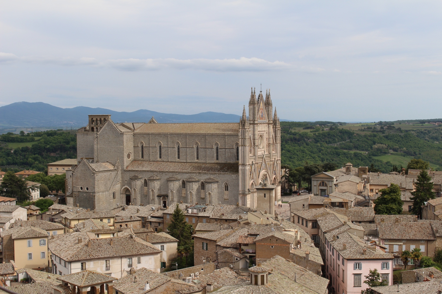
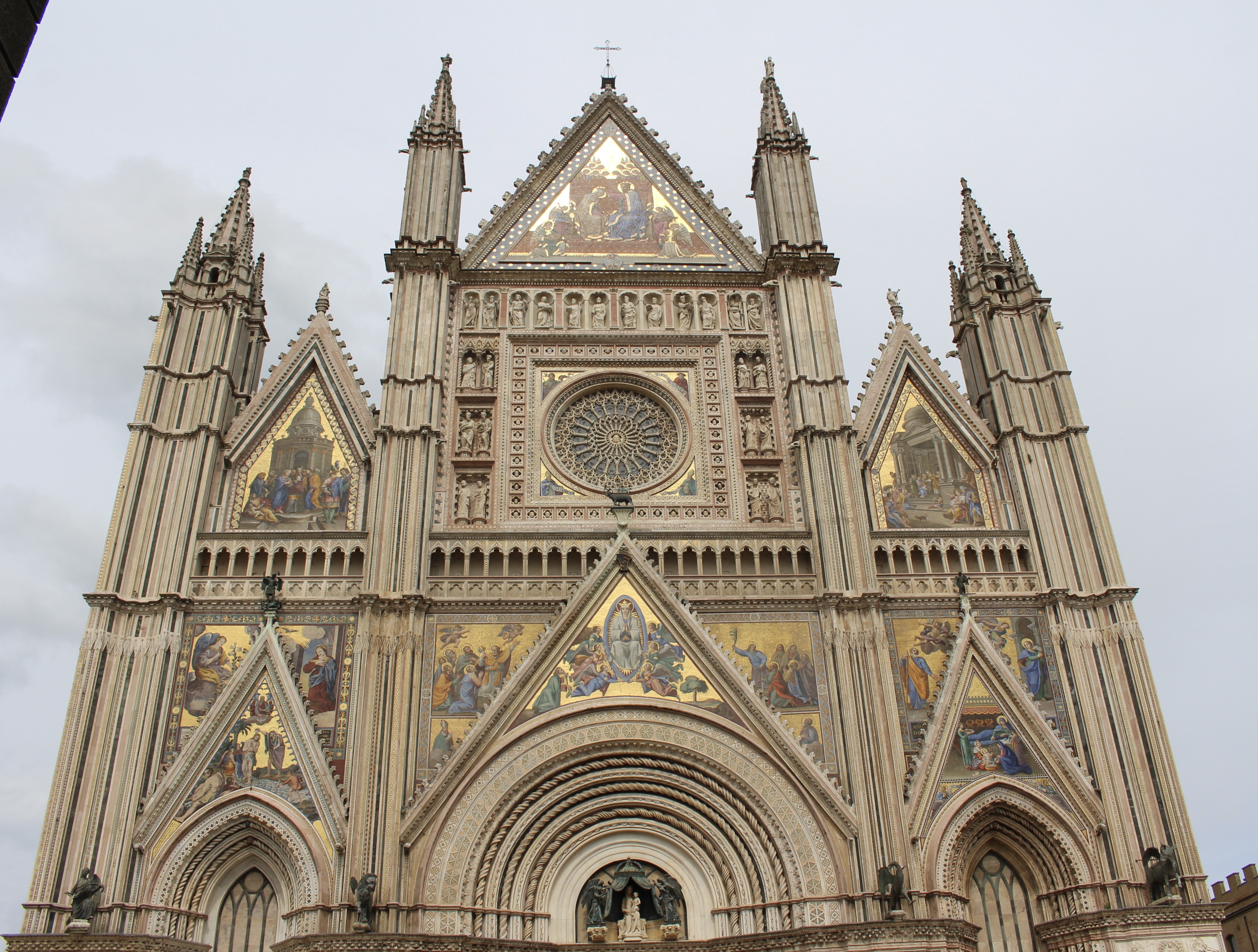
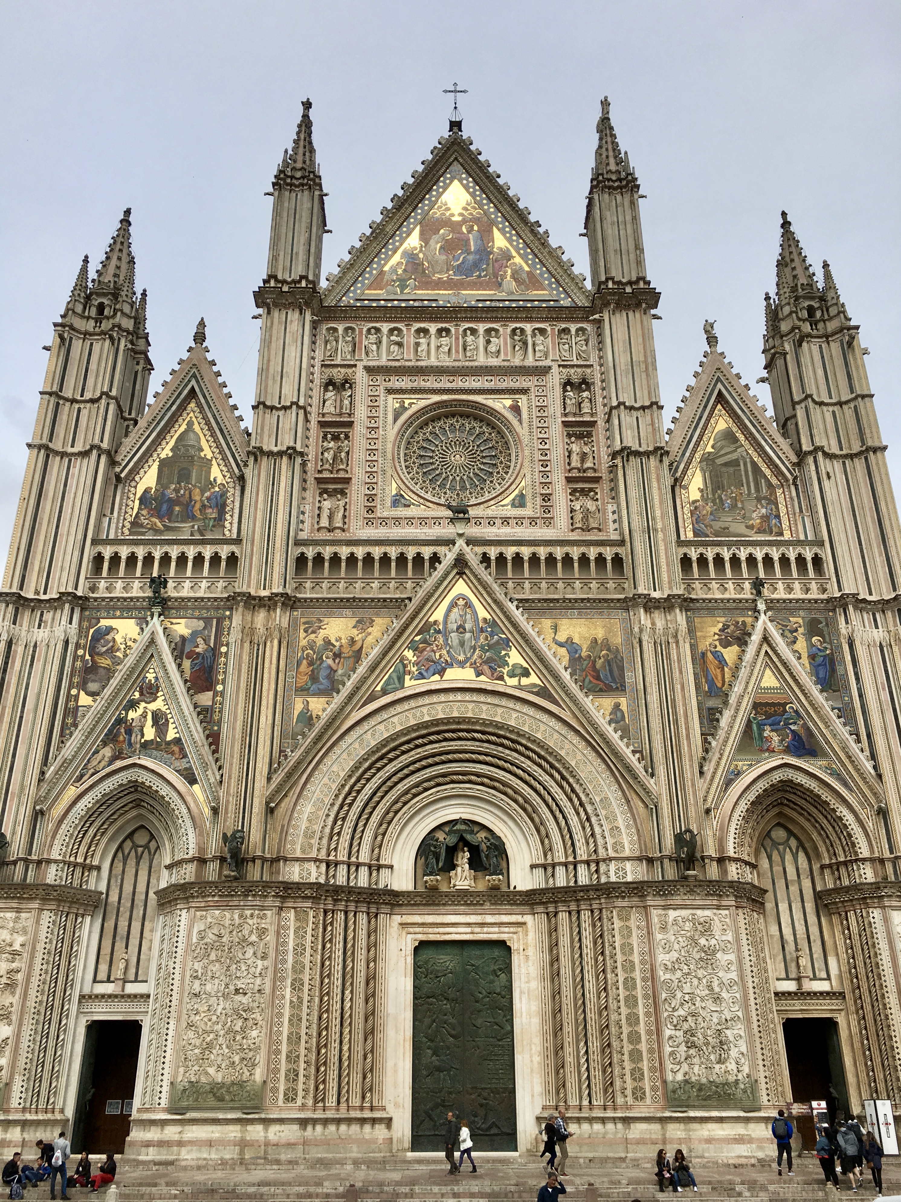


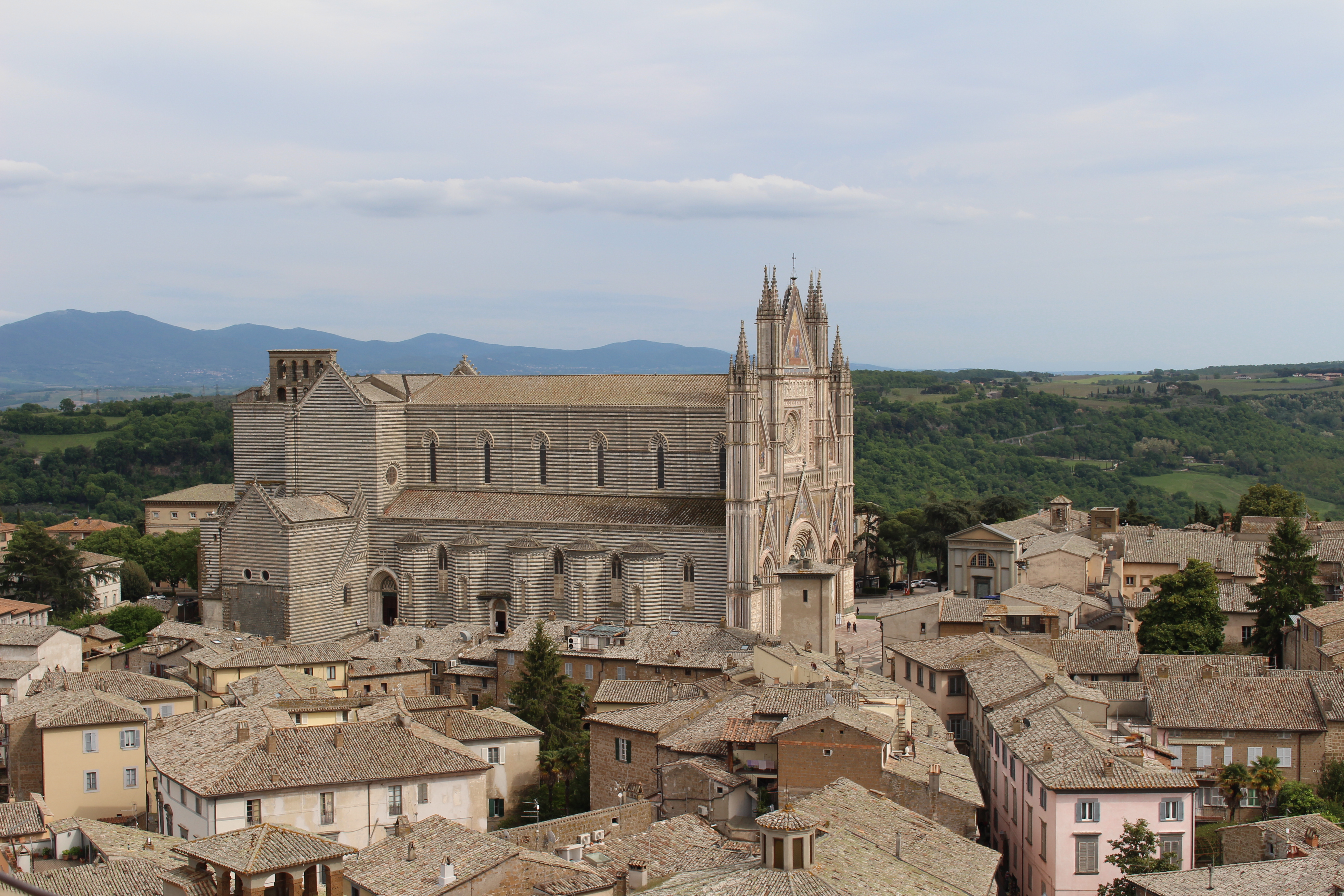
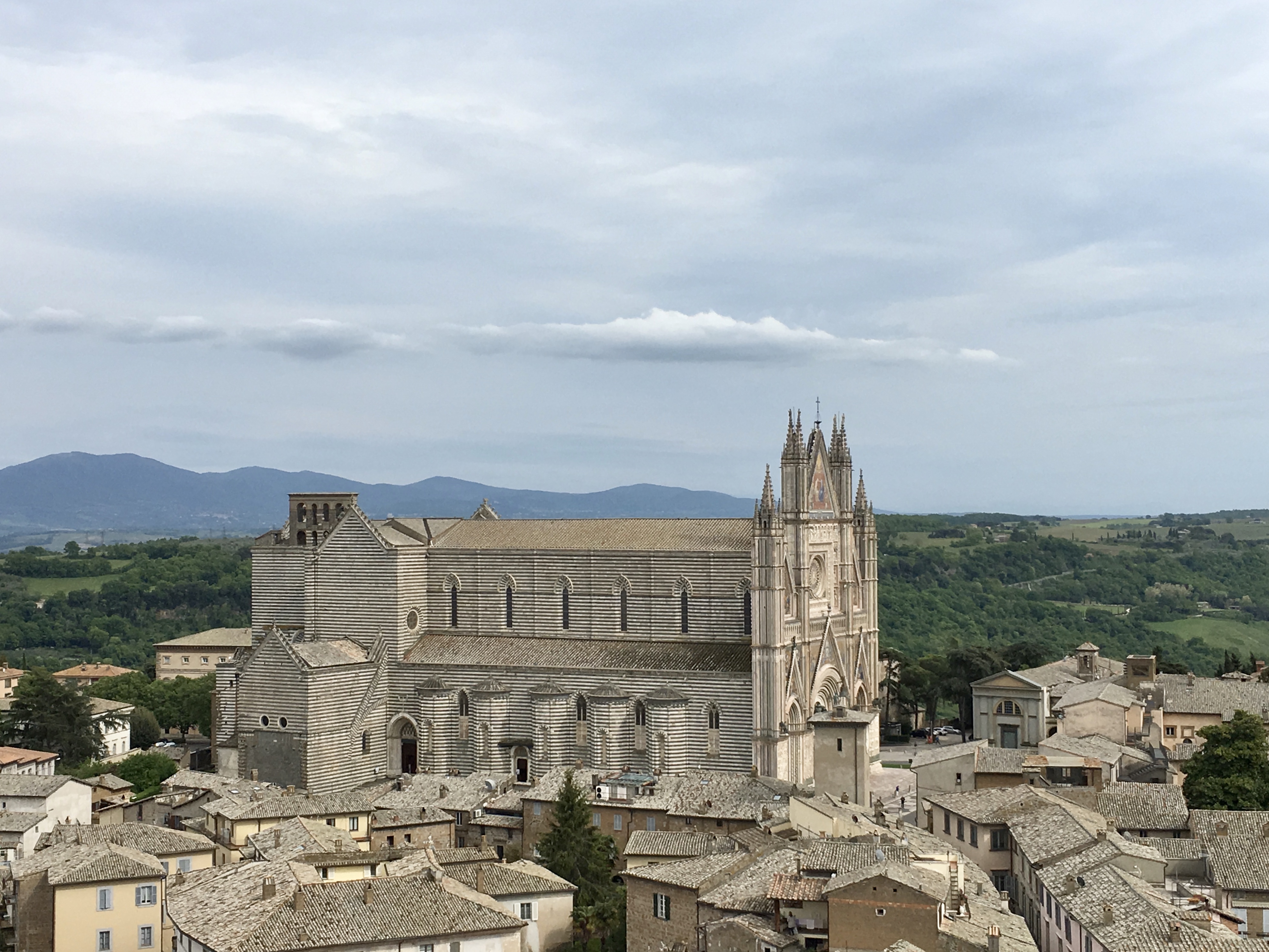
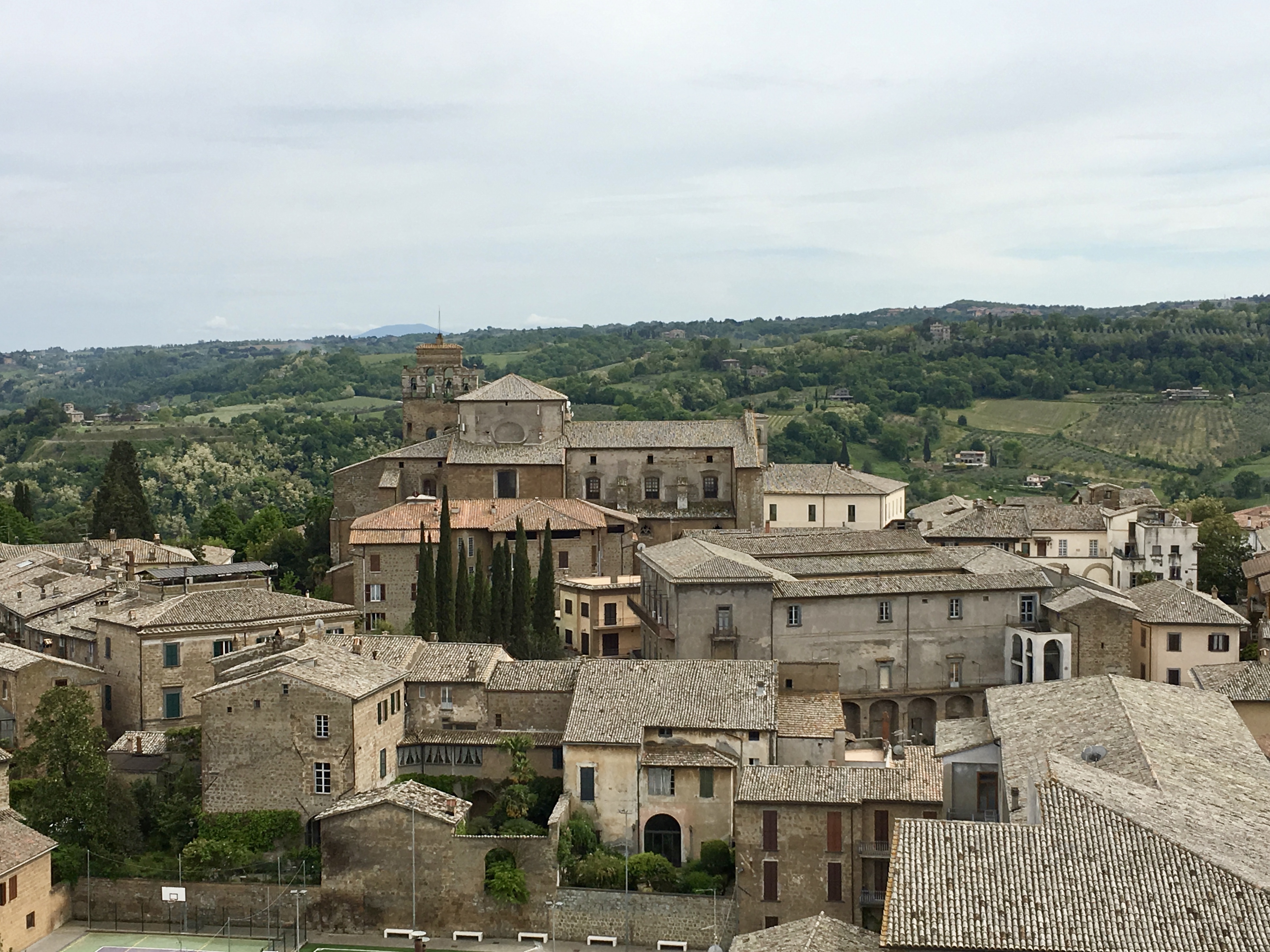
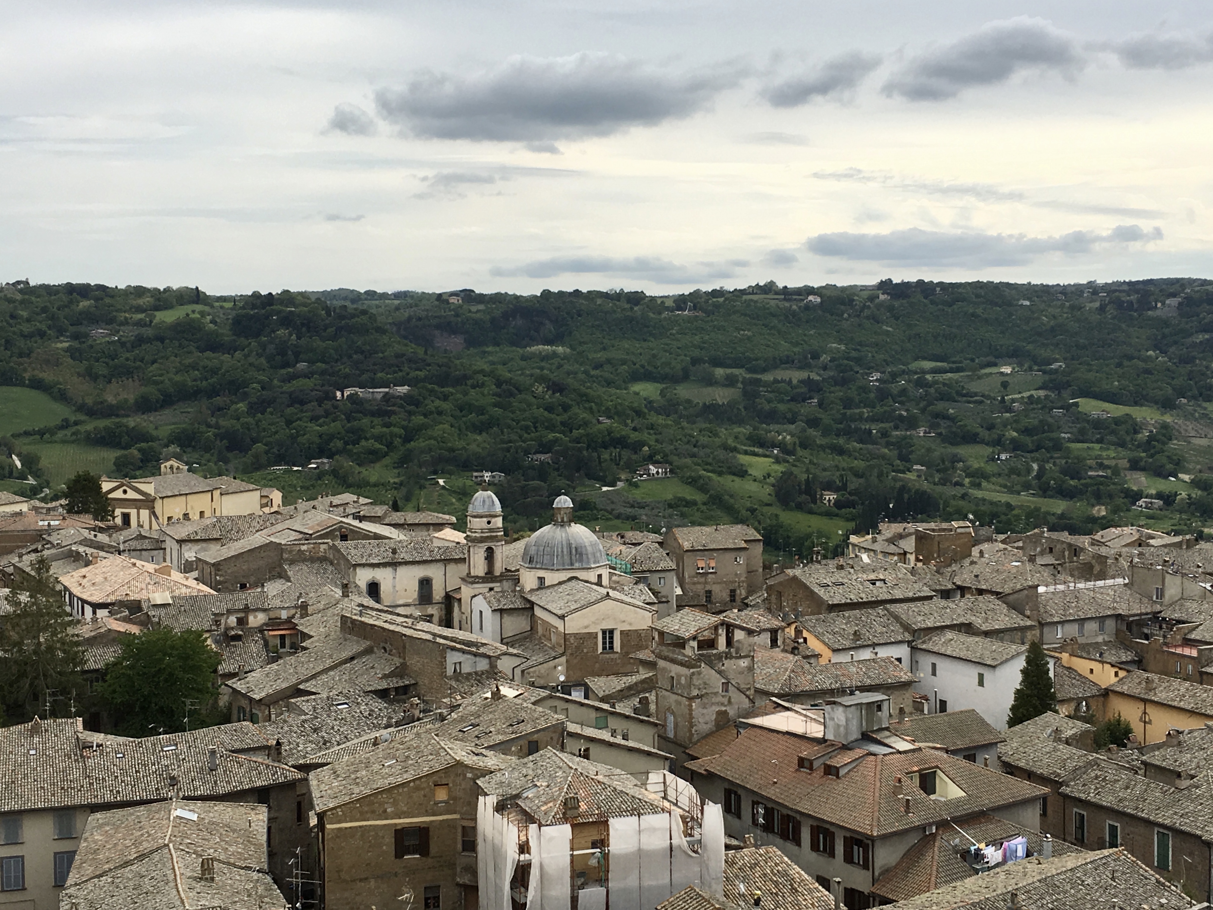

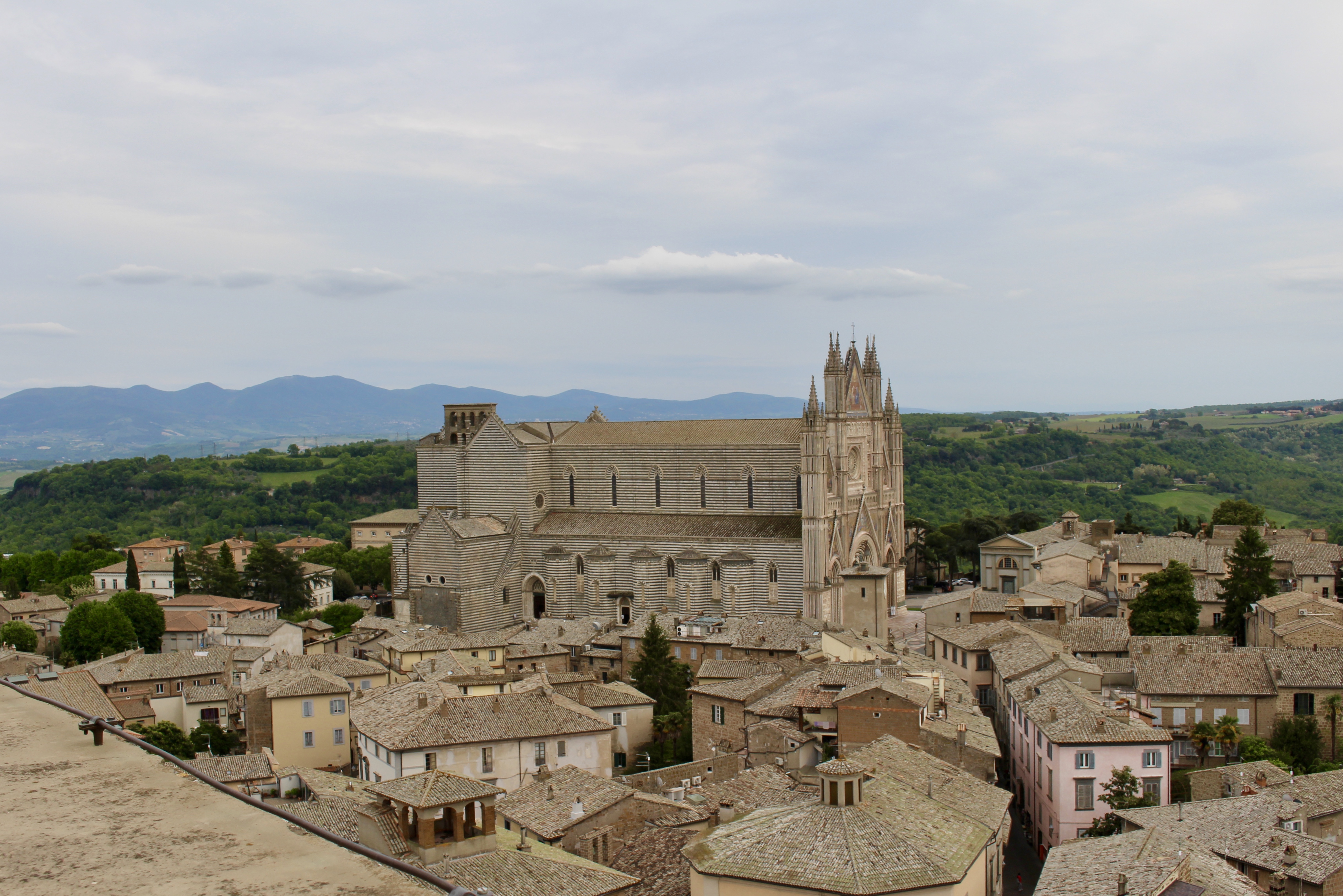


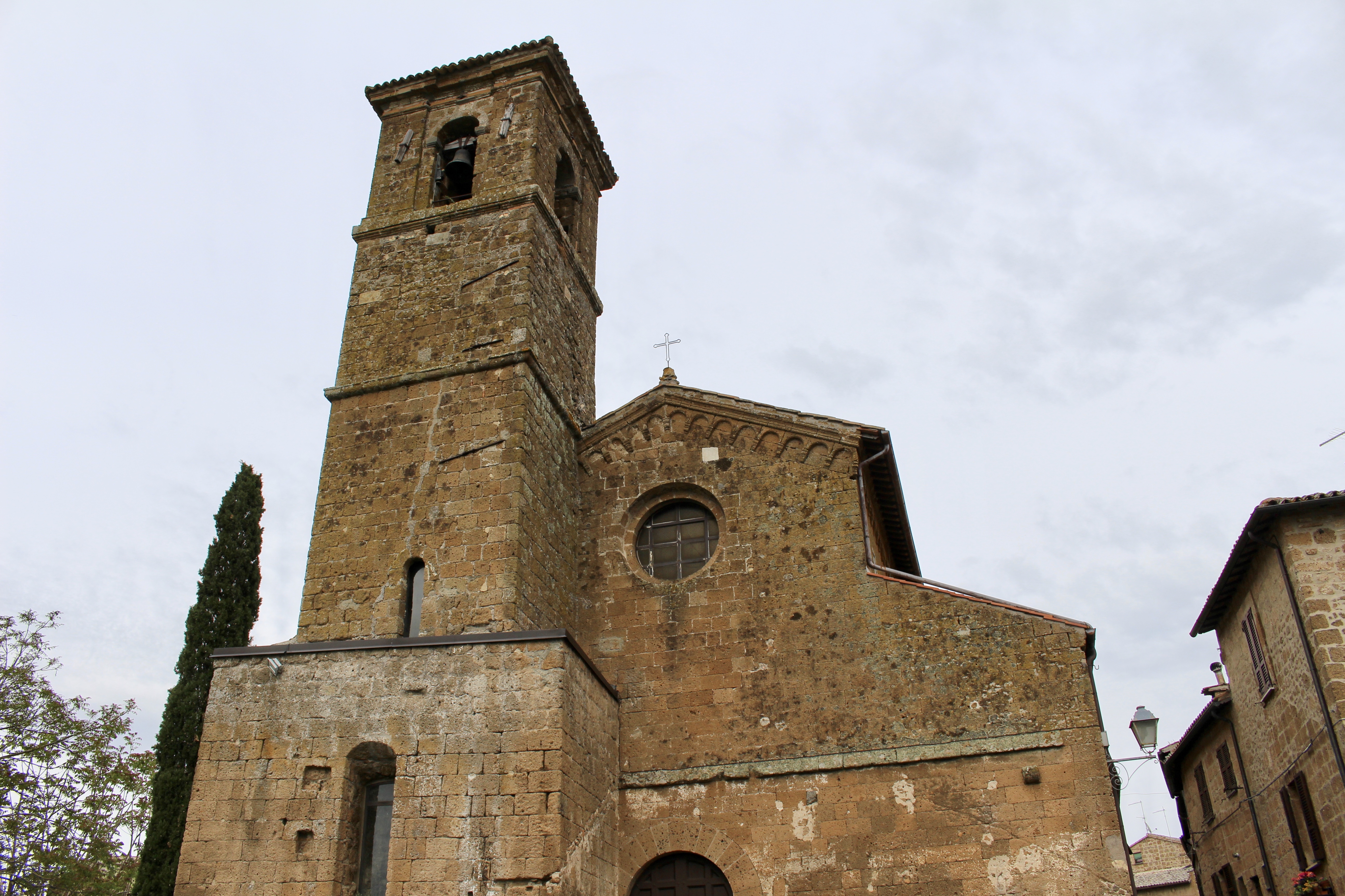
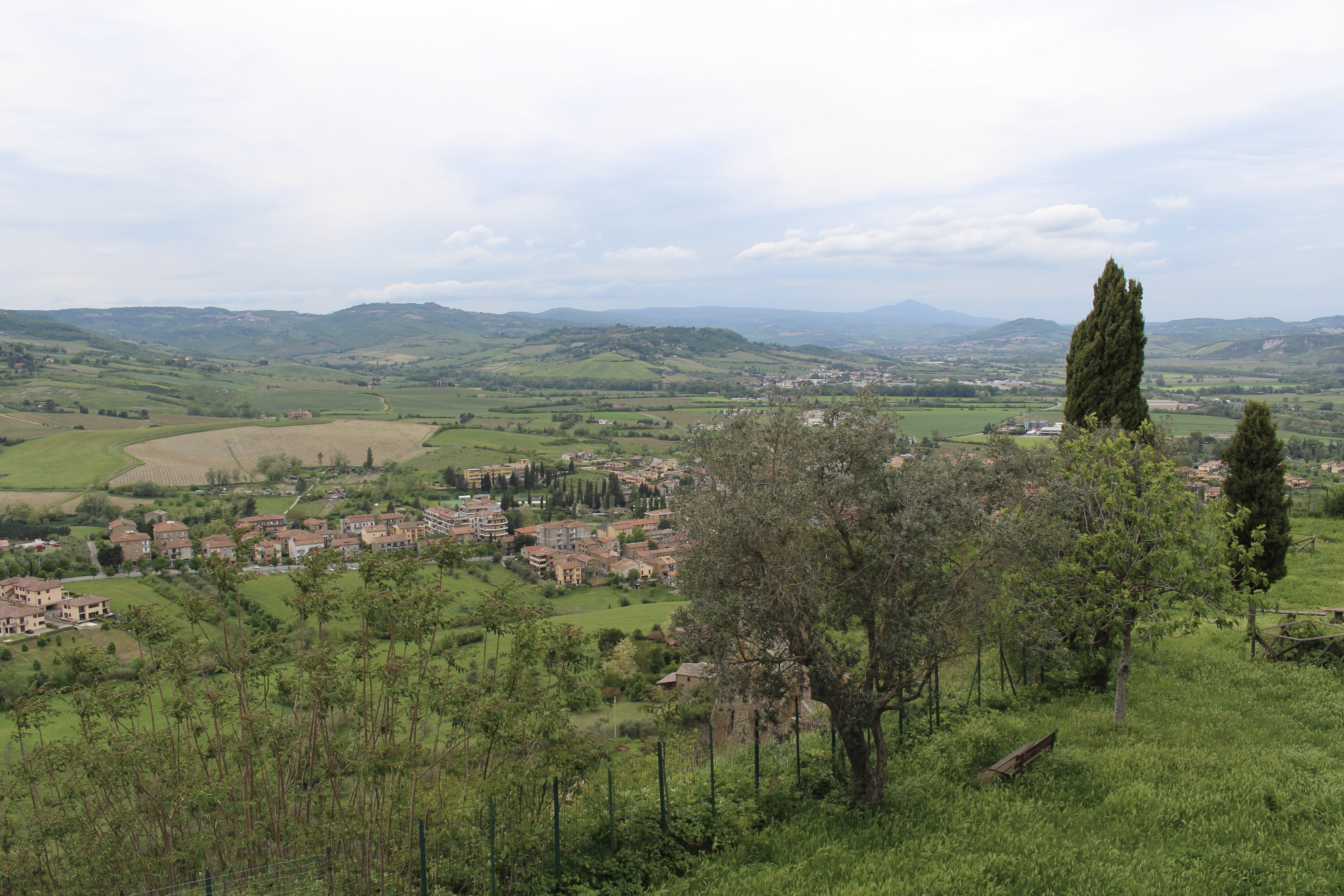
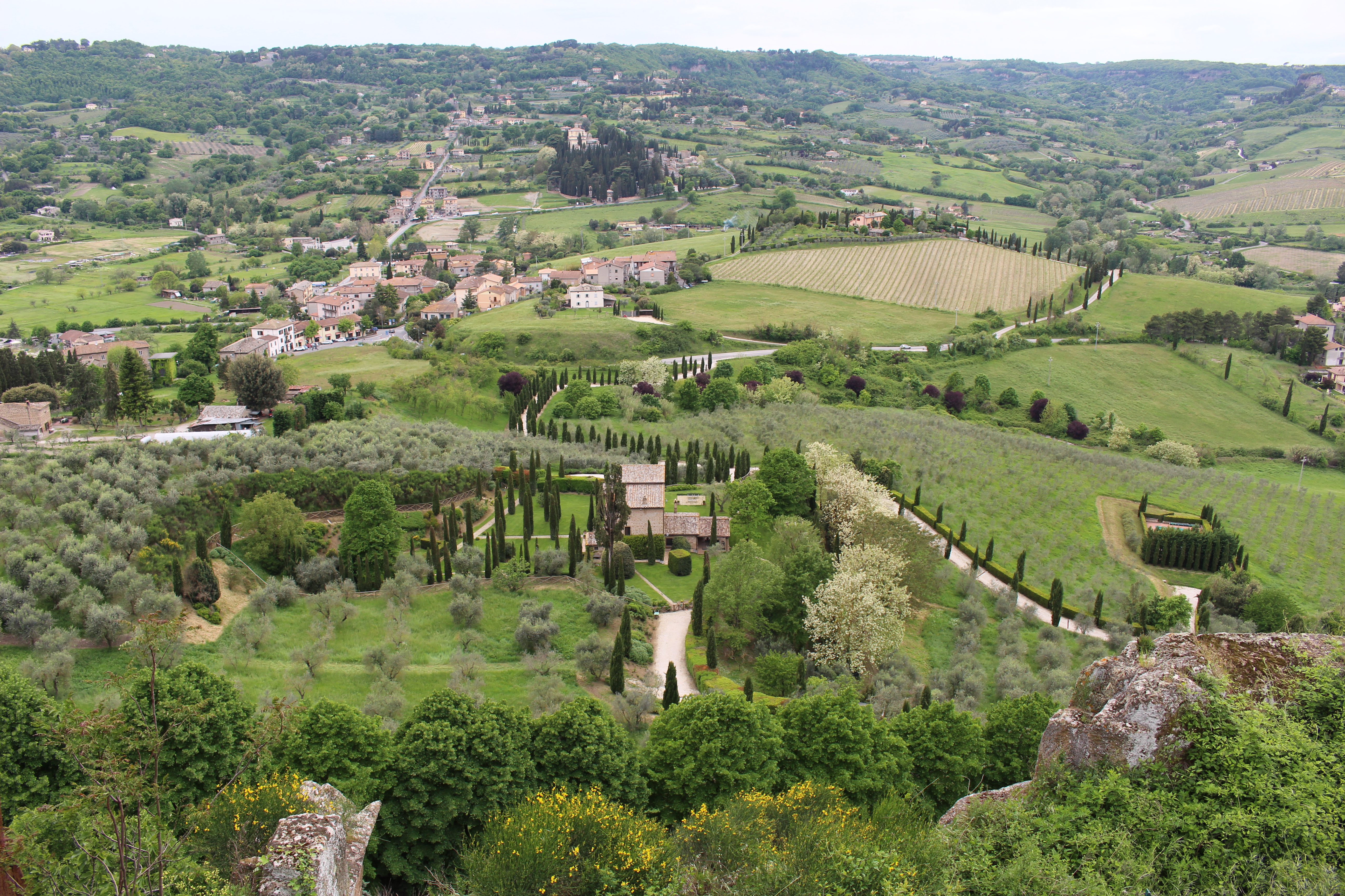

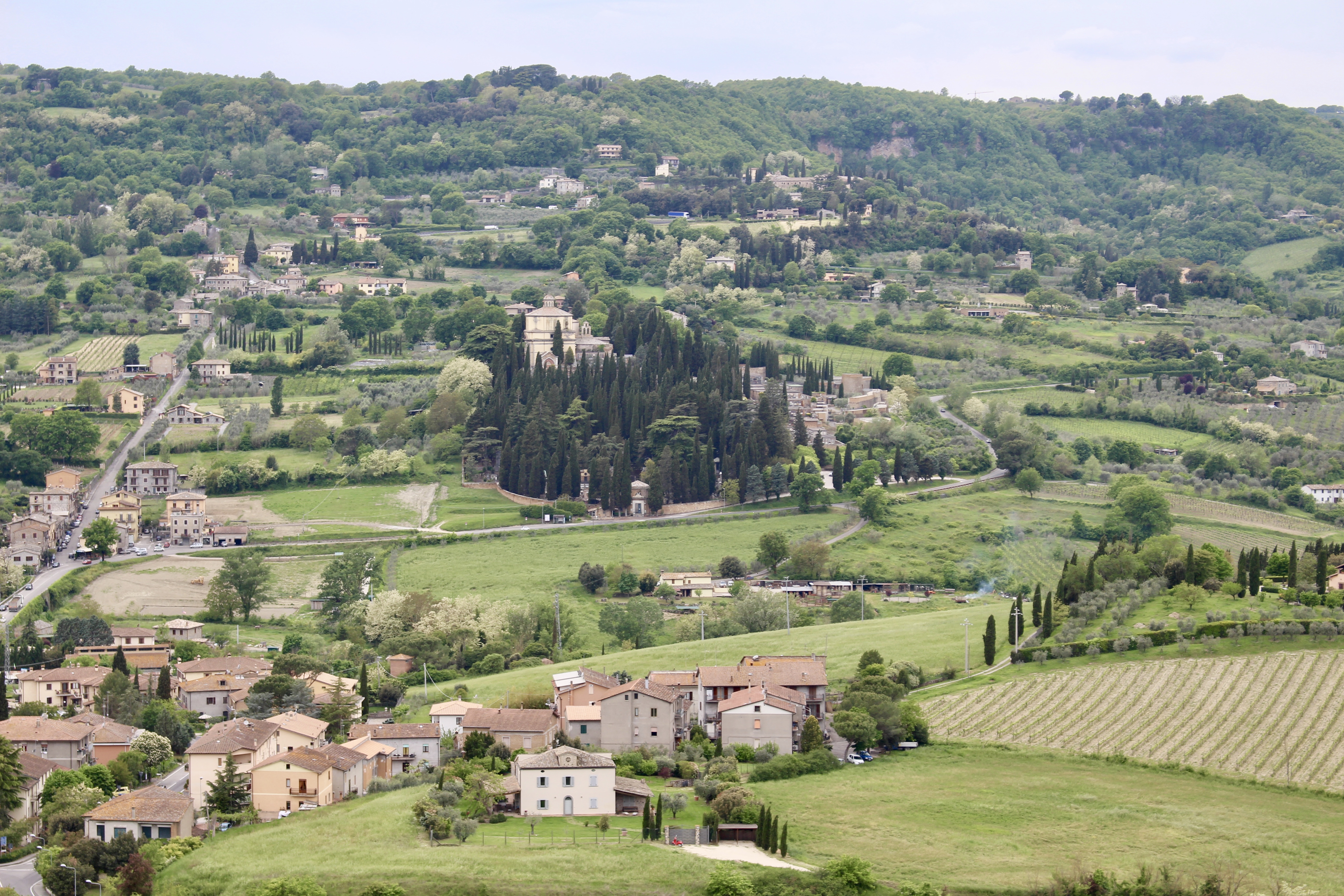
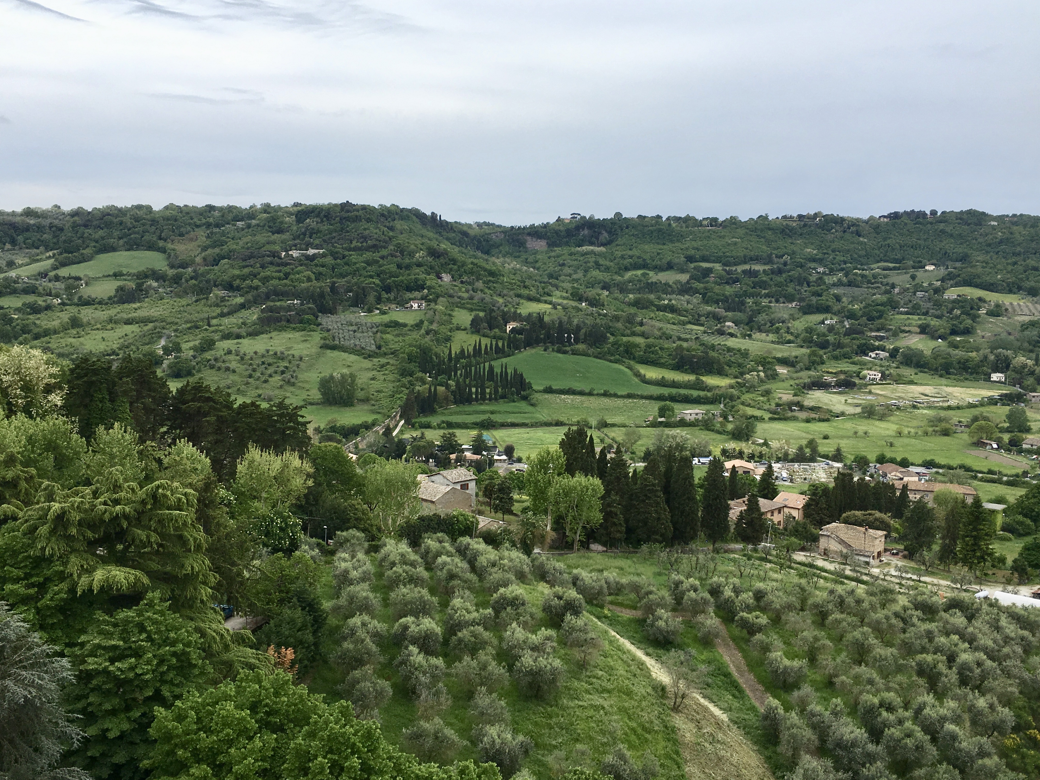


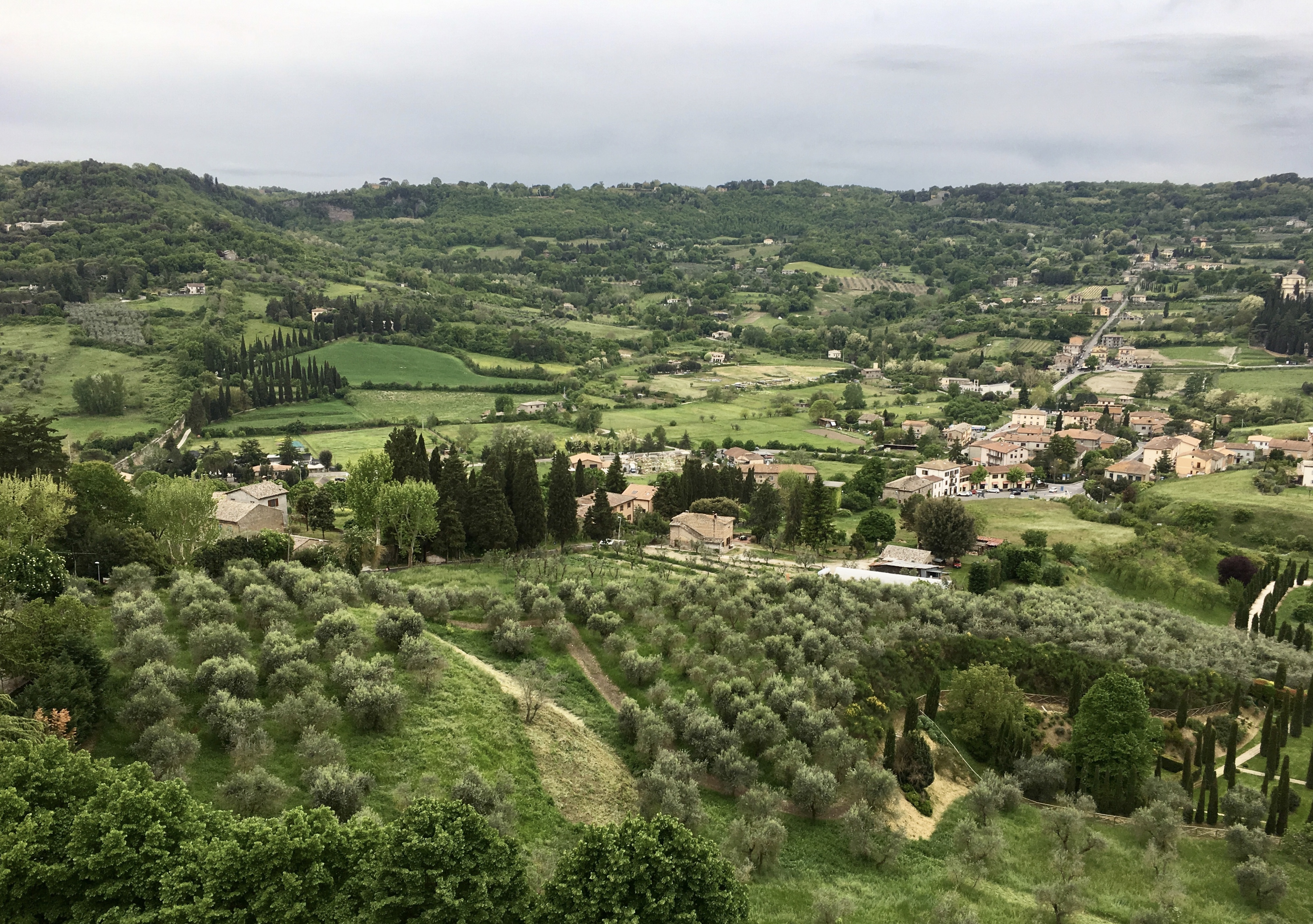


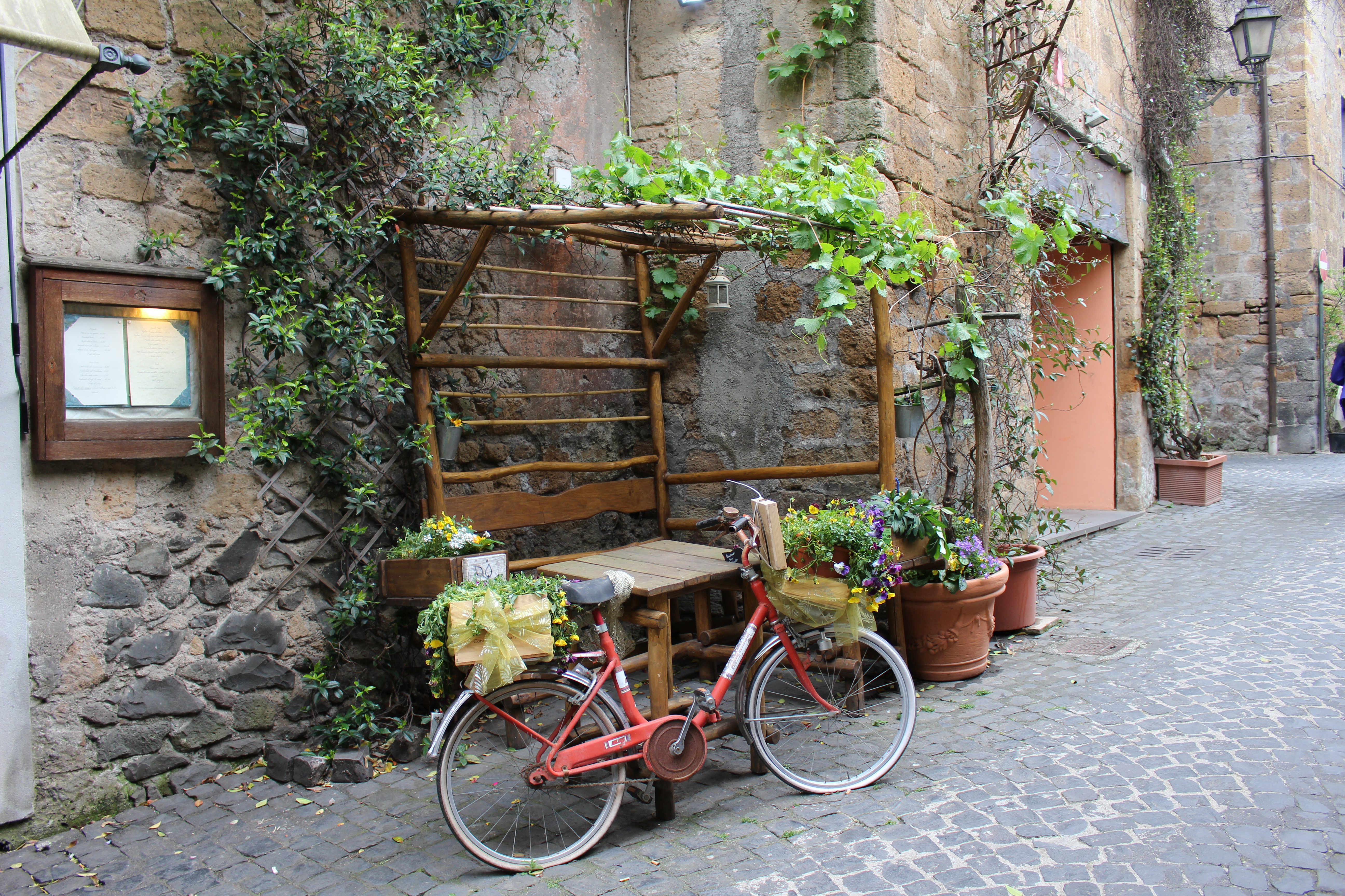
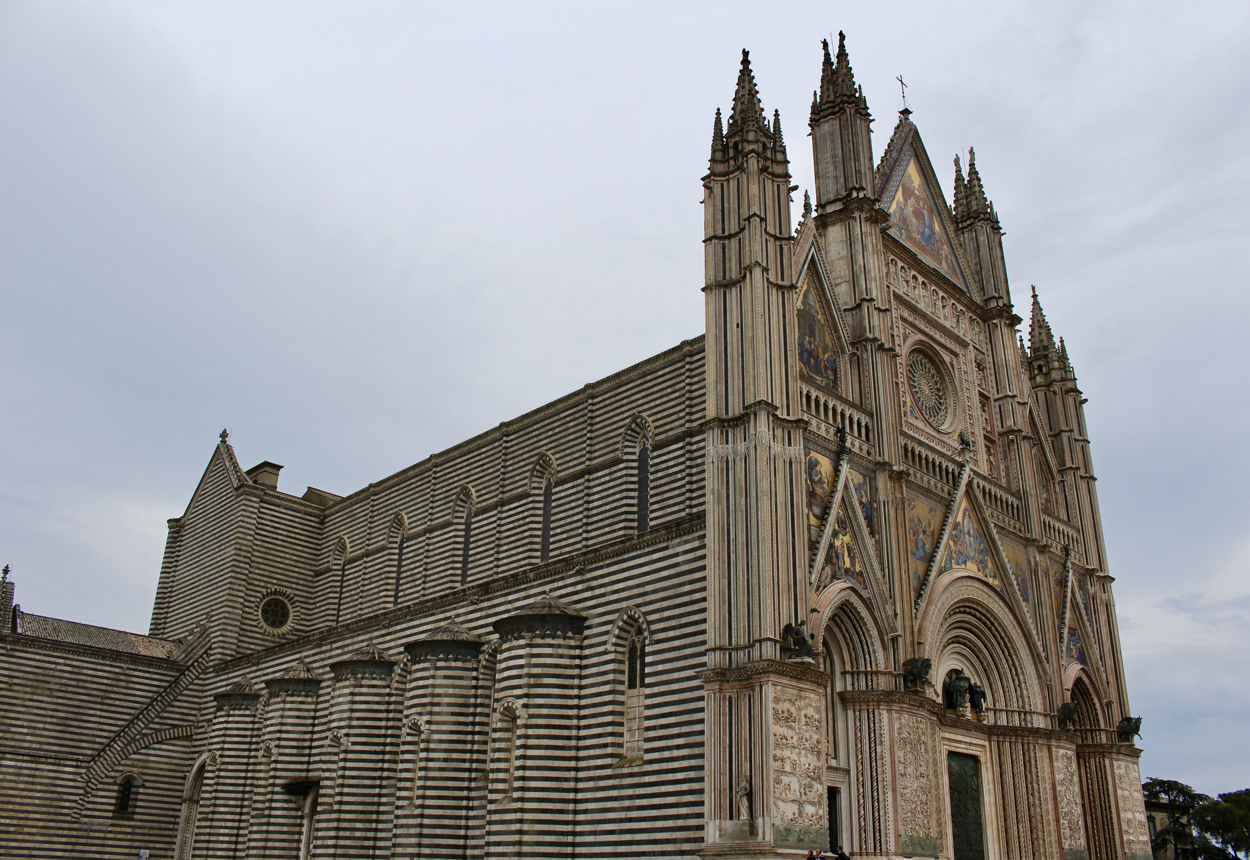

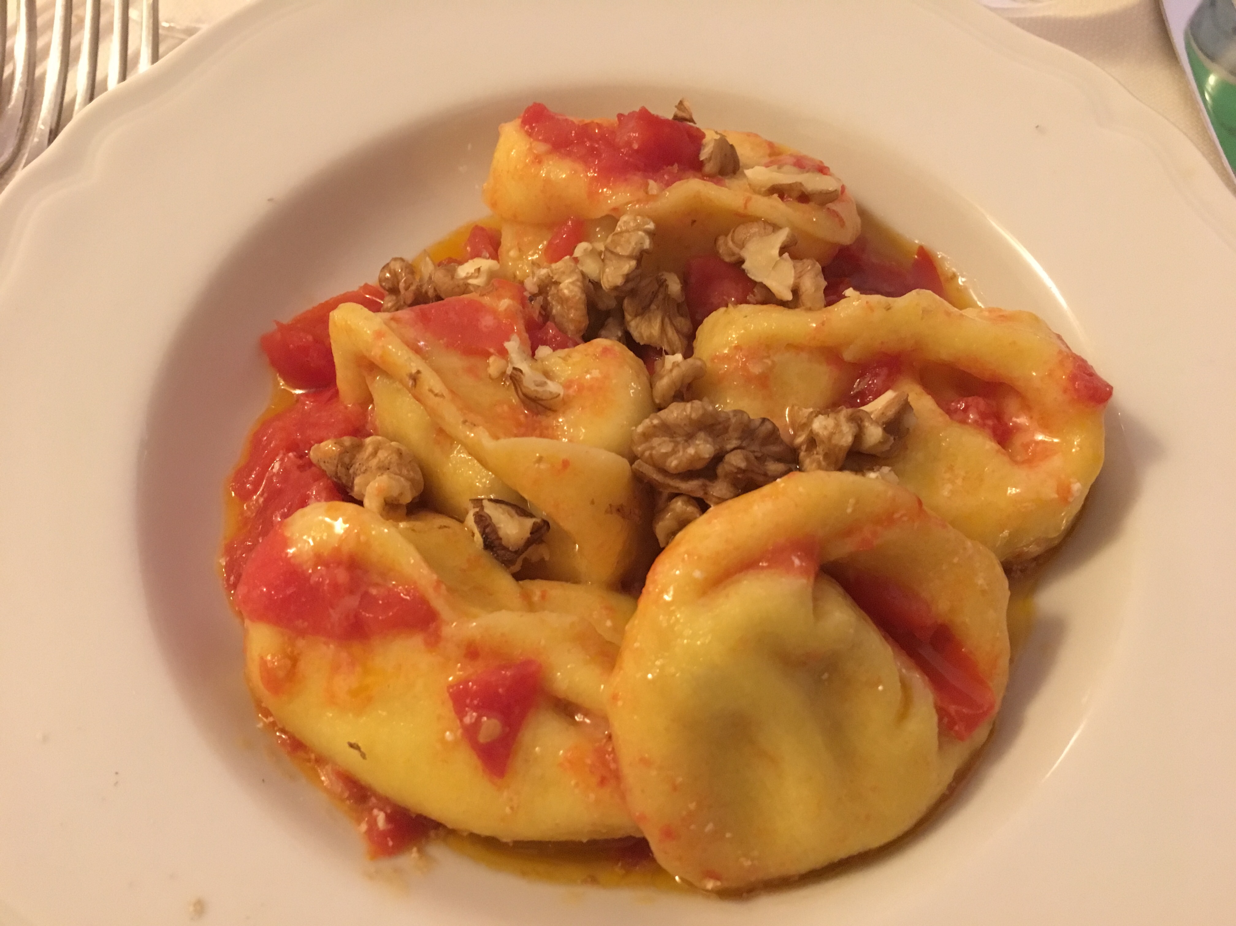

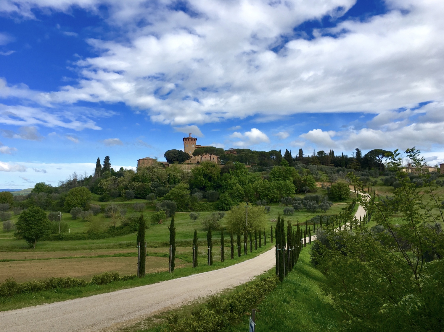


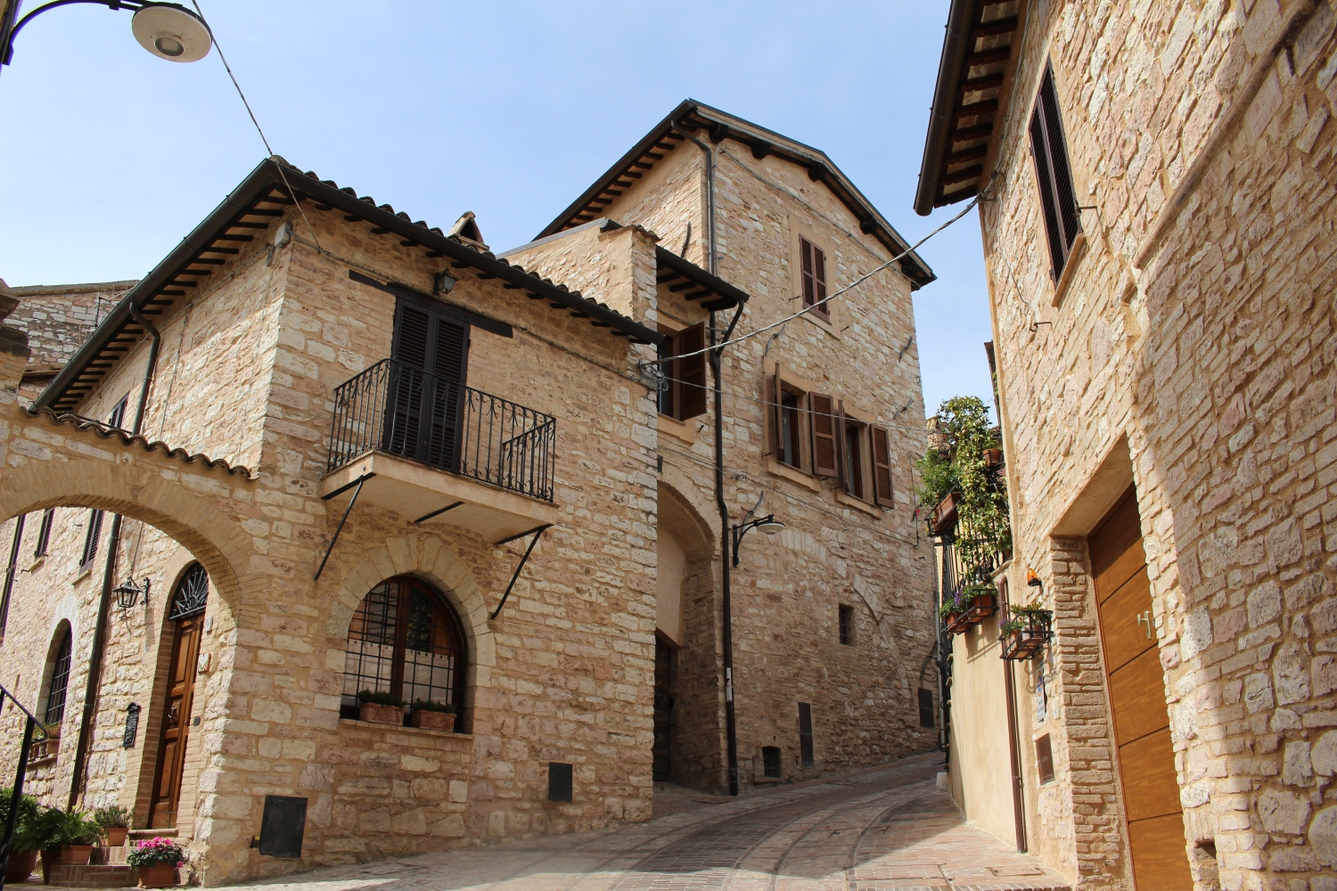

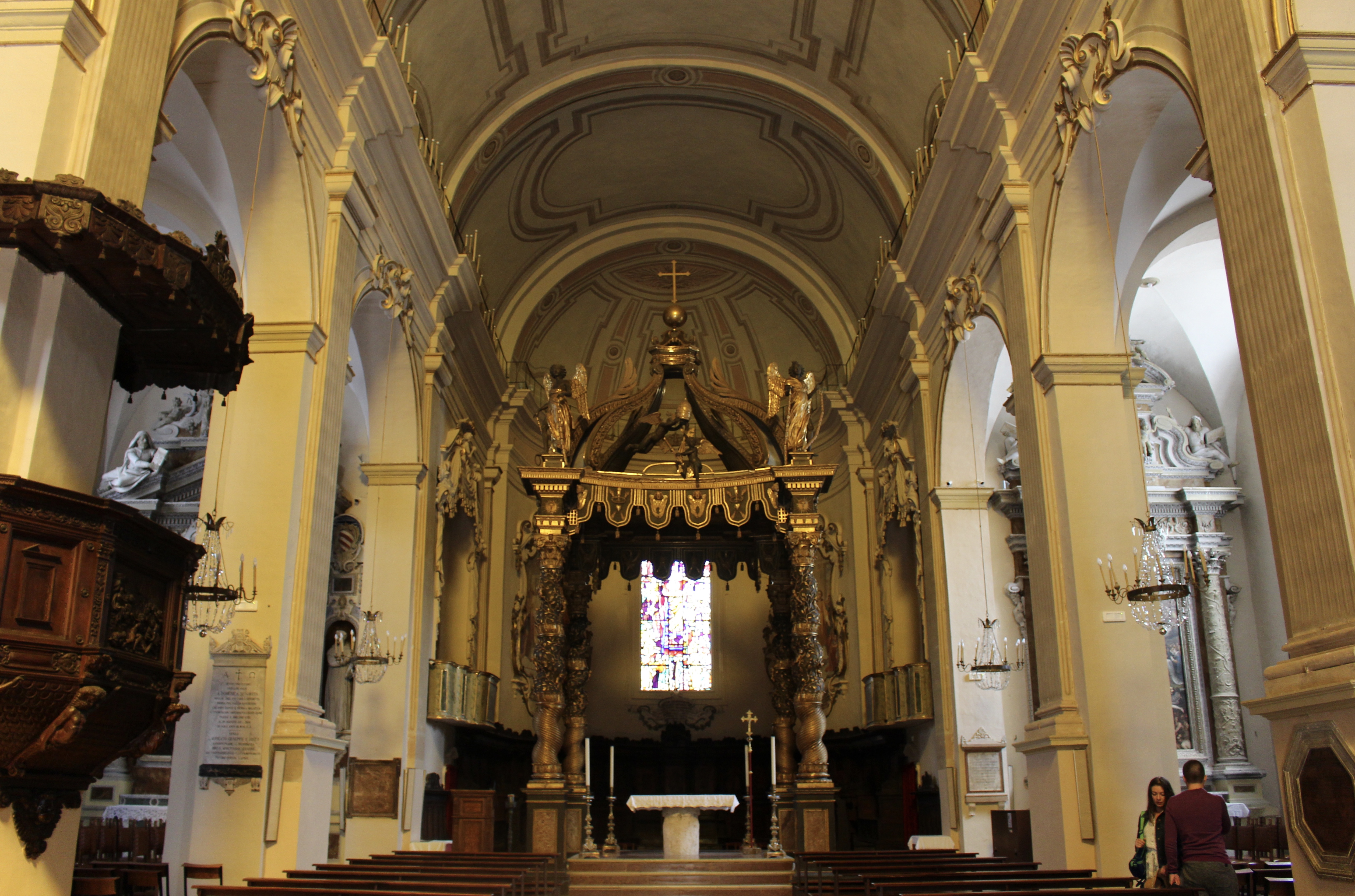
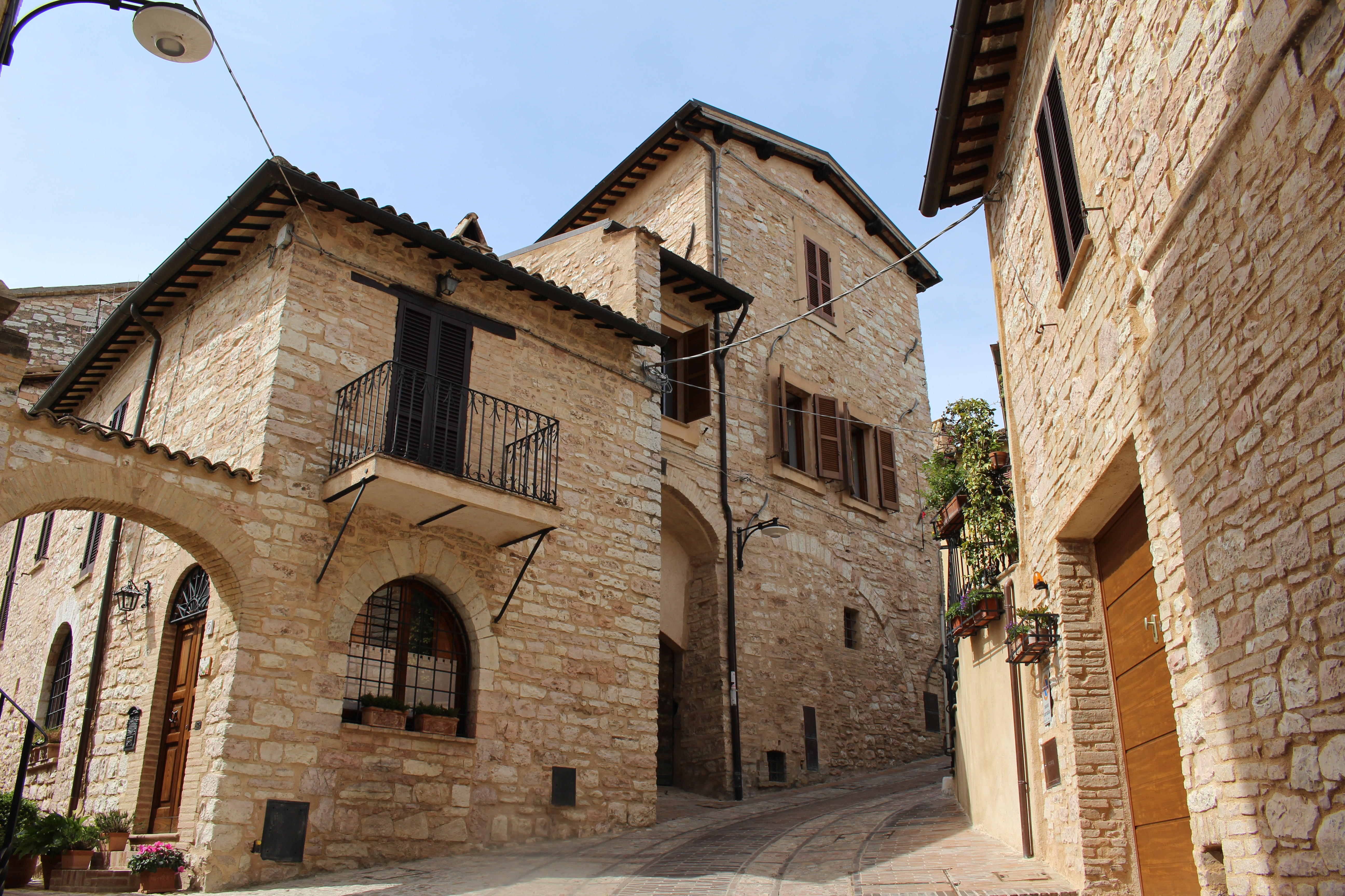
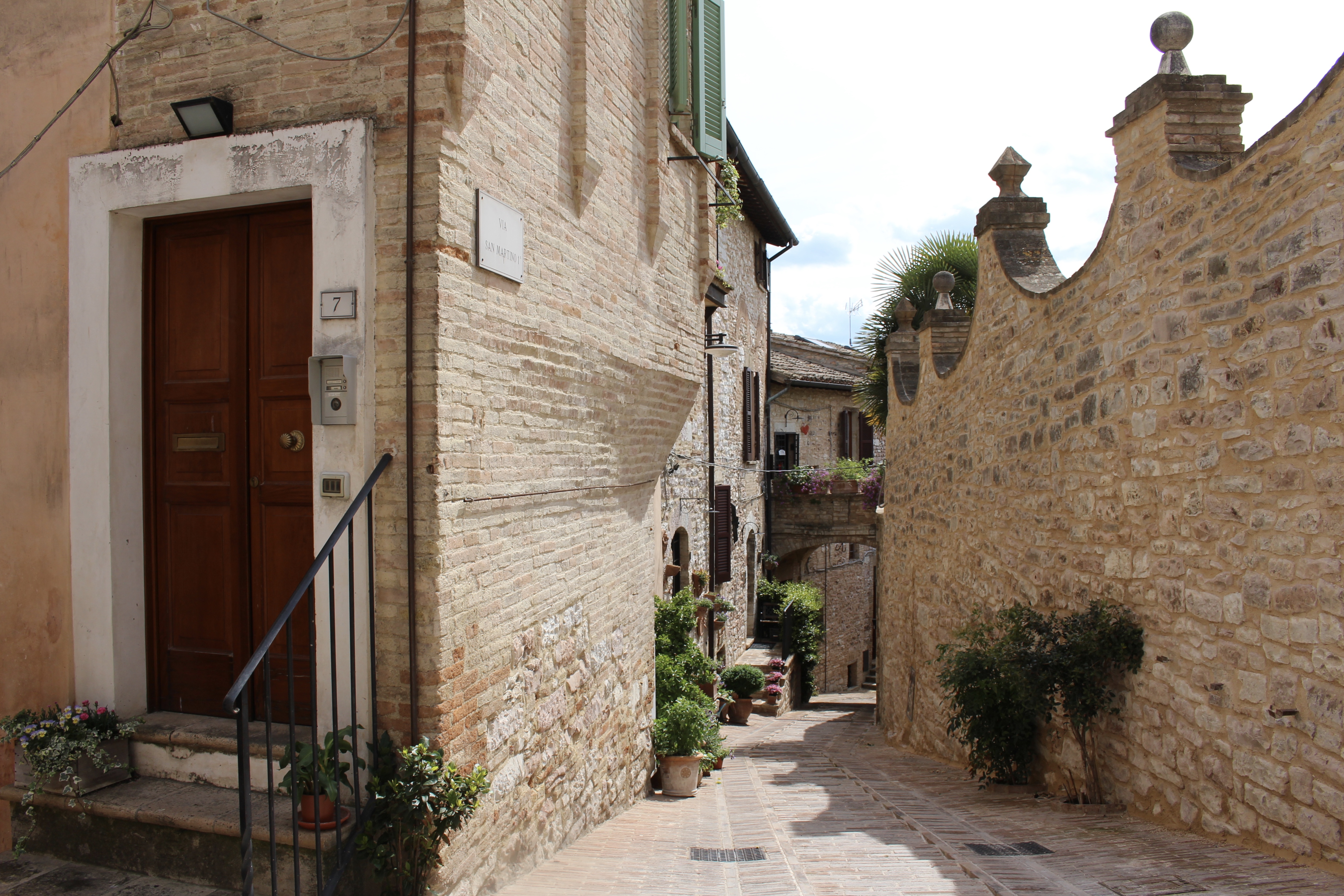
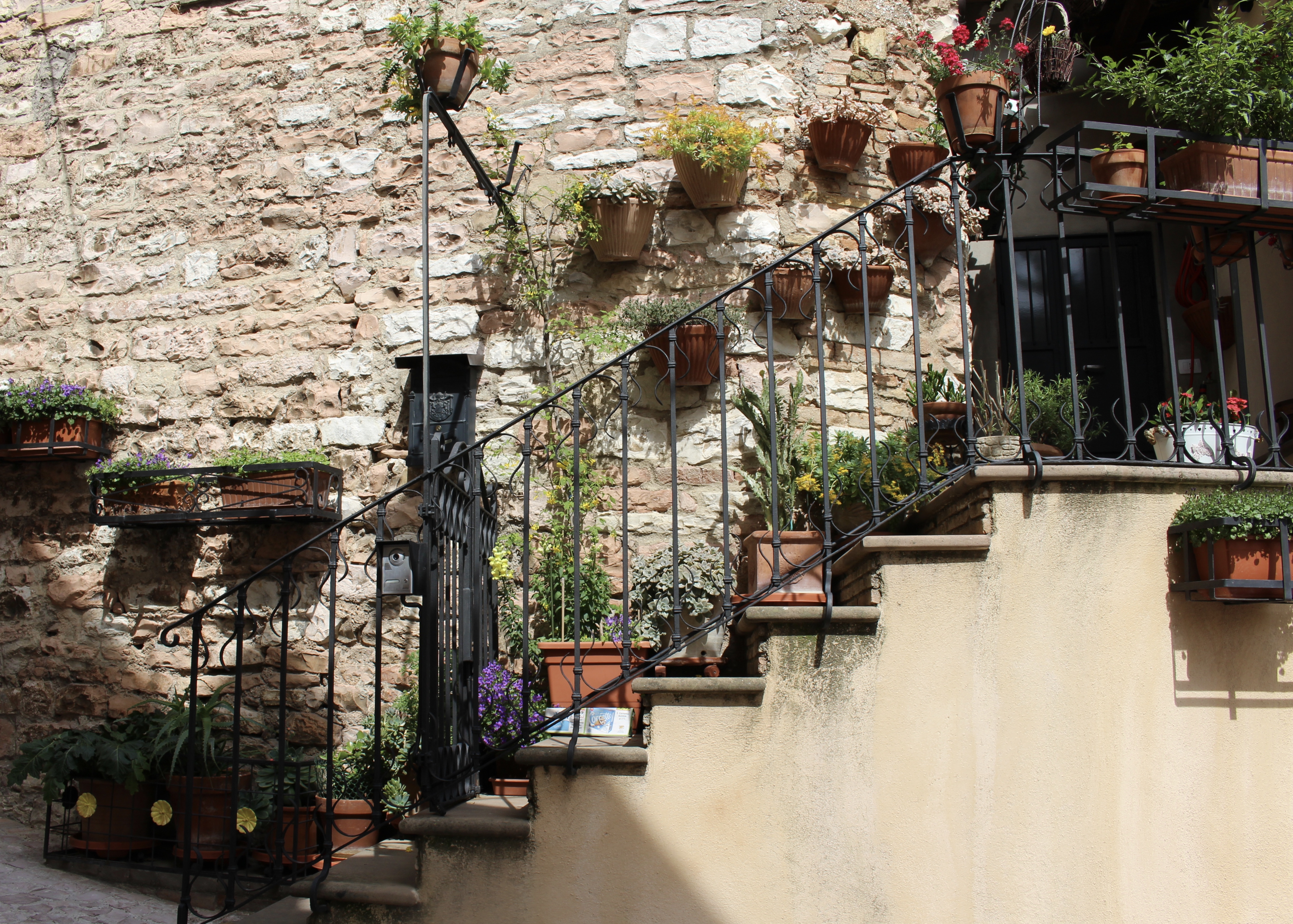
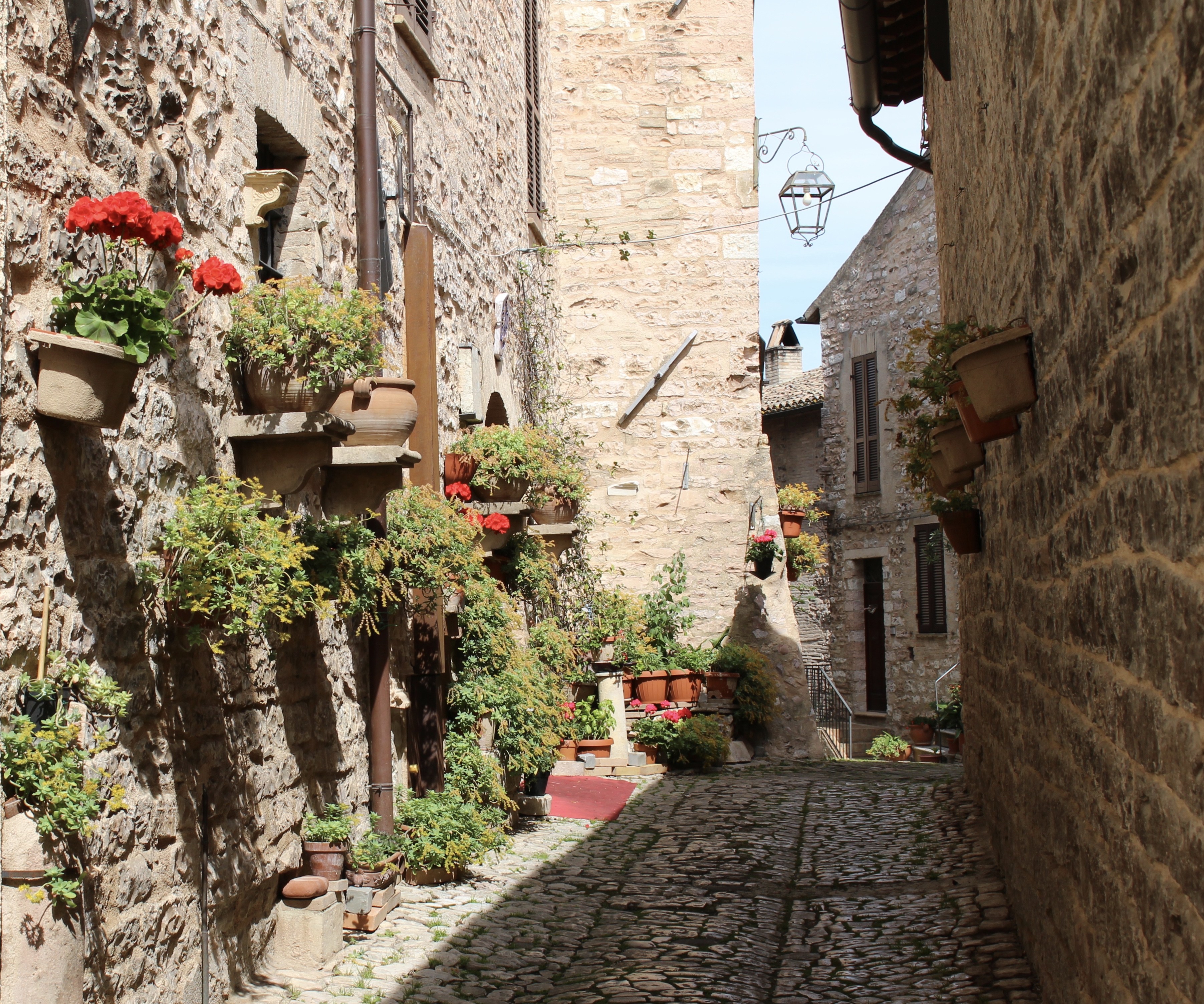
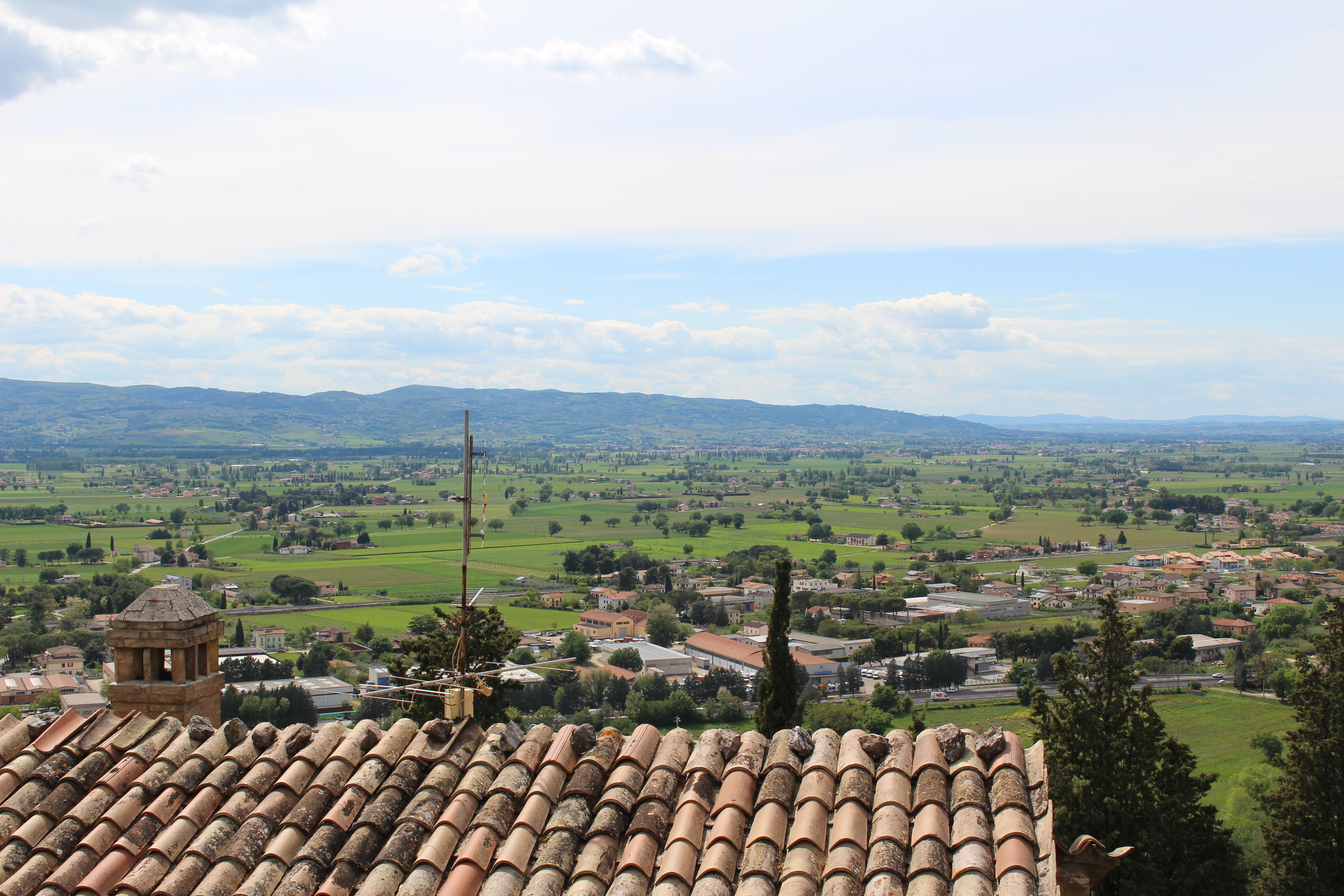
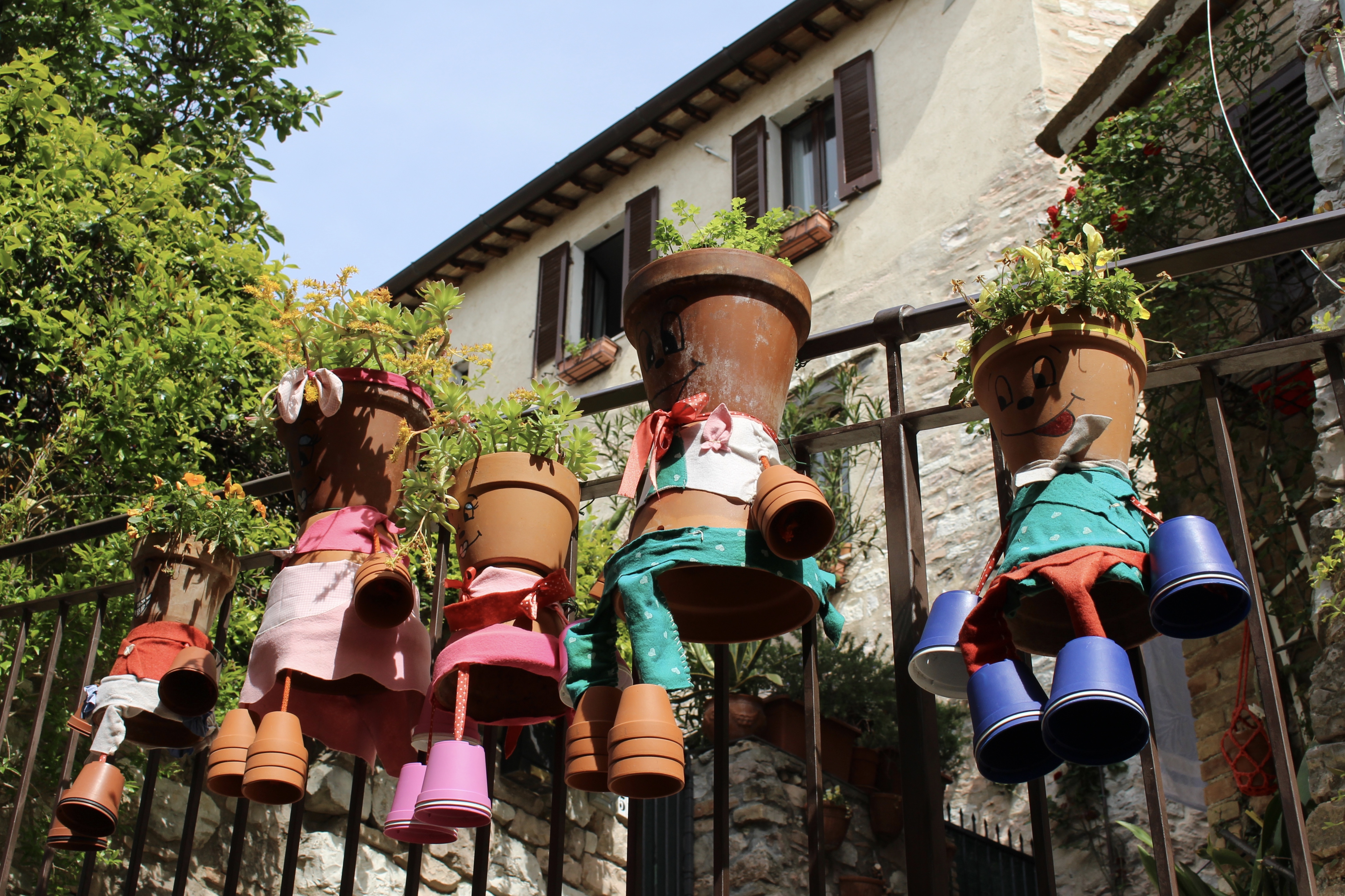

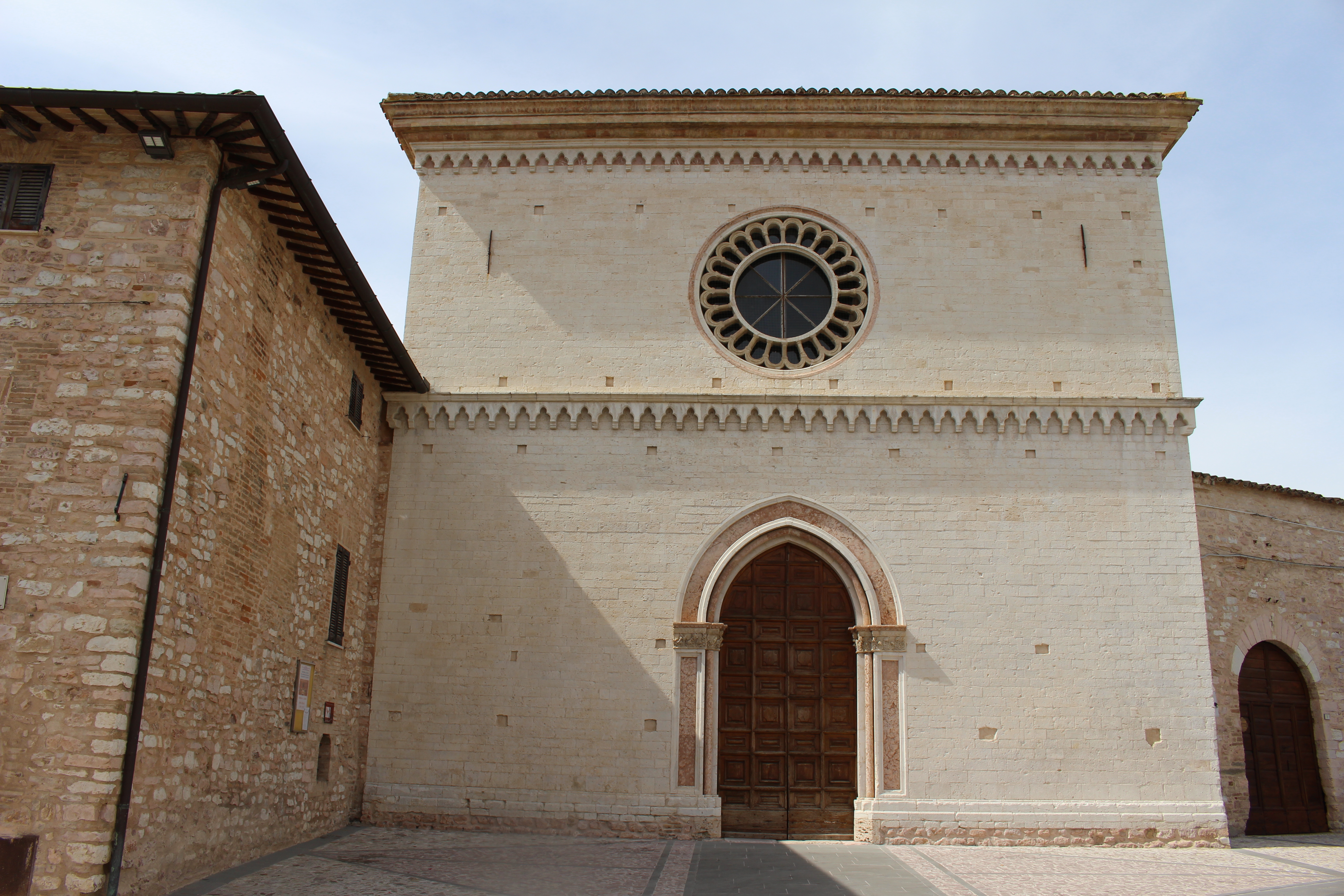
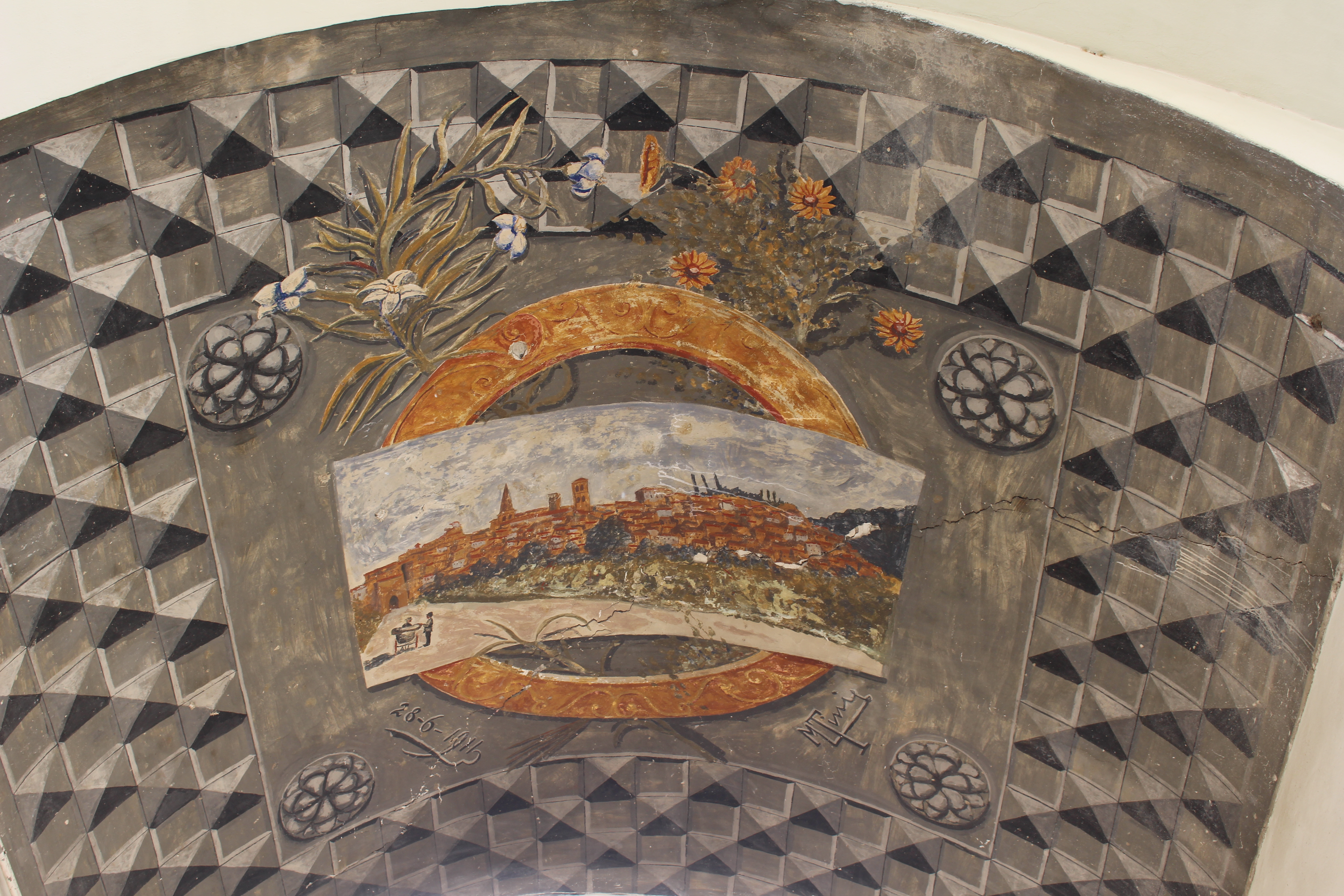
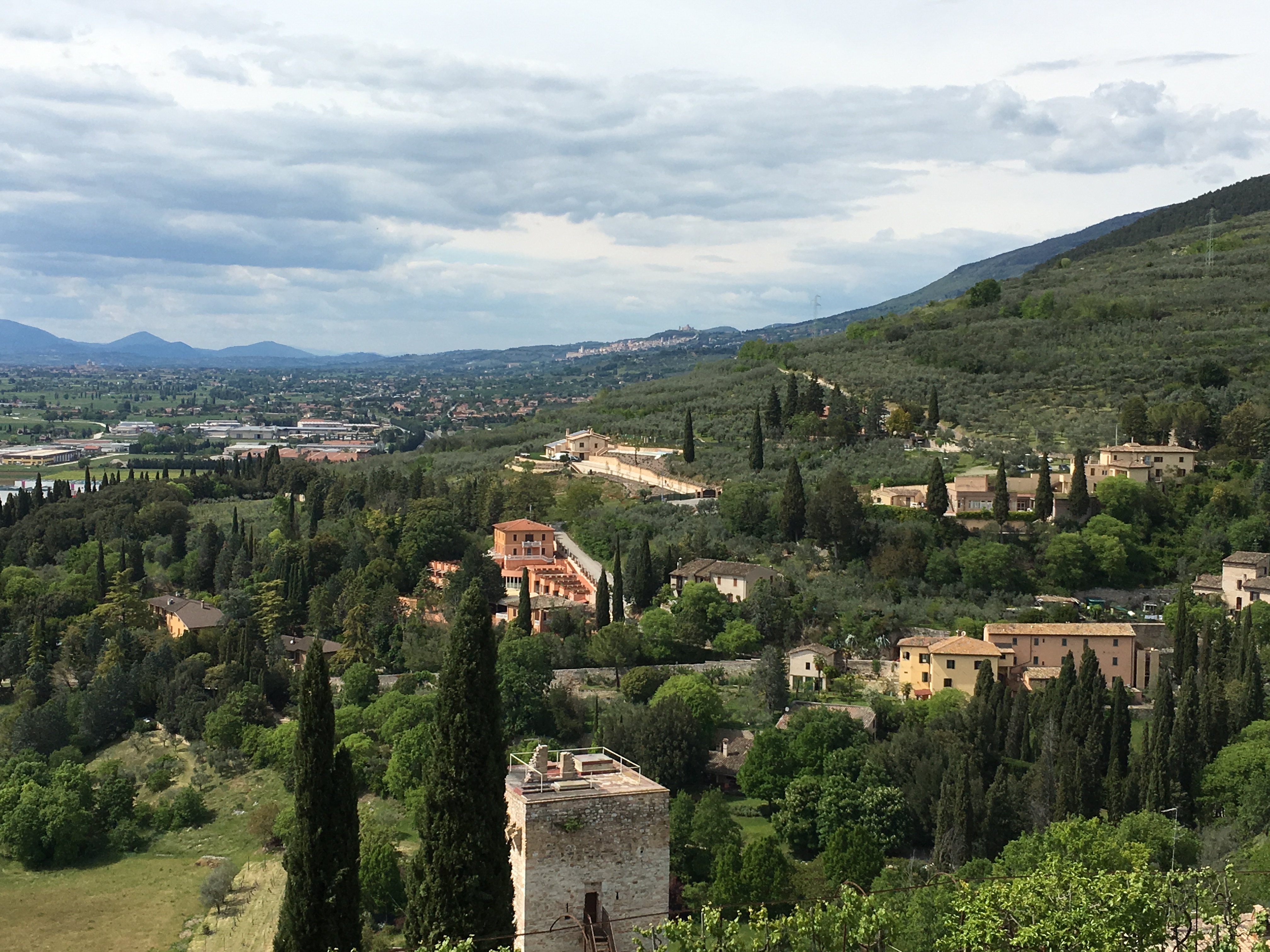
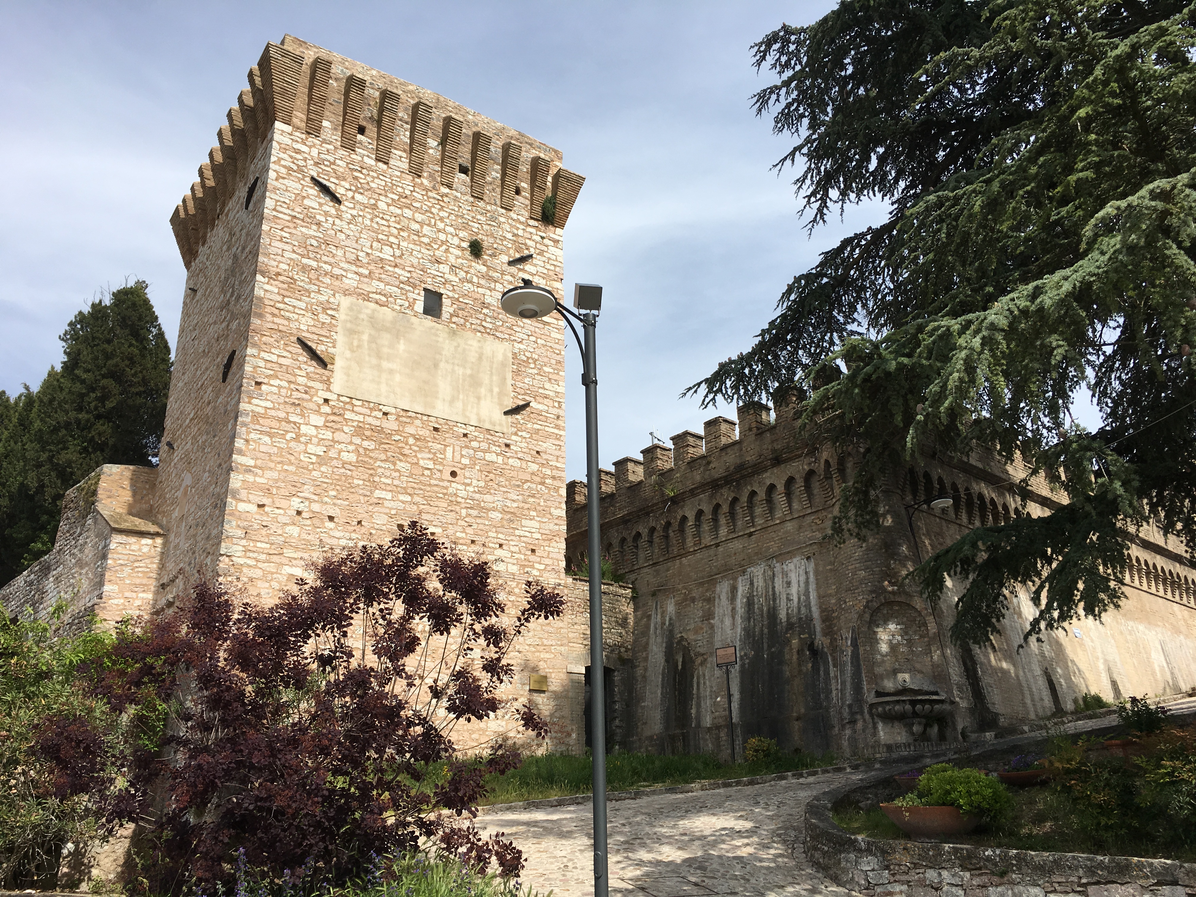
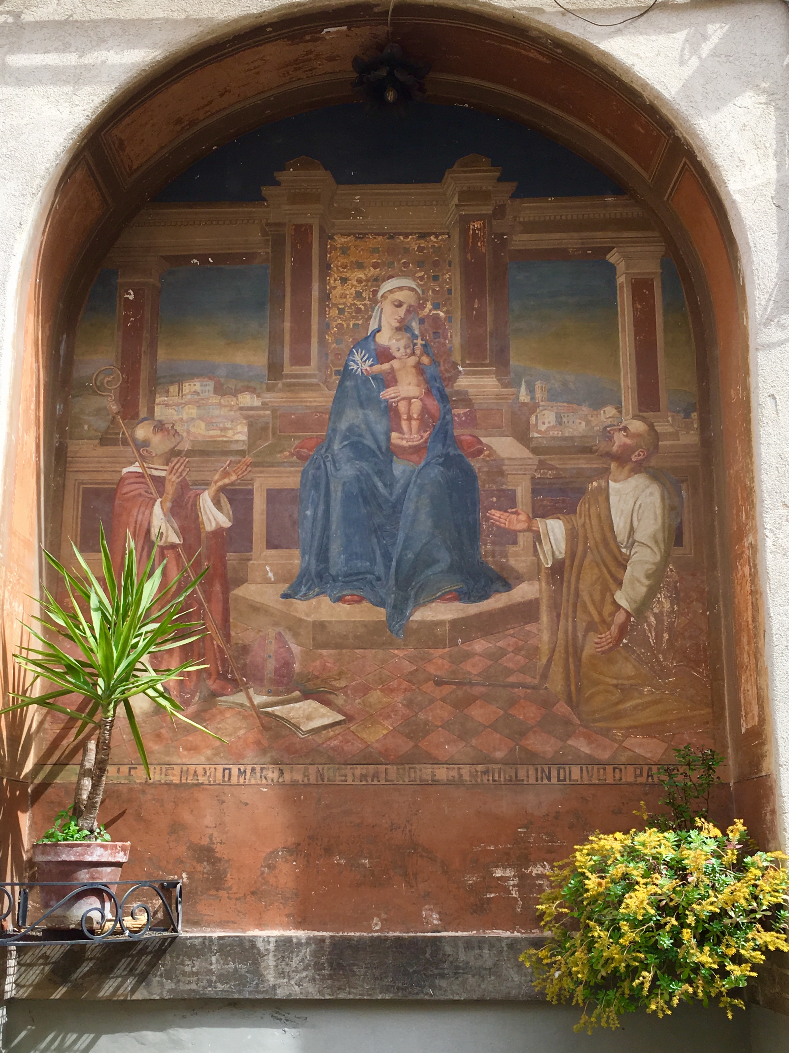
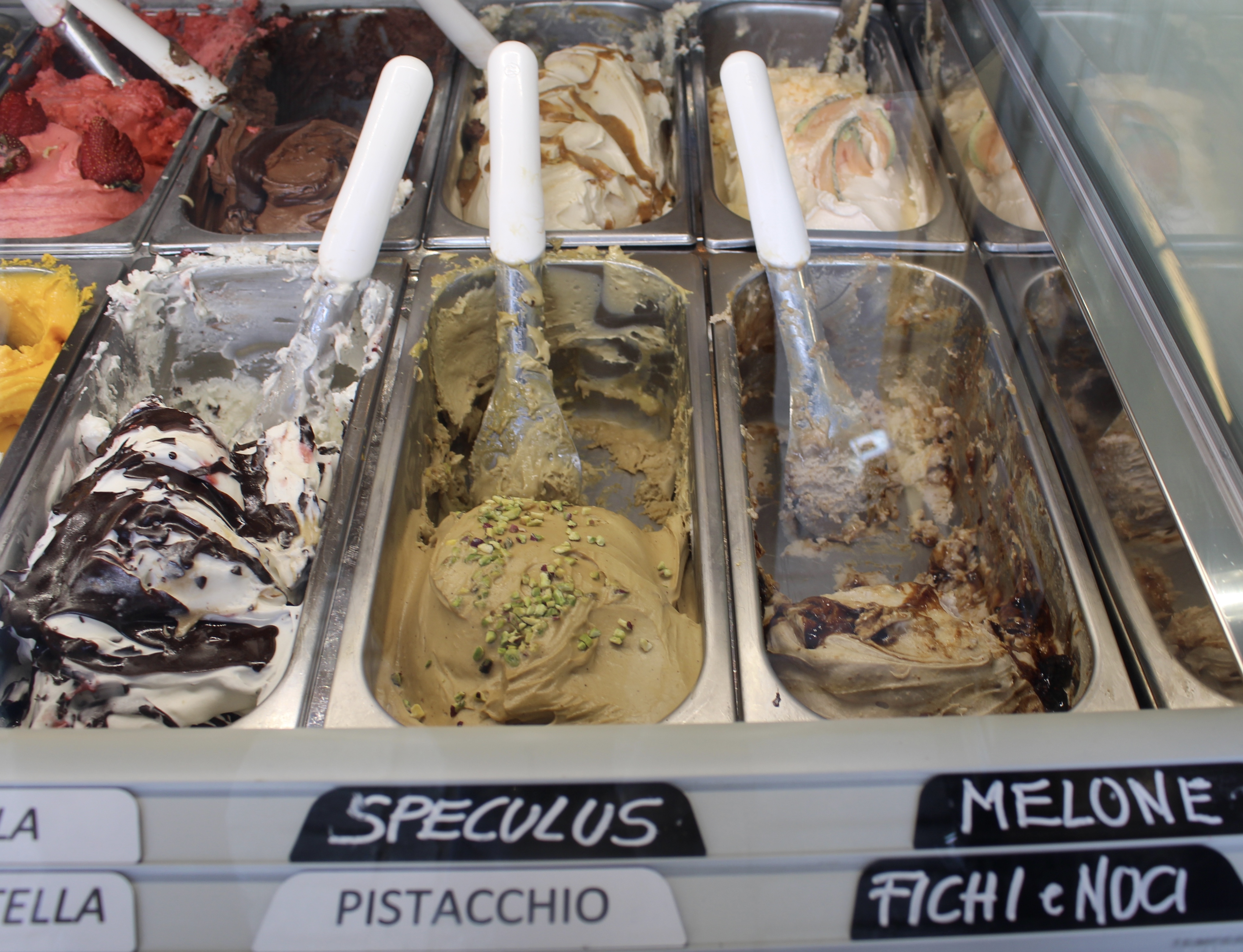
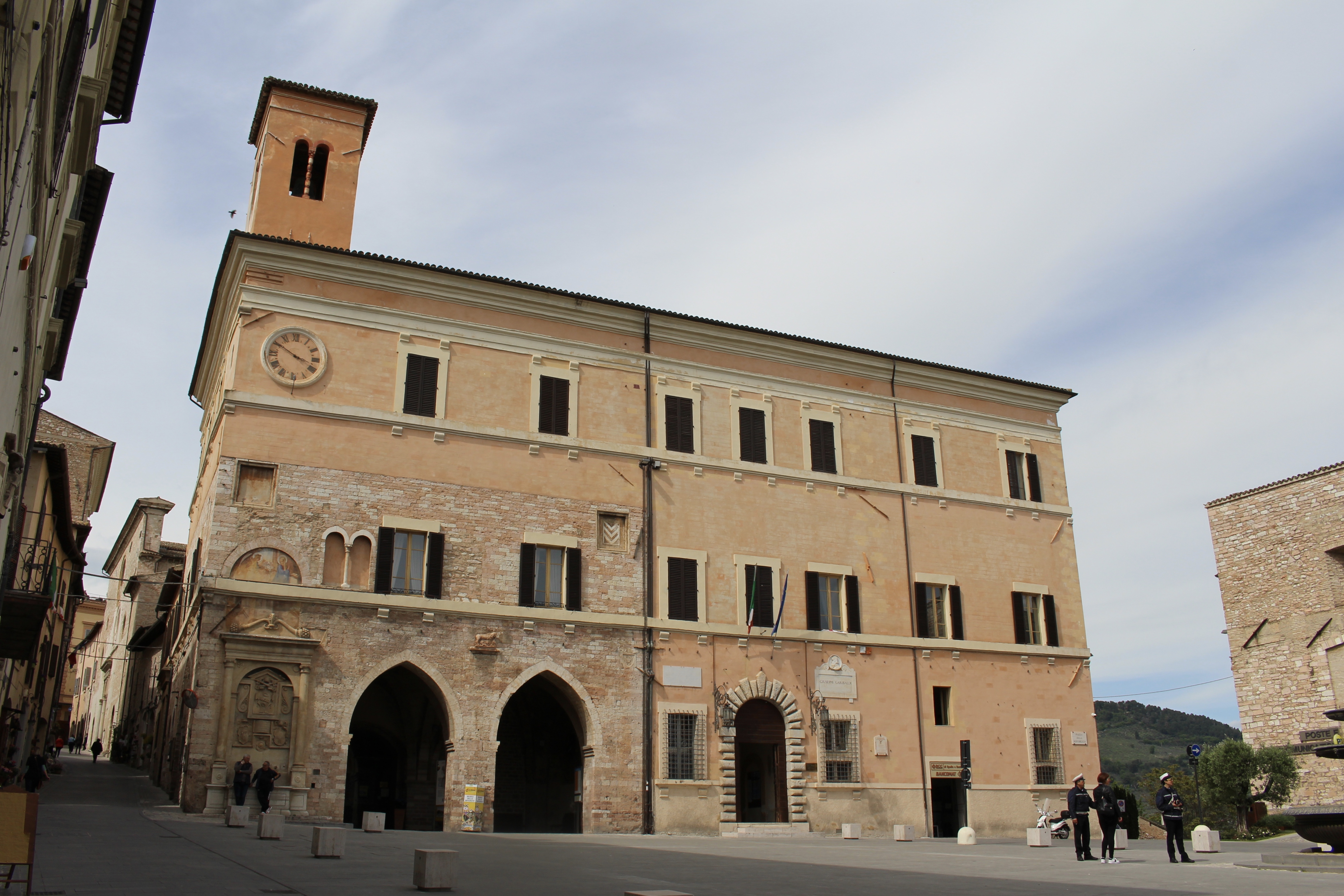


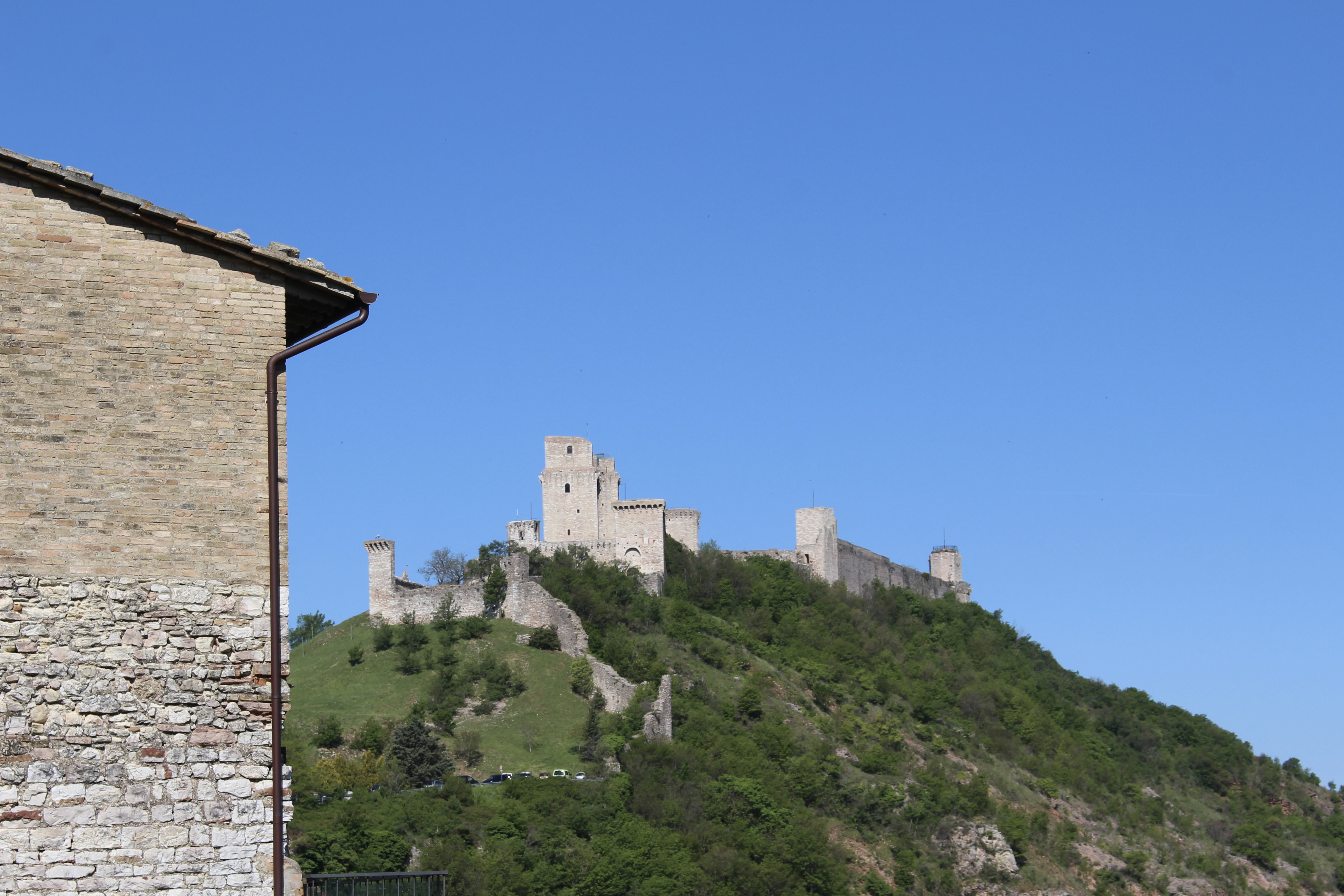


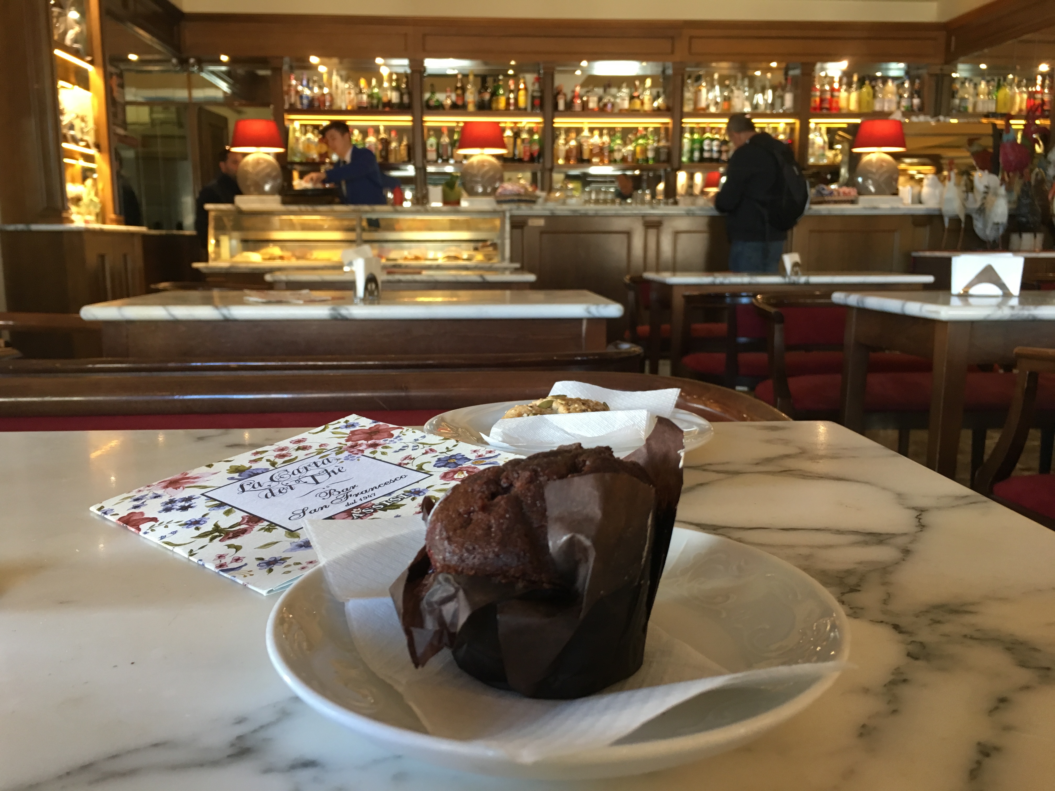
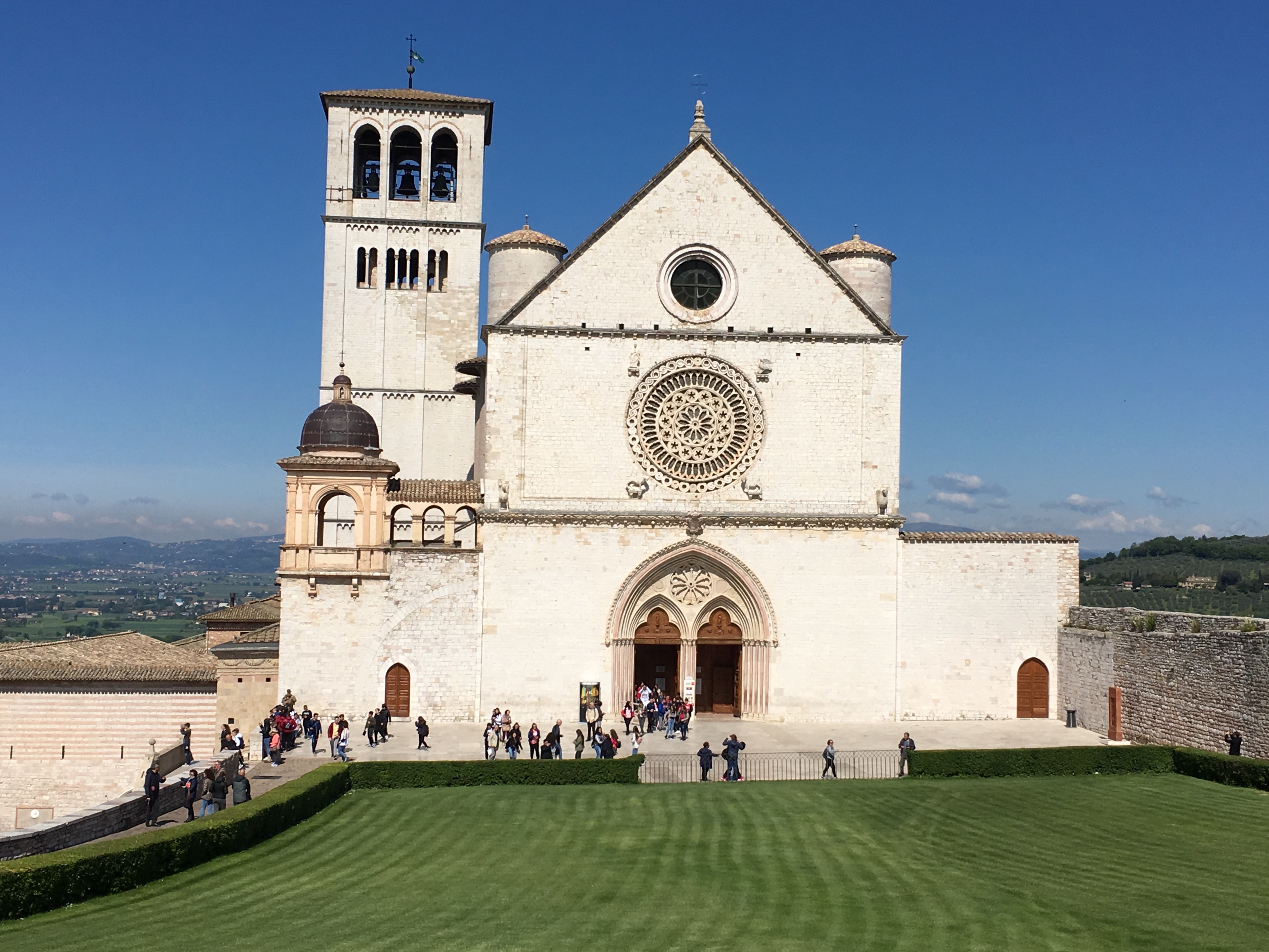


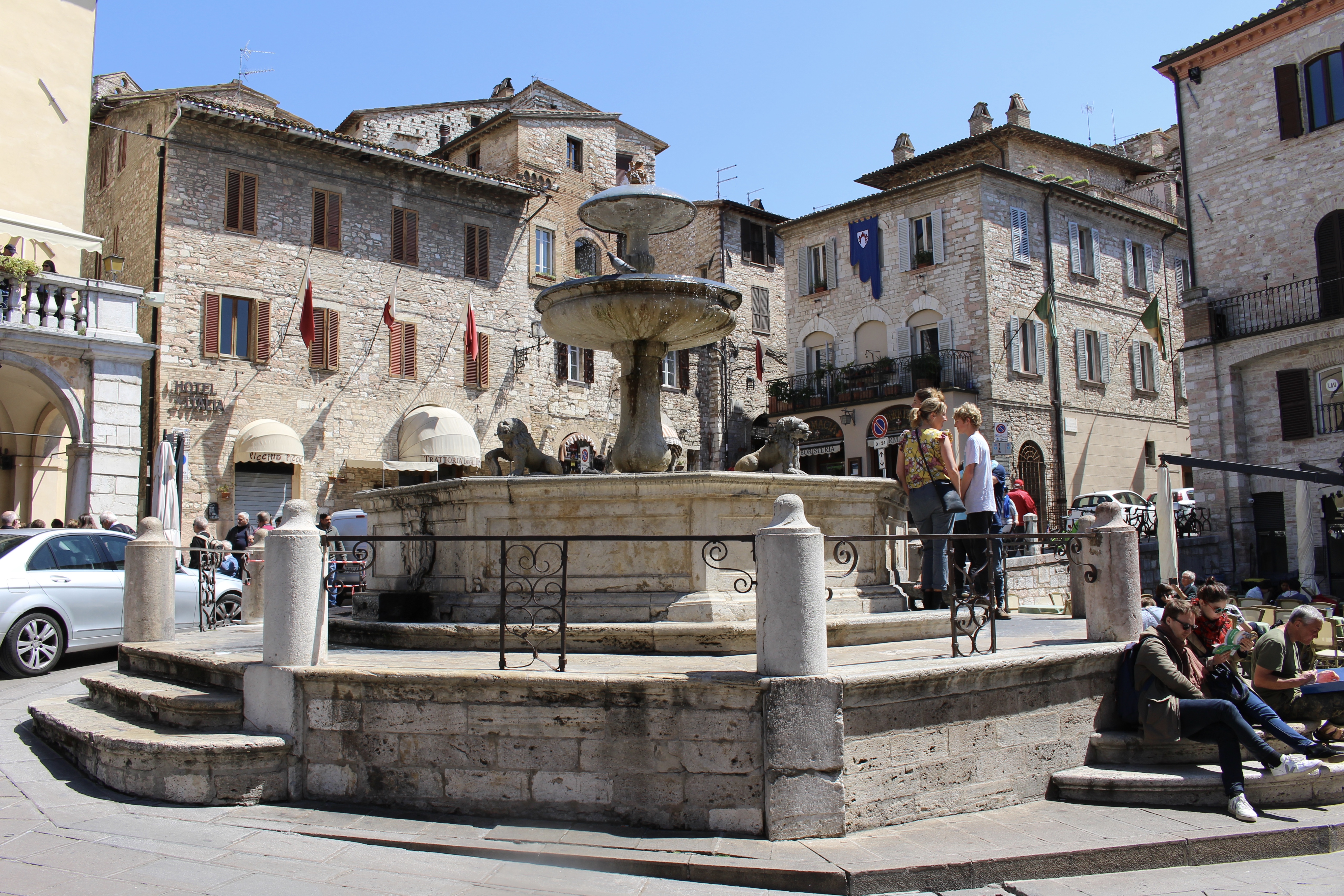


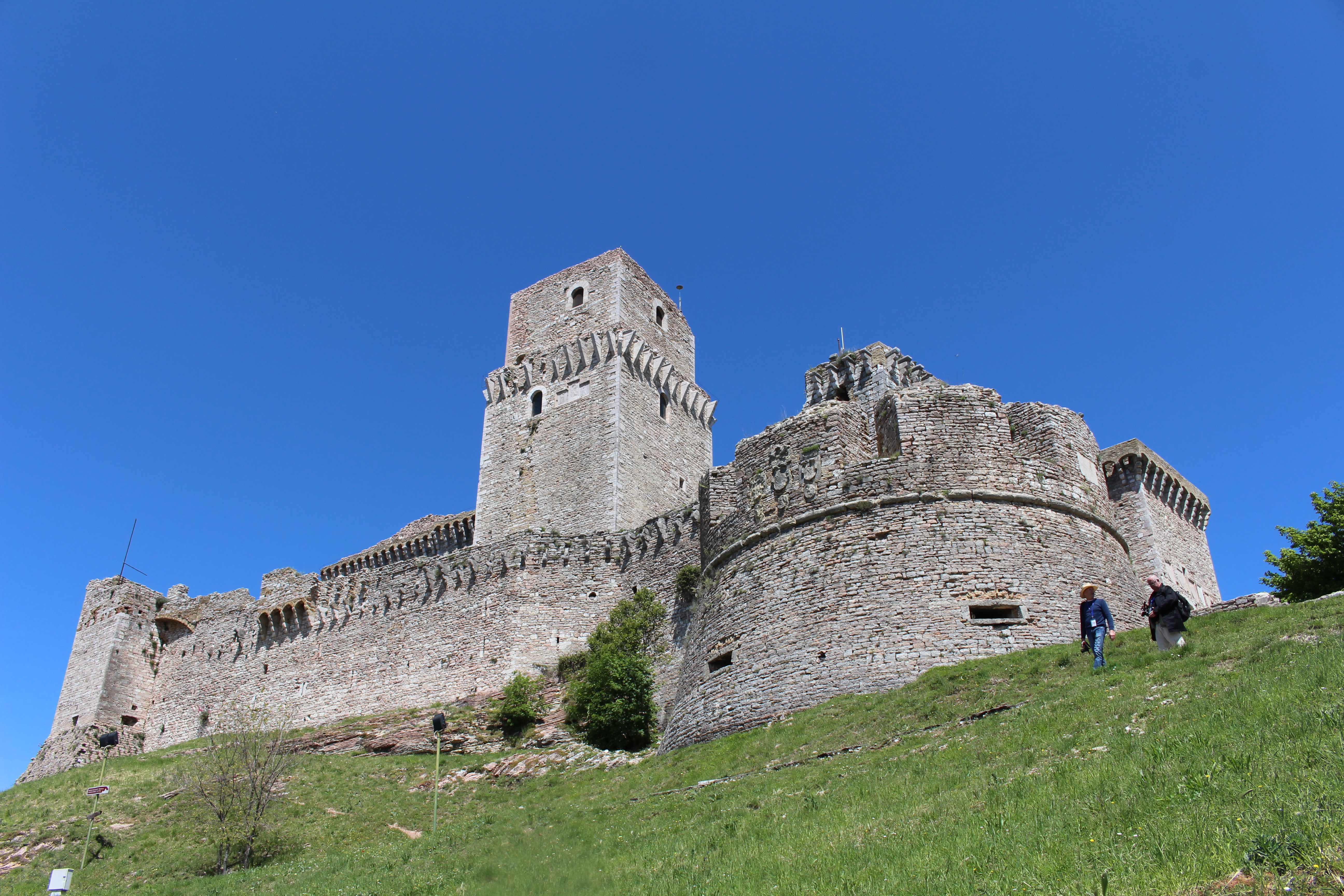
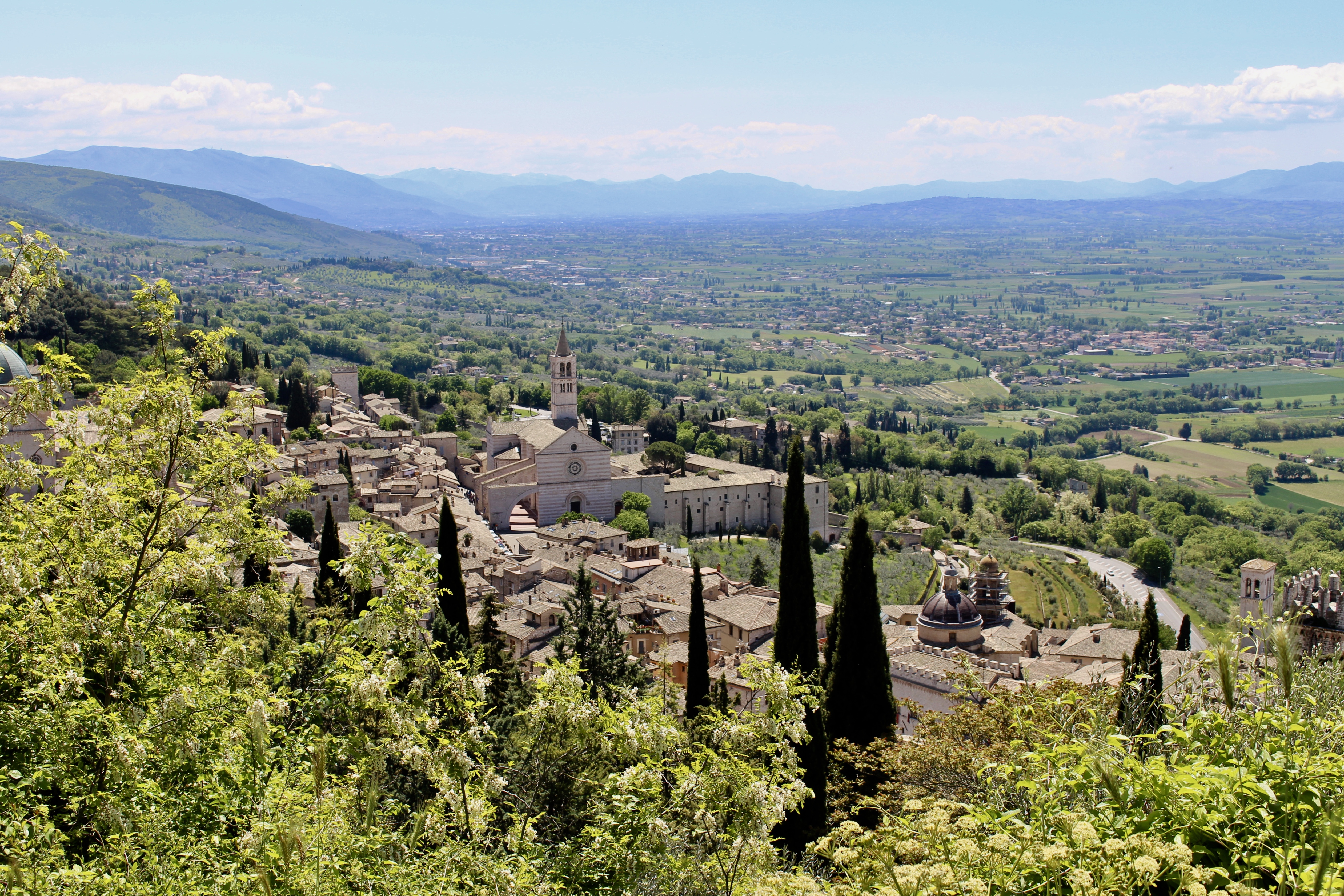
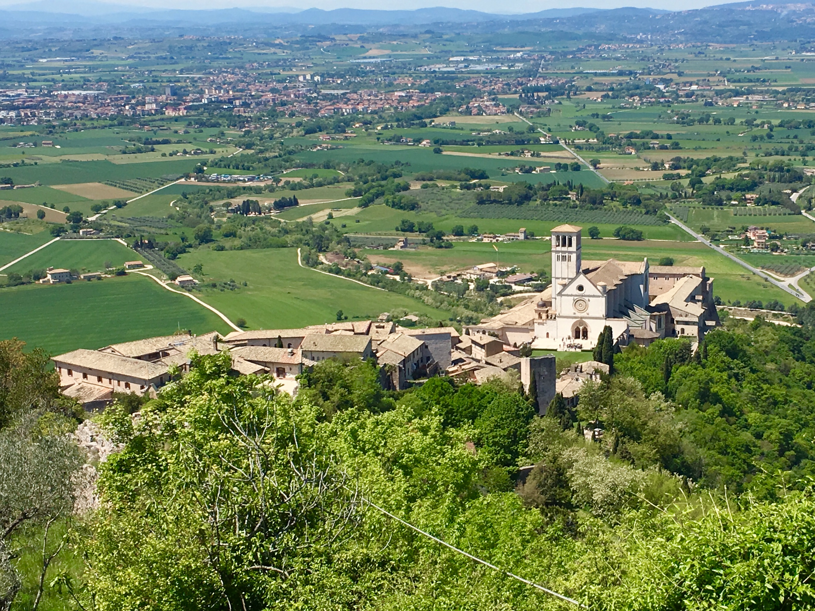


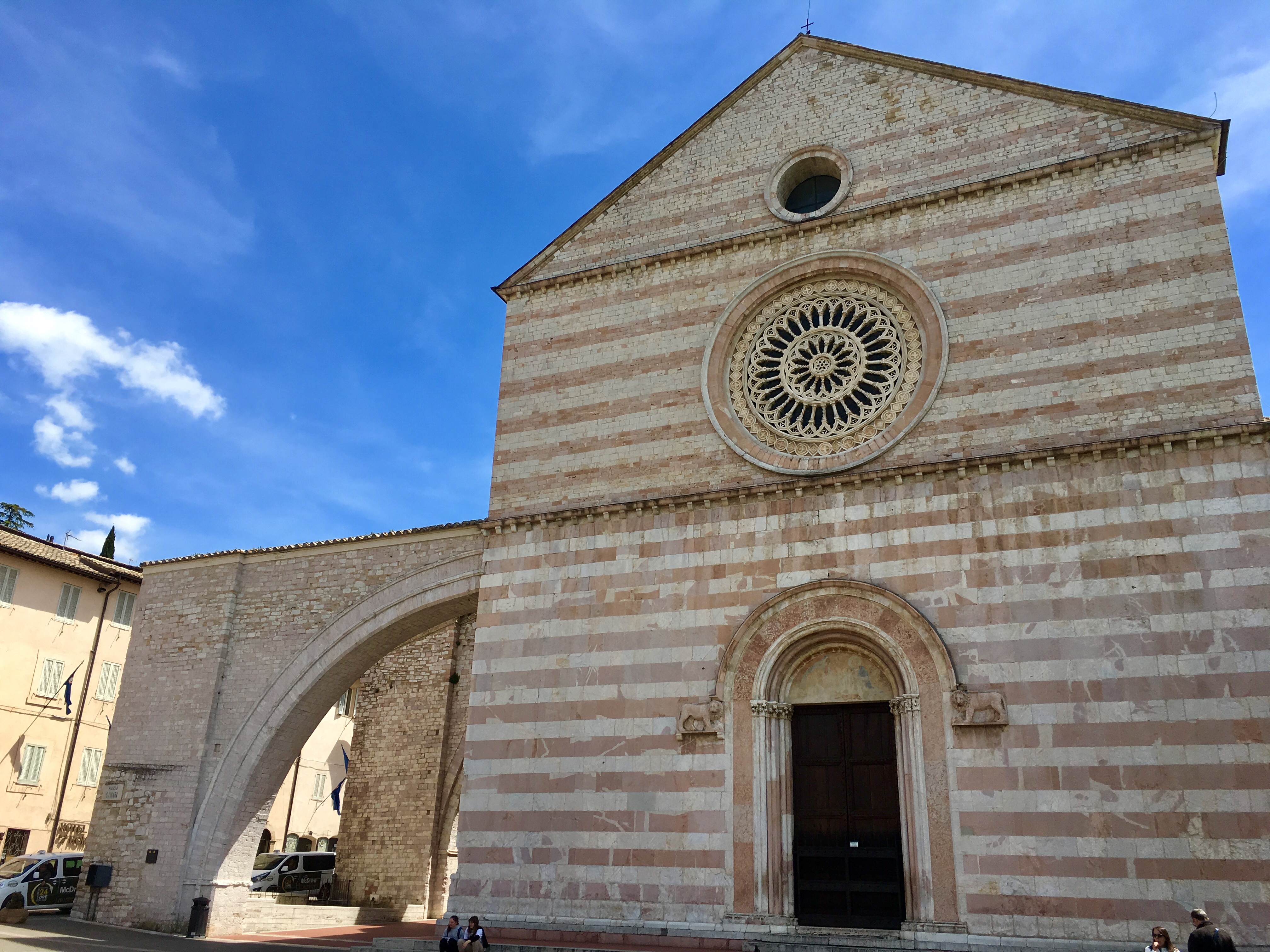
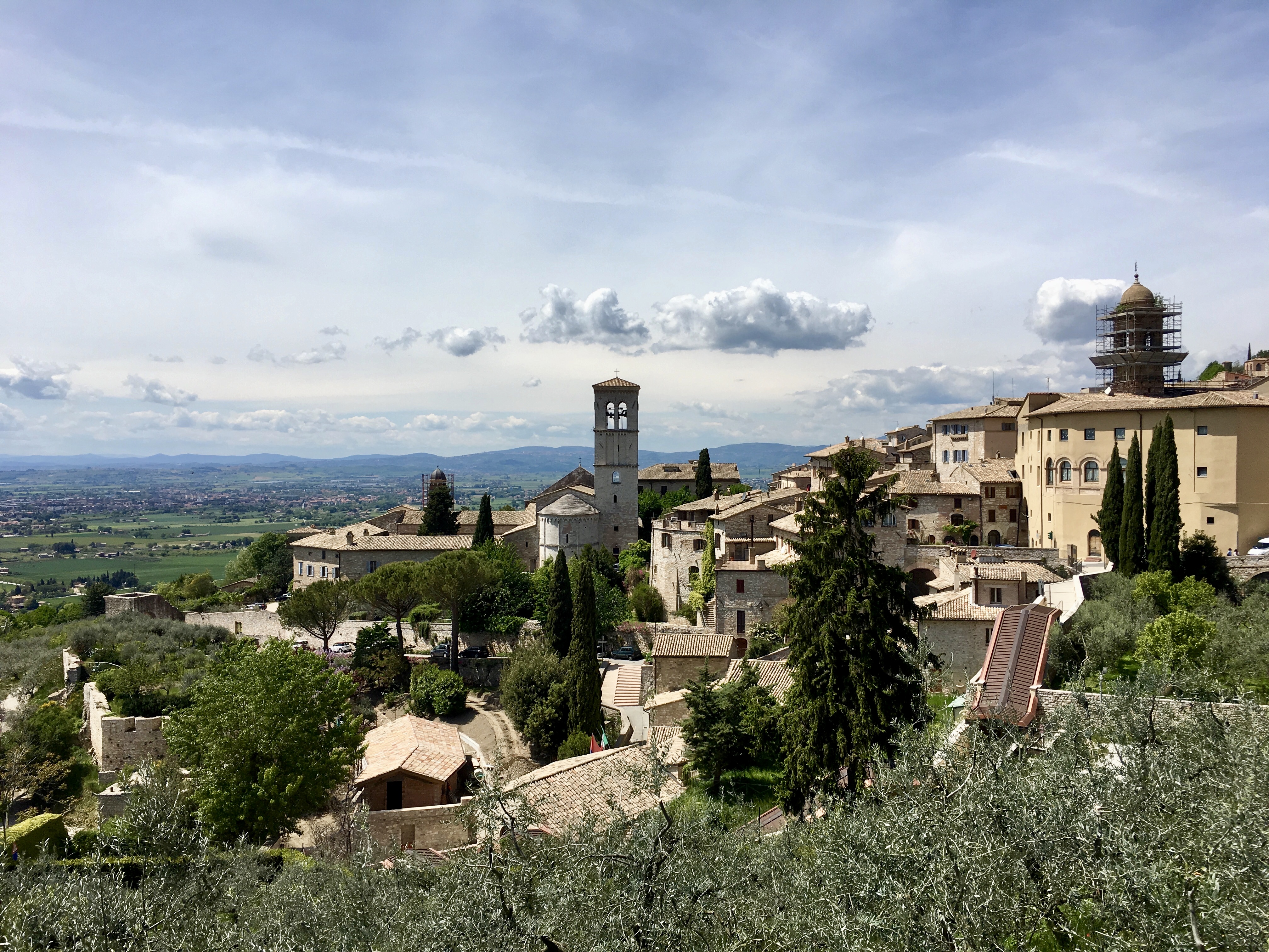
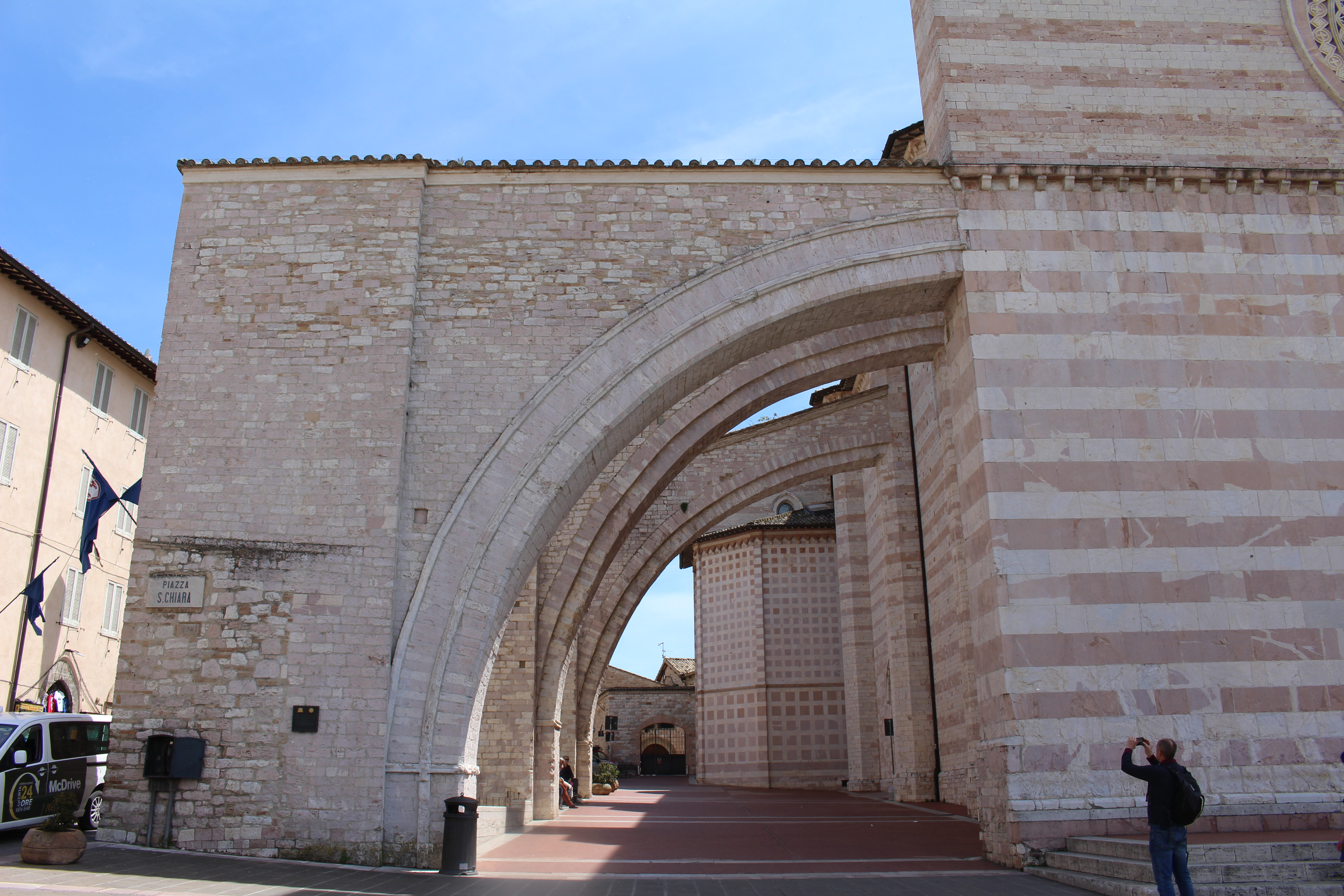


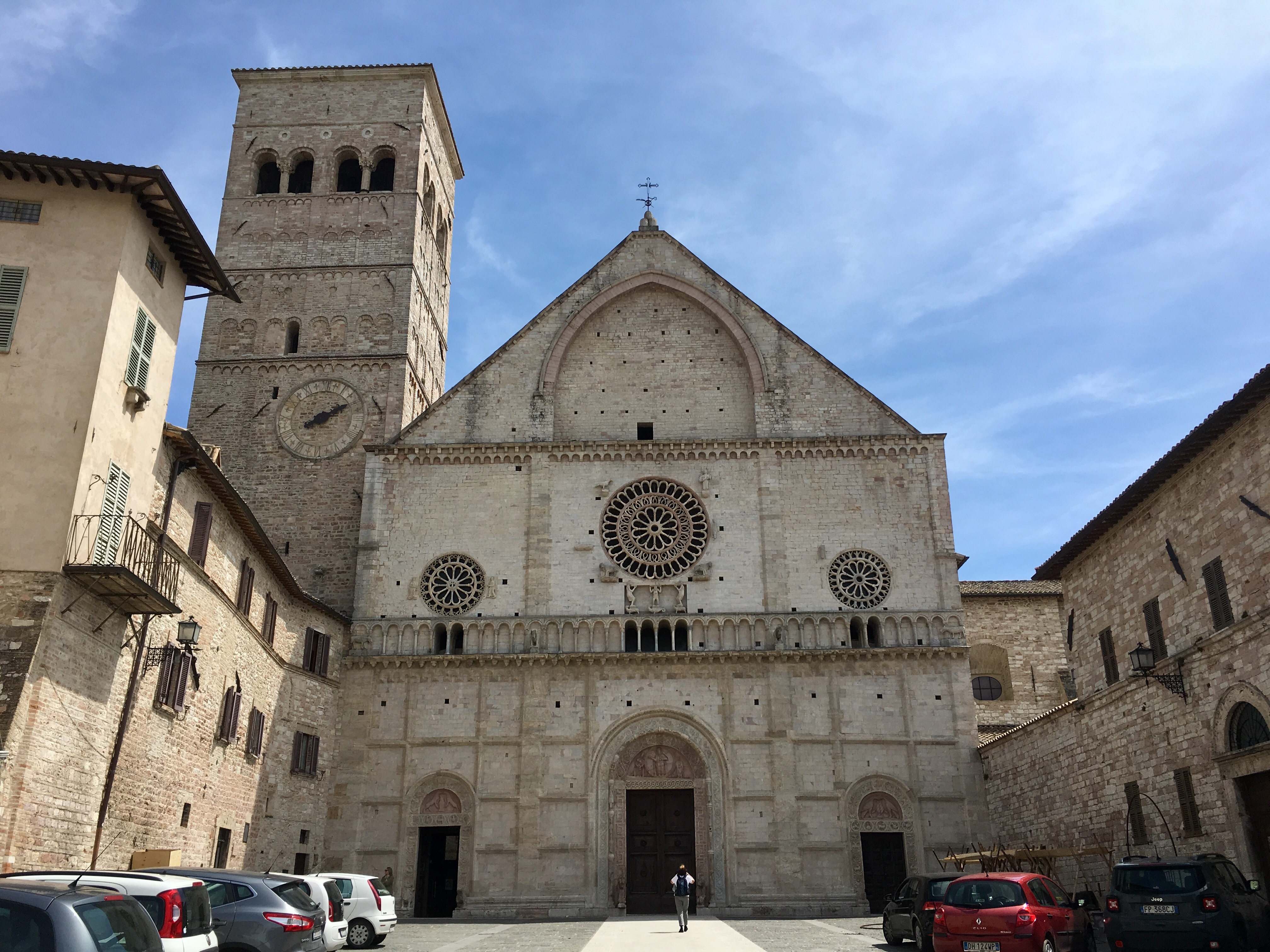


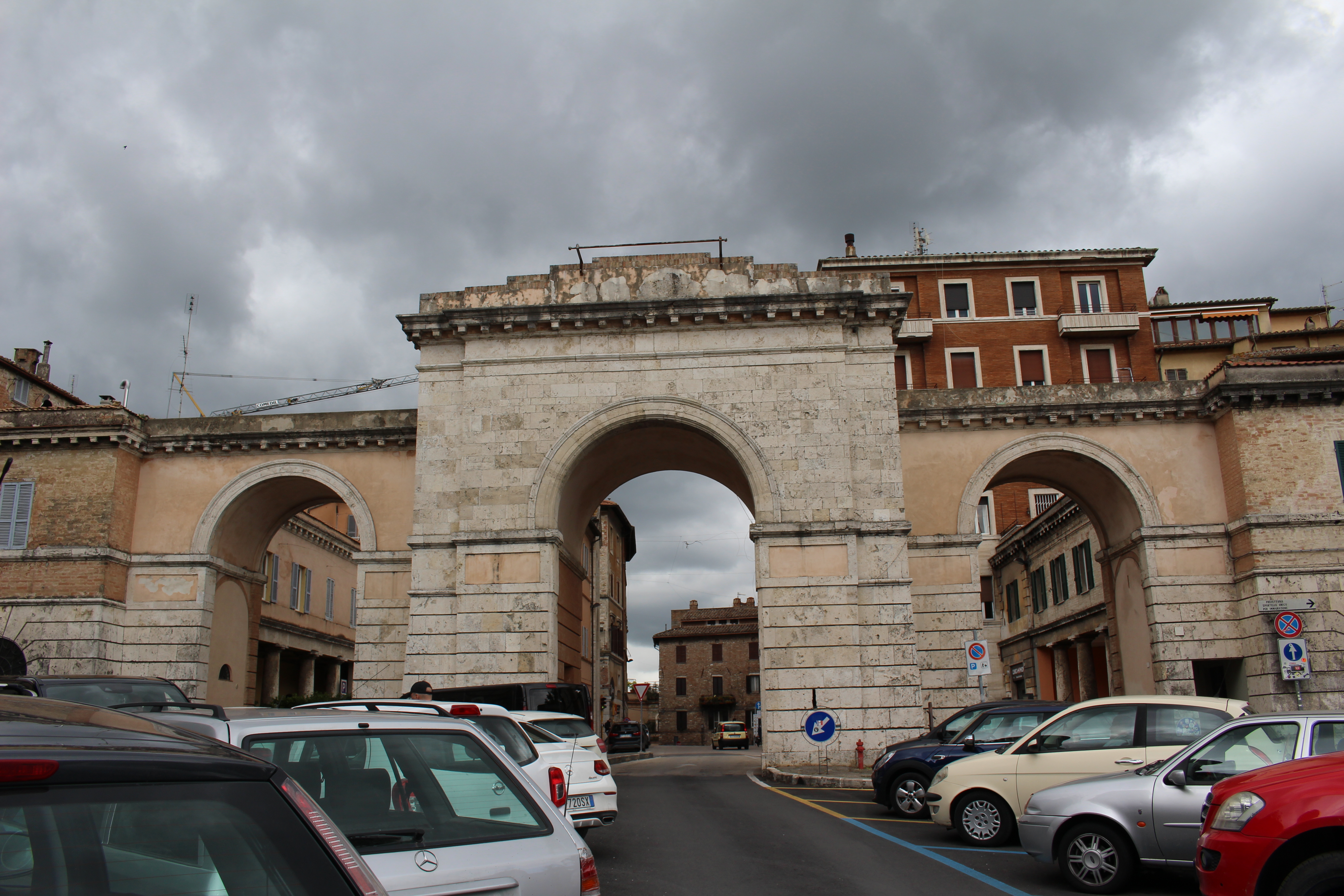


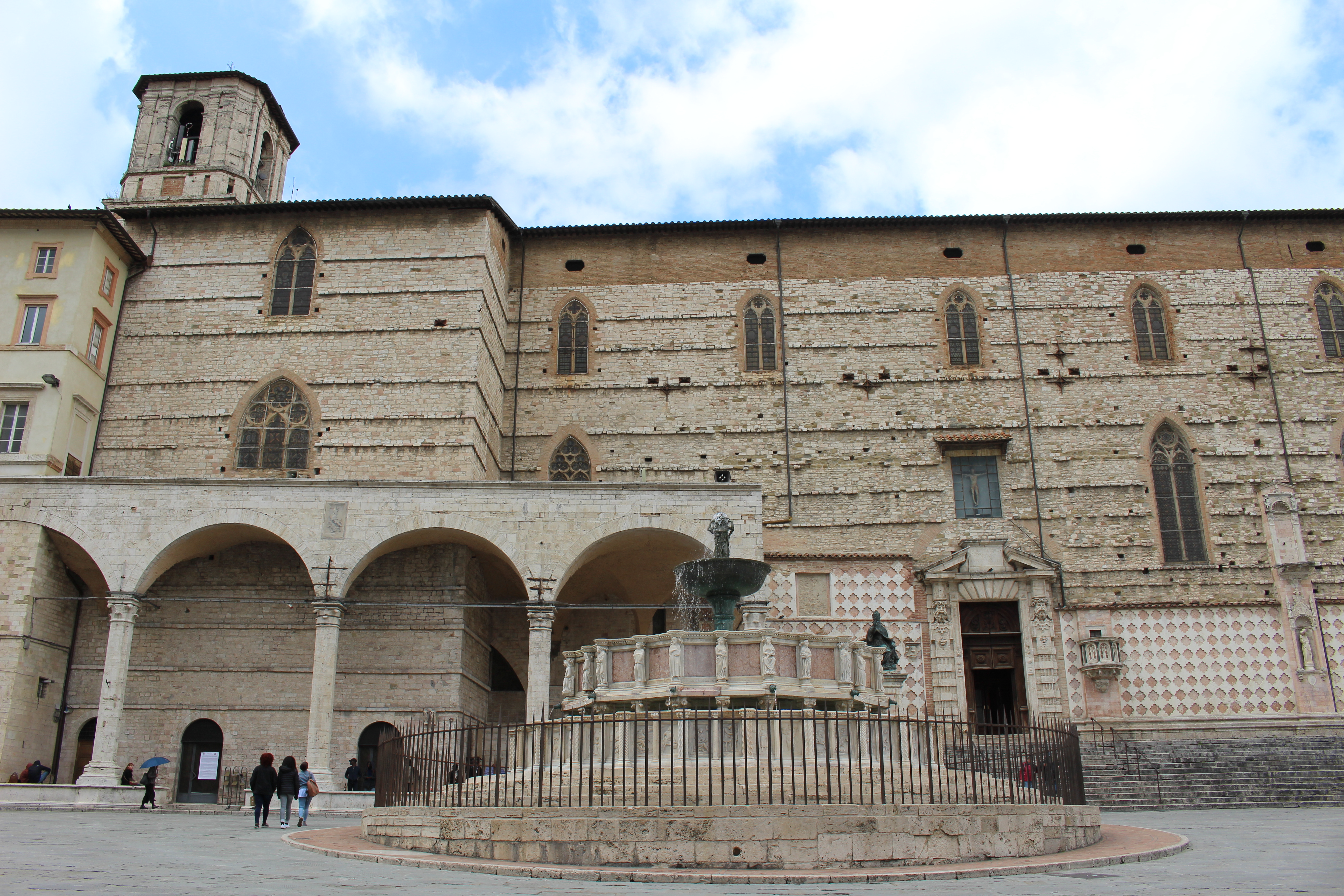
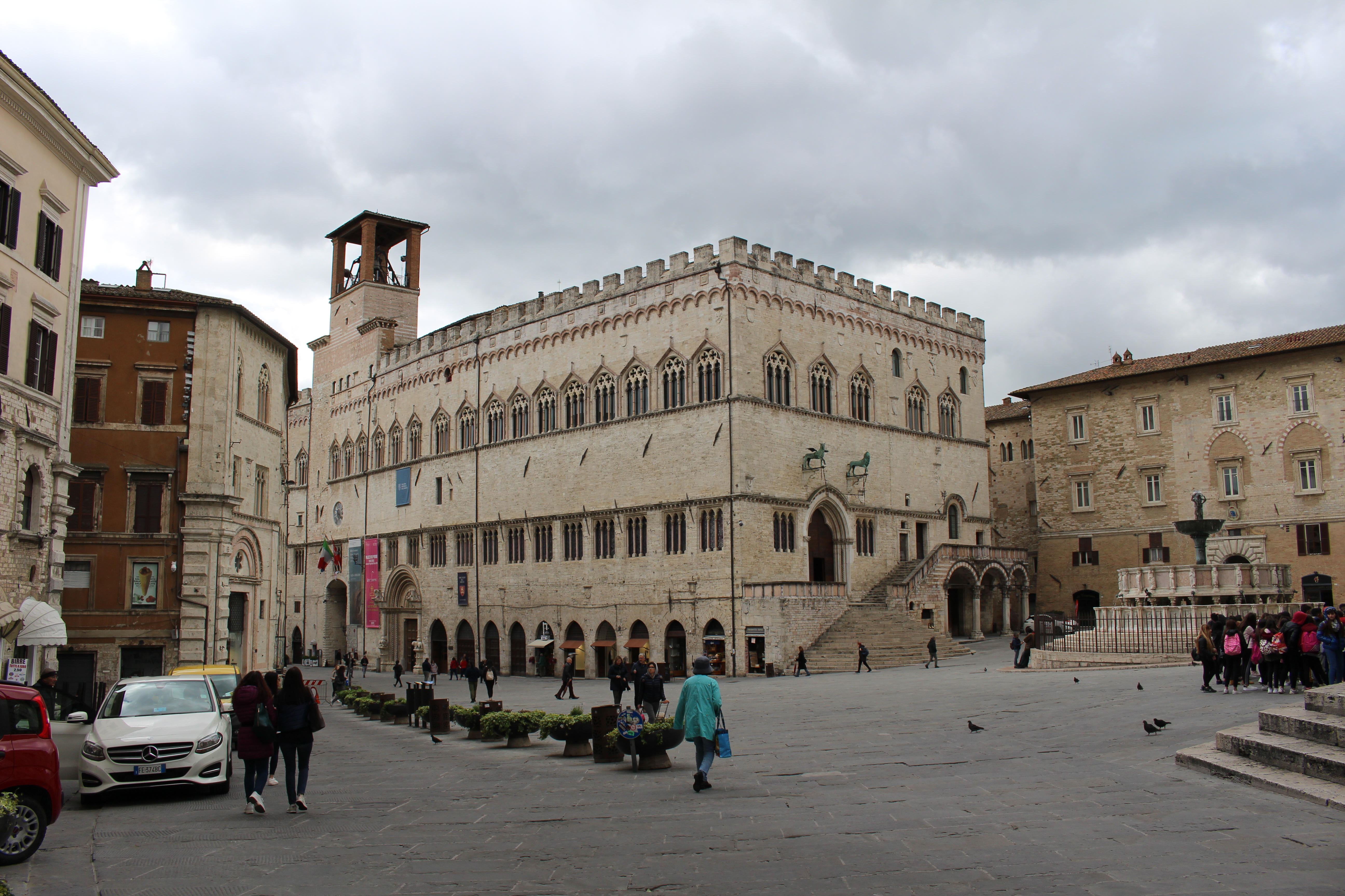
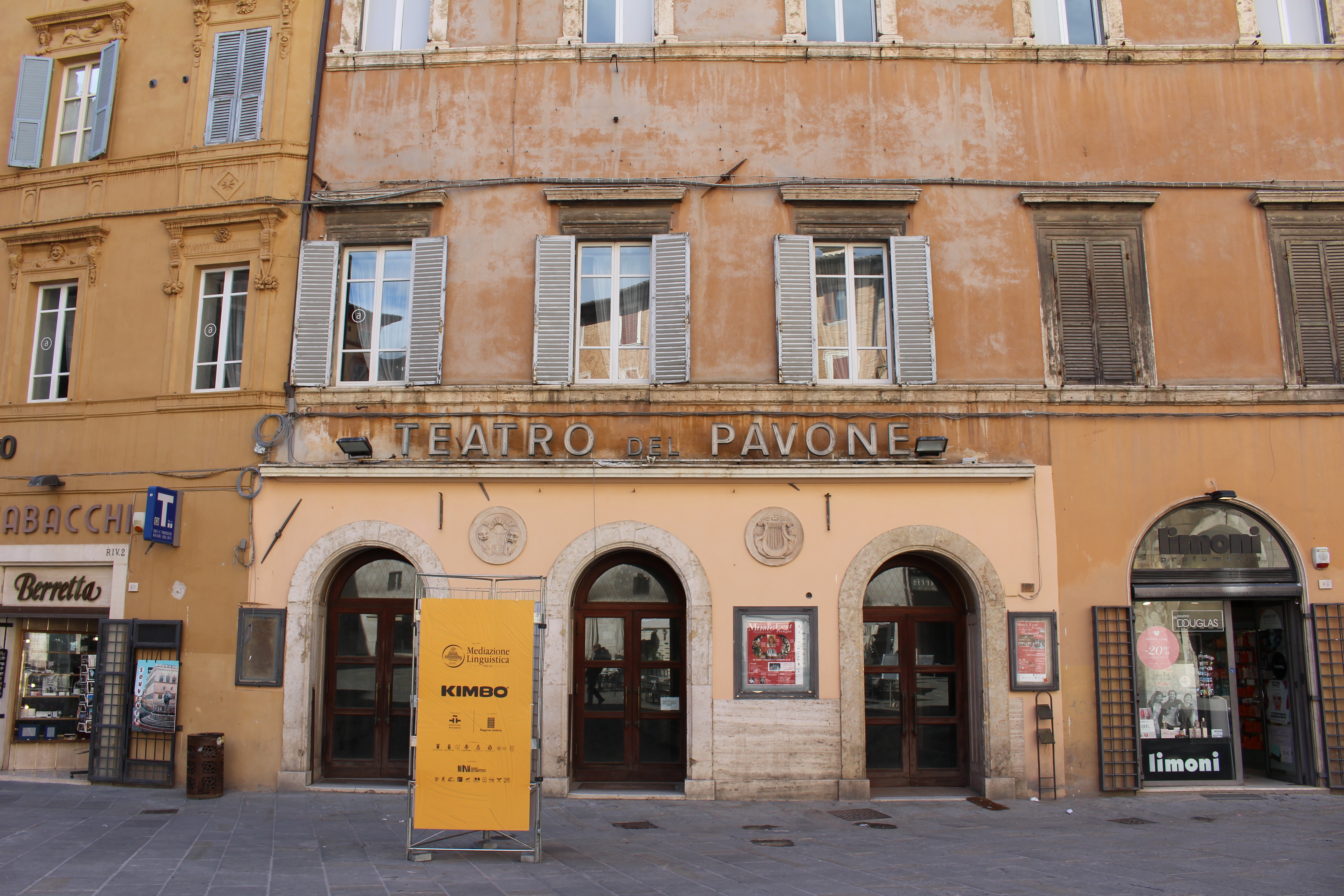
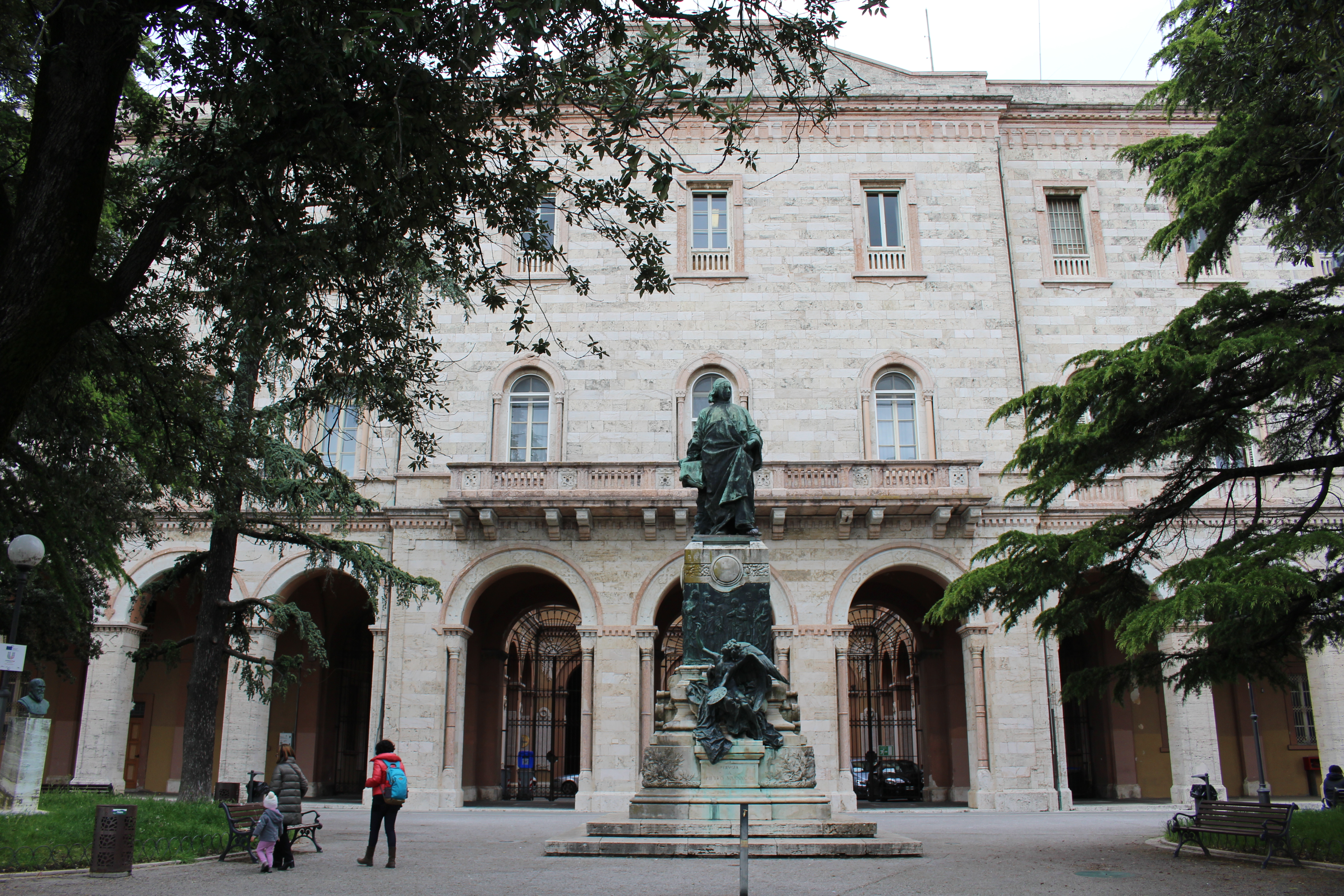
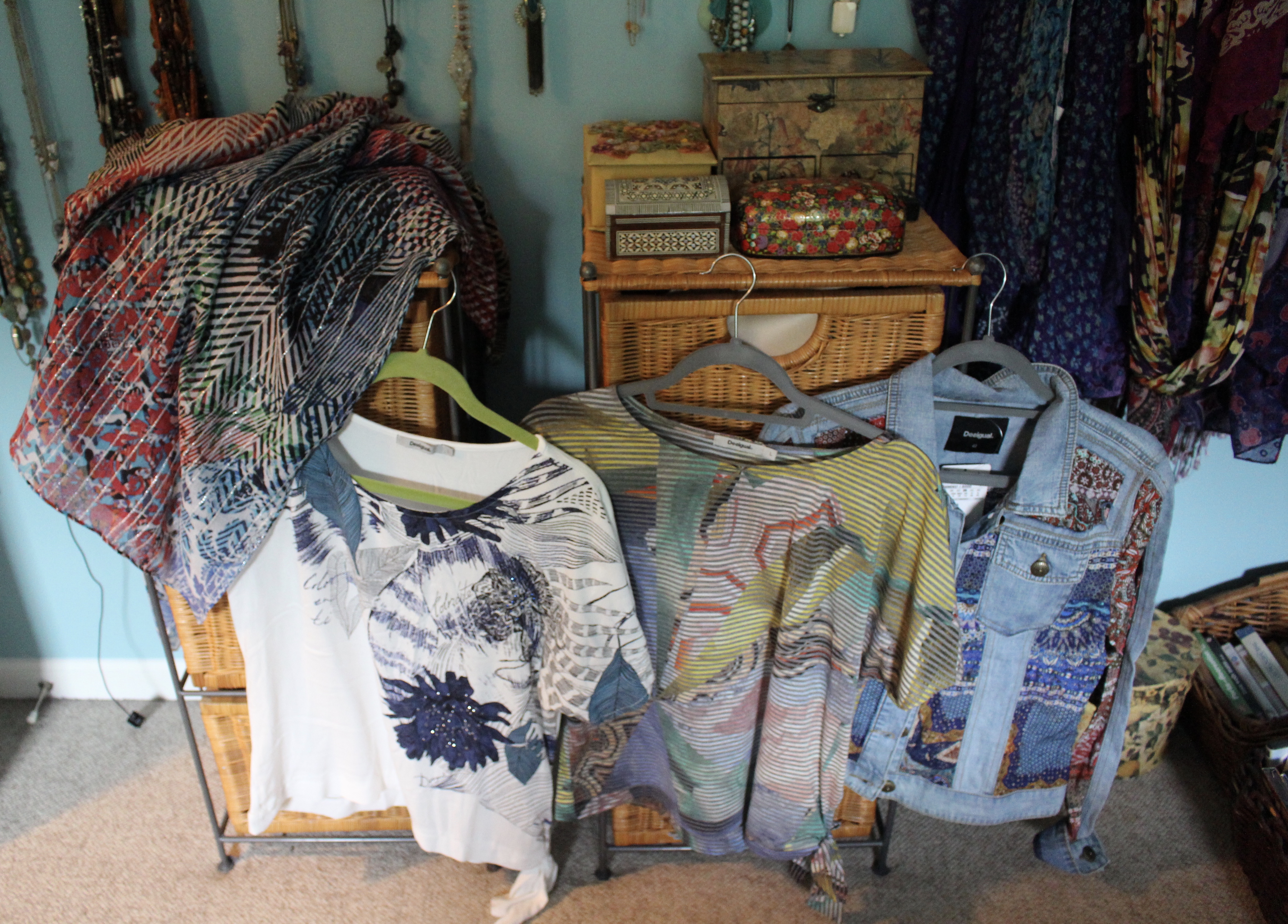
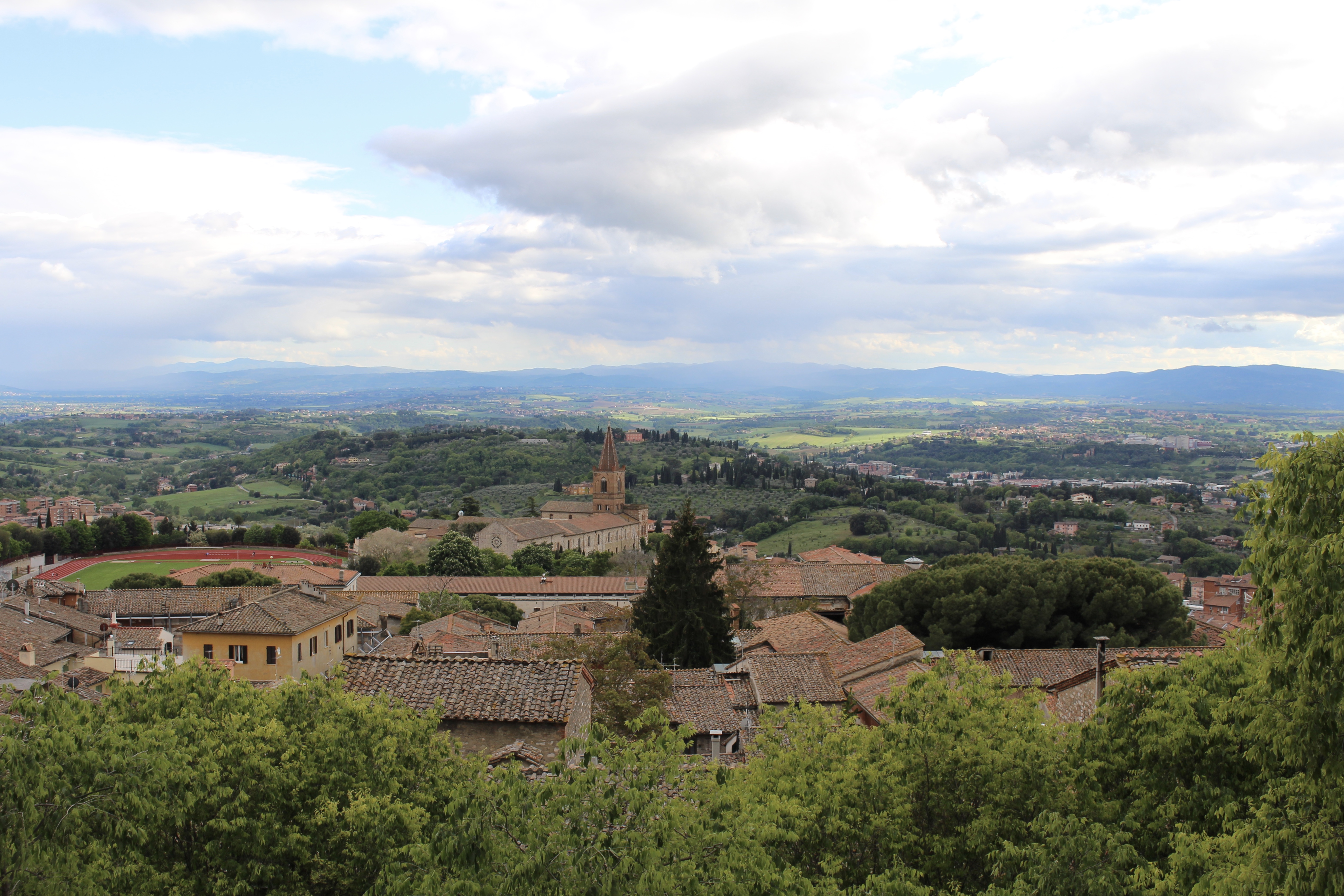
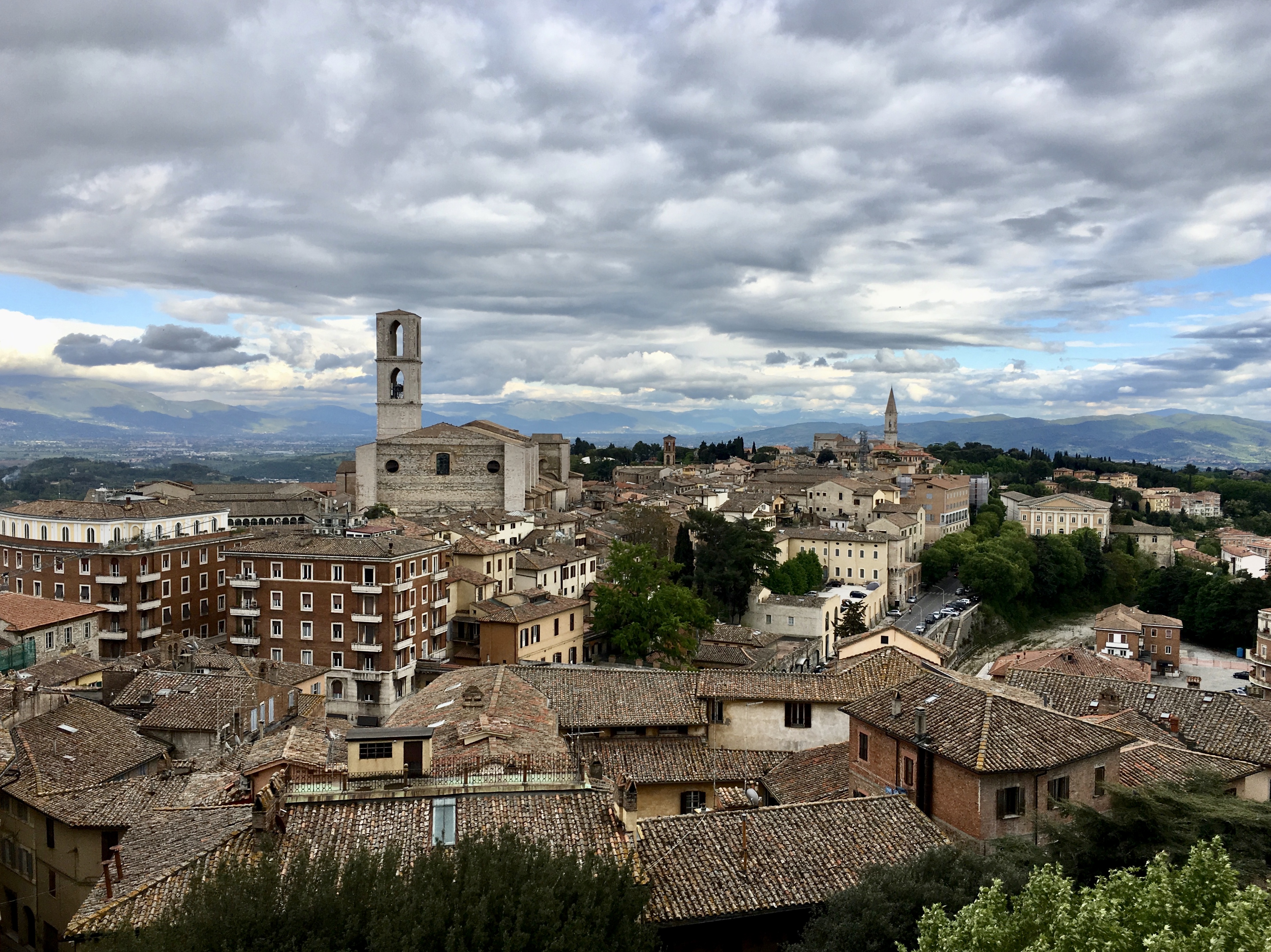
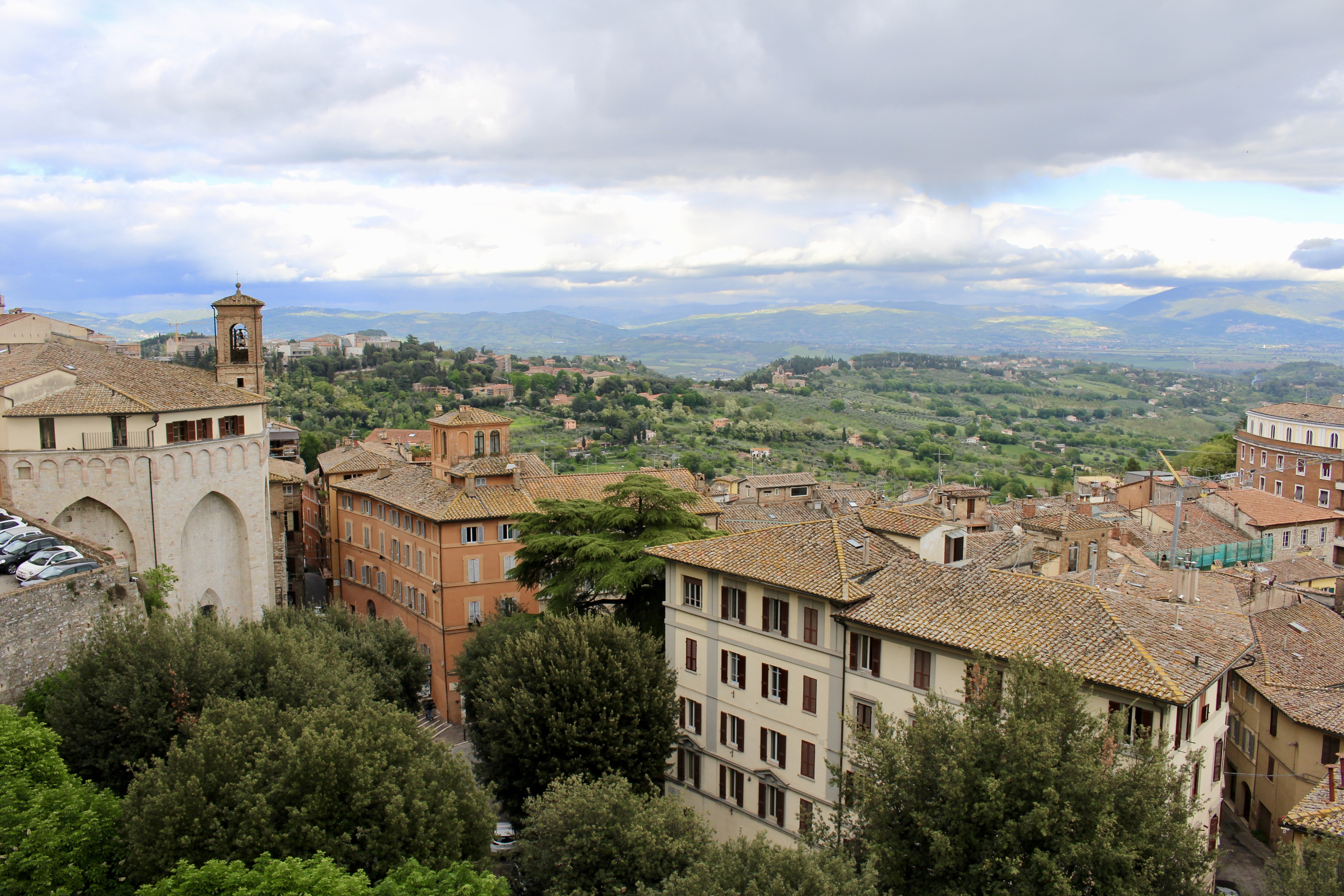
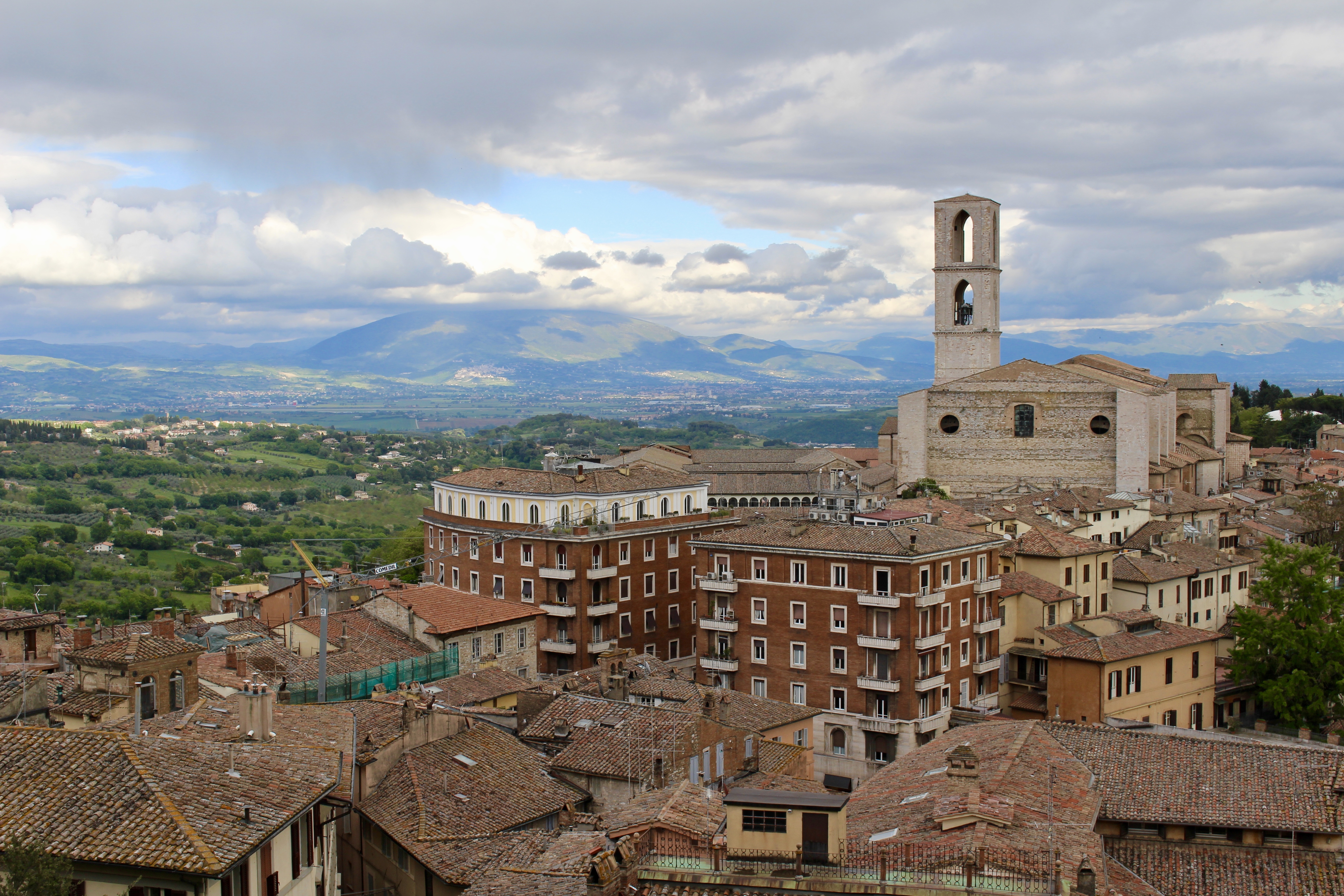
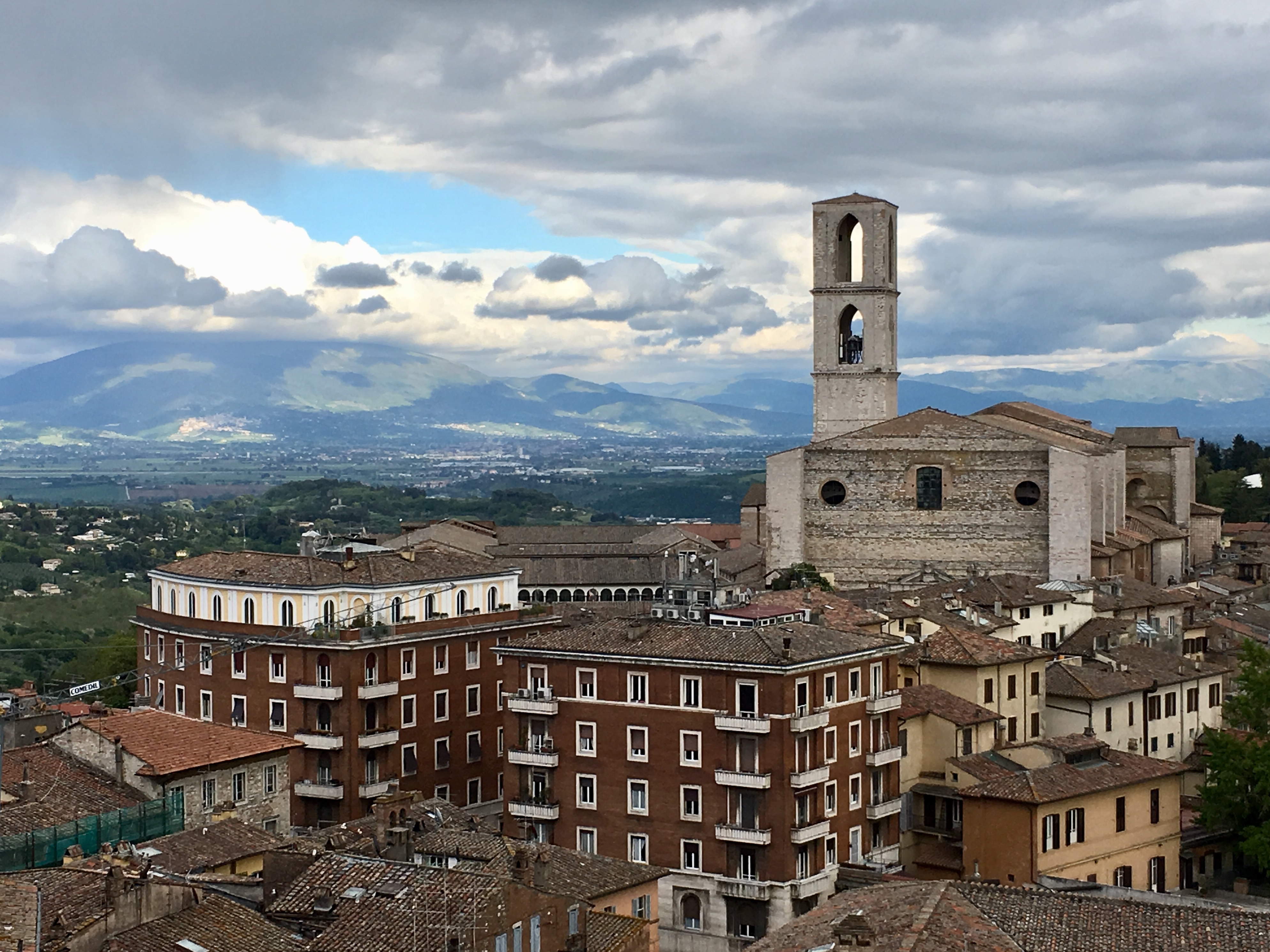
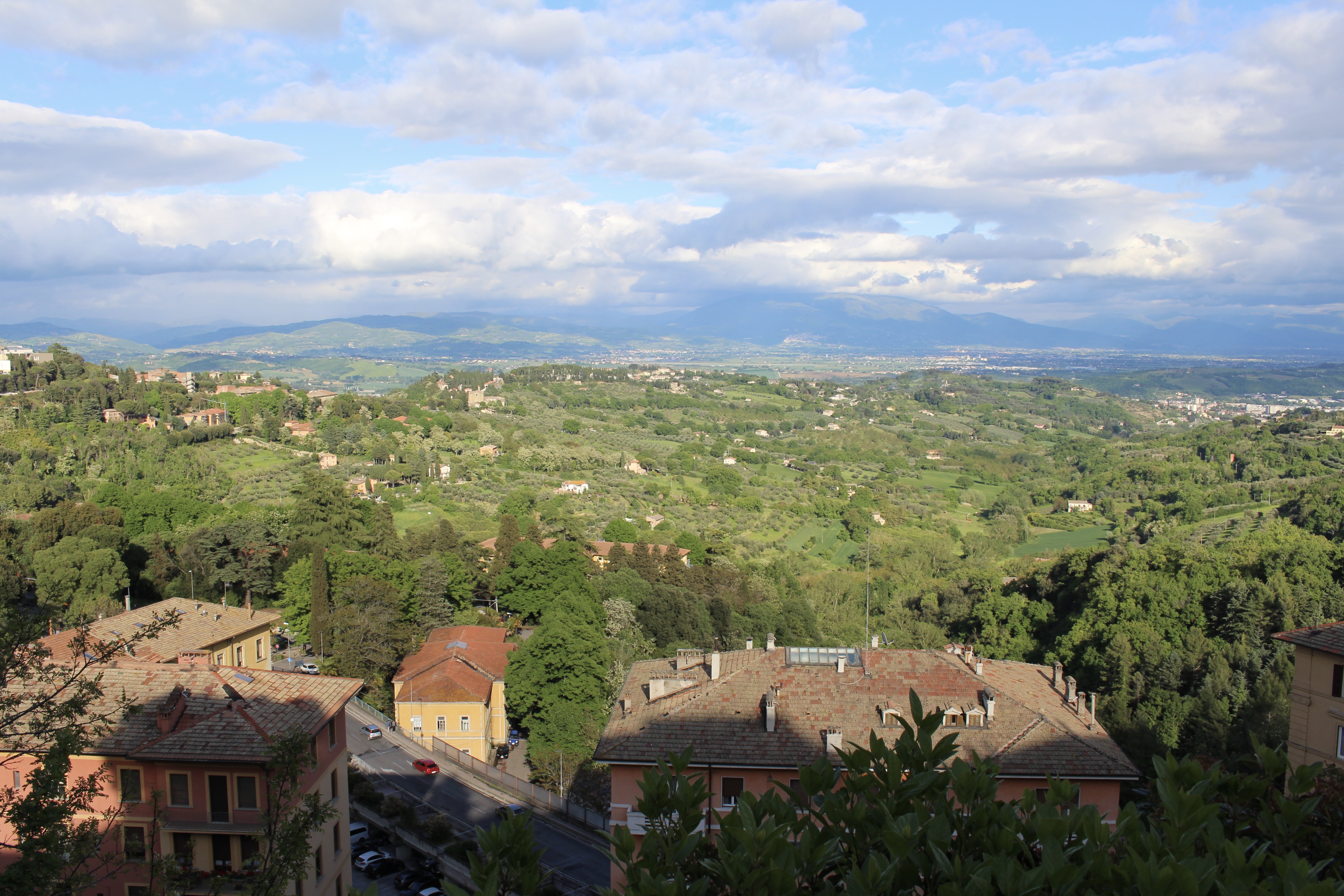


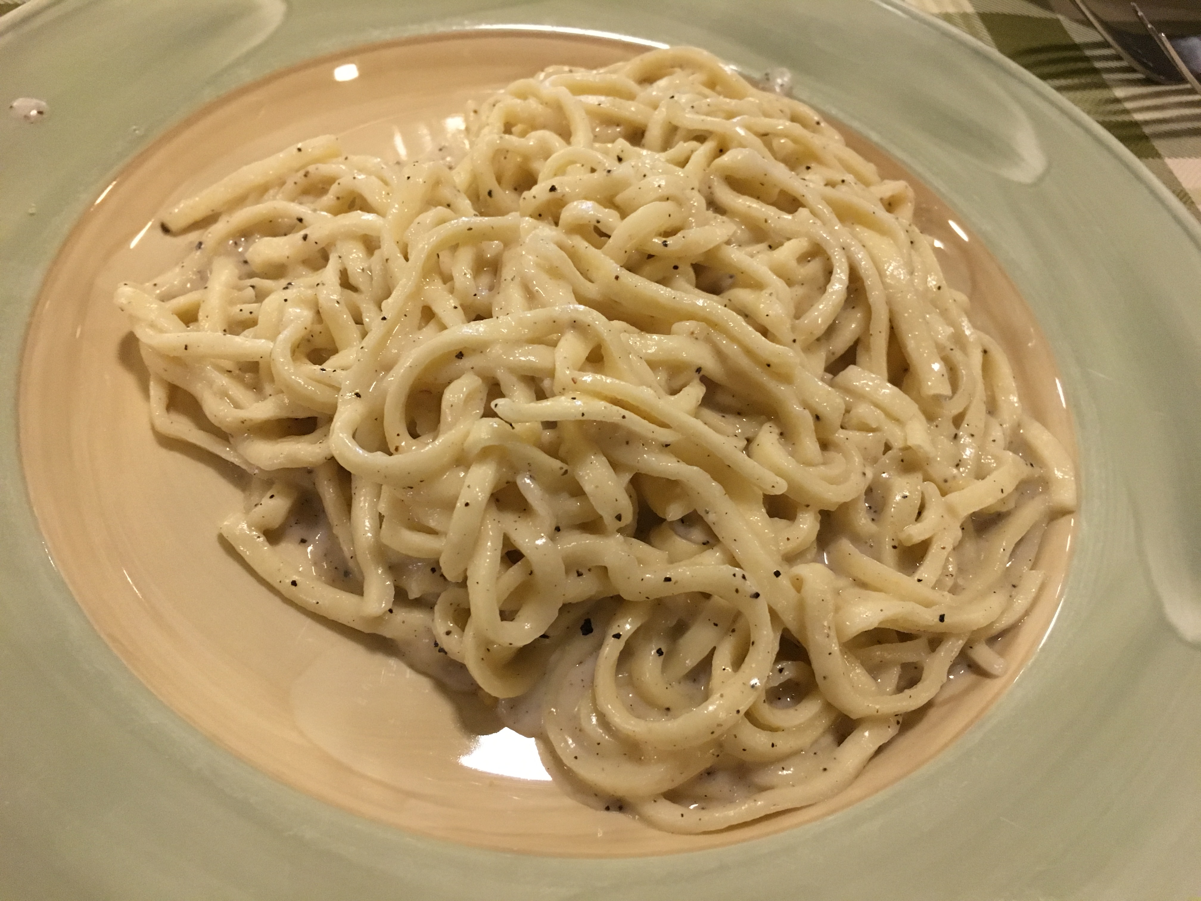
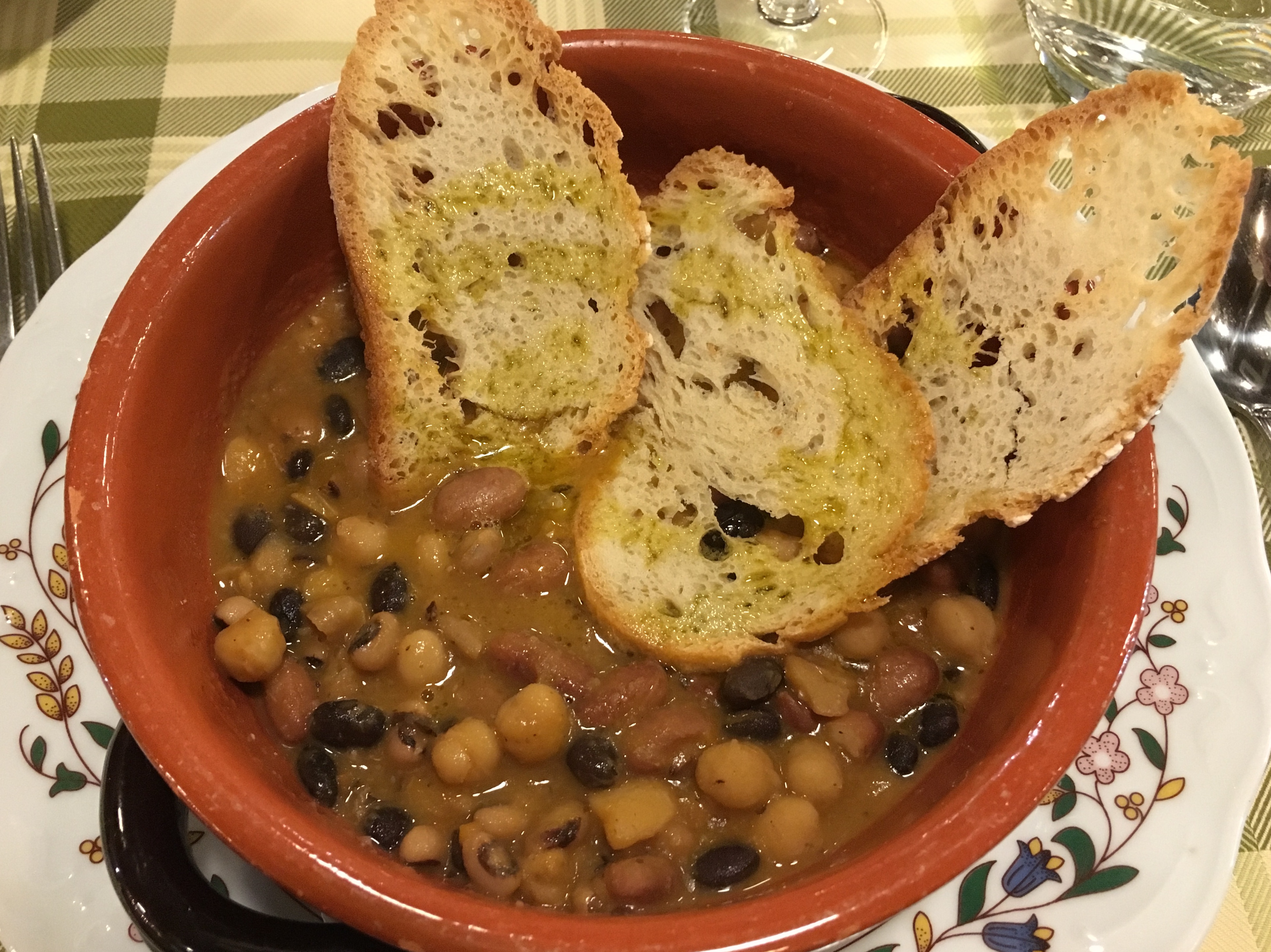
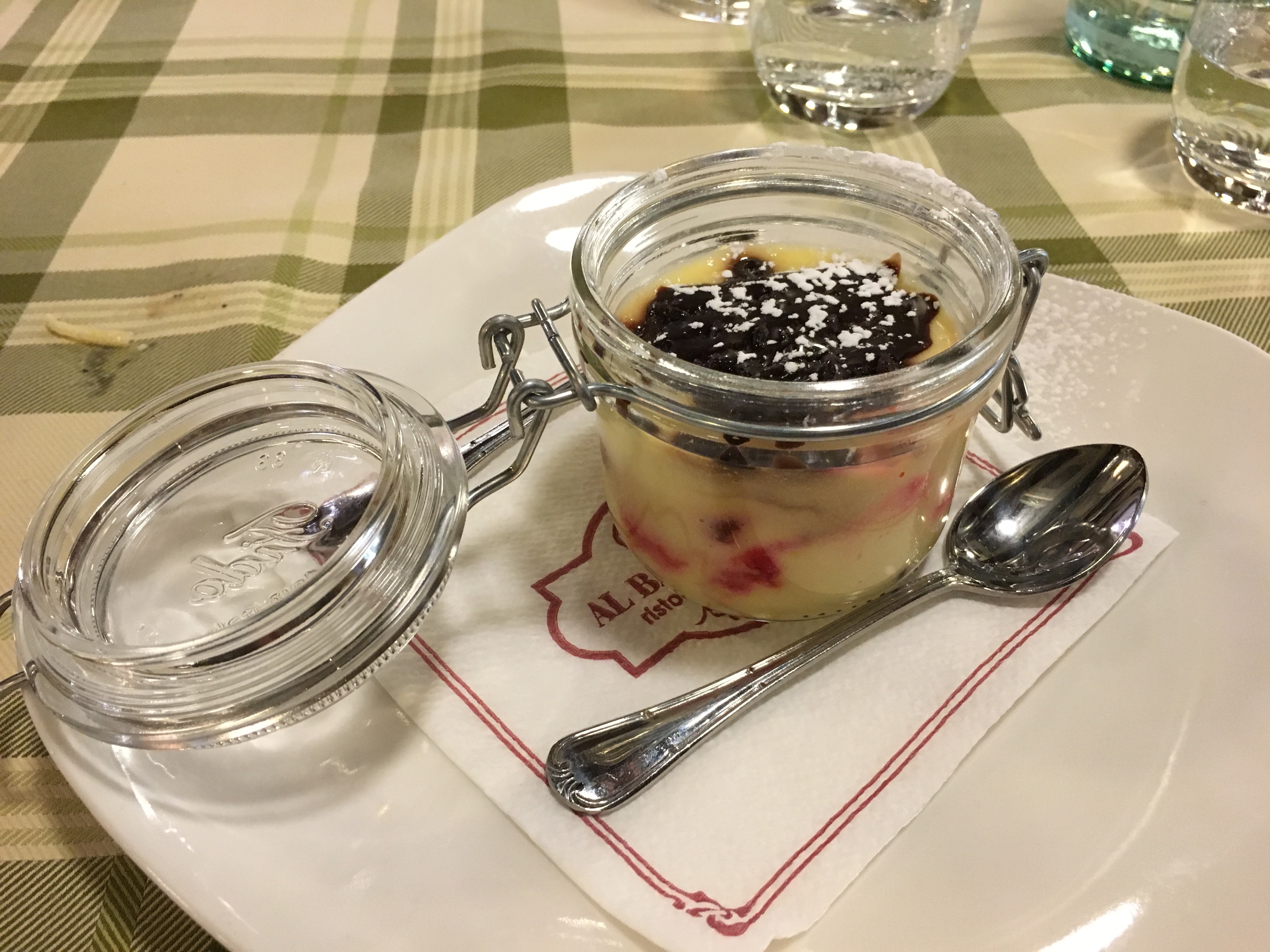


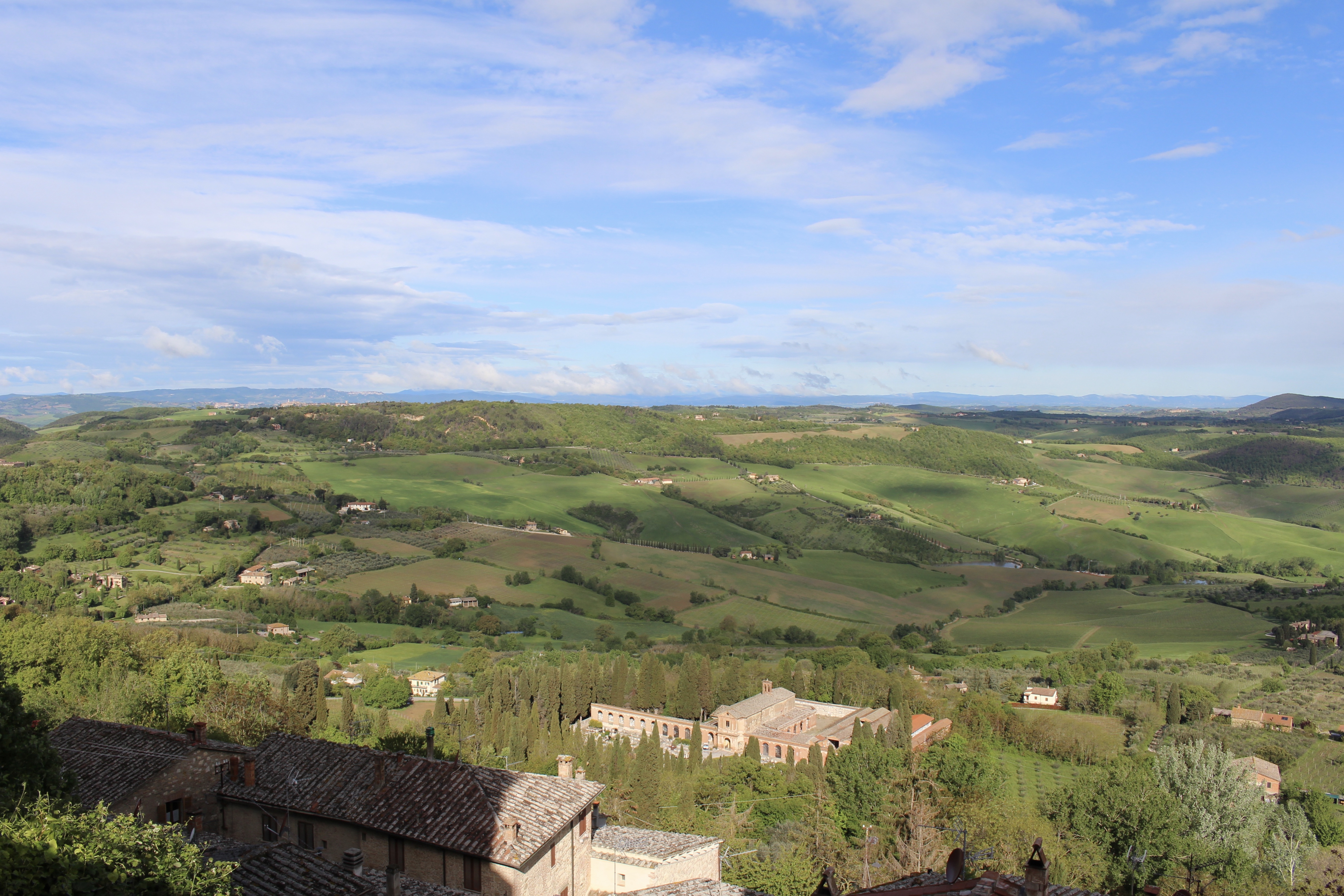
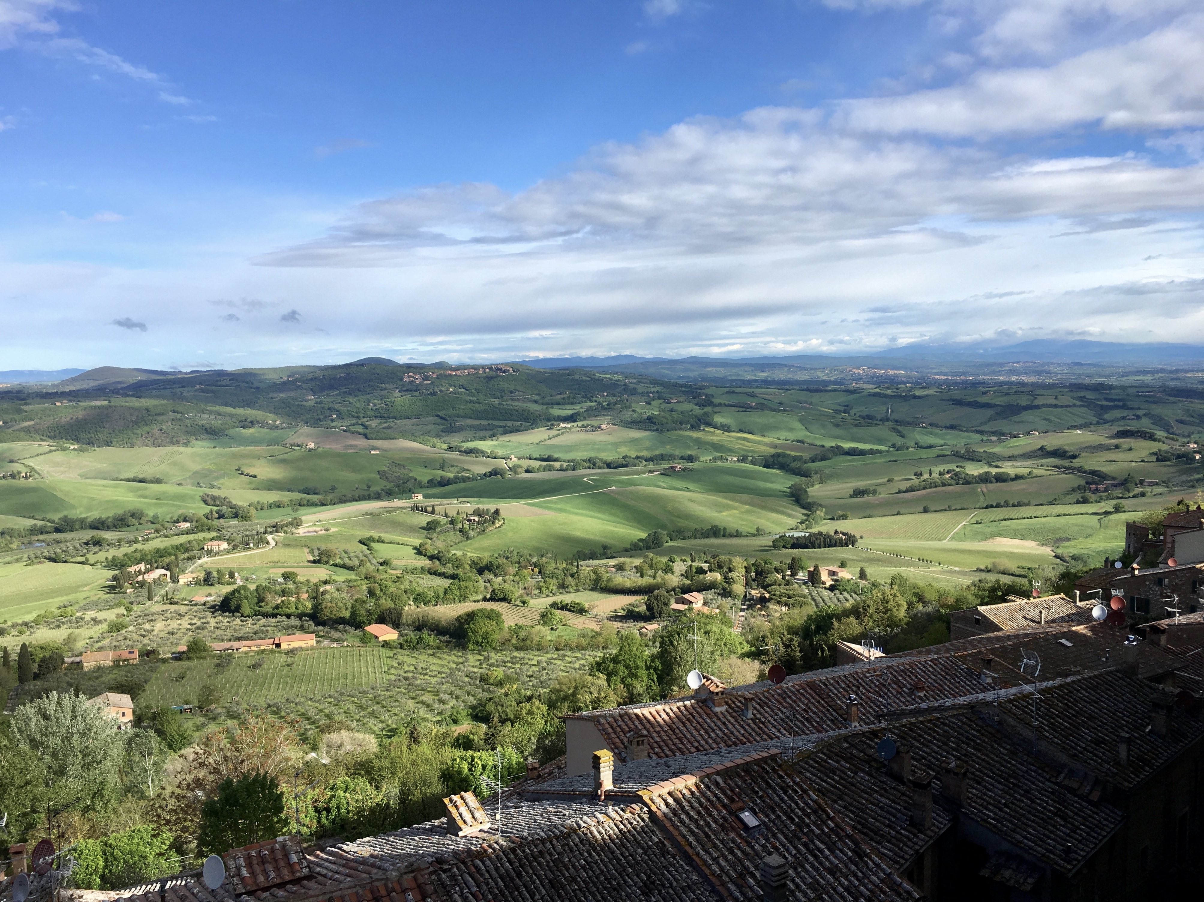
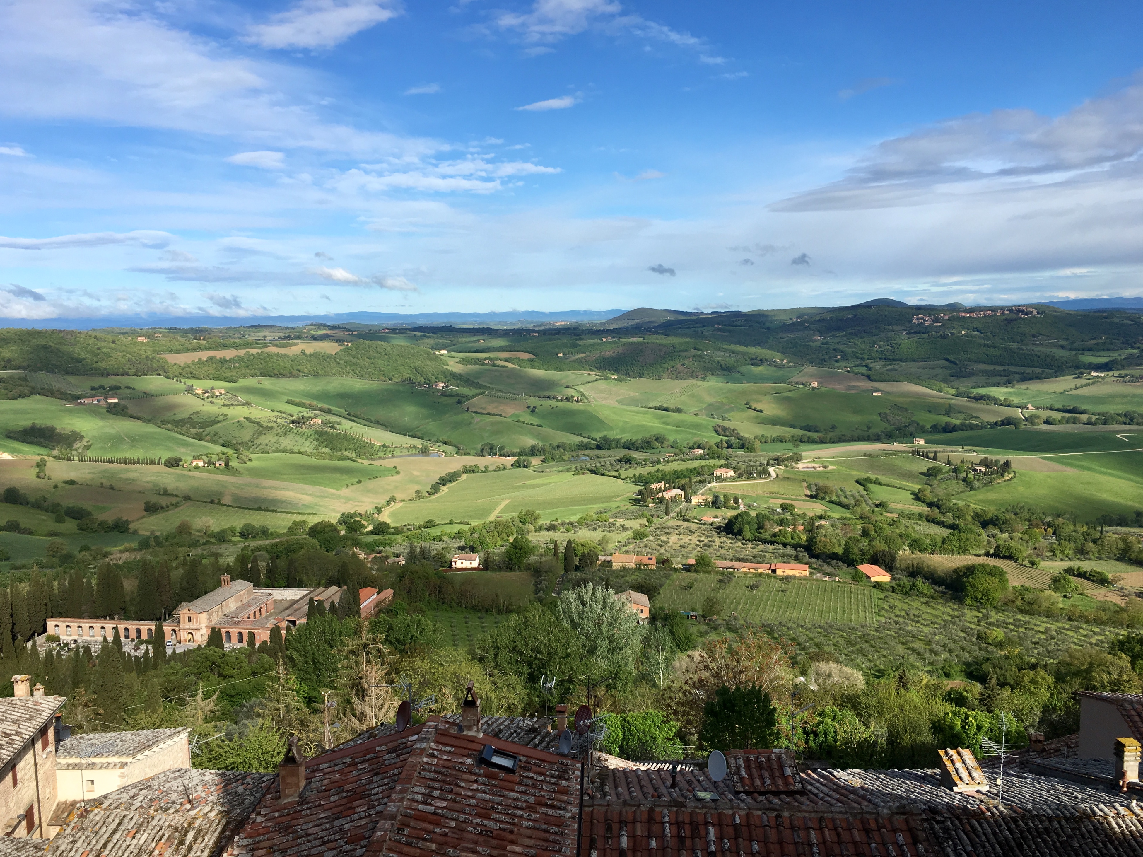

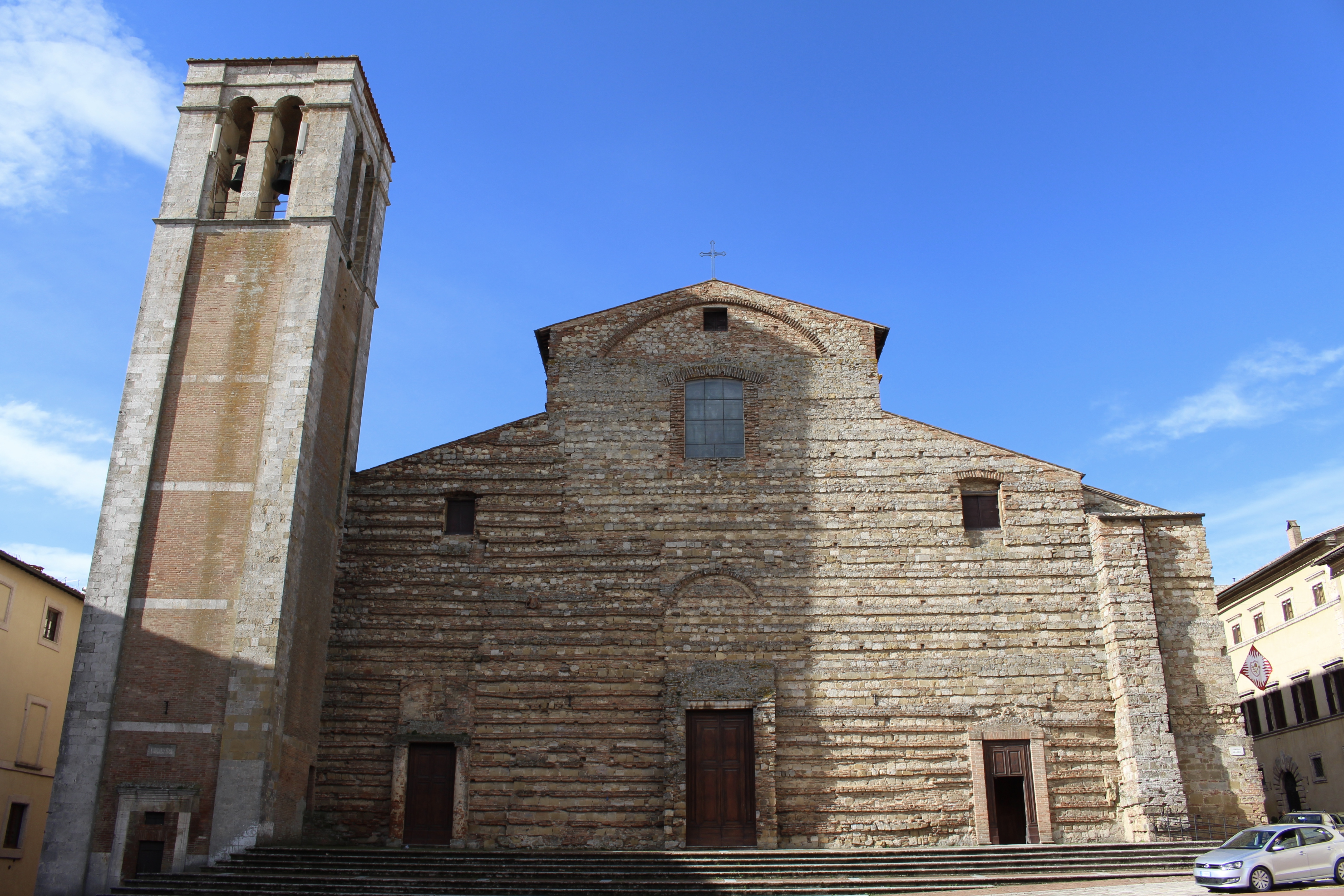


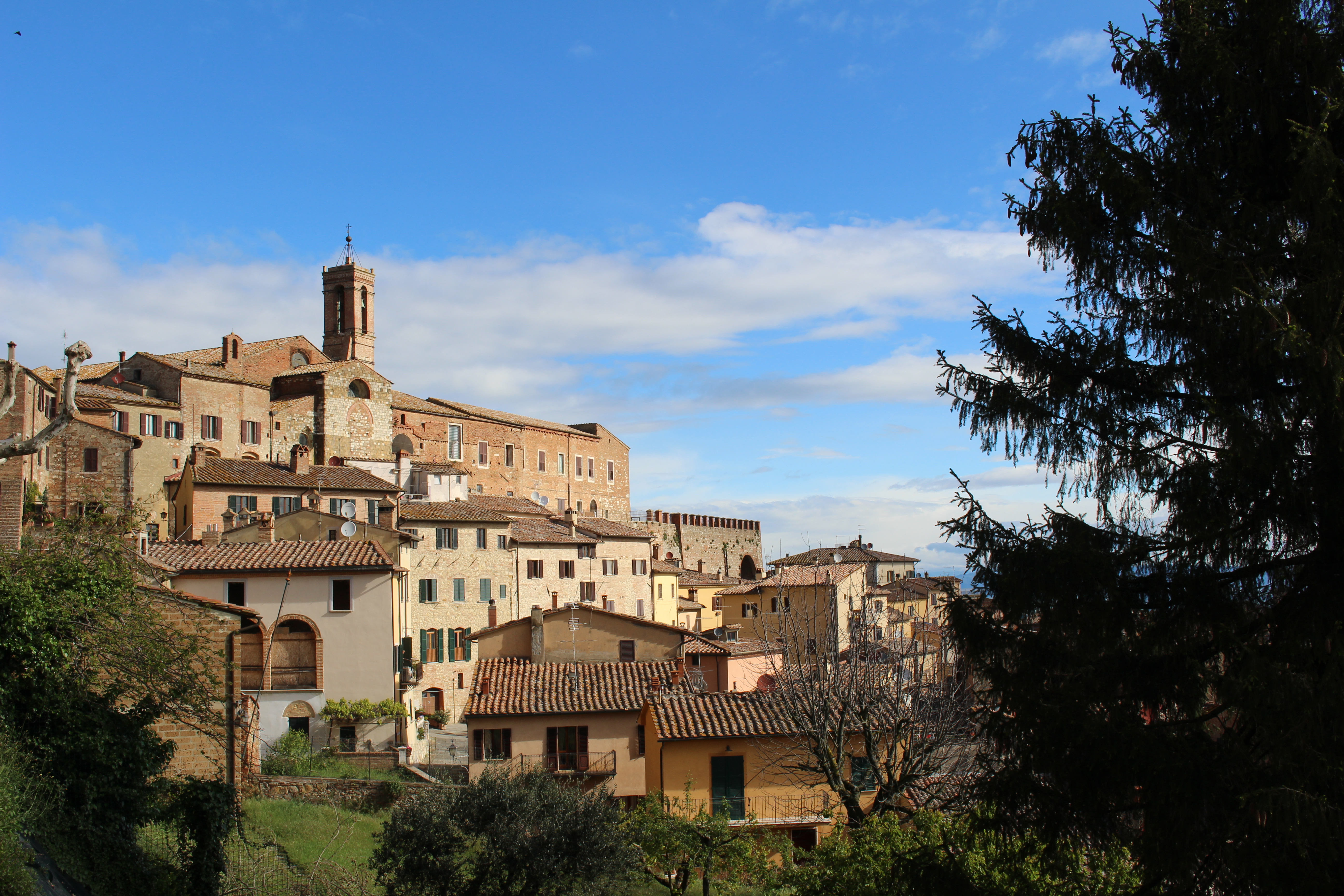


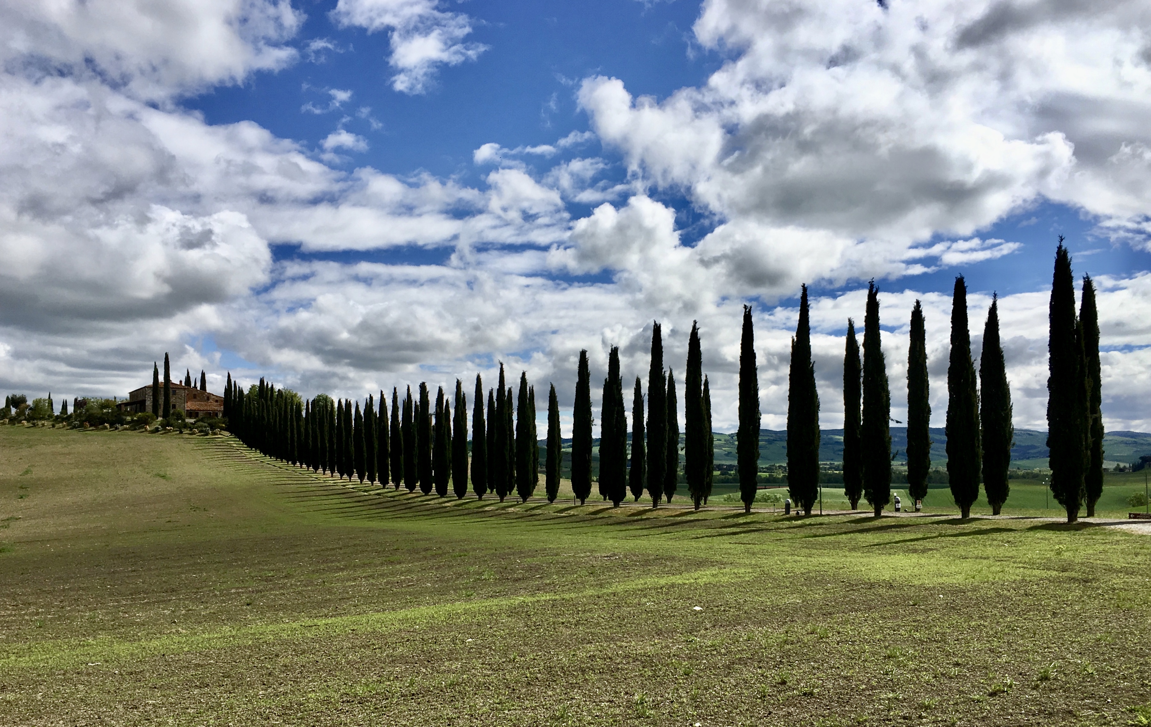
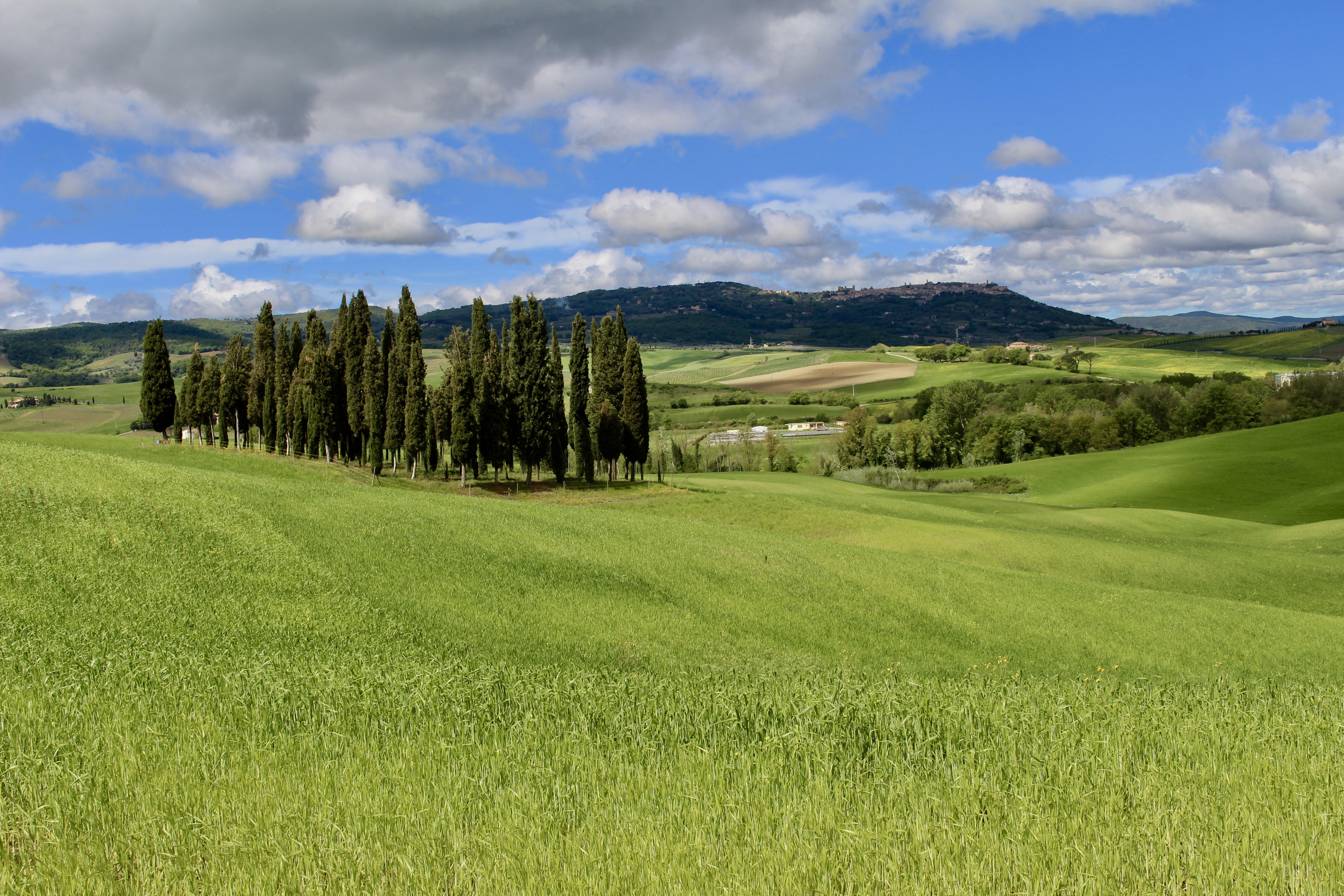
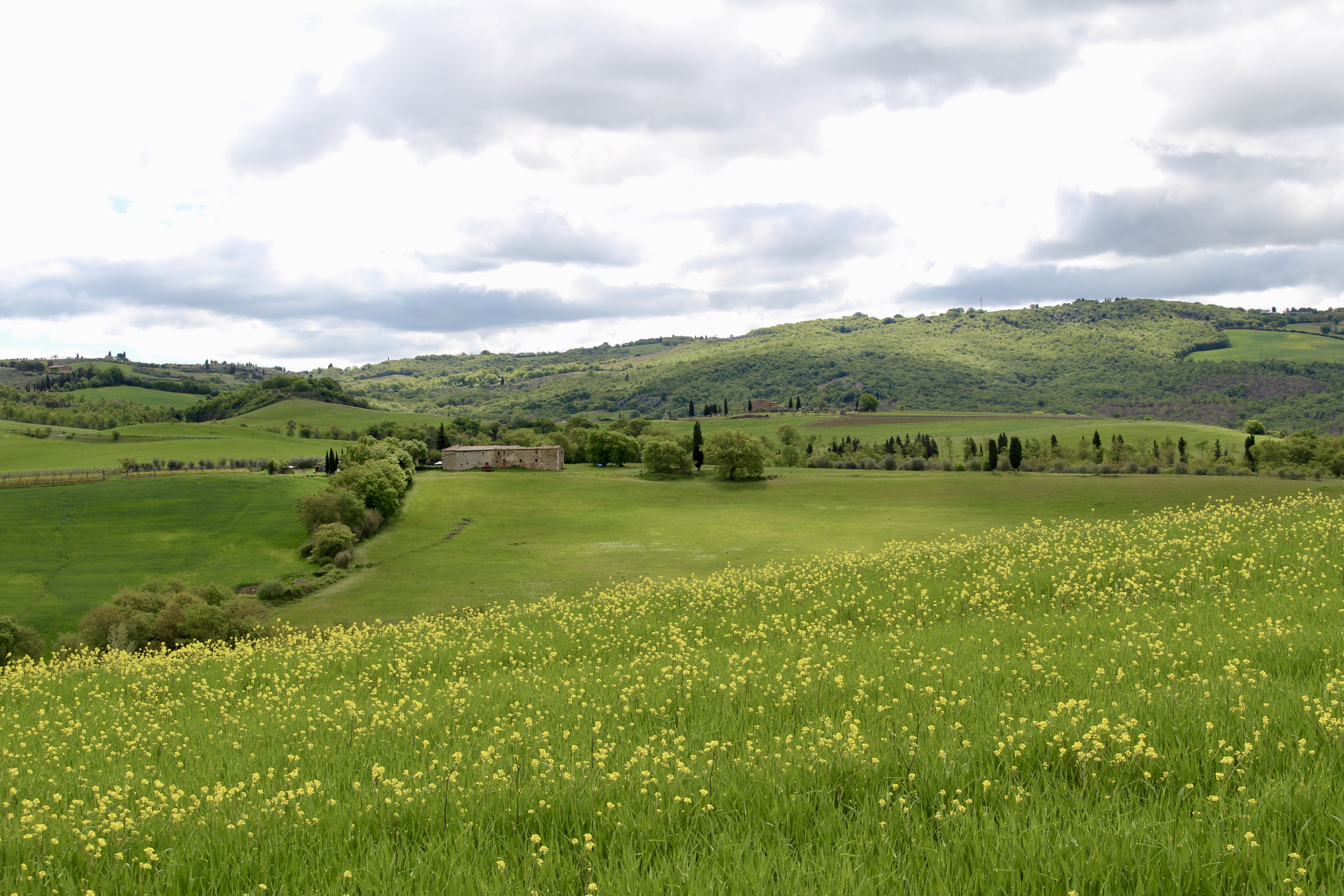
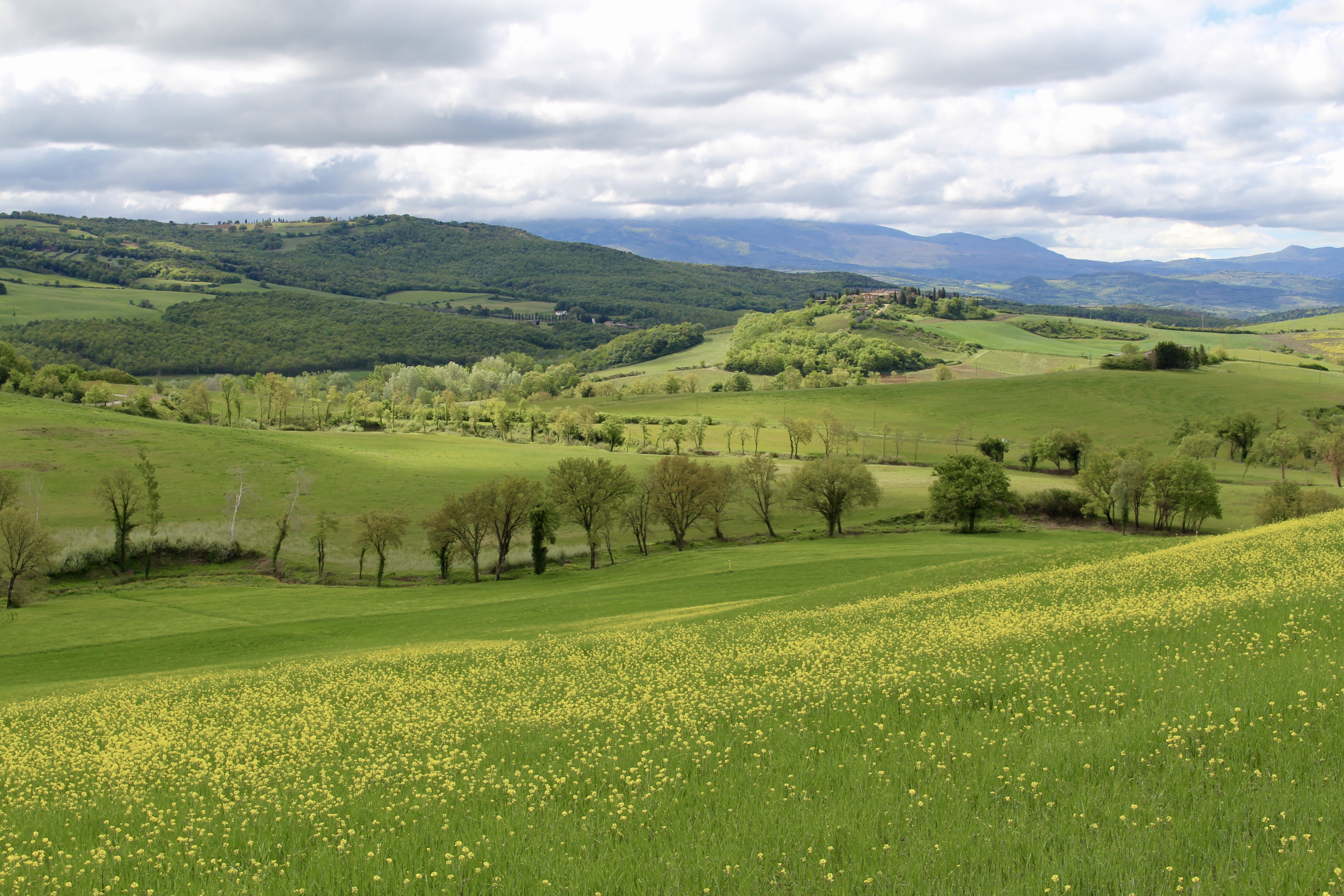
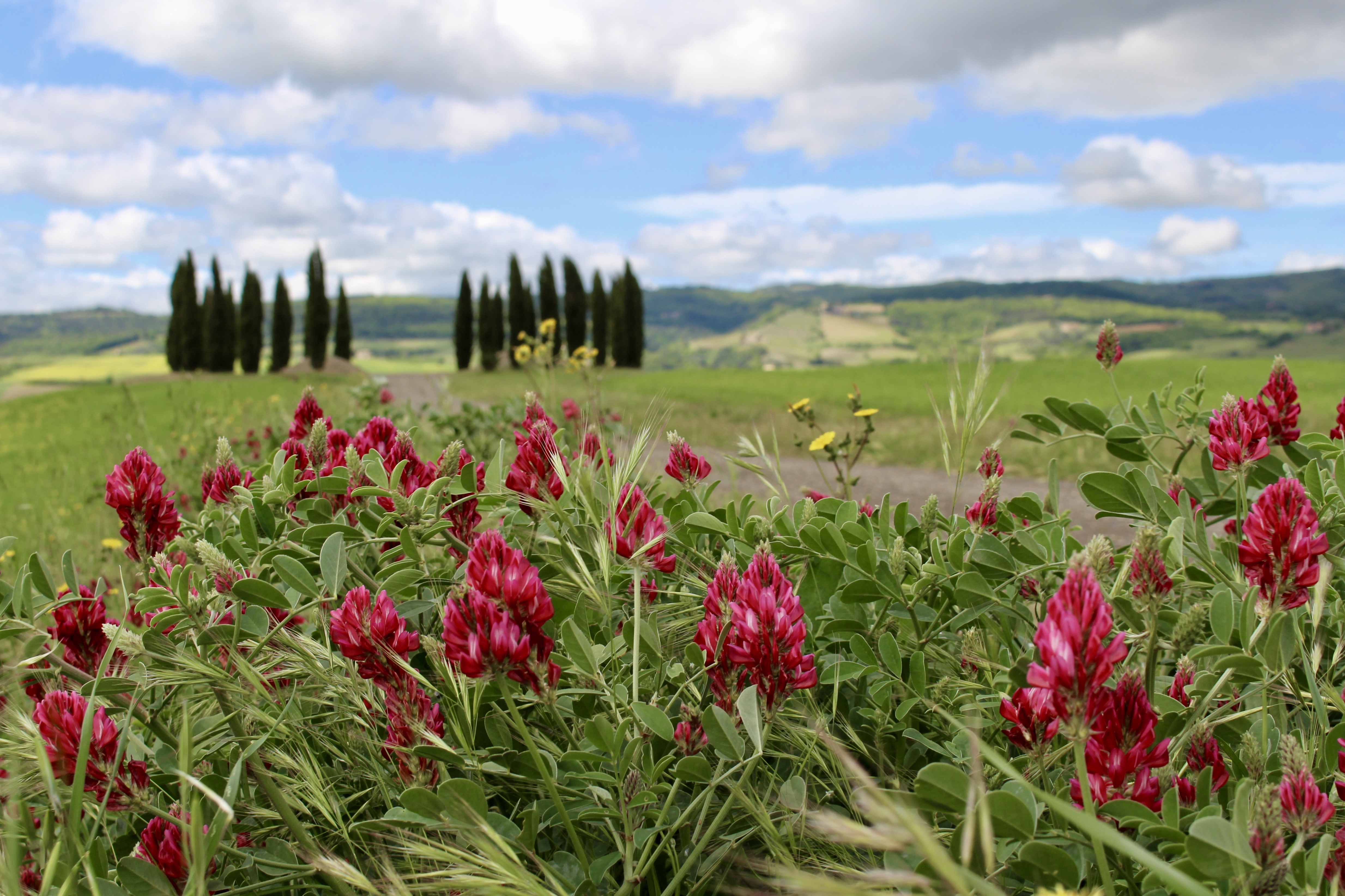
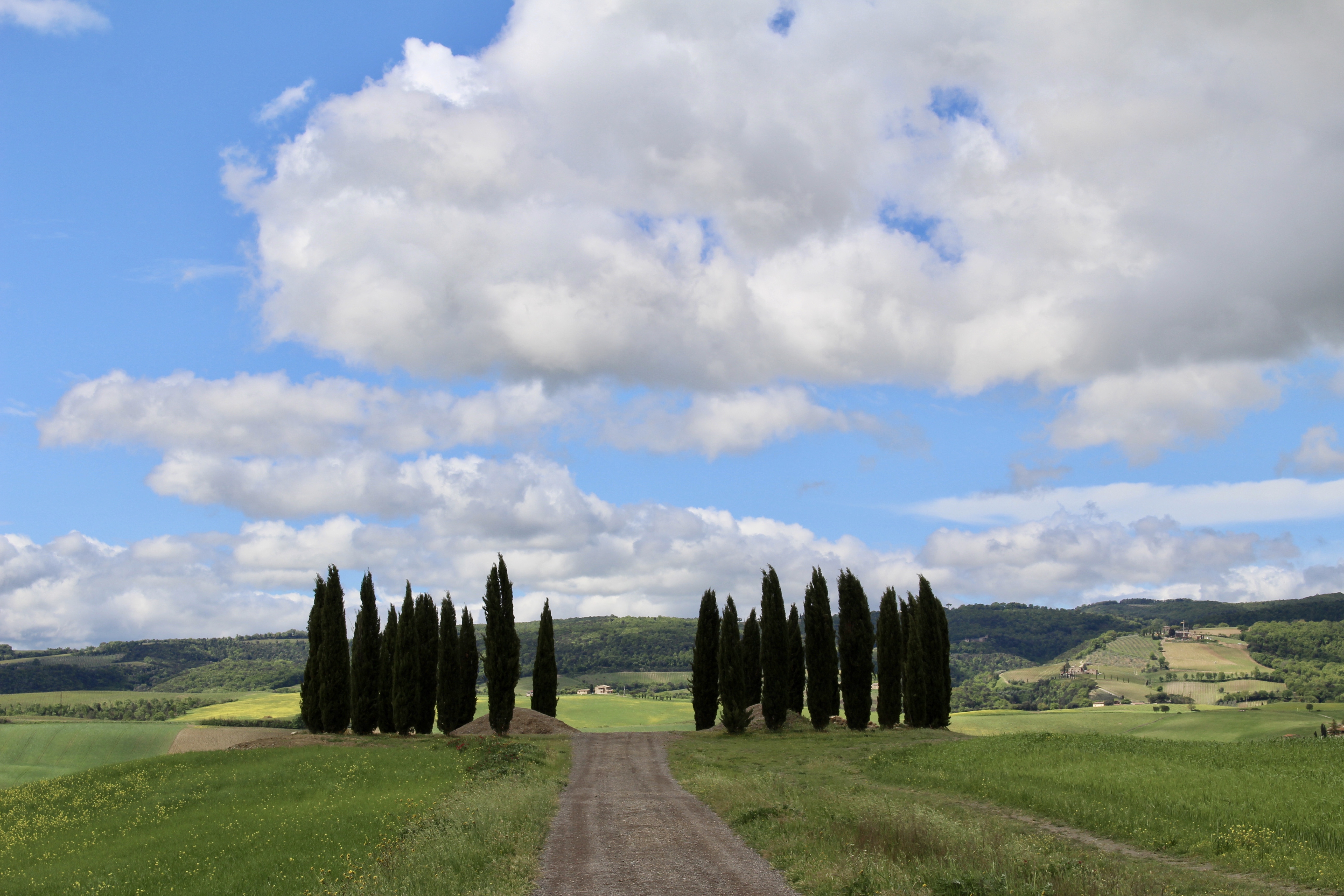
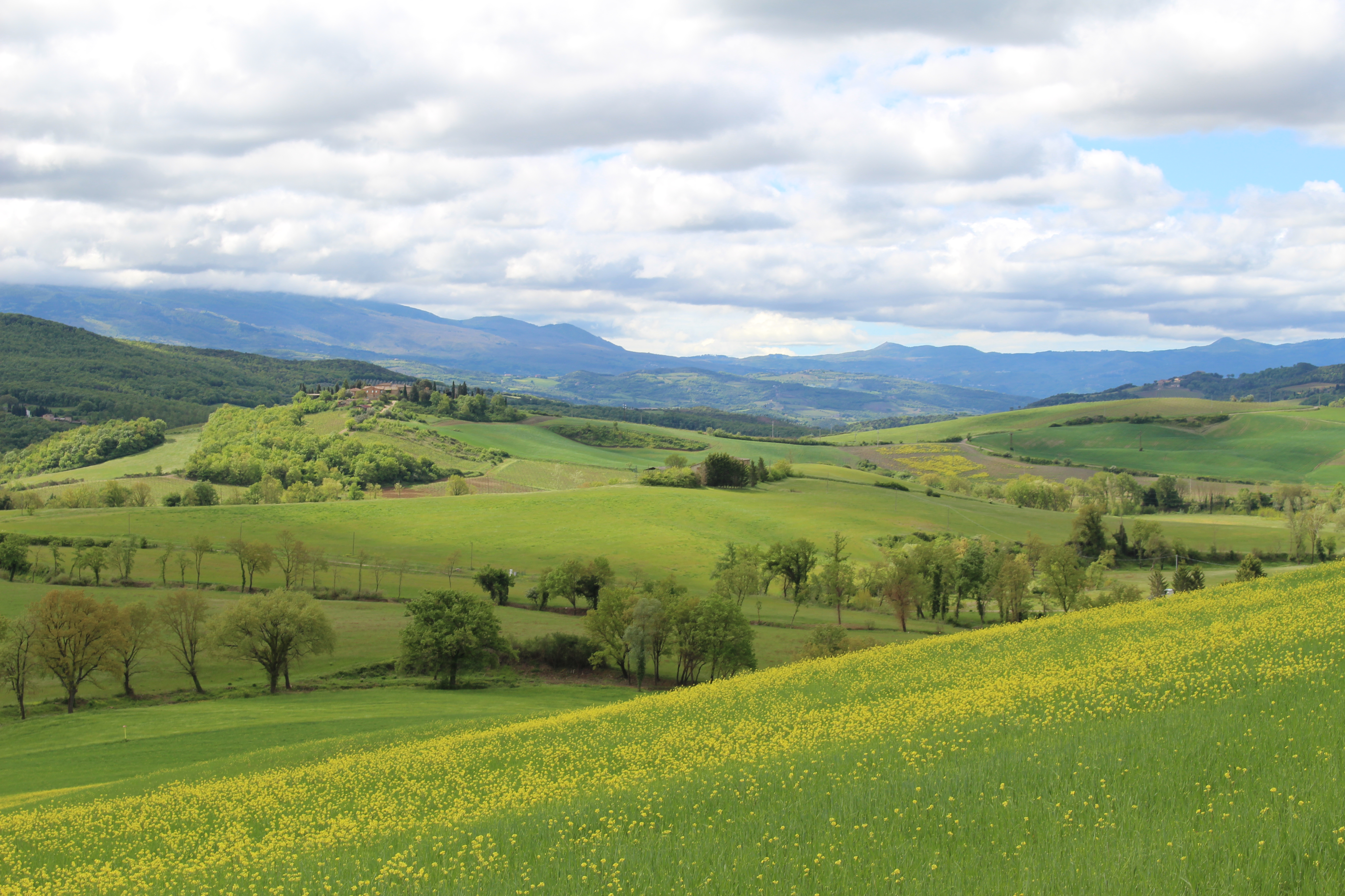
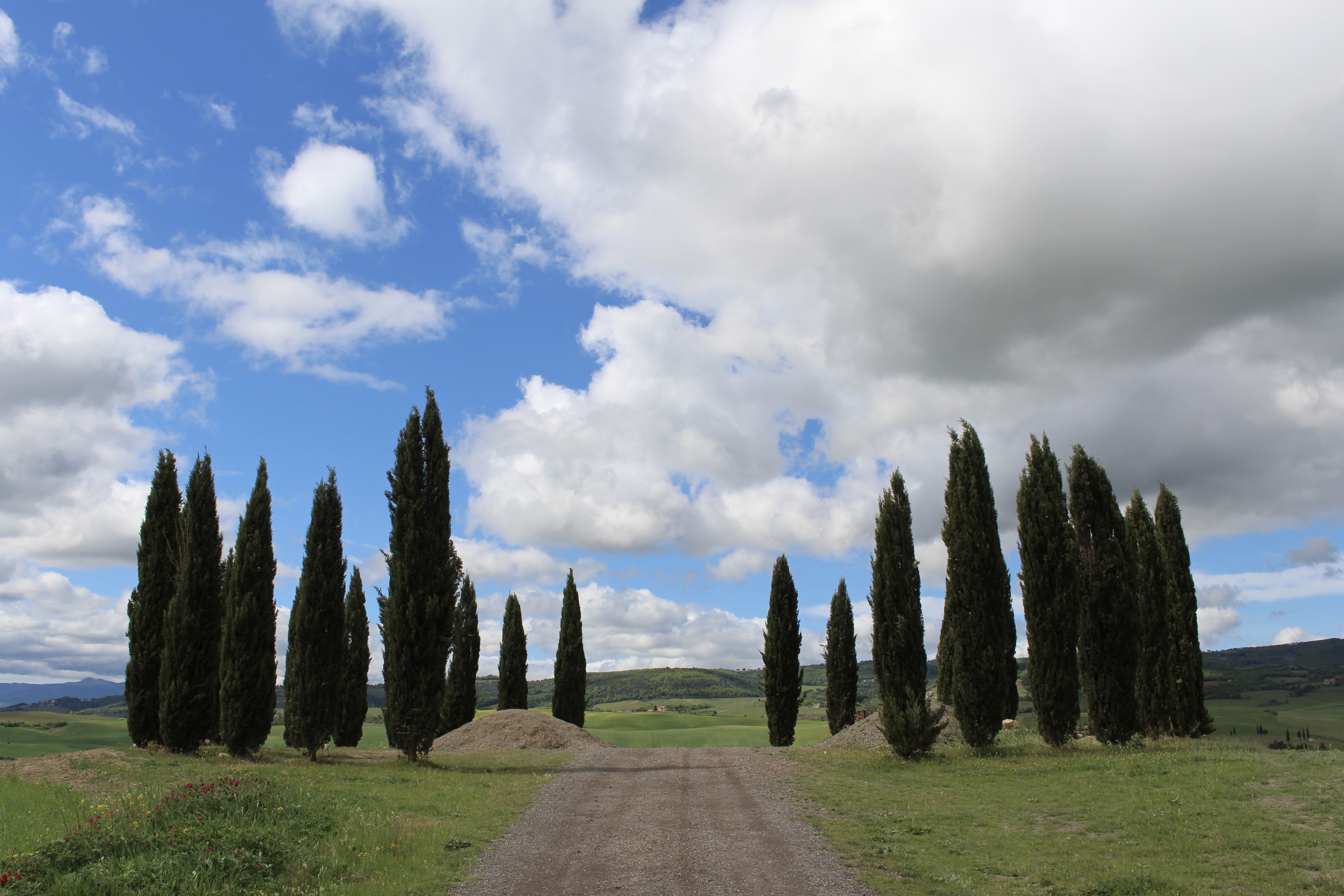
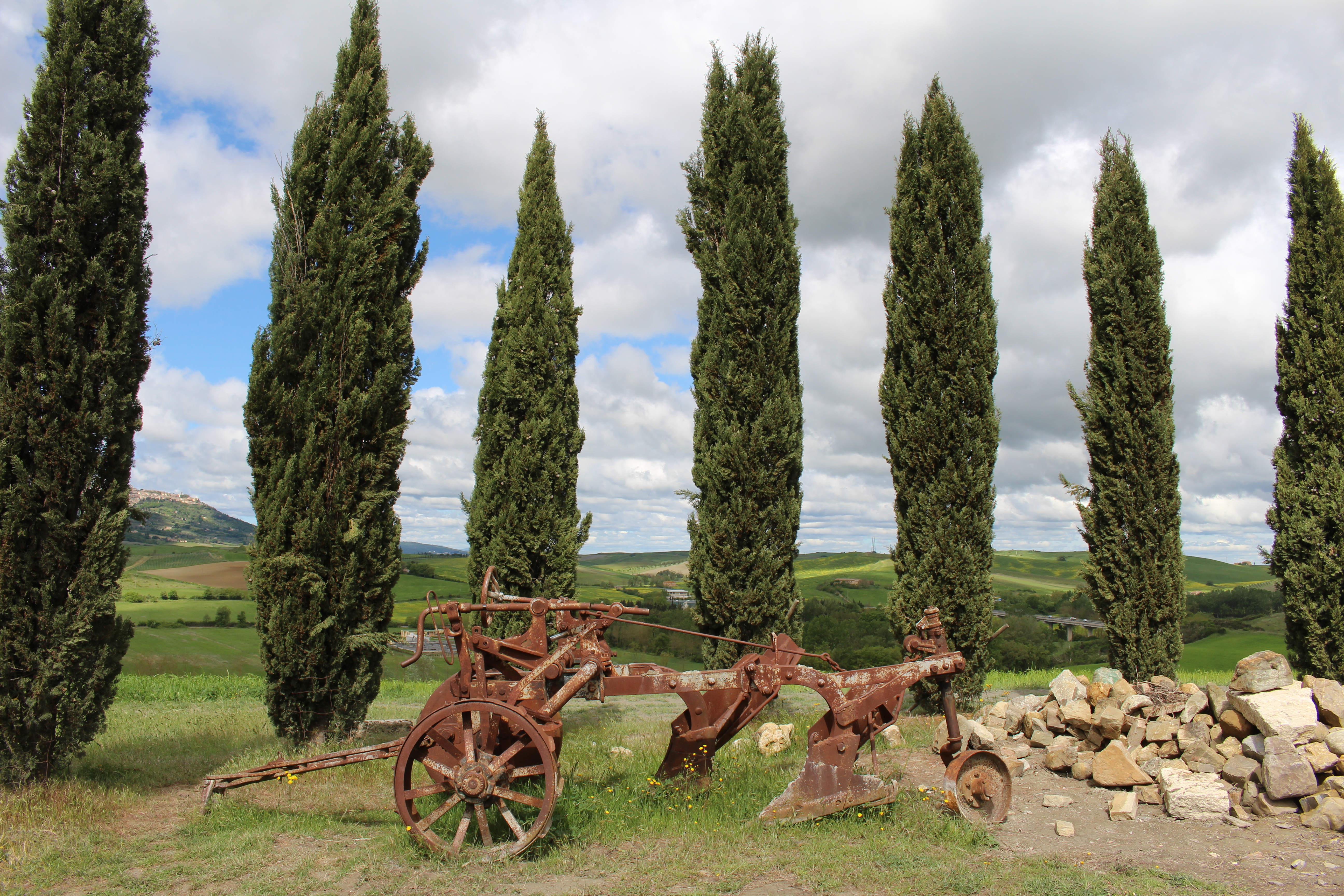
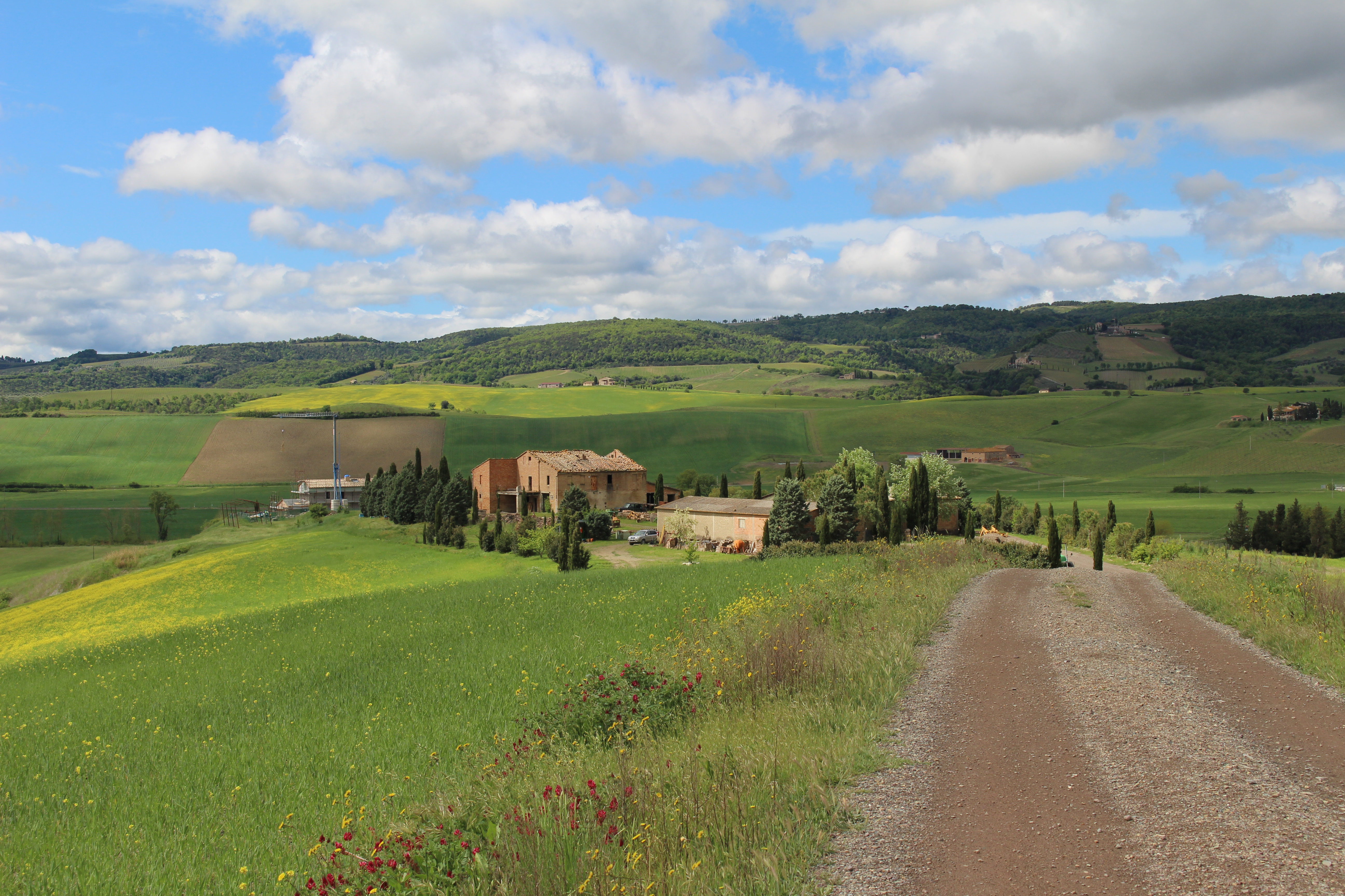
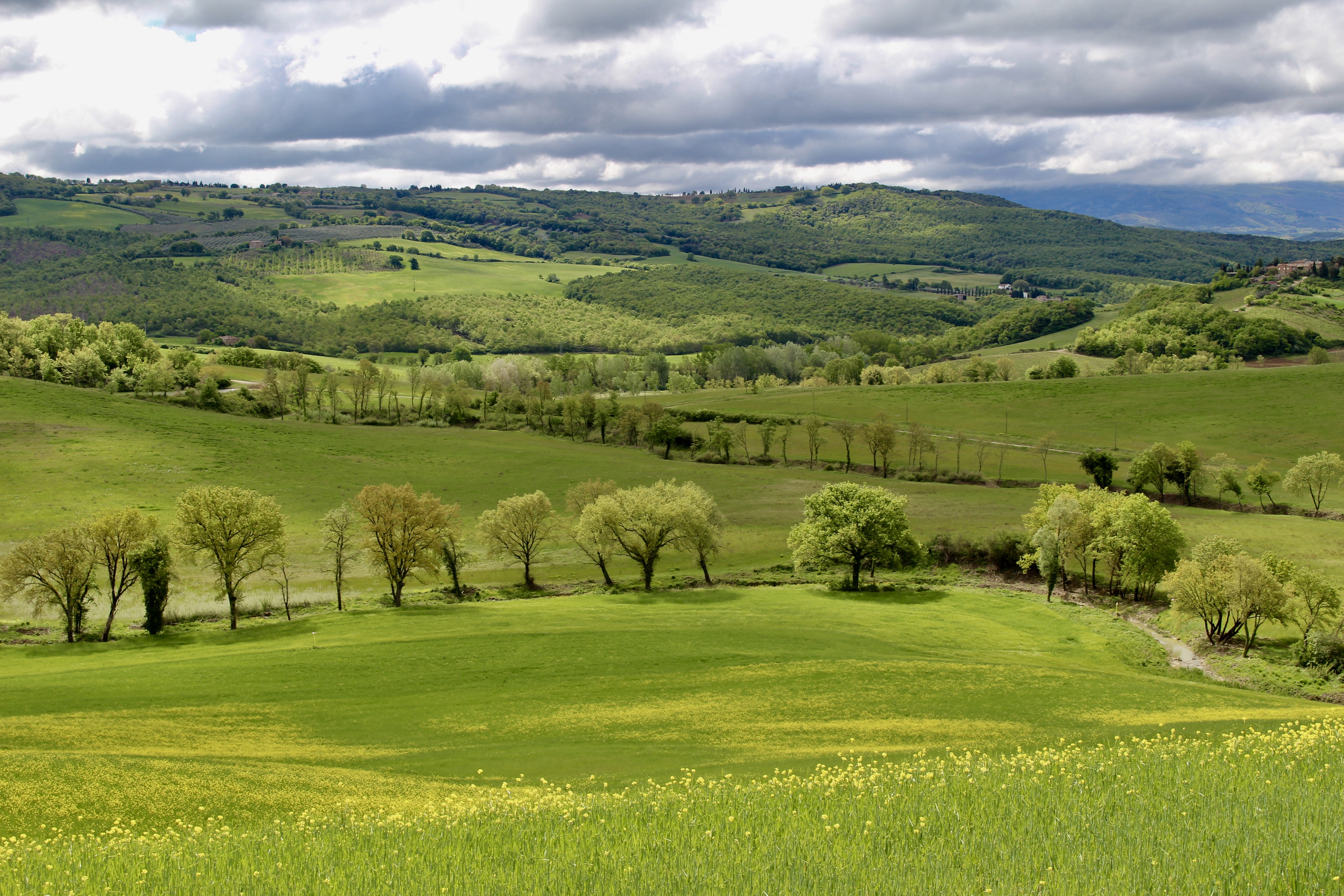
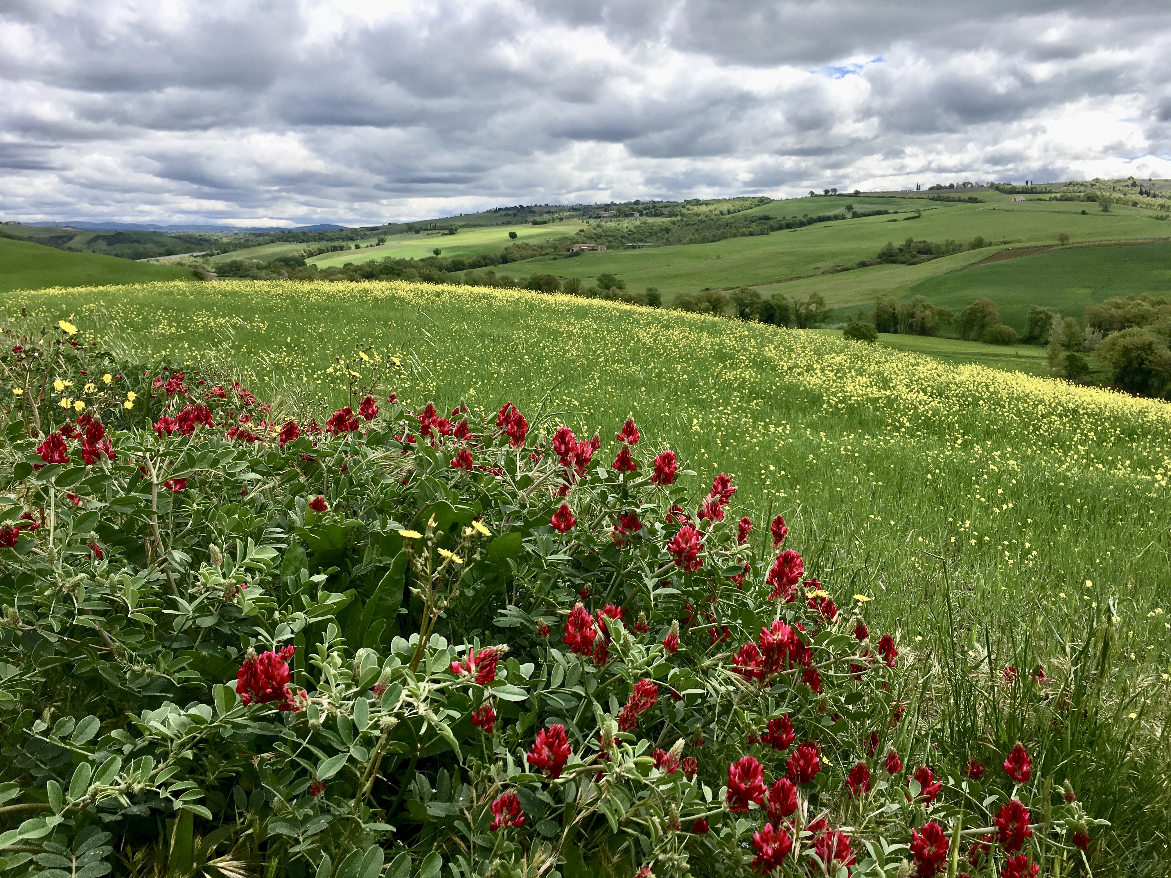
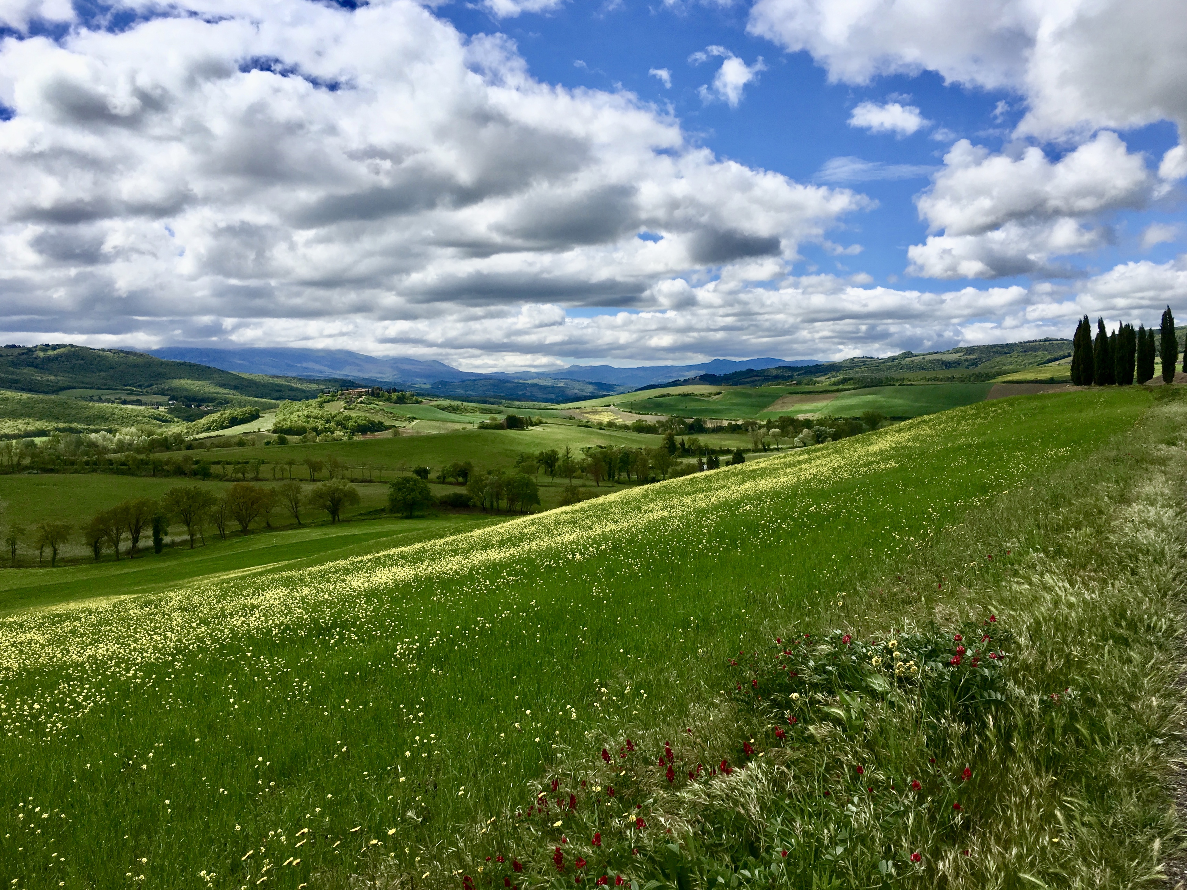
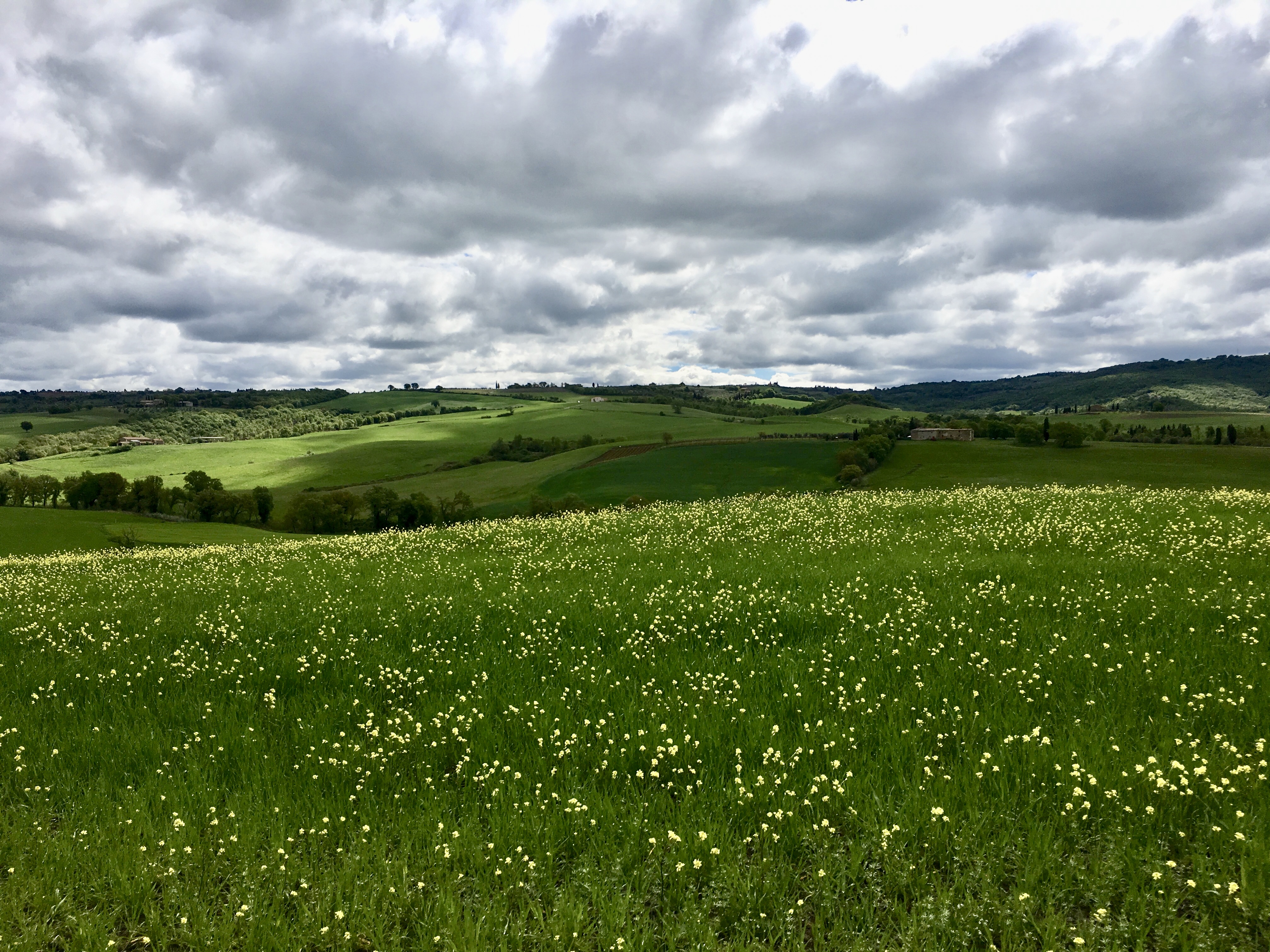
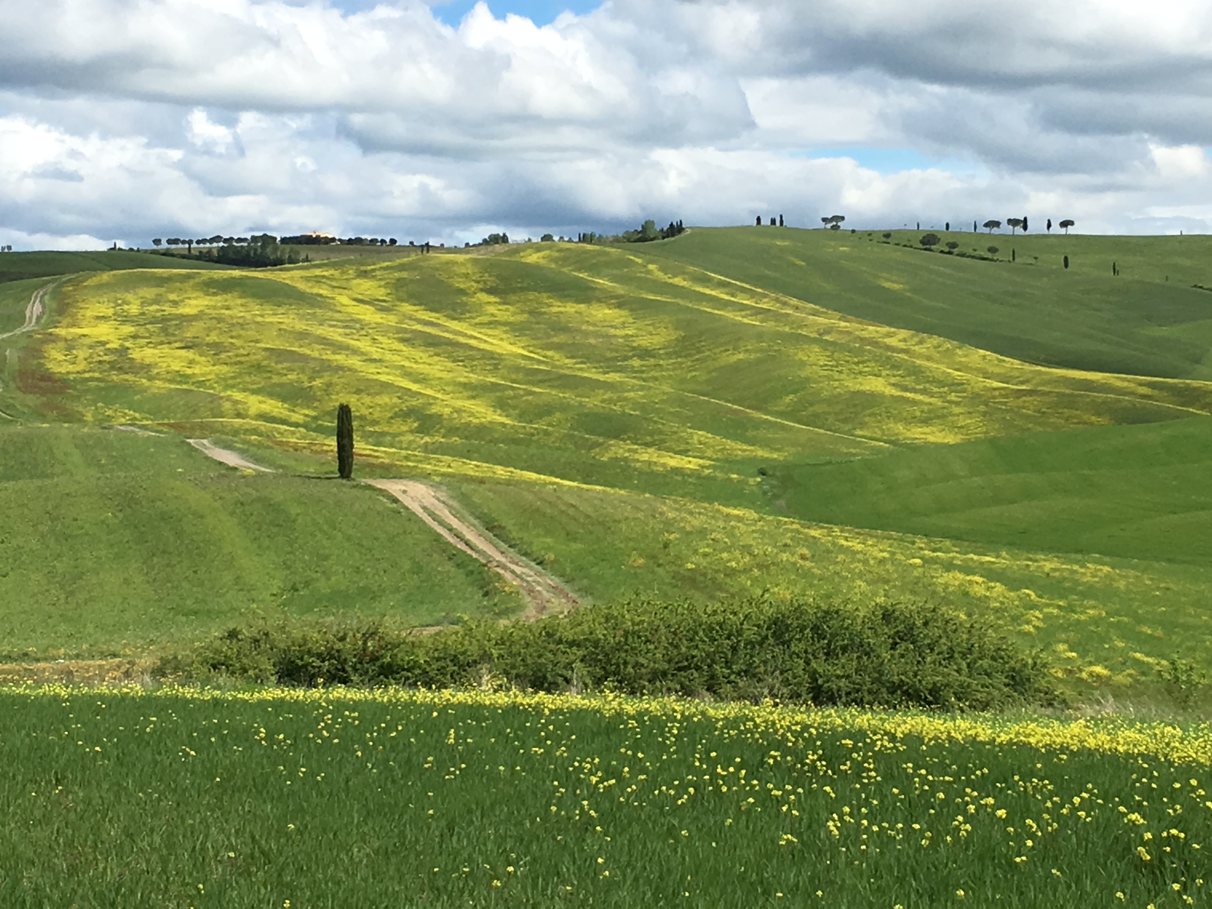
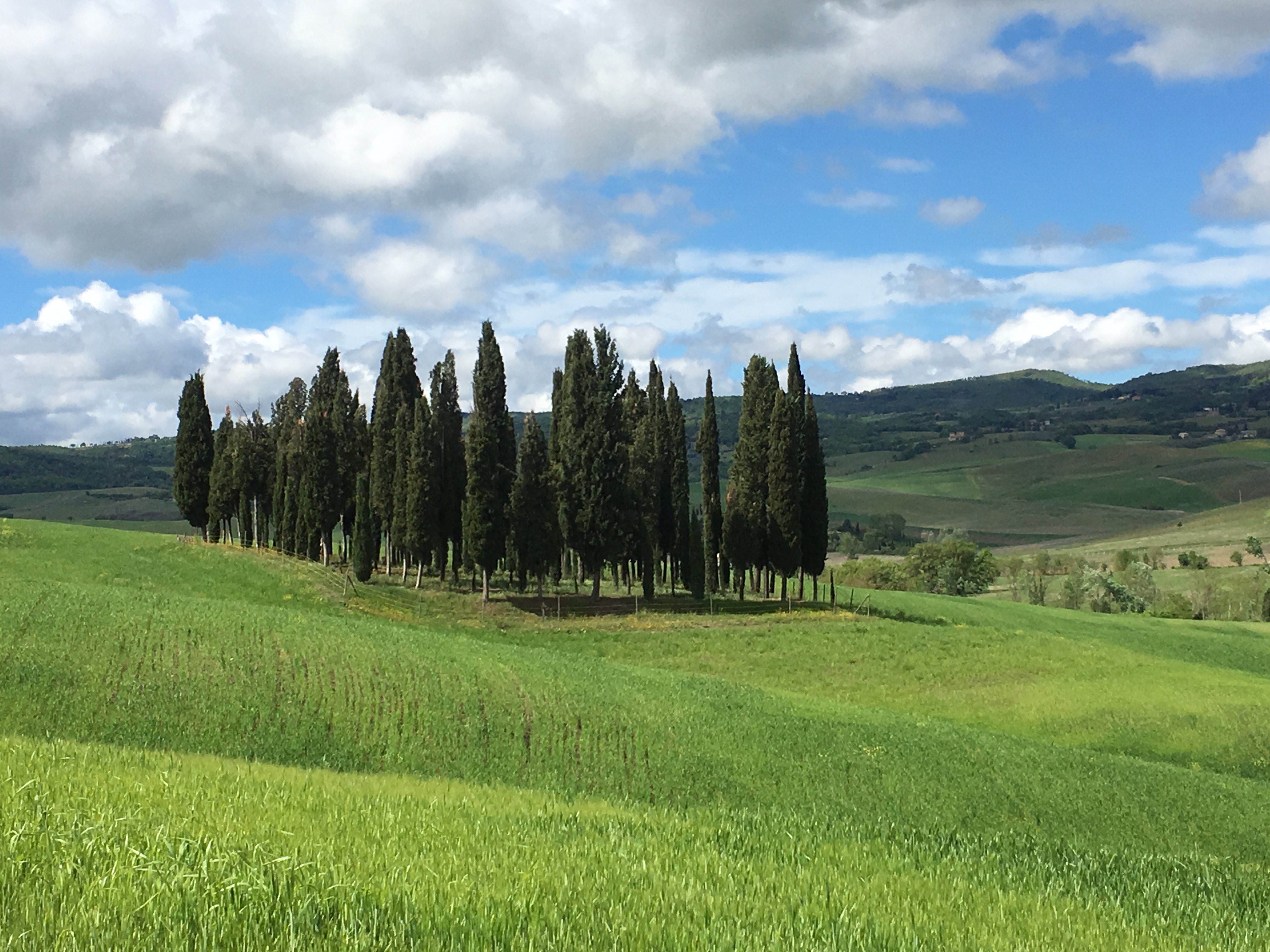


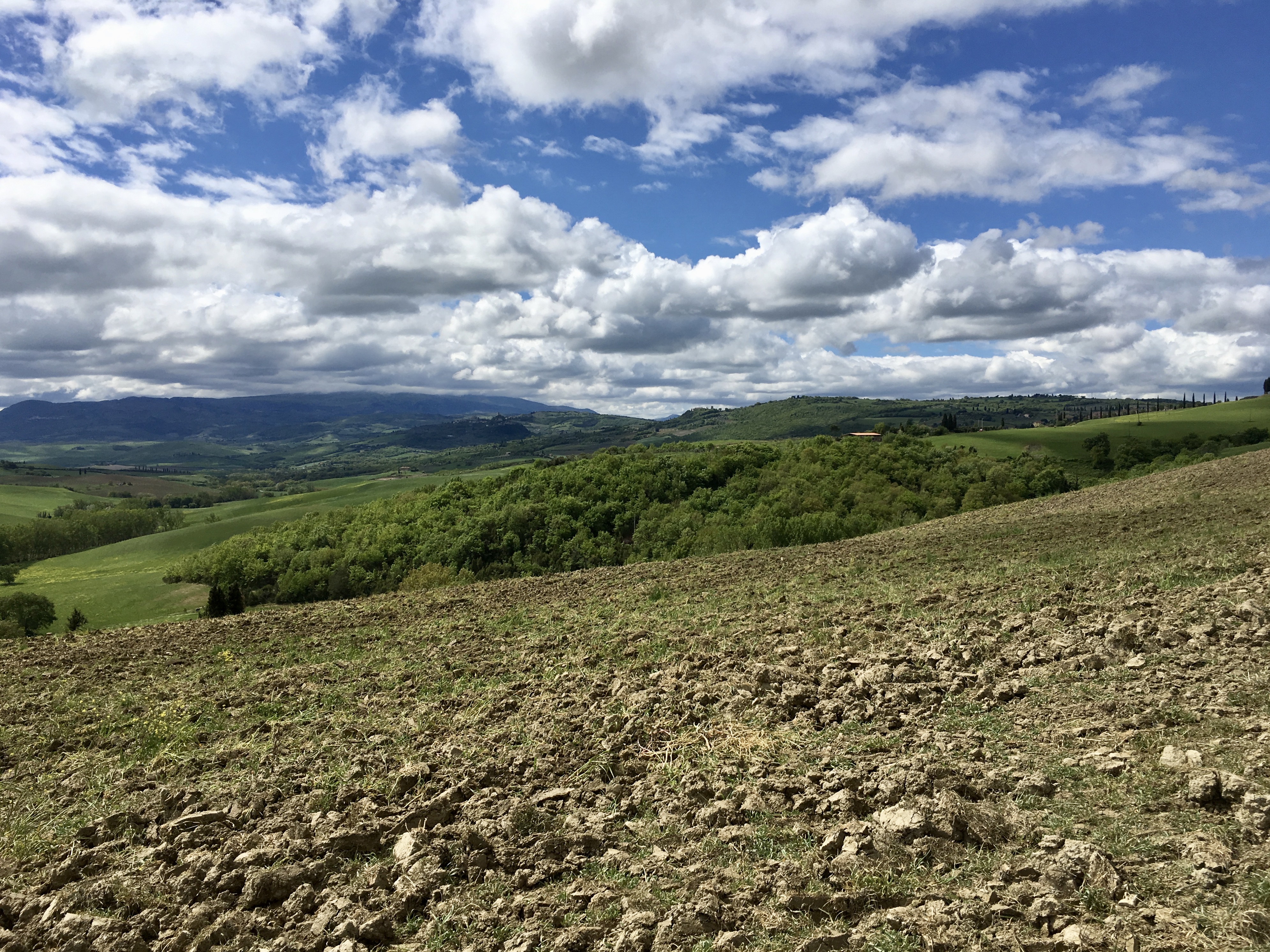
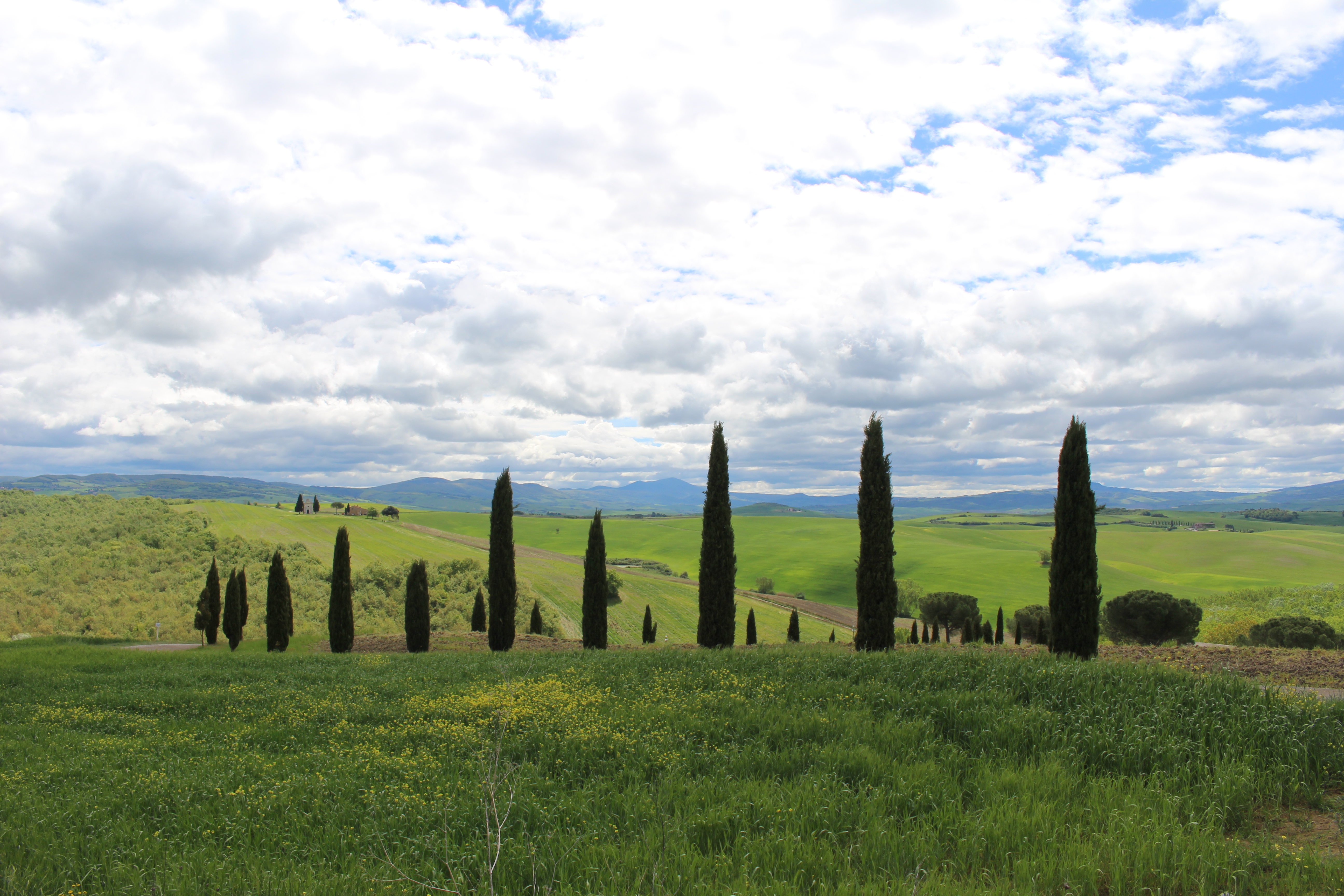
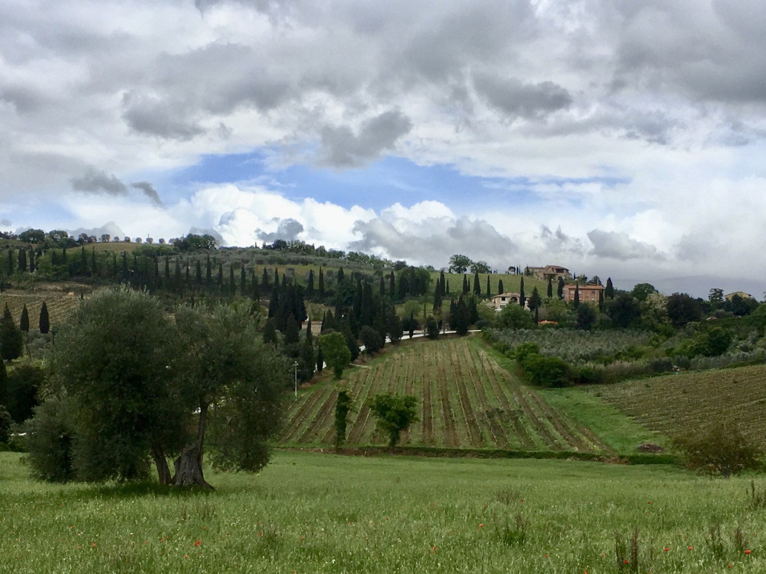
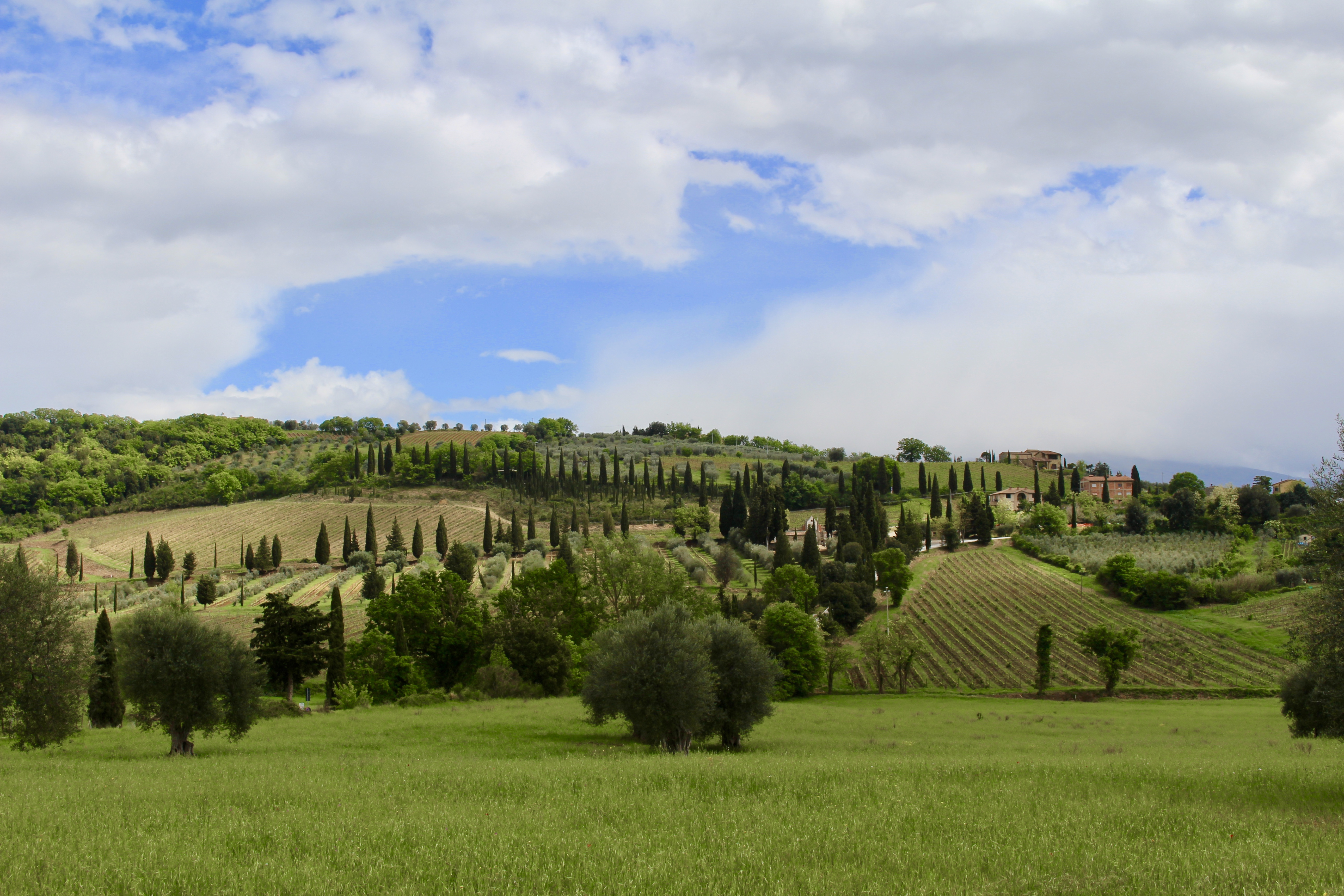
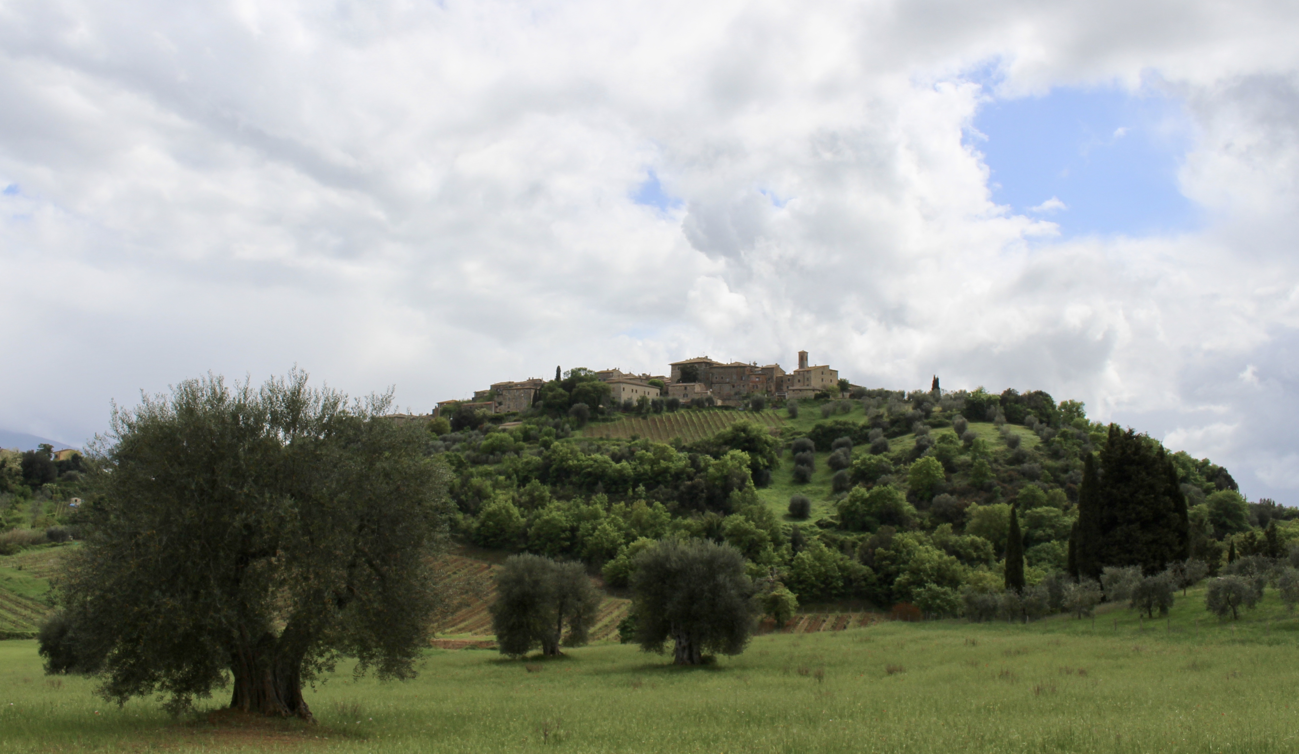


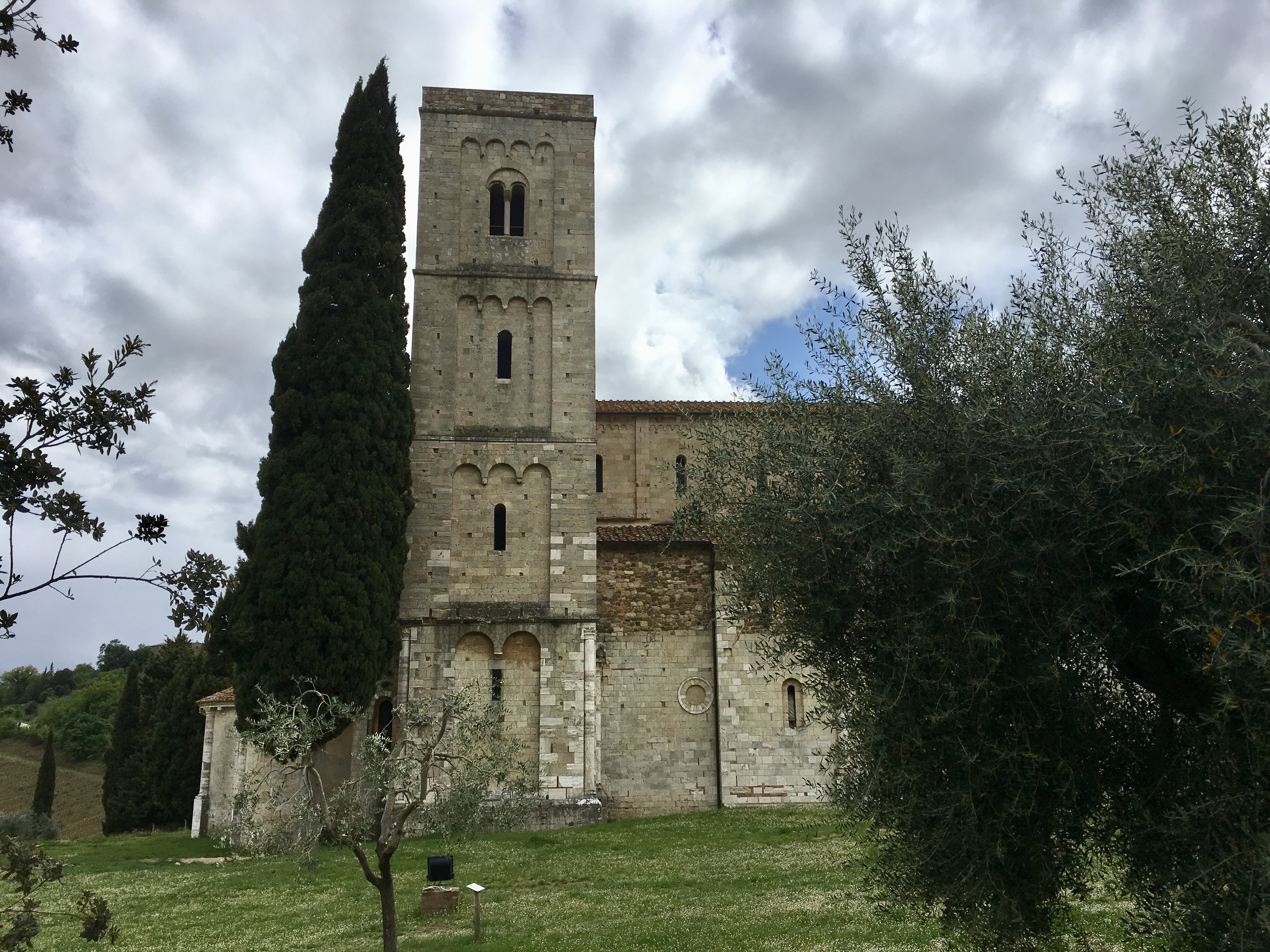
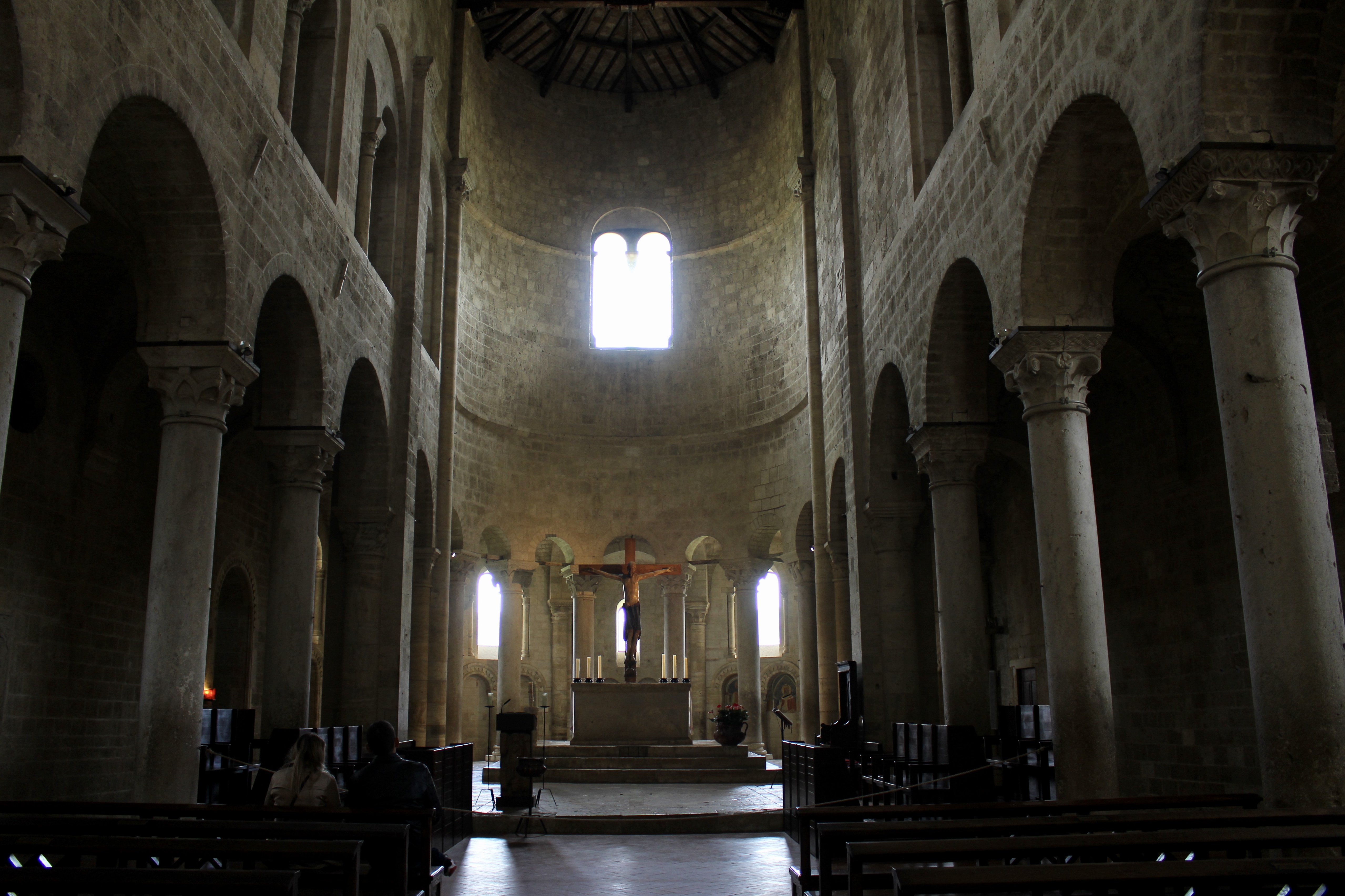

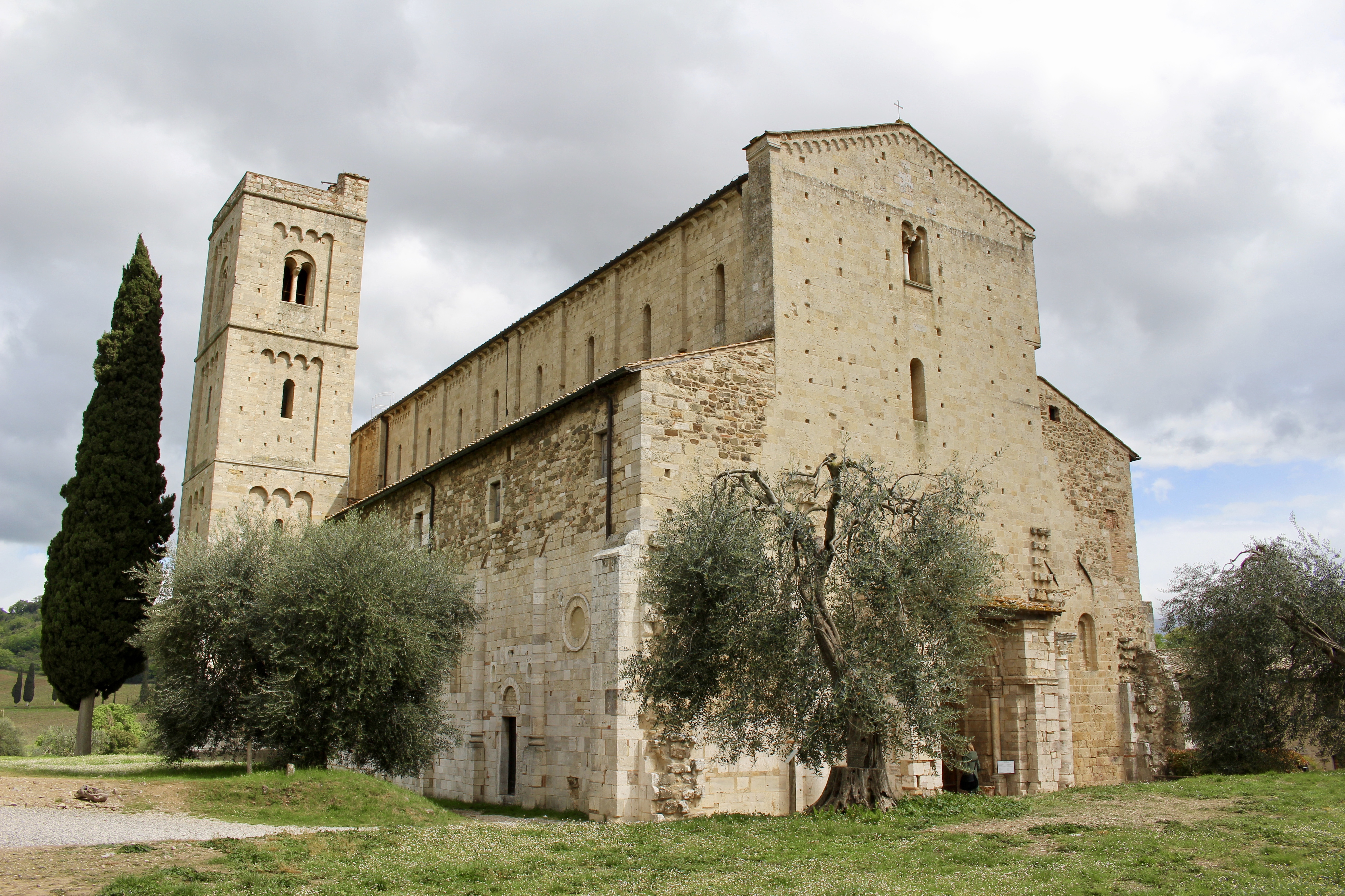
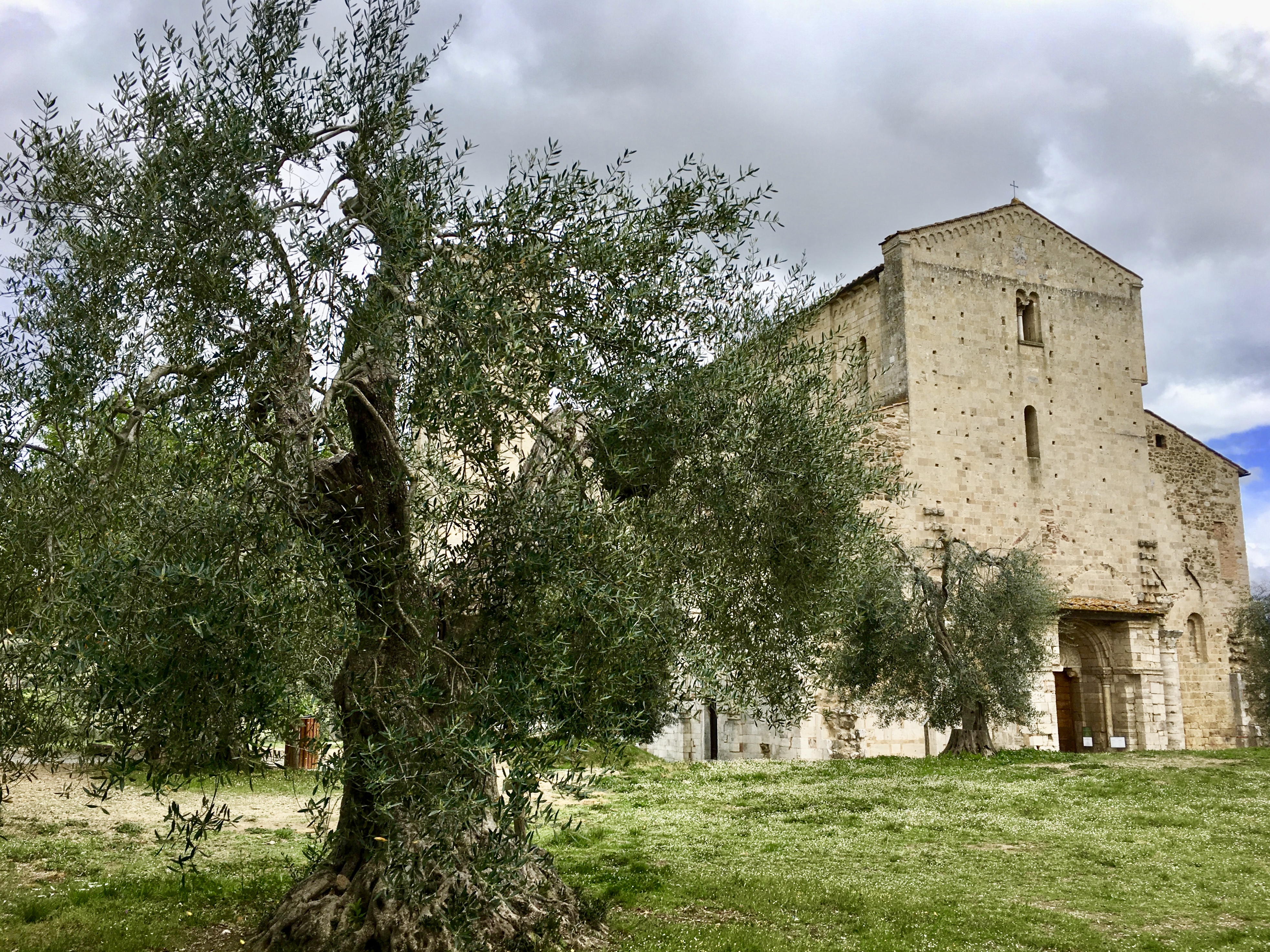

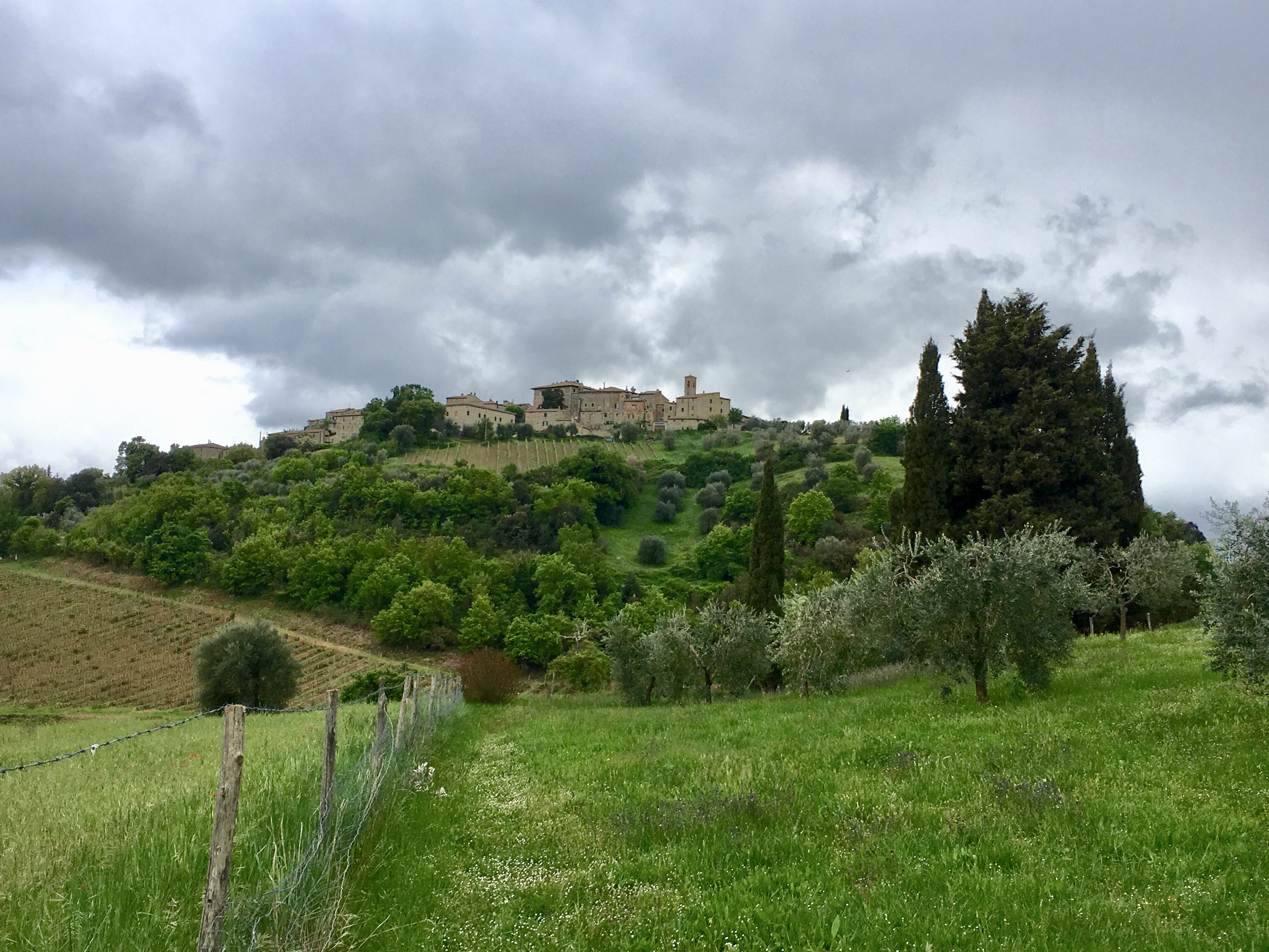

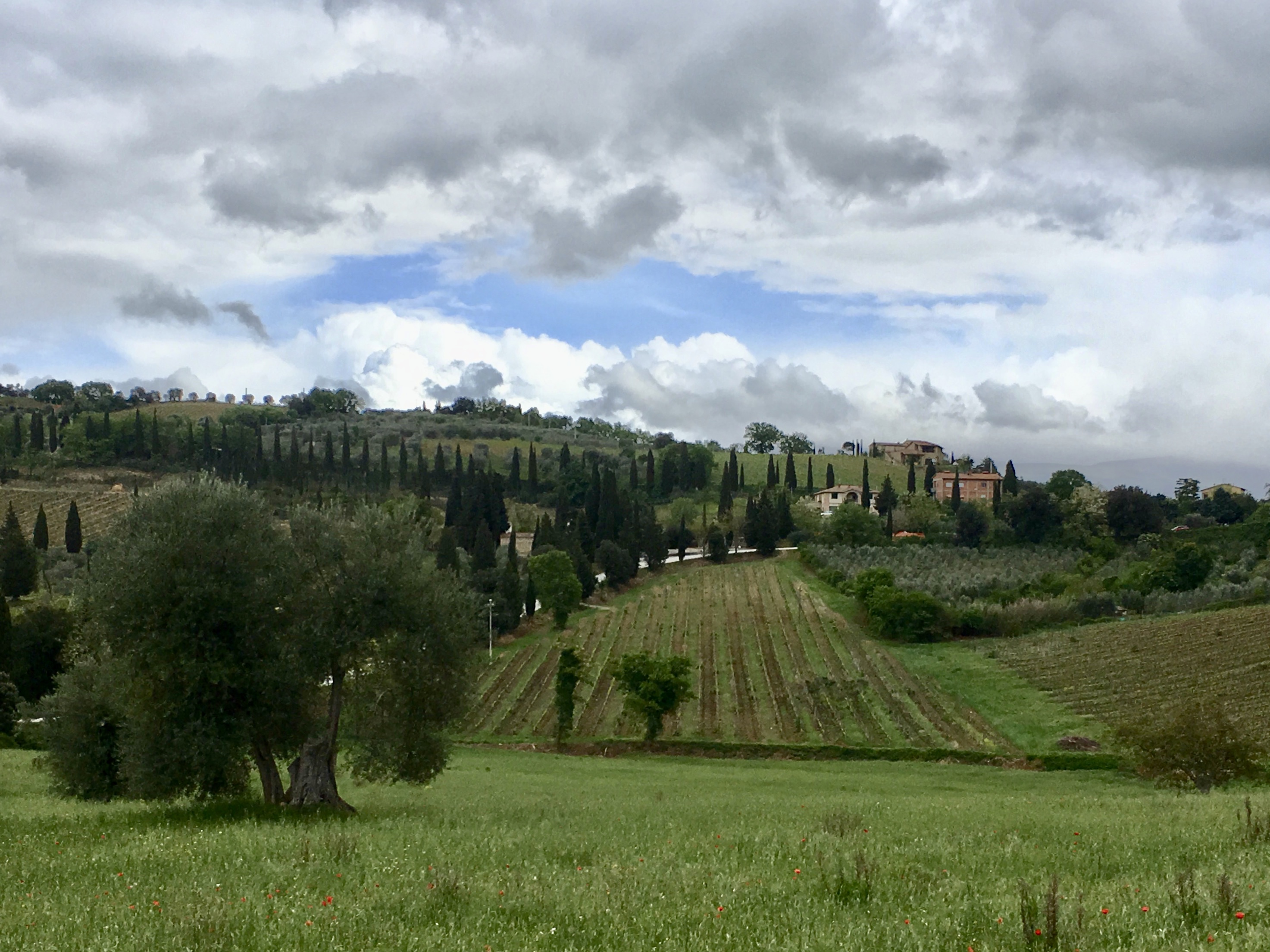

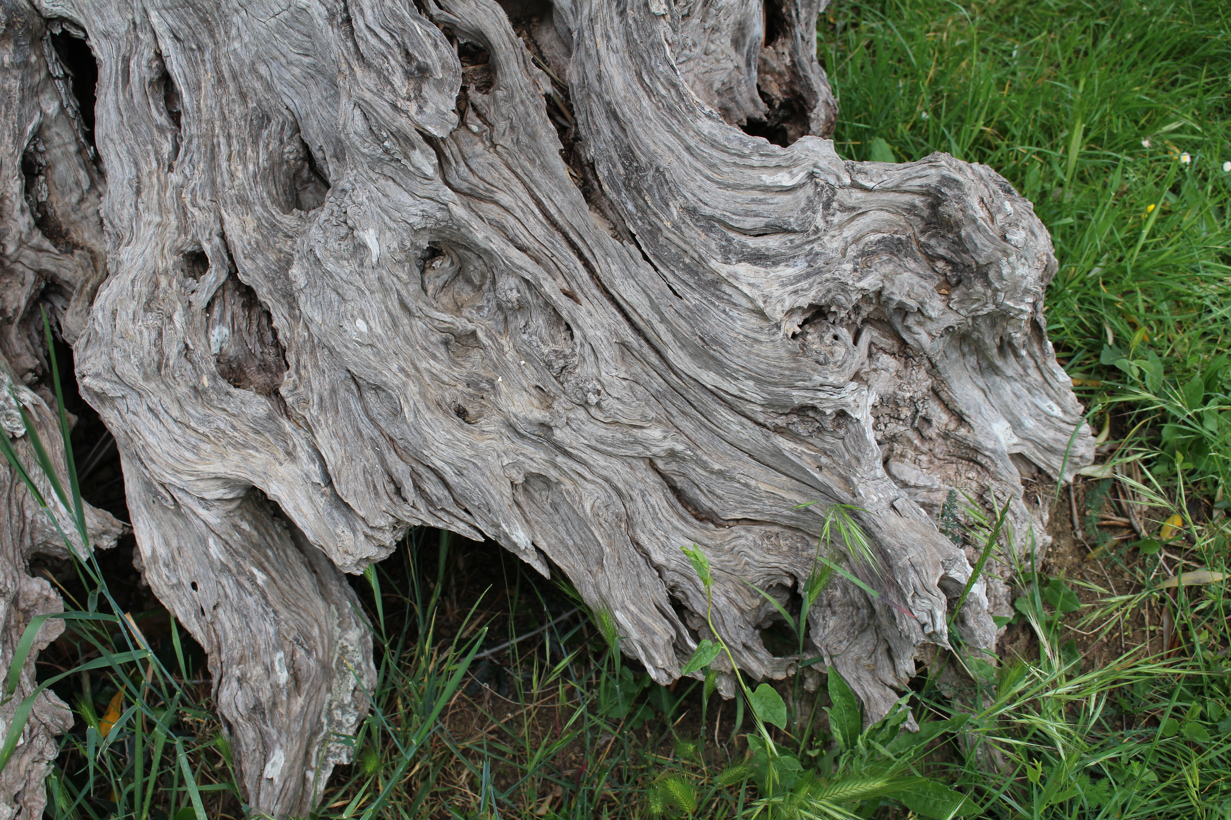
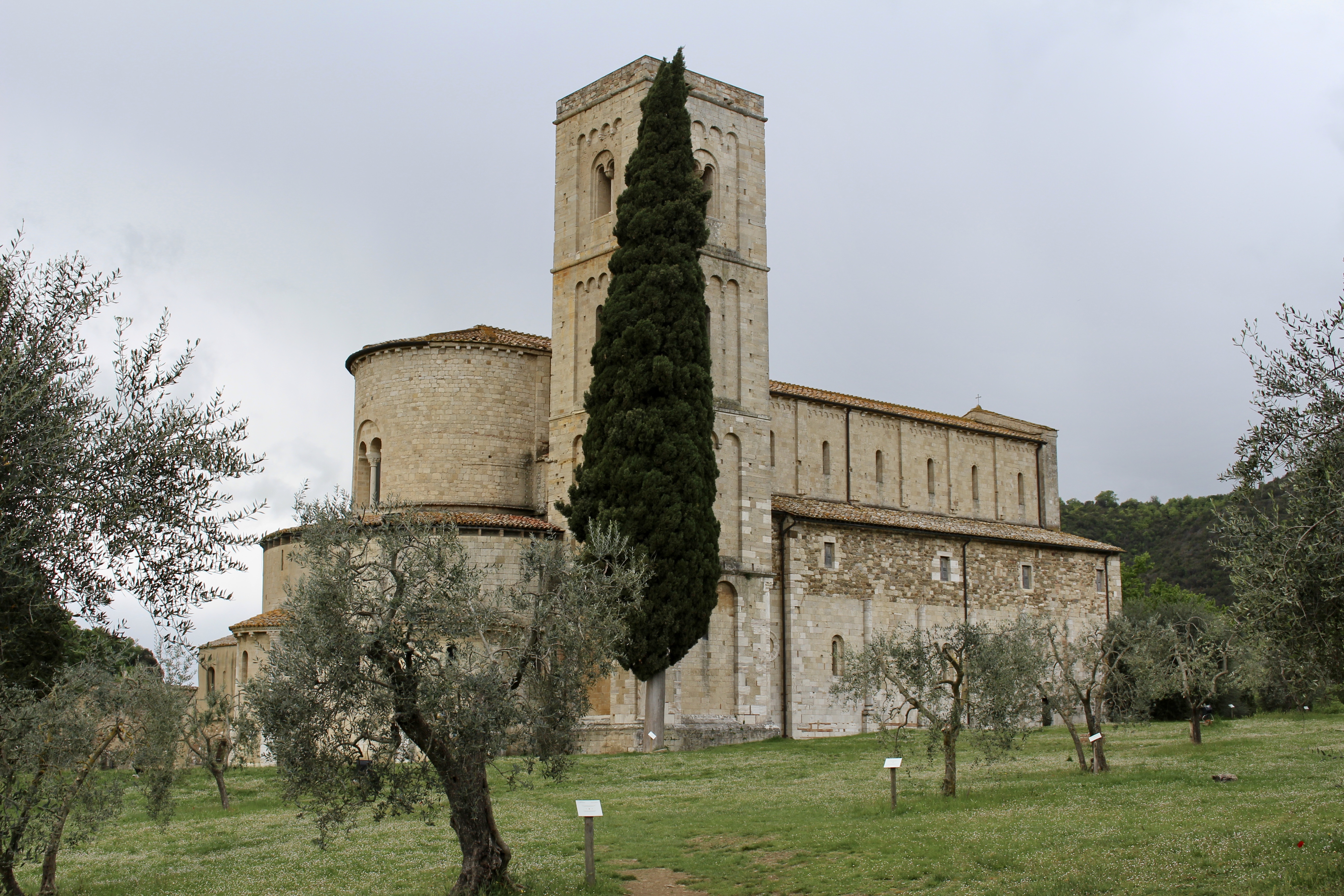

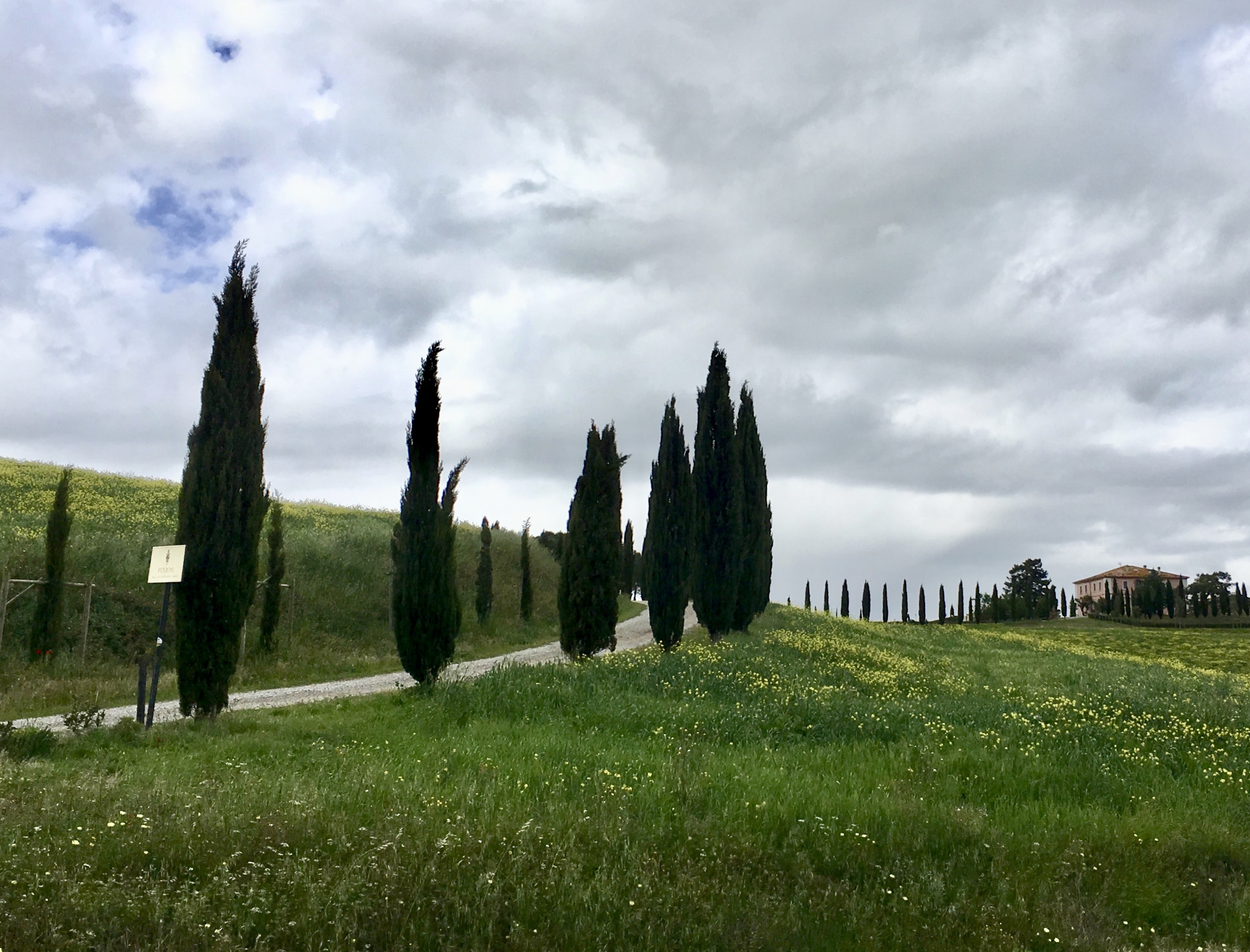
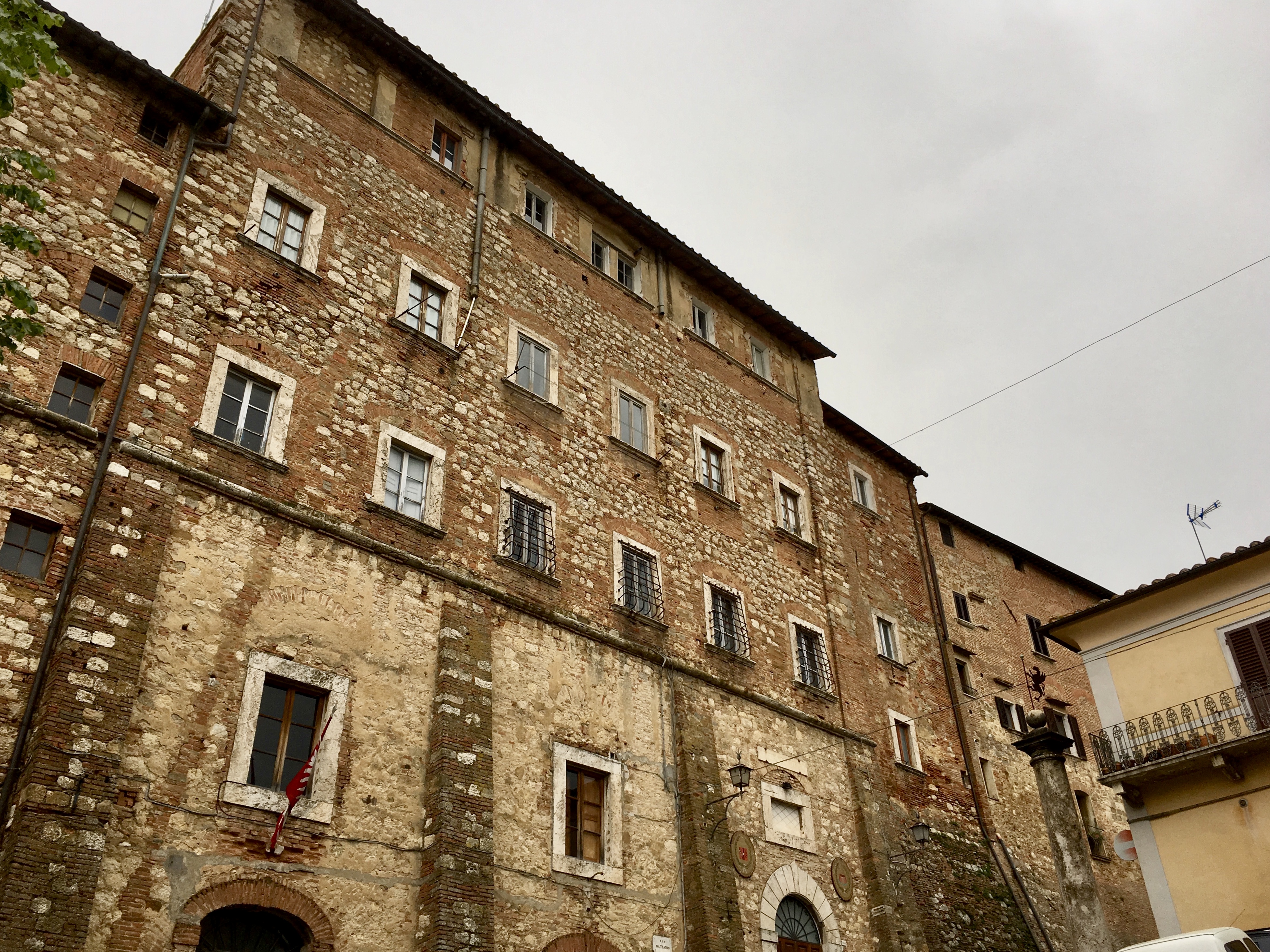
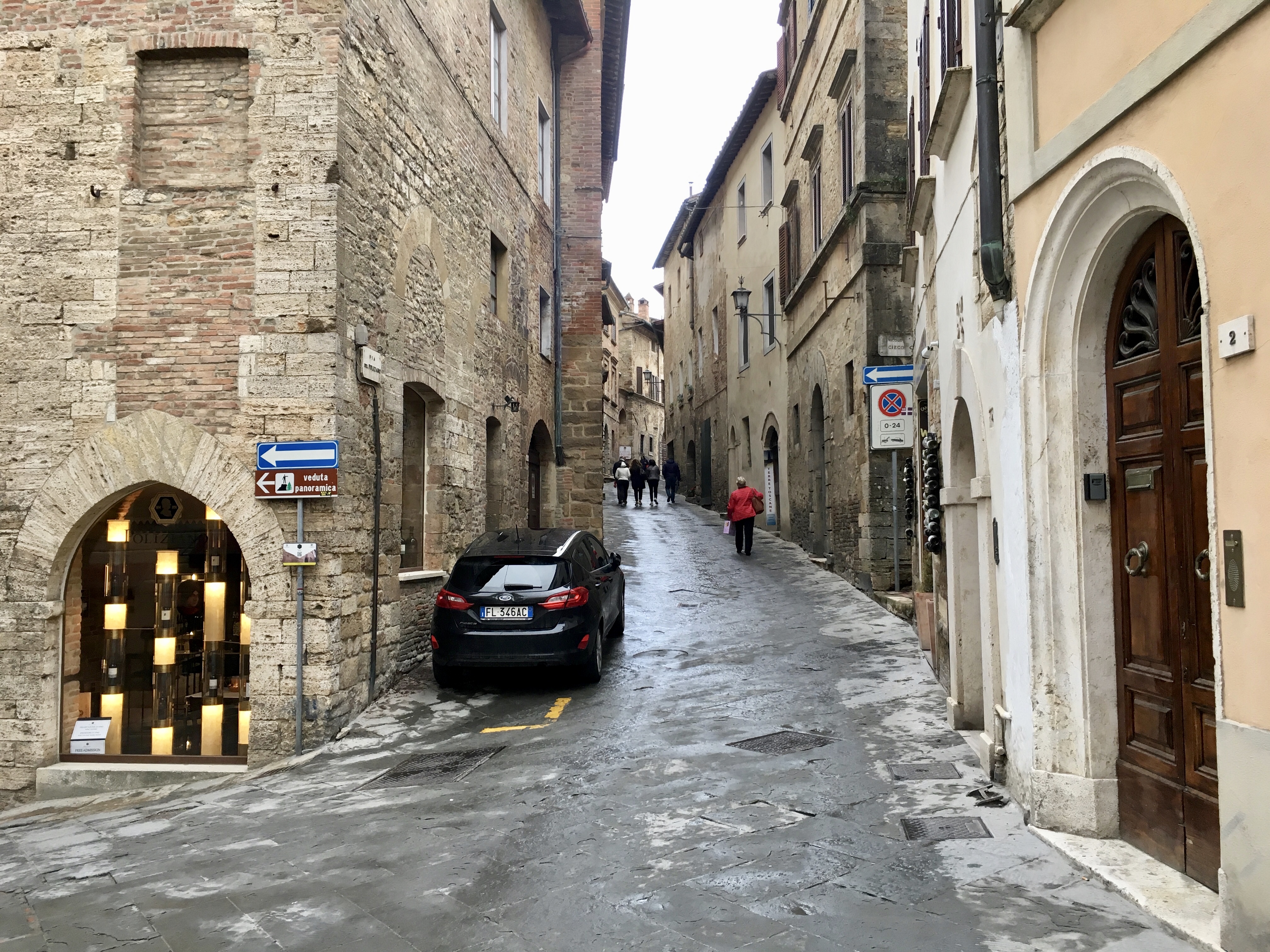
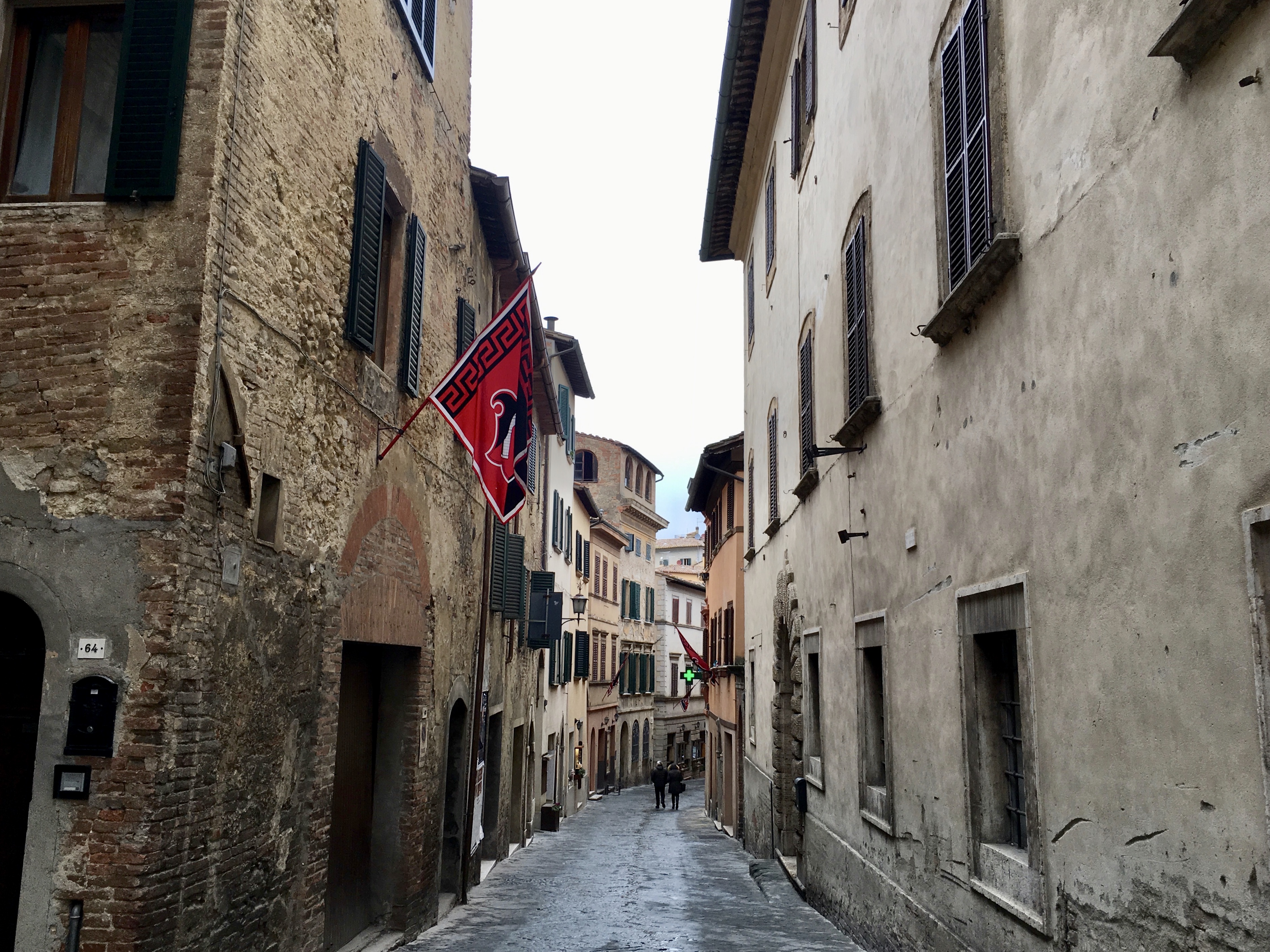


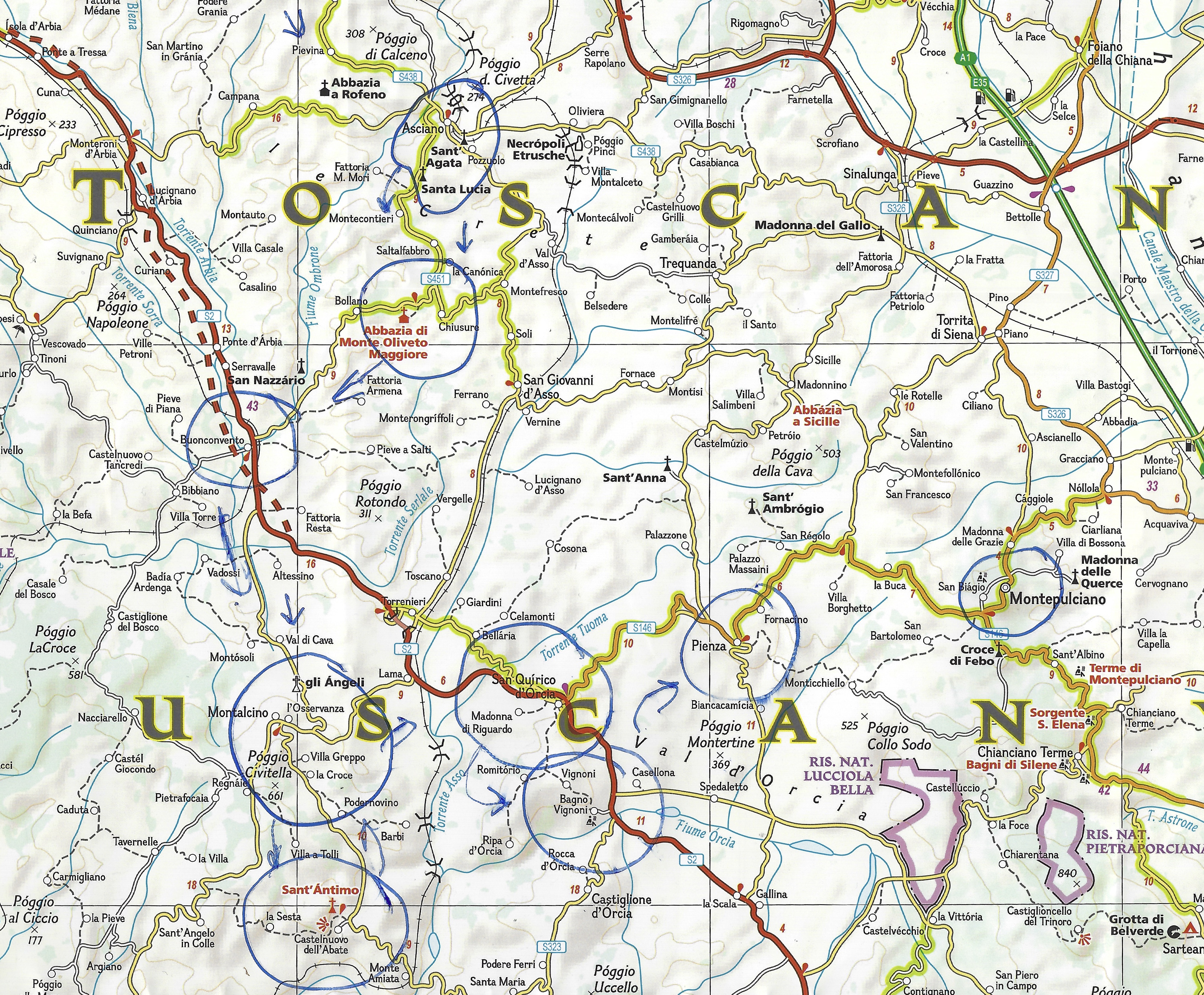

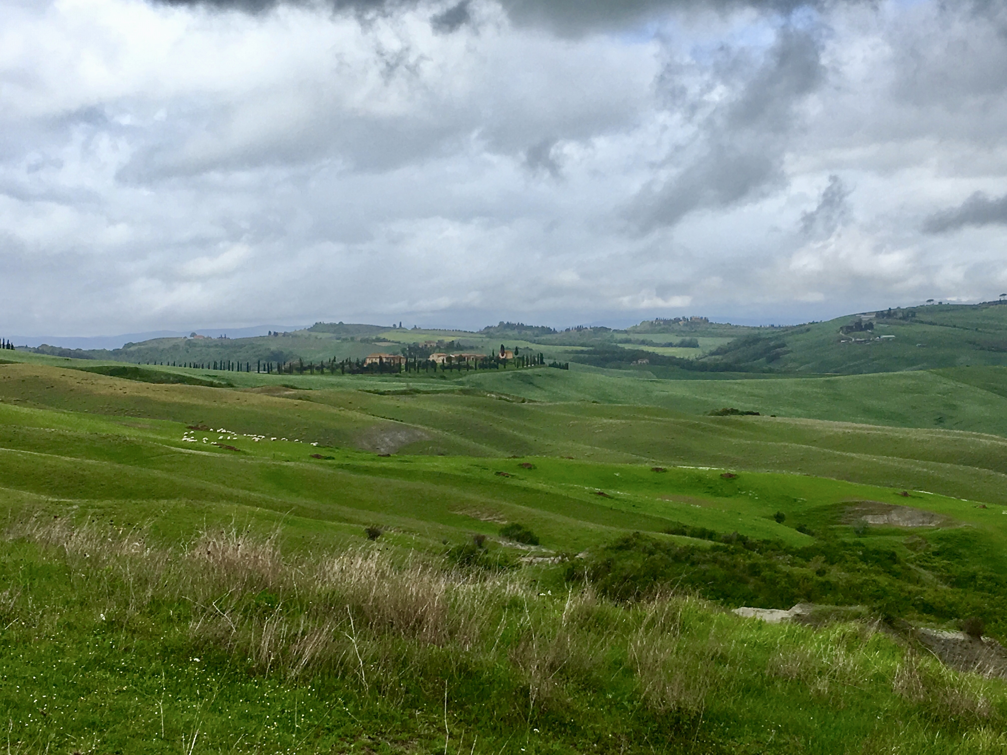
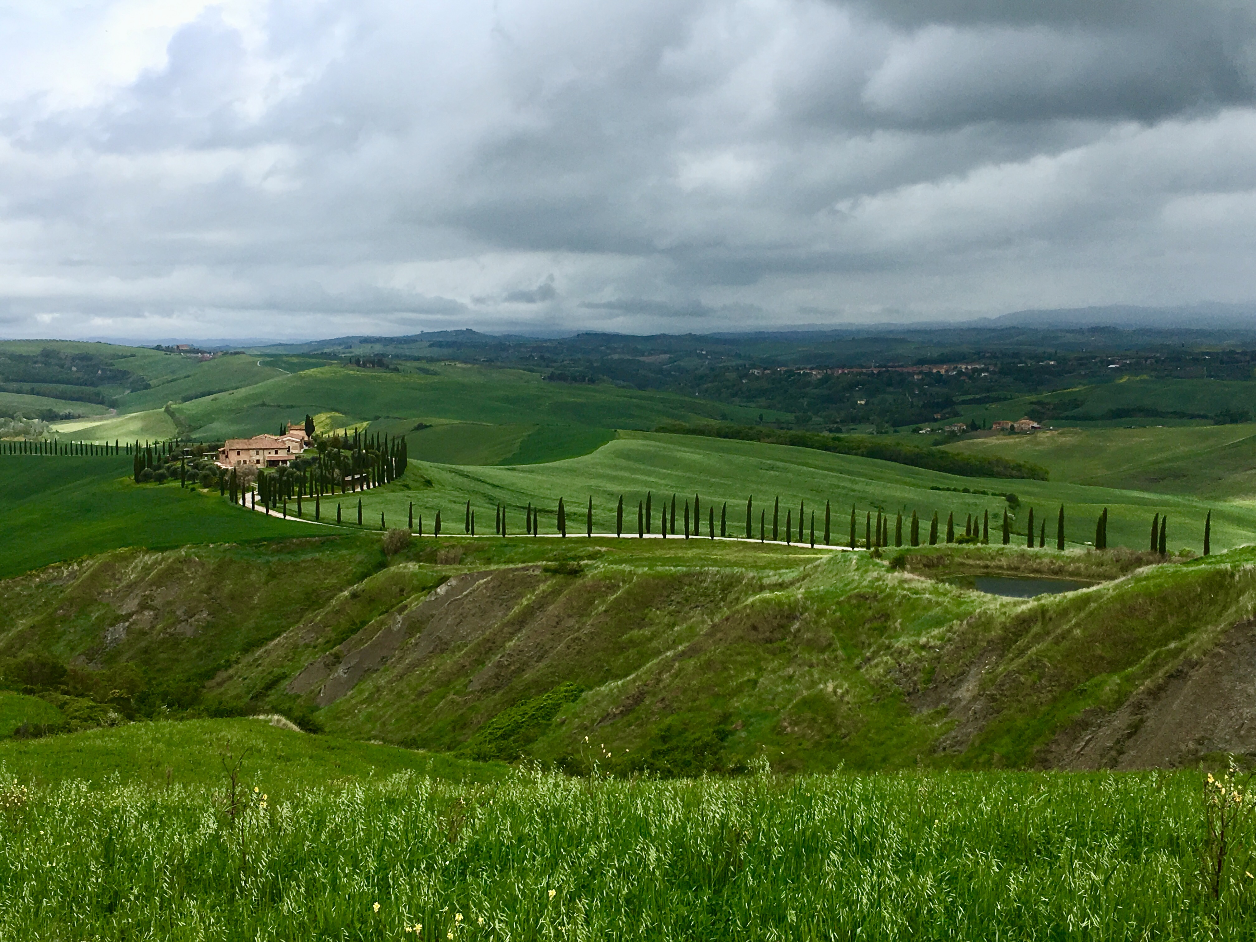
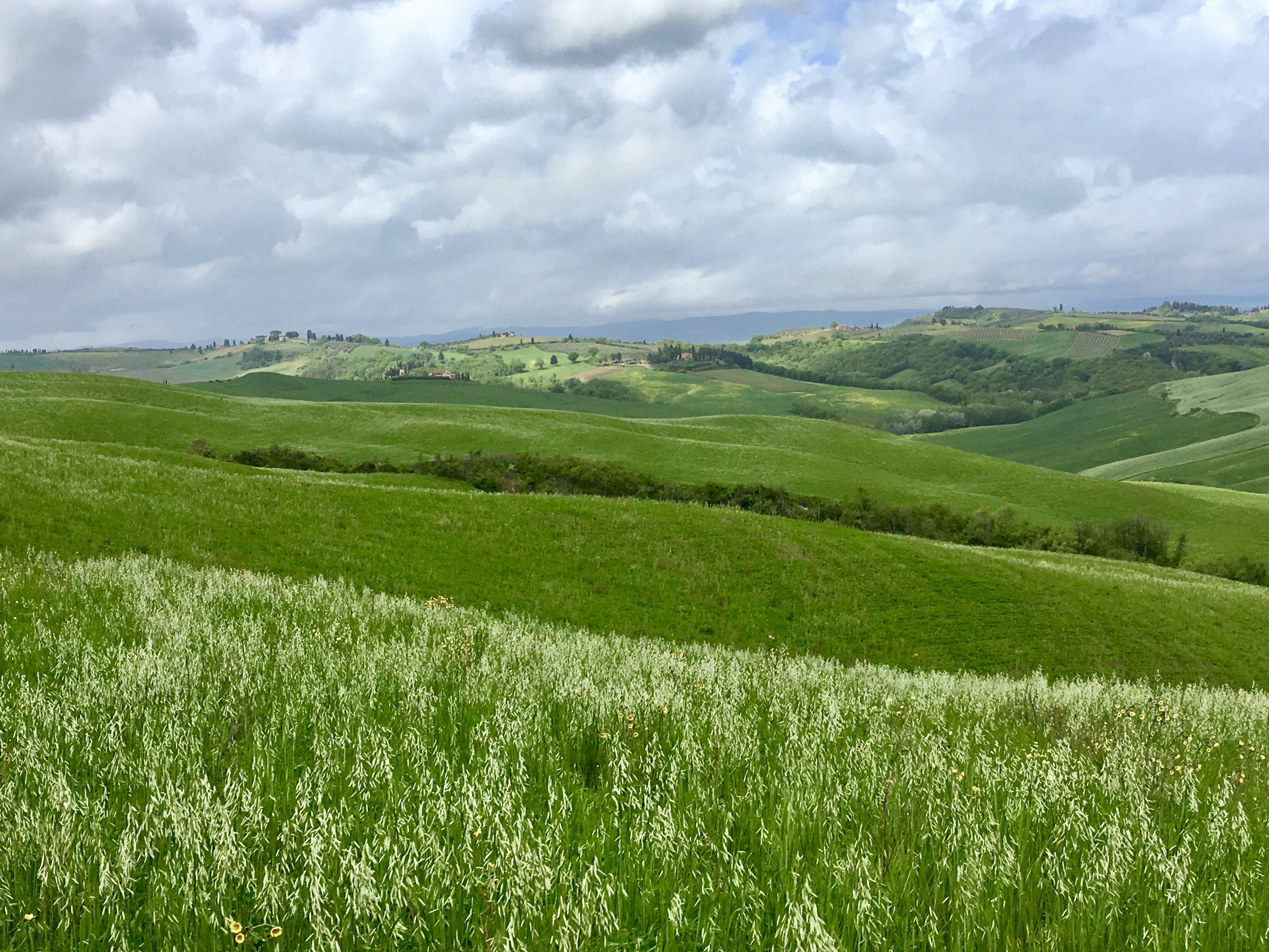

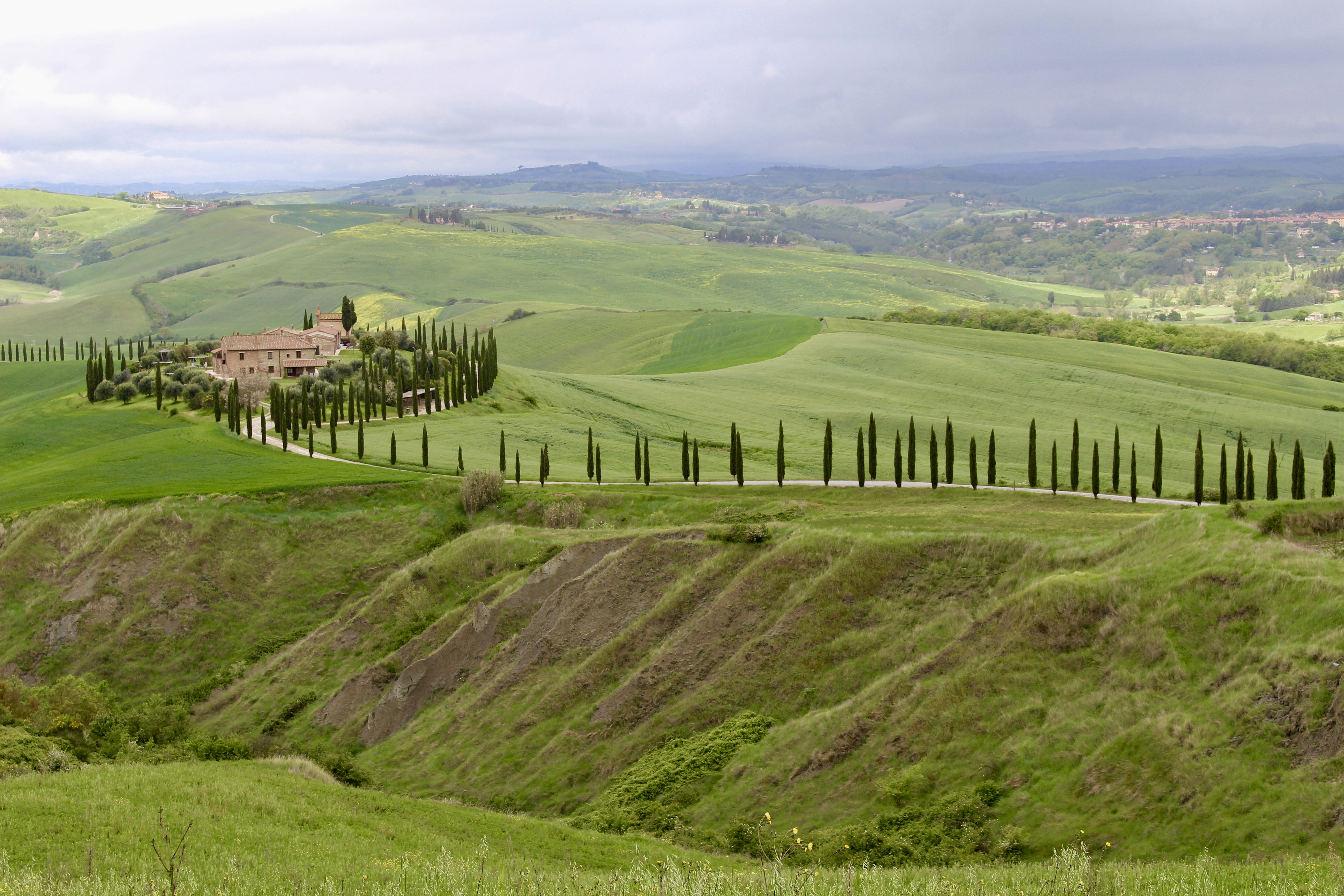
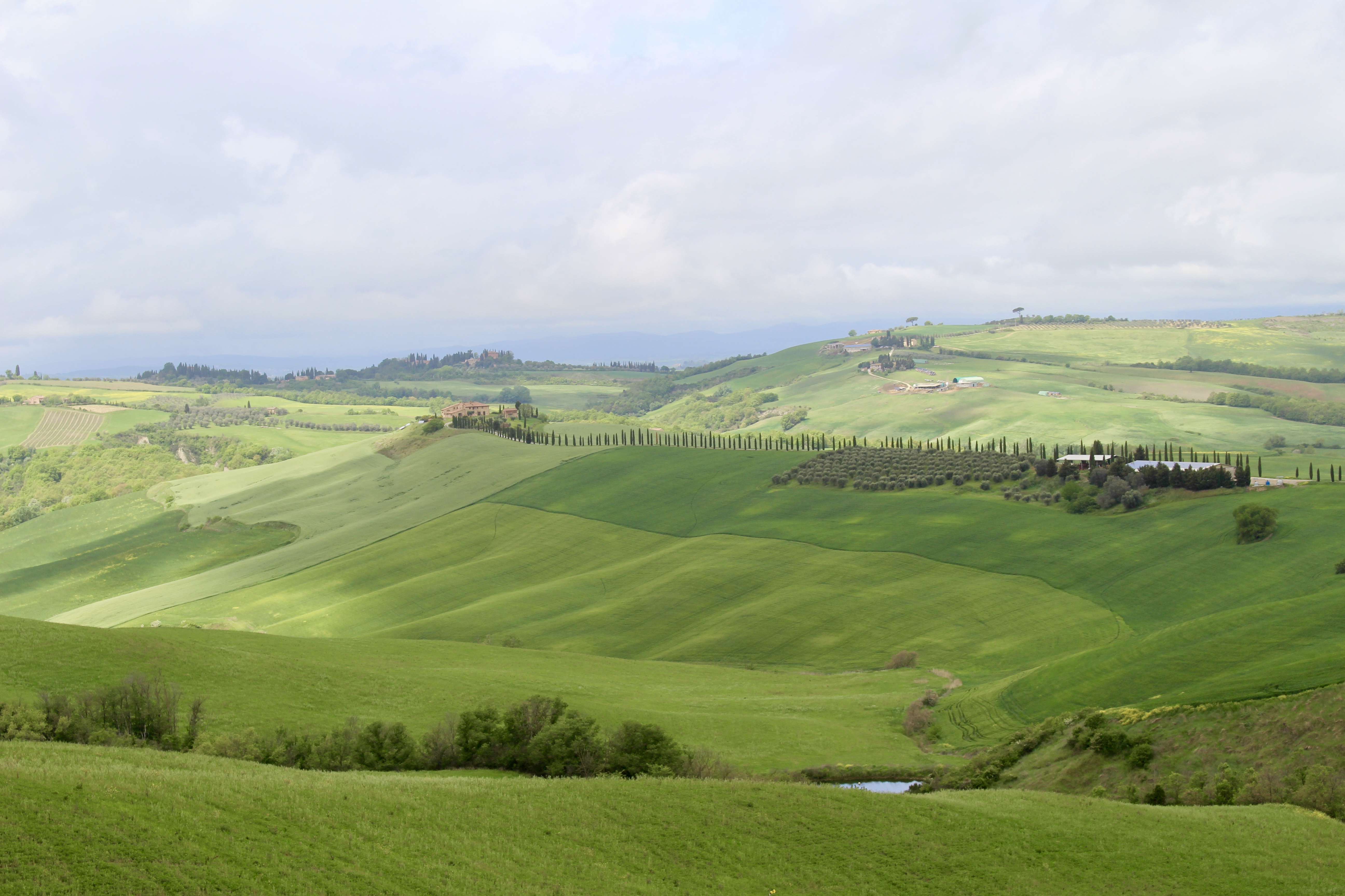
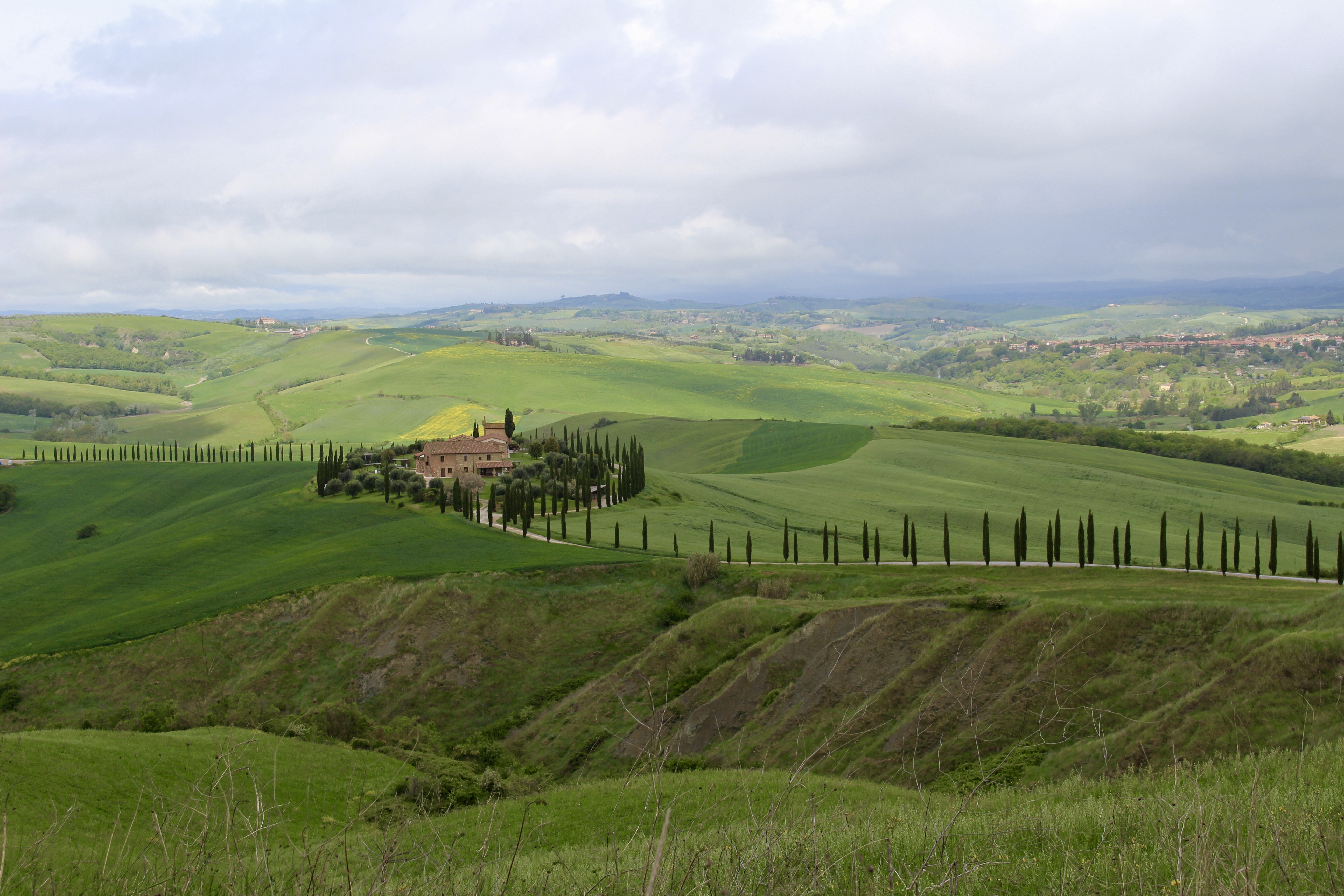
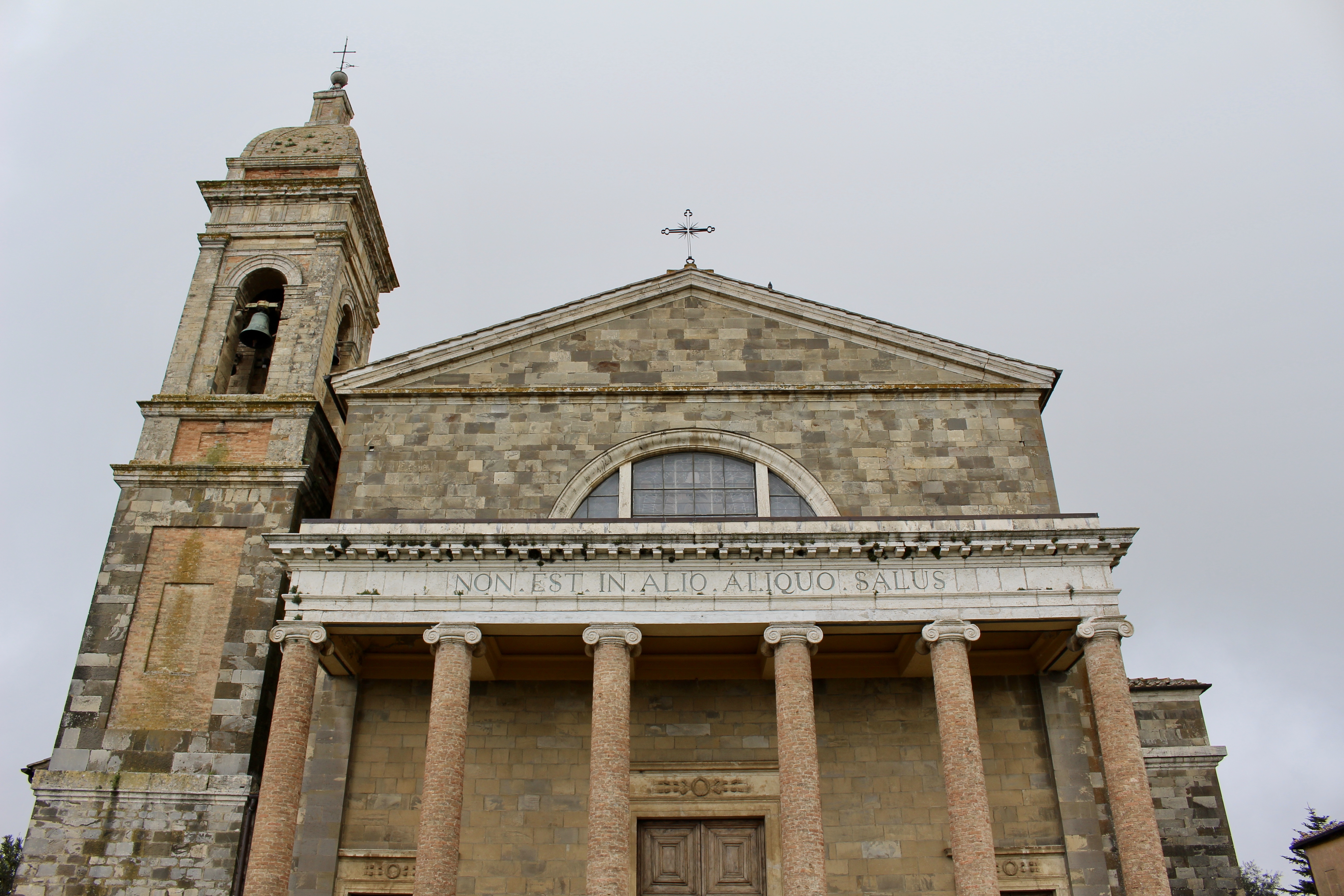
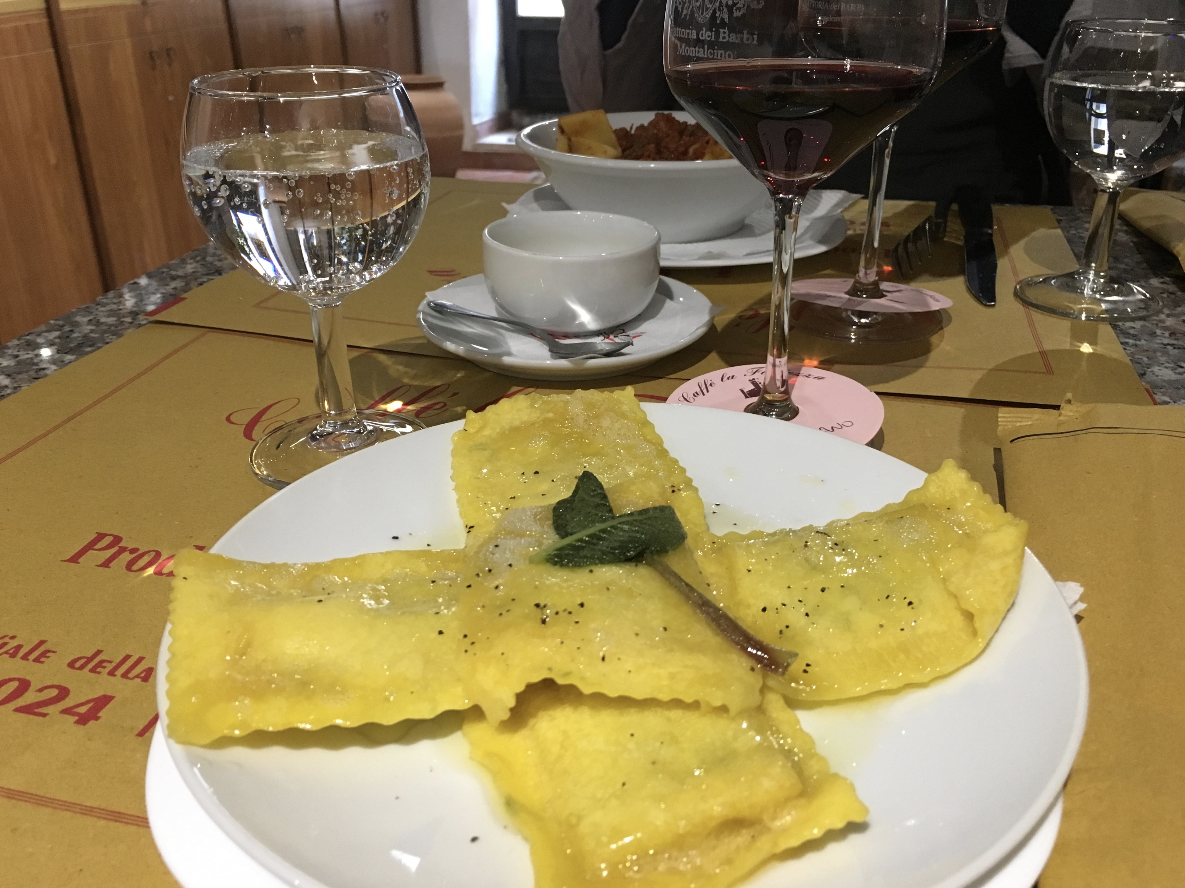


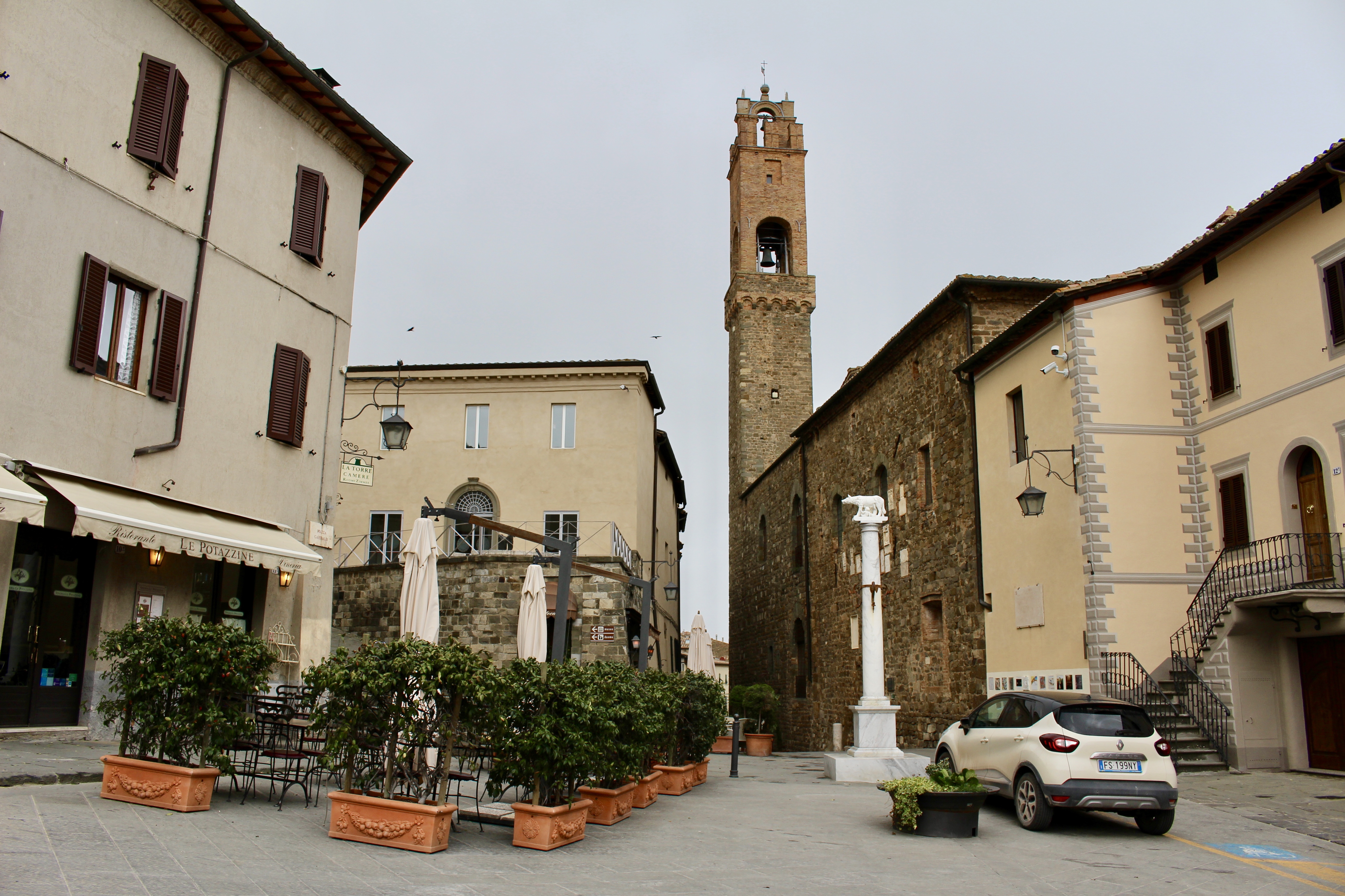
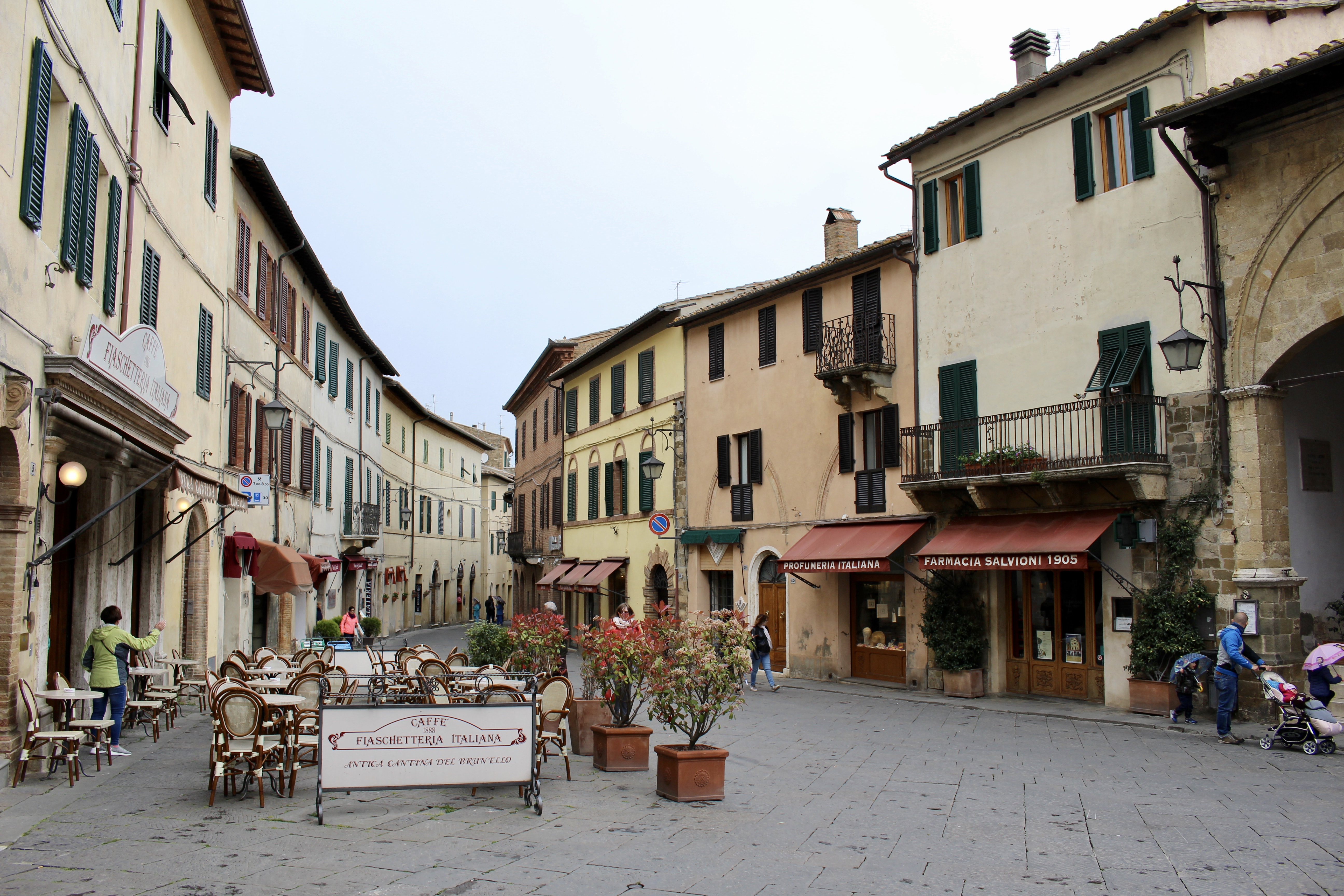
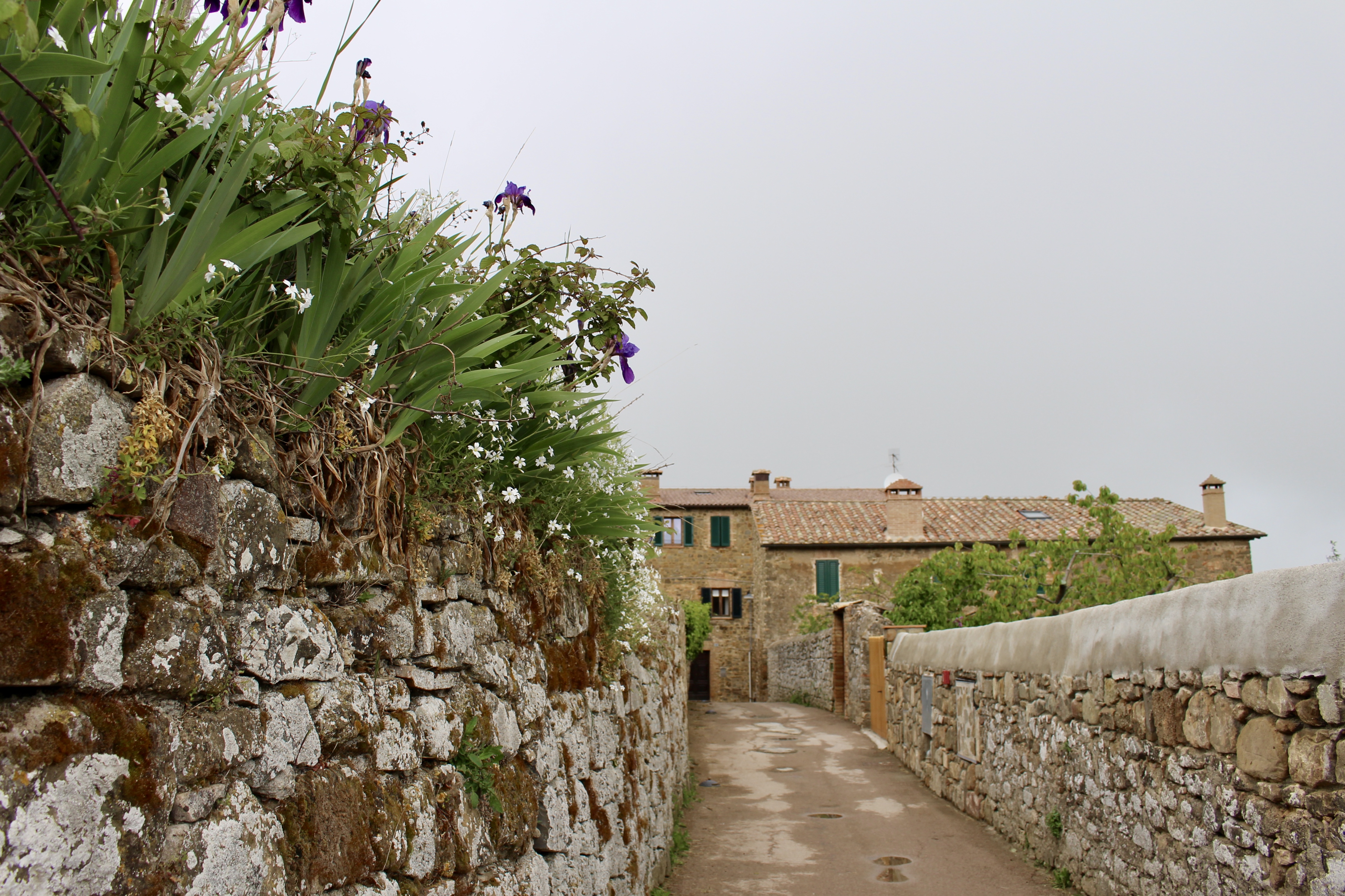
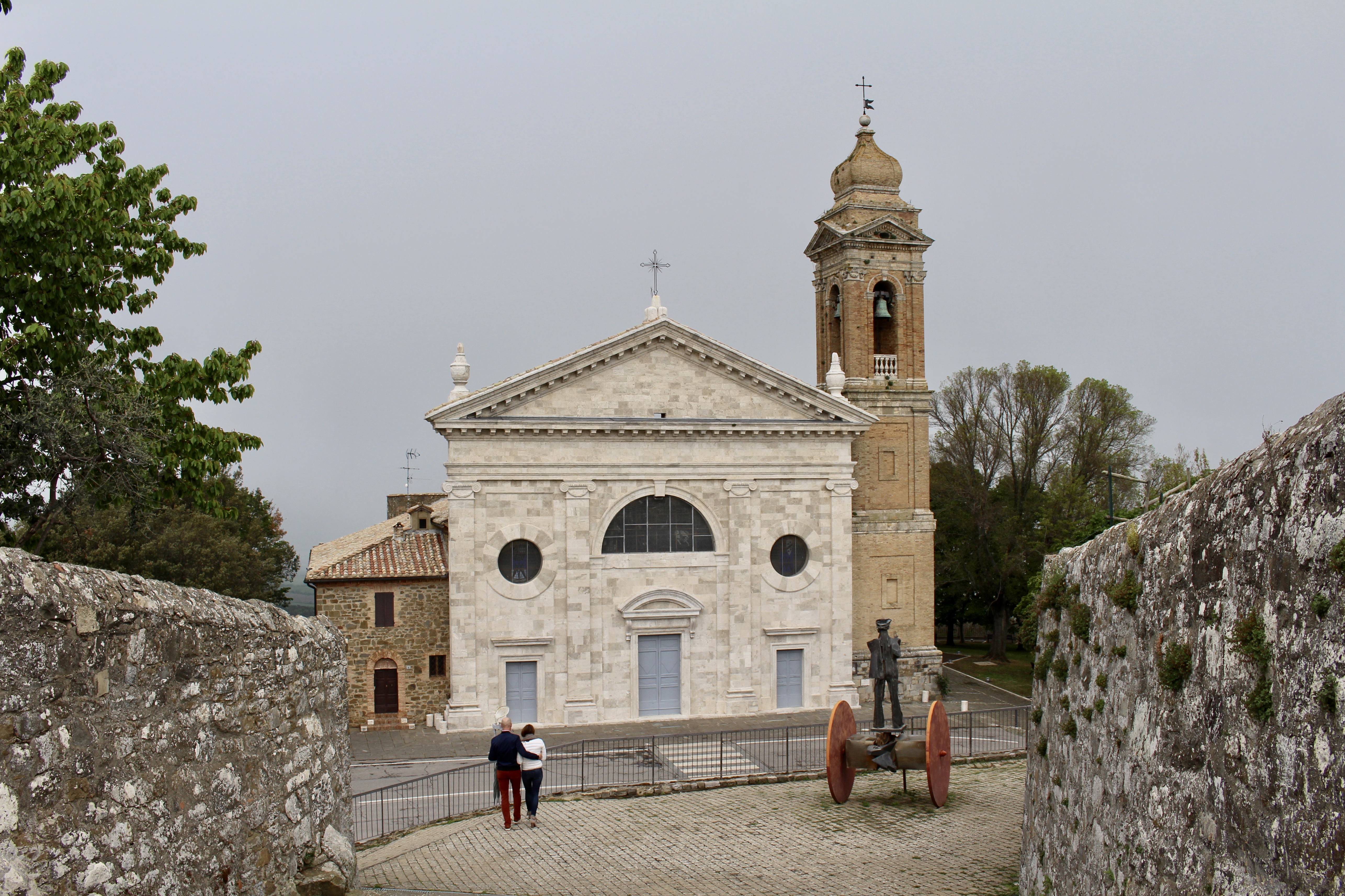
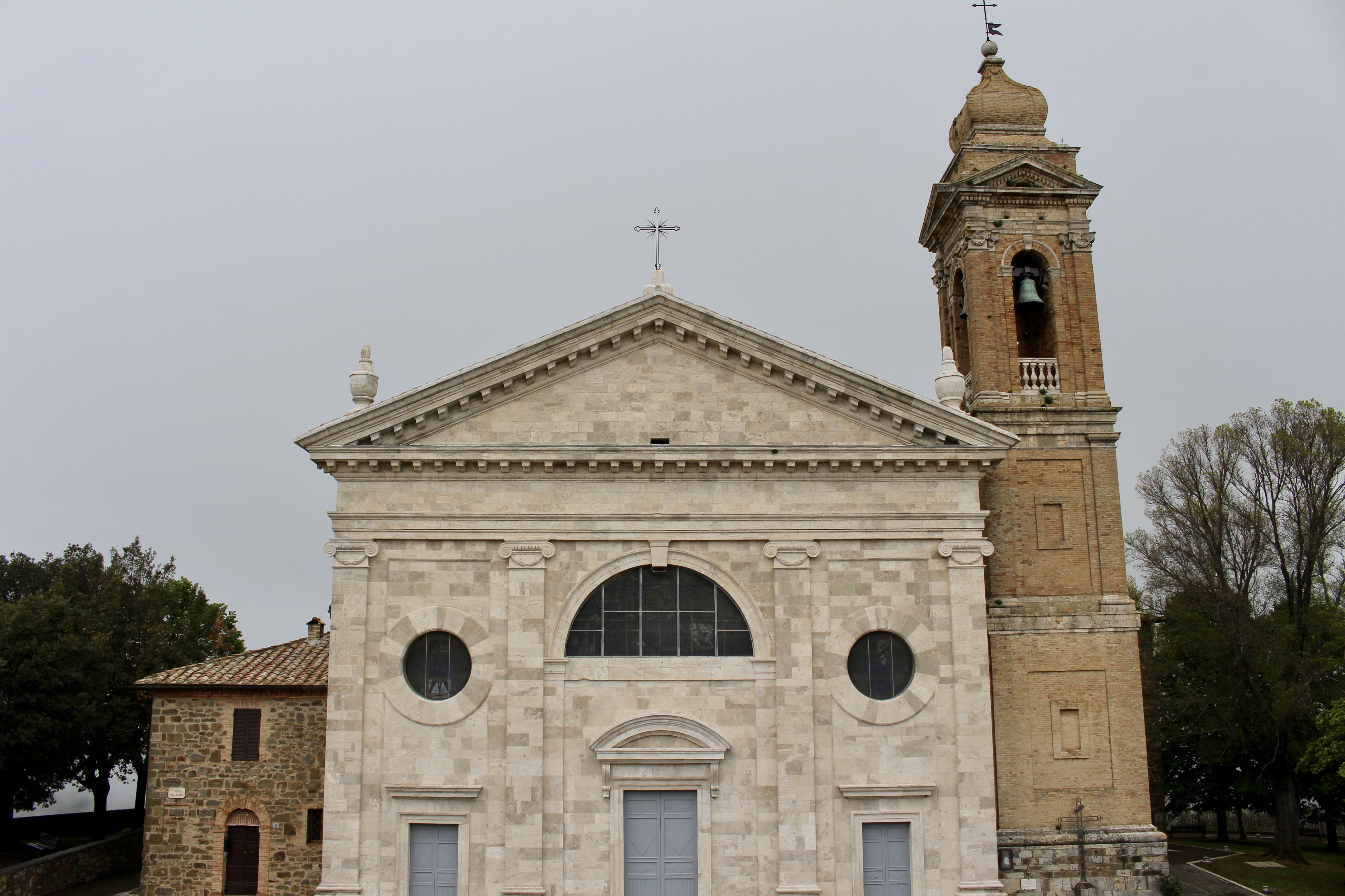
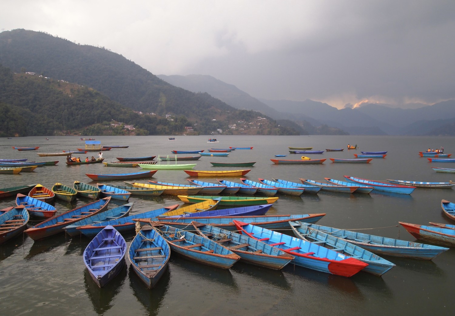


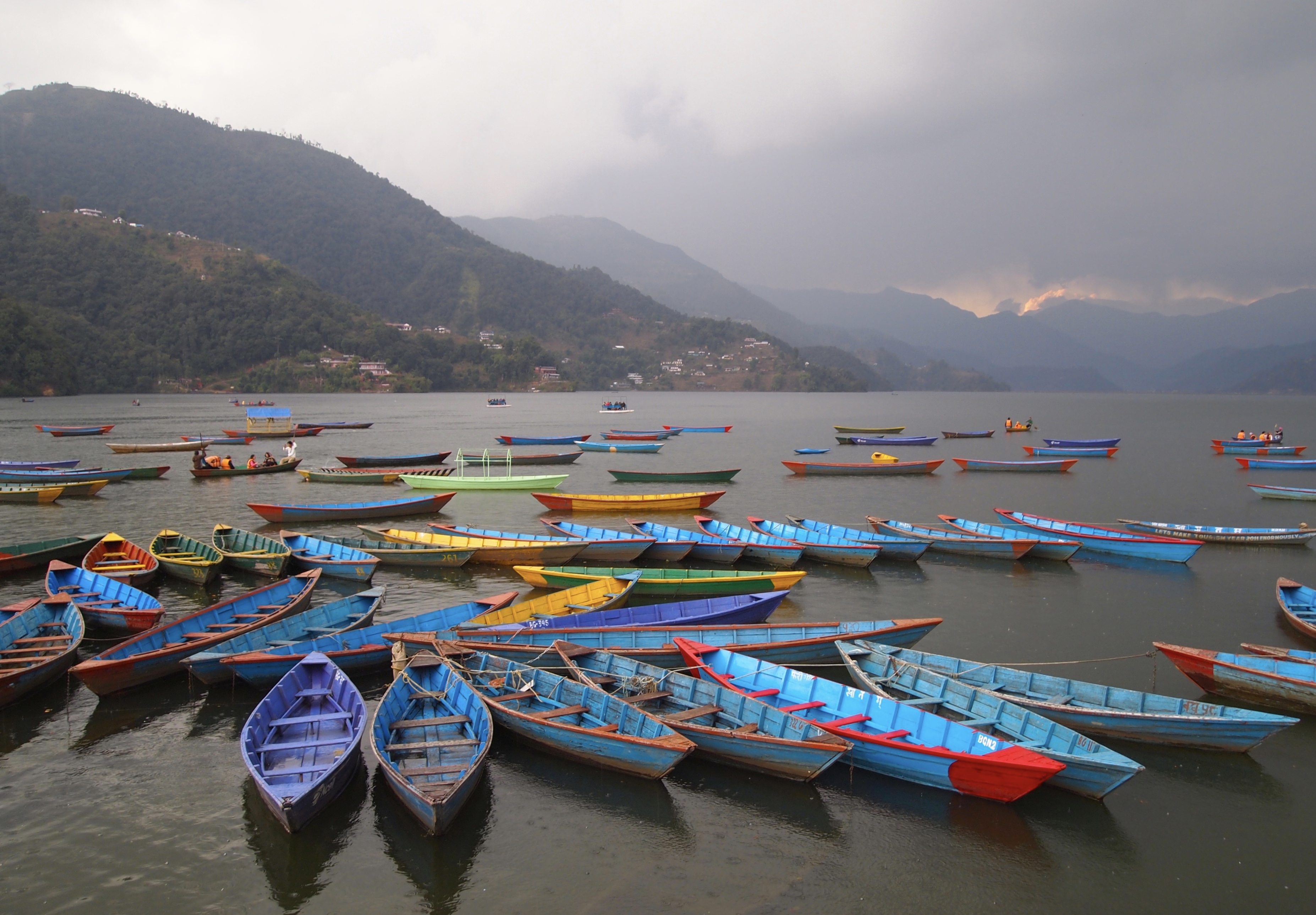


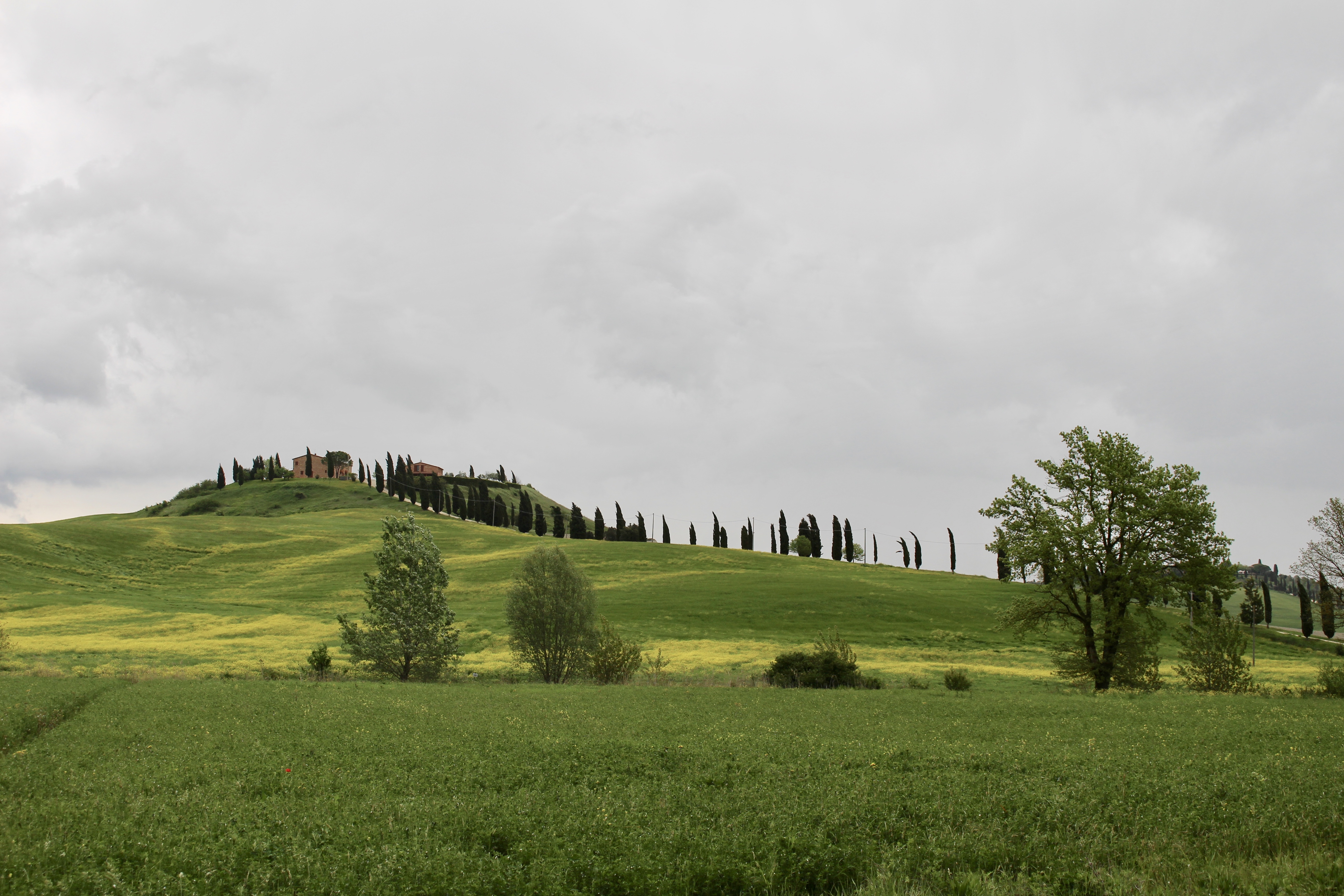
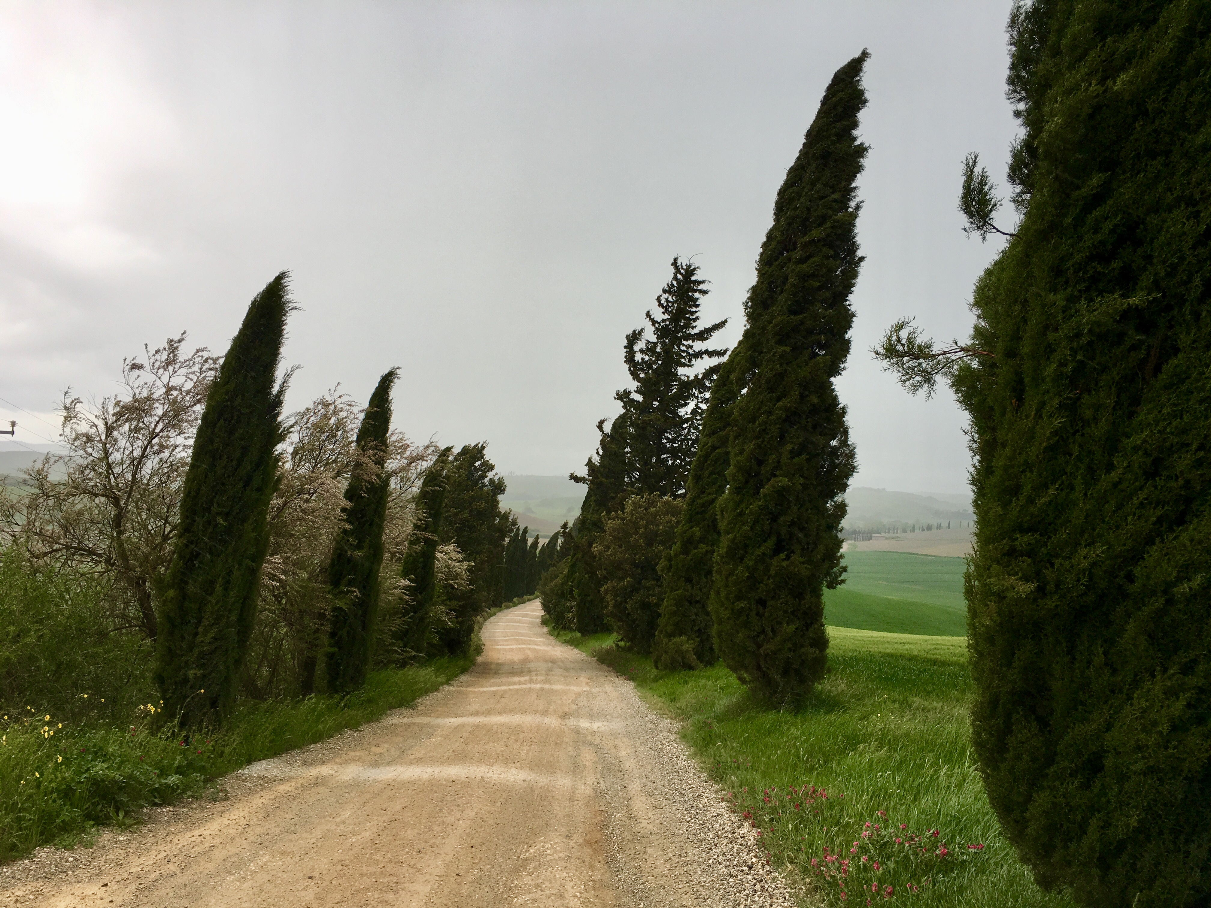
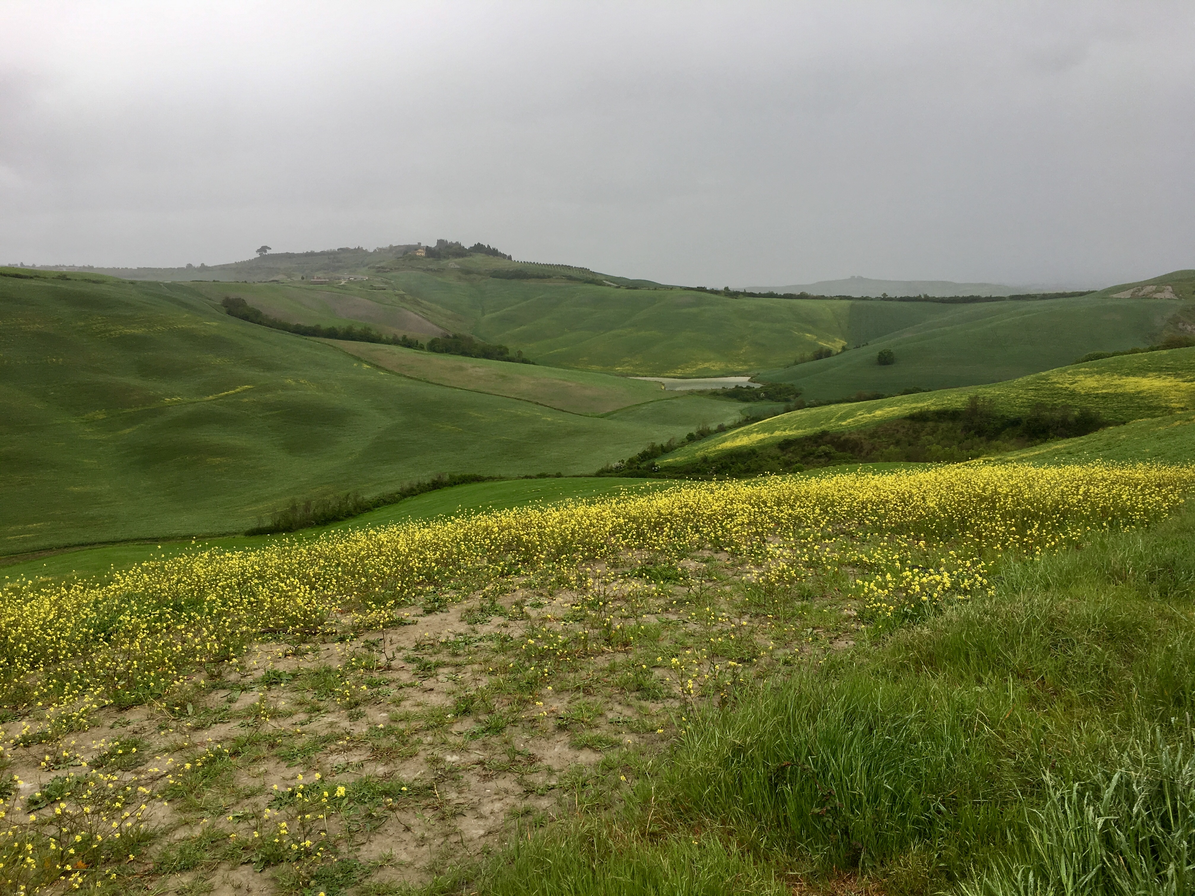
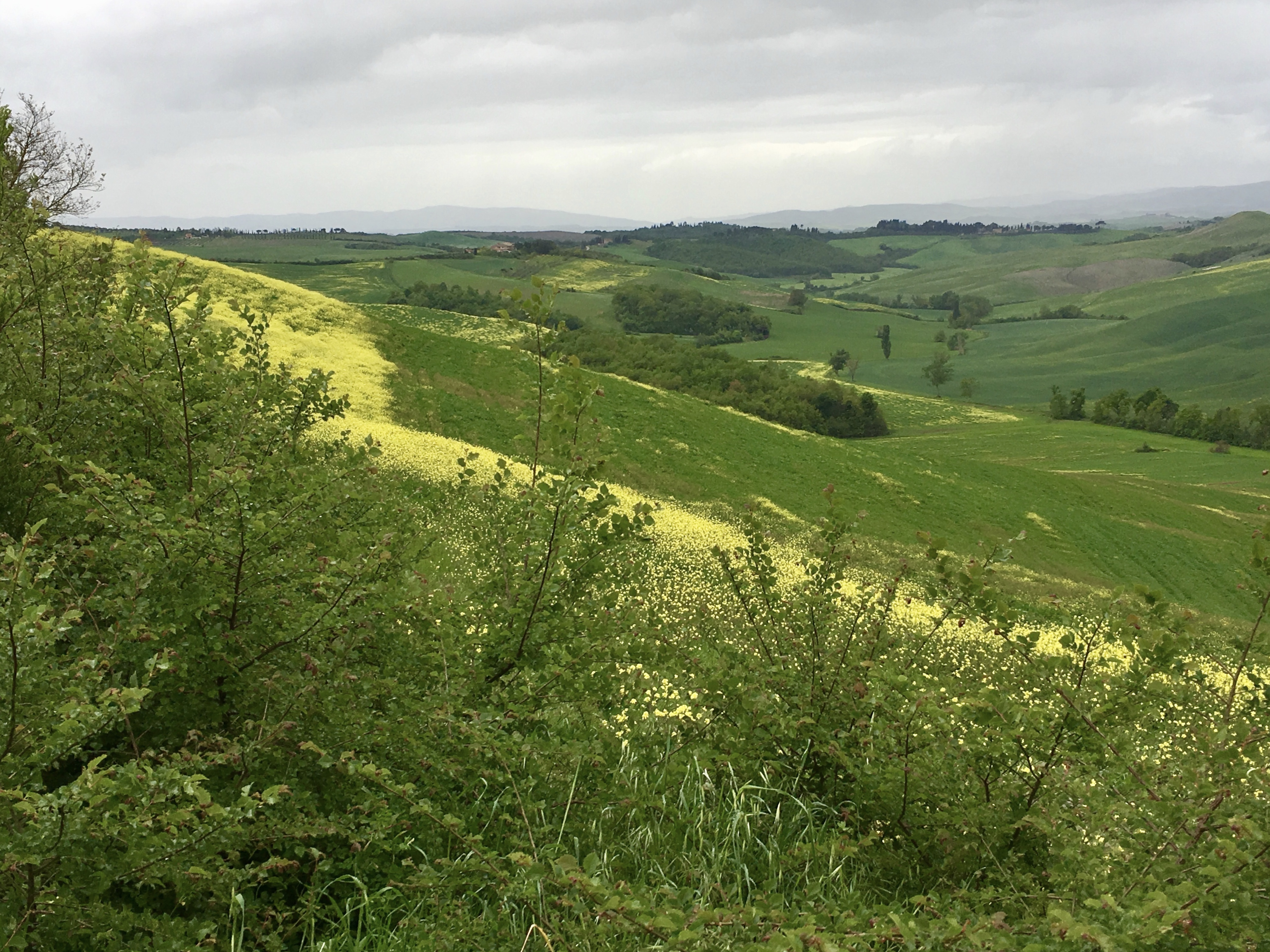
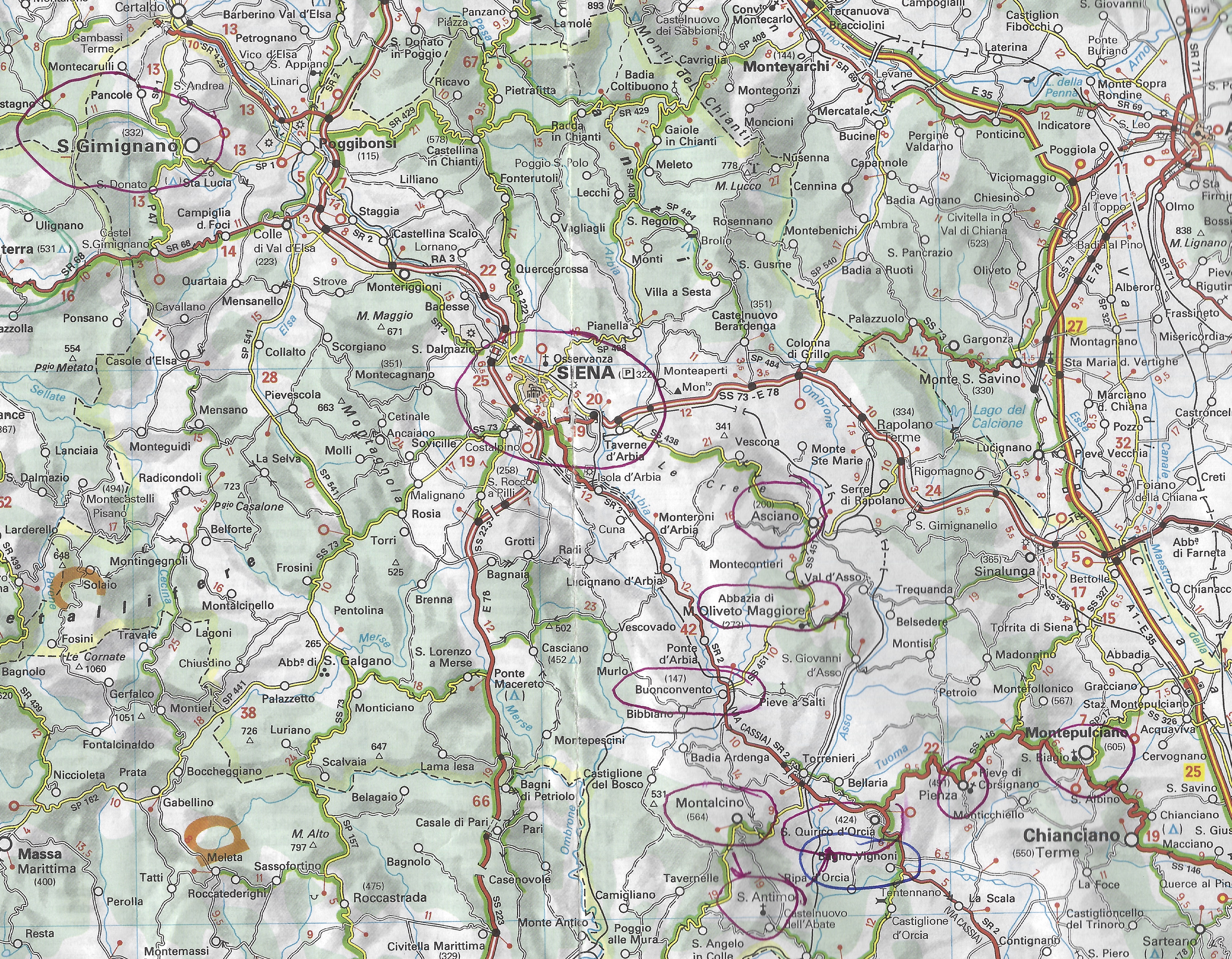
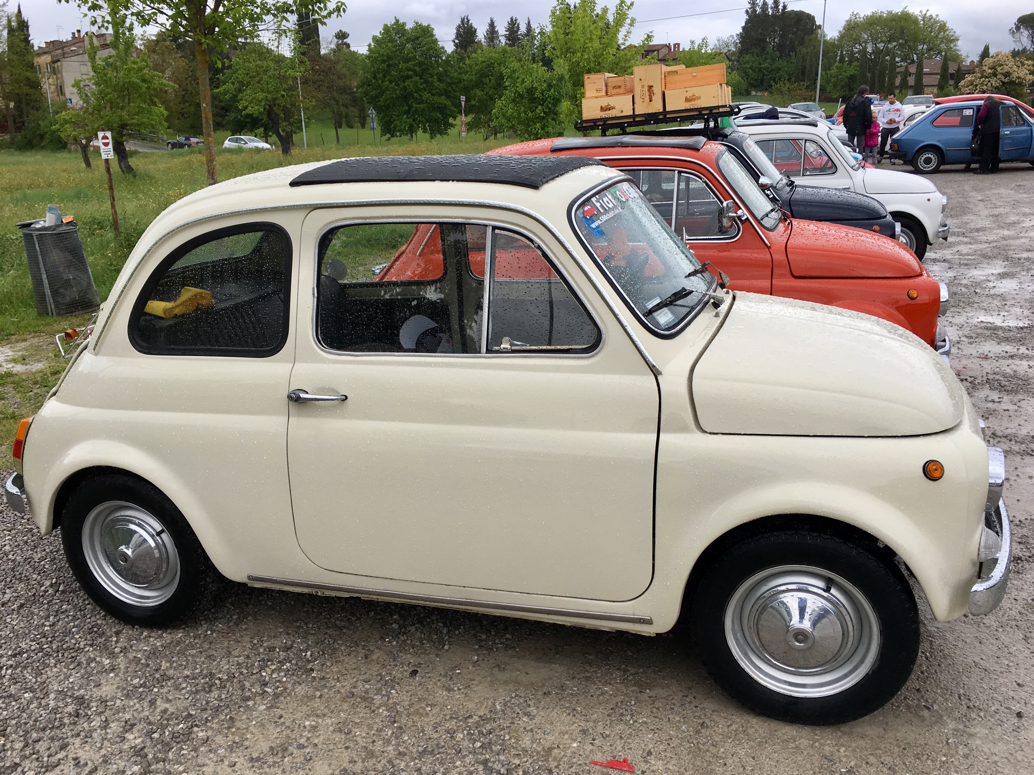
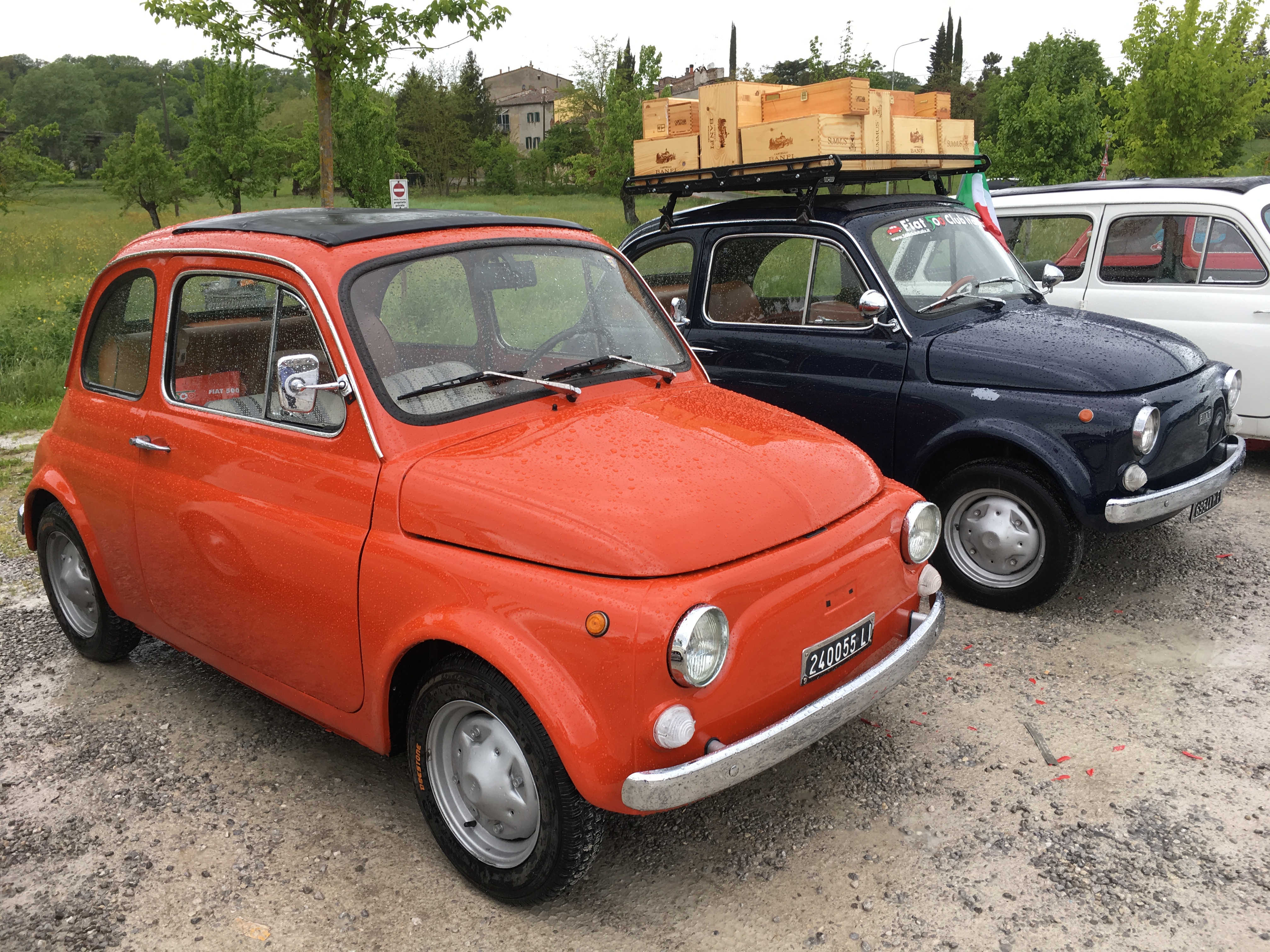
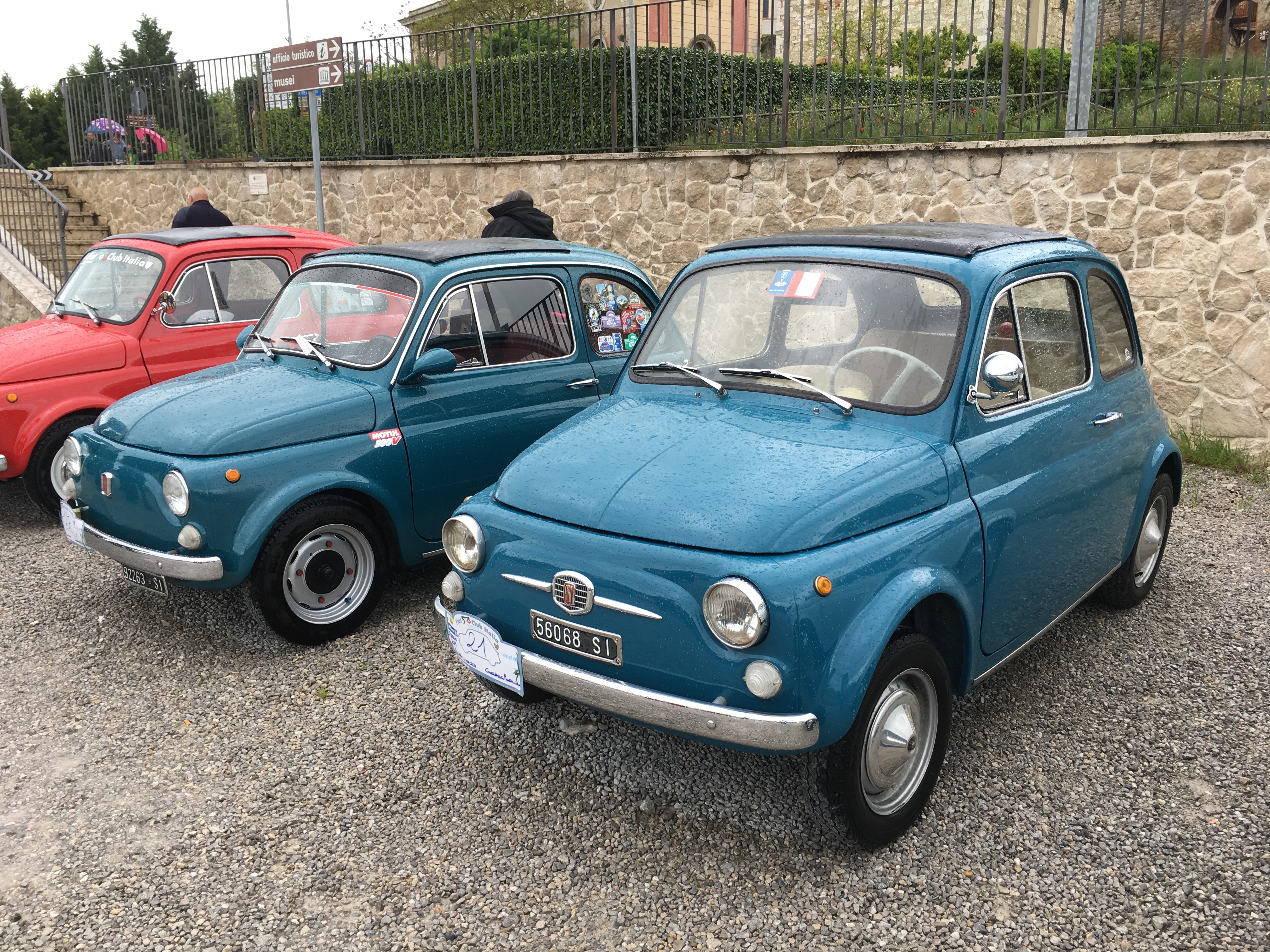
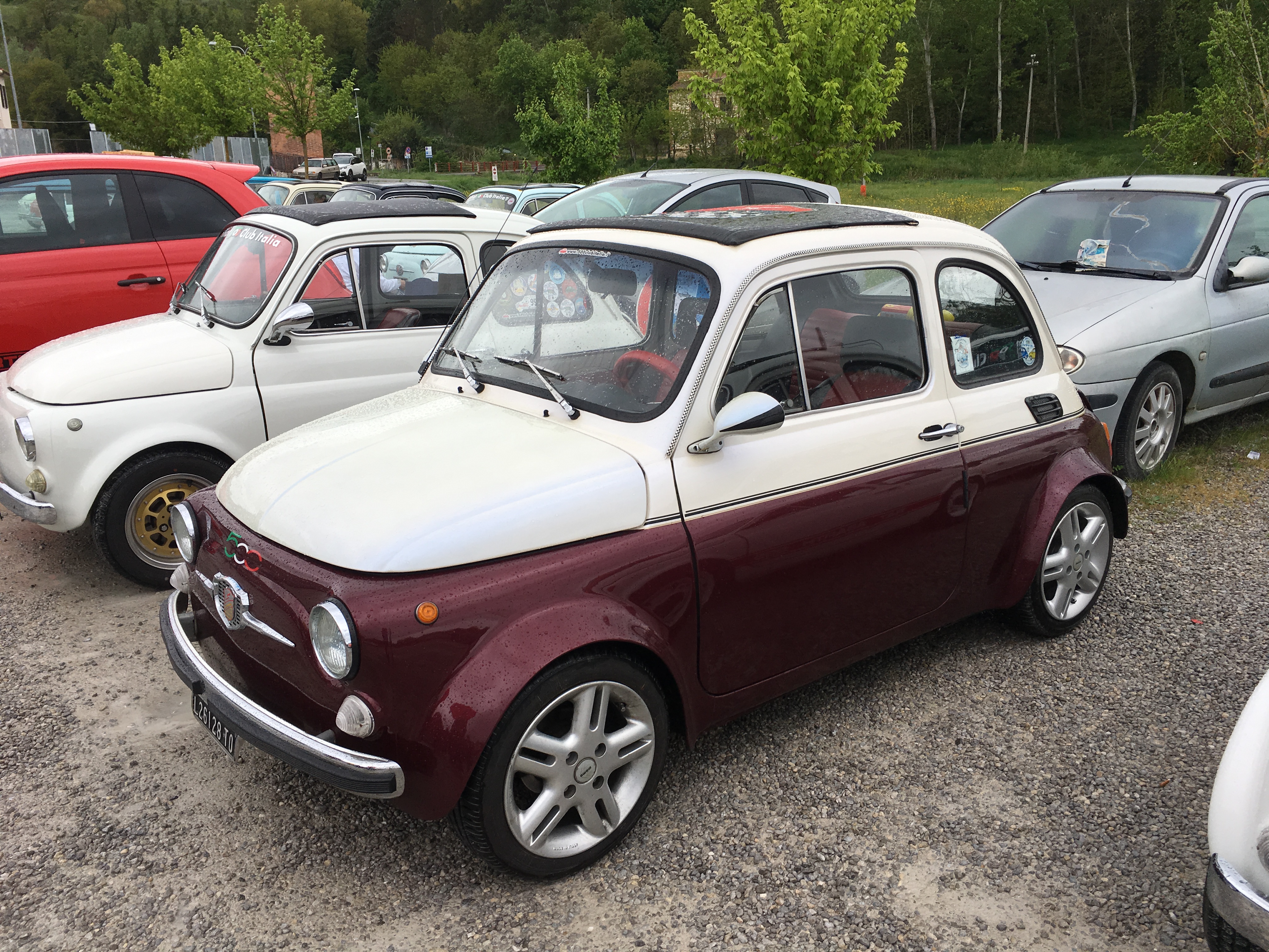
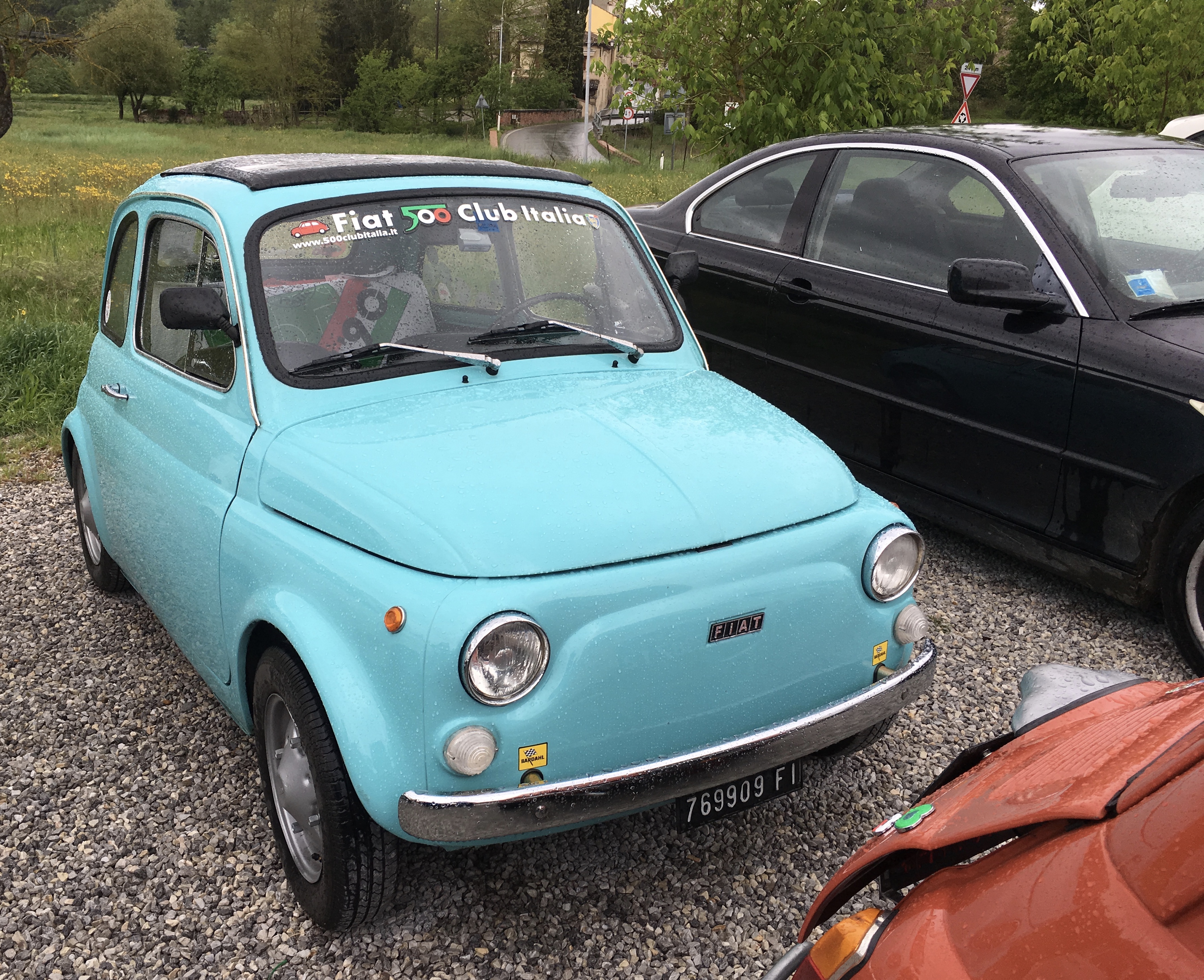


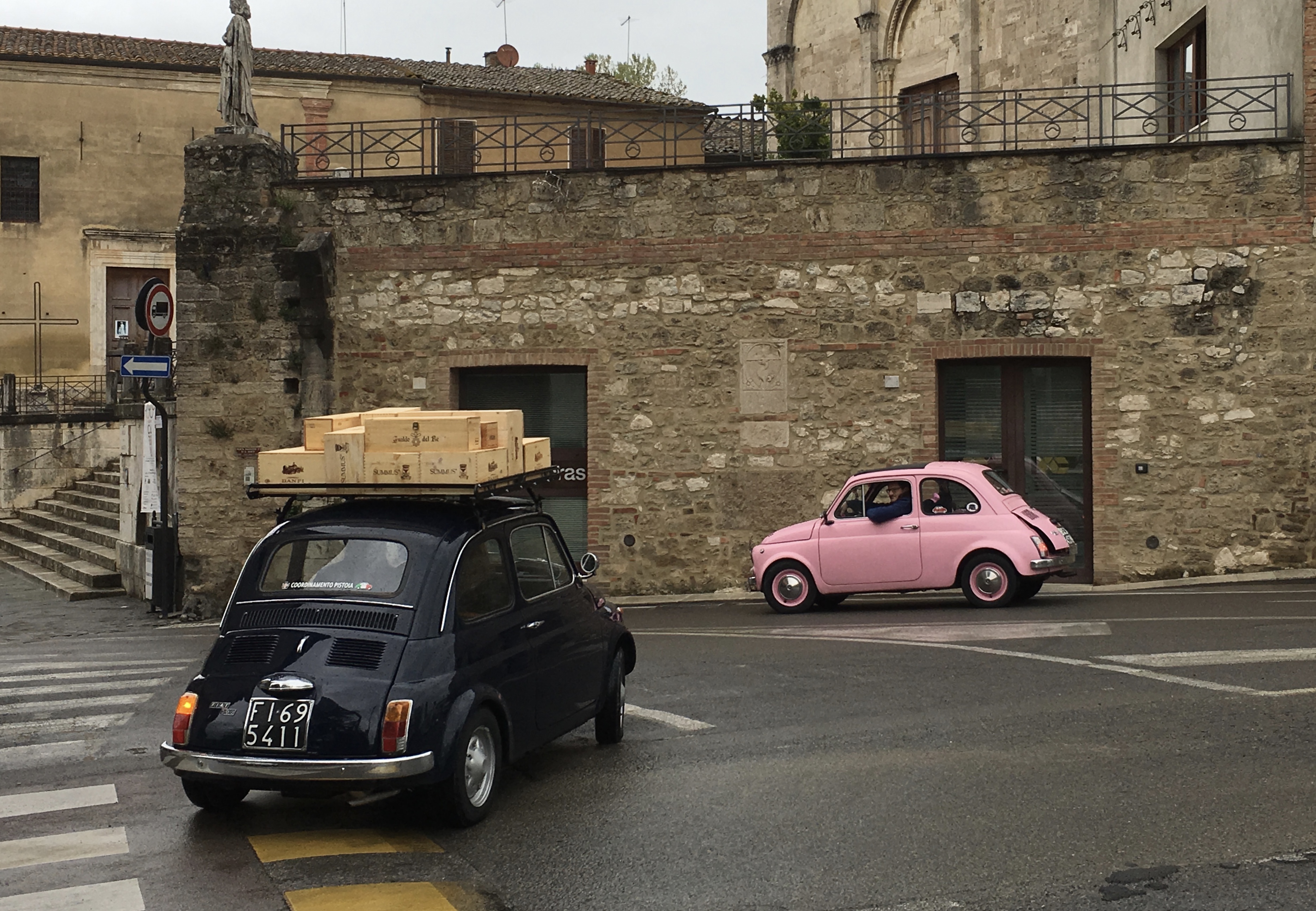
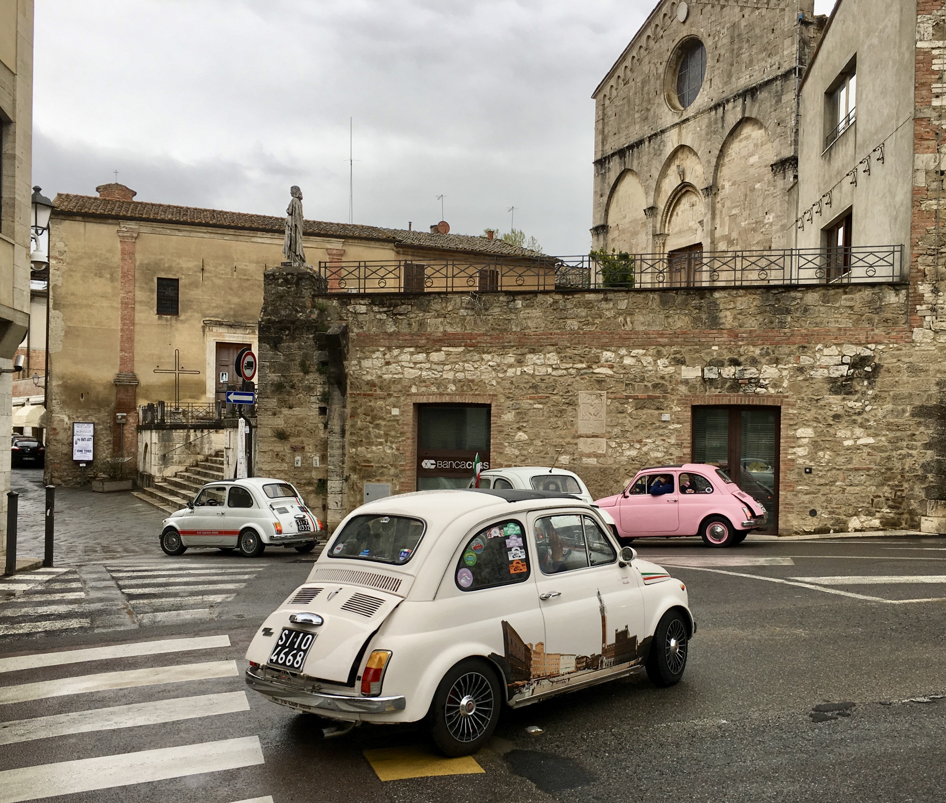
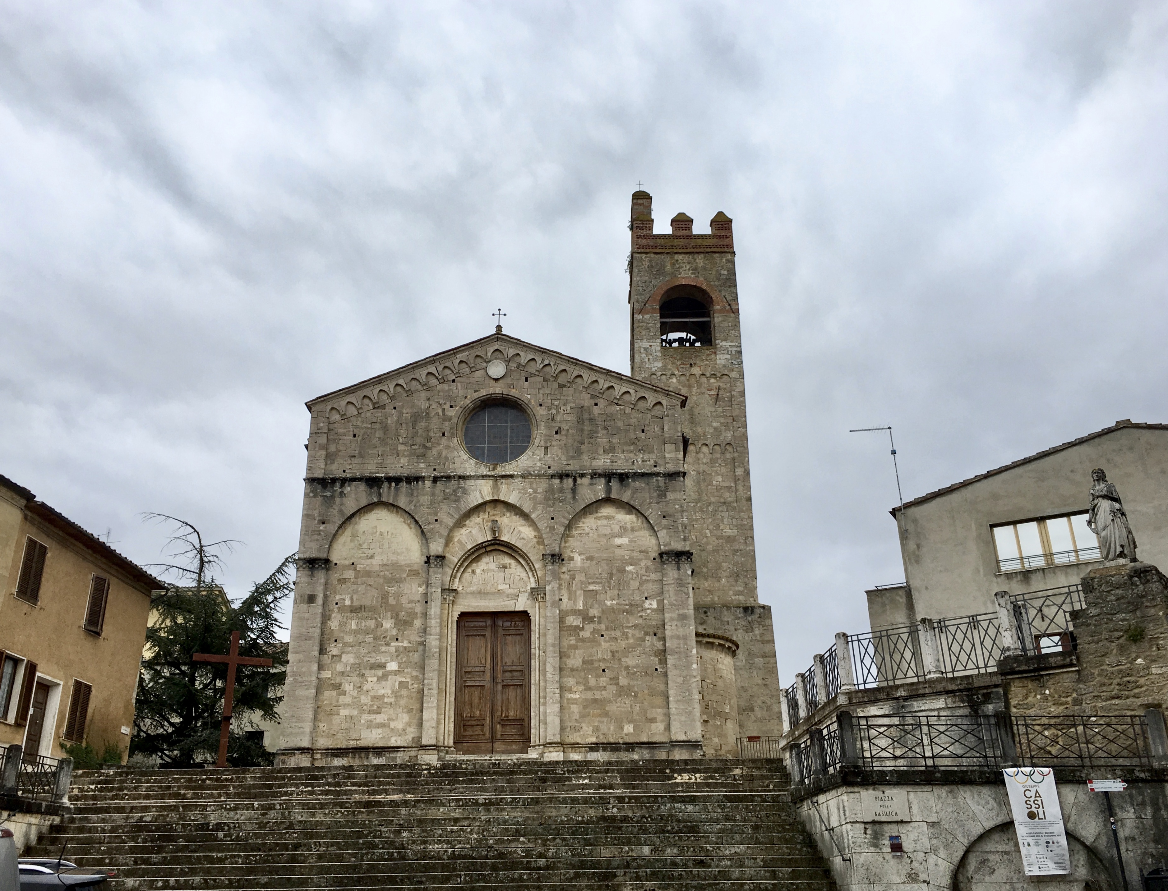
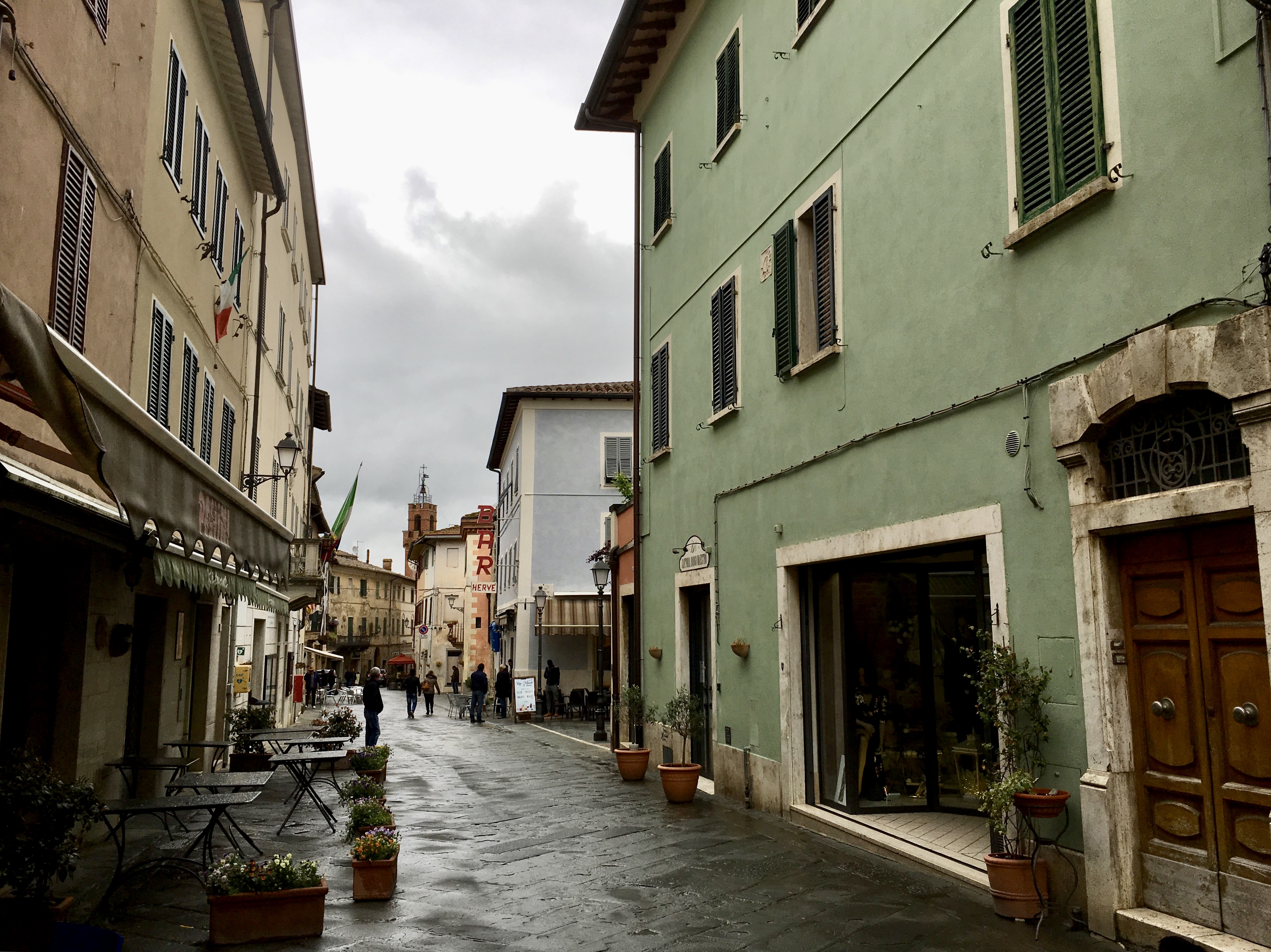

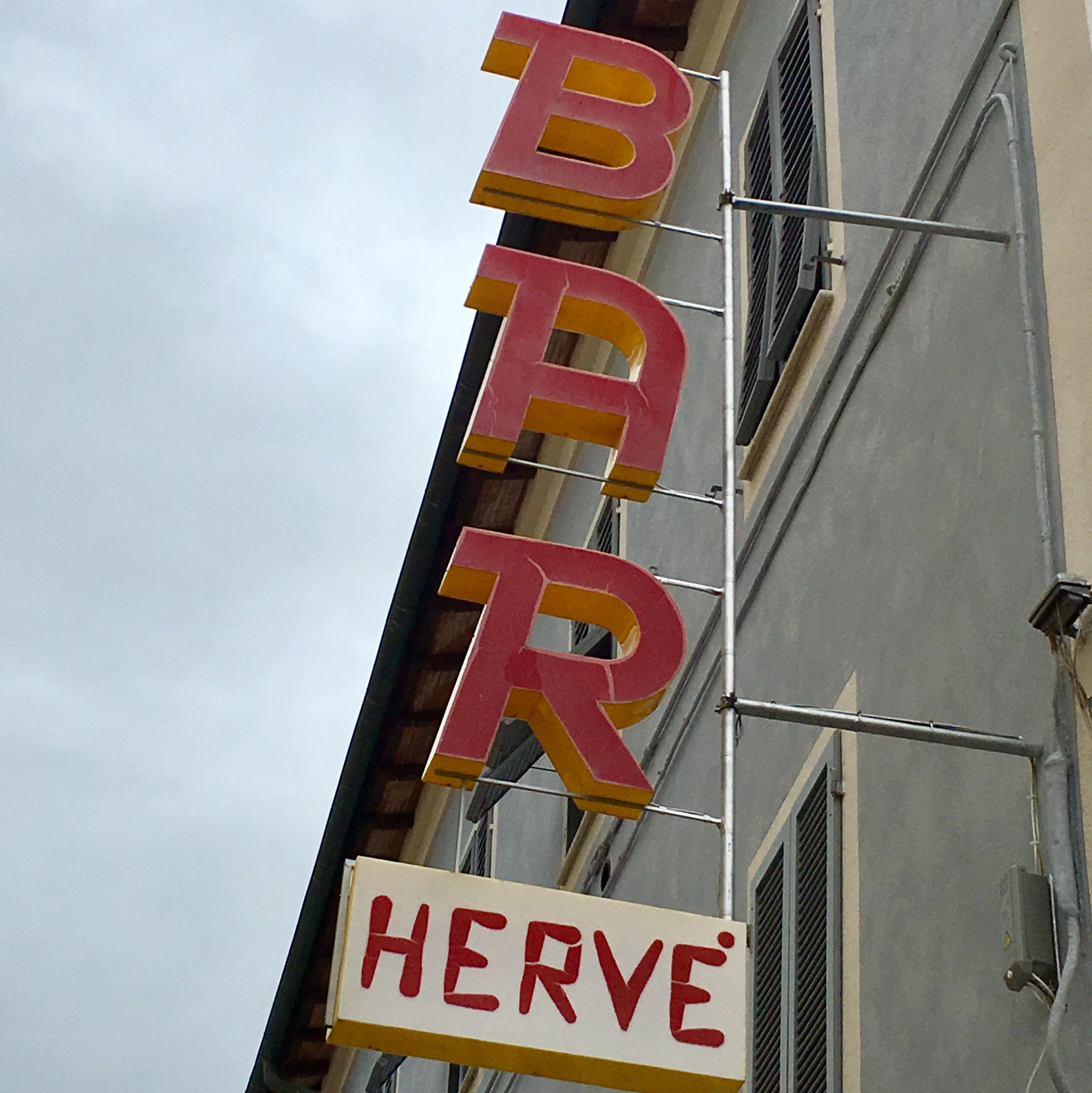

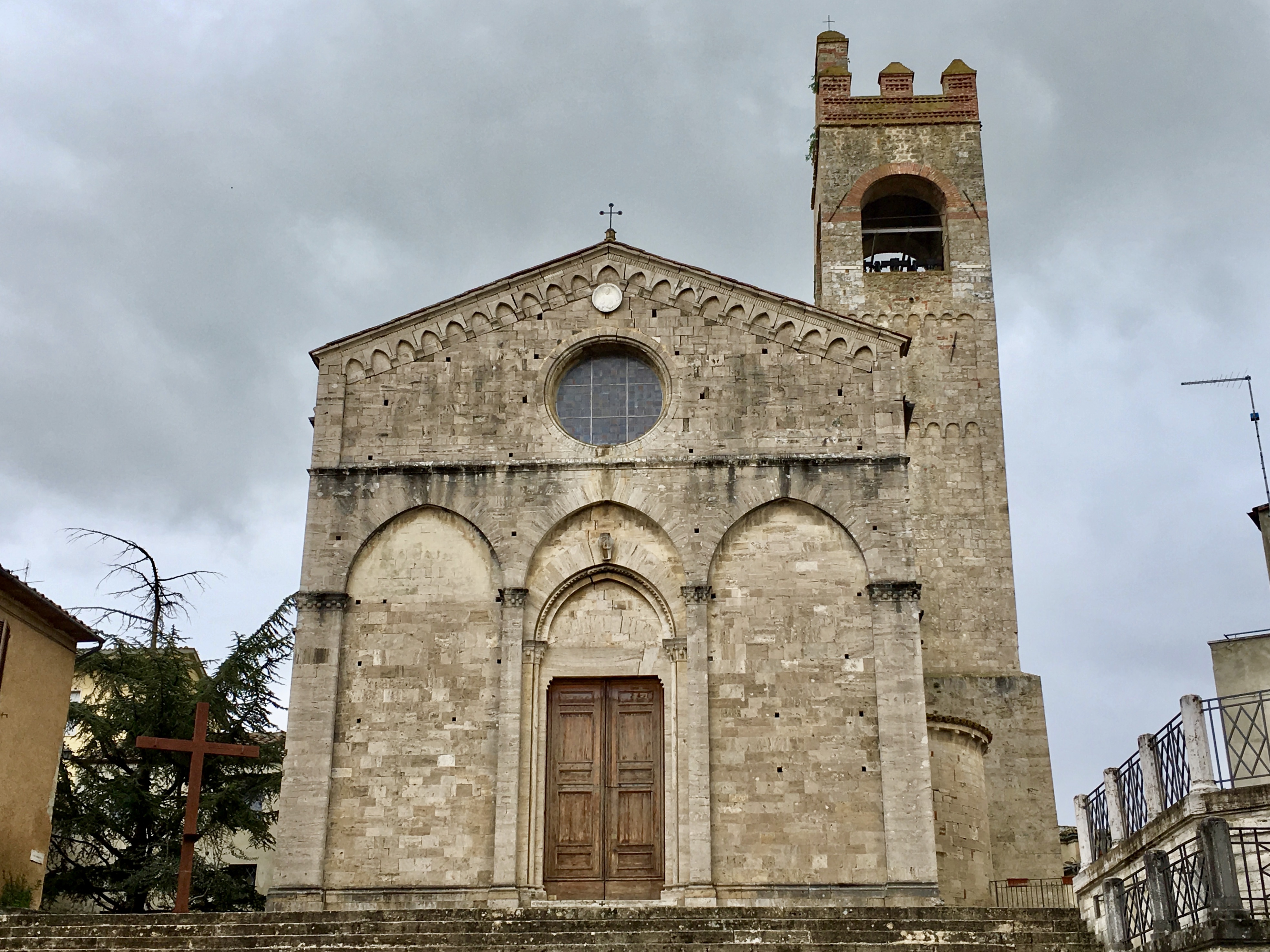

You must be logged in to post a comment.