Monday, July 10: On Monday morning, I sent my pack ahead today for the first time because this stage would be a very long one. I used Rino Personal Bag, a one-man company that Marzia in San Gimignano had recommended. He charged only 15€ compared to the 20€ charged by Bags-Free. It was still a steep price to pay compared to what I paid on the Camino de Santiago at 5€/day. In this heat, it would be a relief to walk without my pack, although I still had to carry a lot of water in a smaller daypack.
We left Colle di Val d’Elsa at 6:00 a.m. and walked down a steep grassy switchback ramp to the lower more modern town where we found the Pinocchio Fountain. Sadly the fountain wasn’t turned on.
Colle di Val d’Elsa
Colle di Val d’Elsa
Colle di Val d’Elsa
Colle di Val d’Elsa
Then we followed a convoluted route that led us down to the River Park of Upper Val d’Elsa. This was quite a surprise because it was a beautiful walk, sign-marked, but not mentioned in our guidebooks at all. The river was a beautiful aquamarine color much like the Rio Celeste in Cost Rica.
Situated in the urban section of Colle Val d’Elsa, the park is one of the protected areas and nature reserves of this region. In the shade of its trees, the river Elsa flows from the Vene (a water spring), creating turquoise pools and glowing springs that have a travertine look to them.
The Sentierelsa (path along the Elsa) took us along the river banks, a route of about 4 km. Apparently not far is the Caldane, hot water ponds that have been known since Etruscan times. The path was lovely but I think it may have added a mile or two to our walk because it seemed to go on forever.
The magical blue water was so intense that we were mesmerized. We walked past many small waterfalls and had to cross numerous times on huge slippery rocks, helped along by rope “handrails.” We crossed with trepidation, fearing we’d fall in and soak all our belongings.
River Park of Upper Val d’Elsa
River Park of Upper Val d’Elsa
me contemplating the crossing
Darina crossing over
River Park of Upper Val d’Elsa
River Park of Upper Val d’Elsa
me crossing the river
me at River Park of Upper Val d’Elsa
River Park of Upper Val d’Elsa
the path in the River Park of Upper Val d’Elsa
River Park of Upper Val d’Elsa
Darina in River Park of Upper Val d’Elsa
River Park of Upper Val d’Elsa
River Park of Upper Val d’Elsa
greenery in River Park of Upper Val d’Elsa
Darina crosses again
River Park of Upper Val d’Elsa
River Park of Upper Val d’Elsa
River Park of Upper Val d’Elsa
Darina marching along
me in River Park of Upper Val d’Elsa
River Park of Upper Val d’Elsa
River Park of Upper Val d’Elsa
After we climbed to the road from the river walk, we crossed a pedestrian bridge and saw signs for the Via Francigena leading into a town with some bars. We were surprised because there were no services supposedly available on this stretch. We found a bar and enjoyed cappuccino and croissants from a nearby bakery and then realized we were not properly following the guidebook. It seems there are many alternate routes that aren’t shown in the guidebook, plus there is the Via Francigena for cyclists which often intersects us. Thus we had to backtrack to the pedestrian bridge over the River Elsa and the parish church that hosts the San Marziale pilgrim hostel. From there, we climbed up a road toward the small village of Ponelle, another 1.9 km under hot sun, much of the time on asphalt, to the village of Scarna, where we found a picnic table in the shade and a fountain and sat to rest and hide for a while from the relentless sun.
climbing up to the road
the bridge over the river
We descended on a gravel trail through the woods and then through the hamlet of Acquaviva. There an older local man joined us, chatting away in Italian as if we could understand any of what he was saying. It was a long hot slog from that picnic table, passing rapeseed fields and other farmland.
fields of rapeseed
long hot slog
Darina walking in the sun
The road turned to asphalt again to the town of Strove/San Martino; the whole town seemed to be under construction, with streets and buildings being torn apart by bulldozers. We found a very nice bar and relaxed for a while. We were even able to get a stamp for our credenciale here; these are not as easy to come by as they were on the Camino. Here the woman at the bar told us it was a half-hour walk to the Abbadia d’Isola (it was longer than that in very hot sun), and then another hour to Monteriggioni (boy was she ever wrong!). We would soon encounter one of the most difficult stretches of our journey.
Strove/San Martino
Strove/San Martino
Strove/San Martino
After descending and ascending into a forest, we spilled out into an olive orchard, where we walked along an exposed gravel trail between stone walls. The stone walls made the path seem like an oven and there was not a bit of shade. When we finally stumbled into Abbadia d’Isola, we were grateful for the cold bottle of water given to us by the woman running the attached hostel. We went into the abbey church where we bought a pilgrim tag to put on our backpacks. We hadn’t before seen much pilgrim paraphernalia. There we admired the Romanesque chapel and the 15th century polyptych altarpiece painted by Sano di Pietro of Siena and meditated on our pilgrimages.
In the year 1001, Countess Ava of Staggiò founded the monastery here and dedicated it to San Salvatore. Sigeric listed this as stage XVI. A pilgrim hospital cared for Via Francigena pilgrims here as early as 1050. The current church was consecrated in 1173 to honor San Cirino, and its increasing importance and strategic position between Florence, Siena and other Tuscan towns led in the 14th century to the building of protective walls. Many of the buildings surrounding the austere and tranquil Romanesque chapel became farm buildings over the centuries, but have recently been restored for events and pilgrim hospitality.
the walk to Abbadia d’Isola with Monteriggioni on the hill in the distance
Abbadia d’Isola
Abbadia d’Isola
Abbadia d’Isola
Abbadia d’Isola
We descended just through the Abbey’s’ main gate, following a path that made a slow circuit to the right around a very wide field. This was a tough part of our stage. We were immediately in the hot sun and we had a huge field to cross. Sometimes I thought if we just walked along the road, our way would be a lot easier and faster, if maybe not as scenic. The road cut diagonally across to Monteriggioni while the path traversed the edges of the fields, taking us in a square around it.
Darina stopped under one of the few trees and I kept plodding along in the harsh sun, figuring she would catch up after drinking some water and bypass me as she always did. In the distance I could see a huge tree and some shade, and I tried not to think about the sun but just to keep focused on reaching that tree. It was a long way, about a third of the way across the field edge. As I got to the tree, Darina telephoned and I turned around to see she was nowhere in sight. She said the sun was burning her skin and she had to go back to the Abbey. By that time, I was not going to backtrack uphill to the Abbey and I told her I was going to keep going. I would call her when I reached a restaurant in Monteriggioni and she could take a taxi there, or if she wanted to take a taxi before I called, she could let me know where she was, and I’d meet her. I passed a pretty sunflower 🌻 field and I could see Monteriggioni at what seemed like a great distance ahead.
the long hot walk toward Monterigioni – the tree I aimed for in the distance
sunflowers in the field
sunflowers galore
I trudged along to the corner of the field, then made a hard left on a long sparsely forested path alongside a hill. At least there was a bit of shade, but it wasn’t a lot. After what seemed an eternity, I rounded a corner and there before me was a very lively restaurant in the lower town. I stopped and went to the patio, looking very bedraggled and sweaty. I got a table for two and asked the waitress if she could call a taxi to go pick up my friend at the Abbey, actually about 3-5 minutes away by car. She told me it was impossible to get taxis, that the taxis only run between Monteriggioni and Siena. That was the most ridiculous thing I had ever heard but this scenario would play out many times in Italy as there was no Uber here. Taxi drivers had a total monopoly and often couldn’t or wouldn’t meet the needs of the people. Luckily a young American guy from New York named Declin overheard my conversation with the waitress. He was sitting with family and friends and he said he had a car and would be happy to go pick up my friend. I called Darina and told her and gave Declin Darina’s number and told him where she was. He immediately took off and was back with Darina in about 10-15 minutes. Declin had saved the day! Darina was relieved as she had been trying to get someone from the Abbey to arrange a ride and was getting nowhere.
We enjoyed a nice lunch with Aperol spritzes and pici with eggplant and cheese and sat for a while. We expressed our gratitude to Declin as much as we could and treated him to an extra beer. We were too tired to climb uphill into Monteriggioni. We wondered how on earth we would make it 6km past Monteriggioni to our place for tonight, Agricola Fratelli Marchi, since there were no taxis available. We didn’t have it in us to walk any more in the heat.
Finally, Darina makes it to the restaurant
Enjoying lunch with Darina after she arrives
We texted Ilara, our host at the Agricola, and asked if it was possible for her to arrange a ride for us. She said she was working and couldn’t come until 7 pm but maybe her brother Alessandro come come at 4:00. It was 2:30 and we said we’d wait. At 4:00, he hadn’t arrived. We kept running out to the parking lot and asking people who drove up, “Are you Alessandro?” We must have asked about 10 people. Finally he arrived and drove us what seemed a very long distance to the Agricola, probably the worst place we stayed on our journey.
Alessandro showed us into the room which was decorated with a bunch of junk someone decided they no longer wanted. There was nothing to drink and no restaurant on site. Ilara brought us a pizza we ordered from a menu she had sent us (probably picked up from the town where she worked). She brought a pair of child’s scissors to cut it with. There was nowhere to sit outside and no place to hang our washed clothes outside and we felt like prisoners stuck in that room eating our pizza sliced with the scissors. Luckily she had brought us beers at our request, allowing us to find some humor in the situation. What a place. We would be happy to leave here in the morning! We never did get to see Monteriggioni but it was no big deal to me as I’d seen it in 2019 (a short stroll thorugh damp monteriggioni) and I couldn’t remember a thing about it. Darina was too exhausted to care. Thank goodness we would have two nights following in Sienna, rest day included.
Steps: 29,212; Miles: 12.39. Day 4 Stage Walk: 9.32 mi, or 15 km.
Weather: Monteriggioni: Hi 98°, Low 66°. Sunny.
The Via Francigena is an ancient road and pilgrimage route that runs from Canterbury, England, through France and Switzerland, to Rome and then to Apulia, Italy, where there were ports of embarkation for the Holy Land. In around 990, Archbishop Sigeric journeyed from Canterbury to Rome and back, but only documented his itinerary on the return journey, taken in 80 stages averaging about 12 miles (20 km) a day, for a total of some 1,100 miles (1,700 km).
This is the continuing saga of our attempt to walk the stages from Lucca to Rome, which are, in total, about 255.07 miles (410.5 km). Since we had to cut out stages due to time constraints, our actual goal was to walk 211.77 miles ( 340.8 km).
Running tally (Day 4):35.36/211.77 miles (56.9/340.8 km).
Wednesday, June 28: We checked into our roomy Airbnb apartment in Verona, dibbed “Casa Teatro Ristori,” after we drove down the Alto Adige Wine Road from Bolzano. It was in a quiet neighborhood not far from the old town. Our terrace overlooked the Teatro Ristori, a cozy theater used for intimate performances.
the view from our terrace in Verona
Casa Teatro Ristori Airbnb
Casa Teatro Ristori Airbnb
Teatro Ristori – the view from our terrace
We had a fabulous dinner at Bistro Con Amore right around the corner from our apartment. The restaurant was run by Christian from Romania and his wife Ina from Moldova. Christian was lively and passionate about his restaurant and about opera. He broke into song several times as I drank a Hugo and Mike enjoyed an Aperol Spritz. I had spaghetti with prawns and Mike had a delectable Eggplant Parmesan with Pugliese Burrata and fresh basil. We sat beside the nicest Italian couple, Lorenzo and Cosette (which, according to her, means “a little thing”). They were there eating cicchetti (Italian tapas) before they went to their home around the corner for dinner. We had a long chat with them about different parts of Italy (where they were from), the geography and rivers, and our travel plans in their decent English and our faltering Italian.
Bistro Con Amore
me with Christian of Bistro Con Amore
Mike with his Aperol Spritz and my Hugo in the foreground
Mike’s Eggplant Parmesan
my spaghetti with prawns
After dinner we strolled around town, heading for the domineering Castelvecchio, built in the 1350s by Cangrande II della Scala. We walked across the asymmetrical brick bridge, Ponte di Castel Vecchio, a triple-arched fortified bridge in Verona which straddles the Adige River. It was built (most likely in 1354-1356) by Cangrande II to enable him to safely escape from the attached castle in the event the population rebelled against his tyrannical rule.
The bridge was totally destroyed, along with the Ponte Pietra, by the retreating German troops on April 24, 1945. The bridge’s reconstruction by architect Libero Cecchini began in 1949 and was completed in 1951, except for the left tower.
Thursday, June 29: Our first full day in Verona, we headed first to the Roman Arena, an open-air amphitheater in Piazza Bra built in 30 AD. It survived a 12th century earthquake and is now internationally famous for its legendary large-scale opera performances.
The Arena, the eighth largest in the Roman Empire, predates the Colosseum in Rome. It is one of the best preserved ancient structures of its kind. In ancient times, the arena’s capacity was nearly 30,000 people. The stage for concerts and opera performances decreases the available places to a maximum of 22,000.
The first 20th-century operatic production at the arena, a staging of Giuseppe Verdi’s Aida, took place on August 10, 1913 to mark the birth of Verdi 100 years before in 1813. Since then, summer seasons of opera have been mounted continually at the Arena, except in 1915–18 and 1940–45, when Europe was embroiled in war.
After wandering through the Arena and watching the work crews setting up the stage, we decided to buy tickets to Thursday night’s performance, which happened to be Aida, the first opera performed at the venue in the 20th century.
on the way to the Arena
Piazza Bra
Piazza Bra
Verona’s Roman Arena
Mike at Verona’s Roman Arena
Verona’s Roman Arena
Verona’s Roman Arena
Verona’s Roman Arena
Verona’s Roman Arena
view of Piazza Bra from the Arena
part of the Roman Arena
We dropped into a church not far from the Arena, San Nicolò all’ Arena, a Roman Catholic parish church dedicated to Saint Nicholas. It was built in the Baroque style between 1627-1683, although the façade wasn’t completed at the time. The neoclassical façade of the Church of San Sebastiano was relocated to San Nicolò in the 1950s, after the former church was destroyed during World War II. The interesting sculpture in front is Frutto Oggetto (“Fruit Object”) by Gino Bogoni, 1990.
streets of Verona
San Nicolò all’ Arena
San Nicolò all’ Arena
San Nicolò all’ Arena
Of course we had to drop by the Casa di Giulietta (Juliet’s House), a fictional place created by a city capitalizing on the fame of Shakespeare’s fictional Romeo & Juliet. In the 1930s the city authorities picked a house in Via Cappello as Juliet’s and added a 14th-century-style balcony and a bronze statue of the heroine. We stopped to touch Juliet’s breast, as it is believed caressing her breast brings good fortune in love. We looked up at the balcony and checked out the love locks, and then we were out of there. I wasn’t dressed for the occasion but I did capture a beautiful young lady dressed to the hilt for the photo op.
Casa di Giulietta
Mike holding Juliet’s breast
me caressing Juliet’s breast
a stylish woman with Juliet
locks at Casa di Giulietta
locks at Casa di Giulietta
Casa di Giulietta
We stopped for cappuccino and croissants 🥐, our normal mid-morning routine. After our coffee break we wandered somewhat aimlessly while making our way slowly to the Torre dei Lamberti. We saw many enticing sweet treats and cool ancient buildings along the way. We found a sculpture of poet Berto Barbarani at Piazza Erbe, but we would have had to wait a long time to get the little girl posing out of the picture. I also bought myself another dress that was the exact style (but different color and pattern) as the one I bought in Venice for 70€; the one at a kiosk here was 25€. Live and learn.
coffee & croissant break
our little pasticceria
pretzels
macaroons
cute shop display
macaroons
popsicles
Piazza Erbe
statue of poet Berto Barbarani
Piazza Erbe
Piazza Erbe
Onward and upward we went to the Torre dei Lamberti. The 84m-high watchtower offered panoramic views of Verona and nearby mountains. Begun in the 12th century and finished in 1463, it has an octagonal bell tower. I took the lift up 2/3 of the way, while Mike climbed the stairs, and we walked up the remaining 1/3rd for the views.
Torre dei Lamberti
view from Torre dei Lamberti
view from Torre dei Lamberti
view from Torre dei Lamberti
view from Torre dei Lamberti
view from Torre dei Lamberti
view from Torre dei Lamberti
view from Torre dei Lamberti
We then climbed the Scala Della Ragione (Stairs of Reason) to the Galleria d’Arte Moderna Achille Forti, the city’s modern art museum. Its collection of paintings spans 1840-1940 and includes many influential Italian artists. We loved the art in this museum, especially the paintings.
Galleria d’Arte Moderna Achille Forti
Galleria d’Arte Moderna Achille Forti
Piazza Erbe, Carlo Ferrari detto Ferrarin (1813-1871)
I portoni della Bra by Ettore Beraldini (1887-1965)
Ritratto di Emilia Vignola by Alfredo Savini (1868-1924)
Panorama di Verona by Baldassarre Longoni (1876-1956)
Il pesco fiorito by Baldassarre Longoni (1876-1956)
Notre vespertine by Francesco Danieli (1852-1922)
Ponte di Veja in Lessinia veronese by Ettore Beraldini (1887-1965)
La mia sorellina by Guido Trentini (1889-1975)
Ritratto di ragazza seduta vestita di rosso by Guido Trentini (1889-1975)
Galleria d’Arte Moderna Achille Forti
Galleria d’Arte Moderna Achille Forti
Piccola descrizione asolana n. 2 by Gino Rossi (1884-1947)
La preghiera by Felice Casorati (1883-1963)
Ritratto di bambina. La figlia sul colle San Felice by Alfredo Savini (1868-1924)
Galleria d’Arte Moderna Achille Forti
Galleria d’Arte Moderna Achille Forti
Natività: omaggio al Bassano by Filippo de Pisis (1896-1956)
Palude, Porto Buso by Renato Birolli (1905-1959)
Paese selvatico by Renato Birolli (1905-1959)
Composizione by Tancredi (Tancredi Parmeggiani 1927-1964)
Cappella dei Notai
Cappella dei Notai
Cappella dei Notai
Il canneto by Eugenio Degani (1923-2000)
Il canneto by Eugenio Degani (1923-2000)
me in front of Il canneto
Galleria d’Arte Moderna Achille Forti
Galleria d’Arte Moderna Achille Forti
Vendemmia a Soave by Adolfo Mattielli (1883-1966)
Galleria d’Arte Moderna Achille Forti
We walked through the Piazza Signori, lined with elegant Renaissance palazzi. A famous statue of Dante sits in the middle. Slightly off the Piazza is the Arche Scaligere, the ornate Gothic funerary monuments of the Della Scala family. They were the ruling family of Verona and mainland Veneto (except for Venice) from 1262-1387, a total of 125 years. The family’s rule was marked by wars, cruel and tyrannical governance, and fratricide, offset by some beautification projects in Verona: palaces, aqueducts, bridges and a treasury.
Dante at Piazza dei Signori
Piazza dei Signori
Dante at Piazza dei Signori
Piazza dei Signori
Piazza dei Signori
Arche Scaligere
Arche Scaligere
Arche Scaligere
Arche Scaligere
By this time we were hungry for lunch so we stopped at a restaurant, Osteria Sottoriva, where we shared a table with two Brits from York, Andy and Shirley. It was a long leisurely lunch, where Mike enjoyed an Insalata d’Orzo and I had an Eggplant Parmesan that wasn’t nearly as tasty as the one Mike had Wednesday night. Mike and Andy talked sports, especially their favorite football clubs. Andy’s was Newcastle, his hometown, and Mike’s Liverpool. We chatted about our travel itineraries. Andy and Shirley planned to stay at Lake Garda for a week after they left Verona. They had taken a day trip to Venice the day before by train, and when they arrived back late at night, around 10:00 p.m., some of the people who had disembarked were trying to get a taxi to their hotels in Lake Garda, but the taxi drivers refused to take them. Later, I would experience similar taxi frustrations during my walk on the Via Francigena. As Italy doesn’t allow Uber, taxi drivers have no competition and thus are inflexible, expensive, and even tyrannical.
streets of Verona
Verona
random flowery restaurant
Osteria Sottoriva
menu at Osteria Sottoriva
my Eggplant Parmesan
Mike’s Insalata d’Orzo
Finally we visited the Italian Gothic Basilica di Sant’ Anastasia. Dating from the 13th-15th centuries, it features an elegantly decorated vaulted ceiling. This is Verona’s largest church with an overwhelming number of frescoes. We saw the beautiful fresco of St. George and the Princess by Pisanello above the entrance to the Pellegrini Chapel. Pisanello is known for his ability to evoke a fantastic chivalrous world.
We also made the acquaintance of the hunchback holding up the 1495 holy water font; he was carved by Gabriele Caliari. It is said that touching a hunchback on the hump brings good luck.
Basilica di Sant’ Anastasia
Basilica di Sant’ Anastasia
hunchback holding water font
hunchback holding water font
Basilica di Sant’ Anastasia
St. George and the Princess by Pisanello
Basilica di Sant’ Anastasia
Basilica di Sant’ Anastasia
Basilica di Sant’ Anastasia
Basilica di Sant’ Anastasia
Basilica di Sant’ Anastasia
Basilica di Sant’ Anastasia
Basilica di Sant’ Anastasia
Basilica di Sant’ Anastasia
Basilica di Sant’ Anastasia
Basilica di Sant’ Anastasia
Basilica di Sant’ Anastasia
Basilica di Sant’ Anastasia
Basilica di Sant’ Anastasia
Basilica di Sant’ Anastasia
Basilica di Sant’ Anastasia
Basilica di Sant’ Anastasia
Basilica di Sant’ Anastasia
Basilica di Sant’ Anastasia
Basilica di Sant’ Anastasia
Basilica di Sant’ Anastasia
Basilica di Sant’ Anastasia
Basilica di Sant’ Anastasia
Basilica di Sant’ Anastasia
Basilica di Sant’ Anastasia
Basilica di Sant’ Anastasia
At the end of our day, we stopped for gelato at Gelateria La Romano. It was a refreshing way to end our day. After resting a bit, we made some delicious pasta in our apartment with green beans and sun dried tomatoes before going back to the Arena to see the opera Aida.
pretty Verona
more colorful macaroons
a pretty hidden square
me enjoying my gelato
Gelateria La Romano
pasta with green beans and sun-dried tomatoes
The opera Aida started at 9:15 and was scheduled to go a full 3 1/2 hours. I doubted my ability to stay up that late, so I told Mike I might want to leave early if I felt like it. He agreed, and off we went.
On our way to the opera we met our Italian “friends,” Lorenzo and Cosette. Holding our seat cushions under our arms, we told them we were on our way to see Aida. They were thrilled for us, gushing with enthusiasm over the opera.
our view from our balcony
me ready for the opera
Lorenzo and Cosette
Piazza Bar
me at Piazza Bar
Mike and I going to the opera
Mike going to the opera
The Arena
The Arena
Aida is one of the most mythical operas to be performed every year at the Arena di Verona. The series of 16 performances began this summer on June 16. The production by Franco Zeffirelli brought ancient Egypt to the stage in a modernistic way, with costumes created by Anna Anni, and a cutting-edge stage design, which featured a huge ghostlike hand that moved slowly up and down; the performance boasted a black, white and red color motif.
Detailed information on Aida:
Venue: Arena di Verona
Duration: 3 hours and a half approximately
Book by: Antonio Ghislanzoni
Music composed by: Giuseppe Verdi
Language: Italian
Directed and staged by: Franco Zeffirelli
Costume design by: Anna Anni
Aida, an opera in four acts set in ancient Egypt, was commissioned to celebrate the opening of the Khedivial Opera House in El Cairo, where it premiered in December 1871. It is among the most performed operas in history. For instance, it has been performed over a thousand times at the Metropolitan Opera of New York since 1886.
The story revolves around the Ethiopian princess Aida, who is captured and sent to Egypt as a slave. At her arrival, Radames enters the scene. He is a commander for the Pharaoh who falls in love with Aida and will have to struggle between his love for her and his loyalty to the Pharaoh. The plot thickens when Amneris, daughter of the Pharaoh, demands the love of Radames, leading to a love triangle.
We left after 2 hours because I was so uncomfortable sitting on the concrete slabs of the Arena and also felt trapped because it’s frowned upon to get up at any time except intermission, which was between Act 2 and Act 3.
Aida at the Arena di Verona
Aida at the Arena di Verona
Aida at the Arena di Verona
Aida at the Arena di Verona
Aida at the Arena di Verona
Aida at the Arena di Verona
Aida at the Arena di Verona
Aida at the Arena di Verona
Here is a short video of some scenes from the opera.
Steps: 16,443; Miles: 6.97. High 87°, Low 66°. Partly cloudy.
Friday, June 30: On Friday morning, our last day in Verona, we ventured out to see some of the famous churches. First stop was Chiesa di San Fermo. The church was built in the 5th century in honor of saints Fermo and Rustico, who became martyrs in 304 AD. Here one church is built over another: Franciscan monks raised the 13th-C Gothic church right over an original 11th-C Romanesque structure. Inside the main Gothic church we admired the larch timber ceiling which resembles an upturned boat’s hull. Some 14th-C frescoes depict the life of St. Francis.
Chiesa di San Fermo
Chiesa di San Fermo
Chiesa di San Fermo
Chiesa di San Fermo
Chiesa di San Fermo
Chiesa di San Fermo
Chiesa di San Fermo
Chiesa di San Fermo
Chiesa di San Fermo
Chiesa di San Fermo
Chiesa di San Fermo
Chiesa di San Fermo
Chiesa di San Fermo
Chiesa di San Fermo
Chiesa di San Fermo
Chiesa di San Fermo
Chiesa di San Fermo
Chiesa di San Fermo
Chiesa di San Fermo
Chiesa di San Fermo
We stopped at the Duchi Café and then walked along the river. We didn’t get far because it started raining 🌧️ ☔️ and we hadn’t brought our raincoats or umbrellas. We ducked under the umbrellas of another cafe to eat the panini we had bought earlier, along with a bowl of bean soup we bought at the café. We enjoyed two Aperol Spritzes while waiting for the rain to stop.
Ponte Pietra over the Fiume Adige
Duchi Café
Duchi Café
ancient Roman ruins
Roman ruins
horseman
another pretty storefront
me along the Fiume Adige
a cozy respite from the rain
Mike and his sandwich
me with Aperol Spritz
bean soup
When the rain abated, we crossed the Ponte Pietra at the northern end of the city center. Two of the bridge’s arches date from the Roman Republican era in the 1st century BC, while the other three were replaced in the 13th century. The ancient bridge remained largely intact until 1945 when retreating German troops blew it up. Locals fished the pieces out of the river and painstakingly rebuilt the bridge stone by stone in the 1950s.
hills along the river
postal vehicle
walking to Ponte Pietra
the River Adige
hills to the north of Verona
the River Adige
the River Adige
Ponte Pietra
Mike and me on Ponte Pietra
hills around Verona
hills around Verona
streets of Verona
cute car in Verona
Finally we went to the Cattedrale Santa Maria Matricolare, also known as the Duomo di Verona, Verona’s 12th century cathedral. It was built after an earthquake destroyed two Palaeo-Christian churches on the same site in 1117. The Romanesque-style cathedral was consecrated on September 13, 1187. The structure was later modified by several renovations, although the plan has remained unchanged. The interior was extravagantly frescoed in the 16th-17th centuries.
Cattedrale Santa Maria Matricolare
Cattedrale Santa Maria Matricolare
Cattedrale Santa Maria Matricolare
Cattedrale Santa Maria Matricolare
Cattedrale Santa Maria Matricolare
Cattedrale Santa Maria Matricolare
Cattedrale Santa Maria Matricolare
Cattedrale Santa Maria Matricolare
Cattedrale Santa Maria Matricolare
Cattedrale Santa Maria Matricolare
back of Cattedrale Santa Maria Matricolare
Because of the damp weather and because we were tired from so much walking, we headed back to the apartment to relax and nap. It rained off and on all afternoon.
We went out in the evening to our favorite neighborhood restaurant, Bistro Con Amore Cicchetteria, where we sampled a delectable assembly of Italian tapas (cicchetti) accompanied by opera music. Of course I had to have my Hugo!
me on our balcony
Mike on our balcony
cicchetti at Bistro Con Amore Cicchetteria
Tiramisu at Bistro Con Amore Cicchetteria
cicchetti at Bistro Con Amore Cicchetteria
more Roman arches in Verona
Steps: 11,705; Miles 4.96. High 81°, Low 65°. Cloudy and some rain.
After leaving Verona on Saturday morning, we would head to Lake Garda and on to Bergamo.
Saturday, June 24: As we were leaving Cinque Torri, we found on our GPS that the Great Dolomites Road was closed at the pass, so we had to reroute and couldn’t take our scenic route to Bolzano. We ended up backtracking all the way to Cortina d’Ampezzo and to Dobbiaco and Brunico and then eventually toward Bolzano on the A12 autostrada.
The Renon Plateau: Kinig Farm
Just before Bolzano we were instructed to take a windy road up and up a very steep mountain. It felt very perilous! There were many steep drop-offs and the road eventually narrowed to just over one lane wide. Switchback after switchback led us eventually to the “town” of Signato on the Renon plateau and to a farm called Kinig, where Werner (the father of the Airbnb host Franz Maria) greeted us. We had reserved an apartment on this high mountain farm for 4 nights. It was a charming little place!
Kinig farmhouse
Kinig farmhouse
Kinig farmhouse
Kinig farmhouse
urinal with painted spider that fooled both of us!
kitchen in Kinig farmhouse
Kinig farmhouse
Kinig farmhouse
view of Bolzano from the farmhouse
Soprabolzano/Oberbozen
Luckily, though the road ended at a gate, we were given a pass to open the gate so we could drive a few kilometers further up to the town of Soprabolzano/Oberbozen. Neither of us were thrilled about having to drive that winding road back down the mountain to go to dinner or get groceries in Bolzano, so that gate-opening card was truly the magic ticket. We were also given a free gondola card which we could use for the gondola down to Bolzano.
After checking into our farmhouse Airbnb apartment, we drove up the mountain to Soprabolzano. Here we stocked up on groceries for our 4 night stay in Renon, then we went to eat dinner at the lively and friendly Gasthaus Babsi, recommended by the friendly check-out lady at the supermarket. It was a cool place with a friendly staff and old American tunes playing. We shared a Rucola and Brie pizza and I had the most delightful drink called a Hugo that had Prosecco, lime, fresh mint, seltzer, and elderberry liqueur. Mike had an Estivo: white wine, soda and lemon.For dessert we shared a buckwheat cake with lingonberry jam and whipped cream. Before we left the place, the bartender gave us each complimentary limoncellos.
We took an after-dinner stroll on the lower edge of the town, where we saw beautiful views of the jagged Dolomites against a foreground of alpine meadow. The town also had a community swimming pool which we had access to. From the town, there was a large cable car 🚠 that went down into the valley to the city of Bolzano. We planned to take that down one day to avoid the harrowing drive up to our farmhouse apartment.
We admired the charming Parrocchia Maria Assunta di Soprabolzano with its fetching onion dome in the waning sunlight.
Gasthaus Babsi
Gasthaus Babsi
me with a Hugo at Gasthaus Babsi
Mike at Gasthaus Babsi
buckwheat cake with lingonberry jam and whipped cream
signs in Soprabolzano
Soprabolzano
cable car at Soprabolzano
cable car at Soprabolzano
little lambs in Soprabolzano
Hotel Post in Soprabolzano
Parrocchia Maria Assunta di Soprabolzano
Steps: 12,253; Miles 5.19. High 77°, Low 52°. Sunny.
Val di Funes: the Panoramaweg & Sunnseitnweg Circuit Hike
Sunday, June 25: On Sunday morning, we drove about an hour from Renon to Val di Funes to hike the Panorama Trail (“Panoramaweg” in German) and the Sunny-side Trail (“Sunnseitnweg”), which when linked together creates an easy, scenic circuit hike.
We started in Santa Maddalena/ St. Magdalena, a village in Val di Funes (Villnösstal) in South Tyrol. This small mountain village is home to the historic Santa Maddalena Church, which is one of the most popular photo spots in the region. The church dedicated to Santa Magdalena is located where pagan rituals once took place. The first building was mentioned in 1394 documents; today only the church tower remains of that original church. The interior has Baroque elements. The altar features a contrite St. Magdalena, patron saint of the church. Next to her are sculptures of St. Peter, John the Baptist, John the Evangelist and Jerome.
The Santa Maddalena Panorama trail led us through meadows, pockets of forest, and historic Tyrolean farmsteads along narrow footpaths as well as low-trafficked paved roads.
We enjoyed grand views of the Odle/Geisler Peaks, which form the dramatic backdrop of Santa Maddalena Church and the tidy farmhouses set in the lovely green valley.
a church near our farmhouse in Renon
Val di Funes
Panoramaweg & Sunnseitnweg
the start of the Panoramaweg
Santa Maddalena Church
Santa Maddalena Church
Val di Funes
Panoramaweg
Santa Maddalena Church set against the Odle/Geisler Peaks
Santa Maddalena Church set against the Odle/Geisler Peaks
me in Val di Funes
Val di Funes
trail markers in Val di Funes
Mike in Val di Funes
Val di Funes
Val di Funes
cute little bench
tractor set up
Sunnseitnweg
Santa Maddalena Church set against the Odle/Geisler Peaks
Santa Maddalena Church set against the Odle/Geisler Peaks
Val di Funes
Val di Funes
Santa Maddalena Church set against the Odle/Geisler Peaks
me on the Sunnseitnweg
returning to Santa Maddalena
cemetery at Santa Maddalena Church
interior of Santa Maddalena Church
Santa Maddalena Church
After our hike, which was about 4.5 miles and took us about 3 hours of leisurely walking, we visited the tiny and picturesque onion-steepled Chiesetta di San Giovanni/ St. Johann Church nearby. It is one of the Dolomites’ most iconic photo-ops. The small Baroque church, founded by Michael von Jenner and built in 1744, sits alone in a meadow, part of the Ranuihof Farm, below the spiky peaks of the Odle mountain group. We paid to park plus a 4€ entrance fee to visit. Because of the way it was blocked off and because of the entrance fee, it felt a bit too staged for us.
Chiesetta di San Giovanni/ St. Johann Church
Chiesetta di San Giovanni/ St. Johann Church
Chiesetta di San Giovanni/ St. Johann Church
Sunday evening after our hike at Val di Funes, we returned to our farmhouse Airbnb and enjoyed wine, bread and cheese at a picnic table in the shade. We made an asparagus and cheese pappardelle that was quite delicious. We spent the evening relaxing in our charming apartment.
airplane in front of Kinig farmhouse
me enjoying a wine at Kinig farmhouse
Kinig farmhouse
table set for dinner
asparagus pappardelle
Steps: 13,119; Miles: 5.56. High 83°, Low 55°. Sunny.
Bolzano/Bozen
Monday, June 26: Monday morning we took the cable car 🚠 (a 12-minute ride) from Soprabolzano, not far from our farmhouse, to Bolzano down in the valley.
taking the cable car down to Bolzano
taking the cable car down to Bolzano
taking the cable car down to Bolzano
taking the cable car down to Bolzano
Bolzano/Bozen is the capital city of the province of South Tyrol. With a population of 108,245, Bolzano is also by far the largest city in South Tyrol. In the 2020 version of the annual ranking of quality of life in Italian cities, Bolzano was ranked joint first for quality of life alongside Bologna.
Bolzano is considered a bridge between Northern Europe and Southern Europe due to the three spoken languages in South Tyrol (Italian, German, and Ladin) and the confluence of Italian and German-Austrian culture.
Being located at multiple climate borders, Bolzano features a humid subtropical climate with hot summers and very cold winters by Italian standards.Because of its low altitude in a valley south of the main alps, Bolzano is sheltered from cool winds during daytime, ensuring much warmer temperatures year-round than in similar valley cities north of the range. It was in the mid-90s on the day we went down while it was in the low 80s on the Renon plateau.
We enjoyed wandering around the town. We walked around Waltherplatz, the main square in Bolzano. Walther von der Vogelweide, the square’s namesake, towers as a white statue in the middle of the square. We stopped at a favorite store we keep running into in various Italian towns, OVS. Mike was looking for some t-shirts and shorts and I bought a dress 👗. 😂
We had a lovely lunch in a shady and breezy alley. I had a burrata and tomato salad that was super refreshing. Mike had a tuna salad. As always in Italian towns, we love to watch the fashionable people strolling by. After lunch, we happened upon a lively flower market.
After strolling around a bit more, we made our way to the cable car and took it back up the mountain to Renon.
Bolzano/Bozen
cute orange bicycle
Bolzano/Bozen
Bolzano/Bozen
Bolzano/Bozen
Bolzano/Bozen
Bolzano/Bozen
Bolzano/Bozen
Bolzano/Bozen
burrata and tomato salad
flower market in Bolzano/Bozen
flower market in Bolzano/Bozen
flower market in Bolzano/Bozen
flower market in Bolzano/Bozen
window decor
window decor
Bolzano/Bozen
Taking the cable car back up to Renon
Taking the cable car back up to Renon
Taking the cable car back up to Renon
a view of our farmhouse from the cable car
returning to Soprabolzano
returning to Soprabolzano
The Renon/Ritten Plateau
After Bolzano, we spent the rest of our day on the Renon/Ritten Plateau, home to our farmhouse apartment. We drove to the town of Collalbo/Klobenstein and wandered around. Not much was happening there as it was in the heat of the afternoon, so we settled inside the only cafe in town to enjoy a very skimpy serving of gelato 🍧. It was refreshing but not quite enough to sooth our souls.
Collalbo/Klobenstein
Collalbo/Klobenstein
Collalbo/Klobenstein
Collalbo/Klobenstein
gelato in Collalbo/Klobenstein
a church near Collalbo/Klobenstein
view from the church
a church near Collalbo/Klobenstein
We reached the peak at Rittner Horn, at an altitude of 2260 meters, by taking the gondola from Pemmern/Tre Vie to Schwarzseepitze. From there it’s about an hour hike up to the top, but we didn’t take the hike. We could see excellent views of the mountains all around.
gondola to Rittner Horn
view from Rittner Horn
me at Rittner Horn
view from Rittner Horn
view from Rittner Horn
horses seen from the gondola ride back down
After our day taking the cable car to Bolzano and exploring some of the Renon/Ritten plateau, we stayed at the farmhouse and cooked some Bratwurst and some leftover pasta with zucchini. It was nice to spend a slower day simply enjoying our home town area.
dinner in the farmhouse
Steps: 11, 706; Miles 4.96. High 97°, Low 64°. Sunny.
The High Alpine hikes of Alpe di Siusi
Tuesday, June 27: With a size of 56 square kilometers, the Alpe di Siusi in South Tyrol is the largest high alpine pasture in Europe. On Tuesday, we drove about an hour from Renon to Ortesei/St. Ulrich where we took the Mont Sëuc cable car to the alpine meadow. There we spent much of the day, about 5 1/2 hours, hiking all over the meadow, about 6 1/2 miles.
We started by following Trail 9 to Saltria, which was a long slow descent. We passed alongside pastures of grazing horses and sprawling fields of colorful wildflowers. Many people posed amidst the wildflowers for pictures.
Saltria is a small village on Alpe di Siusi, located at an elevation of 1675 meters. It’s also the lowest point of the plateau. We had amazing views of the Catinaccio/Rosengarten range as we descended. We stopped at a hotel in Saltria for a cappuccino and an apple strudel.
As we crossed the rolling Alpe di Siusi meadows, Sassolungo and Sasso Piatto dominated the view to the southeast and the Catinaccio and Sciliar mountains dominated the views directly south and to the southwest. To the north, views extend to Monte Pic, Seceda, and the Geisler Group.
Of course what goes down must come up, so we hiked a long uphill out of the valley through the Römer mountain pasture, where cattle grazed freely.
Mont Sëuc cable car
first views of the Alpe di Siusi
me at Alpe di Siusi
Alpe di Siusi
Alpe di Siusi
Alpe di Siusi
Alpe di Siusi
stream at Alpe di Siusi
Alpe di Siusi
greenery at Alpe di Siusi
wildflowers
selfie 🙂
me with Mike at Alpe di Siusi
wildflowers at Alpe di Siusi
Alpe di Siusi
Alpe di Siusi
Alpe di Siusi
me in the wildflowers
Alpe di Siusi
horses at Alpe di Siusi
horses at Alpe di Siusi
Alpe di Siusi
Alpe di Siusi
Alpe di Siusi
wildflowers
Alpe di Siusi
more wildflowers
Mike at Alpe di Siusi
wildflowers
Alpe di Siusi
wildflowers
cows at Römer mountain pasture
Römer mountain pasture
Mike and his cow friends
me at Alpe di Siusi
Alpe di Siusi
Römer mountain pasture
Alpe di Siusi
Alpe di Siusi
Alpe di Siusi
Alpe di Siusi
greeter at Alpe di Siusi
Alpe di Siusi
We headed toward Compaccio but stopped for a restroom break at Rauchhütte before venturing back to our starting point. We originally intended to go to the town of Compaccio but decided not to go all the way into town.
We made another stop, this time at Sanon Hütte/Baita Sanon where Mike had a beer and I had my new favorite drink, a Hugo (Prosecco, mint and elderflower liqueur). Yum.
After we left the hut we enjoyed more beautiful views of the mountains. Looking north, we saw Monte Pic, the Geisler Peaks, Monte Stevia, Piz Duleda, and Col dala Pieres.
We had paid the extra 5 euros for the gondola from Sole Lake back up to the Mont Sëuc cable car, and we were happy we did as it saved us a long uphill slog at the end. What a gorgeous hike!
wood carvings on the way to Rauchhütte
carved bench near Rauchhütte
Rauchhütte
Rauchhütte
bathroom sign at Rauchhütte
bathroom sign at Rauchhütte
Seiser Alm, view from Rauchhütte
leaving Rauchhütte
Alpe di Siusi
Alpe di Siusi
Alpe di Siusi
Alpe di Siusi
Alpe di Siusi
Mike at Sanon Hütte/Baita Sanon
Sanon Hütte/Baita Sanon
me at Sanon Hütte/Baita Sanon with my Hugo
bathroom signs at Sanon Hütte/Baita Sanon
Alpe di Siusi
more wildflowers
Alpe di Siusi
riding the cable car back to Mont Sëuc
Ortesei/St. Ulrich
After our hike at Alpe di Siusi, we took a short wander around the town of Ortesei/St. Ulrich. This is in Val Gardena where many people stay when they come to the Dolomites. The town looked appealing, but we were happy with our little mountain farmhouse in Renon.
Ortesei/St. Ulrich
Ortesei/St. Ulrich
Ortesei/St. Ulrich
Ortesei/St. Ulrich
Ortesei/St. Ulrich
Ortesei/St. Ulrich
Ortesei/St. Ulrich
Ortesei/St. Ulrich
Ortesei/St. Ulrich
Ortesei/St. Ulrich
Ortesei/St. Ulrich
Ortesei/St. Ulrich
Soprabolzano
After we relaxed a bit at our farmhouse apartment, we drove up to Soprabolzano where we had a lovely dinner on the terrace of The Post Hotel overlooking the valley and the cable car. We had intended to go to Gasthaus Babsi again, but it was closed on Tuesdays. We shared Rinderbouillon mit Kräuterfrittaten, a delicious soup with tiny strips of pancake in it. Mike had Hacksteak vomeinheimischen Lamm auf roten Zwiebeln und Röstinchen, a delicious lamb loaf with a potato pancake and red onions; I had Spinatspätzle mit Entenragout, spinach spaetzle with duck ragout.
After dinner we strolled briefly around the town. This would be the last time we’d see our cute little town above the farmhouse.
me at our farmhouse apartment
Mike and the airplane at our farmhouse
me with the Kinig pots & pans
The Post Hotel
me on the terrace of The Post Hotel
Rinderbouillon mit Kräuterfrittaten
Hacksteak vomeinheimischen Lamm auf roten Zwiebeln und Röstinchen
Spinatspätzle mit Entenragout
Babsi
Soprabolzano
Soprabolzano
Soprabolzano
Steps: 22,819; Miles 9.68. High 68°, Low 47°. Mostly sunny.
Leaving the Renon Plateau
Wednesday, June 28: Wednesday morning we left our farmhouse apartment in Renon and said goodbye to Werner, the 54-year-old very fit man who gave the farm to his son Franz. Franz, who is about 30, does the farming and Werner runs the apartments and a restaurant that only opens seasonally. Sadly we weren’t there at the right season to partake.
We also said goodbye to our upstairs neighbors Tim and Silke from Berlin. They had their dog named Rala with them. I liked their way of doing a vacation. They stayed in the farmhouse for two weeks; every other day they did a big outing and on the off days, they relaxed. I was envious at their long term stay at this place and their way of vacationing. We always tend to squeeze in too much, although on this trip, we have had more down time than on most. We stayed at the farmhouse 4 nights; I think that needs to be the minimum in each place on future trips. This time we were 4 nights in Venice, but only 3 in Dobbiaco, Verona and Bergamo, and only 2 in Lucca. We’ll get it right one of these days!
last view of our apartment
Werner
Silke & Tim
Tim, Silke, me and Mike
Tim, Silke, Mike and me
view of vineyards from our farmhouse
Zum Signater Hof (near our farmhouse but closed for the season)
church near our farmhouse in Renon
Renon: High: 72°, Low 53°.
Here’s a video of our time in Renon. On Settings (bottom right), hit “Quality: HD” for best experience.
After leaving Renon, we headed down the Alto Adige Wine Road (a suggestion from Tim & Silke) to Verona.
Wednesday, June 21: We left Venice this morning, taking a taxi to Alamo to rent a Volkswagen T-ROC. It wasn’t long before we were in the Dolomites. We stopped for lunch of panini 🥪 at Bar Torre Due in Longarone, a town that was rebuilt after it was totally destroyed by an “inland tsunami.” At about 10:30 p.m. on October 9, 1963 a huge piece of a mountain broke off in a huge landslide upriver of the Vajont Dam, one of the deepest and narrowest in the world. In 4 minutes, the landslide displaced the water, causing a huge tsunami to overflow the dam, killing 2,000 people, many whose clothes were ripped off by a force two times stronger than the atomic bomb at Hiroshima.
There was no sign of such mayhem today, so we enjoyed our lunch break, after which we drove through a number of small towns where the jagged peaks of the Dolomites towered all around us.
Ristorante Bar Torre Due in Longarone
Driving north
Our drive through towns
driving north
first views of the Dolomites
first views of the Dolomites
first views of the Dolomites
Dolomites
Dolomites
Dolomites
Lago di Misurina
We took our first walk at Lago di Misurina. It was a flat, easy walk, about 2 1/2-3 km, but a nice break from our drive to Dobbiaco. We even had glimpses of Tre Cime di Lavaredo (Three Peaks of Lavaredo).
Lake Misurina was where the speed skating events were held during the 1956 Winter Olympics of Cortina d’Ampezzo – the last time Olympic speed skating events were held on natural ice.
Bar at Lago di Misurina
Lago di Misurina
Lago di Misurina
Lago di Misurina
Lago di Misurina
boats at Lago di Misurina
Lago di Misurina
Lago di Misurina
Lago di Misurina
Lago di Misurina
Lago di Misurina
Lago di Misurina
Lago di Misurina
Lago di Misurina
Lago di Misurina
Lago di Misurina
Lago di Misurina
Lago di Misurina
Lago di Misurina
paddle boats at Lago di Misurina
Dobbiaco/Toblach
Late Wednesday afternoon, we checked into B&B Hotel Heidi just outside the little town of Dobbiaco/Toblach (Towns in this area have both Italian/German names since they are so close to Austria). B&B Hotel Heidi, where we stayed three nights, was the only hotel we stayed in during our time in Italy, except when we got to Lucca. Mostly we booked Airbnbs, which we much prefer. This place ended being a lively launching point for active people who were doing multi-day hikes, bike rides, motorcycle rides, or day hikes in the countryside. We ran into crowds of energetic people at breakfast each morning; it was fun to hear of their plans and absorb their enthusiasm.
This area is close to the Austrian border and feels more Austrian than Italian. Most people (95%) speak German. Dobbiaco is not far from the Tre Cime di Lavaredo hike, Lago di Misurina and hikes around Lago di Braies. There were lots more hikes we could have done from here, but we also planned to stay 4 nights in Renon/Ritten near Bolzano/Bozen. There we would do a number of high alpine meadow hikes.
B&B Hotel Heidi
grounds of B&B Hotel Heidi
grounds of B&B Hotel Heidi
grounds of B&B Hotel Heidi
grounds of B&B Hotel Heidi
grounds of B&B Hotel Heidi
After checking in, we went into town to look for dinner. We sat outdoors at Ariston Bar Pizzeria & Restaurant. We toasted each other with Forst Beers for our safe arrival in the Dolomites. I had the most delicious Tris di Canederli: speck, spinaci, rape rosse con burro sfuso e grana (dumplings with speck, spinach, beetroot with melted butter and Parmesan cheese). Mike had Maccheroni Ariston con speck, ragù di carnes, pomodoro, prosciutto, champignon e panna (Macaroni with speck, meat ragout, tomato, ham, mushrooms and cream). Speck is a type of cured, lightly smoked ham typically made in South Tyrol. It was all delicious, and very filling!
After dinner, we wandered around the charming town, where we admired a bubbling fountain, a statue of a cloaked Gustav Mahler, Austrian-style buildings shored up with huge stacks of firewood, and the pale green Baroque Parish Church of St. Giovanni Battista, built between 1764-1774 on the foundations of a Roman and later Gothic church. It was completed in 1804 with a 76m-tall bell tower.
Driving back through the countryside, we took a convoluted route in search of a town we could see in the distance which had a pretty church and steeple. We could see it, but we could never find our way to it. We kept driving around in circles until we finally gave up, returned to the hotel and settled in for the night.
Forst Beer
Tris di Canederli
Maccheroni Ariston
Dobbiaco/Toblach
Baroque Parish Church of St. Giovanni Battista
Gustav Mahler
Baroque Parish Church of St. Giovanni Battista
Baroque Parish Church of St. Giovanni Battista
Dobbiaco/Toblach
Dobbiaco/Toblach
countryside around Dobbiaco/Toblach
countryside around Dobbiaco/Toblach
Steps: 10,526; Miles 4.46. High 84°, Low 56°.
Tre Cime di Lavaredo
Thursday, June 22: Thursday we hiked one of the most popular trails in the Dolomites, the Tre Cime di Lavaredo Circuit Trail. It was a 35 minute drive from Dobbiaco. The views were stunning and well worth the effort. The hike is 10-11 km (6.8 miles) and it’s supposed to take 4 hours. It is rated Easy/Moderate with a 300-400 meter elevation gain. The circuit goes all around the Three Peaks of Lavaredo. Surrounding the circuit are the peaks of the UNESCO World Heritage Listed Dolomites. There is a 30€/car entry to the toll road leading to Rifugio Auronzo, where the hike begins.
The path goes past the Cappella degli Alpini, a quaint alpine church.
The first pictures are from Rifugio Auronzo to Rifugio Lavaredo.
view from the parking lot at Tre Cime di Lavaredo
Tre Cime di Lavaredo
Mike at Tre Cime di Lavaredo
Tre Cime di Lavaredo
Tre Cime di Lavaredo
Tre Cime di Lavaredo
Tre Cime di Lavaredo
Look closely to see the people on the path!
Tre Cime di Lavaredo
Tre Cime di Lavaredo
Tre Cime di Lavaredo
Tre Cime di Lavaredo Circuit Trail
Tre Cime di Lavaredo
Tre Cime di Lavaredo
Tre Cime di Lavaredo
me at Tre Cime di Lavaredo
Tre Cime di Lavaredo
Mike at Tre Cime di Lavaredo
me at Tre Cime di Lavaredo
Tre Cime di Lavaredo
monument at Tre Cime di Lavaredo
another monument at Tre Cime di Lavaredo
Tre Cime di Lavaredo
Cappella degli Alpini
me at Tre Cime di Lavaredo
Rifugio Lavaredo
The next set of pictures is from Rifugio Lavaredo to Forcella Lavaredo Viewpoint.
Rifugio Lavaredo to Forcella Lavaredo Viewpoint
Forcella Lavaredo Viewpoint
Forcella Lavaredo Viewpoint
Forcella Lavaredo Viewpoint
Tre Cime di Lavaredo Circuit Viewpoint
Forcella Lavaredo Viewpoint
Mike at Forcella Lavaredo Viewpoint
me at Forcella Lavaredo Viewpoint
This group of pictures is from Forcella Lavaredo Viewpoint to Rifugio Locatelli, where we stopped to eat our sandwiches overlooking a couple of small alpine lakes.
Forcella Lavaredo Viewpoint to Rifugio Locatelli
Rifugio Locatelli
Rifugio Locatelli
Rifugio Locatelli
map of the trails at Rifugio Locatelli
church near Rifugio Locatelli
view from Rifugio Locatelli
This set of pictures is from Rifugio Locatelli down into the steep and deep valley before ascending out of the valley well before we reached Malga Langalm.
This section is where I’ll add a caveat to the listed information. I would call it moderate/difficult mainly because of the surface of the trails. All surfaces are dirt and slippery gravel; for someone like me who has taken too many falls on surfaces like these, I found the descents not only challenging but disconcerting. I can handle the ascents because I can always get firm footing going uphill. Because of the many tiny steps I took going downhill and the slowness of my descents, the rating for me was more in the difficult range. So the hike took us just under 7 hours, vs the 4 hours estimated. Of course we made many stops for breaks and photos. I had 2,000 steps more than Mike at the end of the day!
The trail is also totally exposed, no shade at all and as temps were in the mid 80s, it was hot except for the breezes we caught now and then.
The worst part was the descent into a deep valley after Rifigio Locatelli and the steep climb on a very rocky surface back out of the valley.
approaching the deep valley after Rifigio Locatelli
interesting rock formations
me at Tre Cime di Lavaredo
Mike at Tre Cime di Lavaredo
the valley after Rifigio Locatelli
the valley after Rifigio Locatelli
the valley after Rifigio Locatelli
the valley after Rifigio Locatelli
the valley after Rifigio Locatelli
the valley after Rifigio Locatelli
the valley after Rifigio Locatelli
the valley after Rifigio Locatelli
the valley after Rifigio Locatelli
climbing up the other side of the valley
the long climb upward
up and up
view nearing the top of the valley
This group shows the rest of the way to Malga Langalm, the last rifugio before returning to the beginning of the hike. It was very slow going and a little scary with steep drop-offs but still stunning altogether.
from the valley to Malga Langalm
from the valley to Malga Langalm
from the valley to Malga Langalm
from the valley to Malga Langalm
from the valley to Malga Langalm
from the valley to Malga Langalm
Malga Langalm
Finally the last section of the hike from Malga Langalm back to Rifugio Auronzo was described as easy, but it did require some effort. I felt a bit uneasy walking on the long trail carved into a huge and steep gravelly mountainside.
We enjoyed the views all around the Three Peaks and the Forcella del Col de Medo viewpoint down into the Puster Valley and to Misurina Lake.
Malga Langalm to Rifugio Auronzo
Malga Langalm to Rifugio Auronzo
Malga Langalm to Rifugio Auronzo
Malga Langalm to Rifugio Auronzo
Malga Langalm to Rifugio Auronzo
views of Lake Misurina
views of Lake Misurina
views of Lake Misurina
The hike was amazing. It is no wonder it’s so popular. It was a great adventure for us as I don’t consider myself much of a mountain climber.
Dobbiaco/Toblach
After hiking Tre Cime di Lavaredo, we showered and relaxed then shared a hamburger in our cute “hometown” of Dobbiaco/Toblach at a place called Eirisch Grill. I don’t know why we couldn’t eat a whole burger after our long hike, but all we could handle was a half each along with wine and beer. The Chris’ Burger had a beef patty, caramelized onions, cheddar, bacon, fried onions, rucola, hot Mayo and BBQ sauce. We also shared French fries even though Mike wanted German-style potato salad, which I’m not keen on.
After our dinner we strolled around the town and then took a drive in the surrounding area, very Austrian in character.
Dobbiaco/Toblach
me in Dobbiaco/Toblach
Dobbiaco/Toblach
Dobbiaco/Toblach
Dobbiaco/Toblach
Dobbiaco/Toblach
church outside of Dobbiaco/Toblach
Steps: 24,678; 10.46 miles. High 85°, Low 57°.
Lago di Braies (Pragser Wildsee)
Friday, June 23: We arrived at Lago di Braies (Pragser Wildsee) early on Friday morning, enabling us to beat the crowds. It was threatening rain and was rather overcast but the rain overnight had cooled the area off so it was very pleasant. We parked in P3, closest to the lake, for a small fee. We took the walk around the lake, 2.6 miles, admiring the crystal clear aquamarine lake with its dramatic mountainous backdrop. The trail was easy. We walked clockwise to get the steep part done first; on the right side of the lake, the path is pretty flat. You can rent a rowboat 🚣♀️ but we didn’t do so.
Lago di Braies is located within the Fanes-Senes-Baies Nature Park. It’s supposedly one of the most Instagrammable and crowded spots in the Dolomites, but I guess between the clouds and cool weather and our early arrival, we didn’t encounter that many people.
We found beaches with cairns, cows 🐄 with cowbells, and beautiful views all around. Sitting on the shore of the lake was the Marienkapelle chapel, also known as Capella di Maria, a small Catholic chapel built in an alpine architectural style in 1904.
hotel at Lago di Braies
Lago di Braies
Lago di Braies
Lago di Braies
Lago di Braies
Capella di Maria
Lago di Braies
Lago di Braies
Lago di Braies
Lago di Braies
me at Lago di Braies
the path at Lago di Braies
Lago di Braies
Lago di Braies
Lago di Braies
me at Lago di Braies
the steep part at Lago di Braies
path at Lago di Braies
cairns at Lago di Braies
Lago di Braies
Lago di Braies
Lago di Braies
Lago di Braies
cows at Lago di Braies
cows at Lago di Braies
cows at Lago di Braies
cows at Lago di Braies
Lago di Braies
Lago di Braies
Mike at Lago di Braies
boat at Lago di Braies
Lago di Braies
Mike at Lago di Braies
Lago di Braies
Lago di Braies
Capella di Maria
hotel at Lago di Braies
Brunico/Bruneck
After our hike around Lago di Braies on Friday, we showered and spent the afternoon exploring the towns of the Puster Valley. We started in Brunico/Bruneck, the largest town in the Puster Valley in the Italian province of South Tyrol. It was about 20 minutes west of where we were staying In Dobbiaco/Toblach, at the confluence of the Ahr with the Reinz, which itself flows into the Eisack River. As of 2011, 83% of the population speak German, 15% Italian, and 2% speak Ladin (a Romance language mainly spoken in the Dolomite Mountains in northern Italy in the provinces of South Tyrol, Trentino and Belluno, by the Ladin people. It has some similarities to Romansh, spoken in Switzerland, as well as Friulian, spoken in northeast Italy).
The town is known for manufacturing and service industries. The ski resort on Kronplatz Mountain is nearby.
We wandered randomly through the town, dipped into shops, looked at local newspapers, and admired the Ursuline Church, built at the start of the 15th century in the Gothic style.
Brunico/Bruneck
me in Brunico
Brunico/Bruneck
Brunico
newspapers in Brunico/Bruneck
Ursuline Church
Brunico/Bruneck
Innichen/San Candido
After Brunico, we drove east toward the Austrian border to Innichen/San Candido. It is located in the Puster Valley on the Drava River, on Italy’s border with Austria. It hosts Italy’s International Snow Sculpture Festival each year. The town sits on the Drava River in the Puster Valley on Italy’s border with Austria. Innichen became part of the Kingdom of Italy in 1919. It is still the site of a Franciscan monastery founded in 1691.
In 2011, 85% of the people spoke German, 15% Italian, and 0.3% Ladin.
Innichen/ San Candido is renowned for its ski resorts, and it includes the natural park of Tre Cime. It is quite a charming town. We enjoyed strolling the cobbled streets and admiring the German-style buildings, the Jurassic relief carvings, and Innichen Abbey and its cemetery. The Romanesque-style Abbey is a former Benedictine monastery founded in the 8th century, and rebuilt in the 12th-13th centuries. We also saw the San Michele Parish Church, originally built in the 12th century in the Romanesque style; it was renovated after 1735 in the Baroque style.
I also found a sporting goods store where I bought a number of hiking shirts and a pair of hiking shorts. 🙂
Innichen/San Candido
Innichen/San Candido
Innichen/San Candido
Innichen/San Candido
San Michele Parish Church
Innichen/San Candido
Innichen/San Candido
Innichen/San Candido
Innichen/San Candido
Innichen/San Candido
Innichen/San Candido
Innichen/San Candido
Innichen Abbey
Innichen Abbey cemetery
Innichen Abbey cemetery
Innichen/San Candido
Innichen/San Candido
San Michele Parish Church
Innichen/San Candido
San Michele Parish Church
Innichen/San Candido
Speckstube Eggerhof
We had found the charming Speckstube Eggerhof, an agriturismo with purple umbrellas, as we were leaving Lago di Braies this morning and we thought it was so adorable we made a reservation to come back for dinner in the evening. On our way to dinner we stopped to take a picture of one of the high alpine meadow hikes we’d heard about: Prato Piazza/ Plätzwiese.
At the restaurant, we enjoyed a hearty German meal directly from the farm. I ate a most delicious broccoli soup and three kinds of dumplings (cheese, spinach & chanterelles) with cabbage salad, melted butter and Parmesan cheese. For sure it was way too much food and I couldn’t finish the dumplings. Mike had bacon dumplings with venison goulash. I had a white burgundy and Mike a beer and a Schnapps. We shared a scrumptious rhubarb cake dusted with powdered sugar.
We chatted for a bit with one woman from Milan who translated the dessert because we were having trouble understanding what it was. Another adorable middle-aged couple, a cool-looking woman with flaming red hair and her husband/boyfriend (born in 1974) were eating beside us. They told us they were from Moderna near Bologna and were in the Dolomites for a week. They told us about an alpine hike they’d taken near the restaurant, and it turned out to be the the one we’d photographed before we got there (Prato Piazza/Plätzwiese). They had been to conferences in Seattle and Cleveland, of all places. The guy was a professor in electrical engineering and had earned his Ph.D. at Berkeley, CA and the woman had studied archeology at MIT in Cambridge but didn’t currently work in that field. It was a lovely way to end our time in the Dobbiaco area. We regretted later not taking pictures of them.
Prato Piazza/ Plätzwiese
church near Speckstube Eggerhof
Speckstube Eggerhof
Mike at Speckstube Eggerhof
Mike at Speckstube Eggerhof
Broccoli soup
me at Speckstube Eggerhof
Mike with his Schnapps
three kinds of dumplings (cheese, spinach & chanterelles)
bacon dumplings with venison goulash
rhubarb cake
Steps: 15,716; Miles 6.66. High 75°, Low 50°.
Cortina d’Ampezzo
Saturday, June 24: On Saturday morning, we left Dobbiaco and headed to Cortina d’Ampezzo, considered by many to be “The Pearl of the Dolomites.” It is a town and commune in the heart of the southern (Dolomitic) Alps in the province of Belluno. Sitting on the Boite River in an alpine valley, it is a summer and winter resort known for its skiing trails, scenery, accommodation, shops and après ski scene, and for its Italian aristocratic crowd.
We arrived in Cortina d’ Ampezzo in the middle of a long-distance mountain running race called the Lavaredo 120km (74.5 miles). The race had started at 11:00 pm the night before, Friday night, and the winner was about the cross the finish line. This race had an elevation gain of 5,800 meters (19,028 feet). The time limit for the race was 30 hours.
We stopped for a coffee & croissant and got caught up in the hubbub over the race. We heard the winner would be crossing the finish line, so Mike stood on the sidelines to watch while I wandered around the town. In a sporting goods store, I found a cute hiking shirt with a picture of a Japanese lady on the front. I’d use this shirt a lot on the Via Francigena.
Finally, Mike saw Jonas Russi (35-39 year-old age group) from Switzerland cross the finish line; he had finished the race in 12 hours and 13 minutes. The second place runner was 18 minutes behind him, and the third another 23 minutes behind. The top woman finished in 15 hours and 57 minutes.
view from Cortina d’Ampezzo
view from Cortina d’Ampezzo
Mike in Cortina d’Ampezzo
view from Cortina d’Ampezzo
view from Cortina d’Ampezzo
Cortina d’Ampezzo
Cortina d’Ampezzo
Cortina d’Ampezzo
Cortina d’Ampezzo
Cortina d’Ampezzo
Cortina d’Ampezzo
Cortina d’Ampezzo
Cortina d’Ampezzo
me in Cortina d’Ampezzo
the Lavaredo 120km
Cortina d’Ampezzo
Cortina d’Ampezzo
Cinque Torri
We left town soon after and began our drive toward Bolzano via the scenic Great Dolomites Road (SS48 to SS241), a 2 3/4 hour drive during which we hoped to stop for a couple of short hikes. We drove 25 minutes west on SR48 and parked at Baita Bai de Dones. We took a chairlift up to Rifugio Scoiattoli. There we did a circuit hike of about 1.7 miles at Cinque Torri, one of the most recognizable rock formations in the Dolomites. Not only is it a popular hiking and rock-climbing destination, it is also an open air war museum, with trenches and bunkers remaining from WWI.
During WWI, this was the site of conflict between the Italians and the Austro-Hungarians. Bunkers and trenches were built amidst the Cinque Torre towers. The formations remained after the war.
Cinque Torri is called such because at first glance it seems there are five main pillars. Actually up close there are many more smaller pillars and towers in this rock formation. The largest tower is Torre Grande, with the others being Torre Seconda, Torre Latina, Quarta Terre, and Quinta Inglese. Torre Grande and Torre Seconda have numerous rock-climbing routes.
We saw many people rock climbing, including little children! It was a gorgeous day for a walk, crisp and clear and breezy – perfect hiking weather.
view of Cortina d’Ampezza
a sign to heed 🙂
Cinque Torri
Cinque Torri
Cinque Torri
Cinque Torri
Cinque Torri
World War I bunker
World War I walls
World War I outdoor museum
Cinque Torri
Cinque Torri
Cinque Torri
another WWI shelter
Cinque Torri
Cinque Torri
Cinque Torri
rock climber at Cinque Torri
a narrow path through Cinque Torri
rock climbers at Cinque Torri
more rock climbers
Mike at Cinque Torri
me at Cinque Torri
Cinque Torri
Cinque Torri
me at Cinque Torri
Mike at Cinque Torri
Cinque Torri
man with horse at Cinque Torri
Cinque Torri
Cinque Torri
Cinque Torri
Cinque Torri
Cinque Torri
Here is a video of our time in the eastern Dolomites. On Settings (bottom right), hit “Quality: HD” for best experience.
Steps: 12,253; Miles 5.19. High 76°, Low 49°.
As we were leaving Cinque Torri, we found on our GPS that the Great Dolomites Road was closed at the Falzarego Pass, so we had to reroute and couldn’t take our scenic route to Bolzano. We were disappointed because it is supposed to be a beautiful route and we had planned to hike around Lago di Carezza. We ended up backtracking all the way to Cortina d’Ampezzo and then to Dobbiaco and Brunico and then eventually toward Bolzano on the A12 autostrada. We were heading to the western Dolomites, where we would stay on the Renon Plateau.
Wednesday, January 11, 2023: Today we drove to Parque Nacional Volcán Tenorio, which required us to backtrack back to Liberia and then head east on Route 1 in Costa Rica. When we turned off to take Route 6 north to Bijagua, we were desperate to find a gas station so we asked a roadside vendor where to find petrol. He was patient with our Spanish, correcting our incorrect words and slowly describing, with energetic hand gestures, directions to the next town of Canas, a bit further east along the main highway. He told us to get gas, turn around and come back to go up Route 6 to Bijagua. He taught us to say, “Pura Vida Mai!” which is something like “Pure Life, buddy!” He said it with much enthusiasm. We bought some of his snacks and thanked him profusely, then we got back on the highway, found gas, and returned to pass by him again. As we drove by, I yelled out the window, “Pura Vida Mai!” He smiled ear-to-ear, waved, and gave us a thumbs up as we drove past. We got a big laugh out of that.
Parque Nacional Volcán Tenorio
After the town of Bijagua, we turned off toward the National Park. Tenorio Volcano National Park and Tenorio Protected Zone are an integral part of the Agua y Paz Biosphere Reserve named by UNESCO in September 2007. As part of the Maleku people’s ancestral territory, the area is of huge cultural value. The park covers more than 30,000 acres, spanning much of the land northwest of Lago Arenal.
We entered through the El Pilón ranger station and walked the Sendero Principal (Main Trail, 3km one way). We encountered lush rainforest; a green vine snake; a soaking rain; mud, tree branches and rocks. And on the entire way out, we got pretty drenched by a steady rain. The forest was mostly primary, protecting species like Jícaro danto, the fruits of which are eaten by the tapir, which disperses the seeds.
lush rainforest at Volcán Tenorio
a green vine snake at Volcán Tenorio
lush rainforest at Volcán Tenorio
lush rainforest at Volcán Tenorio
lush rainforest at Volcán Tenorio
lush rainforest at Volcán Tenorio
lush rainforest at Volcán Tenorio
lush rainforest at Volcán Tenorio
We walked 250 steps down to the 30-meter-tall Catarata Río Celeste, which spills out of the rainforest into an aquamarine pool. Swimming is not allowed in the park, so though the pool at the base of Catarata Río Celeste is enticing, it is off limits.
Catarata Río Celeste
Catarata Río Celeste
me at Catarata Río Celeste
Catarata Río Celeste
Catarata Río Celeste
We found a mountain mirador with a foggy view.
a mirador with a foggy view
On the trail, we also stopped at Laguna Azul (Blue Lagoon) and finally the bubbling jacuzzi-like Borbollones, or bubbling waters. Sadly the bridge to Los Teñideros was washed out, so we couldn’t see the celestial blue color of the river at that point.
Laguna Azul (Blue Lagoon)
Mike at Laguna Azul (Blue Lagoon)
me and Mike at Laguna Azul (Blue Lagoon)
on the way to Borbollones
on the path to Borbollones
Borbollones
Mike at Borbollones
lush tropical plants near Borbollones
Though it was rainy for the first half of the hike and the trail was gooey and muddy, the sky cleared as we made our way back, giving the forest a whole different feel. The rainforest was astoundingly lush.
Relevant mammals in the park are the tapir and cats like the jaguar and puma. Birds include umbrella bird species, the sunbird, the crested hawk and the crested eagle. We didn’t see any of these animals.
As we passed by the waterfall again, Mike went back down the 25o steps to see it with the sun shining on it. On the way up, he found a beautiful bird of paradise while I walked on by myself.
the sky starts to clear
bluer skies
bird of paradise (photo by Mike)
lush rainforest
blue skies!
After the hike, we stopped in Cami’s Shop: Minimarket and Souvenirs, where we bought more chocolate and I got a flowered Costa Rica baseball cap.
Cami’s Shop
Mural at Cami’s Shop
After leaving the park, we took a drive further into the mountains where we crossed a bridge over the Río Celeste and waved to the people swimming below.
a country drive
people in the Río Celeste
pretty murals
We finally backtracked toward the Celeste Mountain Lodge, midway between the park and Bijagua.
Celeste Mountain Lodge
Celeste Mountain Lodge is a 2-story 18-room hotel with an incredible contemporary design; open air communal areas bring the outdoors in to make you feel like you’re right in the forest. Volcán Tenorio and Volcán Miravalles surround the pretty well-manicured property.
We loved the design, the ambiance, the professionalism, and the creativity of our hotel, Celeste Mountain Lodge near Parque Nacional Volcán Tenorio. It is owned by a French-Canadian man who has perfected all aspects of the place. The music was perfectly suited as was the decor, which seemed to revolve around an open-air concept, where guests feel the outdoors is enveloping them in a cozy cocoon. Painted corrugated iron was used to great effect in decor and light fixtures.
Celeste Mountain Lodge
Celeste Mountain Lodge
Celeste Mountain Lodge
We took a walk all around the grounds after we checked in to our room. The gardens at the hotel were sprawling and lush and the view of the grounds with the volcanoes in the background was breathtaking.
gardens at Celeste Mountain Lodge
gardens at Celeste Mountain Lodge
gardens at Celeste Mountain Lodge
gardens at Celeste Mountain Lodge
gardens at Celeste Mountain Lodge
gardens at Celeste Mountain Lodge
gardens at Celeste Mountain Lodge
gardens at Celeste Mountain Lodge
gardens at Celeste Mountain Lodge
gardens at Celeste Mountain Lodge
gardens at Celeste Mountain Lodge
gardens at Celeste Mountain Lodge
gardens at Celeste Mountain Lodge
We had drinks (I had a Caipirinha (Cactaja & lime)) on cushions stuffed with coconut fibers while serenaded by smooth jazz. We were treated to a stunning sunset while we talked with some Americans from Holland, Michigan and Connecticut. One couple had been to many of the same places I had been. The couple from Michigan, Tim and Nancy, had been a librarian and a teacher respectively in Mumbai, India and Tokyo, Japan. Tim had lived in Oman in the 1970s before Sultan Qaboos had overthrown his father and modernized the country.
The open kitchen was immaculate and the chefs were extremely talented and well-coordinated. We enjoyed a meal both delicious and artistically prepared.
I ordered lasagna served with little sausages and cauliflower. Before the main course, we’d had appetizers of ceviche and a giant pitcher of fresh fruit juice. Mike had a steak and we had cannelloni for dessert. We were serenaded by upbeat contemporary Spanish music including “Pīdeme” and “Bachata Cha” by Salsaloco de Cuba. I had learned how to use the app Shazam to identify the songs. 🙂
We loved our one-night stay at this place and wished we could have stayed longer. 🙂
Mike at dinner
the dining area at Celeste Mountain Lodge
ceviche
lasagna
me having dinner at Celeste Mountain Lodge
the open air kitchen at Celeste Mountain Lodge
Thursday, January 12: We had a fabulous breakfast at the hotel then I walked around taking a video of the outdoor spaces. We enjoyed beautiful views of the volcanoes as we left Bijagua and headed to Tilarán on our way to Monteverde. Tilarán is set atop the Cordillera de Tilarán (Tilarán Mountain Range).
views of the volcanoes as we leave Bijagua
views of the volcanoes
volcano views
Here’s a video of our short time at Parque Nacional Volcán Tenorio:
We drove past the roadside vendor who’d helped us find gas yesterday. One our third time past him, I yelled out one more time, “Pura Vida Mai!” He jumped up and gave us a happy thumbs up. It set us off on another round of laughter, a great note on which to part ways with our friend!
Monday, January 9, 2023: It was only about a half-hour drive from Liberia to get to Hotel Hacienda Guachipelin near the entrance to Parque Nactional Volcán Rincón de la Vieja. This park of 14,090 hectares has been divided into two sections: Las Pailas and Santa María. Las Pailas includes the active volcano Rincón de la Vieja, along with fumaroles, bubbling volcanic mud pots, and steam geysers as well as oft-used hiking trails and a large number of refreshing waterfalls.
Volcán Rincón de la Vieja, the huge 15km-wide volcano, dominates the park. Just shy of 2,000 meters tall, the dormant Santa María crater is the park’s largest peak. At least eight other craters hide in the volcano’s girth. Over 30 rivers flow on its slopes, which consist of premontane wet forest, dry forest and cloud forest.
Hotel Hacienda Guachipelin, a top Costa Rican ecotourism hotel, sprawls over 3,400 acres of farmland and is surrounded by exuberant gardens with native trees, exotic flowers, over 300 species of birds and wildlife, as well as views of the volcano and the Pacific Ocean. The sustainable ranch also offers 64 rooms for overnight guests, a spa, a vegetable garden, a greenhouse and a restaurant that serves food grown or raised on-site. The Hacienda staff also oversees the off-site Río Negro Hot Springs, ten small thermal water pools hidden in remote forest at the edge of the Río Negro. There’s also a mud bath where you can paint yourself with volcanic clay.
We stayed at the Hacienda for two nights. After settling into our room, we walked around the grounds, admiring the colorful papier mâché characters and oxcarts used as decor. Tropical exuberance was in full display.
Hotel Hacienda Guachipelin
papier mâché characters
seating areas at Hotel Hacienda Guachipelin
me with a bird mural
Costa Rica’s iconic oxcart
papier mâché character
tropical exuberance at Hotel Hacienda Guachipelin
grounds of Hotel Hacienda Guachipelin
We hiked to the turquoise pool, Poza Turqesa, and the red pool, Poza Roja, where Mike did a little skinny-dipping. 🙂
Poza Turqesa
Poza Turqesa
Poza Roja
Poza Roja
Poza Roja
Mike a-swimming
Poza Roja
We passed burial and domestic sites and petroglyphs. Mounds of rocks are burial places from the de Bagaces Period (300-800 AD), cemeteries located in small valleys close to the water. The people in these lands had a monotonous life. They hunted species such as wild boar, deer, and birds; they also fished. If a man had a pregnant woman it was better for him to stay with her; his hunting mates would share a portion of food with the couple.
They farmed their land in plots, letting some plots “rest” while they planted others. This was so the soil could recover its nutrients and future harvests would improve.
burial and domestic sites
burial and domestic sites
burial and domestic sites
Later in the afternoon, we enjoyed a 45-minute “magneisum deep tissue massage” at Simbiosis Spa. After our massage we were led to a sauna where we baked for 5 minutes. Then we dipped into an icy cold pool for a few seconds. Next, we slathered ourselves with warm volcanic mud, full of “healthy” minerals.
Finally, we sat in a warm pool for 10 minutes. When all was said and done, we were told not to shower for two hours to let the minerals be absorbed through our skin and into our bodies. It was a lovely and relaxing experience. And the masseuses and staff were very patient with our plodding Spanish!
Simbiosis Spa
massage space at Simbiosis Spa
Sauna at Simbiosis Spa
cold water bath at Simbiosis Spa
volcano mud to slather on ourselves
vat with cooling volcano mud
Mike and I slathered in volcano mud
on the way to the warm bath
the warm bath
We returned to Hotel Hacienda Guachipelin after our spa treatment to find a cacophony of squawking parrots in a tree right outside Recepción. They were having quite a fiesta up there in the hinterlands.
We sat around by the pool and enjoyed our complimentary welcome drink while we waited for the minerals to permeate our bodies for the requisite two hours.
We enjoyed a late dinner of grilled fish and a humongous hamburger in the Hacienda Guachipelin Restaurant, accompanied by a mojito (me) and a tequila shot (Mike).
tree of squawking parrots
tree of squawking parrots
the view from our room
poolside as the sun set
Mike and his huge burger
me with my fish dinner
The following day, Tuesday, we had booked a 1-day Adventure Pass.
Tuesday, January 10: Today we had the 1-Day Adventure Pass to the Rincon de la Vieja National Park. Four main activities were included:
A horseback riding Costa Rica Adventure;
A tubing adventure on the Río Negr0 (Black River) with Class III rapids;
Canopy (zip line) tour and rapelling through the Río Blanco Canyon
Relaxing with volcano-heated thermal waters, steam, and mud bath (we didn’t ever do this).
The package also included a buffet lunch at Hacienda Guachipelin Restaurant.
Before starting our day, we enjoyed a nice breakfast at the Hacienda restaurant.
walk to breakfast
our breakfast
We started our day at 8:30 a.m. by horseback riding through the dry tropical forest of the Hacienda property for about an hour. We had to wear our bathing suits and watershoes since we’d be going directly to the Río Negro for the tubing adventure.
The horses walked slowly and were kept in line by the sabaneros (cowboys). One little boy’s horse kept going off the track and had to be pushed back in line. My saddle wasn’t cinched tightly enough and kept rocking back and forth. When we got to the high point of the ride, one of the cowboys had me dismount and he tightened the saddle.
The ride was actually a bit boring.
Mike on his horse
me on my horse
Then we took a bus to the Río Negro where we got our life jackets and paddles and tubes and tubed down many Class III rapids, often being shot downriver at the whim of the water. Too many times to count, I somehow got stuck on rocks or eddies off to the side and was unable to make my way back into the current. Once I got stuck on a rock and the photographer was nearby. I asked him for help and he told me I needed to get out of the tube. I was worried I wouldn’t be able to get back in. Somehow I paddled my way back into the current on my own.
We were in the rapids or peacefully drifting downriver for 1 1/2 hours. It was rough! People were getting swamped and running into boulders and getting stuck and going down chutes like bumper cars, hitting each other and the boulders. Guys were positioned along the river to break up traffic jams. It was a wild and crazy time. Towards the end, many people were tossed into the river.
me tubing down the Roja Negra River
Mike tubing
We returned to our rooms and changed out of our bathing suits and into dry clothes and tennis shoes. Then we enjoyed a buffet lunch.
Next we had our zip line adventure through the Río Blanco Canyon. We had nine zip lines in all, with some of the platforms about 60 feet high above the river in a narrow canyon. It was scary coming in for a landing. Immediately upon landing, we had to grab the tight wire zip line and pull it down or jump up so the guys could hook up our carabiners, pulleys, trolleys, and lanyards to the wire.
prepared for our zip line adventure through the Rio Blanco Canyon
Mike zip lining
me ziplining
Mike goes down the chute
Mike rapelling
Mike ziplining
me ziplining
me ziplining
From one platform, we had to walk across a swinging bridge and climb up the canyon wall on metal rungs screwed into the wall onto what seemed the highest and smallest platform of all. There was no guy to meet us on that platform and at one point six of us were waiting on the tiny platform, perched 60 feet high above the river. Finally, the zip line guy rappelled down the canyon and crossed the canyon to hook us up for the 9th and final line. The whole time, I couldn’t bear to look down and I kept imagining that platform toppling to the river below, or me losing my balance and falling off (although I was tethered, I did NOT feel secure!). Because of the heights and the platforms and the jumping up, I was shaking the whole time. The only thing that didn’t scare me was the actual zipping! The photo of the group of people from Oklahoma standing on the last platform with me as we prepared to take off exemplifies my most terrifying moments. The height of terror!
Cathy on the platform of terror
Mike on the platform
When the zipline part of the adventure was over, we saw a man with two oxen hitched up to Costa Rica’s traditional oxcart. People were posing sitting on the ox but we passed up that opportunity.
With its brightly painted wooden wheels and matching ox yoke, “la Caretta” is the quintessential symbol of Costa Rica’s past. It played an important role in the country’s history since it made the export of coffee and other goods possible. The oxcart is considered one of Costa Rica’s national symbols.
the ox & oxcart
the ox & oxcart
We drove to Oropéndola Waterfall where we hiked down switchbacks and across a hanging stairway bridge to a swimming hole at the foot of the waterfall. Mike swam in the swimming hole with some other people who were already in the water when we arrived. It was a beautiful setting. I didn’t go in because we were planning to go to a stream and mud bath later.
driving to Oropéndola Waterfall
driving to Oropéndola Waterfall
Oropéndola Waterfall
the rope stairway to Oropéndola Waterfall
Oropéndola Waterfall
Oropéndola Waterfall
the hike back from Oropéndola Waterfall
We then walked to a series of four cataracts along the Río Negro, which downstream would lead to some thermal springs and mud baths. However, it was starting to get late and since we’d already done the spa treatment and mud rubdown, we skipped it and returned to the hotel to have a drink by the pool before dinner. (Actually I was quite annoyed with Mike as he was the one pushing to see all the waterfalls, which didn’t give us enough time to enjoy the thermal pools).
walking to cataracts along the Río Negro
Cataract #1 along the Río Negro
Cataract #1 along the Río Negro
Cataract #1 along the Río Negro
Cataract #2 along the Río Negro
Cataract #3 along the Río Negro
Cataract #3 along the Río Negro
Cataract #4 along the Río Negro
Cataract #4 along the Río Negro
Cataract #4 along the Río Negro
We ended our last night at Hotel Hacienda Guachipelin sitting with a drink by the fire pits and chatting with a couple, Mike and Linda, who lived winters in Arizona and summers in Oregon.
Relaxing by the fire pits
relaxing outdoors
Mike and his famous drink
me at the firepit
We enjoyed our last dinner in the Hacienda Guachipelin Restaurant. Under “sopas” on the menu was a dish called “Gallo de Chorizo.” Mike asked if it was indeed a soup and they said yes although the description didn’t sound like a soup: “a classic tico, served with pico de gallo sauce on soft corn tortillas.” When the waiter brought the dish, Mike had gone to the bathroom and I argued with the waiter that the dish was not in fact a soup, which Mike wanted. The manager came over. Finally they offered Mike another soup that wasn’t on the menu. He enjoyed that.
I don’t remember what I ordered but neither of us were very hungry so we didn’t want a lot of food.
We relaxed in our room after our big adventure day.
Here is a video of our time at Hotel Hacienda Guachipelin.
Wednesday, January 11: As we drove out of Hacienda Guachipelin on Wednesday morning, we had one last view of Rincón de la Vieja as we made our way to Parque Nacional Volcán Tenorio.
Saturday, January 7, 2023: After a delicious breakfast at our hotel, we left San Juan del Sur and headed to the Costa Rican border at Peñas Blancas.
Crossing the border was no fun at all. A Saturday and the holidays made for a very long and slow-moving line. We had to turn in our rental car at Alamo in Nicaragua and then lugged all our belongings quite a distance to the Alamo office going into Costa Rica. Alamo Jack directed us to the long line of people and guessed it could be an hour and half to get through. Alex and I got into line to hold our place while Mike signed all the paperwork with Alamo Jack. We only moved a few yards in about 20 minutes.
Crossing the border from Nicaragua to Costa Rica at Peñas Blancas
Luckily when Alamo Jack found out that we were in our 60s (I’d have thought it would be obvious!), he pulled us out of the line and drove us to the front of the line because “Costa Rica is nice to people in their 60s!” Because Alex wasn’t in his 60s, yet he was part of our family group, he was allowed to go through with us. What started as a seeming nightmare turned into a rather decent experience.
Entering Costa Rica
We drove on modern highways with hardly any traffic until we got to Liberia. Alex commented right away that he thought Costa Rica was too much like America. Between the familiar fast food restaurants and other American-styled businesses, he wasn’t impressed. I felt like we’d crossed into a more upscale and organized world than what we found in Nicaragua. But Alex was right: I wasn’t crazy about the American influences.
Between Liberia and Playa Hermosa, we stopped for lunch at an open air restaurant, La Choza de Laurel, which obviously catered to tourists. The food was rather blah, but we were happy to eat it after the stressful border crossing.
Playa Hermosa
We checked into Hotel Velero in Playa Hermosa. Once again, this was a place recommended by Mike’s friend Carol and her husband Carlos in Costa Rica. They didn’t steer us wrong. We promptly changed into bathing suits and spent the afternoon relaxing at the beach and the poolside. After a while, Alex and I ordered mojitos from the bar while we sat poolside. I read some of Monkeys Are Made of Chocolate: Exotic and Unseen Costa Rica by Jack Ewing, which is about Costa Rican wildlife, ecotourism, ecological preservation, and wildlife corridors in the country.
Hotel Velero in Playa Hermosa
Hotel Velero in Playa Hermosa
Hotel Velero in Playa Hermosa
Hotel Velero in Playa Hermosa
Playa Hermosa
Hotel Velero in Playa Hermosa
Monkeys are Made of Chocolate
Hotel Velero in Playa Hermosa
Alex in Hotel Velero
Hotel Velero in Playa Hermosa
At sunset, we took a walk down the beach and then walked uphill to Ginger Restaurant Bar, which serves Asian-inspired tapas in a tree house setting. I was sweating after the walk uphill and, irritatingly, never stopped sweating through the entire meal. 😦
The food was delicious and the atmosphere charming. We enjoyed a rather expensive meal:
Thai Green Curry Chicken in Crispy Wontons: filled with creamy Thai green curry chicken with coconut milk.
After our delectable meal, we made our way downhill to Hotel Velero, where we relaxed and psyched ourselves up for our morning ziplining adventure at Diamante Eco Adventure Park.
Diamante Eco Adventure Park
Sunday, January 8: We enjoyed a lovely beach-side breakfast at El Velero, then took off for our drive to Diamante Eco Adventure Park, located in Guanacaste. We had a ziplining tour arranged there. It was the first time I’d ever done ziplining, and though it was terrifying, it was also thrilling. It took a while for the operators to hook us up with the necessary gear.
Alex, me and Mike all geared up for ziplining
We took four separate ziplines. The first one wasn’t too scary. The other upright ziplines were not too scary at all either, except when we came screeching to a halt at each platform.
Alex ziplining
Mike and me ziplining
Mike and me ziplining
On the second zipline we returned back across to a lower point with views of the ocean behind us.
Alex ziplining
Alex ziplining
Mike ziplining
me ziplining
me ziplining
Diamante’s oceanfront location offers the longest dual line in the country. It features a nearly a mile long line (1,360 meters (4,461 feet) long), Superman-style, with great ocean views. It is 80 stories high at its peak and it reaches a maximum speed of 60mph. Diamante uses state-of-the-art carbon lines and an automatic braking system so guests never have to touch the lines.
A van drove us up and up a series of switchbacks to the top of a mountain, the highest point in the park, to do the “Superman,” the aforementioned super high, long and fast zipline, on which you lie flat, belly-down and go headfirst like a torpedo, and nearly as fast as one. I didn’t stop screaming until I was over halfway to the finish!
Alex prepares for the Superman
Alex and Debbie on the Superman zipline
Alex and Debbie on the Superman zipline
Mike and I take off on the Superman zipline
Mike and me on the Superman zipline
We obviously couldn’t take our cameras or phones, so we had to purchase the photos from Diamante. I took a short video of someone else doing one of the ziplines because we couldn’t film ourselves. You can see more of our ziplining in the video below.
Later in the day, we got by email the photos of the Aerial Adventure. My face at the start of the Superman zipline shows I was pretty unsure about what I was about to do. I was not relaxed, not at all!
At the end of our four ziplines, we also did a Quick Jump: a freefall down a 30-foot tower somewhat like a bungee jump but a lot less scary. You can see that in the video below.
We perused the fabulous gift shop at Diamante where we bought tee shirts, hats, stickers and various other souvenirs, including chocolate bars. In the outdoor dining area, we enjoyed cold drinks; Alex had an Imperial beer, while Mike and I had fruit juices.
Alex looks over the Diamante landscape
the view from Diamante
the view from Diamante
Alex enjoys an Imperial
Back to Playa Hermosa
We drove back to the hotel along the curvy coastal roads. In town, we stopped at Ginger to take pictures of the tree house restaurant and we found a large lizard (maybe a gecko?) in the parking lot. He makes an appearance in the video below.
Ginger Restaurant during the day
Back at the hotel, we put on bathing suits and walked from one end of Playa Hermosa to the other. It was such a beautiful beach with boats bobbing in the harbor, palm trees fringing the sand, and rocky promontories at either end.
Playa Hermosa
breezy palms at Playa Hermosa
me at Playa Hermosa
Mike at Playa Hermosa
Playa Hermosa
Playa Hermosa
Playa Hermosa
Playa Hermosa
Playa Hermosa
Playa Hermosa
Playa Hermosa
Playa Hermosa
Playa Hermosa
Playa Hermosa
Playa Hermosa
Playa Hermosa
Playa Hermosa
Playa Hermosa
We went out to dinner at Bocelli Ristorante Pizzeria. A poster of Charlie Chaplin in Le Dictateur watched over us. We shared a delicious pizza with some blackened thing on it, but I don’t remember what it was.
Bocelli Ristorante Pizzeria
our pizza
In the evening, there was a saxophonist playing Stevie Wonder by the pool: “You can feel it all over…🎶” Mike made his famous whiskey and Ginger Ale and we sat on the balcony and listened to the music.
poolside music at Hotel Velero
Monday, January 9: Mike and I got up early and took a walk on the beach and then met Alex, where we enjoyed French toast at a beach-side table for breakfast. We checked out of the hotel and took Alex to the airport in Liberia, from which he would fly home. We saw him off through security, but not before we stood in line a while to pay the Exit Tax. When we got to the front of the line and Alex handed over his passport, the woman said, “You’re American? You don’t need to pay an Exit Tax.” I wish some signs had told us that before we wasted time standing in that infernal line.
early morning walk at Playa Hermosa
early morning walk at Playa Hermosa
early morning walk at Playa Hermosa
early morning walk at Playa Hermosa
early morning walk at Playa Hermosa
early morning walk at Playa Hermosa
early morning walk at Playa Hermosa
French toast for breakfast at Hotel Velero
Here is a video which shows more of the action during our ziplining adventure.
After leaving Alex, we headed through Liberia where we drove around awhile looking in vain for the giant bull, El Toro, that I’d read about. We never found the bull, so we finally headed out of town to our next destination, Hotel Hacienda Guachipelin near Parque Nacional Volcán Rincón de la Vieja.
Friday, January 6: It was with a heavy heart that we parted ways with Adam in San Jorge so he could make his way back to Ometepe and we could drive on to San Juan del Sur and then on to Costa Rica on Saturday. Originally, we had planned for Adam to spend one more night with us in San Juan del Sur, but he was anxious to get back to his home and his little dog, Biggy Smalls.
We felt diminished by his absence but thankful to have had time with him. It was fascinating to see the life he has chosen and to be part of it, if only briefly. We were sad and lackadaisical all afternoon and evening.
The drive from Rivas to San Juan del Sur was quite easy and straightforward, and Mike refrained from passing other cars or doing anything which might cause his license to be confiscated. We settled in to HC Liri Hotel. It was the 2nd least favorite accommodation we stayed in, with Hotel La Posada del Doctor in León being the worst.
San Juan del Sur is on the Pacific Ocean in Southwest Nicaragua. It sits beside a crescent-shaped bay and was a popular layover spot for gold prospectors headed to California in the 1850s. This portion of the Pacific has been the focus of many historic Nicaragua Canal proposals because of its location on the narrow isthmus of Rivas between the Pacific and Lake Nicaragua. In the end, the Panama Canal won out; it was built from 1903-1914.
The city is a vacation spot for tourists, a home to many expats from the U.S., Canada and Europe, and a hot spot for international surfing competitions. Families who live here work in fishing, tourism or the food and beverage industry. Adam wanted me to see it in case I might like it and agree to move there one day. It seemed too bedraggled to me; it’s a place I wouldn’t consider living. Besides, the political situation in the country is untenable, although it might be an option if Trump gets elected again.
The Mirador del Cristo de la Misericordia (Christ of the Mercy) sits on one of the highest points on the northern edge of the bay. It is one of the tallest Jesus statues in the world. We could see it from the beach but we didn’t really have time to go up and see the view from there.
Alex, Mike and I walked along the beach to El Timon, which was recommended by some friends of Mike’s who have made a home in Costa Rica. We planned to visit those friends, Carlos and Carol, at their farm near Tilarán on our way to Monteverde. El Timon is one of the largest and oldest restaurants in San Juan del Sur, a kind of beach shack by the bay. We enjoyed the laid-back vibes of the place while eating nachos.
walking along the beach to El Timon
El Timon
El Timon decked out for New Year’s
El Timon
nachos for lunch
We walked back to our hotel after lunch and relaxed on the rather shabby grounds. Mike made us drinks and we sat by the pool and admired the gorgeous sunset.
Ox cart in San Juan del Sur
mural on business in San Juan del Sur
beach at San Juan del Sur
view from HC Liri Hotel in San Juan del Sur
view from HC Liri Hotel in San Juan del Sur
Mike and Alex enjoy the pool
Mike and Alex enjoy the pool
sunset views from the hotel
views from the hotel
sunset views from the hotel
sunset views from the hotel
sunset views from the hotel
sunset views from the hotel
inside HC Liri Hotel
inside HC Liri Hotel
inside HC Liri Hotel
inside HC Liri Hotel
For some ridiculous reason, we took a taxi back to El Timon for dinner. The taxi driver took us on a rather long detour and I felt like we might be kidnapping victims — until he stopped to pick up his wife to take her out to dinner. 🙂
We managed to enjoy our dinner despite feeling down in the dumps. We hoped our time in Costa Rica would be good, but it would be hard since we still missed our family time with Adam. Alex would be with us for only 3 more nights, then he’d be on his way home to start what was supposed to be his first semester at George Mason University. By the time we returned home, it turned out he had decided to take a full course load at Northern Virginia Community College instead, to get another Associates Degree. Mike and I would be on our own for 7 more nights after Alex left.
Nicaragua was a challenge because of its primitive conditions, but it was eye-opening and educational. We found some gorgeous natural spots in the country, and we were thankful that Adam directed us to the best spots.
For dinner, I had grilled octopus but found some of it rather chewy. It was accompanied by fried plantains.
El Timon at dinner
octopus at El Timon
We decided to walk back on the beach after dinner, and then we prepared ourselves for the border crossing into Costa Rica on Saturday morning.
Wednesday, January 4, 2023: We packed up early in Granada and left the Airbnb by 7 a.m., driving 1 1/2 hours to San Jorge, Rivas. There, we caught the 9:00 ferry (about 1 hour on the very rough seas of Lake Nicaragua) to Moyogalpa, the main gateway to Ometepe. Located on the west side of Volcán Concepción, it is the largest village and commercial center on Isla Ometepe.
the ferry to Ometepe
the ferry to Ometepe
the ferry to Ometepe
Adam, Alex and Mike on the ferry
ropes in the ferry to Ometepe
view of Ometepe from the ferry
view of Ometepe from the ferry
We stopped to take a picture on the airport runway (it’s the only air strip on the island and is rarely used), and then went directly to Punta Jesús María, a narrow spit of land formed by water currents and sediments. In some years, during the dry season, the sand bank juts into the lake for more than 1 km and you can walk to the tip with water splashing in from both sides.
From the land spit, you can have a panoramic view of Isla Ometepe with its two volcanoes. The third volcano, which can be seen across the lake on the mainland of Nicaragua, is Mombacho, which we saw when we were in Granada.
Sadly today we weren’t lucky enough to get out on the sandbar because the lake level, still high from the rainy season, had totally submerged it.
On the long dirt road there, as we drove behind a red truck stuffed with a family of Nicaraguans standing in the back, Adam turned on the music he used to make a video he’d sent us, “Vido de Rico” (Rich Life), a song by Camilo, and played it as we videotaped the drive. Sadly, I can’t include the song on the video as I don’t have the copyright, so I used another Spanish song.
Punta Jesus Maria
Punta Jesus Maria
Punta Jesus Maria
Mike at Punta Jesus Maria
me at Punta Jesus Maria
Punta Jesus Maria
Mike and me at Punta Jesus Maria
We stopped at the Emerald Rainbow Caravan Hostel where Adam worked and lived for a while. The hostel has numerous vehicles that have been painted and converted to guest rooms with Turkish decor. We met some of Adam’s friends, but we talked mostly to Bob from Pennsylvania; he owns a house near the hostel. We sat and visited with him for a bit. He was very thankful that Adam had stayed with him while he had appendix surgery, which he said almost killed him. We could easily see how much people around these parts love Adam.
Emerald Rainbow Caravan Hostel
Emerald Rainbow Caravan Hostel
Bob, Adam’s friend from Pennsylvania
a turkey at Emerald Rainbow Caravan Hostel
Emerald Rainbow Caravan Hostel
Beware of Falling Coconuts
Emerald Rainbow Caravan Hostel
Emerald Rainbow Caravan Hostel
Emerald Rainbow Caravan Hostel
Emerald Rainbow Caravan Hostel
Emerald Rainbow Caravan Hostel
We made another stop to meet Manja, a German woman who married a Nicaraguan man, Horacio, and has two children; the girl is Elouisa but I didn’t catch the boy’s name. Manja has lived on Ometepe for 12 years. She runs a school where Adam volunteers by teaching math to the children. She has been a good friend to Adam. She happened upon Ometepe while volunteering for a women’s organization when she was young and didn’t know yet what to do with her life.
Manja’s backyard
Manja’s kids
We ate lunch at Cafe Campestre, where the food was delicious (but service was very slow). Adam played poker here every Saturday night with a group of ex-pat men. Adam and I ordered Red Snapper Ceviche (very spicy!). Alex enjoyed Red Beef Massaman: a fragrant, mildly spiced tender local beef curry with coconut milk, kaffir lime, potatoes, tamarind, and peanuts. Mike had Pumpkin and Chickpea Curry: pumpkins sauteed in coconut milk with chickpeas, fresh turmeric, lemongrass, galangal, lime and red chilies.
We chatted with the British owner Ben who has been on the island for about 20 years; he has a love of Indian food and is passionate about cooking with spices from around the world.
Manja and Elouisa joined us at the table for most of our lunch. Elouisa teased Adam a lot and kept tossing chili sauce, pepper and salt into his beer. He has a great rapport with children.
Elouisa & Adam at Cafe Campestre
Cafe Campestre
We had helped Adam buy a house on Ometepe as he loves the simple life here and has forged a great community of ex-pats, Christians at the church he attends, and Nicaraguans. He works on various farming projects with rice and plantains, and although nothing has worked out yet, he believes he’s learning from his challenges and failures.
After lunch, we went to Adam’s bright green Nica-style house which needs a lot of work (new roof, new plumbing, indoor kitchen, on and on…). It was a big mess and a lot of junk was piled everywhere. He does have a stovetop, freezer, a nice cupboard with screen panels, and wooden rocking chairs made by a carpenter friend. He also has three bicycles, a massage table, an outdoor shower, an inside toilet, and a motorbike. He laid bricks to create a walkway to the shower and back porch. Adam loves Manja’s Nica-house and there is definitely potential in his, but it needs a LOT of work!
We met his little dog, Biggy Smalls (a female), who he was very happy to see since he’d been traveling with us. Some of his neighbors had looked after her while he was gone.
Adam’s house is in Balgùe near Santa Cruz and on the Volcán Maderas side of Ometepe. Balgùe has a laid-back backpacker vibe and new accommodations and restaurants keep popping up.
Alex, Adam, Biggy and another dog at Adam’s house on Ometepe
Plantains growing in Adam’s yard
Adam’s gardens
Adam’s house on Ometepe
Ometepe’s main road runs in a rough barbell shape, circling each of the two volcanoes and running along the northern shore of the isthmus between them. The Concepción side of the island is more developed, and the major towns of Moyogalpa and Altagracia are connected by paved road.
Alex was feeling very grumpy and down on himself, feeling like he always falls short compared to his brother. He sees that Adam is very sociable and fits in easily everywhere. Alex doesn’t believe he has it in him to be sociable and easygoing with people. Of course, I think he sells himself short as I find him very personable, smart, hard-working and capable.
We stayed at El Encanto Garden Hotel, managed by Adam’s friends Josh and Carolina. From the outdoor dining area of the hotel, we enjoyed watching hummingbirds and seeing the view of Volcán Concepción.
view of Volcán Concepción from El Encanto Garden Hotel
We ate a delicious dinner at Pizzeria Mediterránea where, once again, Adam ran into a number of friends. His community here seems expansive and inclusive.
One of his friends was Emre from Turkey. Emre was setting up tables in front of the restaurant, selling bracelets and other jewelry. He said he loved Ataturk, but despises Erdogan. I bought a bracelet from him in solidarity. 🙂
Pizzeria Mediterránea
Adam, me and Alex at Pizzeria Mediterránea
Pizzeria Mediterránea
Thursday, January 5: In the morning, Mike and the boys went on a walk uphill from Adam’s house, while I enjoyed a relaxing morning writing in my journal. I showered and relaxed on the porch, enjoying the breeze and lush tropical surroundings at El Encanto Garden Hotel.
El Encanto Garden Hotel
El Encanto Garden Hotel
El Encanto Garden Hotel
El Encanto Garden Hotel
El Encanto Garden Hotel
El Encanto Garden Hotel
El Encanto Garden Hotel
El Encanto Garden Hotel
We went to Al Ojo de Agua in the afternoon. Al Ojo de Agua is in the community of Santo Domingo on Ometepe. The water from this natural pool comes directly from Volcán Concepción. Because it is volcanic water, it is rich in potassium, magnesium, calcium, sulfur and sodium.
Another source I read said the crystal clear water was from an underground river that came from Volcán Maderas, Ometepe’s other volcano. The swimming hole is rimmed with cement to form two separate swimming areas where the water gets renewed constantly by the spring that emerges from the bottom of the upper pool.
The lower pool is almost 2 meters deep and 4o meters long. On the edge around the pools can you doze in wooden sun chairs or sit at plastic tables and order food from the restaurant or eat food that you bring yourself.
We ordered a lunch of quesadillas and tacos and fruit juices. At the far end was a platform with a rope swing where you could swing out and jump into the deep water. The boys and Mike had fun doing that while I watched over our belongings.
After a while, Alex and Adam brought us some Coco Locos, rum and coconut drinks. I brought out my selfie stick which I had never used before. We were all laughing hysterically at my utter incompetence at using the selfie stick. I was drinking out of a straw and trying to use the selfie stick and laughing when I suddenly choked and spit out the drink all over the ground. I couldn’t breathe and I thought, this is it! I’m done for! The guys tried to calm me down and I was finally able to breathe with some difficulty.
It was hilarious while at the same time utterly terrifying. Finally, after I calmed down, I decided to give the rope swing a try. I swam to the far end of the pool and thought I saw some steps in the concrete wall so I could climb out. Suddenly, I found myself being sucked into the drainage system for the pool. It took a mighty effort to pull myself free.
I finally climbed up on the platform, put myself in a Zen state of mind, and, without hesitation, jumped out over the water on the rope swing. I felt like I was a thousand pounds of dead weight and plopped heavily into the water.
Adam said he worried about me, especially after almost choking and then almost getting sucked into the drainage pipe. But I survived the rope jump without incident. I didn’t choose to do it twice!
Al Ojo de Agua
Al Ojo de Agua
Al Ojo de Agua
Al Ojo de Agua
Al Ojo de Agua
Al Ojo de Agua
Al Ojo de Agua
Al Ojo de Agua
Al Ojo de Agua
the selfie stick debacle at Al Ojo de Agua
the selfie stick debacle at Al Ojo de Agua
This is the moment I choked!
Adam at Al Ojo de Agua
Mike and me at Al Ojo de Agua
Coco Locos
me swimming at Al Ojo de Agua
When we returned to El Encanto, I took a shower and relaxed some more while Alex and Adam went for a ride on Adam’s motorbike (with Alex driving).
At 4:00 in the afternoon, we rented kayaks from Adam’s friend Hector near Playa Caiman. We took the kayaks down the Rio Istian where the birds and wildlife became increasingly active as it neared sunset. We heard lots of birds in the trees and saw an egret up close; he took off in flight as we approached. We skirted the mangroves and enjoyed the silence. It was a beautiful and peaceful excursion that we all enjoyed immensely, a great way to spend our final afternoon in Ometepe.
Volcanoes of Ometepe
Volcanoes of Ometepe
Playa Caiman
Playa Caiman
kayaking at Playa Caiman
kayaking at Playa Caiman
kayaking at Playa Caiman
kayaking at Playa Caiman
kayaking at Playa Caiman
Adam kayaking at Playa Caiman 2023
Alex kayaking at Playa Caiman
kayaking at Playa Caiman
kayaking at Playa Caiman
kayaking at Playa Caiman
kayaking at Playa Caiman
kayaking at Playa Caiman
kayaking at Playa Caiman
kayaking at Playa Caiman
kayaking at Playa Caiman
kayaking at Playa Caiman
kayaking at Playa Caiman
kayaking at Playa Caiman
kayaking at Playa Caiman
kayaking at Playa Caiman
kayaking at Playa Caiman
kayaking at Playa Caiman
kayaking at Playa Caiman
kayaking at Playa Caiman
kayaking at Playa Caiman
kayaking at Playa Caiman
an egret
cloud formations
sunset at Playa Caiman
sunset at Playa Caiman
Adam at sunset at Playa Caiman 2023
sunset at Playa Caiman
sunset at Playa Caiman
sunset at Playa Caiman
one volcano as seen from Playa Caiman
sunset at Playa Caiman
sunset at Playa Caiman
sunset at Playa Caiman
sunset at Playa Caiman
sunset at Playa Caiman
sunset at Playa Caiman
sunset at Playa Caiman
sunset at Playa Caiman
sunset at Playa Caiman
landing after our kayak trip
We enjoyed a lovely dinner in the thatched roof restaurant at Hotel Los Cocos. We listened to the song “Ola Adiós” by Vacación at the restaurant.
dinner at Hotel Los Cocos
dinner at Hotel Los Cocos
dinner at Hotel Los Cocos
dinner at Hotel Los Cocos
dinner at Hotel Los Cocos
dinner at Hotel Los Cocos
dinner at Hotel Los Cocos
Later, we sat out on the patio of El Encanto and talked with the managers of the hotel, Josh and Carolina, and two Dutch travelers who planned to head to Mexico for the first time on Monday. It was a fun and fascinating conversation about travel and life in Ometepe.
Friday, January 6: After another delicious breakfast at El Encanto, we packed up and drove an hour, arriving in Moyogalpa by 10 a.m. to catch the 11:30 ferry back to the mainland. We had a lot of time to kill so we walked around to get a feel for life in the island port town.
We stopped at The Corner Store for some fruit juices and cold coffee drinks. We were so happy to have Adam with us to help figure out the ferry!
Moyogalpa, on the west side of Volcán Concepción, is home to the ferry terminal for hourly boats from the mainland. It’s the nerve center for Ometepe’s fledgling tourist industry.
We wandered uphill on the main drag to have a look at the pretty Iglesia Moyogalpa and admired the nativity scenes and Christmas decorations.
breakfast at El Encanto
leaving El Encanto via dirt road
Moyogalpa
Moyogalpa
Moyogalpa
Moyogalpa
Moyogalpa
nativity scene leading to Iglesia de Moyogalpa
nativity scene leading to Iglesia de Moyogalpa
Iglesia de Moyogalpa
inside Iglesia de Moyogalpa
inside Iglesia de Moyogalpa
Moyogalpa
Moyogalpa
Moyogalpa
Moyogalpa
map of Ometepe in Moyogalpa
We took the hour-long ferry across to the mainland. It was the same small ferry we’d used to cross over just two days earlier.
Leaving Ometepe and its two volcanoes
After we got to the mainland, we drove Adam to a hardware store to look for a lockbox for his house, but he couldn’t find one. We drove him quickly back to the port so he could catch the 1:30 ferry. Mike passed a car so we could make it on time. We got stopped at a checkpoint by the police not far from where we passed the car. The policeman wanted to confiscate Mike’s driver’s license until Monday, which would have held us up in Nicaragua for three more days; we were due to leave the country on Saturday morning. Thanks to Adam’s knowledge of life in the country and his excellent Spanish-speaking abilities, we were able to avoid the penalty by handing over a 500-cordoba note (~$14).
Adam had told Mike as we left the airport in Managua the first day to never open his wallet in front of the police if we were ever stopped. Instead, he advised him to keep a 500-cordoba note in the glove compartment or between the two front seats to hand the police if we ever got stopped. Since the policeman seemed determined to keep the license despite Adam telling him we were leaving the country the next day, Mike pulled out the reserved note, folded it into his hand, and slipped it to the policeman. He took it quietly and waved us through.
Adam still missed the ferry but it was okay because he met a friend of his and they had a nice chat on the way back to the island.
Here is a video of our time on Isla Ometepe.
We said our goodbyes to Adam, and headed next to San Juan del Sur, where we would spend the night before crossing the border to Costa Rica.
Sunday, January 1: After visiting the Mirador de Catarina on our way from León (nicaragua’s laguna de apoyo & a wasted trip to volcán masaya), we drove onward to Granada and met Erick to let us into our fabulous Airbnb apartment. It was an old colonial home with an open-air plan. There was only a gate locking in our car with about 5 locks on it. It had no real front door or windows, but was open in many spots to the sky. The kitchen was nice, and it had a comfortable living area, a swimming pool, two large bedrooms and 2 1/2 baths.
By far, it was the best placed we stayed in Nicaragua. Every other place had been too cramped for the four of us, but this place had plenty of space to spread out.
Our Granada Airbnb
Our Granada Airbnb
Our Granada Airbnb
artwork in our Granada Airbnb
pictures in our Airbnb bathroom
pictures in our Airbnb bathroom
Our Granada Airbnb
After settling in, we all four walked a couple of blocks to Pan de Vida, where we ordered two pizzas, one vegetarian and one with meat. Mike asked a couple at a long picnic table if we could join them; it was a kind of communal dining place, it seemed. Adam was stressed out by us intruding on the couple and said he felt he was going to be sick any minute, so Alex ran back with him to the apartment. Alex returned to the apartment to join us after dropping Adam at the apartment. With all the locks, and only one set of keys, it was very difficult for one of us to leave without the others.
The restaurant had an open-air courtyard. I enjoyed watching the people with a glass of vino blanco. Mike and Alex had passionfruit juice.
Pan de Vida
Pan de Vida
Adam seemed to be better when we returned to the apartment. Alex said Adam was just stressed out and felt bad from drinking water from the faucet in Granada.
Steps: 4,347; Miles 1.84.
Monday, January 2, 2023: This morning we took a stroll around the historical center of the Granada Department. With an estimated population of 104,980 in 2021, it is Nicaragua’s 9th most populous city. Granada is one of the country’s most important cities, both historically and politically. It has a rich colonial heritage as seen in its architecture and layout.
The city is also known as La Gran Sultana, reflecting its Moorish and Andalusian appearance, unlike its sister city and historical rival León, which displays its Castilian heritage.
Granada was founded in 1524 by Francisco Fernandez de Córdoba, making it one of the oldest cities in the New World. Because it sits on Lago de Nicaragua (Lake Nicaragua), which is navigable to the sea via the Rió San Juan, it was a trade center from its inception. The city became wealthy, but vulnerable. Pirates sacked the city three times between 1665-1670.
After independence from Spain, Granada challenged the colonial capital León for leadership of the new nation. Because of the challenges, León enlisted the services of mercenary William Walker and his band of “filibusterers.” Walker sacked Granada, declared himself president, and launched a conquest of Central America. After a number of embarrassing defeats, he fell into retreat, setting Granada on fire and leaving a sign in the ashes: “Here was Granada.” The city rebuilt and, though its power has waned, it has become an important tourist center.
In our wanderings, we saw the Cathedral, but would have to return another day when it was open. We walked around the interior of another church, Iglesia Merced, and tried to climb the tower, but it closed for siesta just as we got there.
We dipped into various hotels and cafés to see the lush interior courtyards. Colorful mosaics decorated the pedestrian streets. We enjoyed some fresh fruit juices on a shaded porch: pineapple, melon, papaya and watermelon. It was a relief to sit in the shade to escape Granada’s intense heat.
We wandered through a small market in the main square, Parque Central, which sold tee shirts and other souvenirs. We found colorful paintings, and were surprised by the paintings of young men and women sitting on toilets, which seemed to be everywhere.
A white obelisk at Plaza de la Independencia said: “A Las Glorias de 1821. Honor a los Heroes 1811.” It is dedicated to the heroes of the 1821 struggle for independence.
Capilla del Sagrado Corazón
Calle le Calzada
Egyptian relief
inside a bar and courtyard
Calle le Calzada
Calle le Calzada
hotel along Calle le Calzada
inside the hotel
all decked out for Christmas
hotel courtyard
Calle le Calzada
Calle le Calzada
Calle le Calzada
Catedral de Granada
Catedral de Granada
hotel in Granada
market at Parque Central
Catedral de Granada
obelisk at Plaza de la Independencia
fruit juices
Granada streets
Iglesia La Merced
interior of Iglesia La Merced
interior of Iglesia La Merced
Granada’s colorful buildings
Granada’s colorful buildings
Granada’s colorful buildings
me in Granada
me in Granada
Choco Museo
We enjoyed a great mini tour at a chocolate museum: Choco Museo. After teaching us everything about the process of chocolate-making, our guide had us do a little jig while we crushed coffee beans. We chanted: “Baté, baté, chocolate” (mix, mix, mix the chocolate), while scissoring our knees back and forth. We must be the most spastic, uncoordinated family in the world! It was so silly, and so much fun. 🙂
According to a dial, when chocolate was used for trading, as a type of currency, it cost 1,000 beans for a woman (mujer). A rabbit was 30 beans and a slave was 500.
The Mayas were the first to discover the delicious secrets of cacao around 2000 B.C. They cultivated trees in their own gardens for daily consumption. Everyone, regardless of status, could enjoy a chocolate drink. They invented the preparation.
We learned a lot about cacao:
The cacao tree grows in warm and humid tropical regions of the world. Its fruits, cacao pods, grow directly from its trunk.
Cacao leaves are very large. On the jungle floor, they keep the tree moist, key to its health, and feed it with essential nutrients.
The cacao flower is beautiful, attracting midges to pollinate it. It takes 3 months for a flower to turn into a ripe cacao pod.
The cacao pod is the fruit of the cacao tree. It is shaped like a football and its color may vary from yellow to red or green. Each pod contains an average of 40 beans.
The cacao bean is the seed of the cacao pod. Each cacao bean has a thin shell. The inside part, called “nibs” is the raw material of chocolate making.
We also learned about the process of making chocolate:
The harvest: When ripe, cacao pods are cut from the tree and kept together on the floor. Each pod is cut in half by machete, making sure not to cut any beans inside. The sweet white pulp and cacao beans inside the pod are separated in a plastic bag for the fermentation process. The shell of the pod is full of fiber but is usually used as fertilizer.
Fermentation lasts about six days. The white pulp and cacao beans are placed in wooden boxes and covered with banana leaves and jute bags to conserve rising temperatures (up to 50°C). The beans turn from purple to brown and the flavor of cacao develops in the seed.
The drying process takes generally five days, followed by a quality control process of cacao beans, using a guillotine.
Some interesting figures about chocolate:
One hectare of land > 1,000 cacao trees > 40,000 cacao pods > 1,000 kg of cacao > 10,000 chocolate bars
We had fun learning about the chocolate-making process and participating in the little jig. Of course we also had to buy some products, including some cacao lotion for me and chocolate bars for all of us.
Choco Museum
Choco Museum 2023
Choco Museum
Choco Museum
cacao pod at the Choco Museum
Choco Museum
Choco Museum
Choco Museum
Choco Museum
our guide at the Choco Museum
Choco Museum
Choco Museum
Choco Museum
Choco Museum
On our way back to our Airbnb, we popped into the Garden Cafe and determined we’d go there on Tuesday. After getting plenty hot walking around, we enjoyed lounging and swimming in the pool at our Airbnb.
walking back to the Airbnb
peeking inside the Garden Cafe
Garden Cafe
streets of Granada
Danny’s Isletas Boat Tour
In the afternoon, we went on Danny’s Isletas Boat Tour. On the tour, with Victor as our tour guide and Guadalupe as our boat captain, we enjoyed the beautiful nature of the islands of Granada, visiting the ancient Fort of San Pablo on an islet, as well as the Monkey Island. We saw three types of monkeys: capuchinos, howler monkeys, and spider monkeys. It was breezy, cool and refreshing, a nice escape from Granada’s heat.
Many of the islets are occupied. Some are privately owned and hold homes or vacation houses. Hotels and shops are established on some of the islands and boating tours are available.
The Fort of San Pablo on one islet was built in order to protect the city of Granada from pirates in the 18th century.
We saw a whole flock of egrets in one tree.
On the Isletas tour we could see Mombacho Volcano covered in cloud. Mombacho Volcano is 1345m and is the defining feature of Granada’s skyline. It is still active and puffs out smoke periodically.
We saw many of the homes and restaurants that occupy the islets. One spider monkey got very close to our boat and provided a good bit of entertainment. According to Victor: “Monkeys good in sex. Females mate 3 times a day for 8-25 minutes when in heat.” This comment got a lot of laughs.
Danny’s Isletas Boat Tour
Mike, Adam and Alex on Danny’s Isletas Boat Tour
Danny’s Isletas Boat Tour 2023
Danny’s Isletas Boat Tour
Fort of San Pablo
Fort of San Pablo
view from Fort of San Pablo
view from Fort of San Pablo
view from Fort of San Pablo
view from Fort of San Pablo
me, Mike, Alex and Adam at Fort of San Pablo 2023
Alex and Adam at Fort of San Pablo
Adam at Fort of San Pablo
view from Fort of San Pablo
view from Fort of San Pablo 2023
view from Fort of San Pablo
view from Fort of San Pablo of Mombacho
Danny’s Isletas Boat Tour
Danny’s Isletas Boat Tour
Danny’s Isletas Boat Tour
Danny’s Isletas Boat Tour
Volcán Mombacho
Danny’s Isletas Boat Tour
Danny’s Isletas Boat Tour
Danny’s Isletas Boat Tour
Danny’s Isletas Boat Tour
Danny’s Isletas Boat Tour
Back in Granada
When we returned to Granada, we went to Pita Pita, a Mediterranean restaurant, for dinner. It was packed, so service was very slow. I enjoyed the special watermelon mojito. We all shared a delectable fried cauliflower with a tahini dipping sauce that I couldn’t get enough of. I think I ate most of the entire plate. I also enjoyed homemade beef lasagna with a green salad, most of which I had to take back to our apartment because I ate so much of the cauliflower! 🙂
Pita Pita
Watermelon mojito at Pita Pita
Watermelon mojito at Pita Pita
cauliflower and tahini at Pita Pita
Sadly, my FitBit was at the end of its life and quit charging, thus I could no longer measure my steps on our trip. 😦
Tuesday, January 3: We started our morning by going to the cool leather shop Soy Nica, where Alex bought a bag for his girlfriend Jandira and I bought a couple of bags for myself.
Soy Nica is a family-run business. Its leather goods are 100% handmade by local craftsmen using cow leather and skin. They never use plastic, carton, rubber, fabric, etc. Leathers come from Nicaraguan cows. I seem to remember the owner said he was from Denmark, and he, like Adam, never wants to return to Europe (America in Adam’s case). The designs are Scandinavian.
We dropped off our goods in the apartment and Mike and I went by ourselves to visit Granada Cathedral, which had been closed when we went by yesterday. Located right on the Central Plaza, the cathedral is a bright yellow neoclassical church originally built in 1583 and destroyed countless times since. This version was built in 1915. The interior of the church features three naves and four chapels and extensive stained glass windows set into the dome. There were beautiful new-looking frescoes painted on the ceilings. We hoped to go up into the bell tower but we could never find an access point.
The Central Plaza was alive with activity, with vendors and live music. The Cathedral provides an iconic backdrop to the city’s cultural life.
inside Granada Cathedral
inside Granada Cathedral
inside Granada Cathedral
inside Granada Cathedral
inside Granada Cathedral
inside Granada Cathedral
inside Granada Cathedral
inside Granada Cathedral
inside Granada Cathedral
We were finally able to go up the bell tower at Iglesia La Merced. Built in 1534, La Merced is one of the oldest cathedrals in Central America. It was razed by pirates in 1655 and rebuilt with its current baroque facade between 1781-1783. It was one of the most important churches in Granada until its main tower was destroyed in 1854 by William Walker’s forces; it was restored with the current elaborate interior and the rebuilding of the tower in 1862. Today Catholics come to see the Virgen de Fatima. La Merced has three interior naves and is located two blocks west of the Central Plaza, where it sits on a small corner plaza surrounding by other fascinating colonial buildings.
From the bell tower, we enjoyed expansive views over the small town of Granada.
view from Iglesia La Merced
view from Iglesia La Merced
view from Iglesia La Merced
view of Granada Cathedral from Iglesia La Merced 2023
view from Iglesia La Merced
view from Iglesia La Merced
view from Iglesia La Merced
We walked further down the street to see the rather dilapidated yet attractive colonial Iglesia de Xalteva, which houses La Virgen de la Asunción. It was rebuilt in the 1890s after being heavily damaged by an earthquake.
We strolled through some of the side streets where we enjoyed the colorful homes and their cool doors and birdcage windows. We could also see Volcán Mombacho.
Iglesia de Xalteva
me with one of Granada’s doors
streets of Granada
Parque Central
hotel near Parque Central
birdcage houses
Granada Cathedral
view of Volcán Mombacho from Granada
We met Alex and Adam for lunch at the Garden Cafe, where we enjoyed fresh delicious fish tacos, sandwiches and limeade. I also bought a cute pair of earrings after browsing the cafe’s enticing shop.
Garden Cafe
Garden Cafe
Garden Cafe
Fish tacos at Garden Cafe
Garden Cafe
Garden Cafe
Garden Cafe
Garden Cafe
Finally, the boys returned to the Airbnb while Mike and I did a quick walk through the Centro Cultural Museos de Convento San Francisco. Not quite as nice as the museum we loved in León, it was a sprawling building with numerous courtyards and art for sale. I especially loved the Nicaraguan paintings in the museum. I wish we’d had more time there, but we’d made plans to visit Laguna de Apoyo for the afternoon with the guys.
After our afternoon at the lagoon, we returned to the Airbnb, where the guys cooked up some steaks they’d bought at a butcher shop. I ate my leftover lasagna from Pita Pita.
Here’s a video of our time in Granada.
We started packing up everything for an early departure in the morning. We’d reserved a spot on the 9:00 a.m. ferry to Ometepe Island. We’d been told to be there an hour early, which meant we had to leave Granada by 6:45 a.m.
My path less traveled. Rediscovering self after surviving the abuse that almost sunk me. Goal of strengthening and thriving on my adult legs. 👣🙏🏻 #recovery #forgiveness
This blog is for those who wish to be creative, authors, people in the healing professions, business people, freelancers, journalists, poets, and teachers. You will learn about how to write well, and about getting published. Both beginning and experienced writers will profit from this blog and gain new creative perspectives. Become inspired from global writers, and find healing through the written word.
Explore, discover and experience the world through Meery's Eye. Off the beat budget traveler. Explore places, cultural and heritage. Sustainable trotter.
shareable tales of Meery is Meeryable
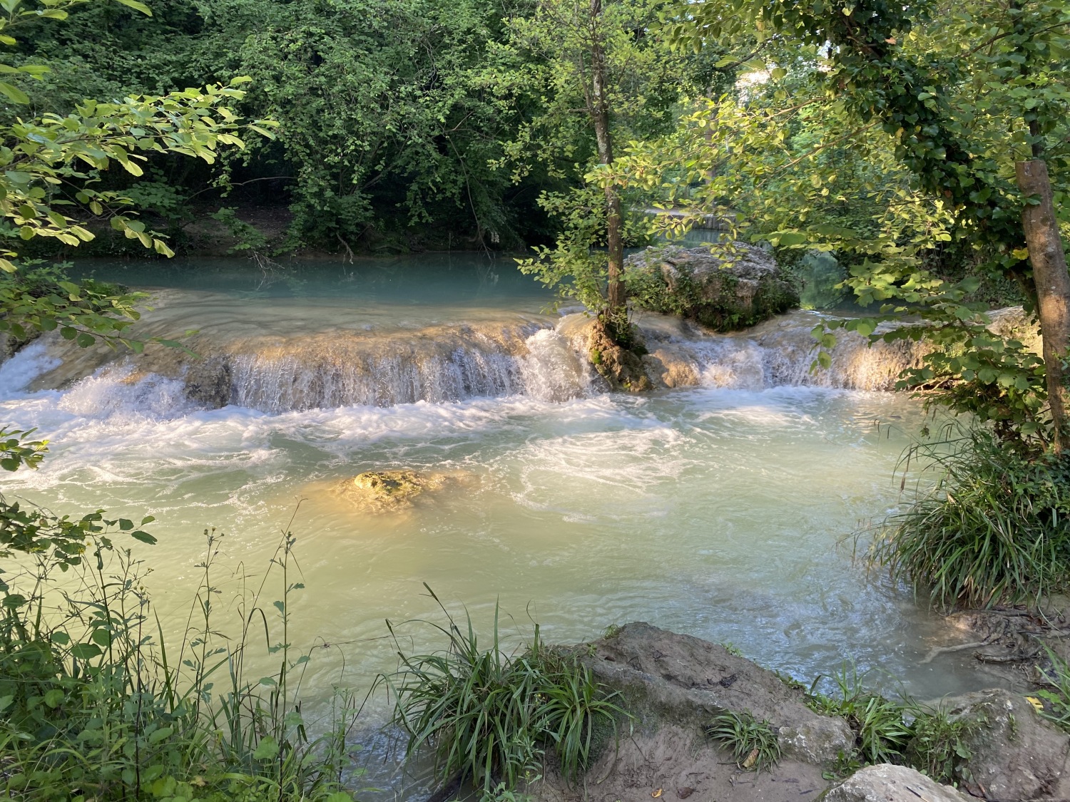


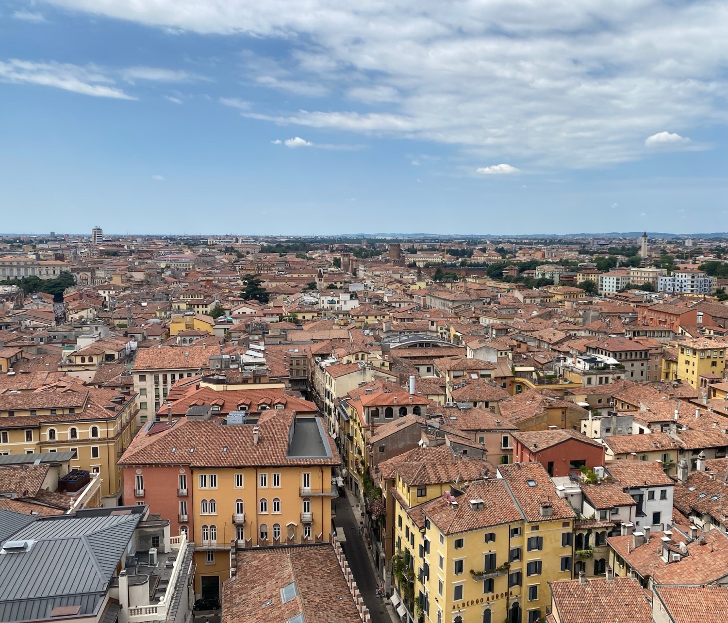


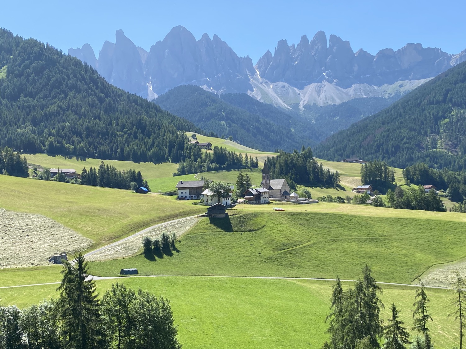


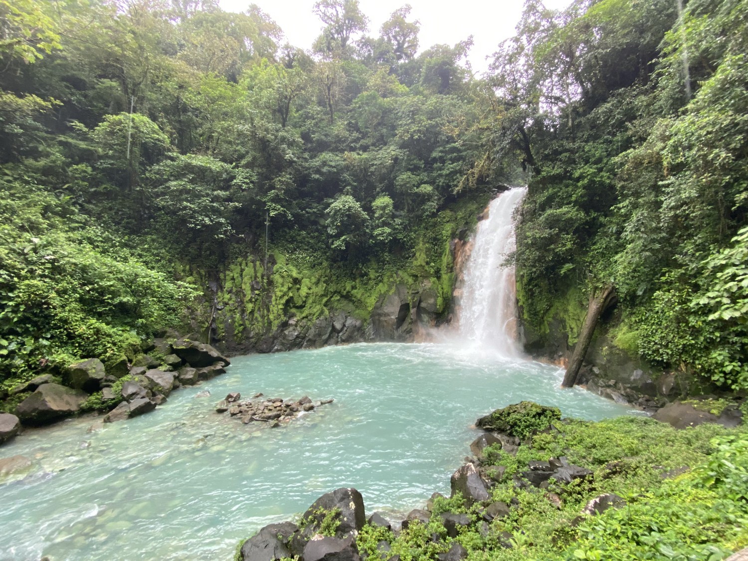


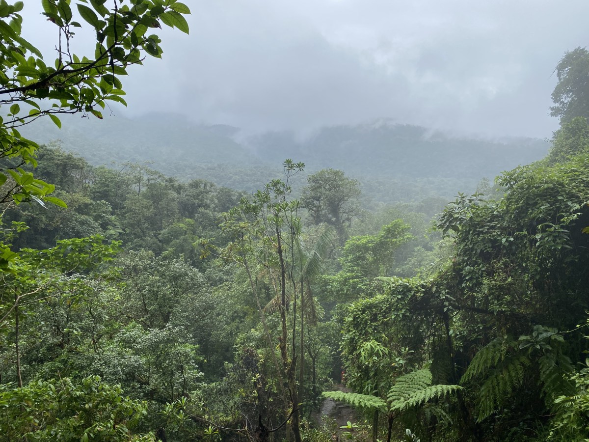


 2")


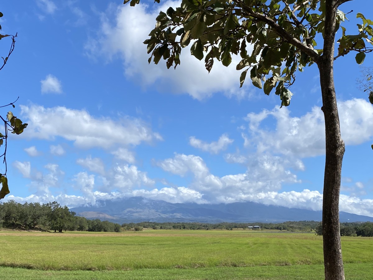
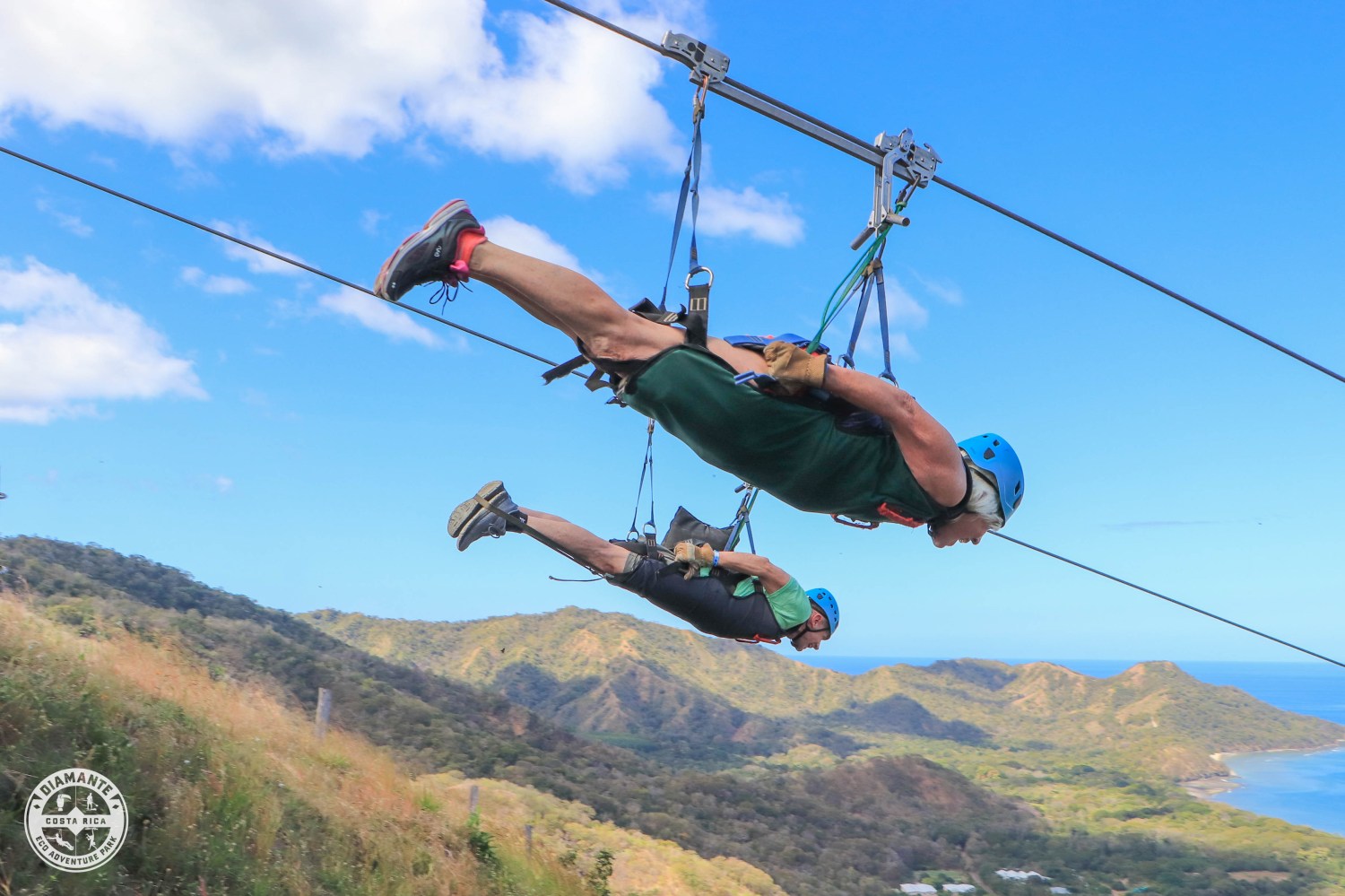
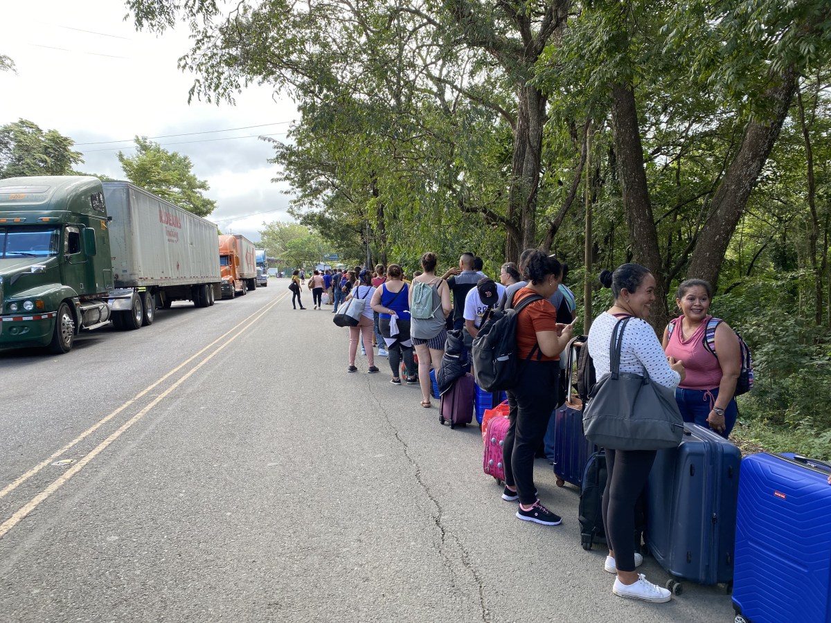


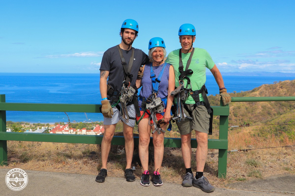


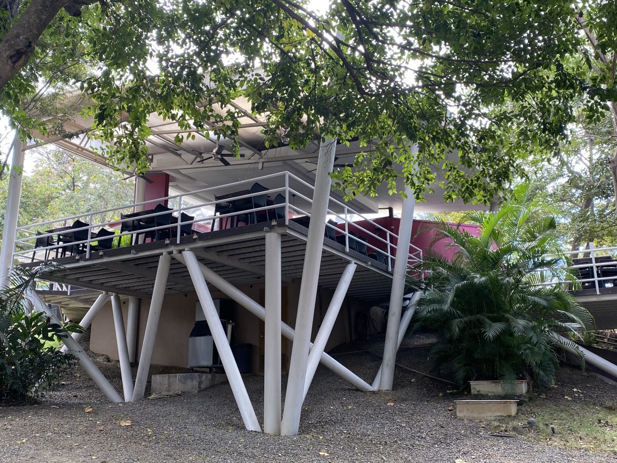


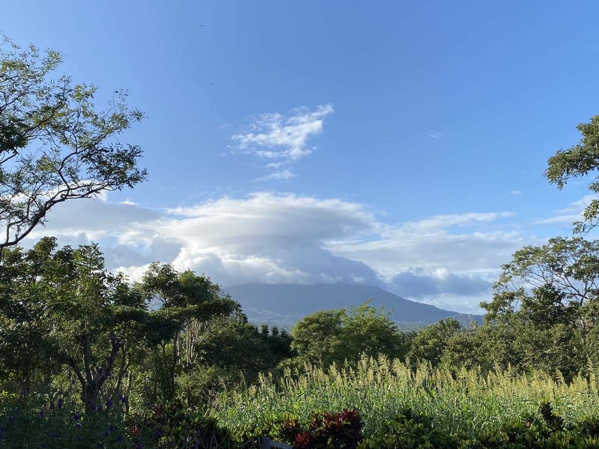


You must be logged in to post a comment.