Monday, October 3, 2022: This morning we checked out of our Airbnb in Saint John and headed for The Hopewell Rocks.
The Hopewell Rocks, also called the Flowerpot Rocks, or simply The Rocks, are rock formations known as sea stacks caused by tidal erosion. They are scattered on the shores of the upper reaches of the Bay of Fundy at the Hopewell Rocks Provincial Park in New Brunswick, Canada. Due to the extreme tidal range of the Bay of Fundy, the base of the formations are covered in water twice a day. It is possible to view the formations from ground level at low tide, which is what we did.
The Hopewell Rocks formations consist of red-brown sedimentary sandstone and minor mudstone rock. They stand 40-70 feet tall. After the retreat of the glaciers in the last Ice Age, surface water filtering through cracks in the cliffs eroded and separated the formations from the rest of the cliff face. Meanwhile, advancing and retreating tides and the associated waves have eroded the base of the rocks at a faster rate than the tops, resulting in their unusual shapes.
We went at low tide to explore the ocean floor around the rocks. We were lucky to have a beautiful day.
It was about a 15-minute walk from the visitor center to the rocks. As we walked, I started doing an exaggerated march, being my silly self. I was wearing my new fisherman hat. Mike said, “Oh, there goes Chairman Mao marching away!” We laughed so hard we were in convulsions. That hat is truly a Chairman Mao hat.:-)
High tide today was at 18:44 and low tide was at 12:43. We arrived at 11:43, and wandered along the coastal floor from one end to the other. The rock formations looked like Clydesdale hooves with all the seaweed clinging to the bases. Our feet got quite muddy traipsing around but there was a fountain at the top to clean them off.
Hopewell Rocks
Hopewell Rocks
Hopewell Rocks
Hopewell Rocks as the tide is going out
Hopewell Rocks
Hopewell Rocks
Hopewell Rocks
Hopewell Rocks
Hopewell Rocks
Hopewell Rocks
Hopewell Rocks
Chairman Mao at Hopewell Rocks
Mike at Hopewell Rocks
Hopewell Rocks
Hopewell Rocks
Hopewell Rocks
Hopewell Rocks
Hopewell Rocks
Hopewell Rocks
Hopewell Rocks
Hopewell Rocks
Hopewell Rocks
Hopewell Rocks
Hopewell Rocks
Hopewell Rocks
Hopewell Rocks
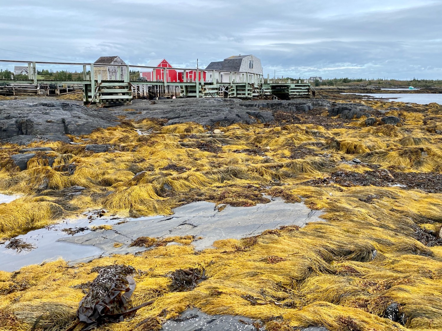
Seaweed at Hopewell Rocks
me with seaweed piles
Hopewell Rocks
Hopewell Rocks
Hopewell Rocks
Hopewell Rocks
Hopewell Rocks
Hopewell Rocks
Hopewell Rocks
Hopewell Rocks
Hopewell Rocks
Hopewell Rocks
Mike at Hopewell Rocks
me at Hopewell Rocks
Hopewell Rocks
Back up near the Visitor Center we had a view of the mudflats, coastline and the Bay of Fundy itself at Daniels Flats, named for one of the area’s early settlers. The bay is about 2.5 miles wide at this point. Salt marshes form a green band around the Bay of Fundy.
Daniels Flats
Daniels Flats
Because the Bay of Fundy is funnel-shaped (wide/deep at one end and narrow/shallow at the other) tides are pushed increasingly higher as they move up the bay.The length of the bay also plays a factor by causing a natural sloshing effect called resonance. This sloshing amplifies the effect of the funnel.
Among the highest in the world, the tides reach up to 14 meters (46 feet) at Hopewell Cape and 17 meters (56 feet) in the upper reaches of the bay. Not only does the tide rise 46 feet (14 meters) vertically, it also recedes almost two football fields horizontally. In fact, 160 billion tons of water move in and out of the bay every 25 hours. Powered by the gravitational pull of the moon and sun, Fundy’s tides are among the highest in the world and vary daily with the changing positions of these celestial bodies.
The name Fundy is thought to be an English translation for the French word “fendu” meaning “split.” The bay has been navigated by western European fishermen since the 16th century.
Bay of Fundy
formation of the flower pot rocks
Bay of Fundy
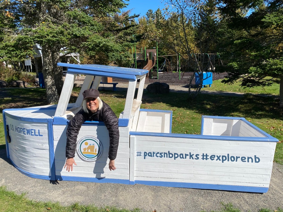
I posed for a picture with my fisherman hat in the tiny S. S. Hopewell. So goofy. 🙂 Mike has endless names for me in my hat. Here, I’m Popeye the Sailor Man. 🙂
me in the S.S. Hopewell
We left Hopewell Rocks and went by Cape Enrage. The 140-year-old lighthouse, which is still working, is perched on the end of the cape’s rocky promontory. Here, tides rise 16 vertical meters (53 feet). We stopped here but it was closed and locked so we couldn’t walk the beach trails.
Cape Enrage
Cape Enrage
Cape Enrage
On the way, we got out to wander a bit on a cairn-dotted rocky beach.
cairn-dotted rocky beach
cairn-dotted rocky beach
cairn-dotted rocky beach
marshlands near Cape Enrage
Back at Fundy National Park, we took a short (boring) hike to Point Wolfe Beach after checking out the cute red covered bridge.
The Point Wolfe River was once the center of a lumber operation. In the early 1800s, the lumber industry was booming on New Brunswick and mills sprung up on most rivers along the Bay. The Point Wolfe Mill was opened in 1826 and continued off and on for almost 100 years.
covered bridge in Fundy National Park
trail to Point Wolfe Beach
trail to Point Wolfe Beach
little pretties along the trail
Point Wolfe Beach
Point Wolfe Beach
We finally headed to Alma where we would stay the night. The small seaside village services Fundy National Park with restaurants and motels.
We showered and changed and wandered around town looking for a place to eat. I had it in my mind I wanted lobster. We found a lineup of colorful Adirondack chairs and boats tied to the wharf which made fetching reflections in the water.
Alma Lobster Shop beckoned. Mike had a lobster roll and chowder. I had a Lazy Lobster Dinner: Shucked lobster meat, cole slaw, drawn butter and roll. We sat on the open air porch, where annoying flies buzzed all around us. We bought two mugs and an Alma lobster shop onesie for the real-life Alma that Mike’s best friend’s son is trying to adopt.
Alma
Alma
Alma
Alma
Alma Lobster Shop
Alma Lobster Shop
Alma Lobster Shop
Alma Lobster Shop
Alma Lobster Shop
As we walked back to our tiny but cozy Airbnb, we saw fishing paraphernalia, colorful coils of rope and lobster pots.
We settled into our cozy Airbnb and watched the last episodes of Virgin River and read.
Alma fishing yard
colorful ropes
our tiny but cozy Airbnb
Steps: 16,779; Miles 7.09. Drove 160 miles.
Tuesday, October 4: This morning we left Alma and headed to Prince Edward Island to visit my friend Lisa. On the way, we returned to Hopewell Rocks. We were hoping to see the rocks at high tide, at which time all you can see are the tops of the rocks covered with vegetation and appearing as tiny islands. Alas, we arrived too late for high tide. We got there at 9:58 a.m., and high tide had been around 7:50 a.m., so we were two hours late. The water was definitely higher than when we were there yesterday, but it was low enough that we could have walked all the way to the beach at the far end.
The time span between low and high tide is 6 hours and 13 minutes. People have the chance to walk on the ocean’s floor from 3 hours before low tide until 3 hours after.
Today’s hours of operation in the park were 9:00 to 17:00, so there was no way we would have seen the morning’s high tide anyway.
We enjoyed some views of the Flower Pots nearest the stairs but they weren’t covered at all by water while we were there from 10:00 a.m. until 10:20 a.m.
Hopewell Rocks on Tuesday morning
the Tides on Tuesday morning
Hopewell Rocks as the tide is going out
Hopewell Rocks as the tide is going out
We took off, heading for Prince Edward Island. We made a stop in Moncton at Café Archibald, where we had coffees and an egg, bacon and cheese English muffin. The cafe was cute and the staff was busily preparing lunches for take-out.
We left after a bit and drove down Moncton’s main street. It was a charming town. People apparently spoke both French and English there. I was sad we didn’t have time to explore more.
Still in New Brunswick, we stopped at Cape Jourimain to take pictures of the Confederation Bridge leading to Prince Edward Island. It is a box-girder bridge carrying the Trans-Canada Highway across the Abegweit Passage of the Northumberland Strait, linking the province of Prince Edward Island with New Brunswick on the mainland. Opened May 31, 1997, the 12.9km (8.0mi) bridge is Canada’s longest bridge and the world’s largest bridge over ice-covered water.
Tolls only apply when leaving Prince Edward Island (traveling westbound). Toll rates since January 2022 are $50.25 for a two-axle auto. Motorcycles pay $20. Pedestrians and cyclists are not permitted to cross the bridge, but a shuttle service is available.
Cape Jourimain is an area comprising two islands and a section of mainland along the southwestern shore of the Northumberland Strait. The two islands, Jourimain and Trenholm, have been connected to the mainland since 1966 by an artificial causeway. It is host to the western end of the Confederation Bridge. In 1980, the two islands, including a section of mainland, were designated as a National Wildlife Area.
There were trails that looked enticing but we didn’t take them because we were due to be at Lisa’s house by 3:00-4:00.
We saw a lighthouse, the Cape Jourimain Lighthouse, built in 1870 after nearly 30 years of petitions. The 15.5m lighthouse was built to help sailors navigate the narrow strait. The lighthouse operated until 1997 when the Cape Tormentine Ferry service was decommissioned as a result of the opening of the Confederation Bridge.
Cape Jourimain
me at Cape Jourimain with the Confederation Bridge behind me
The Confederation Bridge from Cape Jourimain
The Confederation Bridge from Cape Jourimain
Cape Jourimain
Cape Jourimain
Here is a short video of our time at Hopewell Rocks and the rest of New Brunswick.
We crossed the Confederation Bridge to Prince Edward Island.
We spent four nights in Saint John, New Brunswick, from which we visited Fundy National Park, the Bay of Fundy, Ministers Island, and St. Andrews by-the-Sea, as well as exploring the city of Saint John.
Friday, September 30: We got a relatively early start today since we had a longish drive to Fundy National Park. The park preserves unique wilderness on the shores of the Bay of Fundy. It has wilderness areas, as well as beaches, rocky headlands, sea caves and inlets, wildlife and stunning vistas.
This 206-square-km (80 sq. miles) park was New Brunswick’s first national park and serves as a microcosm of New Brunswick’s inland and coastal climates. It has been designated as a Dark Sky Preserve by the Royal Astronomical Society of Canada.
Among the most scenic of the park’s 100km of biking and hiking trails is Laverty Falls, a 2 1/2 km (1 1/2 mi) trail that descends through hardwood forests to Laverty Waterfall.
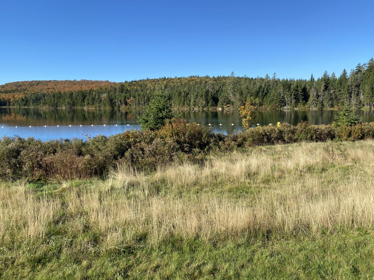
We made a quick stop at Wolfe Lake to see what maps we could get from the Visitor Center. The ranger told us she thought the dirt access road to the Laverty Falls Trail was closed due to fallen trees felled by Hurricane Fiona.
Hoping she was wrong, we drove there anywaw to find the crews had cleared all the trees and we were able to drive up the very long road. When we got to the parking lot, we were the only ones there. It was quite cold, so I was all bundled up in layers, a fuzzy hat and gloves, but because the trail was a descent followed by an ascent, I had taken off most layers by the time we returned to the top.
I prefer to hike with wide open vistas, but the Laverty Falls hike was all in a forest. The forest seemed rather magical, however, with its golden ferns, spaced-out pine trees, moss-covered glades, and dappled light. Likely because of Fiona, there were downed trees and streams flowing down the middle of the path, so it made for some creative rock- and root-hopping. We had the trail almost to ourselves.
We ate bread and cheese on rocks near the beautiful Laverty Waterfall and then made our way back to the top.
Laverty Falls hike
Laverty Falls hike
Laverty Falls hike
Laverty Falls hike
Laverty Falls hike
Laverty Falls hike
Laverty Falls hike
Laverty Falls hike
Laverty Falls hike
a squirrel at Laverty Falls
Laverty Falls hike
Laverty Falls hike
Laverty Falls hike
Laverty Falls hike
Laverty Falls hike
Laverty Falls hike
Laverty Falls hike
Laverty Falls
Laverty Falls
Laverty Falls
Laverty Falls
Laverty Falls hike
Laverty Falls hike
Laverty Falls hike
Laverty Falls hike
Laverty Falls hike
Mike on the Laverty Falls hike
Laverty Falls hike
Me at the end of the hike
After the hike, we drove to the eastern end of Fundy National Park, the bayside, for a viewpoint or two and checked out the small town of Alma where we would stay for one night on our way to Prince Edward Island. To get back to Saint John, we drove through the park again.
view of the Bay of Fundy
Alma
view of the bay from Alma
boardwalk at Alma
Alma marina
marina at Alma
entering back into the park
We had to stop to see the strange golf course at Fundy that Mike remembered playing as a 12- or 13-year-old when he visited with his parents. The tee for the first hole is at the top of a cliff.
The course, nestled in the Dickson Brook Valley, was designed by course architect Stanley Thompson. It has some tricky greens and some quite taxing elevations, but carts are available.
first tee at the Fundy National Park golf course
The New Brunswick side of the Upper Bay of Fundy was designated by UNESCO in 2007 as a World Biosphere Reserve celebrating the area’s unique ecosystems, landscapes and cultures. Biosphere Reserves aim to improve the relationship between people and their environment by promoting the conservation of biodiversity and fostering sustainable development. Fundy National Park is the heart of this Fundy Biosphere Reserve.
Some interesting facts we learned:
Today many agricultural lands are a result of dykes built by the Acadians in the 18th century.
Salt marshes form in sheltered areas of tidal mud flats. They are very productive nursery habitats for many species of the Bay and adjacent land.
The Acadian Forest is made up of 32 species of trees which form a rich ecosystem that is home to people and a multitude of plant and animal life.
Arriving along the Fundy shores in late July from the Canadian Arctic, thousands of shorebirds fatten up on tiny mud shrimp in preparation for a non-stop flight to South America.
The Fisherman’s Clock is always changing. Fishing boats can only leave or dock at the wharf when the height of the tide permits. The night time could be morning, noon, or night!
Saint John
After our trip to Fundy National Park, we went out to dinner at Thandi (“East Meets West”) in Saint John. It’s an Asian fusion place but we had Indian food. I enjoyed Korma with shrimp: a mild creamy sauce combined with a mixture of cashews. Mike had Dal Makhani, an Indian lentil delicacy in rich cream sauce with onions, tomatoes, ginger, garlic and spices.
Mike and I must have been spending too much time together because I got quite annoyed with him after some comments he made about a book I’ve been reading (In the Field by Claire Tacon). I said I couldn’t wait to finish my book. He said, “Why, is it a mystery?” As if a person should only want to find out the ending to a mystery but not any other kind of book. I rarely read mysteries and I’d already told him a lot about this book, which is literary fiction and is set in Nova Scotia. Don’t we want to find out the ending to every genre of book we read? As an English major and an avid reader, I get impatient with his occasional confusion about genres of books and points of view. He said I was being condescending (which I was) and I said he was being condescending (which he was).
On top of that, the waiter kept addressing Mike directly and acting as if I didn’t exist. “Sir, what would you like?” “Sir, can I get you anything else?” It was so patriarchal and annoying. I said, “There are two of us here. And yes, I’m fine, thank you!” I don’t think the guy knew how to speak to women.
Thandi
Thandi
Korma with shrimp
Dal Makhani
Finally, we both relaxed and decided to put it all behind us. We managed to get out of there without strangling each other and the waiter.
We meandered back to our Airbnb, stopping to admire the 1880 Trinity Anglican Church, a Gothic Revival stone church. It was designated a local Historic Place for its architecture and for being the first established congregation in the city.
The port town of Saint John is a much smaller and more industrial city than Halifax. We saw one of two big cruise ships pulling out of port, a beautiful sunset over the harbor, and some cute shops along the streets.
sunset at Saint John waterfront
Trinity Anglican Church
Mike carrying our leftovers
Saint John, New Brunswick
cute shop in Saint John
me in our meanderings through Saint John
another cute shop in Saint John
Back in our Airbnb, we got cozy and watched several more episodes of Virgin River and then cuddled up for the night.
Steps: 19,119; Miles: 8.09. Drove 176.3 miles.
Saturday, October 1: This morning Mike worked out on the exercise bike on our Airbnb apartment while I had a leisurely morning and a hot bath. Then we went out to explore and learn what we could about the city of Saint John.
Mike rides the exercise bike in our Airbnb
Our Airbnb is on the top floor
Natives of Saint John welcomed explorers Samuel de Champlain and Sieur de Monts when the Frenchmen landed here on St. John the Baptist Day in 1604. It was the first city to be incorporated in Canada in 1785. Nearly two centuries later, residents opened their rocky forested land to 3,000 British Loyalists fleeing the U.S. after the American Revolutionary War, and then an influx of Irish families, thousands who came after the Napoleonic Wars in 1815, and then later many thousands more during the Irish potato famine of 1845-1852.
Today cruise ships bring visitors (75 in 2018) that dock at its revitalized waterfront. Now the city has two cruise terminals.
Industry and the salt air combine to give Saint John a weather-beaten quality, but the town also has restored 19th-century wooden and red brick homes as well as modern office buildings, hotels and shops.
Reversing Falls Rapids
We went first thing to see the famous Reversing Falls Rapids in Saint John. The Reversing Falls gorge is the sole drainage outflow for 55,000 square kilometers of land mass in both New Brunswick and the state of Maine.
The strong Fundy tides rise higher than the water level of the Saint John River, so twice each day at the Reversing Falls Rapids, the tide water from the bay pushes the river some 90km (56mi) back upstream and the rapids appear to reverse themselves. We visited first at low tide, around 11:00 a.m. where we saw the rapids of the river flowing toward the bay. At low tide, the full flow of the 724.5km (450mi) Saint John River rolls and swirls through the narrow gorge between Falls View Park and the Irving Pulp & Paper Mill.
We visited again at 4:00 p.m. to see the higher water levels and the rapids going upstream on the river. It is a fascinating phenomenon and we tried many different viewpoints. Sadly, marring the view is that unsightly pulp plant.
Slack tide only lasts for about 20 minutes and happens when the Bay of Fundy waters begin to rise and slow the river’s flow, eventually stopping the flow completely. During the time between these contrary events, the water’s surface rests placidly at slack tide, allowing vessels to come and go through the 150-meter-wide gorge in relative safety. This is the only time that sailboats and pleasure crafts can sail between the Bay of Fundy and the Saint John River.
The Reversing Falls Rapids phenomenon is only about 3,000 years old. The phenomenon is blamed on the Bay of Fundy, a dynamic marine ecosystem known for producing the world’s most extreme tides.
Reversing Falls Rapids
Reversing Falls Rapids
Reversing Falls Rapids
Reversing Falls Rapids
Reversing Falls Rapids
Reversing Falls Rapids
Reversing Falls Rapids
Besides viewing the Reversing Falls twice during the day, we wandered around the town, first stopping for coffee at Catapult Coffee (pumpkin spice latte!). One thing we wanted to do today was to visit the New Brunswick Museum, which supposedly covered the history, geology, and culture of New Brunswick. Sadly it was closed because of “the stress on the artifacts due to large numbers of visitors.” They were looking to relocate it to a larger space elsewhere. That left us with not much to do except eat, drink, shop and see the Reversing Rapids. I did however manage to buy two pairs of earrings and a bookmark at the New Brunswick Museum Gift Shop. 🙂
Catapult Coffee & Studio
Catapult Coffee & Studio
Catapult Coffee & Studio
Trinity Anglican Church
New Brunswick Museum
New Brunswick Museum
We wandered through the Saint John City Market (the oldest continuously operating farmer’s market in Canada, dating from 1876),with its offerings of mustards, honey, syrups, produce, boxes of La Croix sparking water, and take-out eateries (but no place to sit).
Saint John City Market
Saint John City Market
We ate plenty of greens at Marci’s Salads Reimagined, where I had a La Mixta salad and Mike a Sweet Root salad.
Of course I always manage to sniff out a clothing store. I discovered In Pursuit: The Uptown Boutique, where I tried on lots of clothes. Ever patient Mike rested in a “husband chair” while I perused the shop. I bought a black sweatshirt that says “EAST COAST” and a brown Fair Isle sweater. I could have bought more if Mike hadn’t been there!
Marci’s Salads Reimagined
Marci’s Salads Reimagined
Marci’s Salads Reimagined
alley behind Marci’s Salads Reimagined
Mike in his “husband chair” at In Pursuit: The Uptown Boutique
We found some cool murals in our wanderings, one with a giant colorful tortoise and another with an octopus.
Tortoise mural
ocotpus mural
marsh of dreams
Saint John doesn’t have much of a waterfront but plans are underway to re-imagine it. Currently they have a “Container Village” where the cruise ships dock. We wandered through the more than 60 colorful containers but the shops weren’t all that enticing. Calling something a “boutique” when it’s in a container is quite a stretch. Shops open were called Boatique, Beaver Tails, Cannabis NB, The Sugar Spider, and The Vagabond Studios. The village is designed to cater to music events and cruise passengers.
Container Village
Container Village
Container Village
Container Village
Container Village
Container Village
We wandered through the downtown and pretty neighborhoods back to our Airbnb.
downtown Saint John
neighborhoods of Saint John
neighborhoods of Saint John
We drove over to Reversing Falls Rapids at high tide, around 4:00 p.m. and saw the rapids going up the river.
Reversing Falls at high tide
We stayed in this evening and ate our Thandi leftovers and watched several back-to-back episodes of Virgin River.
Here’s a video of the water in action around the Bay of Fundy.
Sunday, October 2, 2022: This morning we drove to St. Andrews by-the-Sea in New Brunswick, almost to the U.S. border in Maine. But before we went into the town, we drove over a sand bar at low tide to Ministers Island.
Ministers Island
The Passamaquoddy people lived on this island, Qonasqamqi Monihkuk, for thousands of years. In 1790, Samuel Andrews, an Anglican minister and Loyalist, built a home here, hence the name. Around 1890, William Van Horne, visionary builder of the Canadian Pacific Railway, established his summer estate here.
The 490-acre Ministers Island stands several hundred meters offshore in New Brunswick’s Passamaquoddy Bay, immediately northeast of St. Andrews-by-the-Sea. It is a geographical oddity in that it is accessible at low tide only by the wide gravel bar suitable for vehicular travel.
It is possible to drive, walk, or bike to the island at low tide; we drove. We were adequately warned to make sure to leave the island before the tide came in or we would be stuck for another 6 hours. The sand bar that connects Ministers Island to the mainland is under at least 14 feet of water at high tide. Tide schedules change daily so it was essential to check the tide chart posted at either end of the bar before crossing. We were warned we should NOT attempt to cross on foot or by vehicle if there were water on the bar as the tide is swift and the water frigid.
Here we are crossing the sand bar to the island.
We drove across at 10:51 a.m. and on the island side, they told us we had to leave the island by 2:00 p.m. or we’d have to wait 6 hours to leave. The overall tide change is 16 feet, covering the sand bar “road” totally.
Ministers Island
the sand bar to Ministers Island
This huge island estate, once completely self-sufficient, was the summer home of Sir William Van Horne (1843 – 1915), chairman of the Canadian Pacific Railway from 1899-1915. Today, Ministers Island is a Provincial and Federal Historic Site and is managed by the Van Horne Estate on Ministers Island, Inc. a community-based non-profit dedicated to preserving the nature and history of the island.
In 1891, construction began on the house named for Sir William Van Horne’s father, Cornelius Covenhoven Van Horne. What started as a somewhat modest summer cottage, after as many as seven modifications, became the 50-room residence of today. It was supported by numerous outbuildings, including a windmill and gardener’s cottage.
By the time of Van Horne’s death in 1915, the island had been transformed into a small idyllic utopia, revolving around the sandstone mansion known as Covenhoven. It was furnished in a lavish late Edwardian manner, with manicured grounds, scenic roads, greenhouses turning out exotic fruits and vegetables as well as a breeding farm.
First, we came upon the large chateau-style barn, designed for Van Horne in 1898; it is one of the largest in The Maritimes, and it was often regarded as the most beautiful. The barn was used for breeding of Van Horne’s prizewinning Clydesdale horses and Dutch-belted cattle, one of the only such herds in North America.
The farm was also home to pigs, geese, ducks, chickens and turkeys. The produce of the farm and gardens was shipped to Montreal by night train during the winter months, providing the family with fresh food throughout the year. The barn was surrounded by several outbuildings, including a creamery, smaller barns and living quarters for the workers. Workers in the barn wore white lab coats. The story goes that, on a visit to the barn, Van Horne saw workers staring out the window. To ensure maximum productivity, he had the windows moved up above their sight lines.
Originally 23 buildings stood on this property, many of which were part of the farm operation. Milk produced by the Dutch Belted Cattle was piped from the barn to the Creamery.
the chateau-style barn
old car in the barn
tractor
buggy
cattle pens
cattle pens
milking stations
the high windows used to keep workers from staring out the window
sheep pens
sheep pens
the Creamery
We went on a tour through parts of Covenhoven, Sir William’s 50-room summer home, which has an old windmill sitting out back.
We were told that in the dining room, leading American and Canadian businessmen, railway barons, Japanese royalty, and well-known members of international society dined at the table, which could seat up to 24. Dinner for the men was followed by port, cigars and billiards. For the ladies, it was playing cards and relaxing by a roaring fire in the living room.
Here, Van Horne pursued his diverse interests from art to zoology. A talented amateur artist and collector, Van Horne used this island estate to encourage Canadian landscape painting.
After the tour, we were left to wander through on our own. The cottage-turned-mansion was quite impressive.
windmill at Covenhoven
Covenhoven
Living room at Covenhoven
Living room at Covenhoven
kitchen at Covenhoven
Covenhoven
Covenhoven
Covenhoven
Covenhoven
Covenhoven
Covenhoven
Covenhoven
Covenhoven
Covenhoven
Covenhoven
Covenhoven
Covenhoven
Van Horne’s artist supplies
details at Covenhoven
Covenhoven
In one part of the home, we learned about Van Horne’s efforts on behalf of national parks in Canada. In 1883, at Van Horne’s suggestion, the federal government began to consider the creation of national parks and in 1885 set aside land around the sulfur hot springs in Banff for public use. Legislation was passed in 1887 making it the first National Park in Canada. Today Parks Canada manages 168 national historic sites, serves as Canada’s representative at the United Nations World Heritage Committee and is responsible for the administration of 11 of Canada’s 17 World Heritage Sites.
The summer estate reflects Van Horne’s vision of the importance of tourism and agriculture in Canada’s development. The buildings are in the Shingles style, popular for resort architecture in Canada in the late-19th and early 20th centuries.
Ministers Island
Canadian Pacific Railway
Banff
As we wandered outdoors on the grounds of the estate, we were confused by the time. Our cellphones kept picking up Maine time (the state is just across the water), which was one hour behind. The time on my phone was showing it to be one hour earlier than it was. So at 2:00, when we were supposed to leave the island, my phone could have been showing 1:00, thus giving us the mistaken impression we had an extra hour before we had to leave the island. If we had not realized what was happening, we might have been stuck on the island another 6 hours.
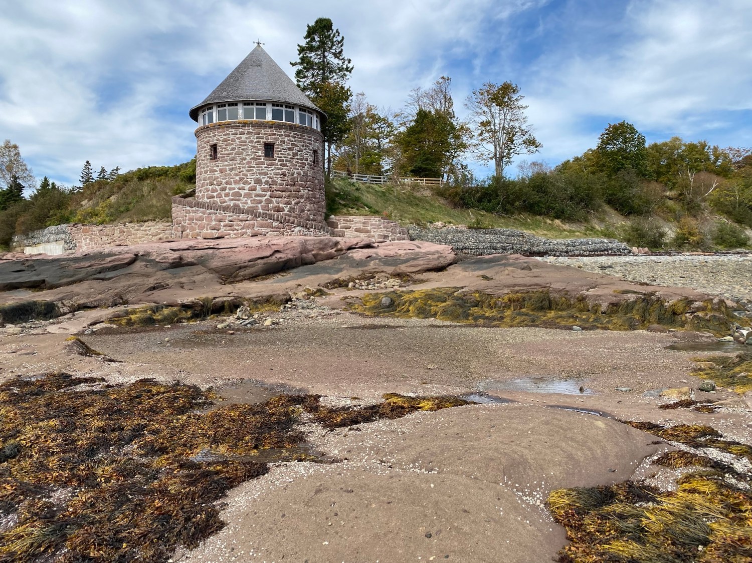
We walked to the southern tip of the island, where Van Horne had constructed a bathhouse from red sandstone blasted from the beach below; the perfectly round two-story building was completed in 1912. The upper level offered panoramic views of the bay while the lower level contained changing rooms and provided access to the beach via a circular walkway and the family’s in-ground tidal saltwater swimming pool. We walked on the rocky beach and were battered about by the icy wind.
walkway to the bathhouse
bathhouse
changing rooms in the bathhouse
Sandstone bathhouse
the beach
me on the “beach”
beach
beach
bathhouse
bathhouse
kelp
bathhouse
Before leaving the island, we saw Cedar Lane, a cedar-lined foot and carriage trail to the Covenhoven estate. We left Ministers Island at 12:40, in plenty of time to avoid being trapped there for six hours, and headed to St. Andrews-by-the-Sea.
Cedar Lane
leaving across the sandbar
leaving across the sandbar
Here we are driving across the sand bar back to the mainland.
St. Andrews-by-the-Sea
We had a nice lunch at Niger Reef Tea House in St. Andrews. I enjoyed fish cakes with lemon dill aioli and Mike had Veggie burgers: mixed bean and roasted vegetables with sun-dried tomato pesto.
Niger Reef Tea House
Niger Reef Tea House
Niger Reef Tea House
Veggie burger
fish cakes
St. Andrews-by-the-Sea, on Passamaquoddy Bay, was designated a National Historic District in 1998. It has long been a summer retreat of the affluent, and mansions ring the town. Of the town’s 550 buildings, 280 were erected before 1880, and 14 of those have survived from the 1700s. In 1777, Loyalists from the U.S. moved north to escape the Revolutionary War and settled in what is now St. Andrews in 1783. Some Loyalists even brought their homes piece by piece across the bay from Castine, Maine.
We walked past the blockhouses built to defend the batteries that were meant to protect the harbor and river from privateering raids. Fort Tipperary, a modest fort, had been built in 1808 above the town, but citizens felt it didn’t protect the harbor sufficiently. During the American Revolution privateers attacked and robbed every port in the Maritimes except Halifax. In wartime, governments licensed private businesses and ships to seize enemy vessels and cargoes as “prizes.” This was frequent along the east coast during the War of 1812. Licensed American privateers were drawn to the ships for their valuable cargoes, or to the town to loot prosperous homes and businesses. Privateering was a common wartime practice until the mid-1800s.
block house in St. Andrews by-the-Sea
low tide
low tide
cannons in St. Andrews by-the-Sea
St. Andrews by-the-Sea
St. Andrews by-the-Sea
We strolled the streets of St. Andrews, stopping at various shops, including McGuire Chocolate Company for hot chocolate and pumpkin spice latte. Another shop, Kilt & Kaboodle, sold woolen sweaters, scarves and hats made in Killarney, Ireland. I bought a fisherman’s hat, which Mike enjoyed poking fun at, calling me “Roscoe” and other crazy names. He said I reminded him of Susie in The Marvelous Mrs. Maisel. That hat gave us lots of laughs throughout our trip.
Mike bought a nice plaid shirt in The Leather House and I bought a cool scarf in browns and creams. I also bought some earrings at Warm & Coasty Boutique. I always enjoy our shopping time during our travels. 🙂
We walked out on the wharf and saw the low tide, the waterfront and people in life vests preparing to sail off on a cruise.
St. Andrews by-the-Sea
St. Andrews by-the-Sea
St. Andrews by-the-Sea
St. Andrews by-the-Sea
St. Andrews by-the-Sea
low tide at St. Andrews by-the-Sea
St. Andrews by-the-Sea
Mike at McGuire Chocolate Company
me at McGuire Chocolate Company
St. Andrews by-the-Sea
me being goofy
Warm & Coasty
Map of St. Andrews by-the-Sea & Ministers Island
cool murals in town
cool murals in town
the tide comes in at St. Andrews by-the-Sea
the tide rolls in
St. Andrews by-the-Sea
We also saw cool murals, The Kennedy Inn, and the Pendlebury Lighthouse, aka the St. Andrews North Point Lighthouse. Built in 1833 at the tip of the peninsula, it was deactivated in 1938 and has since been restored and registered as a Canadian historic place.
Pendlebury Lighthouse
a beautiful house near the lighthouse
In 1840, the Charlotte County Court House was built and used continuously until 2016. Next to it was the Charlotte County Gaol, which operated between 1834-1979. It accommodated the jailer and 17 prisoners. The Presbyterian Greenock Church, built in 1824, was the second church built in town.
Charlotte County Courthouse
Charlotte County Gaol
Greenock Church
We had left Ministers Island at 12:40. While leaving St. Andrews at 4:00, we drove by again. It wasn’t yet high tide (which was at 5:30 p.m.) but at that time we could no longer see the sand bar.
the sandbar at 12:40
the sandbar at 12:40
Ministers Island sign at 4:00
the sand bar is covered at 4:00
4:00 views of the covered sandbar
the covered sandbar at 4:00
Lepreau Falls
On our way to Saint John from St. Andrews, we stopped at a gas station where the young man behind the counter was quite friendly and garrulous. After complimenting my “shirt” (I had on a vest and shirt), he asked where I was from and wanted to know all about Virginia. He told me chunks of his life story, how he lived with his grandmother in Florida two months out of every year and how he had friends he wanted to visit in Virginia. He told us we should visit the nearby Lepreau Falls Provincial Park. Since it wasn’t too far out of the way, we stopped and had the waterfall to ourselves.
The name Lepreau Falls is of French origin and is a derivative of la pereau, for “little rabbit.” The contemporary spelling has prevailed since the mid-19th century.
The rapids above the main falls produce white caps and eddies which culminate with a roar over an 8-meter rocky ledge into the Bay of Fundy at its base. It is one of New Brunswick’s best “drive-by waterfalls.”
Of course Mike requested that Roscoe (the name he began calling me with my new fisherman’s hat) pose for a picture wearing the aforementioned hat.
Lepreau Falls Provincial Park
Mike at Lepreau Falls Provincial Park
Lepreau Falls Provincial Park
me as “Roscoe”
Lepreau Falls Provincial Park
Saint John
Back in Saint John, we went to dinner at Mashawi Zen Syrian Food. The door was locked though signs were outside on the sidewalk indicating it was open. We knocked on the door and the guy there grudgingly opened the door. He took his sweet time waiting on us and then revealed that they didn’t have any meat at all. We ordered the Aleppo Fava Beans plate, a very rich dish into which we dipped bread. Mike had a lentil soup, Mamounieh. All in all, it was very disappointing.
As we walked out, a guy walking by on the street said, “Did you like it?” We said, “They were out of everything!” Mike added, “…because it’s a Sunday.” The guy said, “Great to use ‘Sunday’ as an excuse!” He added, “It’s not my thing.”
Mashawi Zen Syrian Food
Mashawi Zen Syrian Food
We went to our apartment where we got cozy, watched Virgin River, and prepared to move to Alma the next day.
Thursday, September 29: We checked out of our Airbnb in Halifax this morning which required quite a bit of packing and cleaning up.
We did a quick drive through Truro, known as “The Hub of Nova Scotia” because travelers go through it on the Trans-Canada Highway. It might have been an okay town to explore, but it wasn’t all that fetching from what we could tell.
Sackville, New Brunswick
Sackville was of interest to us because of the waitress from The Old Triangle Irish Alehouse in Halifax. Our waitress had gone to college in Sackville, an idyllic university town with stately homes and ivy-clad university buildings. Mount Allison University, founded in 1839, specializes in liberal arts education at the undergraduate level. It’s small, with a student population of about 2,400.
One of the things we learned in this small town is that when people cross crosswalks, they don’t bother to look to see if any cars are approaching. They just step boldly out into the crosswalk, deep in conversation with their friends, bringing cars driven by clueless Americans to a screeching halt. In the U.S. people generally try to catch a driver’s eye to make sure they’re seen before stepping out into a crosswalk.
We made it through the town without running over anyone and went directly for the Sackville Waterfowl Park.
Sackville Waterfowl Park
Sackville Waterfowl Park
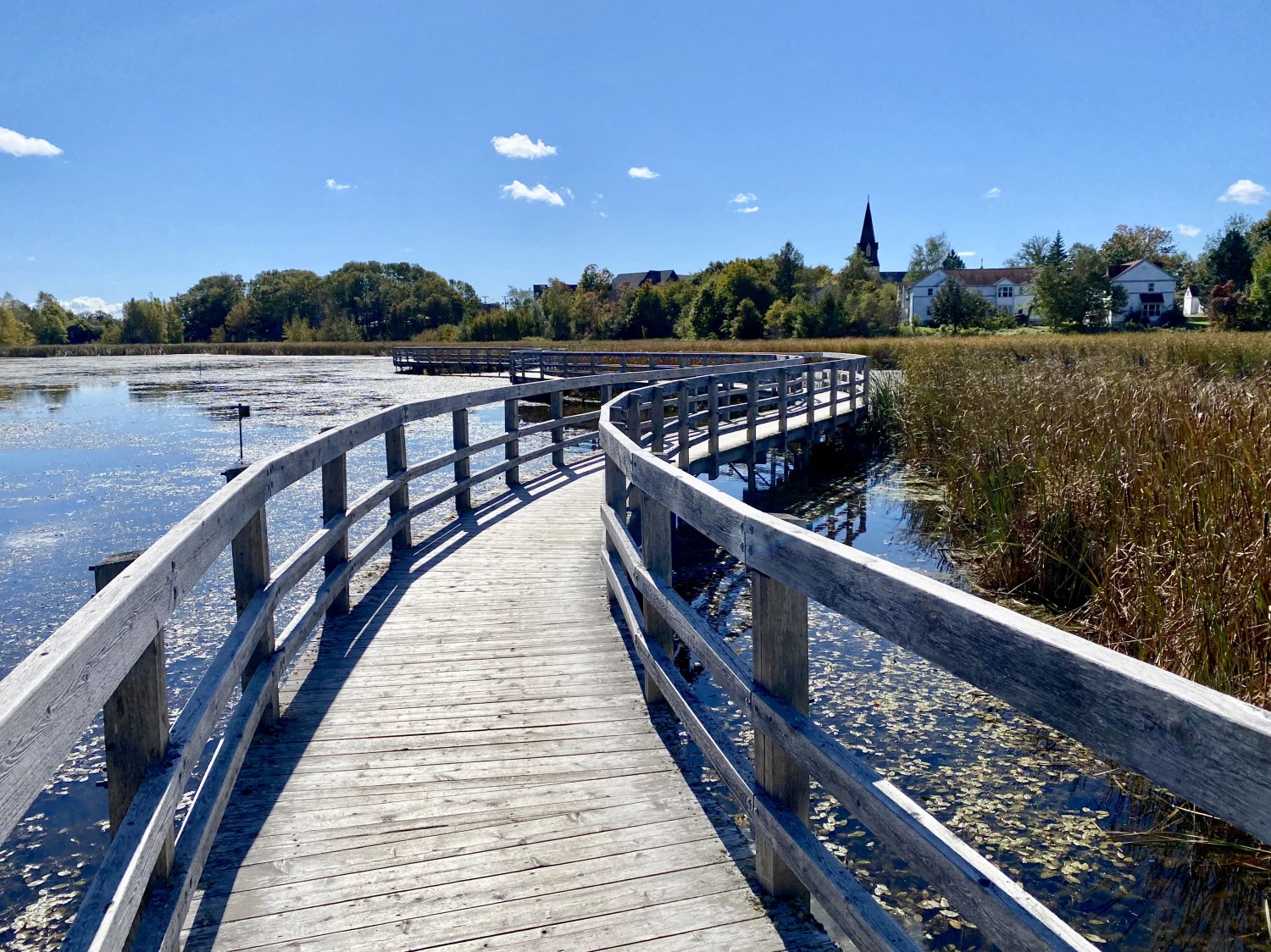
What could be better than all these things at once: a sprinkling of fall colors, a boardwalk over marshland, a breeze tickling the marsh grasses, and gleaming birch trees? We found all of these at the Sackville Waterfowl Park about halfway between Halifax, Nova Scotia and Saint John, New Brunswick.
The Sackville Waterfowl Park has more than 3km (2 mi) of boardwalk and trails through 55 acres of wetlands that are home to some 180 species of birds and 200 species of plants. Throughout the park, viewing areas and interpretive signs reveal the rare waterfowl species that rest here.
At the interpretive center we learned that this area, once part of a vast salt marsh, was dyked and drained by Acadian settlers in the late 1600s to secure land for agriculture. A century later, immigrants from Yorkshire, England expanded drainage to access more farmland.
The park stands at the edge of the upper Bay of Fundy marshes, the largest wetland in Atlantic Canada. Natural wetlands are important water reservoirs, natural purification systems and wildlife habitats. The park was impounded and flooded in 1988.
The trails had some cute names such as Quack Trail, The Birches, Loosestrife Lane, Redwing Way and Minnow Overpass.
marsh grasses at Sackville Waterfowl Park
Sackville Waterfowl Park
Sackville Waterfowl Park
quirky trail names
Sackville Waterfowl Park
Sackville Waterfowl Park
Sackville Waterfowl Park
Sackville Waterfowl Park
Sackville Waterfowl Park
me at Sackville Waterfowl Park
Sackville Waterfowl Park
Mike at Sackville Waterfowl Park
Sackville Waterfowl Park
Sackville Waterfowl Park
Sackville Waterfowl Park
Sackville Waterfowl Park
birches at Sackville Waterfowl Park
Sackville Waterfowl Park
Mike
me at Sackville Waterfowl Park
Sackville Waterfowl Park
a covered bridge at Sackville Waterfowl Park
Sackville Waterfowl Park
Sackville Waterfowl Park
winding boardwalks
Sackville Waterfowl Park
Sackville Waterfowl Park
Sackville Waterfowl Park
It was such a lovely day, it was hard to force ourselves to get in the car to drive another couple of hours to Saint John.
On our way out of town, we stopped at a cute bakery where we bought a few sweets and savories.
Saint John, New Brunswick
We arrived at our Airbnb in Saint John around 4:00. It was an airy and roomy place, the top floor of a large house within a short walk of the downtown. The host’s father rented the bottom floor.
The apartment was actually lived in part-time by the hosts and they efficiently put their stuff away into locked cupboards when guests came to stay.
We enjoyed drinks on the back porch. Then we drove around to look for a grocery store. At Sobey’s we bought some goods to hold us during our four night stay: eggs, grape tomatoes, Fold-it bread, and creamer.
We ate in tonight but I don’t remember what we had. After dinner, we settled in and watched a couple of episodes of Virgin River on their huge flat screen TV.
Mike on the porch of our Saint John Airbnb
kitchen in our Saint John Airbnb
dining area
one bedroom (of two)
stairs leading to the first floor
living room
living room with exercise bikes
It was time for us to begin our explorations of the Bay of Fundy.
Wednesday, September 21, 2022: As I got in the car for my 400 mile drive to Sturbridge, Massachusetts on my way to Halifax, Nova Scotia, Mike came out to the driveway to wish me safe travels. “Things don’t look good,” he said. “It looks like Hurricane Fiona may be headed straight for Halifax.”
This was the first I’d heard we might encounter problems. We had packed up the car and I was on the way out. All of our Airbnbs were booked and it was by no means certain that the hurricane wouldn’t veer off in another direction. It would take me 2 1/2 days to drive and I hoped the forecast would change as I drove. But there was no way to know and no way I was going to cancel our trip based on what-ifs.
I drove through Maryland, Delaware (“Endless Discoveries”), New Jersey via the New Jersey Turnpike, New York, Connecticut and, finally, Massachusetts.
The drive wasn’t horrible until I got to New York, where my GPS routed me to various four-lane parkways that were slow and crowded. In Connecticut, the worst part of the drive, I crept along on the Merritt Parkway and the Hutchinson Parkway until I rerouted myself to Norwalk, where I got on I-95N. That was surprisingly even slower. What was supposed to be a 7 hour drive turned into 9 1/2 hours.
Meanwhile, Hurricane Fiona was looming as a Category 4 hurricane in the Atlantic Ocean. It had made landfall in Puerto Rico and the Dominican Republic, passed near Turks & Caicos Islands and was at that time threatening Bermuda and Atlantic Canada. The 6th named storm, 3rd hurricane, and first major hurricane of the 2022 Atlantic hurricane season, Fiona developed from a tropical wave that emerged from West Africa, before developing into a tropical depression east of the Leeward Islands on September 14.
When I arrived in Sturbridge to Scottish Inns, Sturbridge, I was exhausted. I went out to grab a McDonald’s cheeseburger and ate it as I hunkered down in my room. I watched The Weather Channel, listening carefully to the news about Fiona and learning about all kinds of weather disasters on “Weather Gone Viral.”
Steps: 4,321; Miles: 1.83. Miles driven: 410.9.
All packed up and ready to go
My drive from Virginia to Sturbridge, Massachusetts
Massachusetts to Saint John, New Brunswick
Thursday, September 22: I left Sturbridge by 8:15 a.m., after meeting a family from Denmark in the breakfast room at the hotel. They had just arrived the day before in Boston and were heading to the White Mountains of New Hampshire, then to Niagara Falls, both the American and the Canadian sides. They didn’t need to concern themselves with the hurricane because they’d be inland. I told them I was in love with Danish TV shows: especially Borgen, Rita, and The Bridge. I always mispronounce Borgen and meet puzzled looks when I mention it.
It was dark and pouring rain for the entire drive today. Visibility was almost nonexistent and I was stressed out to the max, driving in those conditions and worrying about Fiona. I arrived at the Maine State Visitor Information Center and took a break; I have always loved the feel of Maine with its pine trees, lobster culture and rugged coastal terrain. I had another 4+ hours to Canada.
Maine Visitor Center in Kittery
Mileage signpost in the visitor center
Lobster pot in the Visitor Center
I was especially stressed on Route 9 to Calais, Maine, which was about 75 miles through a mountainous, deserted, wooded area. It reminded me of the night I drove over the Sangro de Cristo mountains after visiting Adam in Crestone, Colorado. I don’t like being alone driving in dark deserted areas.
Luckily, crossing the border to Canada was easy. One strange question: “Are you carrying anything that you plan to leave in Canada?” I couldn’t think of a thing and answered “No” as to whether I was carrying cannabis or firearms.
At the Welcome Center to New Brunswick, I picked up various pamphlets. The guy working there seemed to think the hurricane coming was not all that unusual or threatening. I bought some funky socks for Mike’s Christmas stocking and was on my way.
Once I got into Canada, the road to Saint John was smooth sailing. It was a modern 4-lane divided highway that I had almost to myself. It took me an hour and half to get to Quispamsis, east of Saint John, where I checked into Quality Inn & Suites Quispamsis. I went out for a dinner of Yellow Thai Curry with Shrimp at House of Chan and enjoyed a cup of wine when I got back to the room. My fortune cookie promised “Your hard work will soon pay off.” I guessed we would see about that.
House of Chan
My route today from Sturbridge, MA to Saint John, New Brunswick
the hurricane forecast on Thursday night
I watched the Weather Channel about what things people should get in case of power outages. They were expecting prolonged power outages especially in Cape Breton. Rather than watching about Fiona’s approach toward the Maritimes, I thought I’d cheer myself up by reading Anne of Green Gables.
Steps: 3,535; Miles: 1.48. Miles driven: 477.10.
Saint John, New Brunswick to Halifax, Nova Scotia
Friday: September 23: There was a nice breakfast with scrambled eggs and bacon at the hotel, so I was properly fueled to face the day. It was sunny, surprisingly, when I left. I had expected the area to already be cloud-covered with Fiona’s approach.
It seemed that Hurricane Fiona was now predicted to make landfall in the Maritimes around 2-3 a.m. Saturday morning. We had our Airbnb reserved in Halifax and if Mike was able to fly in, he was due to fly to Stanfield International in Halifax at 5:18 p.m. Friday. It got windier and rainier the closer I got to Halifax.
I was nervous because I didn’t know if I should continue on to Halifax since the predictions were that Halifax would be hit by the outer southwest fringes of the storm. I wondered if I should scrap my plans to stay at the Airbnb and stay further inland at a big hotel in Truro. But if Mike’s flight in fact came in, there would be no one to pick him up. We had no idea if the flight would even come in at 5:18.
It was touch and go and I didn’t like having to make these decisions without being able to communicate with Mike.
I decided I’d go ahead to the Airbnb and see what it was like. I first stopped at Sobey’s in Truro and stocked up on groceries, trying not to buy too many perishables or refrigerated goods, knowing it was likely we’d be without power for some time. I picked up a prepared meal for Mike of chicken, stuffing, and mashed potatoes since I figured he wouldn’t get a meal on his flight. I would eat my leftover Yellow Thai Curry with Shrimp from Thursday night.
Halifax, Nova Scotia
The Airbnb, an entire three-story house (including basement with laundry room) was nice enough and certainly too large for the two of us, but the neighborhood was rather slovenly. The steps up the backdoor were broken and rather precarious. Luckily the house sat on high ground and there weren’t many big trees around. I moved all our stuff into the house and got the food situated. After getting settled, I drove a half hour back to the airport, which I’d passed on the way in, hoping Mike’s flight would arrive. It did arrive, probably the last flight of the day, but it took him forever to find me despite the airport’s small size.
It turned out that the pilot had told the passengers on Mike’s flight that if it was too windy in Halifax, they’d have to turn around and return to Toronto, where Mike had connected from Washington.
We drove to the house and got comfortable for the night. Mike ended up eating my leftover Thai food, and he made us his famous whiskey and ginger ale. We watched the Weather Channel, trying to determine when and where Fiona would land. We also watched an episode of Bitter Daisies (O sabor das margaridas) and did our Duolingo. We rarely watch TV when we’re traveling, but this would be one trip where we watched something nearly every night.
We went to sleep in one room but the wind was howling on that side of the house so we moved to the other side of the house.
We didn’t know how much damage the storm would cause, how long we might be without power, how long it would rain or how long we might be trapped by downed trees. Everything was unknown.
I couldn’t help but think of people all over the world affected by crazy climate events that don’t have any choice but to fight for their survival in the face of devastating storms, fires, flooding, earthquakes, or devastating winds.
Steps: 4,132; Miles 1.75. Miles driven: 316.
our Airbnb in Halifax
Watching the Weather Channel in Halifax
Saturday, September 24: The wind and rain of Hurricane Fiona battered the house all night long, but for the most part we slept through it. Of course we woke up to no power. Luckily there was still hot water in the tank, so I was able to take a hot bath and Mike a shower. Of course we couldn’t brew coffee in the multiple coffee / espresso makers that came with the house, and sadly the stove was electric, so there was no way to cook or heat up anything. We luckily had some yogurt to eat for breakfast. The house, however, was getting cold quickly without heat.
One of the places we planned to go during our stay in Nova Scotia was the cute town of Lunenburg, and since it was further southwest and away from the storm’s center, we hoped the town would have power. Mike called a hotel listed in the guidebook and they told us they were on a different power grid than Halifax, so they had power. We drove 55 miles to get a cup of coffee and to visit that area. As we drove out, it seemed all of Halifax was without power. Not even gas stations or McDonalds were open. There were no lights on anywhere for miles around.
Mahone Bay, Nova Scotia
In Mahone Bay, we found a cozy coffee shop, The Barn Coffee and Social House. It was warm and bustling with people trying to dry out from the storm. We sat inhaling the coffee beans and the beeswax candles and chatting with other customers who had come in out of the cold on this Saturday morning. Mahone Bay was further removed from the center of the hurricane which was at that moment moving over Cape Breton and Newfoundland, further north. One woman chatted on and on about her property and the horses she used to have.
me staying warm in The Barn Coffee and Social House
Mike in The Barn Coffee and Social House
The Barn Coffee and Social House
The Barn Coffee and Social House
The Barn Coffee and Social House
beeswax candles in The Barn Coffee and Social House
Mahone Bay is a pastoral town with three vintage churches strung out along a grass-fringed curved shoreline. The town was once a thriving shipbuilding center. Back in the day, pirates and privateers thrived here. The town was named for the type of low-lying ship they used: a corruption of the French word “mahonne,” a low-lying barge-like boat. Galleries and studios lined Main Street but sadly none were open on this post-storm day. Its population of 1,100 includes many craftspeople.
After our leisurely time in the coffee shop, we drove around, encountering crews working to remove downed trees from porches, driftwood sculptures resembling dinosaurs, a Humpty Dumpty on a red clapboard house porch, Saltbox Brewing, a marina and sailboats bobbing in the bay. Houses and businesses in orchid and turquoise colors lined the street. Bluestone Magik boasted of fresh fudge and a yellow raincoated sailor steered through a storm. On the window of a cute restaurant was “Oh My Cod!”
Mahone Bay – crews removing downed trees
crazy driftwood sculpture in Mahone Bay
Humpty Dumpty in Mahone Bay
Mahone Bay
Mahone Bay
Mahone Bay
“Oh My Cod!” in Mahone Bay
Lunenburg, Nova Scotia
We drove to Lunenburg, a town whose colorful buildings and colorful past earned it a UNESCO World Heritage Site designation in 1995. It has many rainbow hued houses, many with the “Lunenburg Bump,” a detailed dormer over the front door.
The British founded the town in 1753, attempting to settle Protestants in Nova Scotia. The Germans, Swiss and French Protestants recruited to settle here also put their stamp on the town.
UNESCO considers the site the best example of planned British colonial settlement in North America, as it retains its original layout and appearance of the 1800s, including wooden vernacular architecture.
By the 1850s, the town was a world-class fishing and shipbuilding center. The town flourished in the late 1800s and much of the historic architecture dates from that period.
By this time, we were hungry for lunch, but the town was still mostly shuttered. We stopped in the only place open in town, J’s Pizza, and enjoyed pizza with spinach and mushrooms, accompanied by a glass of wine for me and a beer for Mike. We had to celebrate our survival through our first hurricane.
Mike in J’s Pizza
me in front of J’s Pizza
We strolled around the colorful town after lunch, popping into one of the town’s only open shops, Seek Gifts and Home Decor, where “troubles melt like lemon drops.” I bought a Chai Candle that we could use upstairs in our room at the Airbnb if the power remained out. The ladies there were super friendly and said they heard that parts of Halifax had power as did some neighborhoods. We felt temporarily hopeful that we’d return home to find our lights on. They told us the Salt Shaker Deli & Inn was planning to open at 4:00, so we could come back to town for dinner at that time.
We stopped into another shop, Down Home Living Furnishings, where I bought a bar of pear soap and some stickers for my journal. That woman was quite chatty and told us we should take a short drive to Blue Rocks, which is “no Peggy’s Cove but is a cute village on the water that is scenic and charming.” She showed us paintings people did of Blue Rocks. We determined we’d go there and see it and then return to Lunenburg for dinner around 4:00.
We walked up and down the steep hills of the charming and colorful town. We also saw the Lunenburg Academy, a rare survivor from Nova Scotia’s 19th-century academy system of education. It was designed in 1894 by Henry H. Mott in the Second Empire style. It was built of wood, the most popular building material of the Maritimes. Academies were regarded as the most prestigious publicly funded secondary institutions in the each county. We also admired the stately churches, Zion Lutheran Church and St. John’s Anglican Church.
Lunenburg
Lunenburg
Seek Gifts and Home Decor
Lunenburg
Lunenburg Academy
The Lunenburg Bump
Lunenburg
Lunenburg
mural in Lunenburg
Lunenburg
Lunenburg
Lunenburg
The Fisheries Museum of the Atlantic
Lunenburg
Lunenburg
Lunenburg
Lunenburg
Lunenburg
Lunenburg mural
Lunenburg
Blue Rocks
We drove to Blue Rocks, a community that stands seaward of Lunenburg. It is still a working fishing village with blue slate rocks that have made it a muse for painters and photographers since the 1940s. Today the village boasts many artist and there are numerous guest houses to be found among the fishermen’s dwellings. It is advertised as “Lunenburg’s answer to Peggy’s Cove.” The fish shack sitting in the water is the most photographed building in the county.
We wandered all around the rocks covered in kelp and enjoyed the fishing pier and colorful weathered fishing shacks. A funky lighthouse had a sign: Virginia Beach, VA Home Base: 1300 miles. The owners apparently were Canadians who lived in Virginia Beach, VA, our home state.
Lighthouse in Blue Rocks
Sign on the lighthouse
mileage signs
Blue Rocks, Nova Scotia
Blue Rocks, Nova Scotia
Mike at Blue Rocks
kelp at Blue Rocks
kelp up close at Blue Rocks
Blue Rocks
Blue Rocks
Blue Rocks
Blue Rocks
Blue Rocks
Blue Rocks
Blue Rocks
Blue Rocks
Blue Rocks
me and the famous fishing shack
fishing shack at Blue Rocks
fishing shack at Blue Rocks
fishing shack at Blue Rocks
Back to Lunenberg, and “home” to Halifax
We drove back to Lunenburg, where we had a lovely early dinner at Salt Shaker Deli & Inn. We sat at a table overlooking the water. Mike enjoyed a seafood chowder with scallops, mussels, shrimp and smoked haddock. I had Fish Cakes: salt cold, salt pork and potato fish cakes with tomato chow and Caesar salad.
Salt Shaker Deli & Inn
Fish cakes with Caesar salad
After dinner, we drove back to Halifax hoping against all odds that the power would be back on, but we were sorely disappointed to find it wasn’t. However, a number of places in the vicinity had lights on, so we were hopeful that ours would come back during the night. It was dark in the house, so we lit the candles and bundled up under layers of blankets. There was nothing to do because even our phones were running out of power and there was no way to charge them. We went to bed quite early out of sheer boredom. I told Mike if we didn’t get power back by the following day, I’d insist we check into one of the large hotels we’d seen that had power. I basically leeched off of Mike’s body heat all night.
Steps: 8,675; Miles: 3.68. Miles driven: 146.
Here’s a short video of our journey to Nova Scotia and our day in Mahone Bay and Lunenburg.
Our final road trip for 2022 will be to The Maritimes, also called the Maritime provinces, of Eastern Canada. This region consists of three provinces: New Brunswick, Nova Scotia, and Prince Edward Island. The biggest draw for me is to see my dear friend, Lisa, who I met in Egypt in 2007. She moved to Prince Edward Island soon after Trump was elected and then invited me to visit her in 2018; at that time, I’d already made plans to walk the Camino de Santiago. I couldn’t make it north in 2019, and then of course COVID hit in 2020 and 2021 (and is still here!). Finally, I determined this year to visit Lisa in PEI, to visit the Halifax area and Cape Breton Highlands in Nova Scotia, and to visit St. John and the Bay of Fundy in New Brunswick.
One of my happiest times: Left to Right: Lisa, me, & Shannon at the Grand Cafe in Cairo in July 2007
Somehow an article online came to my attention that further cemented my desire to visit The Maritimes: “12 Top-Rated Hiking Trails in Nova Scotia.” The photos and trail descriptions in this article lured me with promises of wide open views of the sea. I have made a hike-heavy itinerary, with visits to the towns of Halifax, Charlottetown, and Saint John, as well as to Kejimkujik National Park, Cape Breton Highlands National Park, and Fundy National Park. We’ll also spend time exploring smaller villages such as Lunenburg, Cape d’Or, Ingonish (all Nova Scotia); Summerside and Victoria by the Sea (PEI); and finally Alma and St. Andrews by the Sea (New Brunswick).
Mostly, I look forward to spending some time with my hilarious friend, Lisa; walking outdoors near the sea; and eating a lot of seafood.
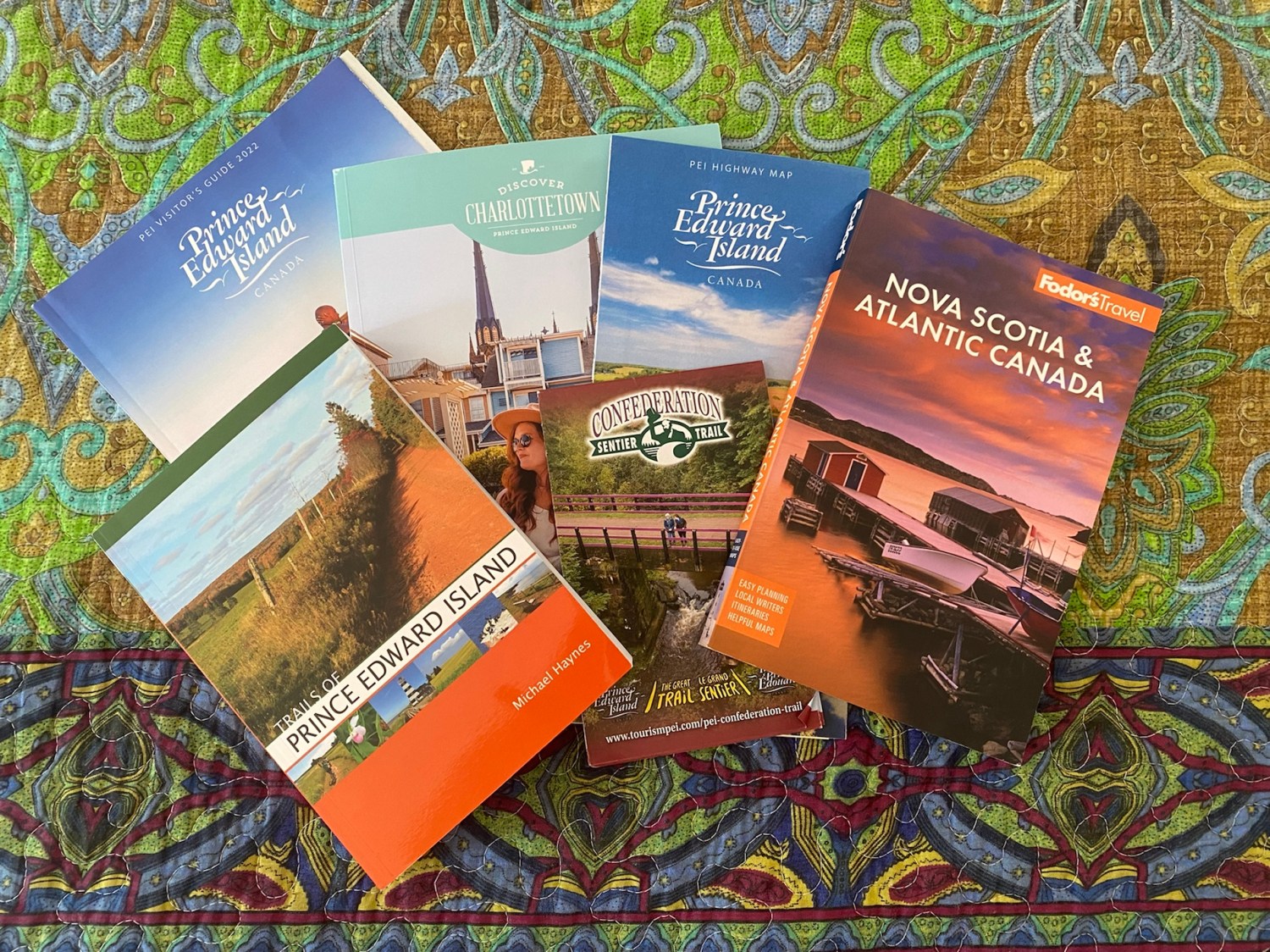
To prepare, I read Fodor’s Nova Scotia & Atlantic Canada. I have also purchased a book to bring along: Trails of Prince Edward Island by Michael Haynes. I wrote to Prince Edward Island Tourism to get more information, and from these sources and the article I found (mentioned above), I fashioned a road trip which will take, including driving time there and back, nineteen days (including four+ days of driving there and back).
Travel preparation for The Maritimes
Music
Lisa sent me some YouTube videos of Canadian music that she loves, including the following:
Besides these songs, I discovered a Canadian-Mexican musician I love: Lhasa De Sela. She sings in English, French and Spanish. Here is one of her songs: J’arrive à la ville.
And I made up my own playlist on Spotify: Canadian tunes.
Books
Of course, I always love to read books set in my destination, so I read some of the books below (indicated with stars and ratings). I own the books in green and will read them sometime during the year.
Workin’ Moms (TV series 2017-2023) **** (early seasons are best)
I prepared a journal, but it’s nothing fancy.
My journal for this trip
The Maritimes
Some things to do
a drawing of Peggy’s Cove lighthouse in Nova Scotia
The biggest obstacle we face at this point is my father’s health. He has been bedridden for the last eight months or so, and at any point things could change with him, causing us to have to cancel our plans. We are prepared to do whatever is necessary.
My path less traveled. Rediscovering self after surviving the abuse that almost sunk me. Goal of strengthening and thriving on my adult legs. 👣🙏🏻 #recovery #forgiveness
This blog is for those who wish to be creative, authors, people in the healing professions, business people, freelancers, journalists, poets, and teachers. You will learn about how to write well, and about getting published. Both beginning and experienced writers will profit from this blog and gain new creative perspectives. Become inspired from global writers, and find healing through the written word.
Explore, discover and experience the world through Meery's Eye. Off the beat budget traveler. Explore places, cultural and heritage. Sustainable trotter.
shareable tales of Meery is Meeryable


You must be logged in to post a comment.