Friday, July 7: We started our first stage of actually walking the Via Francigena from Ponte a Cappiano at 6:50 this morning, after I’d grabbed a chocolate croissant at Bar Cappiano. It would be 5km to Fucecchio. We walked for a while along the brackish canal on a grassy path. The Via Francigena is not that well-marked so we had to keep reading the guidebook and tracking ourselves on the Via Francigena app. Even though we left early, it was still very humid and the grassy path was wet with dew. We were in full sun the whole way.
leaving Ponte a Cappiano
sign for the Via Francigena
Ponte a Cappiano
Ponte a Cappiano
Darina in the cornfields
Cornfields
the flat boring path to Fucecchio
the flat boring path to Fucecchio
me trudging along to Fucecchio
We finally arrived in Fucecchio after 5km; we didn’t count on this part of the walk, as we thought our hostel was in Fucecchio when we booked it but then realized it was 5km north in Ponte a Cappiano. So our day was longer than we expected at about 16km or nearly 10 miles.
Fucecchio was called “Arne Blanca” by Sigeric and listed as his stage XXIII. The town’s main crop at one time was figs, and its name derives from Latin for “fig plantations.” A decimating plague rampaged the town in the 14th century; in the 16th century the Medicis began to redevelop it.
We visited the church on the hill, The Collegiate Church of San Giovanni Battista, and happened upon a priest who was able to stamp our passports. The neoclassical church with its austere brick facade was richly decorated inside. We had views of the sprawling landscape from behind the church. The main square, Piazza Vittorio Veneto, was classic Italian.
I reach Fucecchio
view from the hill in Fucecchio
view from the hill in Fucecchio
Fucecchio
Fucecchio
view from the hill in Fucecchio
The Collegiate Church of San Giovanni Battista
The Collegiate Church of San Giovanni Battista
The Collegiate Church of San Giovanni Battista
view from the hill in Fucecchio
Piazza Vittorio Veneto
The Collegiate Church of San Giovanni Battista
Vedutta della Collegiata e dell’affresco di Son Cristoforo
In the newer part of Fucecchio, we stopped at a cafe for some breakfast. Darina’s hiking shoes and socks had gotten soaked in the dewy morning grass, so she took them off and leaned them against a planter in the square where the sun could dry them off.
At one point I looked up and noticed the shoes had vanished. I alerted Darina. A man was sweeping trash in the square with a broom while a street sweeping machine was moving slowly down the street. They had already gone by us and it didn’t seem possible the machine could have swept the shoes up because there were barriers around the square. We asked everyone around if they’d seen someone take Darina’s boots, but no one had.
Darina hurried over to the driver of the street sweeping machine and asked (through Google Translate) if his machine had sucked up her shoes. The man with the broom even came over to see what they were talking about. He must have been the town idiot because he acted as if he didn’t know a thing about the shoes. She asked the machine driver to open the back of his truck and look for her shoes, but he said he had to finish street sweeping for another hour; he promised he’d return and open it then. We finally gave up because we couldn’t wait around forever. All of this had taken 2 hours of the day already. Darina didn’t care that much because she was happy to walk in her Tevas, but she wanted to know the truth of what happened to her shoes.
Darina had spotted a camera on the outside of the pharmacy so she went in and asked them to replay the video of the square. There on the video, she saw the man with the broom vigorously sweeping her shoes into the street sweeping machine. What I would have given to see that video! It cracked me up just picturing it.
What a comedy of errors! It was like something you’d see in a Charlie Chaplain movie. So hilarious. Every time I thought about it the rest of the day, I cracked up laughing.
We were ready to shake off the town of Fucecchio as soon as possible, after the incident yesterday with our misplaced hostel, the trains and the exorbitant taxi, and today with Darina’s hiking boots.
the cafe where we stopped
Darina points to the crime scene – where her shoes were disposed of
Saying goodbye to Fucecchio
We crossed a bridge over the Arno River, which flows 241km from the Apennines through Florence before emptying into the Tyrrhenian Sea near Pisa. We walked behind a paper factory then along another dyke.
It was a miserably long hot slog along dykes and flat boring farmland to get to San Miniato Basso (6.7 km). We saw some Danish pilgrims sitting on a bench and we followed suit by resting on another bench before climbing the steep climb to San Miniato.
Arno River
long and hot flat slog through farmland
long and hot flat slog through farmland
long and hot flat slog through farmland
San Miniato Basso
church in San Miniato Basso
We took what was apparently a new path of the Via Francigena into San Miniato (elevation 147 meters, pop. 27,585). We could see the town looming high above us and thought it terribly daunting. The zigzag climb was hot and uphill and we wondered if there were a set of steps because we were getting close to the town rising straight up before us. Suddenly we saw there was a elevator that took people up to the town! It was a gift from the heavens for sure!
The high hills of San Miniato made it a prized fortress of the Lombards, who built a castle here in the 11th century, when it briefly surpassed Florence in importance as the Tuscan capital for the Lombard Holy Roman Empire.
San Miniato is known for the white truffle. Trufflers go out during the night with their dogs and walk through hidden paths between the trees to find the prized truffles. Lucky for us, the first cafe we found in the shade, Piccola Osteria del Tartufo, specialized in white truffle dishes. It turned out to be an excellent stop. We got bread, cheese, sour cream, & thinly sliced white truffles topped with honey. We also had Aperol spritzes. Everything was refreshing and delicious. We were so hot and tired that we sat there for a long time enjoying the accomplishment of our first day of walking about 10 miles in high heat with no shade. However, we still weren’t at our destination for the night.
the zigzag path to San Miniato
San Miniato
San Miniato
view of Tuscan countryside from San Miniato
San Miniato
lunch at Piccola Osteria del Tartufo
The friendly waitress allowed us to leave our packs in the restaurant so we could walk up to see the Duomo of Sant’Assunta, where we also got a stamp. Its asymmetrical San Mathilde clock tower was originally part of the medieval fortress.
Duomo of Sant’Assunta
Duomo of Sant’Assunta
view from Duomo of Sant’Assunta
Duomo of Sant’Assunta
Duomo of Sant’Assunta
Duomo of Sant’Assunta
The waitress at the restaurant also called us a taxi because we needed to take one to the bus stop at Ponte a Elsa so we could get two more buses to Gambassi Termi. We were skipping the stage from San Miniato to Gambassi Terme because it was a rough 26 km with no services.
The funny thing was that when they called us a taxi, it was Antonio, the same guy who had charged us 30 euros yesterday to drive us from the train station at San Miniato Basso to Ponte a Cappiano. He had quoted 20 euros today for the same distance he drove us yesterday. We could only assume it was because Italians had called him. I guess he figured he could take advantage of us English-speaking pilgrims.
We waited for the 3:40 bus 🚎 to Castelfiorentino and then switched to another bus to Santamaría a Chianni, basically 1.4 km north of the town of Gambassi Terme.
We jumped off the bus at about 4:30 in Chianni, right across from Ostello Sigerico, a very nice and well-run pilgrim hostel in a former monastery next to the medieval church of Santa Maria Assunta. It was the 20th stop made by Sigeric, the archbishop of Canterbury. They had drying racks for our clothes in the courtyard and a pilgrim dinner lined up for 7:30. We could even take a tour of the attached Romanesque church after dinner.
It was nice to meet some fellow pilgrims because we hadn’t seen many thus far. We met Pauline from Netherlands. She had been walking since near the border of Switzerland and France. We met an Italian man who was actually in the Osteria where we ate in Ponte a Cappiano the night before; he recognized us and he had, unbeknownst to us, appeared in our photos. He was walking long distances at breakneck speed. We also met two friendly young Italians who were trying to become actors. María Giulia Toscano (25) had played a bit part in Romantiche, and she was hoping to act in another movie soon. She and her friend had tried to do two stages of the Francigena from Fucecchio to San Miniato to Gambassi Terme in one day, and María had twisted her ankle so they were going home earlier than they planned.
After dinner we were able to go inside the Romanesque church attached to the Ostello.
me approaching Ostello Sigerico
approaching Ostello Sigerico
Ostello Sigerico
Darina with the pilgrim at Ostello Sigerico
me at Ostello Sigerico
vineyards seen from the garden at Ostello Sigerico
vineyards seen from the garden at Ostello Sigerico
Ostello Sigerico
Ostello Sigerico
Ostello Sigerico
dinnertime at Ostello Sigerico
Darina at dinner
pasta at Ostello Sigerico
Romanesque church at Ostello Sigerico
Romanesque church at Ostello Sigerico
Romanesque church at Ostello Sigerico
me, María & Darina
María and her friend
Ostello Sigerico
vineyards of Gambassi Terme
Overall, it was a perfect ending to our first day of walking.
Steps: 25,347; Miles: 10.75. Day 1 Stage Walk: 8.95 miles (14.4km).
Weather: (San Miniato) Sunny. Hi 89°, Lo 66°. (Gambassi Terme): Sunny. Hi 82°, Lo 66°.
The Via Francigena (pronounced Fran-chee’-gina) is an ancient road and pilgrimage route that runs from Canterbury, England, through France and Switzerland, to Rome and then to Apulia, Italy, where there were ports of embarkation for the Holy Land. In around 990, Archbishop Sigeric journeyed from Canterbury to Rome and back, but only documented his itinerary on the return journey, taken in 80 stages averaging about 12 miles (20 km) a day, for a total of some 1,100 miles (1,700 km).
This is the story of our attempt to walk the stages from Lucca to Rome, which are, in total, about 255.07 miles (410.5 km). Since we had to cut out stages due to time constraints, our actual goal was to walk 211.77 miles ( 340.8 km).
Running tally (Day 1): 8.95/211.77 miles (14.4km/340.8km).
Tuesday, July 4: Mike and I drove about 3 1/2 hours from Bergamo to arrive at Lucca. We checked into our hotel, Albergó San Marino, and then went out in search of the pilgrim credenciale. The receptionist at our hotel said he’d done the Via Francigena before and sent us confidently across town to the Tourist Info office. They in turn told us to go to Cathedral San Marino from 9:30-6:00; it was right around the corner from our hotel but we didn’t make it because we stopped for an Aperol spritz at a shady cafe near where they were setting up the stage for Lucca’s famous music festival; tonight it would be Billy Idol and Generation Sex. On Thursday night Bob Dylan would be playing, but only one general admission ticket was remaining at a cost of 145€. It didn’t matter because on Thursday, Darina and I would begin our walk to Rome, and Mike would be on his way home.
We walked to Piazza dell’Anfiteatro and had an excellent dinner at Sotto Sotto Ristorante. The waiter and manager, Eugene, was super friendly and welcoming. I had ricotta and spinach ravioli with butter and sage and Mike had the most delicious meal: Pulled pork sandwich, burrata stracciatella, green sauce and baked potatoes. It was breezy and cool and the plaza was quite lively, such a pleasant experience all around. The only detraction from the experience was some YouTube influencer sitting a couple of tables away with her family; she was taking a video of herself gushing about how she’d now reached a million followers, or some such nonsense. It was so obnoxious!
Albergó San Marino
Albergó San Marino
me in front of Albergó San Marino
Lucca Summer Music Festival 2023
Lucca Summer Music Festival 2023
doorway in Lucca
one of Lucca’s many churches
Sotto Sotto Ristorante
Mike at Sotto Sotto Ristorante
me at Sotto Sotto Ristorante
ricotta and spinach ravioli with butter and sage
Pulled pork sandwich, burrata stracciatella, green sauce and baked potatoes
Wednesday, July 5: This morning at the hotel breakfast we met an Italian couple, Stefano and Stefani, along with Stefani’s best friend Firenzia, who sported a Generation X T-shirt (Gen X is generally defined as those born between 1965-1980). We found they had attended the Generation Sex and Billy Idol concert the night before. Firenzia had been to 44 Billy Idol concerts all over the world and Stefani had been to 42. Stefani had been to San Diego multiple times and wanted to live there; Firenzia was in love with Las Vegas and wanted to marry an Elvis impersonator there. They were hilarious and even sang us a few lines of “White Wedding.” They were groupies in the truest sense of the word.
After breakfast, we walked out of Lucca’s city walls through the Porto San Pietro to the Aqueduct of Nottolini. This 19th century epic structure was once used to carry water from the mountains into the city and contained 400 arches made of stone stretching for 3km. It was rather disheveled and unkempt, not like many that have been well-preserved in other places.
Stefano, Stefani, & Firenzia
Albergó San Marino
Porto San Pietro
Aqueduct of Nottolini
Aqueduct of Nottolini
Aqueduct of Nottolini
Mike at Aqueduct of Nottolini
me at Aqueduct of Nottolini
When we returned from our aqueduct walk, we headed for the Lucca Cathedral Museum to get our pilgrim passports. Finally I was able to find them after being sent on a wild goose chase yesterday.
We then wandered around awhile and found San Michele Paolino Allesandro Church, where I got my first pilgrim stamp. Unlike most churches in Italy, this one is very plain inside. Known as the church of S. Michele in Foro, it was built over the ruins of a previous church (from 795) and on the area of the ancient Forum of Roman Lucca. Its present form dates back to the 12th century.
The white Church has impressive proportions and blind arcades run around the entire church. The façade is higher than the roof, which makes this church completely different from all the other ones in Lucca.
Lucca Cathedral
San Michele Paolino Allesandro church
San Michele Paolino Allesandro church
San Michele Paolino Allesandro church
San Michele Paolino Allesandro church
San Michele Paolino Allesandro church
We had lunch at Ciacco on San Napoleon Square. Mike had a panini with a zucchini omelette inside; I had Pappa Al Pomodoro: Tuscan tomato bread soup and Calabrian anchovies with burrata, a kind of room temperature soup that was more bread 🥖 than soup. It wasn’t my favorite. Then we wandered around waiting for Darina to arrive; she was keeping us informed of her progress coming from Pisa to Lucca.
Ciacco
Pappa el Pomodoro
panini with a zucchini omelette
Ciacco
church in Lucca
Polarsteps of Mike’s and my trip through Northern Italy to Lucca
Darina arrived in Lucca after her travel from Slovakia, by way of Budapest and Pisa, and met us at Piazza Napoleon for cool Aperol Spritz drinks. She came bearing a gift from Slovakia: Tatratea, a liqueur with 52% alcohol content! Mike would take it home so we could enjoy it in the safety of our own home 😂🤣.
I gave Darina the two pilgrim credenciales I’d picked up for her at the Cathedral Museum. I didn’t know if we needed one or two but we liked to get a lot of stamps, so I played it safe since the documents seemed quite elusive. After our drinks, we went to Lucca Cathedral so Darina could get her first passport stamp.
Darina with her gift of Tatratea
Darina, me and Tatratea
Lucca Cathedral
Lucca Cathedral
Lucca Cathedral
Lucca Cathedral
We all three rented bicycles and rode around Lucca’s 4km of city walls. It was a great green space, full of trees 🌳, breezes, people strolling and small groups pedaling four-person contraptions that seemed quite comedic. After we got off the city walls, Darina and I parked our bikes at several churches to get more stamps in our pilgrim credenciales.
Then it was time to finish a bottle of wine Mike and I had bought in Bergamo. Darina came to our hotel and we sat out on the patio and drank and talked about everything from Danish political TV shows to the screwed-up American political system.
a bikeride around Lucca’s city walls
a bikeride around Lucca’s city walls
a bikeride around Lucca’s city walls
a bikeride around Lucca’s city walls
Church of San Frediano
Church of San Frediano
Church of San Frediano
Church of San Frediano
Church of San Frediano
Church of San Frediano
San Michele Paolino Allesandro Church
San Michele Paolino Allesandro Church
parked bikes
finishing up our bikeride
the bike shop
We finished our evening at Ristorante Des Arts, the same restaurant where Mike and I ate in April of 2019 when we briefly visited Lucca. We had cacio e pepe again, but somehow it paled in comparison. It had been cold then and we had huddled inside; this evening it was warm so we sat outside and enjoyed a different atmosphere altogether. I was pleased to meet Darina again after five years apart.
Darina and me at Ristorante Des Arts
me with Darina at Ristorante Des Arts
Mike, me and Darina at Ristorante Des Arts
Steps: 18,079; Miles 7.67. Weather Partly cloudy. Hi 83°, Lo 65°.
Thursday, July 6: Mike took off this morning at 6:30 am for the Pisa airport. Luckily he made it in time and caught his flight in Frankfurt despite a short layover. I was sad to have him go but was also trying to get in the state of mind for my pilgrimage. I rearranged my suitcase and my pack to send my suitcase through Bags Free to Rome.
I checked out of my hotel, left my suitcase and backpack at reception, and went to meet Darina at 10:30 near the Church of San Frediano with its beautiful façade, which displays a splendid Byzantine mosaic of the Ascension. Christ, in an almond shape, is surrounded by the apostles; the Madonna is portrayed in the center. We had passed it Wednesday on our bikeride but the mosaic was in the shadows. This morning, we were able to capture it in full sunlight.
We had drinks near Napoleon Square, next to the music festival stage where they were doing sound checks for Bob Dylan’s show that night. We had both done some research about how to take public transportation to Fucecchio, skipping the first 2 stages of the Via Francigena because we’d read those stages went through Lucca’s ugly suburbs. Also in the interest of time we had to choose to eliminate some stages. We thought we had our route figured out, and we headed to Lucca’s train station.
one of Lucca’s towers
Church of San Frediano
Church of San Frediano
another of Lucca’s towers
the Bob Dylan sound stage
We took a train to Pisa, switched trains and arrived at San Miniato-Fucecchio. We realized too late that the Ostello Il Ponte dei Medici was actually in Ponte a Cappiano, 5 km north of Fucecchio. By this time it was late and hot and no way did we want to walk north to the Ostello and then have to backtrack south tomorrow morning. Some kindly locals tried to help and instructed us to take the train to Lucca! I said we just came from Lucca and that could not be the solution. Finally we found a taxi to take us to the Ostello for a steep 30 euros, way too much for a 12-minute drive.
Darina and I checked into our first hostel, Ostello il Ponte dei Medici, at around 3:00 after our challenging day navigating public transportation to get to Ponte a Cappiano. We weren’t too sweaty since we didn’t actually walk, so we postponed our showers and went to the only bar open in the small town, Bar Cappiano. We each had a beer and a panini with formaggio, Pomodoro & prosciutto while we observed a gaggle of local old men who probably gather there every day. It was quite fun to watch this group of obvious old friends. We wondered what on earth people do in a small town such as this, and we figured this was it: sitting around chatting at the local bar while the women cooked and cleaned at home.
After a long lazy while, we climbed uphill to the only church in town, Chiesa di San Bartolomeo. Darina buzzed the doorbell of a side building and a black priest stuck his head out of an upper window and waved like the Pope giving his benediction. We asked if he could open the church and stamp our pilgrim passport. He had a cell phone glued to the side of his head but he came down, stamped our passports and opened the church. By the time we came out, he was in the parking lot waiting and still chatting away on the phone. Down the hill someone was burning something and smoke was wafting up from below. We could see what we thought was San Miniato in the distance.
We returned to the hostel, which is built into the top of the famous medieval bridge of the town. This stop was identified as Sigeric’s Stage XXIV on the Via Francigena, also known as Aqua Nigra (“Black water”) – named for the brackish waters of the Usciana Canal which it spans. The bridge had strategic value in the medieval wars between Lucca and Florence, who each fortified or destroyed it at various times in its history. One of the Medicis rebuilt it, earning it the name “Medici Bridge.” For centuries the Hospitallers of Altopascio safeguarded the bridge for pilgrim traffic on the Via Francigena (according to Sandy Brown in Walking the Via Francigena Pilgrim Route – Part 3: Lucca to Rome).
late lunch in Bar Cappiano
Chiesa di San Bartolomeo
Chiesa di San Bartolomeo
view of Ponte a Cappiano from Chiesa di San Bartolomeo
Ponte a Cappiano
Ponte a Cappiano
Medici Bridge (Ostello il Ponte dei Medici is inside the bridge)
Usciana Canal
Usciana Canal
Usciana Canal
We showered but didn’t bother washing our clothes because we hadn’t sweated that much. However, after showering, we immediately started sweating profusely. We escaped the stuffy hostel, which we had all to ourselves, and went back to the bar, sitting in a shady corner and writing in our journals.
The only Osteria in town opened at 8:00, so we went there for dinner. The woman, Nonna (grandmother), served us cool white wine in flower-painted wine glasses. We each had bruschetta, a plate of spaghetti arrabiata and some bread dipped in olive oil. It was a very pleasant evening as the woman was super nice and the ambiance was lovely and welcoming. We got another stamp in our passport. We now had seven stamps without having walked a step 😂🤣.
Darins with the painted glasses in the Osteria
me in the Osteria
Osteria in Ponte a Cappiano
spaghetti arrabiata
Darina and me in the Osteria
our pilgrim passports with 7 stamps
Steps: 12,405; Miles 5.26. Weather: Hi 89°; Low 64°. Mostly sunny.
The Via Francigena (pronounced Fran-chee’-gina) is an ancient road and pilgrimage route that runs from Canterbury, England, through France and Switzerland, to Rome and then to Apulia, Italy, where there were ports of embarkation for the Holy Land. In around 990, Archbishop Sigeric journeyed from Canterbury to Rome and back, but only documented his itinerary on the return journey, taken in 80 stages averaging about 20 km (12 mi) a day, for a total of some 1,700 km (1,100 mi).
This begins the story of our attempt to walk the stages from Lucca to Rome, which are in total about 410.5 km (or 255.07 miles). Since we had to cut out stages due to time constraints, our actual goal was to walk 340.8 km (or 211.77 miles).
Saturday, June 24: As we were leaving Cinque Torri, we found on our GPS that the Great Dolomites Road was closed at the pass, so we had to reroute and couldn’t take our scenic route to Bolzano. We ended up backtracking all the way to Cortina d’Ampezzo and to Dobbiaco and Brunico and then eventually toward Bolzano on the A12 autostrada.
The Renon Plateau: Kinig Farm
Just before Bolzano we were instructed to take a windy road up and up a very steep mountain. It felt very perilous! There were many steep drop-offs and the road eventually narrowed to just over one lane wide. Switchback after switchback led us eventually to the “town” of Signato on the Renon plateau and to a farm called Kinig, where Werner (the father of the Airbnb host Franz Maria) greeted us. We had reserved an apartment on this high mountain farm for 4 nights. It was a charming little place!
Kinig farmhouse
Kinig farmhouse
Kinig farmhouse
Kinig farmhouse
urinal with painted spider that fooled both of us!
kitchen in Kinig farmhouse
Kinig farmhouse
Kinig farmhouse
view of Bolzano from the farmhouse
Soprabolzano/Oberbozen
Luckily, though the road ended at a gate, we were given a pass to open the gate so we could drive a few kilometers further up to the town of Soprabolzano/Oberbozen. Neither of us were thrilled about having to drive that winding road back down the mountain to go to dinner or get groceries in Bolzano, so that gate-opening card was truly the magic ticket. We were also given a free gondola card which we could use for the gondola down to Bolzano.
After checking into our farmhouse Airbnb apartment, we drove up the mountain to Soprabolzano. Here we stocked up on groceries for our 4 night stay in Renon, then we went to eat dinner at the lively and friendly Gasthaus Babsi, recommended by the friendly check-out lady at the supermarket. It was a cool place with a friendly staff and old American tunes playing. We shared a Rucola and Brie pizza and I had the most delightful drink called a Hugo that had Prosecco, lime, fresh mint, seltzer, and elderberry liqueur. Mike had an Estivo: white wine, soda and lemon.For dessert we shared a buckwheat cake with lingonberry jam and whipped cream. Before we left the place, the bartender gave us each complimentary limoncellos.
We took an after-dinner stroll on the lower edge of the town, where we saw beautiful views of the jagged Dolomites against a foreground of alpine meadow. The town also had a community swimming pool which we had access to. From the town, there was a large cable car 🚠 that went down into the valley to the city of Bolzano. We planned to take that down one day to avoid the harrowing drive up to our farmhouse apartment.
We admired the charming Parrocchia Maria Assunta di Soprabolzano with its fetching onion dome in the waning sunlight.
Gasthaus Babsi
Gasthaus Babsi
me with a Hugo at Gasthaus Babsi
Mike at Gasthaus Babsi
buckwheat cake with lingonberry jam and whipped cream
signs in Soprabolzano
Soprabolzano
cable car at Soprabolzano
cable car at Soprabolzano
little lambs in Soprabolzano
Hotel Post in Soprabolzano
Parrocchia Maria Assunta di Soprabolzano
Steps: 12,253; Miles 5.19. High 77°, Low 52°. Sunny.
Val di Funes: the Panoramaweg & Sunnseitnweg Circuit Hike
Sunday, June 25: On Sunday morning, we drove about an hour from Renon to Val di Funes to hike the Panorama Trail (“Panoramaweg” in German) and the Sunny-side Trail (“Sunnseitnweg”), which when linked together creates an easy, scenic circuit hike.
We started in Santa Maddalena/ St. Magdalena, a village in Val di Funes (Villnösstal) in South Tyrol. This small mountain village is home to the historic Santa Maddalena Church, which is one of the most popular photo spots in the region. The church dedicated to Santa Magdalena is located where pagan rituals once took place. The first building was mentioned in 1394 documents; today only the church tower remains of that original church. The interior has Baroque elements. The altar features a contrite St. Magdalena, patron saint of the church. Next to her are sculptures of St. Peter, John the Baptist, John the Evangelist and Jerome.
The Santa Maddalena Panorama trail led us through meadows, pockets of forest, and historic Tyrolean farmsteads along narrow footpaths as well as low-trafficked paved roads.
We enjoyed grand views of the Odle/Geisler Peaks, which form the dramatic backdrop of Santa Maddalena Church and the tidy farmhouses set in the lovely green valley.
a church near our farmhouse in Renon
Val di Funes
Panoramaweg & Sunnseitnweg
the start of the Panoramaweg
Santa Maddalena Church
Santa Maddalena Church
Val di Funes
Panoramaweg
Santa Maddalena Church set against the Odle/Geisler Peaks
Santa Maddalena Church set against the Odle/Geisler Peaks
me in Val di Funes
Val di Funes
trail markers in Val di Funes
Mike in Val di Funes
Val di Funes
Val di Funes
cute little bench
tractor set up
Sunnseitnweg
Santa Maddalena Church set against the Odle/Geisler Peaks
Santa Maddalena Church set against the Odle/Geisler Peaks
Val di Funes
Val di Funes
Santa Maddalena Church set against the Odle/Geisler Peaks
me on the Sunnseitnweg
returning to Santa Maddalena
cemetery at Santa Maddalena Church
interior of Santa Maddalena Church
Santa Maddalena Church
After our hike, which was about 4.5 miles and took us about 3 hours of leisurely walking, we visited the tiny and picturesque onion-steepled Chiesetta di San Giovanni/ St. Johann Church nearby. It is one of the Dolomites’ most iconic photo-ops. The small Baroque church, founded by Michael von Jenner and built in 1744, sits alone in a meadow, part of the Ranuihof Farm, below the spiky peaks of the Odle mountain group. We paid to park plus a 4€ entrance fee to visit. Because of the way it was blocked off and because of the entrance fee, it felt a bit too staged for us.
Chiesetta di San Giovanni/ St. Johann Church
Chiesetta di San Giovanni/ St. Johann Church
Chiesetta di San Giovanni/ St. Johann Church
Sunday evening after our hike at Val di Funes, we returned to our farmhouse Airbnb and enjoyed wine, bread and cheese at a picnic table in the shade. We made an asparagus and cheese pappardelle that was quite delicious. We spent the evening relaxing in our charming apartment.
airplane in front of Kinig farmhouse
me enjoying a wine at Kinig farmhouse
Kinig farmhouse
table set for dinner
asparagus pappardelle
Steps: 13,119; Miles: 5.56. High 83°, Low 55°. Sunny.
Bolzano/Bozen
Monday, June 26: Monday morning we took the cable car 🚠 (a 12-minute ride) from Soprabolzano, not far from our farmhouse, to Bolzano down in the valley.
taking the cable car down to Bolzano
taking the cable car down to Bolzano
taking the cable car down to Bolzano
taking the cable car down to Bolzano
Bolzano/Bozen is the capital city of the province of South Tyrol. With a population of 108,245, Bolzano is also by far the largest city in South Tyrol. In the 2020 version of the annual ranking of quality of life in Italian cities, Bolzano was ranked joint first for quality of life alongside Bologna.
Bolzano is considered a bridge between Northern Europe and Southern Europe due to the three spoken languages in South Tyrol (Italian, German, and Ladin) and the confluence of Italian and German-Austrian culture.
Being located at multiple climate borders, Bolzano features a humid subtropical climate with hot summers and very cold winters by Italian standards.Because of its low altitude in a valley south of the main alps, Bolzano is sheltered from cool winds during daytime, ensuring much warmer temperatures year-round than in similar valley cities north of the range. It was in the mid-90s on the day we went down while it was in the low 80s on the Renon plateau.
We enjoyed wandering around the town. We walked around Waltherplatz, the main square in Bolzano. Walther von der Vogelweide, the square’s namesake, towers as a white statue in the middle of the square. We stopped at a favorite store we keep running into in various Italian towns, OVS. Mike was looking for some t-shirts and shorts and I bought a dress 👗. 😂
We had a lovely lunch in a shady and breezy alley. I had a burrata and tomato salad that was super refreshing. Mike had a tuna salad. As always in Italian towns, we love to watch the fashionable people strolling by. After lunch, we happened upon a lively flower market.
After strolling around a bit more, we made our way to the cable car and took it back up the mountain to Renon.
Bolzano/Bozen
cute orange bicycle
Bolzano/Bozen
Bolzano/Bozen
Bolzano/Bozen
Bolzano/Bozen
Bolzano/Bozen
Bolzano/Bozen
Bolzano/Bozen
burrata and tomato salad
flower market in Bolzano/Bozen
flower market in Bolzano/Bozen
flower market in Bolzano/Bozen
flower market in Bolzano/Bozen
window decor
window decor
Bolzano/Bozen
Taking the cable car back up to Renon
Taking the cable car back up to Renon
Taking the cable car back up to Renon
a view of our farmhouse from the cable car
returning to Soprabolzano
returning to Soprabolzano
The Renon/Ritten Plateau
After Bolzano, we spent the rest of our day on the Renon/Ritten Plateau, home to our farmhouse apartment. We drove to the town of Collalbo/Klobenstein and wandered around. Not much was happening there as it was in the heat of the afternoon, so we settled inside the only cafe in town to enjoy a very skimpy serving of gelato 🍧. It was refreshing but not quite enough to sooth our souls.
Collalbo/Klobenstein
Collalbo/Klobenstein
Collalbo/Klobenstein
Collalbo/Klobenstein
gelato in Collalbo/Klobenstein
a church near Collalbo/Klobenstein
view from the church
a church near Collalbo/Klobenstein
We reached the peak at Rittner Horn, at an altitude of 2260 meters, by taking the gondola from Pemmern/Tre Vie to Schwarzseepitze. From there it’s about an hour hike up to the top, but we didn’t take the hike. We could see excellent views of the mountains all around.
gondola to Rittner Horn
view from Rittner Horn
me at Rittner Horn
view from Rittner Horn
view from Rittner Horn
horses seen from the gondola ride back down
After our day taking the cable car to Bolzano and exploring some of the Renon/Ritten plateau, we stayed at the farmhouse and cooked some Bratwurst and some leftover pasta with zucchini. It was nice to spend a slower day simply enjoying our home town area.
dinner in the farmhouse
Steps: 11, 706; Miles 4.96. High 97°, Low 64°. Sunny.
The High Alpine hikes of Alpe di Siusi
Tuesday, June 27: With a size of 56 square kilometers, the Alpe di Siusi in South Tyrol is the largest high alpine pasture in Europe. On Tuesday, we drove about an hour from Renon to Ortesei/St. Ulrich where we took the Mont Sëuc cable car to the alpine meadow. There we spent much of the day, about 5 1/2 hours, hiking all over the meadow, about 6 1/2 miles.
We started by following Trail 9 to Saltria, which was a long slow descent. We passed alongside pastures of grazing horses and sprawling fields of colorful wildflowers. Many people posed amidst the wildflowers for pictures.
Saltria is a small village on Alpe di Siusi, located at an elevation of 1675 meters. It’s also the lowest point of the plateau. We had amazing views of the Catinaccio/Rosengarten range as we descended. We stopped at a hotel in Saltria for a cappuccino and an apple strudel.
As we crossed the rolling Alpe di Siusi meadows, Sassolungo and Sasso Piatto dominated the view to the southeast and the Catinaccio and Sciliar mountains dominated the views directly south and to the southwest. To the north, views extend to Monte Pic, Seceda, and the Geisler Group.
Of course what goes down must come up, so we hiked a long uphill out of the valley through the Römer mountain pasture, where cattle grazed freely.
Mont Sëuc cable car
first views of the Alpe di Siusi
me at Alpe di Siusi
Alpe di Siusi
Alpe di Siusi
Alpe di Siusi
Alpe di Siusi
stream at Alpe di Siusi
Alpe di Siusi
greenery at Alpe di Siusi
wildflowers
selfie 🙂
me with Mike at Alpe di Siusi
wildflowers at Alpe di Siusi
Alpe di Siusi
Alpe di Siusi
Alpe di Siusi
me in the wildflowers
Alpe di Siusi
horses at Alpe di Siusi
horses at Alpe di Siusi
Alpe di Siusi
Alpe di Siusi
Alpe di Siusi
wildflowers
Alpe di Siusi
more wildflowers
Mike at Alpe di Siusi
wildflowers
Alpe di Siusi
wildflowers
cows at Römer mountain pasture
Römer mountain pasture
Mike and his cow friends
me at Alpe di Siusi
Alpe di Siusi
Römer mountain pasture
Alpe di Siusi
Alpe di Siusi
Alpe di Siusi
Alpe di Siusi
greeter at Alpe di Siusi
Alpe di Siusi
We headed toward Compaccio but stopped for a restroom break at Rauchhütte before venturing back to our starting point. We originally intended to go to the town of Compaccio but decided not to go all the way into town.
We made another stop, this time at Sanon Hütte/Baita Sanon where Mike had a beer and I had my new favorite drink, a Hugo (Prosecco, mint and elderflower liqueur). Yum.
After we left the hut we enjoyed more beautiful views of the mountains. Looking north, we saw Monte Pic, the Geisler Peaks, Monte Stevia, Piz Duleda, and Col dala Pieres.
We had paid the extra 5 euros for the gondola from Sole Lake back up to the Mont Sëuc cable car, and we were happy we did as it saved us a long uphill slog at the end. What a gorgeous hike!
wood carvings on the way to Rauchhütte
carved bench near Rauchhütte
Rauchhütte
Rauchhütte
bathroom sign at Rauchhütte
bathroom sign at Rauchhütte
Seiser Alm, view from Rauchhütte
leaving Rauchhütte
Alpe di Siusi
Alpe di Siusi
Alpe di Siusi
Alpe di Siusi
Alpe di Siusi
Mike at Sanon Hütte/Baita Sanon
Sanon Hütte/Baita Sanon
me at Sanon Hütte/Baita Sanon with my Hugo
bathroom signs at Sanon Hütte/Baita Sanon
Alpe di Siusi
more wildflowers
Alpe di Siusi
riding the cable car back to Mont Sëuc
Ortesei/St. Ulrich
After our hike at Alpe di Siusi, we took a short wander around the town of Ortesei/St. Ulrich. This is in Val Gardena where many people stay when they come to the Dolomites. The town looked appealing, but we were happy with our little mountain farmhouse in Renon.
Ortesei/St. Ulrich
Ortesei/St. Ulrich
Ortesei/St. Ulrich
Ortesei/St. Ulrich
Ortesei/St. Ulrich
Ortesei/St. Ulrich
Ortesei/St. Ulrich
Ortesei/St. Ulrich
Ortesei/St. Ulrich
Ortesei/St. Ulrich
Ortesei/St. Ulrich
Ortesei/St. Ulrich
Soprabolzano
After we relaxed a bit at our farmhouse apartment, we drove up to Soprabolzano where we had a lovely dinner on the terrace of The Post Hotel overlooking the valley and the cable car. We had intended to go to Gasthaus Babsi again, but it was closed on Tuesdays. We shared Rinderbouillon mit Kräuterfrittaten, a delicious soup with tiny strips of pancake in it. Mike had Hacksteak vomeinheimischen Lamm auf roten Zwiebeln und Röstinchen, a delicious lamb loaf with a potato pancake and red onions; I had Spinatspätzle mit Entenragout, spinach spaetzle with duck ragout.
After dinner we strolled briefly around the town. This would be the last time we’d see our cute little town above the farmhouse.
me at our farmhouse apartment
Mike and the airplane at our farmhouse
me with the Kinig pots & pans
The Post Hotel
me on the terrace of The Post Hotel
Rinderbouillon mit Kräuterfrittaten
Hacksteak vomeinheimischen Lamm auf roten Zwiebeln und Röstinchen
Spinatspätzle mit Entenragout
Babsi
Soprabolzano
Soprabolzano
Soprabolzano
Steps: 22,819; Miles 9.68. High 68°, Low 47°. Mostly sunny.
Leaving the Renon Plateau
Wednesday, June 28: Wednesday morning we left our farmhouse apartment in Renon and said goodbye to Werner, the 54-year-old very fit man who gave the farm to his son Franz. Franz, who is about 30, does the farming and Werner runs the apartments and a restaurant that only opens seasonally. Sadly we weren’t there at the right season to partake.
We also said goodbye to our upstairs neighbors Tim and Silke from Berlin. They had their dog named Rala with them. I liked their way of doing a vacation. They stayed in the farmhouse for two weeks; every other day they did a big outing and on the off days, they relaxed. I was envious at their long term stay at this place and their way of vacationing. We always tend to squeeze in too much, although on this trip, we have had more down time than on most. We stayed at the farmhouse 4 nights; I think that needs to be the minimum in each place on future trips. This time we were 4 nights in Venice, but only 3 in Dobbiaco, Verona and Bergamo, and only 2 in Lucca. We’ll get it right one of these days!
last view of our apartment
Werner
Silke & Tim
Tim, Silke, me and Mike
Tim, Silke, Mike and me
view of vineyards from our farmhouse
Zum Signater Hof (near our farmhouse but closed for the season)
church near our farmhouse in Renon
Renon: High: 72°, Low 53°.
Here’s a video of our time in Renon. On Settings (bottom right), hit “Quality: HD” for best experience.
After leaving Renon, we headed down the Alto Adige Wine Road (a suggestion from Tim & Silke) to Verona.
Wednesday, June 21: We left Venice this morning, taking a taxi to Alamo to rent a Volkswagen T-ROC. It wasn’t long before we were in the Dolomites. We stopped for lunch of panini 🥪 at Bar Torre Due in Longarone, a town that was rebuilt after it was totally destroyed by an “inland tsunami.” At about 10:30 p.m. on October 9, 1963 a huge piece of a mountain broke off in a huge landslide upriver of the Vajont Dam, one of the deepest and narrowest in the world. In 4 minutes, the landslide displaced the water, causing a huge tsunami to overflow the dam, killing 2,000 people, many whose clothes were ripped off by a force two times stronger than the atomic bomb at Hiroshima.
There was no sign of such mayhem today, so we enjoyed our lunch break, after which we drove through a number of small towns where the jagged peaks of the Dolomites towered all around us.
Ristorante Bar Torre Due in Longarone
Driving north
Our drive through towns
driving north
first views of the Dolomites
first views of the Dolomites
first views of the Dolomites
Dolomites
Dolomites
Dolomites
Lago di Misurina
We took our first walk at Lago di Misurina. It was a flat, easy walk, about 2 1/2-3 km, but a nice break from our drive to Dobbiaco. We even had glimpses of Tre Cime di Lavaredo (Three Peaks of Lavaredo).
Lake Misurina was where the speed skating events were held during the 1956 Winter Olympics of Cortina d’Ampezzo – the last time Olympic speed skating events were held on natural ice.
Bar at Lago di Misurina
Lago di Misurina
Lago di Misurina
Lago di Misurina
Lago di Misurina
boats at Lago di Misurina
Lago di Misurina
Lago di Misurina
Lago di Misurina
Lago di Misurina
Lago di Misurina
Lago di Misurina
Lago di Misurina
Lago di Misurina
Lago di Misurina
Lago di Misurina
Lago di Misurina
Lago di Misurina
Lago di Misurina
paddle boats at Lago di Misurina
Dobbiaco/Toblach
Late Wednesday afternoon, we checked into B&B Hotel Heidi just outside the little town of Dobbiaco/Toblach (Towns in this area have both Italian/German names since they are so close to Austria). B&B Hotel Heidi, where we stayed three nights, was the only hotel we stayed in during our time in Italy, except when we got to Lucca. Mostly we booked Airbnbs, which we much prefer. This place ended being a lively launching point for active people who were doing multi-day hikes, bike rides, motorcycle rides, or day hikes in the countryside. We ran into crowds of energetic people at breakfast each morning; it was fun to hear of their plans and absorb their enthusiasm.
This area is close to the Austrian border and feels more Austrian than Italian. Most people (95%) speak German. Dobbiaco is not far from the Tre Cime di Lavaredo hike, Lago di Misurina and hikes around Lago di Braies. There were lots more hikes we could have done from here, but we also planned to stay 4 nights in Renon/Ritten near Bolzano/Bozen. There we would do a number of high alpine meadow hikes.
B&B Hotel Heidi
grounds of B&B Hotel Heidi
grounds of B&B Hotel Heidi
grounds of B&B Hotel Heidi
grounds of B&B Hotel Heidi
grounds of B&B Hotel Heidi
After checking in, we went into town to look for dinner. We sat outdoors at Ariston Bar Pizzeria & Restaurant. We toasted each other with Forst Beers for our safe arrival in the Dolomites. I had the most delicious Tris di Canederli: speck, spinaci, rape rosse con burro sfuso e grana (dumplings with speck, spinach, beetroot with melted butter and Parmesan cheese). Mike had Maccheroni Ariston con speck, ragù di carnes, pomodoro, prosciutto, champignon e panna (Macaroni with speck, meat ragout, tomato, ham, mushrooms and cream). Speck is a type of cured, lightly smoked ham typically made in South Tyrol. It was all delicious, and very filling!
After dinner, we wandered around the charming town, where we admired a bubbling fountain, a statue of a cloaked Gustav Mahler, Austrian-style buildings shored up with huge stacks of firewood, and the pale green Baroque Parish Church of St. Giovanni Battista, built between 1764-1774 on the foundations of a Roman and later Gothic church. It was completed in 1804 with a 76m-tall bell tower.
Driving back through the countryside, we took a convoluted route in search of a town we could see in the distance which had a pretty church and steeple. We could see it, but we could never find our way to it. We kept driving around in circles until we finally gave up, returned to the hotel and settled in for the night.
Forst Beer
Tris di Canederli
Maccheroni Ariston
Dobbiaco/Toblach
Baroque Parish Church of St. Giovanni Battista
Gustav Mahler
Baroque Parish Church of St. Giovanni Battista
Baroque Parish Church of St. Giovanni Battista
Dobbiaco/Toblach
Dobbiaco/Toblach
countryside around Dobbiaco/Toblach
countryside around Dobbiaco/Toblach
Steps: 10,526; Miles 4.46. High 84°, Low 56°.
Tre Cime di Lavaredo
Thursday, June 22: Thursday we hiked one of the most popular trails in the Dolomites, the Tre Cime di Lavaredo Circuit Trail. It was a 35 minute drive from Dobbiaco. The views were stunning and well worth the effort. The hike is 10-11 km (6.8 miles) and it’s supposed to take 4 hours. It is rated Easy/Moderate with a 300-400 meter elevation gain. The circuit goes all around the Three Peaks of Lavaredo. Surrounding the circuit are the peaks of the UNESCO World Heritage Listed Dolomites. There is a 30€/car entry to the toll road leading to Rifugio Auronzo, where the hike begins.
The path goes past the Cappella degli Alpini, a quaint alpine church.
The first pictures are from Rifugio Auronzo to Rifugio Lavaredo.
view from the parking lot at Tre Cime di Lavaredo
Tre Cime di Lavaredo
Mike at Tre Cime di Lavaredo
Tre Cime di Lavaredo
Tre Cime di Lavaredo
Tre Cime di Lavaredo
Tre Cime di Lavaredo
Look closely to see the people on the path!
Tre Cime di Lavaredo
Tre Cime di Lavaredo
Tre Cime di Lavaredo
Tre Cime di Lavaredo Circuit Trail
Tre Cime di Lavaredo
Tre Cime di Lavaredo
Tre Cime di Lavaredo
me at Tre Cime di Lavaredo
Tre Cime di Lavaredo
Mike at Tre Cime di Lavaredo
me at Tre Cime di Lavaredo
Tre Cime di Lavaredo
monument at Tre Cime di Lavaredo
another monument at Tre Cime di Lavaredo
Tre Cime di Lavaredo
Cappella degli Alpini
me at Tre Cime di Lavaredo
Rifugio Lavaredo
The next set of pictures is from Rifugio Lavaredo to Forcella Lavaredo Viewpoint.
Rifugio Lavaredo to Forcella Lavaredo Viewpoint
Forcella Lavaredo Viewpoint
Forcella Lavaredo Viewpoint
Forcella Lavaredo Viewpoint
Tre Cime di Lavaredo Circuit Viewpoint
Forcella Lavaredo Viewpoint
Mike at Forcella Lavaredo Viewpoint
me at Forcella Lavaredo Viewpoint
This group of pictures is from Forcella Lavaredo Viewpoint to Rifugio Locatelli, where we stopped to eat our sandwiches overlooking a couple of small alpine lakes.
Forcella Lavaredo Viewpoint to Rifugio Locatelli
Rifugio Locatelli
Rifugio Locatelli
Rifugio Locatelli
map of the trails at Rifugio Locatelli
church near Rifugio Locatelli
view from Rifugio Locatelli
This set of pictures is from Rifugio Locatelli down into the steep and deep valley before ascending out of the valley well before we reached Malga Langalm.
This section is where I’ll add a caveat to the listed information. I would call it moderate/difficult mainly because of the surface of the trails. All surfaces are dirt and slippery gravel; for someone like me who has taken too many falls on surfaces like these, I found the descents not only challenging but disconcerting. I can handle the ascents because I can always get firm footing going uphill. Because of the many tiny steps I took going downhill and the slowness of my descents, the rating for me was more in the difficult range. So the hike took us just under 7 hours, vs the 4 hours estimated. Of course we made many stops for breaks and photos. I had 2,000 steps more than Mike at the end of the day!
The trail is also totally exposed, no shade at all and as temps were in the mid 80s, it was hot except for the breezes we caught now and then.
The worst part was the descent into a deep valley after Rifigio Locatelli and the steep climb on a very rocky surface back out of the valley.
approaching the deep valley after Rifigio Locatelli
interesting rock formations
me at Tre Cime di Lavaredo
Mike at Tre Cime di Lavaredo
the valley after Rifigio Locatelli
the valley after Rifigio Locatelli
the valley after Rifigio Locatelli
the valley after Rifigio Locatelli
the valley after Rifigio Locatelli
the valley after Rifigio Locatelli
the valley after Rifigio Locatelli
the valley after Rifigio Locatelli
the valley after Rifigio Locatelli
climbing up the other side of the valley
the long climb upward
up and up
view nearing the top of the valley
This group shows the rest of the way to Malga Langalm, the last rifugio before returning to the beginning of the hike. It was very slow going and a little scary with steep drop-offs but still stunning altogether.
from the valley to Malga Langalm
from the valley to Malga Langalm
from the valley to Malga Langalm
from the valley to Malga Langalm
from the valley to Malga Langalm
from the valley to Malga Langalm
Malga Langalm
Finally the last section of the hike from Malga Langalm back to Rifugio Auronzo was described as easy, but it did require some effort. I felt a bit uneasy walking on the long trail carved into a huge and steep gravelly mountainside.
We enjoyed the views all around the Three Peaks and the Forcella del Col de Medo viewpoint down into the Puster Valley and to Misurina Lake.
Malga Langalm to Rifugio Auronzo
Malga Langalm to Rifugio Auronzo
Malga Langalm to Rifugio Auronzo
Malga Langalm to Rifugio Auronzo
Malga Langalm to Rifugio Auronzo
views of Lake Misurina
views of Lake Misurina
views of Lake Misurina
The hike was amazing. It is no wonder it’s so popular. It was a great adventure for us as I don’t consider myself much of a mountain climber.
Dobbiaco/Toblach
After hiking Tre Cime di Lavaredo, we showered and relaxed then shared a hamburger in our cute “hometown” of Dobbiaco/Toblach at a place called Eirisch Grill. I don’t know why we couldn’t eat a whole burger after our long hike, but all we could handle was a half each along with wine and beer. The Chris’ Burger had a beef patty, caramelized onions, cheddar, bacon, fried onions, rucola, hot Mayo and BBQ sauce. We also shared French fries even though Mike wanted German-style potato salad, which I’m not keen on.
After our dinner we strolled around the town and then took a drive in the surrounding area, very Austrian in character.
Dobbiaco/Toblach
me in Dobbiaco/Toblach
Dobbiaco/Toblach
Dobbiaco/Toblach
Dobbiaco/Toblach
Dobbiaco/Toblach
church outside of Dobbiaco/Toblach
Steps: 24,678; 10.46 miles. High 85°, Low 57°.
Lago di Braies (Pragser Wildsee)
Friday, June 23: We arrived at Lago di Braies (Pragser Wildsee) early on Friday morning, enabling us to beat the crowds. It was threatening rain and was rather overcast but the rain overnight had cooled the area off so it was very pleasant. We parked in P3, closest to the lake, for a small fee. We took the walk around the lake, 2.6 miles, admiring the crystal clear aquamarine lake with its dramatic mountainous backdrop. The trail was easy. We walked clockwise to get the steep part done first; on the right side of the lake, the path is pretty flat. You can rent a rowboat 🚣♀️ but we didn’t do so.
Lago di Braies is located within the Fanes-Senes-Baies Nature Park. It’s supposedly one of the most Instagrammable and crowded spots in the Dolomites, but I guess between the clouds and cool weather and our early arrival, we didn’t encounter that many people.
We found beaches with cairns, cows 🐄 with cowbells, and beautiful views all around. Sitting on the shore of the lake was the Marienkapelle chapel, also known as Capella di Maria, a small Catholic chapel built in an alpine architectural style in 1904.
hotel at Lago di Braies
Lago di Braies
Lago di Braies
Lago di Braies
Lago di Braies
Capella di Maria
Lago di Braies
Lago di Braies
Lago di Braies
Lago di Braies
me at Lago di Braies
the path at Lago di Braies
Lago di Braies
Lago di Braies
Lago di Braies
me at Lago di Braies
the steep part at Lago di Braies
path at Lago di Braies
cairns at Lago di Braies
Lago di Braies
Lago di Braies
Lago di Braies
Lago di Braies
cows at Lago di Braies
cows at Lago di Braies
cows at Lago di Braies
cows at Lago di Braies
Lago di Braies
Lago di Braies
Mike at Lago di Braies
boat at Lago di Braies
Lago di Braies
Mike at Lago di Braies
Lago di Braies
Lago di Braies
Capella di Maria
hotel at Lago di Braies
Brunico/Bruneck
After our hike around Lago di Braies on Friday, we showered and spent the afternoon exploring the towns of the Puster Valley. We started in Brunico/Bruneck, the largest town in the Puster Valley in the Italian province of South Tyrol. It was about 20 minutes west of where we were staying In Dobbiaco/Toblach, at the confluence of the Ahr with the Reinz, which itself flows into the Eisack River. As of 2011, 83% of the population speak German, 15% Italian, and 2% speak Ladin (a Romance language mainly spoken in the Dolomite Mountains in northern Italy in the provinces of South Tyrol, Trentino and Belluno, by the Ladin people. It has some similarities to Romansh, spoken in Switzerland, as well as Friulian, spoken in northeast Italy).
The town is known for manufacturing and service industries. The ski resort on Kronplatz Mountain is nearby.
We wandered randomly through the town, dipped into shops, looked at local newspapers, and admired the Ursuline Church, built at the start of the 15th century in the Gothic style.
Brunico/Bruneck
me in Brunico
Brunico/Bruneck
Brunico
newspapers in Brunico/Bruneck
Ursuline Church
Brunico/Bruneck
Innichen/San Candido
After Brunico, we drove east toward the Austrian border to Innichen/San Candido. It is located in the Puster Valley on the Drava River, on Italy’s border with Austria. It hosts Italy’s International Snow Sculpture Festival each year. The town sits on the Drava River in the Puster Valley on Italy’s border with Austria. Innichen became part of the Kingdom of Italy in 1919. It is still the site of a Franciscan monastery founded in 1691.
In 2011, 85% of the people spoke German, 15% Italian, and 0.3% Ladin.
Innichen/ San Candido is renowned for its ski resorts, and it includes the natural park of Tre Cime. It is quite a charming town. We enjoyed strolling the cobbled streets and admiring the German-style buildings, the Jurassic relief carvings, and Innichen Abbey and its cemetery. The Romanesque-style Abbey is a former Benedictine monastery founded in the 8th century, and rebuilt in the 12th-13th centuries. We also saw the San Michele Parish Church, originally built in the 12th century in the Romanesque style; it was renovated after 1735 in the Baroque style.
I also found a sporting goods store where I bought a number of hiking shirts and a pair of hiking shorts. 🙂
Innichen/San Candido
Innichen/San Candido
Innichen/San Candido
Innichen/San Candido
San Michele Parish Church
Innichen/San Candido
Innichen/San Candido
Innichen/San Candido
Innichen/San Candido
Innichen/San Candido
Innichen/San Candido
Innichen/San Candido
Innichen Abbey
Innichen Abbey cemetery
Innichen Abbey cemetery
Innichen/San Candido
Innichen/San Candido
San Michele Parish Church
Innichen/San Candido
San Michele Parish Church
Innichen/San Candido
Speckstube Eggerhof
We had found the charming Speckstube Eggerhof, an agriturismo with purple umbrellas, as we were leaving Lago di Braies this morning and we thought it was so adorable we made a reservation to come back for dinner in the evening. On our way to dinner we stopped to take a picture of one of the high alpine meadow hikes we’d heard about: Prato Piazza/ Plätzwiese.
At the restaurant, we enjoyed a hearty German meal directly from the farm. I ate a most delicious broccoli soup and three kinds of dumplings (cheese, spinach & chanterelles) with cabbage salad, melted butter and Parmesan cheese. For sure it was way too much food and I couldn’t finish the dumplings. Mike had bacon dumplings with venison goulash. I had a white burgundy and Mike a beer and a Schnapps. We shared a scrumptious rhubarb cake dusted with powdered sugar.
We chatted for a bit with one woman from Milan who translated the dessert because we were having trouble understanding what it was. Another adorable middle-aged couple, a cool-looking woman with flaming red hair and her husband/boyfriend (born in 1974) were eating beside us. They told us they were from Moderna near Bologna and were in the Dolomites for a week. They told us about an alpine hike they’d taken near the restaurant, and it turned out to be the the one we’d photographed before we got there (Prato Piazza/Plätzwiese). They had been to conferences in Seattle and Cleveland, of all places. The guy was a professor in electrical engineering and had earned his Ph.D. at Berkeley, CA and the woman had studied archeology at MIT in Cambridge but didn’t currently work in that field. It was a lovely way to end our time in the Dobbiaco area. We regretted later not taking pictures of them.
Prato Piazza/ Plätzwiese
church near Speckstube Eggerhof
Speckstube Eggerhof
Mike at Speckstube Eggerhof
Mike at Speckstube Eggerhof
Broccoli soup
me at Speckstube Eggerhof
Mike with his Schnapps
three kinds of dumplings (cheese, spinach & chanterelles)
bacon dumplings with venison goulash
rhubarb cake
Steps: 15,716; Miles 6.66. High 75°, Low 50°.
Cortina d’Ampezzo
Saturday, June 24: On Saturday morning, we left Dobbiaco and headed to Cortina d’Ampezzo, considered by many to be “The Pearl of the Dolomites.” It is a town and commune in the heart of the southern (Dolomitic) Alps in the province of Belluno. Sitting on the Boite River in an alpine valley, it is a summer and winter resort known for its skiing trails, scenery, accommodation, shops and après ski scene, and for its Italian aristocratic crowd.
We arrived in Cortina d’ Ampezzo in the middle of a long-distance mountain running race called the Lavaredo 120km (74.5 miles). The race had started at 11:00 pm the night before, Friday night, and the winner was about the cross the finish line. This race had an elevation gain of 5,800 meters (19,028 feet). The time limit for the race was 30 hours.
We stopped for a coffee & croissant and got caught up in the hubbub over the race. We heard the winner would be crossing the finish line, so Mike stood on the sidelines to watch while I wandered around the town. In a sporting goods store, I found a cute hiking shirt with a picture of a Japanese lady on the front. I’d use this shirt a lot on the Via Francigena.
Finally, Mike saw Jonas Russi (35-39 year-old age group) from Switzerland cross the finish line; he had finished the race in 12 hours and 13 minutes. The second place runner was 18 minutes behind him, and the third another 23 minutes behind. The top woman finished in 15 hours and 57 minutes.
view from Cortina d’Ampezzo
view from Cortina d’Ampezzo
Mike in Cortina d’Ampezzo
view from Cortina d’Ampezzo
view from Cortina d’Ampezzo
Cortina d’Ampezzo
Cortina d’Ampezzo
Cortina d’Ampezzo
Cortina d’Ampezzo
Cortina d’Ampezzo
Cortina d’Ampezzo
Cortina d’Ampezzo
Cortina d’Ampezzo
me in Cortina d’Ampezzo
the Lavaredo 120km
Cortina d’Ampezzo
Cortina d’Ampezzo
Cinque Torri
We left town soon after and began our drive toward Bolzano via the scenic Great Dolomites Road (SS48 to SS241), a 2 3/4 hour drive during which we hoped to stop for a couple of short hikes. We drove 25 minutes west on SR48 and parked at Baita Bai de Dones. We took a chairlift up to Rifugio Scoiattoli. There we did a circuit hike of about 1.7 miles at Cinque Torri, one of the most recognizable rock formations in the Dolomites. Not only is it a popular hiking and rock-climbing destination, it is also an open air war museum, with trenches and bunkers remaining from WWI.
During WWI, this was the site of conflict between the Italians and the Austro-Hungarians. Bunkers and trenches were built amidst the Cinque Torre towers. The formations remained after the war.
Cinque Torri is called such because at first glance it seems there are five main pillars. Actually up close there are many more smaller pillars and towers in this rock formation. The largest tower is Torre Grande, with the others being Torre Seconda, Torre Latina, Quarta Terre, and Quinta Inglese. Torre Grande and Torre Seconda have numerous rock-climbing routes.
We saw many people rock climbing, including little children! It was a gorgeous day for a walk, crisp and clear and breezy – perfect hiking weather.
view of Cortina d’Ampezza
a sign to heed 🙂
Cinque Torri
Cinque Torri
Cinque Torri
Cinque Torri
Cinque Torri
World War I bunker
World War I walls
World War I outdoor museum
Cinque Torri
Cinque Torri
Cinque Torri
another WWI shelter
Cinque Torri
Cinque Torri
Cinque Torri
rock climber at Cinque Torri
a narrow path through Cinque Torri
rock climbers at Cinque Torri
more rock climbers
Mike at Cinque Torri
me at Cinque Torri
Cinque Torri
Cinque Torri
me at Cinque Torri
Mike at Cinque Torri
Cinque Torri
man with horse at Cinque Torri
Cinque Torri
Cinque Torri
Cinque Torri
Cinque Torri
Cinque Torri
Here is a video of our time in the eastern Dolomites. On Settings (bottom right), hit “Quality: HD” for best experience.
Steps: 12,253; Miles 5.19. High 76°, Low 49°.
As we were leaving Cinque Torri, we found on our GPS that the Great Dolomites Road was closed at the Falzarego Pass, so we had to reroute and couldn’t take our scenic route to Bolzano. We were disappointed because it is supposed to be a beautiful route and we had planned to hike around Lago di Carezza. We ended up backtracking all the way to Cortina d’Ampezzo and then to Dobbiaco and Brunico and then eventually toward Bolzano on the A12 autostrada. We were heading to the western Dolomites, where we would stay on the Renon Plateau.
Thursday, January 12, 2023: After leaving our friends in Tilarán, we drove well over an hour on Route 14S and 606 (33km) on bumpy potholed and gravelly roads through the mountains to reach Monteverde. It was a brain-rattling journey, and we were relieved to finally check into the comfortable and welcoming Hotel Claro de Luna. We walked into the small and touristy town of Santa Elena to dip into shops.
After wandering a bit, we had dinner at the rather overpriced Tree House, which is built around a huge ancient ficus tree. We shared a hamburger and some leek and potato soup. The food was excellent and since we shared, it turned out to be not overly costly.
On the road back to our hotel in the dark, we saw a mural that said “Stop Animal Selfies.”
Hotel Claro de Luna
our room at Hotel Claro de Luna
bathroom with hot tub at our hotel
The Tree House
The Tree House
Hamburger & leek & potato soup
The Tree House
Stop Animal Selfies
our room at Hotel Claro de Luna
Friday, January 13: The breakfast room at Hotel Claro de Luna was very cute with tables set for each room with the proper number of place settings. It was a good breakfast with scrambled eggs, pancakes, fruit juice and coffee.
Hanging Bridges Tour & Aerial Tram at Monteverde Sky Adventures Park
The first thing we did in Monteverde was to take a guided Hanging Bridges tour at Monteverde Sky Adventures Park. Our guide Danny led us through the cloud forest for two hours. We crossed over five hanging bridges and hiked on trails above the tree line of the forest. We saw a tarantula in its home cave, a millipede and a Highland Tinamou. Sadly we didn’t see any special birds other than that but Danny introduced us to the Merlin app which identifies nearby birds by their song. Danny identified a gray-breasted wood-wren using the app.
We didn’t see many other creatures but we did learn about the primary and secondary forest and the different plants and trees that sustain wildlife in the cloud forest. While a tree can host several hundred other species in the secondary forest (at lower elevation), it can host as many as a thousand other species in the primary forest, which is at a higher elevation.
It was a very windy day at the park, and Danny was concerned we might not be able to cross some of the higher elevation bridges because the wind might make them too dangerous.
We started at Puente 5 (Bridge 5), which was 774 feet (236m) long and 164 feet (50m) high. This was the longest of the hanging bridges. From this bridge we could see the Zapote tree. Its sap was used as bubble gum a long time ago.
Hanging Bridges Tour at Monteverde Sky Adventures Park
Hanging Bridges Tour at Monteverde Sky Adventures Park
Hanging Bridges Trail map
Puente 5 (Bridge 5)
Hanging Bridges Tour at Monteverde Sky Adventures Park
view from Puente 5
Puente 5 (Bridge 5)
view from Puente 5
Puente 5 (Bridge 5)
view from Puente 5
view from Puente 5
view from Puente 5
Next we crossed the second longest bridge, Puente 4, which was 413 feet (126m) long and 118 feet (36m) high. From here we were introduced to the Inga, or ice cream beans. New leaves are brown in color, mimicking a dead tree to fool predators.
view from Puente 4 – Inga (Ice Cream beans)
view from Puente 4 – Inga (Ice Cream beans)
view from Puente 4
view from Puente 4
view from Puente 4
view from Puente 4
Our guide Danny
a tarantula in his cave-like home
tarantula claw
Monteverde Sky Adventures Park
Puente 3 was 374 feet (114m) long and 56 feet (17m) high. Danny showed us the Maria (conostegia xalapensis), which has an edible fruit that is olive-shaped and purple in color. We saw a millipede, a Highland Tinamou, and turkey tails, popular mushrooms mostly known for their “medicinal” benefits. They help to decompose logs and stumps of deciduous trees, and on the rare occasion, coniferous trees. They’re widely used as a medicinal in things like mushroom tinctures.
view from Puente 3
view from Puente 3
view from Puente 3
view from Puente 3
view from Puente 3
Monteverde Sky Adventures Park
Monteverde Sky Adventures Park
the Merlin App
Highland Tinamou
Monteverde Sky Adventures Park
Monteverde Sky Adventures Park
Monteverde Sky Adventures Park
tree rings in the cloud forest
millipede
millipede
turkey tails
turkey tails
Puente 2 was the third longest bridge at 400 feet (122m) long and 160 feet (49m) high. From here we saw the Cecropia, or Trumpet tree. It has medicinal uses for asthma, cardio-respiratory diseases, and as a diuretic.
view from Puente 2
Cecropia, or Trumpet tree
Cecropia, or Trumpet tree
Mike on Puente 2
me on Puente 2
view from Puente 2
The shortest bridge was Puente 1 at 216 feet (66m) long and 49 feet (15m) high. The Espavel, or Anacardium excelsum, was used for tree houses, furniture and horse saddles.
We never made it over Bridge 6.
Mike on Puente 1
tropical abundance
Puente 1
pretty in purple
The safe zone
tropical canopy
After our tour and before we took the aerial tram, we ate a delicious tomato soup with avocado along with a ham and cheese sandwich with various toppings and a delicious sauce, one of the best meals I’ve eaten at a venue like that.
tomato soup with avocado
a ham and cheese sandwich
We took the aerial tram which I thought would be a whole circuit around the park, but which was only a 12-minute blustery ride up to a high elevation at the continental divide. There, the wind and rain battered us on a short circuit hike at the top. We drank a fancy hot coffee to attempt to keep warm at the little cafe at the top.
at the continental divide
at the continental divide
at the continental divide
Mike on the blustery path
at the continental divide
me with my friends the tropical leaves
at the continental divide
at the continental divide
hot drinks to warm us up
at the continental divide
at the continental divide
at the continental divide
After taking the tram back down after a 30 minute wait, Mike found a coati (or pizote in Costa Rica) in the parking lot.
We took a tourist bus back to our hotel where we enjoyed a nice snack in our hot tub accompanied by one of Mike’s drink concoctions. We then strolled all around the hotel property enjoying the lush tropical gardens. It was nice to have time to relax before our night walk at 6:00. After seeing a rainbow, a colorful bird, and the sunset at our hotel, we left by bus for our night walk at the El Refugio Night Tour (El Bosque Monteverde).
coati (or pizote in Costa Rica)
Hotel Claro de Luna
Hotel Claro de Luna
the grounds of Hotel Claro de Luna
the grounds of Hotel Claro de Luna
Hotel Claro de Luna
the grounds of Hotel Claro de Luna
the grounds of Hotel Claro de Luna
hygrangea
huge hydrangea
the kitchen room at Hotel Claro de Luna
our room at Hotel Claro de Luna
Mike rocks on the porch
rainbow from Hotel Claro de Luna
sunset from our hotel
Night Walk at El Refugio
El Refugio is a 55-acre conservation area in Monteverde at the heart of a biological corridor, an area of habitat connecting wildlife populations separated by human activities or structures, where dozens of animals live. I had read about these wildlife corridors in Monkeys Are Made of Chocolate: Exotic and Unseen Costa Rica by Jack Ewing.
The night tour is a light 2-hour walk in search of creatures of the night. It is possible to see sloths, armadillos, porcupines, possums, coatis, olingos, monkeys and kinkajous, as well as frogs, snakes, sleeping birds and a wide variety of insects. It is also a great location to see bird species such as quetzals, mot-mots, and toucans. Animals in Monteverde are more active and prominent during the nighttime when they come out in search of food and shelter.
On our 2-hour night walk at El Refugio with Mauricio as our guide, our small group of six saw a sleeping hummingbird, a couple of toucans, a howler monkey, a green viper, a strangler fig that had killed its host, wild avocados, a couple of colorful birds and a katydid.
sleeping hummingbird
toucan
howler monkey
green viper snake
toucan
strangler fig that has killed its host
katydid
wild avocado
We weren’t too hungry when we returned to our hotel, so we just ate cheese and crackers in our room. 🙂
Sloth Sanctuary at Selvatura Park
Saturday, January 14: At 8:30 this morning, we drove to Selvatura Park and by surprise met with Mauricio from our night walk tour at El Refugio last night. He was our guide for the Sloth Sanctuary at the park. Most of the sloths were being their lazy selves but we saw one moving in slow motion on a quest for food. The others were all sleeping. One or two poked their heads up momentarily but I wasn’t fast enough with with my iPhone camera. We saw all three-toed sloths which thrive at the altitudes of the cloud forest in Monteverde.
We learned much about sloths from Mauricio and from the fact signs spread throughout the sanctuary.
Rather than being lazy, sloths are cautious, silent, discreet and respectful. They are basically pacifists. Their metabolism is very slow; they need to eat less than a large leaf a day and can take up to one week to digest it. Their evolutionary origin is in the neotropics and they come from one of the most antique animal lineages.
Algae easily adheres to sloth fur and provides sloths with good camouflage. The algae also provides sloths with nitrogen, a nutrient deficient in sloths due to their leaf-based diet. They absorb it in various ways: by licking their fur, through their hairs, or through their skin.
Some species of moths have adapted to live on sloth bodies and feed off the algae that grows on their fur during the rainy season. The sloths’ fur, as well as anteaters’ fur, offer thermic insulation. They transform into “spheres” to conserve heat and they don’t handle high temperatures very well.
Of six species of sloth, four are three-toed species and two are two-toed.
The three-toed sloth is called Bradypus Variegatus. Its weight varies between 3.9-12.3 pounds (1.8-5.5kg). The fur is long, dense and wavy. Its back color is marbled gray with prominent whitish spots that concentrate in its lower back and hind legs. Its head is small and rounded and its ears are not visible. Front paws are longer than legs, featuring three long and curved digits or claws on all limbs.
This species is more vulnerable to extinction, which has contributed to their disappearance from many of their original distribution areas. Their movements are very slow and their curved claws allow them to hang passively from tree branches, where they spend most of their lives feeding on the forest canopy leaves.
Females, who reach reproductive maturity at 3 years of age, give birth to a single offspring once a year after a 5-8 month gestation. Males can reproduce between 3-5 years of age, but they do not participate in the rearing of the young.
The average life span in nature or in captivity is 30-40 years. Their habitats include both Caribbean and Pacific slopes from sea level to 9,850 feet (3,000m).
The two-toed sloth, known as Choloepus hoffmanni, weighs from 4.5-8 kg. These are solitary with herbivore-omnivore diets. The 2-toed sloth prefers trees with lots of vines and canopy exposed to direct sunlight. The two-toed sloth prefers to remain hidden between vines and leaves during the day, which makes it difficult for predators to find them and attack. They go to the ground to defecate every 6-8 days, at which time they are in the greatest danger. They can climb down from trees on their heads.
They have a more varied diet than the 3-toed sloth as they can eat fruits and flowers as well as leaves.
The general rule is there is one birth per gestation period, which usually occurs during the rainy season. The gestation period is close to 11.5 months. Females reach sexual maturity at 3-4 years, while males reach it between 4-5 years.
The average lifespan in the wild for the 2-toed sloth is 12 years. In captivity it increases to 31 years.
Sloths in general have 10 vertical vertebrae which provides them with an increased degree of head rotation (humans only have 7 cervical vertebrae). Sloths have few teeth, without enamel and with permanent growth.
During our tour, Mauricio showed us an owl butterfly which has eyes like an owl and plays dead when it senses vibrations nearby.
We stopped in the Selvatura Park Restaurant for coffee in hopes it would stop raining. It never did.
sloths in the Sloth Sanctuary
sloths in the Sloth Sanctuary
vegetation in the Sloth Sanctuary
ferns in the Sloth Sanctuary
owl butterfly
the backside of the owl butterfly
a hot drink to keep warm
Reserva Biologica Bosque Nuboso de Santa Elena
After visiting the sloth sanctuary, we went for a moderate-level 2-mile hike at the Reserva Biologica Bosque Nuboso de Santa Elena. This 766-acre reserve is smaller and higher in elevation than the Monteverde Cloud Forest Reserve.
We took the Sendero Encantado (Encantado Trail). It was a 3.5km loop, 2-3 hours, moderate). It was rainy and windy the entire time. We were of course in the cloud forest, but we were told some kind of front was moving across Costa Rica from the Caribbean side. We got rather soaked but it was well worth it to experience the primary cloud forest and see its lush, jungle-like greenery.
Reserva Biologica Bosque Nuboso de Santa Elena
Reserva Biologica Bosque Nuboso de Santa Elena
Reserva Biologica Bosque Nuboso de Santa Elena
me at Reserva Biologica Bosque Nuboso de Santa Elena
Reserva Biologica Bosque Nuboso de Santa Elena
Reserva Biologica Bosque Nuboso de Santa Elena
Reserva Biologica Bosque Nuboso de Santa Elena
Reserva Biologica Bosque Nuboso de Santa Elena
Reserva Biologica Bosque Nuboso de Santa Elena
Reserva Biologica Bosque Nuboso de Santa Elena
Reserva Biologica Bosque Nuboso de Santa Elena
Reserva Biologica Bosque Nuboso de Santa Elena
Reserva Biologica Bosque Nuboso de Santa Elena
Reserva Biologica Bosque Nuboso de Santa Elena
Reserva Biologica Bosque Nuboso de Santa Elena
moss-covered bench at Reserva Biologica Bosque Nuboso de Santa Elena
Reserva Biologica Bosque Nuboso de Santa Elena
Trail map at Reserva Biologica Bosque Nuboso de Santa Elena
Stella’s Monteverde
After our cloud forest walk, we stopped at Stella’s Monteverde for lunch. A British woman had told us after our Night Walk that we should have lunch there; they’re not open for dinner. It was one of the best meals we’ve had on this trip. I had a tasty limeade and quiche with hearts of palm and sweet corn. Mike had a Pork BBQ sandwich with Cole slaw. All of it was fabulous, plus we sat outside and watched colorful parakeets on the bird feeders. Besides that, they had an excellent gift shop on site that had locally-made arts and crafts. It was a nice relaxing experience after our rainy walk through the cloud forest.
At the gift shop, I bought a pair of silver dangly earrings that looked like tropical leaves. Mike planned to give them to me for Valentine’s Day. Also I bought a little silk scarf (what else is new?) and a journal.
Mike at Stella’s Monteverde
limeade at Stella’s Monteverde
delicious quiche at Stella’s Monteverde
me at Stella’s Monteverde
We relaxed in our hotel room with a hot tub soak and Mike’s special drinks. We were tired and cold from our long morning.
For dinner, we walked into Santa Elena and ate at a big sports bar called Bar Amigos. We shared a Sopa Azteca. I had a Hamburguesa Especial and Mike had nachos with beef. It was a lively place for our last night in Monteverde.
Sopa Azteca at Bar Amigos
Hamburguesa Especial at Bar Amigos
Nachos with beef at Bar Amigos
Here is a video of our time in Monteverde.
Sunday, January 15: We left Monteverde this morning for a long mountainous drive to San José, our final destination before we would fly home on Tuesday. The views leaving Monteverde were spectacular. We could see all the way to the Gulf of Nicoya and the mountains all the way to Liberia. Amazing views! Costa Rica is truly a gorgeous country. 🙂
views as we left Monteverde
Gulf of Nicoya in the distance
views as we left Monteverde
views as we left Monteverde
The drive was a harrowing one over potholed and super curvy mountain roads and it seemed to take us forever. Later we were caught up in heavy, slow-moving traffic and went on another detour to get around it, so we didn’t arrive in San José until early afternoon. 🙂
Tuesday, December 27, 2022: We left home at the ungodly hour of 3:15 a.m., taking an Uber to Reagan International Airport. Our flight on American Airlines took off at 6:30 a.m. and landed us three hours later in Miami, 924 miles. The only refreshment was a Lotus Biscoff, a cardboard-like gingerbread cookie. Mike had tomato juice, which I never think of ordering but looked refreshing. Alex slept almost the entire flight, which I envied. We had a period of some turbulence, surprising because we weren’t in clouds but under sunny skies. 🙂
There was a nasty body odor smell throughout the cabin that made for unpleasantness. A curly-headed toddler was screaming his head off across the aisle from us before takeoff. It was so obnoxious. The only way the parents could calm him down was to show him either a video or a video game on the phone. What a brat!
Taking off from D.C.
Taking off from D.C.
In flight over the U.S. East Coast
In flight over the U.S. East Coast
In flight over the U.S. East Coast
In flight over the U.S. East Coast
coming in for a landing in Miami (South Beach below)
In Miami we walked a long way to Gate D7, then grabbed some lunch. I had a turkey and Swiss sandwich, Mike a tuna wrap, and Alex an egg, cheese and bacon empañada. I also got a Pure Green Cold Pressed Juice with apple, lemon and ginger (& kale, spinach, cucumber, celery, zucchini and romaine) that gave my stomach somersaults.
The plane loaded quickly in Miami but we took off an hour late because of seven planes ahead of us. The flight was 1,017 miles over 2:46 hours.
A guy behind us was talking about his female friend who got murdered and robbed of her purse and phone in Nicaragua. He was looking to adopt her 12-year-old daughter and had three children of his own.
I got stuck in the middle seat with Mike at the window and Alex in the aisle seat. Alex worked on Soduko and was reading Love & Math that he got for Christmas. Mike was chuckling over Nadine’s escapades in the book Happier Than a Billionaire.
Adam had been writing to say he was in Managua and planned to shop some before meeting us at the airport. I looked forward to seeing him after nearly three years.
landing in Managua – volcano below
Coming into Managua
Arrival in Nicaragua and onward to Matagalpa
We arrived in Managua at 12:35 p.m., but we had to pick up our luggage and go through customs; there, I had to stand in a separate line to have my carry-on bag searched. I had brought my Canon Power Shot, which I never use but carry only as a backup in case something happens to my phone; for some reason it showed on their scanner and they didn’t know what it was. Mike and Alex went ahead to get the rental car from Alamo, a Toyota Rush, and when I was finally released by customs, I gave Adam a big hug. I was so happy to see him! We thought he must have grown because he seemed super tall to us all.
Mike got the rental car and we piled all our luggage in the back and began our drive to Matagalpa. We were on the road, a decent 2-lane road shared with moto taxis and motorbikes. Mountains loomed before us.
Driving to Matagalpa
We stopped to use a bathroom and get some snacks. Adam wanted us to try Chicharrones con Sabor a limon. We also got a bag of Del Rancho Chicharrones. Both were different versions of fried pork skins. It has taken me a long time to get used to my once-vegan sons becoming fully carnivorous.
We drove ever so slowly behind lumbering overloaded trucks, moto taxis and horses pulling carts for 2 1/2 hours to Matagalpa.
Our hotel in Matagalpa, Hotel San José, had an interior courtyard with a colorful nativity scene. The back of the courtyard was bursting with tropical plants. We enjoyed cool beers in the hotel courtyard. It was wonderful to all be together again.
Hotel San José
Hotel San José
courtyard at Hotel San José
Mike, Adam, Alex and me at Hotel San José
Matagalpa is one of Nicaragua’s largest cities, but it is fairly provincial and laid back. Soaring mountains circle the city’s central neighborhoods. Coffee, which accounts for the city’s historic wealth, is produced in the hillsides. The city serves as a good urban base to explore the surrounding countryside of primary forest, gushing waterfalls and coffee plantations.
We went to dinner at Casa Blanca, where I enjoyed shrimp with garlic sauce, and then we wandered through a magical park, Darío Park, lit with Christmas lights and the biggest nativity scene I had ever seen. We found a statue in the park of Rubén Darío (1867-1916), a Nicaraguan poet who had a great and lasting influence on 20th century Spanish-language literature and journalism. He has been praised as the “Prince of Castilian Letters” and undisputed father of the modernismo literary movement.
Across from the park, we saw the pink San José Church, relevant in the architecture and history of the city. Formerly called the Church of Laborío or Dolores, in 1881 it served as a barracks for rebellious Indians. It’s an elegant construction with a colonial façade to which a bell tower with a clock was added. Large swaths of the pink paint were peeled off so it seemed rather sad and derelict.
We were all exhausted from our long day of travel, so we exchanged Christmas gifts in our long narrow 4-bedded room and zonked out early. Sadly, the shoes we gave Adam for Christmas were too small but he thought they’d stretch. I could have kicked myself for not buying pairs in two sizes just in case one didn’t fit. 😦
Alex and Adam at Casa Blanca
my shrimp dinner
statue of Rubén Darío
Rubén Darío Park
Rubén Darío Park
Rubén Darío Park
San José Church
Steps: 8,644; Miles: 3.64.
Reserva Natural Cerro Apante
Wednesday, December 28: Our breakfast at Hotel San José was served up at a private table; it was a meal we would eat frequently in both Nicaragua and Costa Rica: scrambled eggs with peppers and onions, fried plantain chips, a slice of soft cheese (like Feta), and rice and red beans.
We drove to the start of the hike at Reserva Natural Cerro Apante, a cloud forest reserve with a cool pleasant climate. The sign at the outset said:
Sendero El Roble
Distancia 3.2 kmts ± 3 horas
Dificultad: moderamente dificil
Parqueo C$ 30
The reserve has an area of 1,962 hectares. Its name means “hill of water” in Nahuatl, or “land of two waters.” It is named so for the numerous sources of water that originate here. The water is used by people in the urban and rural areas of Matagalpa.
breakfast at Hotel San José
sign at Reserva Natural Cerro Apante
our Toyota Rush
It features a tropical cloud forest with 75 species of plants, including a mix of trees such as sweet gum and walnut which come from North America and whose southern limit of distribution is in Nicaragua. Several species of oak and pine also thrive here. In addition, eight registered orchid species are known. Giant tree ferns known as monkey’s tail are also abundant.
The route was very steep, rocky and root-tangled. We walked through tropical exuberance, around bamboo patches, and alongside streams. Alex and Adam sat in the branches of a fallen tree for a pose.
We found a waterfall where the guys swam. Adam jumped into a pool from a tall rock.
Reserva Natural Cerro Apante
Reserva Natural Cerro Apante
Reserva Natural Cerro Apante
Reserva Natural Cerro Apante
Reserva Natural Cerro Apante
Reserva Natural Cerro Apante
Mike at Reserva Natural Cerro Apante
Adam at Reserva Natural Cerro Apante
Alex and Adam
me wtih Alex
Adam
Mike
Reserva Natural Cerro Apante
Reserva Natural Cerro Apante
Reserva Natural Cerro Apante
Reserva Natural Cerro Apante
Reserva Natural Cerro Apante
Reserva Natural Cerro Apante
Reserva Natural Cerro Apante
Then we continued climbing to the mirador overlooking the city of Matagalpa, La Cruz de Cerro Largo Viewpoint. We came up a long steep set of steps from behind a blue and white metallic cross. In front of the cross is the rather derelict mirador, where we could see the city of Matagalpa scattered across the valley. Cerro Apante is 1,442 meters above sea level. At its summit is the 33-meter-high La Cruz de la Paz (in memory of the years of Jesus Christ’s earthly life), the highest Catholic monument in Nicaragua. The statue is a carving of the Virgin Mary with a winged Christ child at her feet. It is part of the Montaña de la Paz project, meant to be a pilgrimage site where the Christian faithful can come to reflect, pray and make spiritual retreats.
The viewpoint and the huge statue were quite unusual, but we were happy to be rewarded with cacao bars Adam gave us as Christmas gifts, expansive views, and conversation in Spanish with some very friendly Nicaraguans.
another cross on the way to La Cruz de la Paz
La Cruz de la Paz
La Cruz de la Paz
La Cruz de la Paz
view of Matagalpa
Adam & Alex at La Cruz de la Paz
Adam & Alex at La Cruz de la Paz
view of Matagalpa 2023
La Cruz de la Paz 2023
views of area surrounding Matagalpa
Mike and me at the viewpoint
Adam and Alex at the viewpoint
The route back took us on a loop so we could experience different views and flora. Coming down on steep gravelly surfaces is always challenging to me, but I took my time and tried to be patient, not an easy thing for me! We found a horse grazing freely. Our hike was exhausting but in the end, the views were worth all the effort.
a grazing horse
pretty butterfly
coming back down Reserva Natural Cerro Apante
interesting vegetation
crazy looking cacti
more interesting vegetation
more interesting vegetation
Spanish moss on trees
more Spanish moss
more interesting plant life
more interesting plant life
return to the beginning
Back in Matagalpa, we found a cute veterinarian office with a mural of cows, horses, pigs and oxen on the front. We dropped into a little restaurant in town, but the food was rather disappointing. I was okay with my cheese quesadilla, but the guys weren’t happy at all with the lack of meat in their dishes.
veterinarian office in Matagalpa
our disappointing lunch
We enjoyed a beer in the hotel courtyard, showered and relaxed for a while. Alex seemed to be feeling a bit under the weather and he took a nap while we relaxed before dinner.
Adam had walked around earlier, while we were resting, and scoped out a Mexican restaurant, Rincón Azteca, with a taco special. As we walked to go out to dinner, we stumbled across a blue car with four little white fuzzy heads looking out at us. The owner of the pups came out and tried to hand one over to me. Then we stopped into a festively decorated church where we found yet another richly arranged nativity scene.
We enjoyed various taco dishes and a chalupa poblano. Adam, who loves his sweets, downed two horchatas and we sipped on something like non-alcoholic margaritas. The colorful drinks were served in jars with handles, overlooked by festive snowmen.
The decor in the restaurant was cute and colorful with striped blankets and patterned pillows on orange couches and sombreros to try on for photos.
cute little pups
cute pups and their owner
nice church in Matagalpa
church in Matagalpa
church in Matagalpa
church in Matagalpa
church in Matagalpa
me at Rincón Azteca
me with Mike at Rincón Azteca
Rincón Azteca
tacos at Rincón Azteca
tacos
chalupa poblano at Rincón Azteca
Steps: 12,955; Miles: 5.49.
Selva Negra and a wander around Matagalpa
Thursday, December 29: Today we visited Selva Negra Mountain Resort and Coffee Estate, a historical coffee farm set up by German immigrants in 1891.
In the 1850s, when gold was discovered in California, many American and European passengers made their way to California crossing the Isthmus of Central America through Nicaragua. On one of these trips, a German couple, Ludwig Elster and Katharina Braun, from the region of Germany’s Black Forest (Selva Negra in Spanish), chose to stay in Nicaragua rather than continue to San Francisco. They were discouraged from their original intention of going to California for the gold rush because they were told it wasn’t a good environment for families and children. Instead of looking for gold, they planted the first coffee beans in this region. The coffee was of good quality, so many other Europeans and Americans chose to do the same. It was known then as “La Hammonia” Farm, strictly a coffee farm.
One hundred years later, Eddy Kühl and Mausi Hayn, descendants of the first settlers, decided to build a tourist resort, completed between 1975-1976. They built 23 mountain bungalows, an additional building with 14 rooms, a youth hostel, bar and restaurant.
In addition to coffee production and the hotel, Selva Negra Ecolodge, alternative sources of production have been developed over the last 30 years, whether for in-house consumption or income generation. These include organic meat and milk products such as cheeses: Gouda, Manchego, Camembert, & Feta; vegetables and fruit crops; pork and sausages; laying hens and meat chickens, etc.
Activities are all eco-touristic: mountain hiking, horseback riding, bird watching, and coffee plantation tours.
We did the coffee plantation tour, where we were walked through the stages of the process. We were introduced to the machinery that sorts and washes the coffee beans. We tasted some of the defective coffee. Selva Negra sells coffee all over the world, mostly to the U.S. but also to Australia, Mexico and Czech Republic. One of their biggest customers is Whole Foods in the U.S.
We watched the raking and drying of the coffee beans. Depending on the type and quality of the beans, drying can take days to months.
There is much integration on the farm: leftover food from the restaurant feeds the pigs, the pigs’ waste generates methane gas used to fuel the kitchen that cooks the sausages made from the pigs. They also use multiple methane gas processes from coffee wastewater, animal manure and human waste.
driving to Selva Negra
Selva Negra
Selva Negra
Selva Negra
Selva Negra
machinery at Selva Negra
coffee beans at Selva Negra
coffee beans
coffee beans
machinery at Selva Negra
coffee beans
tasting defective coffee beans
machinery at Selva Negra
Sign for Selva Negra
more signs at Selva Negra
signs at Selva Negra
the owner’s house in the middle of the operation
German owner’s house
more signs
a little pond on the coffee plantation
coffee beans drying
coffee beans drying
coffee beans drying
coffee beans drying
coffee beans drying
Adam, Mike, me and Alex at Selva Negra
the coffee map
the coffee map
the youth hostel at Selva Negra
the youth hostel at Selva Negra
Selva Negra
At Selva Negra, we took a 4WD down into the coffee plantation. We drove past the workers’ quarters. Deeper into the plantation, we saw giant lemons, which they let fall to the ground to make the soil more acidic. Cacao grows on the plantation as well. The coffee hacienda grows 100% organic shade coffee.
On the bumpy ride, there was only room inside the truck for Mike and me and two Nicaraguan women, one of whom wanted to set her daughter up with Adam. Adam and Alex had to sit in the truck bed, not comfortable because of a sudden smattering of rain and the bumpy ride.
workers’ quarters at Selva Negra
workers’ quarters at Selva Negra
workers’ quarters at Selva Negra
workers’ quarters at Selva Negra
workers’ quarters at Selva Negra
lemons on the plantation
cacao on the plantation
the shade-grown coffee
Coffee plants
coffee beans
coffee beans
coffee beans
The two Nicaraguan ladies on our tour
We witnessed the lunchtime break for the workers on the coffee plantation. They work from 7-4 each day with a 10-minute lunch. The company brings the food down in a kind of chow-wagon (truck), and workers stand in line to get their food and gobble it down. They carry their bags of coffee beans down to lunch because they want to keep access to the beans they’ve picked; they’re paid by the box, about $2/box. Most workers pick 5-10 boxes/day. It’s very labor intensive and they’re not about to leave their bags behind during lunch.
workers head to lunchtime at Selva Negra
workers head to lunchtime at Selva Negra
the chow wagon at Selva Negra
the chow wagon at Selva Negra
After our tour, we drank the free coffee we got as part of the tour and ate some cheese we bought at a table in the dining area, which overlooks a small lake.
When we got back to the hotel, Alex wasn’t feeling good, so he took a nap while Mike, Adam and I wandered around Matagalpa. Mike and Adam did a little dance to some music bursting from a storefront.
Adam and Hotel San José
Matagalpa mural
Matagalpa mural
Matagalpa wanderings
Matagalpa wanderings
Matagalpa wanderings
We strolled over to the Coffee Museum. It tells the story of how in 1852, Luis Elster (1814-1916) and his wife Katharina Braun (1830-1887) arrived with their two-year-old boy, Wilhelm. While awaiting a ship to California in San Juan del Sur, Nicaragua, they found two North Americans returning to New York. They were told conditions were bad for children in California. They were told to go north, close to Matagalpa, where there were gold mines. They went north in a wagon pulled by oxen to Matagalpa and then to San Ramon, where they bought land from indigenous people and founded their farm Ludwigwalk, or “La Lima.” Luis dug for gold, but didn’t find big quantities. Instead they planted coffee seeds and were surprised when the bushes yielded cherries bigger and more aromatic than those on the Pacific. (I believe this is the same couple referred to above at Selva Negra, but the names and dates don’t match exactly).
The Elsters dried the beans in the sun and after dried, they exported them to Germany to be dehusked. There were many problems, mainly that transporting them was too bulky and the taste was affected. They thought of a way to remove the dried shells using wood cylinders.
We saw a map of the coffee trajectory. European and North American immigrants received land from the government with the condition that they had to plant coffee (in Matagalpa and Jinotega). We learned of different types of coffee and different roasts.
the Coffee Museum in Matagalpa
the Coffee Museum in Matagalpa
the Coffee Museum in Matagalpa
the Coffee Museum in Matagalpa
the Coffee Museum in Matagalpa
the Coffee Museum in Matagalpa
the Coffee Museum in Matagalpa
We wandered past street markets where Adam introduced us to Nicaraguan street food: buñelos (yucca cheese sugarballs); respado (a snow cone with sweetened condensed milk and fruit syrups; atol (milk & grain sweetened); and unripe mangoes with salt, lime and chili.
It was quite busy in the streets with all kinds of commerce and blaring music and loudspeakers announcing various bargains.
Nicaraguan street food
Nicaraguan street food
Nicaraguan street food
We found a statue in Morazan Park of Carlos Fonseca and Comandante Tomas Borge Martinez, both drivers of the revolution.
Comandante Tomas Borge Martinez andCarlos Fonseca
me and Mike with the statue
another famous person
I wandered into the Matagalpa Cathedral, also known as Catedral de San Pedro, which still had a large nativity scene. It is the third largest cathedral in Nicaragua, built in 1874 as a parish church under the Jesuits. It reflects the opulence of Matagalpa in that age. It is built in a Baroque style with heavy bell towers set at both sides of an airy spacious interior. Dedicated to St. Peter the Apostle, it is the seat of the Roman Catholic Diocese in Matagalpa. It was finally completed and consecrated in 1897.
Matagalpa Cathedral
Matagalpa Cathedral
nativity scene at Matagalpa Cathedral
Matagalpa Cathedral
We also stopped at the Carlos Fonseca Museum, once the revolutionary leader’s childhood home. Carlos Fonseca Amador (23 June 1936 – 8 November 1976), was a Nicaraguan teacher, librarian and revolutionary who founded the Sandinista National Liberation Front (FSLN – Frente Sandinista de Liberación Nacional). He was killed in the mountains of the Zelaya Department, Nicaragaua, three years before the FSLN took power.
The small and simple house, made of taquezal (mud and wood), holds two exhibition rooms, one small office and a salon-turned-library. Photo exhibits of Fonseca, showing images of different stages of his life, as well as important people in his life, line the walls. On display are also information about his childhood and family, his revolutionary activism in different countries, guerilla partners and more. There were many faded old news clippings, including one about his death in the war against the Guardia Nacional (Somoza’s army), as well as personal artifacts.
Carlos Fonseca Museum
Carlos Fonseca Museum
Carlos Fonseca Museum
Carlos Fonseca Museum
returning to our hotel
We returned to the hotel to find Alex well-rested, although he still didn’t feel good. We all went out to dinner for local Nica food at El Taquero, which made the guys happy but not me because too much meat was involved in every dish. Even the Chalupina I ordered because I thought it didn’t have meat, was full of fatty meat. 😦
El Taquero
Alex, Adam and me at El Taquero
dinner at El Taquero
Steps: 10,490; Miles: 4.45.
Below is a video of our time in Matagalpa.
The following day, Friday, we would be on our way to León, where we would stay to welcome in the New Year.
We spent four nights in Saint John, New Brunswick, from which we visited Fundy National Park, the Bay of Fundy, Ministers Island, and St. Andrews by-the-Sea, as well as exploring the city of Saint John.
Friday, September 30: We got a relatively early start today since we had a longish drive to Fundy National Park. The park preserves unique wilderness on the shores of the Bay of Fundy. It has wilderness areas, as well as beaches, rocky headlands, sea caves and inlets, wildlife and stunning vistas.
This 206-square-km (80 sq. miles) park was New Brunswick’s first national park and serves as a microcosm of New Brunswick’s inland and coastal climates. It has been designated as a Dark Sky Preserve by the Royal Astronomical Society of Canada.
Among the most scenic of the park’s 100km of biking and hiking trails is Laverty Falls, a 2 1/2 km (1 1/2 mi) trail that descends through hardwood forests to Laverty Waterfall.
We made a quick stop at Wolfe Lake to see what maps we could get from the Visitor Center. The ranger told us she thought the dirt access road to the Laverty Falls Trail was closed due to fallen trees felled by Hurricane Fiona.
Hoping she was wrong, we drove there anywaw to find the crews had cleared all the trees and we were able to drive up the very long road. When we got to the parking lot, we were the only ones there. It was quite cold, so I was all bundled up in layers, a fuzzy hat and gloves, but because the trail was a descent followed by an ascent, I had taken off most layers by the time we returned to the top.
I prefer to hike with wide open vistas, but the Laverty Falls hike was all in a forest. The forest seemed rather magical, however, with its golden ferns, spaced-out pine trees, moss-covered glades, and dappled light. Likely because of Fiona, there were downed trees and streams flowing down the middle of the path, so it made for some creative rock- and root-hopping. We had the trail almost to ourselves.
We ate bread and cheese on rocks near the beautiful Laverty Waterfall and then made our way back to the top.
Laverty Falls hike
Laverty Falls hike
Laverty Falls hike
Laverty Falls hike
Laverty Falls hike
Laverty Falls hike
Laverty Falls hike
Laverty Falls hike
Laverty Falls hike
a squirrel at Laverty Falls
Laverty Falls hike
Laverty Falls hike
Laverty Falls hike
Laverty Falls hike
Laverty Falls hike
Laverty Falls hike
Laverty Falls hike
Laverty Falls
Laverty Falls
Laverty Falls
Laverty Falls
Laverty Falls hike
Laverty Falls hike
Laverty Falls hike
Laverty Falls hike
Laverty Falls hike
Mike on the Laverty Falls hike
Laverty Falls hike
Me at the end of the hike
After the hike, we drove to the eastern end of Fundy National Park, the bayside, for a viewpoint or two and checked out the small town of Alma where we would stay for one night on our way to Prince Edward Island. To get back to Saint John, we drove through the park again.
view of the Bay of Fundy
Alma
view of the bay from Alma
boardwalk at Alma
Alma marina
marina at Alma
entering back into the park
We had to stop to see the strange golf course at Fundy that Mike remembered playing as a 12- or 13-year-old when he visited with his parents. The tee for the first hole is at the top of a cliff.
The course, nestled in the Dickson Brook Valley, was designed by course architect Stanley Thompson. It has some tricky greens and some quite taxing elevations, but carts are available.
first tee at the Fundy National Park golf course
The New Brunswick side of the Upper Bay of Fundy was designated by UNESCO in 2007 as a World Biosphere Reserve celebrating the area’s unique ecosystems, landscapes and cultures. Biosphere Reserves aim to improve the relationship between people and their environment by promoting the conservation of biodiversity and fostering sustainable development. Fundy National Park is the heart of this Fundy Biosphere Reserve.
Some interesting facts we learned:
Today many agricultural lands are a result of dykes built by the Acadians in the 18th century.
Salt marshes form in sheltered areas of tidal mud flats. They are very productive nursery habitats for many species of the Bay and adjacent land.
The Acadian Forest is made up of 32 species of trees which form a rich ecosystem that is home to people and a multitude of plant and animal life.
Arriving along the Fundy shores in late July from the Canadian Arctic, thousands of shorebirds fatten up on tiny mud shrimp in preparation for a non-stop flight to South America.
The Fisherman’s Clock is always changing. Fishing boats can only leave or dock at the wharf when the height of the tide permits. The night time could be morning, noon, or night!
Saint John
After our trip to Fundy National Park, we went out to dinner at Thandi (“East Meets West”) in Saint John. It’s an Asian fusion place but we had Indian food. I enjoyed Korma with shrimp: a mild creamy sauce combined with a mixture of cashews. Mike had Dal Makhani, an Indian lentil delicacy in rich cream sauce with onions, tomatoes, ginger, garlic and spices.
Mike and I must have been spending too much time together because I got quite annoyed with him after some comments he made about a book I’ve been reading (In the Field by Claire Tacon). I said I couldn’t wait to finish my book. He said, “Why, is it a mystery?” As if a person should only want to find out the ending to a mystery but not any other kind of book. I rarely read mysteries and I’d already told him a lot about this book, which is literary fiction and is set in Nova Scotia. Don’t we want to find out the ending to every genre of book we read? As an English major and an avid reader, I get impatient with his occasional confusion about genres of books and points of view. He said I was being condescending (which I was) and I said he was being condescending (which he was).
On top of that, the waiter kept addressing Mike directly and acting as if I didn’t exist. “Sir, what would you like?” “Sir, can I get you anything else?” It was so patriarchal and annoying. I said, “There are two of us here. And yes, I’m fine, thank you!” I don’t think the guy knew how to speak to women.
Thandi
Thandi
Korma with shrimp
Dal Makhani
Finally, we both relaxed and decided to put it all behind us. We managed to get out of there without strangling each other and the waiter.
We meandered back to our Airbnb, stopping to admire the 1880 Trinity Anglican Church, a Gothic Revival stone church. It was designated a local Historic Place for its architecture and for being the first established congregation in the city.
The port town of Saint John is a much smaller and more industrial city than Halifax. We saw one of two big cruise ships pulling out of port, a beautiful sunset over the harbor, and some cute shops along the streets.
sunset at Saint John waterfront
Trinity Anglican Church
Mike carrying our leftovers
Saint John, New Brunswick
cute shop in Saint John
me in our meanderings through Saint John
another cute shop in Saint John
Back in our Airbnb, we got cozy and watched several more episodes of Virgin River and then cuddled up for the night.
Steps: 19,119; Miles: 8.09. Drove 176.3 miles.
Saturday, October 1: This morning Mike worked out on the exercise bike on our Airbnb apartment while I had a leisurely morning and a hot bath. Then we went out to explore and learn what we could about the city of Saint John.
Mike rides the exercise bike in our Airbnb
Our Airbnb is on the top floor
Natives of Saint John welcomed explorers Samuel de Champlain and Sieur de Monts when the Frenchmen landed here on St. John the Baptist Day in 1604. It was the first city to be incorporated in Canada in 1785. Nearly two centuries later, residents opened their rocky forested land to 3,000 British Loyalists fleeing the U.S. after the American Revolutionary War, and then an influx of Irish families, thousands who came after the Napoleonic Wars in 1815, and then later many thousands more during the Irish potato famine of 1845-1852.
Today cruise ships bring visitors (75 in 2018) that dock at its revitalized waterfront. Now the city has two cruise terminals.
Industry and the salt air combine to give Saint John a weather-beaten quality, but the town also has restored 19th-century wooden and red brick homes as well as modern office buildings, hotels and shops.
Reversing Falls Rapids
We went first thing to see the famous Reversing Falls Rapids in Saint John. The Reversing Falls gorge is the sole drainage outflow for 55,000 square kilometers of land mass in both New Brunswick and the state of Maine.
The strong Fundy tides rise higher than the water level of the Saint John River, so twice each day at the Reversing Falls Rapids, the tide water from the bay pushes the river some 90km (56mi) back upstream and the rapids appear to reverse themselves. We visited first at low tide, around 11:00 a.m. where we saw the rapids of the river flowing toward the bay. At low tide, the full flow of the 724.5km (450mi) Saint John River rolls and swirls through the narrow gorge between Falls View Park and the Irving Pulp & Paper Mill.
We visited again at 4:00 p.m. to see the higher water levels and the rapids going upstream on the river. It is a fascinating phenomenon and we tried many different viewpoints. Sadly, marring the view is that unsightly pulp plant.
Slack tide only lasts for about 20 minutes and happens when the Bay of Fundy waters begin to rise and slow the river’s flow, eventually stopping the flow completely. During the time between these contrary events, the water’s surface rests placidly at slack tide, allowing vessels to come and go through the 150-meter-wide gorge in relative safety. This is the only time that sailboats and pleasure crafts can sail between the Bay of Fundy and the Saint John River.
The Reversing Falls Rapids phenomenon is only about 3,000 years old. The phenomenon is blamed on the Bay of Fundy, a dynamic marine ecosystem known for producing the world’s most extreme tides.
Reversing Falls Rapids
Reversing Falls Rapids
Reversing Falls Rapids
Reversing Falls Rapids
Reversing Falls Rapids
Reversing Falls Rapids
Reversing Falls Rapids
Besides viewing the Reversing Falls twice during the day, we wandered around the town, first stopping for coffee at Catapult Coffee (pumpkin spice latte!). One thing we wanted to do today was to visit the New Brunswick Museum, which supposedly covered the history, geology, and culture of New Brunswick. Sadly it was closed because of “the stress on the artifacts due to large numbers of visitors.” They were looking to relocate it to a larger space elsewhere. That left us with not much to do except eat, drink, shop and see the Reversing Rapids. I did however manage to buy two pairs of earrings and a bookmark at the New Brunswick Museum Gift Shop. 🙂
Catapult Coffee & Studio
Catapult Coffee & Studio
Catapult Coffee & Studio
Trinity Anglican Church
New Brunswick Museum
New Brunswick Museum
We wandered through the Saint John City Market (the oldest continuously operating farmer’s market in Canada, dating from 1876),with its offerings of mustards, honey, syrups, produce, boxes of La Croix sparking water, and take-out eateries (but no place to sit).
Saint John City Market
Saint John City Market
We ate plenty of greens at Marci’s Salads Reimagined, where I had a La Mixta salad and Mike a Sweet Root salad.
Of course I always manage to sniff out a clothing store. I discovered In Pursuit: The Uptown Boutique, where I tried on lots of clothes. Ever patient Mike rested in a “husband chair” while I perused the shop. I bought a black sweatshirt that says “EAST COAST” and a brown Fair Isle sweater. I could have bought more if Mike hadn’t been there!
Marci’s Salads Reimagined
Marci’s Salads Reimagined
Marci’s Salads Reimagined
alley behind Marci’s Salads Reimagined
Mike in his “husband chair” at In Pursuit: The Uptown Boutique
We found some cool murals in our wanderings, one with a giant colorful tortoise and another with an octopus.
Tortoise mural
ocotpus mural
marsh of dreams
Saint John doesn’t have much of a waterfront but plans are underway to re-imagine it. Currently they have a “Container Village” where the cruise ships dock. We wandered through the more than 60 colorful containers but the shops weren’t all that enticing. Calling something a “boutique” when it’s in a container is quite a stretch. Shops open were called Boatique, Beaver Tails, Cannabis NB, The Sugar Spider, and The Vagabond Studios. The village is designed to cater to music events and cruise passengers.
Container Village
Container Village
Container Village
Container Village
Container Village
Container Village
We wandered through the downtown and pretty neighborhoods back to our Airbnb.
downtown Saint John
neighborhoods of Saint John
neighborhoods of Saint John
We drove over to Reversing Falls Rapids at high tide, around 4:00 p.m. and saw the rapids going up the river.
Reversing Falls at high tide
We stayed in this evening and ate our Thandi leftovers and watched several back-to-back episodes of Virgin River.
Here’s a video of the water in action around the Bay of Fundy.
Thursday, September 29: We checked out of our Airbnb in Halifax this morning which required quite a bit of packing and cleaning up.
We did a quick drive through Truro, known as “The Hub of Nova Scotia” because travelers go through it on the Trans-Canada Highway. It might have been an okay town to explore, but it wasn’t all that fetching from what we could tell.
Sackville, New Brunswick
Sackville was of interest to us because of the waitress from The Old Triangle Irish Alehouse in Halifax. Our waitress had gone to college in Sackville, an idyllic university town with stately homes and ivy-clad university buildings. Mount Allison University, founded in 1839, specializes in liberal arts education at the undergraduate level. It’s small, with a student population of about 2,400.
One of the things we learned in this small town is that when people cross crosswalks, they don’t bother to look to see if any cars are approaching. They just step boldly out into the crosswalk, deep in conversation with their friends, bringing cars driven by clueless Americans to a screeching halt. In the U.S. people generally try to catch a driver’s eye to make sure they’re seen before stepping out into a crosswalk.
We made it through the town without running over anyone and went directly for the Sackville Waterfowl Park.
Sackville Waterfowl Park
Sackville Waterfowl Park
What could be better than all these things at once: a sprinkling of fall colors, a boardwalk over marshland, a breeze tickling the marsh grasses, and gleaming birch trees? We found all of these at the Sackville Waterfowl Park about halfway between Halifax, Nova Scotia and Saint John, New Brunswick.
The Sackville Waterfowl Park has more than 3km (2 mi) of boardwalk and trails through 55 acres of wetlands that are home to some 180 species of birds and 200 species of plants. Throughout the park, viewing areas and interpretive signs reveal the rare waterfowl species that rest here.
At the interpretive center we learned that this area, once part of a vast salt marsh, was dyked and drained by Acadian settlers in the late 1600s to secure land for agriculture. A century later, immigrants from Yorkshire, England expanded drainage to access more farmland.
The park stands at the edge of the upper Bay of Fundy marshes, the largest wetland in Atlantic Canada. Natural wetlands are important water reservoirs, natural purification systems and wildlife habitats. The park was impounded and flooded in 1988.
The trails had some cute names such as Quack Trail, The Birches, Loosestrife Lane, Redwing Way and Minnow Overpass.
marsh grasses at Sackville Waterfowl Park
Sackville Waterfowl Park
Sackville Waterfowl Park
quirky trail names
Sackville Waterfowl Park
Sackville Waterfowl Park
Sackville Waterfowl Park
Sackville Waterfowl Park
Sackville Waterfowl Park
me at Sackville Waterfowl Park
Sackville Waterfowl Park
Mike at Sackville Waterfowl Park
Sackville Waterfowl Park
Sackville Waterfowl Park
Sackville Waterfowl Park
Sackville Waterfowl Park
birches at Sackville Waterfowl Park
Sackville Waterfowl Park
Mike
me at Sackville Waterfowl Park
Sackville Waterfowl Park
a covered bridge at Sackville Waterfowl Park
Sackville Waterfowl Park
Sackville Waterfowl Park
winding boardwalks
Sackville Waterfowl Park
Sackville Waterfowl Park
Sackville Waterfowl Park
It was such a lovely day, it was hard to force ourselves to get in the car to drive another couple of hours to Saint John.
On our way out of town, we stopped at a cute bakery where we bought a few sweets and savories.
Saint John, New Brunswick
We arrived at our Airbnb in Saint John around 4:00. It was an airy and roomy place, the top floor of a large house within a short walk of the downtown. The host’s father rented the bottom floor.
The apartment was actually lived in part-time by the hosts and they efficiently put their stuff away into locked cupboards when guests came to stay.
We enjoyed drinks on the back porch. Then we drove around to look for a grocery store. At Sobey’s we bought some goods to hold us during our four night stay: eggs, grape tomatoes, Fold-it bread, and creamer.
We ate in tonight but I don’t remember what we had. After dinner, we settled in and watched a couple of episodes of Virgin River on their huge flat screen TV.
Mike on the porch of our Saint John Airbnb
kitchen in our Saint John Airbnb
dining area
one bedroom (of two)
stairs leading to the first floor
living room
living room with exercise bikes
It was time for us to begin our explorations of the Bay of Fundy.
Sunday, September 25: We were sorely disappointed to find we still had no power in our Airbnb when we woke up. Surprisingly, there was still a bit of hot water, so we were both able to take short showers. The next-door neighbors said that Nova Scotia Power showed on their website about what time they estimated power to be restored, and it showed an estimate of 11 p.m. tonight for our neighborhood. It was frustrating because so many places around us already had power. The worst thing was not being able to have phone access; we had to keep turning off the phone to conserve power. It made me nervous in case Alex or someone in the family had to reach us. Also, we were going to Peggy’s Cove and Polly’s Cove today, and I had so little charge in my phone I might not be able to take pictures. I wished I had brought an extra camera along.
We stopped at Tim Horton’s and found a table with plugs so we ordered hot coffees and sat for about an hour, waiting for our phones to charge.
It was a gorgeous and sunny day, and the forecast was for warmer temps than yesterday. Sadly, it was supposed to rain all day Monday.
Peggy’s Cove
After charging our phones sufficiently, we drove to the beautiful Peggy’s Cove, the home of Canada’s most photographed lighthouse. It sits on Margaret’s Bay on rugged outcroppings deposited by the last glaciers that crawled through. One one side, massive granite boulders stand semi-erect in scrubby fields, on the other, they lie prone, creating the granite shelf on which Peggy’s Cove lighthouse is perched.
Peggy’s Cove Lighthouse
The lighthouse sits on what geologists call “perched boulders” or “erratics.” They are boulders left behind by melting continental glaciers that crept their way across the area some 20,000 years ago. As the glaciers thawed, water filled existing fractures in the granite bedrock. When the water froze, the glaciers plucked up and carried away chunks of rock. The more the glaciers moved, the more rock they gathered. When they melted, they left behind these perched boulders.
Peggy’s Cove Lighthouse
Mike at Peggy’s Cove
Peggy’s Cove
Peggy’s Cove
Peggy’s Cove
Peggy’s Cove
Peggy’s Cove
Peggy’s Cove
me at Peggy’s Cove
Peggy’s Cove
The hamlet is a fishing village in miniature, sitting on a harbor with a tiny wooden church, a cluster of shingled homes and salt-bleached jetties. The solitary lighthouse towers over a slab of wave-blasted rock.
Tourism began to overtake fishing in economic importance in Peggy’s Cove following the Second World War. Today, Peggy’s Cove is a major tourist attraction, though its inhabitants still fish for lobster and the community retains a rustic undeveloped appearance. It has been declared a preservation area to protect its rugged beauty.
We enjoyed wandering through the village with its colorful lobster pots, old weathered boats, and piles of rusted anchors. We found a yellow fishing boat called “Hunger & Thirst” and a shop selling weathered buoys which people around these parts use as home and yard decor.
Peggy’s Cove
Peggy’s Cove
Peggy’s Cove
Peggy’s Cove
Mike at Peggy’s Cove
anchors at Peggy’s Cove
Peggy’s Cove
Peggy’s Cove
Peggy’s Cove
Peggy’s Cove
Peggy’s Cove
buoys for sale at Peggy’s Cove
Peggy’s Cove
Peggy’s Cove
Peggy’s Cove got increasingly crowded by the minute. By the time we left, they were swarming all over the place. The sea was quite lively, leaping up as it hit the rocky shoreline. Though it was beautiful, I get impatient and annoyed at crowded places. I was ready to move on.
Polly’s Cove
I had read about this hike in an article: “12 Top-Rated Hiking Trails in Nova Scotia.” We went to the unmarked trailhead about 2km from Peggy’s Cove. Polly’s Cove is full of expansive coastal views. From June to October, the landscape is colored with a carpet of red and green shrubs and wildflowers. From various points we could catch glimpses of the Peggy’s Cove Lighthouse. The landscape is dotted with huge glacial erratics, boulders deposited thousands of years ago by retreating glaciers.
This place is truly a hidden gem, not at all crowded with tourists. It is a coastal barrens landscape full of monolithic granite. All the trails are unmarked, narrow and naturally rugged. Wades through brush are not uncommon.
We stopped at the foundation ruins of a former radar station to scope out the area.
Walking on this trail was one of my favorite experiences in Nova Scotia. The whole scene was breathtaking with expansive views of the sea as well as the rocky coastline and the rocks intermingled with green and red vegetation.
Polly’s Cove
Polly’s Cove
Polly’s Cove
Polly’s Cove
Polly’s Cove
Polly’s Cove
Polly’s Cove
Polly’s Cove
Polly’s Cove
Polly’s Cove
Polly’s Cove
Polly’s Cove
Polly’s Cove
Polly’s Cove
Polly’s Cove
Polly’s Cove
Polly’s Cove
Polly’s Cove
Polly’s Cove
Polly’s Cove
Polly’s Cove
Polly’s Cove
Polly’s Cove
Polly’s Cove
Swissair Flight 111 Memorial
We stopped near Peggy’s Cove to see the Swissair Flight 111 Memorial. This was a scheduled international passenger flight from John F. Kennedy International Airport to Cointrin Airport in Geneva, Switzerland. On September 2, 1998, the McDonnell Douglas MD-ll performing this flight crashed into the Atlantic Ocean southwest of Halifax Stanfield International Airport at the entrance to St. Margarets Bay, Nova Scotia. The crash site was 8km (5 mi) from shore, roughly equidistant from the small fishing and tourist communities of Peggy’s Cove and Bayswater. All 229 passengers and crew onboard were killed, making the crash the deadliest McDonnell Douglas MD-11 accident in history.
The memorial commemorates the 229 casualties and honors the courageous local fisherfolk involved in recovery efforts and in comforting the grieving families.
Swissair Flight 111 Memorial
Swissair Flight 111 Memorial
Swissair Flight 111 Memorial
Swissair Flight 111 Memorial
Halifax Waterfront Boardwalk
After our hikes and visits to the memorial, we returned to our house but the power still wasn’t on. I was so depressed that we could still be days without power. But, after a short while at the house, we were suddenly surprised when the lights popped on. We had seen so many houses and businesses and stoplights all around us, yet our neighborhood had still been dark. I was ready to insist we move to a hotel, but suddenly, there was no need for that. (Yes, I’m spoiled rotten.)
Suddenly the world was brighter. I was able to take a quick shower and then we went to the Halifax Waterfront Boardwalk.
We ate dinner at Bluenose II. I enjoyed mussels and clam chowder and Mike had Digby scallops. As a seafood lover, I was in heaven here. We had an Indian waitress who was very friendly and talkative. She was attending Dalhousie University (she called it “Dal”), which has a 25% international student population. It’s a large public research university in Nova Scotia.
mussels at Bluenose II
Bluenose II
Then we strolled along the lively boardwalk in the blue light. I felt happy that our discomforts were over. I’m really such a wimp for hardships. The 3km (2mi) boardwalk runs from the Canadian Museum of Immigration at Pier 21 to Casino Nova Scotia. The path offers backdoor access the the Marine Museum of the Atlantic and other historic properties.
We walked up a tiered wharf with a rectangular glass and metal sculpture. We admired the Cable Wharf and a wire sailboat sculpture that glowed golden in the blue light like an apparition. We saw the backsides of the Maritime Museum of the Atlantic with its anchors, skiffs and motors lying scattered about.
We came across the festive and crowded BG Beer Garden that was inviting, but we didn’t really want another drink.
We met a statue that said: “This monument is a universal symbol of a proud, strong and globally united Lebanese community. The statue honors the early Lebanese settlers who, 130 years ago, established a presence in this country, sewing the bonds of loyalty, faith and perseverance. We are thankful to our Nova Scotia community and for the enduring friendships built in our new home, Canada.”
We also might have been tempted by the poutine shop, Smoke’s Poutinerie, if we hadn’t already eaten. “You’ll think you’ve died and gone to Canada!” and “How Do You Like Your Poutine?”
Halifax Waterfront Boardwalk
Halifax Waterfront Boardwalk
Halifax Waterfront Boardwalk
Halifax Waterfront Boardwalk
Maritime Museum of the Atlantic
Halifax Waterfront Boardwalk
Halifax Waterfront Boardwalk
BG Beer Garden
BG Beer Garden
Smoke’s Poutinerie
Lebanese statue
We heard on the news that it was quite a mess up in Cape Breton so we wrote to both our Airbnb hosts to find out the situation. They both said we shouldn’t come up to Cape Breton and offered to refund us fully. We were very disappointed but they were without power and would be for some time; there were long lines at gas stations and there was no food on the shelves.
Luckily, we now had power and could finally enjoy our time in Nova Scotia. We settled into the cozy living room and watched an episode of Bitter Daisies (O Sabor das margaridas). Because we’d cancelled our two days in Cape Breton, and our Airbnb had availability for the next two nights after our rental period ended, the 27th and 28th, we opted to extend our stay in Halifax. Also, Lisa, who we planned to visit in Prince Edward Island on September 29, told us she needed more time to get up to her house in PEI from Pennsylvania. PEI had suffered intense damage from the hurricane so we weren’t keen to go up there so soon and possibly encounter shutdowns and lack of power. Thus we rearranged everything, cancelling our Saint John’s Airbnb and booking another one from September 19-October 3. We’d now go to Alma on October 3 and to PEI on October 4.
Here’s a petite video of our time in Peggy’s Cove, Polly’s Cove and the Halifax Waterfront.
Monday, August 8: We arrived in the evening at the adorable Hostal Huasicama with its colorful murals of an indigenous parade, the Mamá Negra Festival. Luckily, we seemed to be the only guests there, and we were able to switch our room for one with a hot tub. It was the El Capitán Room: El Capitán is said to be “Mama Negra’s lover and the only one who is allowed to dance with her; its origin is Spanish. He wears a military suit and he is accompanied by a group of people who are called Engastadores.” All the rooms are named after characters from the Mamá Negra Festival.
The town of Latacunga is dominated by Volcán Cotopaxi. It erupted violently in 1742 and again in 1768, destroying much of the city both times. The survivors were not deterred; they rebuilt only to suffer an immense eruption in 1877. The townspeople dusted themselves off, rebuilt again, and have been spared Cotopaxi’s wrath ever since.
To celebrate their good luck and revel in their rich indigenous and Catholic history, the townspeople threw a party, the Mamá Negra Festival (Black Mother). Usually the celebration is September 23-24 and again on the weekend closest to November 8. At the head is the Virgen de las Mercedes, Latacunga’s protectress from volcanic eruptions. A local man plays the part, dressing as a black woman.
Hostal Huasicama
Hostal Huasicama
Hostal Huasicama with mural of Mamá Negra Festival
Hostal Huasicama
our El Capitan room
El Capitán
Hostal Huasicama
Hostal Huasicama
Hostal Huasicama
We ate a light dinner in the room – leftovers of Mike’s non-grilled cheese sandwich and other snacks. Mike made drinks for us with Sprite and the whiskey he bought at a shop across the street. We soaked for a good while in the hot tub and enjoyed a relaxing evening after our long drive today.
Tuesday, August 9: After an excellent breakfast in the cozy fern-filled common room at Hostal Huasicama, we drove part of the Quilotoa Loop. Many people spend three days hiking this loop; we drove and that seemed to take forever. We took a comfortable paved but winding road through heavy fog around mountainous curves. Our GPS told us that we had a couple more hours to go after we had driven nearly an hour and we considered turning around in frustration.
Tigua
We finally came to a small cluster of art galleries along the road around milepost 50km. A young woman named Cuillar ran a cafe there, along with her art gallery. We enjoyed hot coffees in her cafe and asked how much further it was to Quilotoa; she said not far, maybe a half hour. Our GPS had misled us. We were glad we hadn’t given up and turned around.
One of the things I wanted to buy in Ecuador, besides Panama hats, were paintings by a community of painters in Tigua known for bright paintings of Andean life. We found the Tigua paintings in Cuillar’s art gallery, along with paintings by her father, who has shown them in galleries in Chicago. We took a photo of Martha (the grandmother), Cuillar (the mother) and Vanessa (the granddaughter). I bought two of the small Tigua paintings, one depicting Quilotoa and one Volcán Cotopaxi. They’re painted on sheep hides.
Martha, Vanessa & Cuillar
Tigua
Tigua
Tigua painting of Laguna Quilotoa
Tigua painting of Cotopaxi
We found a mural painted in the Tigua style in the town Zumbahua on the way to Quilotoa. We were running out of cash and needed to find an ATM, so in Zumbahua, we asked a group of indigenous people who were clustered around what looked like a bank. We were using our pequito español and no one could understand what we were saying. We used hand gestures to mime getting cash out of an ATM. The women started snickering and they were all laughing heartily as we walked away, our tails between our legs; we were chuckling ourselves after another episode of failing miserably to make ourselves understood. Luckily we found a bank on the edge of town.
Zumbahua
Tigua style mural in Zumbahua
Just after Zumbahua, we found a tourist attraction at the Toachi River Gorge (Cañon del Toachi). We did a quick stroll around and Mike posed on a seat set within a heart overlooking the gorge. We also pushed the swing over the gorge, but neither of us had the nerve to actually sit in the swing.
the drive to Quilotoa
the drive to Quilotoa
Mike at the Toachi River Gorge (Cañon del Toachi)
Toachi River Gorge (Cañon del Toachi)
Laguna Quilotoa
We arrived at the famous volcanic crater-lake of Laguna Quilotoa about 14km north of Zumbahua. The winds were fierce and cold, but that didn’t stop us from tackling the walk down into the crater 280m to the mirror-green lake. According to guide books, the hike down takes a half hour and the hike back up twice that. We were told you could take a donkey back up for $10, which, once we started the steep and slippery downhill slog, we determined we would absolutely do.
Bienvenidos a Quilotoa
Quilotoa
Laguna Quilotoa
Laguna Quilotoa
I’m extremely cautious on downhill hikes, especially if the surface is slippery gravel atop a hard rock surface, which this was. It was incredibly steep. Even using hiking poles I was very slow and I kept losing my footing. It took us a full hour to get to the bottom. Mike insists that I’m a terrible descender as I tend to lean back instead of forward, not trusting gravity to take me downhill safely.
At the bottom, it seemed donkeys and horses were in short supply and the daunting prospect of climbing back up that slippery slope, especially at the altitude of 12,800 feet, had me in tears. Mike tried to console me and insist we’d find a ride back up, but I had my doubts. It was touch and go as I contemplated a two-hour hike back up.
Finally, at long last, we found a donkey and a horse to take us back up. The donkey took a lot of stubborn rest breaks and the boy was panting away during the donkey’s stops. Though I felt horrible putting the donkey and the boy handler through all of that, I also felt relieved that I didn’t have to make that challenging climb.
Laguna Quilotoa
me with a llama
Mike with his llama friend
the slippery path down Quilotoa
Laguna Quilotoa
Laguna Quilotoa
Laguna Quilotoa
taking the donkey up
Laguna Quilotoa
Laguna Quilotoa
There is also a rim hike around the crater that is estimated to take 4-5 hours. We talked to a young Dutch couple who said they had hiked that trail “in the typical Dutch style – fast!” They said it was a scary narrow path often bordering steep precipices. They wished they had slowed down and enjoyed it more.
We left the cold winds of Quilotoa behind and started our drive back after I bought a huge wool poncho in a sprawling gift shop. I thought I might wear it at Cotopaxi where it is notoriously cold.
All along the highway, spaced at what seemed equal distances, were solitary dogs, either lying on the side or even in the middle of the road. We figured they had staked out their territory and were waiting or hoping for food. We jokingly called it “Señor Perro Highway.”
Señor Perro Highway
leaving Quilotoa
On our drive back from Quilotoa, the sun peeked out and washed the landscape in golden light. We stopped again at the little art gallery/café near Tigua for another cappucino and enjoyed views of the heights. We met Cuillar’s father who was manning the shop but we didn’t buy any of his paintings.
As we continued on another hour, we were able to catch views of the mighty Volcán Cotopaxi.
view of Volcán Cotopaxi
Return to Latacunga
We had another relaxing hot tub soak back in our room then we walked down several sets of steep steps to Terraza Resto Bar. Mike got a fancy rainbow colored shot, Barbados Sunrise (Ron blanco, curazao azul, granaidna, zumode naranja). I enjoyed a delicious meal of Tacos de Pollo (tortilla de maiz, rellena de pollo, fréjol, nachos, pico de gallo, guacamole). Mike enjoyed a Hamburguesa: a Lo Mero Mero (carne, jalapeños, guacamole, nachos, queso cheddar y queso fundido) and French fries.
Terraza Resto Bar
Barbados Sunrise
Tacos de Pollo
Hamburguesa: A Lo Mero Mero
It was a lovely end to a fun but challenging day. Even though the descent down into the crater was super stressful, I was glad we did it instead of simply driving all that way and looking at it from the mirador (overlook). We had a true experience instead of simply checking off √ the want-to-see list. 🙂
Here’s a little video of our time in Latacunga & Quilotoa.
My path less traveled. Rediscovering self after surviving the abuse that almost sunk me. Goal of strengthening and thriving on my adult legs. 👣🙏🏻 #recovery #forgiveness
This blog is for those who wish to be creative, authors, people in the healing professions, business people, freelancers, journalists, poets, and teachers. You will learn about how to write well, and about getting published. Both beginning and experienced writers will profit from this blog and gain new creative perspectives. Become inspired from global writers, and find healing through the written word.
Explore, discover and experience the world through Meery's Eye. Off the beat budget traveler. Explore places, cultural and heritage. Sustainable trotter.
shareable tales of Meery is Meeryable
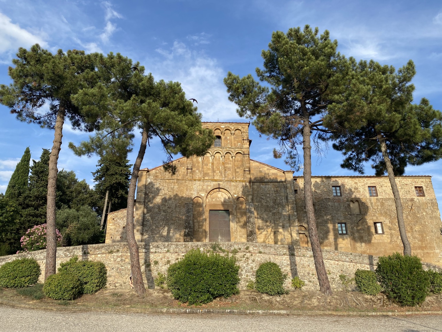


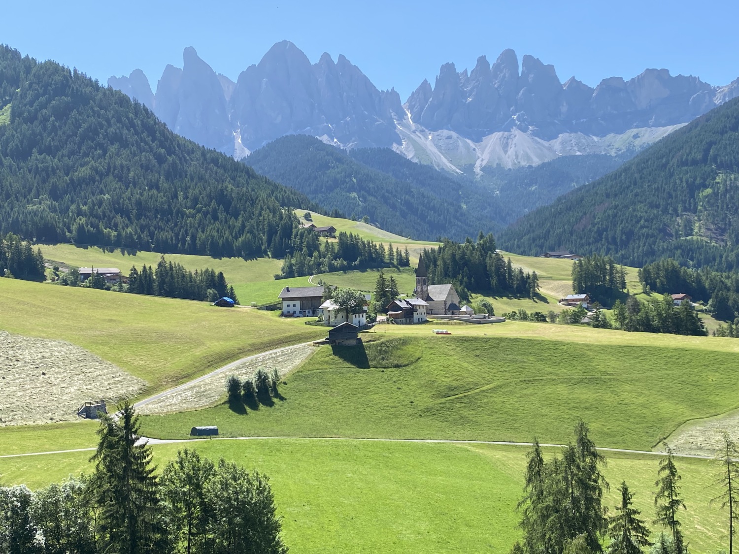


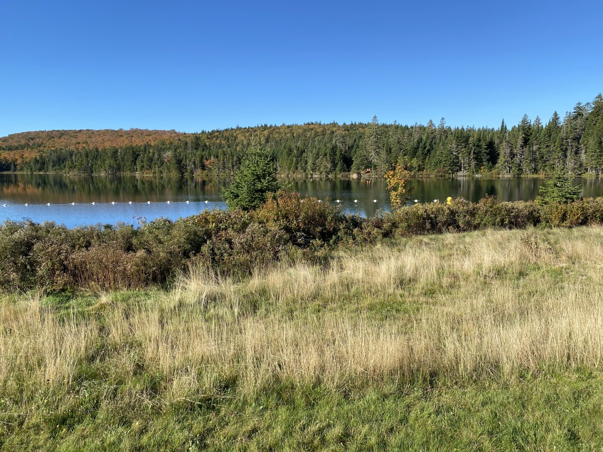


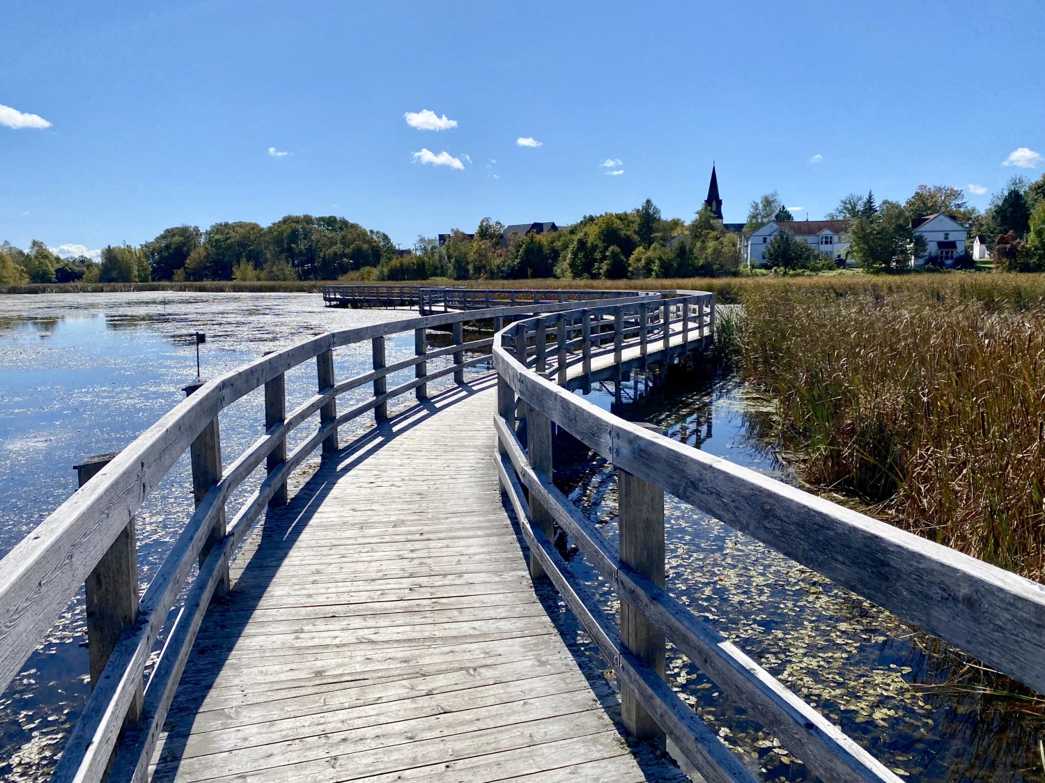


You must be logged in to post a comment.