
Terlingua “Ghost Town”
Wednesday, October 18, 2023: We drove out of Big Bend National Park on its western side, through the Maverick Junction Entrance Station. Shortly after leaving the park, we stopped at the one-time mining district, now “Ghost Town,” of Terlingua. According to the latest census its population is now 78, but it, along with nearby Study Butte, actually provides accommodation and dining options for visitors to the remote Big Bend National Park. The accommodations at Big Bend are slim pickings, and visitors need to reserve rooms up to a year ahead, as we did.
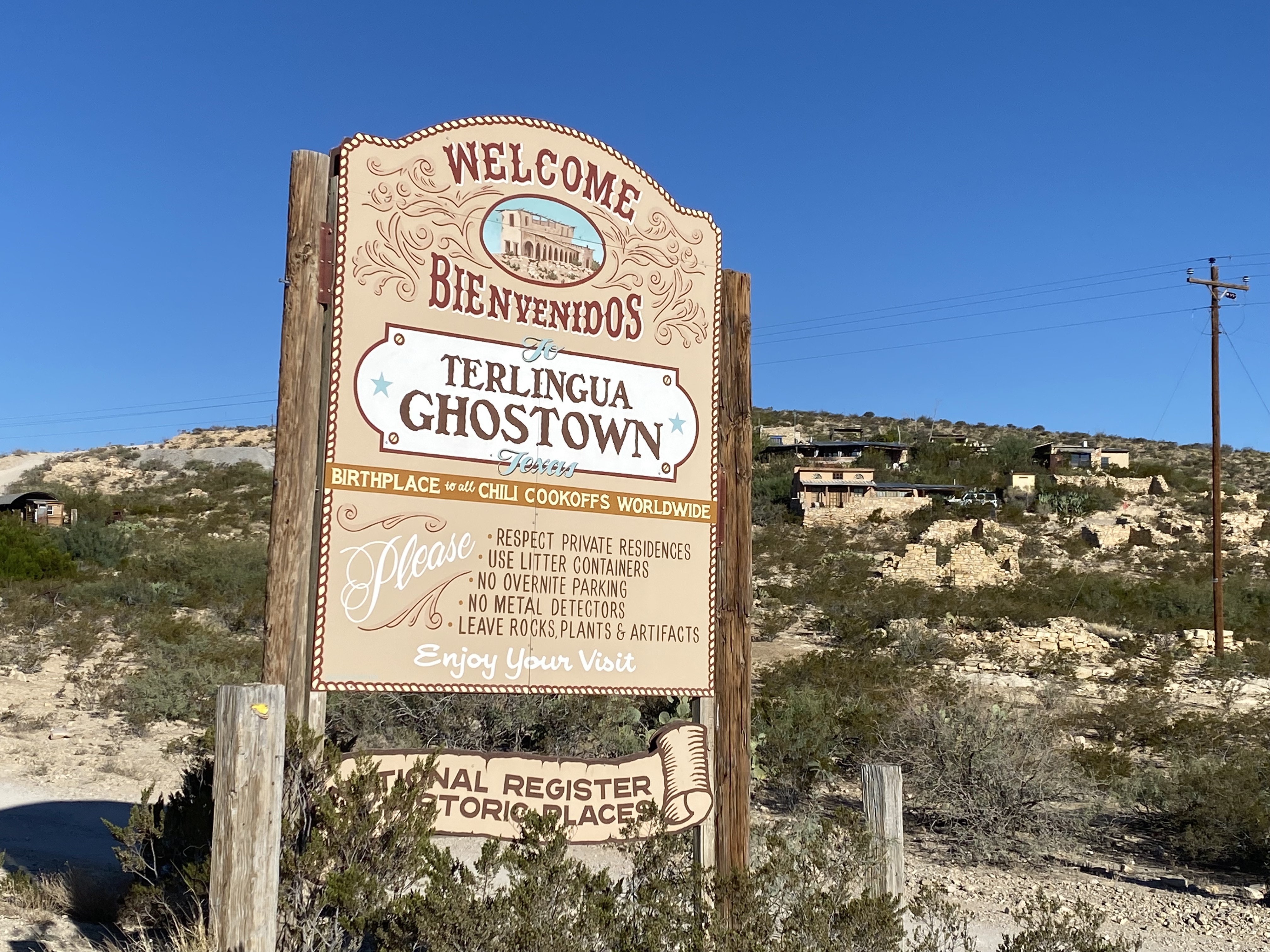
Terlingua Ghostown
Terlingua’s mining operations grew with the discovery of cinnabar, from which the metal mercury is extracted. The mid-1880s brought miners to the area, creating a city of 2,000 people. World War I stimulated an increased demand for mercury, which was used in the manufacture of explosives. European sources for mercury were interrupted by the war, further improving the market for US-produced mercury.
The end of World War I lowered demand for mercury, while ample stockpiles along with resumption of operations by European sources kept prices low. By 1927, increased worldwide economic activity exhausted surplus supplies and then the stock market crash of 1929 and the Great Depression reduced demand in a typical “boom and bust” cycle.
The Chisos Mine operated at a loss until declared bankrupt in 1942. In 1943, the Texas Railway Equipment Company purchased the Chisos facilities and kept the mine open through WWII, hoping to strike an elusive bonanza that never materialized. The site was abandoned in 1946 due to an uncontrollable influx of artesian groundwater into the mine was well as the depressed post-war market for mercury.
The only remnants of the mining days are a ghost town of the Howard Perry-owned Chisos Mining Company (established in 1903) and several nearby capped and abandoned mines, most notably the California Hill, the Rainbow, the 248, and the Study Butte mines.
Though life in Terlingua might have seemed a hardscrabble one, many migrant miners felt it was an improvement from their native Mexico, which was torn by political instability and civil war for the first 20 years of the century. By 1913, Terlingua citizens had access to a well-stocked commisary, an ice-making plant, public food and lodging facilities, erratic telephone service, dependable water supply, and US Mail service three times a week. The Chisos Store attracted people from a 100-mile radius and long outlasted the mines. By 1936, Terlingua’s citizens enjoyed the Oasis Ice Cream Shop and the Chisos Theater for motion pictures. Dances were held most weekends on a concrete slab. A local schoolteacher, Hattie Grace Peters, summed up life there: “We had a good life, we made our fun.”
There are some funky old buildings: a trading post, an old theater, quirky art galleries, restaurants, bars, and coffee shops. Even the one-cell Terlingua jail is open to try on for size.


After having coffee and a shared breakfast burrito at Espresso Y Poco Mas, we stopped at Terlingua Cemetery, where many once-miners are buried alongside more recent residents. It dates to the early 1900s and was for residents and mine workers that succumbed to dangerous working conditions, gunfights, and the influenza epidemic of 1918. It’s an interesting cemetery with rock piles and wooden crosses and is still used by the local community. Each November 2, people gather here to celebrate the Day of the Dead and offer their respect to the departed.


Marfa, Texas
From Terlingua, we drove 2 hours and 20 minutes to Marfa, Texas. I was excited to stop there because it’s so hyped up in guidebooks. I was sorely disappointed. It sits in the high desert in far West Texas, between the Davis Mountains and Big Bend National Park. It is the county seat of Presidio County, and its population as of the 2010 United States Census was under 2,000. The city was founded in the early 1880s as a water stop; the population peaked in the 1930s and has continued to decline each decade since.
Today, Marfa is a tourist destination and a major center for minimalist art. I’m not into minimalist art but it didn’t matter, most of the galleries were closed on Wednesday when we stopped.


We enjoyed walking through the Hotel Paisano, but other than that, the rest of the town wasn’t all that interesting. The hotel opened in 1930 and is best known as the location headquarters for the cast and crew of the 1956 film Giant for six weeks in the summer of 1955. Members of the cast and crew included James Dean, Elizabeth Taylor, Rock Hudson, Sal Mineo, Chill Wills and Jane Withers, among 300+ others. The hotel is built in a Spanish Revival Style; it has a U-shape plan with a large fountain centered in a 50×50 courtyard.


We didn’t leave Marfa until after we found the run-down Highland Service Station, which had been the subject in several paintings in the hotel. The building was added to the National Register of Historic Places on August 1, 1978.


Prada Marfa
We then drove a half-hour to Prada Marfa, a permanent sculptural art installation by artists Elmgreen & Dragset, located along U.S. Route 90, about 1.4 miles northwest of Valentine, and about 26 miles northwest of Marfa (its namesake city). It is out in the middle of nowhere. The installation, in the form of a freestanding building—specifically a Prada storefront—was inaugurated on October 1, 2005. The work is supposedly a critique of consumerism in the U. S.


Guadalupe Mountains National Park
Our last stop in Texas before heading to New Mexico was at Guadalupe Mountains National Park, east of El Paso. The mountain range includes Guadalupe Peak, the highest point in Texas at 8,751 feet (2,667 m), and El Capitan, used as a landmark by travelers on the route later followed by the Butterfield Overland Mail stagecoach line.
According to the National Park Service, the Guadalupe Mountains are among the best examples of a marine fossil reef that formed 260-270 million years ago. During that time a tropical ocean covered portions of what is now Texas and New Mexico. Over millions of years, calcareous sponges, algae, and other lime-secreting organisms precipitated from the seawater to form the 400-mile-long, horseshoe-shaped Capitan Reef. When the sea eventually evaporated, the reef subsided and was buried in a thick layer of sediments and mineral salts. The reef was entombed for millions of years until a mountain-building uplift exposed part of it.
Until the mid-1800s, these remote highlands were exclusively inhabited by the Nde (Mescalero Apache), who hunted and camped there. Later, explorers and pioneers saw the mountains as an important landmark, valuing their water and shelter. These interlopers were not welcomed by the Nde, so in 1849, the US Army began a campaign against them that lasted 30 years. By 1880, the Nde had been driven from the mountains.


Amidst this conflict, Butterfield stagecoaches began carrying mail through the mountains on the first transcontinental mail route. Later, ranches developed around the Guadalupes. In the 1920s, geologist Walter Pratt bought land in McKittrick Canyon, and in 1959 donated his land to the National Park Service. More land was acquired from J.C. Hunter. In 1972 Congress created Guadalupe Mountains National Park.
The sparsely populated plains of the Chihuahuan Desert surround the Guadalupe Mountains. The desert receives between 10-20 inches of rain per year; in summer, temperatures rise to 90°F and above. Despite its heat and aridity, the desert is abundant with life such as agaves, prickly pear cacti, walking-stick chollas, yuccas, and sotol. Lizards, snakes, coyotes, bobcats, and mule deer also live in this vast area.
From the Pine Springs Visitor Center, we walked the Pinery Trail to the mid-1800s ruins of the Pinery Station, a stop on the Butterfield Overland Mail stagecoach line.For 11 months from September 1858 to August 1859, red and green celebrity stagecoaches regularly stopped here for water, food, rest, fresh mule teams, and protection. Each coach traveled day and night, averaging 120 miles a day and carrying up to 9 passengers, essential baggage, and 12,000 letters. Drivers and passengers kept company here with the station-keeper, cooks, herders, blacksmith, roadcrews, express riders, freighers, packers, traders, gold-seekers, adventurers and settlers. Speed was imperative; the grueling 2,700-mile wilderness journey between St. Louis, Missouri and San Francisco, California, was completed within 25 days as promised.
Long after the station was abandoned for a more adequately protected route designed to better serve a chain of forts along the southern military route to El Paso, the high limestone walls continued to provide refuge for freighters, solders, drovers, outlaws and emigrants.
The Butterfield Overland Mail Route was heralded by some as the one of “the greatest events of the age,” and as forerunner of the Pony Express and Transcontinental Railroad, a vital step in the settlement of the West.


We drove to the pleasant restored Frijole Ranch situated in a shady spot near Smith Spring. Two pioneer ranchers, the Rader brothers, settled here in the 1870s with a few cattle. The Smith family moved here in the summer of 1906. They primarily made their living from truck farming and a small orchard. They used the first hydraulic ram in the area to pump water for the house and farm use. The nearest market for their produce was Van Horn, a bumpy 60-mile wagon trip away. The family would leave in the evening, after covering the fruits and vegetables with wet paper and rags to protect them from the heat, and arrive in time to meet the next morning’s customers. During their 34 years here, the Smiths added the kitchen, two bedrooms, and upstairs to the Rader brothers’ original ranch house. They also built the spring house, guest house, and double bath house. A red building was periodically used as a bunk house, storage shed, barn and school house for the eight local children. All these structures were built entirely of native materials. Over the years, this complex served as the community center for dances and other social gatherings and the site of the “Frijole” Post Office from 1912-1940, named by the local folks for their abundant diet of beans.
In the early 1940s, Judge J.C. Hunter bought the Frijole Ranch and many surrounding ranches. He renamed his purchases the Guadalupe Mountains Ranch and covered the mountains with thousands of Angora sheep and goats.


The park covers over 85,000 acres in the same mountain range as Carlsbad Caverns National Park, about 25 miles (40 km) to the north in New Mexico. A hike to Guadalupe Peak apparently offers views of El Capitan and the Chihuahuan Desert, but we didn’t hike it.
We drove to the start of the McKittrick Canyon trail, which leads to a stone cabin built in the early 1930s as the vacation home of Wallace Pratt, a petroleum geologist who donated the land. It was hot and late in the day, and we were on our way to Carlsbad, NM, so we didn’t hike the trail. Rattlesnake warning signs abounded. I wasn’t keen on the possibility of tangling with a rattlesnake!


Carlsbad, New Mexico
Finally on Wednesday evening, after driving over 350 miles from Big Bend, we reached our Airbnb in Carlsbad, New Mexico. We had finished our time in Texas, probably never to return. Though we enjoyed many places and experiences in the state, which I’ve visited 3-4 times in my life, I cannot condone the state’s politics and thus never want to spend any more time or money there.
Steps: 8,856; Miles 3.75. Drove 351.9 miles. Weather Hi 87°, Lo 48°.
Discover more from ~ wander.essence ~
Subscribe to get the latest posts sent to your email.

So much history and amazing scenery in this post – very interesting.
LikeLike
The history of this area is fascinating, Carol. I learned a lot. I just can’t imagine stagecoaches traveling over this rough terrain or people living under these conditions. People had to really struggle to live in these places!
LikeLiked by 1 person
I agree with Carol – but the bit that really stood out just because of its oddity was the Prada shop front. How bizarre is that?
LikeLike
That Prada shopfront is really bizarre, Anabel. And it really is out in the middle of nowhere. But people come to see it from miles around. Just ahead of us a whole family got out of their car in their Sunday best and took many photos of themselves posing in front of this. Crazy!
LikeLiked by 1 person