
I left Omaha on a highway that cut through cornfields neatly trimmed with white wooden fences, all glimmering in the breeze. Vaguely rolling hills, soft and green, surrounded me. It seemed everyone in these parts had SUVs or pickup trucks. Soon I passed a Christmas tree farm called Santa’s Woods.
I was looking for the city of Blair and found “Dana College” painted on the town’s water tower. I went directly to Black Elk-Neihardt Park to see the Tower of the Four Winds, designed by Dana College professor F.W. Thomsen. Built to promote world peace, brotherhood and humanity, it portrays the message of Black Elk, an Oglala Sioux holy man and visionary. He is said to have envisioned a radiant person with outstretched arms in a blessing to all people, standing in front of the tree of life. The 45-foot tower, made from native rock and covered with a 50,000 piece mosaic, represents the messiah-like figure of Black Elk’s vision.

Tower of the Four Winds
Several trails crisscrossed the 80 acres of rolling hills in the park. They included a paved trail with pedestal mosaics by Prof. Thomsen depicting Native-American descriptions of north, south, east and west.


I took a pleasant and breezy stroll around the park in a happy start to my morning. At the “heights,” I had some views of flat Nebraska.

Blair, Nebraksa

Blair, Nebraksa

Blair, Nebraksa


I then crossed the Missouri River into Iowa, where I entered the DeSoto National Wildlife Refuge. Established in 1958, it encompasses land in both Iowa and Nebraska. It lies on the wide plain formed by prehistoric flooding and shifting of the Missouri River. The Refuge’s primary purpose is to serve as a stopover for migrating ducks and geese. Peak populations of 50,000 or more ducks, mostly mallards, are common on the refuge during the fall migration.
The seven-mile-long lake that is the heart of the refuge was once a hazardous bend in the Missouri River. The DeSoto Bend got its name from the nearby river town of DeSoto.
Lewis and Clark’s Corps of Discovery traveled through this area in 1804 and 1806. They set up camp along DeSoto Bend after meeting with Indians at “council bluff” (according to William Clark’s journal) on August 3, 1804.

Desoto National Wildlife Refuge
I looked around the Visitor’s Center, including the goods scavenged from the Steamboat Bertrand, which sank on April 1, 1865.

Facts about Steamboat Bertrand
By the mid-1800s, the Missouri River had become an artery for trade that opened the West. Steamboats carried supplies to the early fur trading posts, frontier settlements, and mining towns. But the turbulent, snag-infested “Big Muddy” took its toll on the early stern and side-wheelers. During the 19th and early 20th centuries, more than 400 steamboats sank or were stranded between St. Louis, Missouri and Fort Benton, Montana.
When the Bertrand sank on April 1, 1865, the Missouri River quickly covered the boat in mud. In 1968, the boat and its cargo were discovered on the refuge and unearthed the following year. The Center holds over 250,000 artifacts from the shipwrecked steamboat.

The Final Voyage
The cargo contained all manner of goods needed for the new Montana Territory, gold mines, logging camps, farms and households. Aside from tools and equipment, even food items and clothing were recovered from the boat. Remarkably preserved, the cargo provided a unique time capsule for researchers.


There were also displays about local history and wildlife at the Visitor’s Center. As the land here was opened up by riverboats, pioneers settled in the area and changed the land to suit their needs. Croplands replaced the meadows of Bluestem and Indiangrass, and native animals were sometimes displaced along with the plants. Today, the Refuge is working to restore pieces of prairie.
The lure of gold along the upper reaches of the Missouri produced a major boom in the middle 1860s. By 1865, eager fortune seekers swarmed over the hills and panned in streams. The activities of miners often produced devastated landscapes, sterile mine dumps, and foul water that killed native fish and made streams unfit for drinking by man or animal. Some mining techniques washed entire hillsides into the valley below, destroying wildlife habitat and polluting mountain streams with silt and other sediments.
Towns in the region became focal points for settlements. Sometimes entire towns sprang up almost overnight on what had once been limitless prairie or wooded river bluffs. The building of a town had much the same effect on wildlife as the activities of the farmer and miner.


I watched the film at the refuge then drove through part of the refuge and took a walk on the Grasslands trail (3/4 mile), where I saw a variety of grasses, goldenrod, and other yellow flowers that looked like rudbeckia – yellow petals with brown faces. Critters kept skittering across the trail in front of me, but they were so fast I couldn’t tell if they were lizards, grasshoppers or tiny frogs. I heard a commotion in a pine tree and saw three large raccoons scampering up the tree. Lots of action in these wetlands!

Grasslands trail

Grasslands trail

Grasslands trail
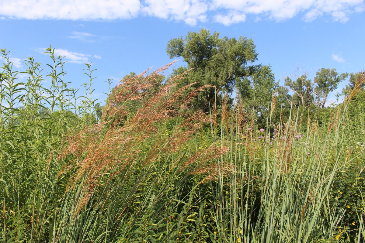
Grasslands trail

Grasslands trail

Grasslands trail

Grasslands trail
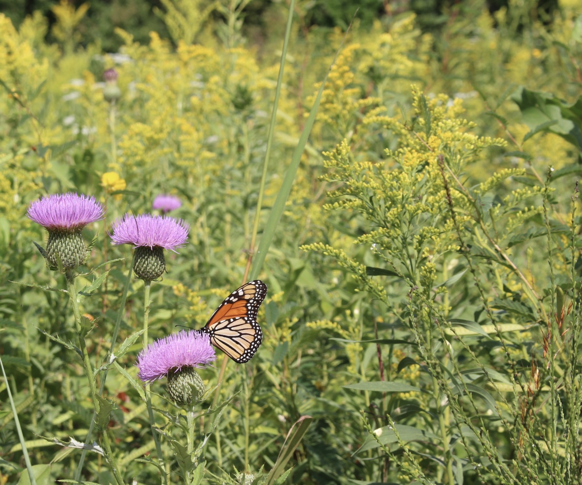
butterfly along the Grasslands trail

Grasslands trail

Missouri River

Missouri River

Missouri River
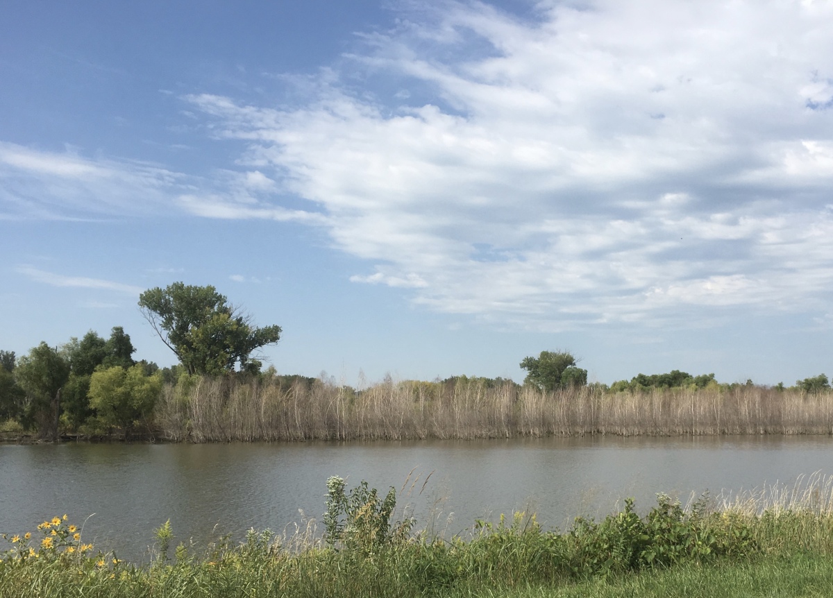
Missouri River
I left the wildlife refuge close to 11:00 a.m. and headed to Fort Atkinson State Historical Park.
*Thursday, September 5, 2019*

Love the grasslands, and the symbols at the 4 winds. America seems so endless to me 🙂 🙂
LikeLiked by 1 person
Thanks so much, Jo. Believe me, on this trip, American seemed endless to me too! I drove over 7,500 miles in all, and much of it over open prairies and grasslands. It was great to see a part of the country I’d never seen before. 🙂
LikeLiked by 1 person
fascinating countryside
LikeLike
Thank you, Indra. The Missouri River plays a big part in the history of the U.S. 🙂
LikeLiked by 1 person
It is always good to know more about countries.
LikeLike
I always love learning about new cultures and places, Indra. Have a great weekend. 🙂
LikeLiked by 1 person
Thanks, Cathy, for this very interesting post, with all the beautiful pictures.
LikeLike
Thank you, Pit, for dropping by and coming along with me. Have you and Mary been to the Dakotas and Nebraska? I do remember for sure you went to Sioux Falls, as you inspired me to go there. 🙂
LikeLike
We have good friends who live in Omaha, so I’ve enjoyed seeing their state through your eyes.
LikeLike
Great! How interesting that you have friends there. I was surprised at what a nice city it was. 🙂
LikeLiked by 1 person
The tower is beautiful, but the thing I found most fascinating is the shipwreck, it’s amazing that they could recover so much.
LikeLike
I was amazed they could recover so much from that sunken boat too, Anabel. It must have been a very messy business.
LikeLiked by 1 person
The artwork is impressive to say the least. I think I’m drawn to the mosaic work on pillars depicting winds and directions. Probably, I don’t apprehend the literal enormity of the tower.
I enjoy your depiction in words and photographs of the refuge. We were so wanton about settling and taking what we wanted. If the current administration should have its way, we’d be wanton again.
Thank you, Cathy, for this beautiful and thoughtful post.
LikeLike
I loved those mosaics on the pillars too, Christopher. The tower is quite large, but maybe looks more so because it sits on a hill. I learned a lot at DeSoto Refuge; we don’t often realize how much damage we do everywhere we settle, but places like this are a good reminder. And for sure, if the current administration had its way, we’d certainly be even more wanton! Thanks for coming by to visit, and as always, for your thoughtful comment. 🙂
LikeLike
As usual, lovely images and I think my favourites have to be the Missouri river ones, although the photographs of the wildlife park are outstanding. Fascinating place.
LikeLike
Thanks so much, Mari, for coming along! The Missouri River isn’t the most scenic river I’ve seen, but it certainly has lots of personality. It has a mind of its own, apparently. I’ll be talking more about it in the coming months. 🙂
LikeLike