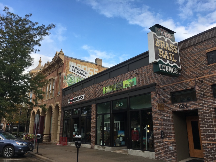
We started our day in Rapid City under gray clouds and sputtering rain, with a 48°F chill in the air. We strolled around the town, past various storefronts, the Elks Building, and the original 1915 Rapid City Fire Department.
We visited the Alex Johnson Hotel, one of the tallest buildings in town. Project construction began in August 1927, one day before work began carving the granite faces of Mount Rushmore. We stopped at the Alex Johnson Mercantile for earrings, a mug, a dragonfly bag and some cards.
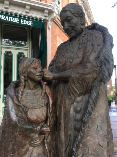
We wandered past some of the many president sculptures and some Native American sculptures as well.
We walked through Art Alley, but it wasn’t nearly as nice as the one in Bismarck, North Dakota, which I wrote about here: bismarck art alley.
Rapid City was a cute town, but we had to be on our way to Nebraska.
We were on 79S by 10:05. We passed Roy’s Drive-In, an old drive-in theater that was still operational. We saw the Black Hills to the west, as well as the Needles. A bull humped a cow in a field and a cluster of beehives buzzed with activity. We were going straight south on the Plains.
By 10:30, the temperature had gone up by 10°F and the rain had stopped. The sun was peeking through the clouds. I mailed a postcard to myself at the Rapid City Post Office.
We passed French Creek, hay bales, black cows with white faces, brown cows, and painted brown and white cows. I don’t know my cows, but they could have been Black Angus, Hereford (brown & white painted), Red Angus, Holstein (black & white) or Limousin (golden red).
It is often said that there are more cows than people in South Dakota, according to the South Dakota Breeds Council. I saw signs for the Wyoming Quilt Trail, an extension of the American Quilt Trail movement that is alive and well throughout the United States and beyond.
We heated leftovers in a gas station microwave, and ate a lunch of shrimp and broccoli, and leftover chile relleno and tamale, rice and beans.
A sign for the Wild Horse Sanctuary informed us that the 2004 film Hidalgo was filmed in this area. In Ardmore, we left behind a bunch of junk.
Bruce Springsteen sang “Nebraska” as we crossed the state line: Welcome to Nebraska … the good life. Home of Arbor Day.

Nebraska . . . the good life Home of Arbor Day
We drove through the Oglala Grassland and the temps were finally up to 65°F by noon. I looked up the population of the states I’d visited:
- Nebraska: 1.9 million (37th in size) (77,358 square miles)
- South Dakota: 882,235 (46th) (77,116 sq. miles)
- North Dakota: 760,077 (47th) (70,761 sq. miles)
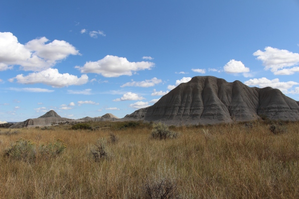
We drove down a 13-mile dirt road to Toadstool Geologic Park; the road ran alongside a railroad. The clouds looked like a still life painting, almost fake.
Thirty million years ago, this was an ancient river valley where miniature horses, humpless camels, gigantic tortoises, pigs and even rhinoceroses roamed. The broad shallow river current carried volcanic debris that, layer upon layer, formed the rocks found here today. Over time, water and wind sculpted the rock into badlands.
We walked a 1.2 mile loop hike. The trail wound along dry stream beds, through gullies, and over sandstone rock.
The first visitors in the 1800s must have felt they were traveling through a land of giant mushrooms. They labeled the jumble of sandstone slabs resting upon their clay pillars “toadstools.”
Toadstools are created by the forces of wind and water, eroding the soft clay faster than the hard sandstone that caps it. Erosion collapses the toadstools while new ones form.
By 1:40, we were leaving the Oglala National Grassland. Cattails lined the road. A train barrelled past across the prairie.

Train tracks near Toadstool Geologic Park
By 1:45, we were off the dirt road. We saw longhorn cows and strangely-shaped cliffs and ridges as we approached Crawford, Nebraska.

cliffs and ridges near Fort Robinson

cliffs and ridges near Fort Robinson
At Fort Robinson State Park, the Post Headquarters was constructed in 1905. The Post Commander’s office was located here, along with other administrative offices, post office, and the Fort’s telephone exchange. The Nebraska State Historical Society opened the Fort Robinson Museum in June, 1956, as part of the effort to preserve Fort Robinson’s Heritage.

Fort Robinson Museum and History Center

Fort Robinson Museum and History Center
At the Fort Robinson Museum and History Center, we learned that the Fort Laramie Treaty of 1868 resulted in a Sioux political victory. The United States Army had to abandon Forts Phil Kearney, Reno and C.F. Smith in the heart of the northern hunting range; the Bozeman Trail was closed. Although the Indians were allowed to hunt on this land the government expected them to begin permanent settlements on the newly established reservations. They would receive food and clothing and an education while making the transition from a life of hunting to farming.
Commissioners arrived in Fort Laramie on April 19, 1868 to begin the negotiations. Spotted Tail, the Brule Sioux chief, signed the treaty before the end of the month. Red Cloud, the Oglala leader, did not arrive until October 4 and questioned the terms of the treaty for nearly a month before signing. The treaty of 1868 established the Great Sioux Reservation and called for an agency or administration headquarters to be located near its center. In August of 1873, the Red Cloud Agency moved from North Platte River to White River, near Crawford, Nebraska.
In March of 1874, the U.S. Government authorized the establishment of a military camp to protect the Red Cloud Agency and its employees. Some 13,000 Lakota had been resettled at the Agency, some of them hostile. Tensions grew between whites and Lakota, who had been forced off much of the land.
War was almost assured between the United States and the Sioux, Cheyenne, and Arapaho tribes after November, 1875. President Grant instructed the army to ignore the trespassing miners in the Black Hills. Meanwhile the Bureau of Indian Affairs ordered the Sioux to settle on the reservation. Those who disobeyed would be brought in by force.
Full scale war broke out in 1876. Named after Lt. Levi H. Robinson, who had been killed by Indians while on a wood detail in February, Camp Robinson served as a base of operations for military expeditions against the Indians during the Sioux Wars of 1876-1890.

The Sioux and Arapahoe Delegations

decorative Native American items
The War Chief Crazy Horse surrendered here with his band of 889 followers on May 6, 1877, bringing the Sioux War to an end.
In late summer, rumors spread that Crazy Horse and his band were planning to break away and renew war with the whites. On September 3, department commander General George Crook ordered him arrested. In the meantime, Crazy Horse fled to the Spotted Tail Agency, forty miles northeast. There he was convinced to return to Camp Robinson and give himself up. At 6:00 p.m. on September 5th, he rode in, escorted by friendly Sioux scouts.
Crook ordered several of his band accompany Crazy Horse to Fort Laramie that evening, then to Cheyenne, and on by rail to division headquarters at Chicago to see General Phil Sheridan. Crazy Horse was taken to the guardhouse to await departure.
After a brief scuffle inside the guardhouse, Crazy Horse bolted out the door and received a fatal bayonet wound from the sentry outside. He was then moved to the adjoining adjutant’s office, where a surgeon provided the dying man with medical aid.

Illustration of Crazy Horse being killed by bayonet
With the Sioux War at an end, the Red Cloud Agency was moved to a new site on the Missouri River. There it would be less costly to deliver annuities and rations. The Oglala hated the Missouri River country and opposed the move, but they had little choice. On October 25, 1877, they began the long march to the river. In the spring they came back to a new agency called Pine Ridge.
On December 30, 1878, Camp Robinson was redesignated as a fort. The name change signaled its status as a permanent military post.
In 1885, the 9th Cavalry regiment, nicknamed the “Buffalo Soldiers” by Native Americans, was stationed at Fort Robinson for 18 years. This was an all-black unit with mostly white officers.
Dr. Walter Reed was stationed at Fort Robinson from 1884-1887. After leaving the fort, he was able to prove in 1901 that yellow fever was carried by a certain species of mosquito.

Dr. Walter Reed
In 1886, the Fremont, Elkhorn and Missouri Valley Railroad reached Fort Robinson, stimulating settlement in the area. The railroad assured Fort Robinson’s survival, while causing other posts to close.

Fort Robinson State Park
Below is a buffalo overcoat worn by Captain John Kerr, Sixth Cavalry, in 1891.

buffalo overcoat worn by Captain John Kerr
The peaceful life at Fort Robinson was broken when war with Spain was declared on April 19, 1898.
In 1902, the men of the “Fighting Tenth” Cavalry, veterans of the battle of San Juan Hill, made their headquarters here. Four years later, the 10th helped capture Ute Indians who had fled their Utah reservation, the last military action against Indians on the northern Plains. In 1907, the regiment left for duty in the Philippines.
In 1919, after the end of World War I, the fort became a Remount Depot for the U.S. Army’s Quartermaster Corps. Horses were purchased and then shipped here for conditioning and issue to the mounted services. The fort maintained registered stud horses to improve the breeding of horses in the region for potential military purposes.
The fort was selected as the summer training site for the 1936 United States Olympic Equestrian Team. The American team won several medals for individual events at the Berlin games. Training continued here from 1937-1939 for the 1940 games to be held at Helsinki, Finland, but World War II broke out in September 1939.
America was plunged into World War II on December 7, 1941. Military events around the globe indicated that horses were outmoded, of limited value in combat, and expensive to feed. The “horse soldiers” of the Fourth Cavalry exchanged their animals at Fort Robinson for armored cars in April 1942.
In World War II, the fort was the site of a K-9 corps training center. Dogs were trained for guard duty, to sniff out mines, to carry messages, and to pull sleds. The dogs were donated by private citizens, and most large breeds of dogs were used.
The prisoner of war camp at Fort Robinson opened in November 1943. It had a capacity of 3,000 men, although initially only about 700 German Afrika Korps enlisted men were held here. By December 1944, however, the camp reached its maximum population. Early in 1945, it was designated a naval camp, and German sailors replaced most of the army prisoners. Most of the POWs appreciated the fair treatment they received. The Fort Robinson POW camp closed in May 1946.
The army still needed pack mules on isolated battlefields in places like Italy, China and Burma. Fort Robinson trained and shipped out over 10,000 mules before the war ended in 1945.
The U.S. Army abandoned the fort in 1947; it was transferred to the USDA for a Beef Cattle Research Station. In 1956, a museum opened.
In 1971, the USDA closed its operations and transferred the property to the State of Nebraska.
We intended to go to Agate Fossil Beds National Monument, but we had a tire pressure problem on the driver’s side rear tire, which sent us to a gas station in Crawford and down Rt. 71S, making us miss the monument. That was our reward for driving too fast over that 13-mile dirt road to Toadstool!
We headed on to Scotts Bluff, Nebraska to finish up our day.
*Steps: 11,851; 5.02 miles*
*Sunday, September 22, 2019*


We have good friends who live in Nebraska. Hopefully we’ll get to see all this for ourselves one day.
LikeLike
I hope so. Which town do they live in?
LikeLike