
On my second day of driving back across country from my Four Corners trip, I stopped to visit the Gateway Arch National Park in St. Louis, Missouri. I had visited the Arch in 1979 with my first husband, but at that time I had never heard of the National Parks Passport, so I didn’t get a cancellation stamp. We had only stopped briefly, and we didn’t take the tram inside the Arch to the top, where we could see views of the city of St. Louis and the Mississippi River. On this day, I took the tram to the top and also got my cancellation stamp. 🙂
The Gateway Arch soars 630 feet in a graceful curve on the eastern shore of the Mississippi River, with the city of St. Louis to the west. It stands on ground that was once the original village of St. Louis, founded in 1764. By the 1840s, this spot was the center of a bustling riverfront district, where explorers, fur trappers and covered wagon pioneers readied themselves for their journey westward.

The Gateway Arch
The idea to memorialize the role of St. Louis in the western expansion of the United States was proposed in the 1930s but it took 30 years to complete. Hoping to revitalize an ugly and rundown waterfront, the idea was set in motion, with President Franklin D. Roosevelt creating the memorial by executive order in 1935. The National Park Service was chosen to manage the memorial and to research the history of the site. Between 1939 and 1942, 40 blocks of condemned buildings were razed.
In 1940, the city deeded the Old Courthouse, the historic building in which the Dred Scott case began (a case that pushed the nation closer to Civil War), to the National Park Service. It was incorporated into the memorial.

Old Courthouse in St. Louis
Just as progress was being made, the nation became embroiled in World War II. After the war, Luther Ely Smith, the prominent St. Louis attorney who had instigated the process of creating the memorial, raised money to fund an architectural contest, hoping for something “transcending in spiritual and aesthetic values” which would attract visitors from at home and abroad. The design by Eero Saarinen was selected, although none of the judges actually believed the Arch could be built.
After delays caused by the Korean War, President Dwight D. Eisenhower signed a bill authorizing the memorial in 1954. There were many challenges in building a 630-foot arch that could support two leaning legs up to the point where a keystone section could be inserted. You can read more information about the architecture here.
Before going up into the arch, I took a walk by the riverfront where one-hour riverboat cruises along the St. Louis downtown riverfront are available.

Riverboat Cruises on the Mississippi River
At 1:10 p.m., as per my timed entry ticket, I took the four-minute tram ride to the top of the Arch. From the inside windows, the view stretches for miles east and west over metropolitan St. Louis, including the Mississippi River and Illinois. The observation room comfortably holds about 100 people. On most days, no motion can be felt at the top, but when the wind picks up, the Arch gently sways several inches from side to side. Engineers estimate that in a 150 mph wind, the arch will sway only 18″ at the top. I felt a slight movement while I was up there.

view from the top of the Arch


The stability of the Arch arises naturally out of a few elegantly simply ideas. No inner frame or skeleton holds it up. It traces the lines of a “catenary” curve, the curve that an idealized hanging chain or cable assumes under its own weight when supported only at its ends. This is a sound shape for a standing arch. All the forces of thrust are kept in the center of the legs and transferred directly to the massive concrete foundations, which are sunk deeply into bedrock.

The Gateway Arch view from the river
The legs of the Arch are equilateral triangles, the most rigid geometric shape in nature. With a taper diminishing from 54 feet on a side at ground level to 17 feet at the top, the shape reduces wind loading and virtually eliminates stresses caused by oscillations.


After going to the top, I walk down by the riverfront and then all around the surrounding park.

Riverboat Cruises
I circle the Arch, getting closer to the Old Courthouse.

Old Courthouse in St. Louis
From this side, I see the base and the Arch looking the east toward the Mississippi River.

Gateway Arch from the Old Courthouse
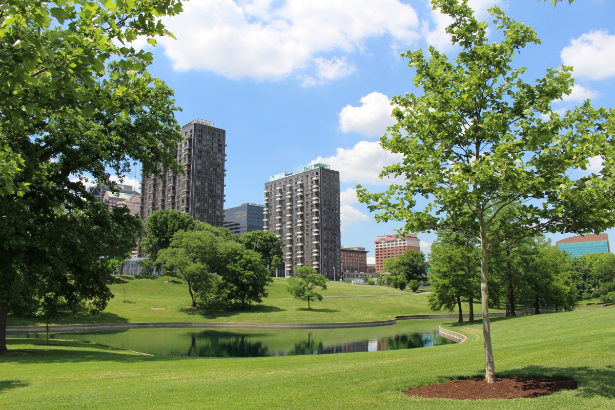
The landscape around the Arch reflects the curvilinear nature of the structure. Curves define the entire landscape, from the gentle arc of tree-lined paths and staircases to the retaining walls and the flowing ribbons of the ponds edges.

Hyatt at north end of Gateway Arch National Park

serpentine ponds at the park

The Gateway Arch
Gateway Arch National Park


Of course, I got my sticker and cancellation stamp. 🙂

Gateway Arch sticker and cancellation stamp
*Thursday, May 24, 2018*
Steps: 9,609 (4.07 miles)
Below are photos of Bill and me during our 1979 trip to St. Louis and the Gateway Arch.


***********************
On Sundays, I post about hikes or walks that I have taken in my travels; I may also post on other unrelated subjects. I will use these posts to participate in Jo’s Monday Walks or any other challenges that catch my fancy.
This post is in response to Jo’s Monday Walk: Boa Vista.

Fabulous photos – we were in St Louis several years ago and went up into the arch – wasn’t as clear a day as yours though!
LikeLiked by 1 person
I was lucky to have a good view that day, Marie. I’m glad you went up into it too. It’s one of those experiences you feel like you should do. 🙂
LikeLike
That is one beautiful arch and I’m glad you’ve blogged about it as I doubt I shall ever get to see it. I liked that you included a link to the full description which was fascinating, but mostly I enjoyed your images and the views from the top. I did a Mississippi cruise many, many years ago and would have loved to have shown my images of life then along Old Miz but I was taking slides in those days and somehow they got damp and turned a nasty shade of pink. Little did I know years ago that if I’d kept them I could have recovered them somewhat with Photoshop today. What a waste. Still, you are here to fill in the gaps for all of us and a big thank you for this post.
LikeLiked by 1 person
Thanks, Mari. It seemed to have changed a lot since I was there in 1979, especially the landscape. I still haven’t ever taken a Mississippi Cruise. I was driving through that day and had a long trip ahead of me, so I couldn’t take one. I hope you enjoyed the experience. That’s a shame about your slides. Photoshop is amazing these days, but sadly I have to confess I don’t know much about all its features. I’m glad you enjoyed the post, Mari. You’re so kind and thoughtful with your comments. 🙂
LikeLike
No. I still can’t see any windows up top. And I can’t imagine a tram inside that arch. Do you have any interior images? Great views over looking the city.
LikeLiked by 1 person
That trams inside was not ideal [BIG understatement] for claustrophobic people. But the viewas from the top of the arch were worth it. More here: https://wp.me/p4uPk8-T6
LikeLiked by 1 person
Thanks for the link Pit. Gosh they are small, you wouldn’t want any overlarge people sharing with you and I can see why knees where touching! I couldn’t go in that, even though the views from the top are great.
LikeLiked by 1 person
I certainly think there’s kind of a “natural size limit” in these. 😉
LikeLiked by 1 person
For sure!
LikeLiked by 1 person
I didn’t think it was that bad, but I only had 3 women in my module. 🙂
LikeLiked by 1 person
It wasn’t totally full when I went up, just three women, so it didn’t seem too claustrophobic to me. I’m easily claustrophobic too, so I’m glad it wasn’t too crowded. 🙂
LikeLike
The tram was very tiny, Jude. It kind of made me think of being in a closed-in container on a Ferris Wheel. I think it only fit 4 people. I didn’t take any interior pictures, sadly. But I see Pit included a link, which I haven’t yet looked at. 🙂
LikeLiked by 1 person
Pit’s link is very informative. I wouldn’t like to go into that capsule!
LikeLiked by 1 person
Yes, I just read it. I loved how he went to the Courthouse and got a picture of the model of the module. That was perfect. 🙂
LikeLiked by 2 people
Thanks for the praise, you two! 🙂
LikeLiked by 1 person
Great pictures, Cathy. Even if we spent a few days there, you still show me a lot I haven’t seen: thanks for sharing!
So you did feel the )little) swaying of the Arch, too. When we were up there, there wasn’t much wind really, but we still could feel the swaying, and I must admit, it did make me feel slightly uncomfortable. Did you take one of the river cruises, too? We did, and we enjoyed it very much.
In all, we had a great time there, sightseeing and bicycling, and enjoying one of the best meals I’ve ever had. My account of our visit to St. Louis starts here [https://wp.me/p4uPk8-Qz], with our trip up there from Hot Springs/AR. Since there was so much to see and to narrate about, it took me 7 more posts to write everything. 😉
LikeLike
I just did a stop through at the Arch, Pit, as I was driving from Kansas City to Lexington. So I didn’t spend much time here. I would like to explore some of downtown St. Louis. I’ll have to check out your blog posts, but as I’m traveling now, I’ll do it once I return home. Thanks for sharing! Seven posts!? I better sit down for a spell to read it all. 🙂
LikeLiked by 1 person
It’s 7 posts because Mary and I did quite some bicycling I wanted to tell about, plus I really needed to tell about our fantastic supper one evening.
LikeLike
What a beautiful structure – I haven’t heard of it before. I like the old photos too!
LikeLiked by 1 person
Thanks, Anabel. I usually overlook the Midwest, but I’m determined to explore areas throughout the country in the coming years! I’m glad you liked the old photos too. 🙂
LikeLiked by 1 person
It’s a good-looker, isn’t it, Cathy? 🙂 🙂 Many thanks for sharing it and the lovely surrounds.
LikeLike
Thanks, Jo. I was glad I got to return and see the views from inside the Arch. 🙂
LikeLike
They’re beautiful! Sorry about the ‘e’. It was actually a damp Carnival and they started the parade without the floats, but as it dried up a little they brought them out and the place went wild 🙂 🙂 Think our walk may be rained off this morning, which will be a huge shame, but we do need a little rain. Better now than when James comes in 4 weeks time!
LikeLike
Sorry about the rain but at least you had your celebration once the rain died down. The weather at this time of year is iffy everywhere I guess. We were out and about yesterday in the 20s, but at least it was sunny. We had a snow-rain mix on Sunday. I hope you have fun when James visits!
LikeLiked by 1 person
[…] The Saint Louie Gateway Arch […]
LikeLike
We would love to do a riverboat cruise one day!
LikeLike
Me too!
LikeLike
I’ve seen photos of this arch but never knew about its history or construction, and I had no idea one could go inside! Very interesting post.
LikeLike
I was a little nervous about going inside (it seemed it would be claustrophobic!), but I’m glad I finally did it. Thanks so much for dropping by, Karen. ~Cathy
LikeLiked by 1 person
I love visiting St. Louis!! I grew up about 3 hours away in Northeast Arkansas and we traveled there frequently. My husband had never been, so last October for our anniversary we made the 4.5 hour trip to spend a weekend there! Lots have changed in just the last 20 years since I had been, but it was fun and neat to see as an adult!
LikeLike
I wish I had stayed to visit more of St. Louis and I may have to make another trip there before long! I stopped when driving 3 full days back from Colorado, so I only had time for the Arch. I’m glad you loved it so much and that you had a great anniversary celebration. Thanks for dropping by and commenting, Marley. 🙂
LikeLiked by 1 person
Understandable! It’s a fun city, and lots to do. We only spent 2 days there in October and I had it packed full of things to do.
No problem, I enjoyed reading your post. 🙂
LikeLiked by 1 person
Thanks! I sometimes only give myself 2 days in a city, but often I wish I had one more! I’ve been trying to give myself three when I can. 🙂
LikeLiked by 1 person