
This May morning, we’re on our way to Canyonlands National Park from Moab. Heading south on UT 313, we drive past Navajo Rocks Mountain Bike Trails: Ramblin’ Big Mesa and Middle Earth, with biker access for Coney Islands and Rocky Tops. We drive through open range and rugged vistas.

along the drive to Canyonlands

open range on the way to Canyonlands
Canyonlands National Park preserves some 337,598 acres of colorful canyons, mesas, buttes, fins, arches and spires in the heart of Utah’s desert. There are two main areas in Canyonlands (along with two less accessible ones). Island in the Sky is closest to Moab, a drive 10 miles north and 22 miles south; it rests on sheer sandstone cliffs over 1,000 feet above the surrounding terrain. Unfortunately, this is the only area we have time to visit while in Utah.
The Needles, which is accessed through an entrance 40 miles south of Moab, and another 35 miles west, is named for the colorful spires of Cedar Mesa Sandstone that dominate the area.
Today, we take the 34-mile round-trip scenic drive along the mesa top, stopping at the various viewpoints and taking several hikes along the way.
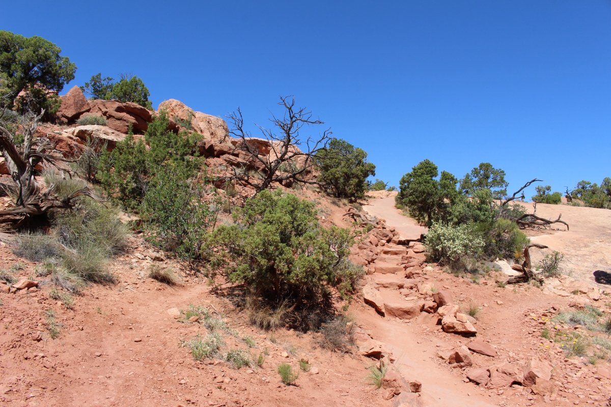
Our first hike is to Upheaval Dome. The trail leads to two scenic overlooks along the rim of a three-mile wide 1,000-foot deep crater.

starting the Upheaval Dome Hike
Upheaval Dome hike
We stop at the first overlook at Upheaval Dome, which has mysterious origins. It was possibly caused by a meteorite that created a big splash of minerals when it hit or a salt dome that originated from within the earth.

Upheaval Dome
One theory of Upheaval Dome’s origins, the salt dome theory, surmises that an inland sea covered the area 300 million years ago. Climate change caused the water to evaporate, leaving a thick salt deposit behind. Layers of sediment built up over the salt and hardened into sandstone, pushing down on the salt until a bulge formed in the salt layer. An upheaval dome appeared on the surface, which eventually eroded. If this theory is true, Upheaval Dome would earn the distinction of being the most deeply eroded salt structure on earth.

Upheaval Dome
The meteorite theory surmises that a meteorite with a diameter of approximately one-third of a mile crashed into this spot 60 million years ago. The impact created a large explosion, sending dust and debris high into the atmosphere. The crater left behind was initially unstable and some areas collapsed while other spaces filled from below by rock and salt moving up into the sudden opening in the earth. Erosion since the impact has washed away any meteorite debris, and now provides a glimpse into the interior of the impact crater, exposing rock layers once buried thousands of feet underground.

Upheaval Dome
Was it a great upheaval or a meteorite crashing into earth that caused the crater? Scientists are now fairly certain Upheaval Dome was created by a meteor.
We continue our hike past the first overlook to the second overlook, where we can see some of Upheaval Canyon to the west. Much of this hike is up and down over slickrock. A churlish wind is blowing red dust into our faces, eyes and mouths. I have to rinse out my mouth and spit out the water-sand mixture. It’s hot today, 85 degrees F, and I’m covered in a layer of sweat and my skin is sticky and gritty.


The Upheaval Dome Hike is about 1.8 miles round trip and takes us about an hour.
We pass Whale Rock as we leave this northwestern point in the park. This long sandstone formation looks like a giant beached whale that came ashore on the Island in the Sky.

Whale Rock
Of course, I had to get my sticker and cancellation stamp for Canyonlands National Park. 🙂

Cancellation stamp for Canyonlands National Park
*Thursday, May 10, 2018*
***********************
On Sundays, I plan to post various walks that I took on our Four Corners trip as well as hikes I take locally while training for the Camino de Santiago; I may also post on other unrelated subjects. I will use these posts to participate in Jo’s Monday Walks or any other challenges that catch my fancy.
This post is in response to Jo’s Monday Walk: Cotherstone and the Teesdale Way.

You have done some amazing walks over the past few weeks Cathy and I think you must be well and truly ready for the Camino. What an interesting back story to this walk too
LikeLiked by 1 person
Thanks, Pauline. All these walks in the Four Corners were in May, when I was at my strongest. Believe me, things have gone downhill since then, but I’m hoping to recover and to embark on my journey, letting the Camino train me! Thanks for your encouraging words. It’s less than two weeks now till I fly off to Lisbon and begin my journey. 🙂
LikeLike
The time has flown by. Have a safe and happy journey
LikeLiked by 1 person
I’m enjoying these arid landscapes and sculptured rocks. The scenery is fabulous.
LikeLike
Thanks so much, Carol. I enjoyed these landscapes too. It’s funny, now that I’ve been assembling photos, they’re starting to all look alike! I see you posted your first Canadian post. Will have to visit this afternoon after my walk. 🙂
LikeLiked by 1 person
Yes, Canada posts have begun! There will be many. We did so much in our five weeks away.
LikeLike
Ok, I better get over there now!
LikeLiked by 1 person
Island in the Sky was the only part we had time to visit too. We are gradually slowing our road trips down (ie more nights in fewer places) but it’s still never enough.
LikeLike
I know what you mean, Anabel. We saw a lot around Moab, but still there wasn’t time to squeeze everything in, though we stayed 3 nights. It’s all so time-consuming, especially if you do any hiking. 🙂
LikeLiked by 1 person
Upheaval is right, Cathy! Pauline is right with the encouragement. You have done a lot of walking, and in tricky terrain some of the time, so you’re all set so long as the knee plays ball. Thanks so much for the link, hon. 🙂 🙂 Have a great week!
LikeLike
I did so much walking in March, April and May, Jo, but my training since then has gone downhill as I’ve been working to get my knee in shape with physical therapy, riding the indoor bike and walking without a pack. At this point, as it’s getting better, I don’t want a setback, so I’m just going to wait and let the Camino train me! Some of the terrains in the trip out west were challenging, so it was good for me for sure. But May seems so long ago now. Enjoy your weekend too. Any bites on the house yet? 🙂
LikeLike
Sometimes last weekend seems a long time ago, Cathy! 🙂 🙂 A few viewings but nothing definite.
LikeLiked by 1 person
wouw.. what a beautiful landscape and photos. Is it easy walk or difficult?
LikeLike
Thank you so much, Mickey and Yunni, and thanks for dropping by. This walk was a bit difficult, but not too much. Mainly it was the wind and dust that made things difficult. 🙂
LikeLiked by 1 person
I’m always impressed by your stamina, Cathy!
LikeLike
Thanks, Sue. This was all back in May, so now that I’ve been waylaid by my knee for two months, my stamina isn’t as great. 🙂
LikeLiked by 1 person
Well, here’s wishing you all the best for the Camino!
LikeLiked by 1 person
Thanks, Sue! I’ll need all the luck I can get. 🙂
LikeLike
Good morning, Cathy,
I admire your stamina on these hikes! I don’t know if I could do that. As much as i’d want to see all those gorgeous sights. All te more I’m happy that I can “wander” around in them in your blog here. 😉 Thanks for the pictures. And the interesting texts.
Have a wonderful Sunday,
Pit
LikeLike
Good morning to you, Pit. By the way, I saw you have some new posts, so I will try to get over the visit them later today.
I have to build up stamina for the Camino coming up, and I’m still not up to speed; this hike wasn’t too strenuous actually, mainly the wind, heat and dust were the issue. Those hikes to Delicate Arch and Landscape Arch at Arches were more strenuous than this one. Have a wonderful week.
LikeLike
Good luck with your preparations, and especially with your knee. How hot will it be on the Camino?
LikeLike
Thanks, Pit. Not too hot, I hope. But it probably will be warm at least in September. 🙂
LikeLike
I’ll be keeping my fingers crossed, and looking forward to your posts about that trek.
LikeLike
Thanks, Pit. 🙂
LikeLike
“Churlish wind” or not, you took some wonderful photographs. How I love those ancient junipers against the red rock and blue sky! I’m curious – thinking about your whole Four Corners trip, what did you like the most, or what intrigued you the most?
LikeLike
Thank you, Lynn. That was an interesting hike and I loved all the junipers everywhere. As for what intrigued me, the Four Corners was a great trip overall, and I have a lot of thoughts about it that I’ll be posting on October 1. Basically, I was depressed over the state of poverty on the reservations, overwhelmed and awed by the landscapes, and impressed by all the cave and canyon dwellings left behind by ancient people. I also was pleasantly surprised and delighted by the remnants and vintage signs, hotels, etc along the Old Route 66. There will be more detail about my whole experience in my 10/1 post. 🙂 Thanks for asking about it.
LikeLike
All of what you said makes sense. The question of reservation life is so complex….for me, it’s more front and center now, since there’s a small reservation nearby that I drive through once in a while. The most disturbing thing about it so far, is its proximity to a cute, artsy town full of well-off whites that sits directly across a narrow channel. Living on either side would be painful for me, with the raw juxtaposition of haves and have-nots.
We had a fascinating conversation with an older Hopi man, a silversmith, who had moved back to the reservation, intentionally. This was near Second Mesa in AZ. He talked about being sent away to school as a child, the loss of language and culture, etc. Along with isolation comes the chance to strengthen the culture. Like I said, it’s complicated.
I’m looking forward to that post…which will happen when you’re away, right? I realize you’re probably used to scheduling posts.
LikeLike
Thanks for your thought-provoking comments, Lynn. Seeing that gap between the haves and have-nots is always disturbing, and it seems a more glaring gap as each day goes by. I wish I’d made it to Second Mesa; it was on my itinerary but the drive there was quite out of my way and I was getting travel-weary by then. I’m sure when the silversmith moved away, he did feel a loss of culture and language. I know it must be complicated.
I haven’t often scheduled posts in the past but now that I have a set schedule on my new blog, I hate to lose momentum. So, during my entire trip on the Camino and to Portugal, I have posts scheduled. 🙂
LikeLike
Another fabulous landscape to enjoy with you Cathy. I really enjoyed our time in the Canyons region, doing scenic drives and stopping to do short hikes and take plenty of photos. I’m sure you’ll do OK on the Camino as long as you take it easy. I just hope you enjoy it too apart from the physical challenge it will present.
LikeLike
Thanks so much, Jude. That Canyonlands region is really great, isn’t it?
As for the Camino, my number one goal is to enjoy the process, without getting too stressed out. Mike will tell you I’ve been stressed in the preparation, but I think once I’m on the plane, I’ll relax right into it, as I usually do on my travels. 🙂
LikeLiked by 1 person
Well you are used to travelling alone, but maybe you will meet some like-minded person on the trail so you can support one another.
LikeLike
Maybe so. Jude. I hope to meet all kinds of like-minded people along the way, but it’s doubtful I will stick with any one person for any great lengths. I am looking for total freedom to do whatever my heart tells me to do. 🙂
LikeLiked by 1 person
85 degrees is hot for walking, but great preparation for the Camino. I prefer the idea of a meteor to the earth itself exploding!
LikeLike
It probably will be that hot in September, Gilly. I really hate walking in the heat. I’ll take a cold day anytime.
I also prefer the meteor idea! 🙂
LikeLike
[…] The Upheaval Dome Hike in Canyonlands […]
LikeLike
These are beautiful pictures!
LikeLike
Thank you so much, Ilka. It was a very scenic hike. 🙂
LikeLiked by 1 person
I wish I could be there.
LikeLike
Love this site. Found my way here via another blogger and I’m so glad.
LikeLike
Thanks so much for coming by, Tina. I’m glad to find you too. 🙂
LikeLiked by 1 person